


TRIP DETAILS
TRAIL MAP
OVERVIEW
Notes:
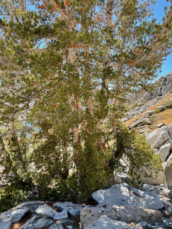
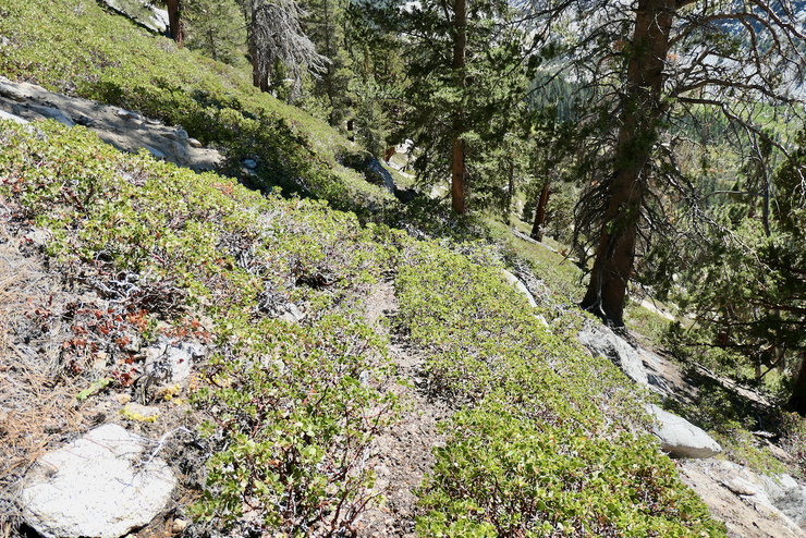
- It is amazing that you can go from the John Muir Trail—where you will easily see a dozen people every hour$—to Gardiner Basin just a few miles away and not see or hear a single person in Gardiner Basin.
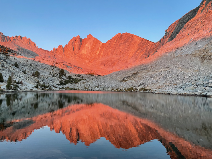
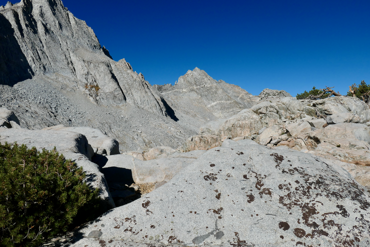
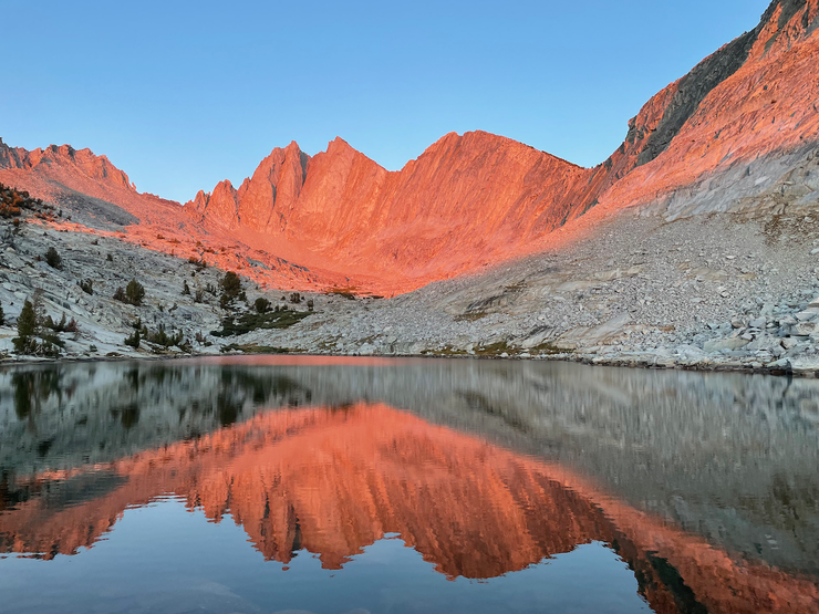
- Mt. Gardiner and the surrounding range offers some of the best alpenglow I've seen in the Sierras, especially as seen from the shore of the unnamed lake just to its west.
- As you might be able to tell from the topographical map, the east side of the two passes that can get you into Gardiner Basin (Gardiner Pass and what I'm calling "Rabbit Foot's Col") are significantly steeper on the east side. I am so glad I did this in a counterclockwise fashion because going down very steep, rocky slopes is not something I like doing in my 40s. As Arnot indicates in his book "High Sierra", Rabbit Foots Col is "solid class 2" on the east side.
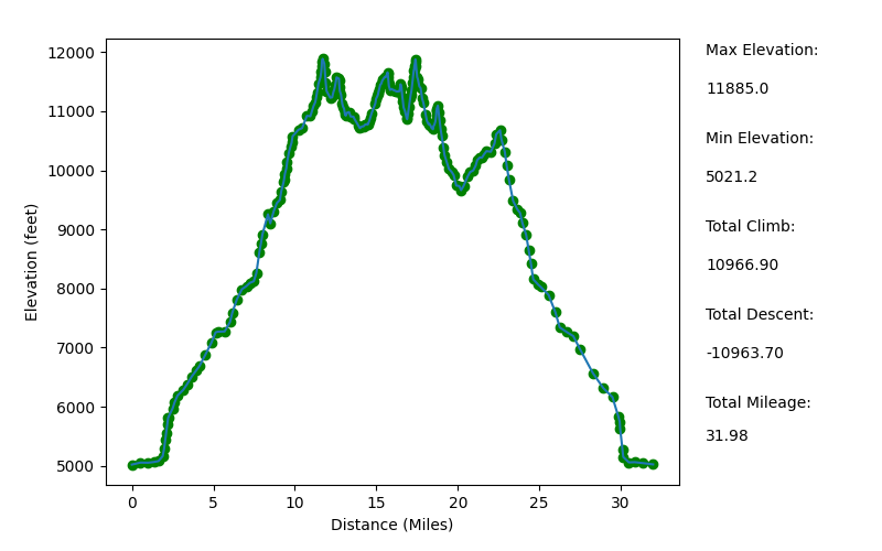
Elevation Profile (Mileage Highly Underestimated)
TRIP LOG
This trip started out in a very unorthodox fashion. A little over a month beforehand, I had made a reservation to enter Kings Canyon over Shepherd's Pass and visit Wallace Lake during the Labor Day Weekend. The Monday before I was supposed to leave, I got an email from Recreation.gov saying that my permit had been canceled because all National Forests in California were being shut down because of fire danger. Boy was I bummed.
I made some calls to the Kings Canyon ranger stations and started asking them questions. Was the fire danger so bad that they would shut down? Was there any chance I could get a walk-up permit to enter via Roads End or another trailhead in SEKI? It turns out that they weren't too worried about fires in Kings Canyon at all. One of the rangers I spoke to said it was really a precautionary measure. If somehow multiple fires started in different national forest areas, they would be spread too thin to save people during that time. So they decided to just shut everything down. As for walk-up permits, it was hard to get a good read on whether I had a good chance of securing one if I got there before 7 am the day I wanted to start my trip.
Since I had already requested vacation time at work and had been physically training for this trip, I really had my heart set on doing something over Labor Day Weekend. I figured I'd take a chance and try to get a walk-up permit on the Thursday before. I didn't think my chances were good since they start handing out those permits at 1 pm the day before, and this was one of the busiest weekends of the year, but if I had to delay the trip by a day I could live with that. Instead of Wallace Lake, I decided I'd try Gardiner Basin. The latter had been at the top of my list of remote destinations for quite awhile.
And so began the earliest departure I've ever taken on a trip to the Sierras from the Bay Area. I left Livermore at 1:45 am with the waning crescent moon rising just above the eastern horizon. About an hour into the trip—when I was just passing through Modesto on highway 99—I got caught in a bit of a panick when I realized that I had forgotten my hat. I had remembered to pack the sunshade that attaches to the hat, but I had left he hat on the shelf in my garage behind where I had stored my backpack.
Where could I find a hat at three in the morning, I thought. I stopped at a large gas station on 99, but they had nothing in the way of hats or bodily accessories of any kind. I figured I might be able to find some place in Fresno that wasn't too far off highway 180 that was open 24 hours a day, but my phone returned no good options. So a couple of hours later, in a last act of desperation, I stopped at the last gas station on 180 before the road starts climbing in the foothills. And to my delightful surprise, they had woven straw farmer hats! Over the next six days I would end up combining this hat with my sunshade to provide ample sun protection for my neck.
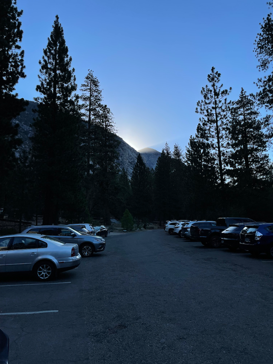
When I pulled up to Roads End, it was just after 630 am. Two groups had already lined up at the permit station. When I started talking with a guy in the second group in line, I found out none of them had any idea what are chances were. I had a nice conversation with this guy (his name was Dirk) and his father, who had flown in from Delaware, which made the time pass by rather quickly. And when the rangers showed up at 700, we were all giddy to learn that there were still plenty of permits available!
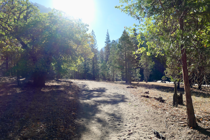
After securing the permit, I went back to my car, got all my gear together, and ate the last breakfast of fresh food I'd have for the next five days. and started on the trail with the gorgeous morning sunlight filtering through the mountains.
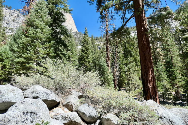
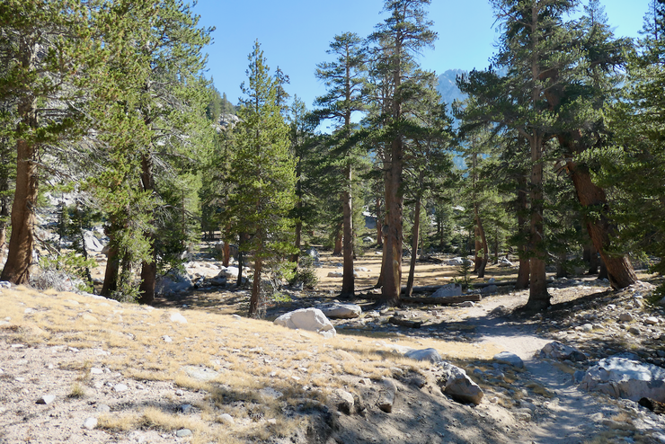
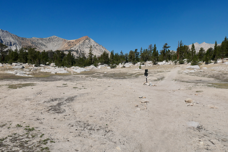
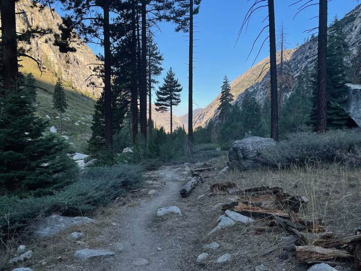
It felt glorious to be back on the sandy trail in Cedar Grove once again.
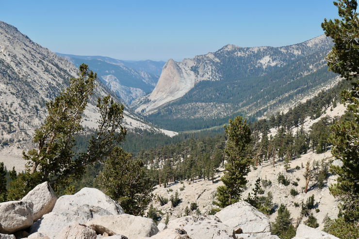
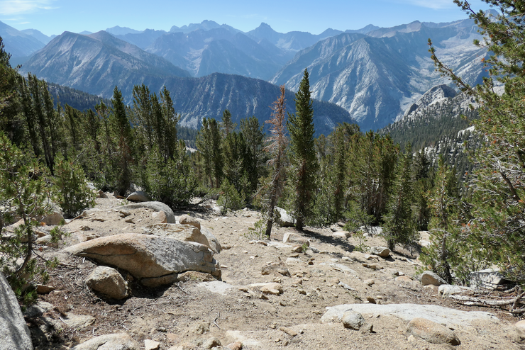
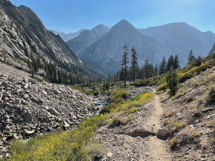
I made it up the initial switchbacks to the Bubbs Creek Trail pretty quickly, stopping from time to time to take in the beautiful views such as the one up to The Sphinx.
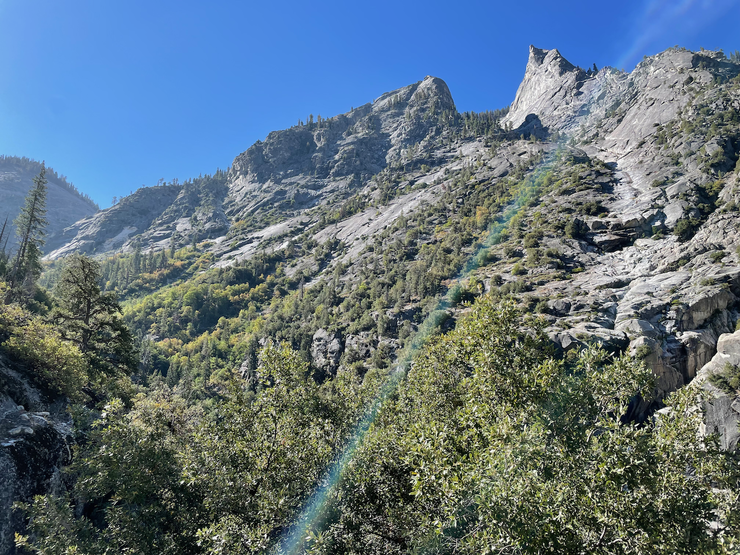
I had just been up this same trail the year prior when I visited Brewer Basin, but on that trip I had turned off at the junction with the Avalanche Pass trail. I was really excited to see Bubbs Creek after all these years. The last time I had been on this section of trail was almost 20 years ago when I did the Rae Lakes Loop Trail!
Bubbs Creek was every bit as magical as I had remembered. In fact, it reminded me strongly of the creek that flows through the Canyon of the Muro Blanco, which is one of my favorite canyons in all the Sierras.
When I got to Charlotte Creek, I took a moment to pause. I had contemplated bushwhacking my way along Charlotte Creek to make it either up to or down from Gardiner Basin (I had a Garmin inReach on me, so I could alert my wife to whatever option I ended up choosing). My legs were feeling pretty good, but I still didn't love the idea of bushwhacking that mile or so with a fully loaded pack. It didn't look all that imposing from where I was sitting...
but Arnot's description of it left me a bit leery. I figured it would actually be less taxing on my body and mind to do the extra 9 miles or so over Glen Pass than to duck under aspens and climb over dead trees on the really steep incline up the creek. Plus, I was leaning towards doing a CCW trip to avoid going down the really steep sections of Gardiner Pass and Rabbit Foots Col. So I just continued on up Bubbs Creek trail.
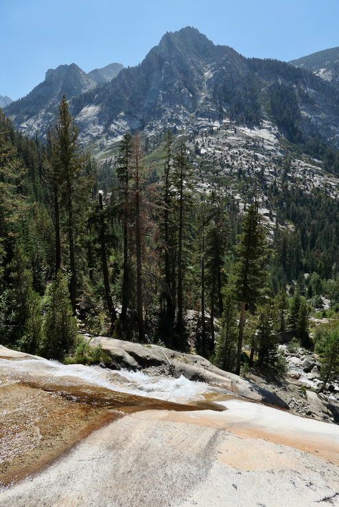
I stopped for a nice lunch by the creek at Junction Meadow and then quickly got on my way to Vidette Meadow. I couldn't help but stop at the really cool waterfall right next to trail a few hundred feet up from Junction Meadow.
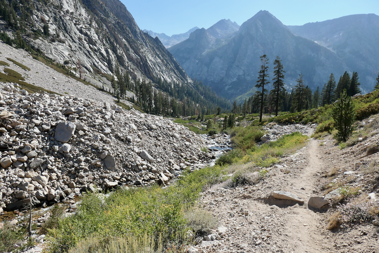
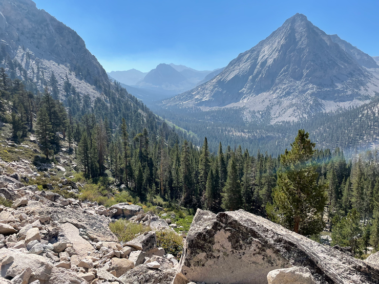
I was beginning to slow down a bit in the afternoon heat, which was fine by me since the views down towards the Bubbs Creek canyon were getting better and better by the minute.
At around 1700 PDT, I had reached about 9400 feet elevation and I was pretty much cashed. I didn't want to camp at Vidette Meadow because I figured it would be crowded judging from the plethora of people I had seen on the trail already. So I decided I'd cross the creek and try to find a campsite in one of the flat patches of ground I saw on the south side. The creek crossing wasn't too bad since the water level was low, but it wasn't entirely nontrivial. I managed to find a small, level patch of sand for my tent right away.
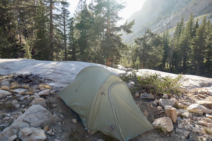
After I was done setting up, I took a quick dip in the creek to wash off and then started to prepare dinner. I'm not sure if it was the elevation, exhaustion, lack of blood sugar, or what...but as I sat there staring off into the distance, I began to question why I was even doing this trip in the first place. Hadn't I already seen all this—the trees, the creeks, the mountains—before? Was this really worth all the effort? And for that matter, was there any reason for my existence to begin with?
Within minutes of finishing my food, I started to feel better and the negative thoughts abated. I dug through memories of previous trips, and I could remember feeling this way before after a very long day of exertion at high elevation. I knew that with a good night's rest I'd feel the zest for life that had brought me here in the first place.
I took a few minutes to enjoy the distant alpenglow from a vantage point just above my campsite,
and then retired. Despite the forecast saying it would be in the mid-50's that evening at about 10,000 feet, it got down to the freezing point. I had to put on every layer I had to stay warm enough to stay asleep.
When I woke up, I felt infinitely better than I did the previous night. It is absolutely amazing what a decent meal and a good night's rest can do for your constitution, isn't it? After some oatmeal, dried fruit, and tea—and humming a few motivational songs from 80's movies—I felt mentally prepared to conquer Glen Pass.
Getting back to the trailed side of the creek proved to be more difficult than I had anticipated. The crossing I had used in the first place looked much more difficult in the opposite direction due to the presence of some slippery rock ledges. So I ended up heading east and using a crossing that looked a bit easier. I still wound up with a wet shoe, though.
It wasn't long before I got back to the trail and the sweet open forest surrounding Vidette Meadow.
My enjoyment was short lived, though, as I reached the junction with the John Muir Trail (JMT) and the switchbacks immediately consumed me. Again, I was moving slowly uphill with my heavy pack. But the views towards Forester Pass gave me good reason to pause and enjoy.
I was so incredibly elated that the air was so clear. I just couldn't believe how lucky I was that fires were burning throughout California, but here I was with some of the best skies I had seen in the Sierras during late summer!
After about an hour of hiking I reached the very distinct, sandy junction that had been so firmly imprinted in my memories from my Rae Lakes Loop trip 15 years prior.
It was at this junction where I had taken a wrong turn toward Charlotte Lake on my way down from Glen Pass, and wound up following cairns down Charlotte Creek before I realized I needed to turn around (at the time I had never even considered going cross-country through a national park). I recalled how dumb I had felt after coming back to this junction and realizing I had taken a wrong turn despite the obvious signage (I had lost my map somewhere near one of the Rae Lakes). Ah, the memories.
I continued up the trail and snapped some shots of Charlotte Lake

and Charlotte Dome.
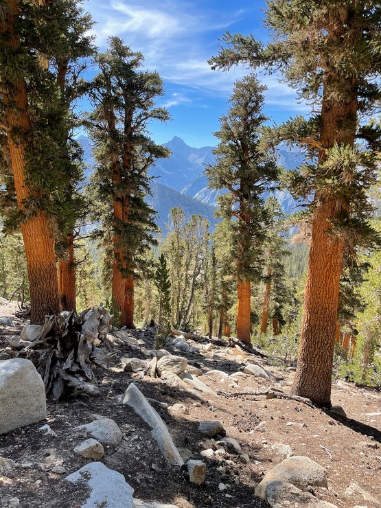
I took a short break under a nice red fir tree to have a snack and then continued on into the barren rock landscape below Glen Pass.
I couldn't believe how little water there was along this stretch. I was expecting to see tairns and some light flow of water along the trail, but there wasn't a drop to be found. Luckily, the little pool just below Glen Pass had an ample supply.
As I sat down next to this small body of water to fill up my water bottles, I was amazed at how many people I could see climbing and descending the switchbacks up to Glen Pass. It had only been a couple of hours since I joined the JMT, but already I was getting that good ol' overcrowded JMT feeling. I think I saw at least two dozen parties heading in the opposite direction within that short span of time. Now, I know the JMT serves a valuable purpose as a central highway through the Sierras and many people love it for just that reason, but as a guy that prefers peace and quiet (and solitude if I'm by myself) in the wilderness, the JMT is just not my favorite place to be. With that in mind, I was very excited to get up and over Glen Pass and into Sixty Lakes Basin.
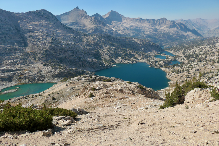
The last few hundred feet up to the top of the pass were definitely tough. It felt great to reach the crest, but when I got there I realized that most of the good places to sit had already been occupied. Luckily one of the occupants was just getting ready to leave, so I took his spot and broke out my lunch materials to take in some much needed calories. The view down towards the Rae Lakes was as astounding as I remembered.
I could see traces of smoke to the far north, but was encouraged that it looked quite clear in the immediate vicinity.
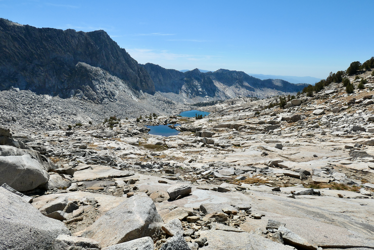
As soon as I began my descent down into Rae Lakes basin, I started eyeing the territory to the northwest in the hope that I could soon leave the JMT and pursue a cross-country route into Sixty Lakes Basin. It looked like there was a fairly straightforward way to get just above the southeastern lake if I broke off from the trail right when it flattened out. That's what I aimed for.
I took a moment to fill up my water bottles at the first tairn I came to, drank a bit of electrolyte powder, and quickly started on my way off-trail. The route up to the ridge separating the basin I was in to the lake I was aiming towards was extremely straightforward. Just a nice succession of gradual slopes all the way up.
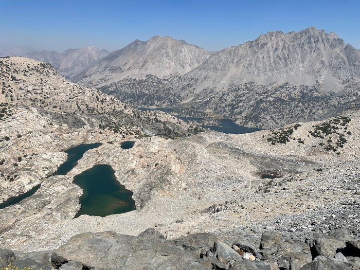
When I got to the top of the ridge, I was blown away by how gorgeous and dramatic the scenery before me was.
I was a bit surprised at just how steep the decline before me was. It's not very evident from the previous picture, but it was most definitely slip and slide territory. Thankfully, this really steep section was very sandy—making it somewhat easy to negotiate—and short-lived.
When it flattened out enough for the bulk of my apprehension to subside, I got my first glimpse of Fin Dome, which I thought looked incredibly cool.
The easiest route down towards the small southeast lake quickly became apparent.

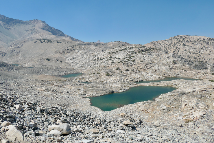
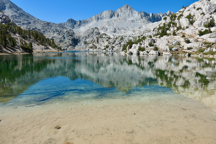
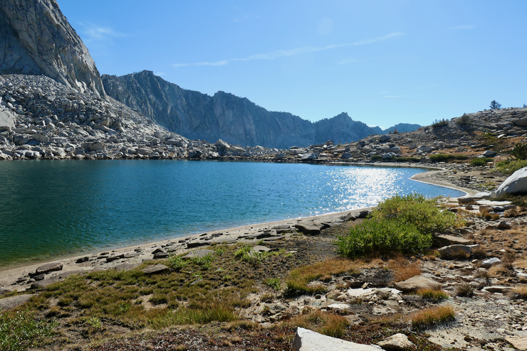
With the toughest section clearly behind me, I took a moment to revel in the fading sunlight and the brilliant reflections coming off the water.
When I approached the shore of the small lake to try to collect some water, I was taken aback by how the sand sank a few inches beneath my feet!
I spent a few minutes snacking and drinking while I tried to figure out my next move. It was not at all clear to me how I should circumnavigate this lake to make my way north. The topo map seemed to suggest that both the east and west sides were equally accessible from where I was sitting. And from what I could see, that was true.
As I descended the modest slope ahead of me, though, I quickly realized I had exhausted the possiblity of traversing the eastern side of the lake, as a sheer vertical rock formation revealed itself.
Too exhausted to climb back up the loose rocks I had just climbed down,
I decided I'd just commit myself to the western side of the lake. From where I was standing, it looked like it was completely doable.

I could see one short section where things would get tricky and I'd have to do a bit of climbing and a bit of gripping onto tree boughs, but nothing that frightened me.
With the sunlight fading and the vertical/horizontal distance of the day adding up, I was eagerly seeking out a good place to set up my tent for the night. The creek connecting the larger of the southeastern lakes (the one I had just traversed) to the smaller one to the north was completely dry, so I figured my best shot was to investiage the shore of the latter.
Although it wasn't the most ideal in terms of flatness, I chose a spot that had an exquisite view through a crack in the mountains to the north where I could observe the fading sunlight.
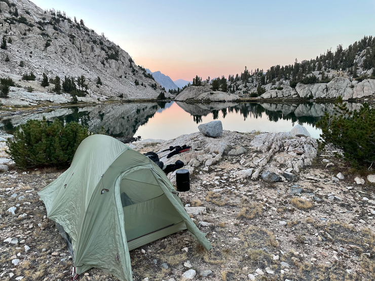
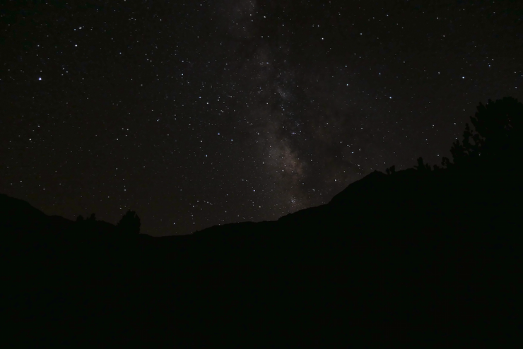
The evening turned out to be significantly warmer than the previous one. After a satiating meal of tuna and jerky and dried fruit and chocolate, I was in a phenomenal mood. My body felt pretty good considering the mileage I had already put in. I ended up setting up my new point and shoot camera in the hopes of taking some shots of the stars. They turned out better than I was expecting, although my 60-second exposures that captured the glow of the Milky Way had the expected star trails that didn't look so hot. But the 30-second exposures were a nice compromise.
I woke up fairly early the following morning with mixed feelings of excitement and apprehension. I was about the tackle the really tough part of the trip: three untrailed passes that looked rather challenging from the topo map lay ahead of me. My goal was to make it up and over the first one today, settling somewhere in the eastern reaches of Gardiner Basin for the evening.
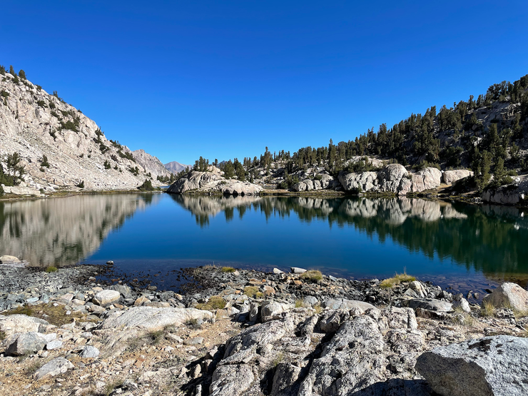
It was an absolutely lovely morning in the high country. I hadn't heard a human voice in over 12 hours and the stillness of the water in front of me made me feel at peace while I ate breakfast.
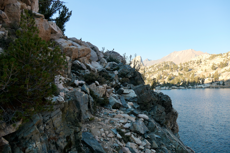
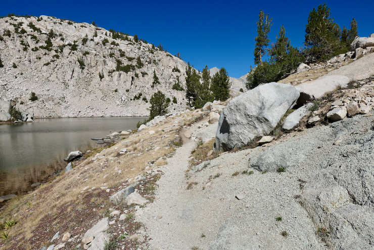
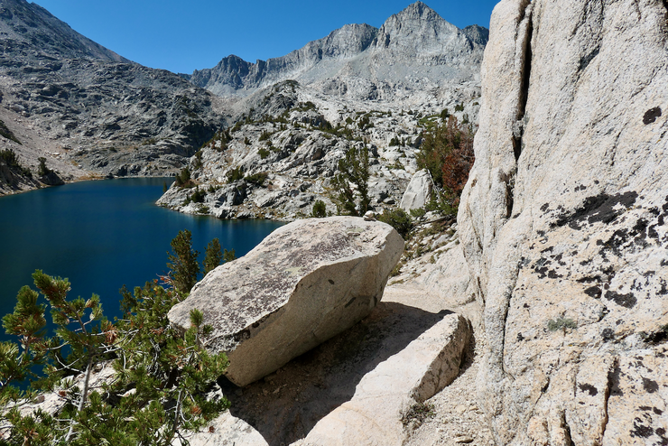
It looked like it would be wise to make it to the east side of the lake before I started heading north, so I took my time to find the best route over the rocky outcrops that would bring me to that side. To my delight, there was a well-established trail there that I used to make my way north.
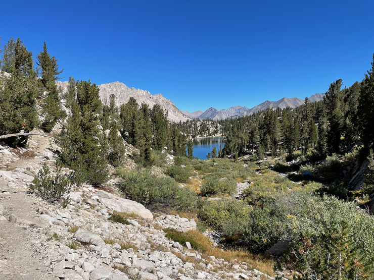
In a short while I joined up with the main Sixty Lakes Basin trail that curves around the spur separating the two chains of lakes at the southern end of the basin. The lake just to the north of the trail looked like a nice spot off in the distance.
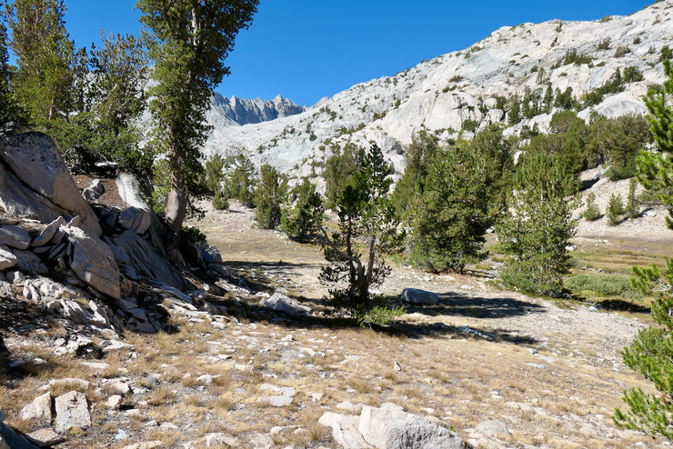
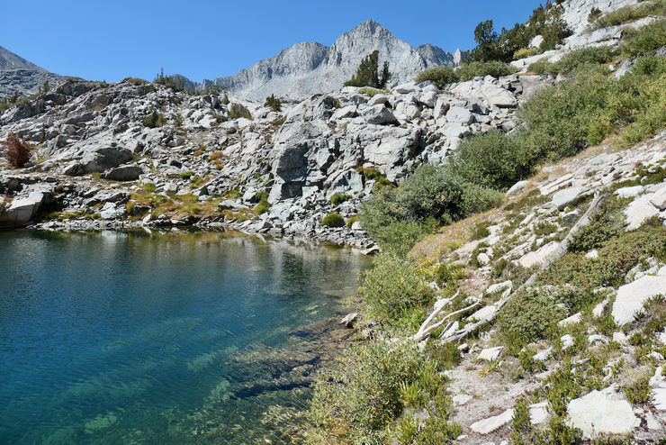
I wasn't on the unofficial trail for very long, as I wanted to try and get as far west as I could before I met up with the lake just east of Mt. Cotter. The terrain was extremely easy to work with for this segment; no obstacles to speak of.
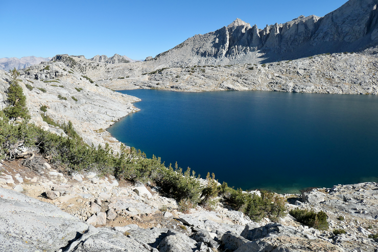
After taking a short break to fill up water bottles at the small creek at the base of Mt. Cotter, I reached the shore of my target lake. The nice sandy bottom really made me want to take a mid-morning dip.
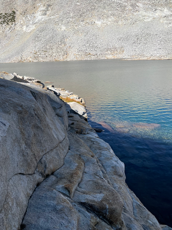
The pleasant look of that lake had me in a very comforted state, but that wouldn't last long as I realized I'd have to climb up to a somewhat ominous looking, narrow ledge if I wanted to stay on the western edge. If I had to do this all over again, I think I'd try to get higher up on the slope and shelves above the lake at a point earlier on because there is one short section where you have to cross a narrow ledge to continue on (there is a large shelf that blocks passage at lake level).
That picture doesn't do it justice, but in that section there's really only room for one of your feet at a time. And with a large pack on it was tricky. I just took a lot of time to establish exactly where I was going to put my feet and hands while I crossed the ledge, and I felt pretty confident it would be ok.
I was very relieved to get back down to the easy-going terrain at lake level.
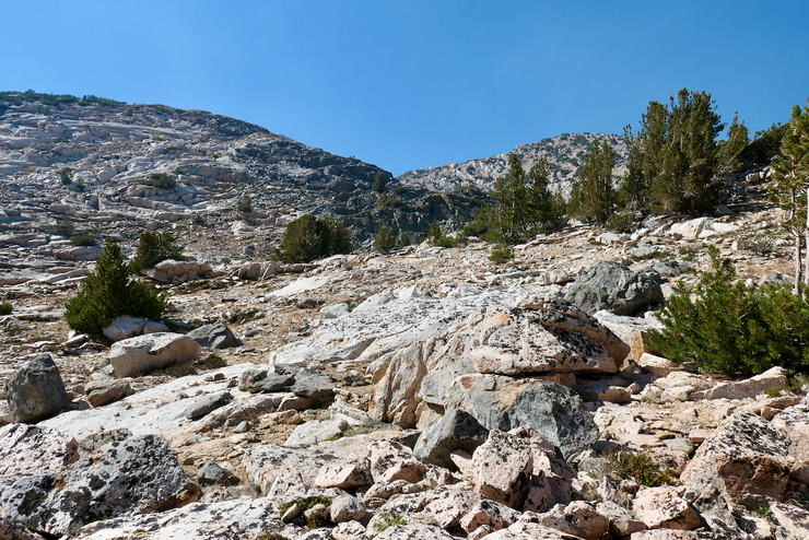
From there, it was a nice, straightforwarded trek on a southwestern course up granite slabs
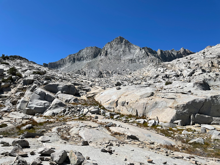
and past some small tairns
before I could see the broad ridge where I would cross over into Gardiner Basin.

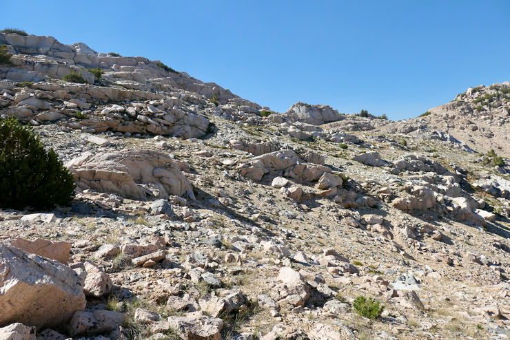
Getting up to that ridge proved to be fairly easy. When I had climbed far enough west to meet a much steeper secton of granite, it became clear that the best way to ascend was to veer north and follow a series of grassy patches that were littered with sheep or goat droppings.
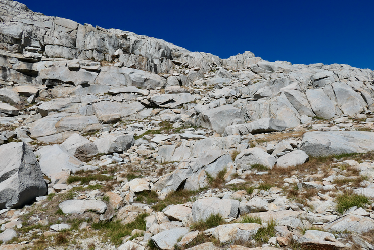
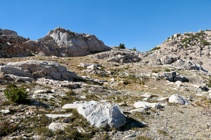
There were so many fresh droppings that I was convinced I'd see one of the creatures along the way, but sadly the encounter never happened. As you can see, the extra yardage needed to follow this route is balanced by the very manageable contours.
Now, although I would recommend following this route to get to the top, I wouldn't recommend turning south like I did at the top of the ridge towards what looks like the "pass". Hopefully you can see what I'm talking about here:
Instead, I'd recommend cresting the ridge as far north as you can and then finding the easiest route west down into Gardiner Basin from that point. Why? Well, it's because if you go to that northernmost point and start descending from there, you will end up in boulder hell. I remembered reading in someone else's trip report that there was an annoying boulder field to tackle somewhere around here, and that is what I had to deal with because of the route I took.
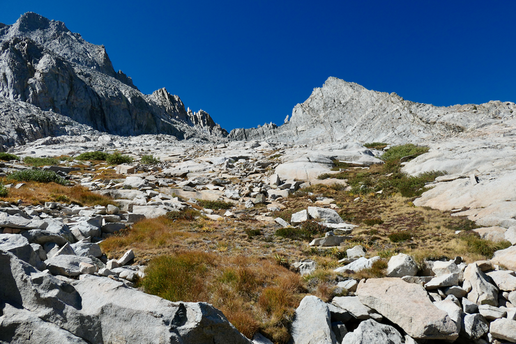
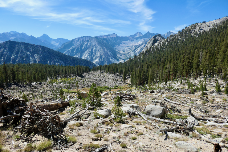
When I did get to the southern side of the ridge, I took a moment to hydrate and admire my first views of Gardiner Basin. It looked truly glorious from where I was standing.
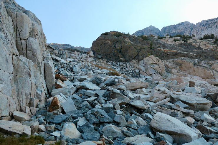
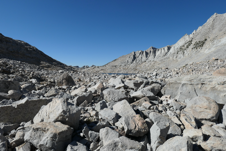
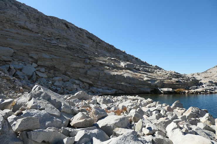
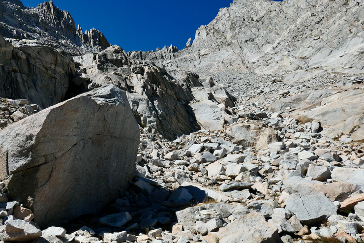
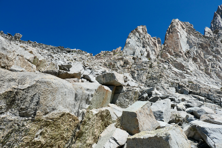
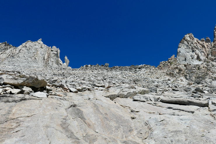
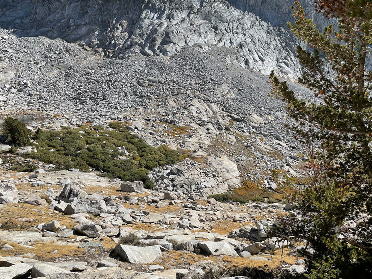
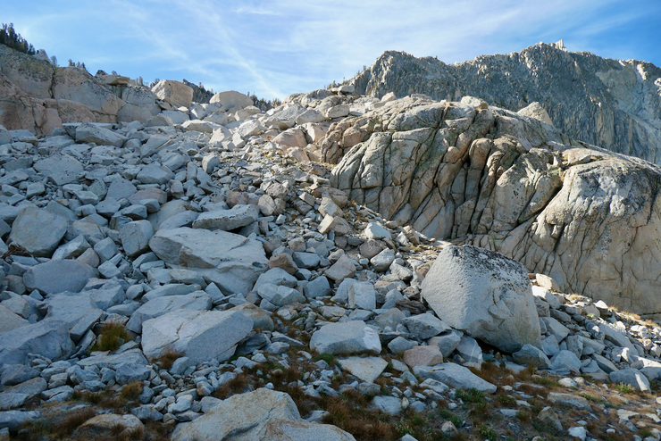
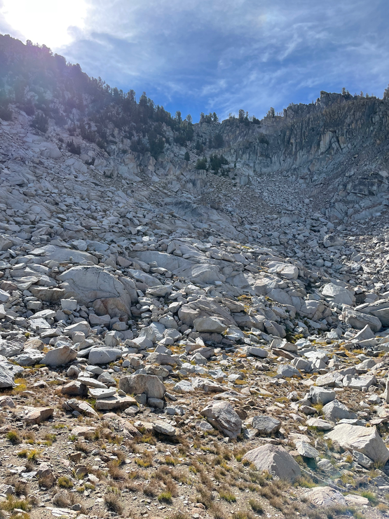
It was some time around 1330 when I started descending in a northwestern direction. I decided to wait until I was at the bottom to have lunch, but it was a decision I'd regret. Getting to the shore of that first lake was a slow, arduous undertaking. The gradient wasn't intimidating at all, but it was just boulder after boulder after boulder.
When I did make it to the water's edge, it was just after 1500. And as I sat eating some lunch, I realized that I had just entered the depths of boulder hell.

Deep into my thoughts about how much I wanted to get back to nice granite slabs and alpine grass and red heather, I noticed a faint sound coming from somewhere to the east of me that I couldn't quite put my finger on. Eventually I saw three backpackers moving behind the one large tree growing on the steep slope in that direction. While I finished lunch, I watched them for about 20 minutes as they made their way through some shelves in the rock and all the way up to the ridge. That's when I realized I could have avoided a lot of the boulder nightmare if I had just started descending at the northern tip of the ridge.
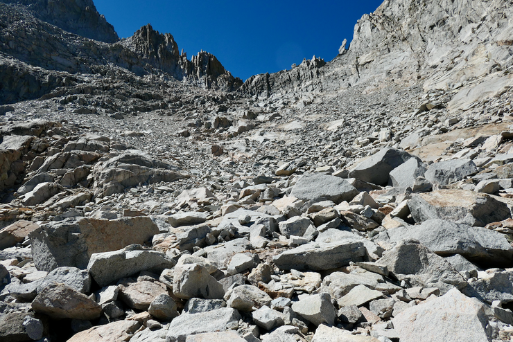
I cursed myself for not taking that route (although the top map does show it's a bit steeper on average than the one I took), and then got on my way, climbing over and around many, many rocks.

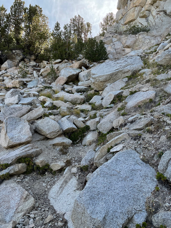
When I got to the northern strip of that lake, I realized I still had to cross a boulder land bridge.
And when I got across that bridge, there were more and more giant rocks still left to conquer.
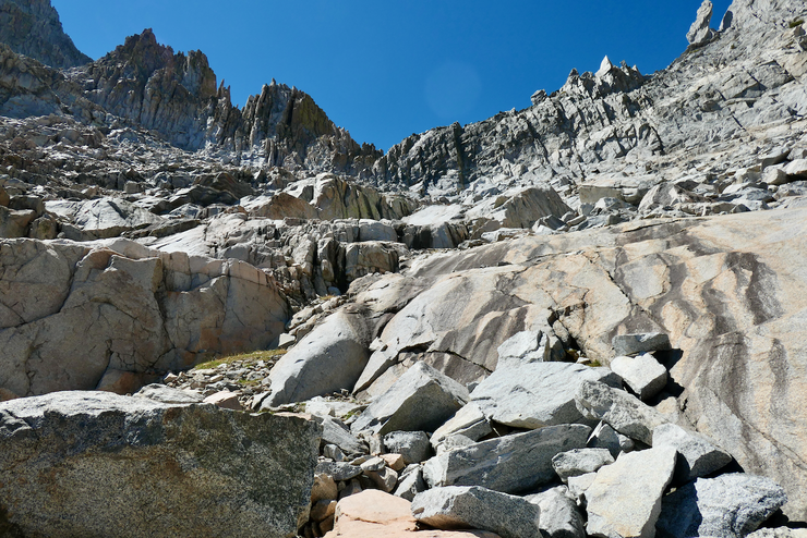
At about 1630, I finally reached a touch of firm granite. It had taken me almost three hours to travel roughly a kilometer. I was excited when I could walk on a firm granite ledge on the western side of the lake.
That excitement was met with equal frustration when I saw that I had more boulders to cross.
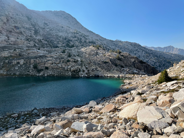
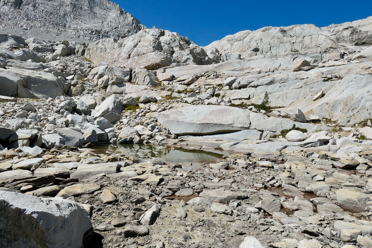
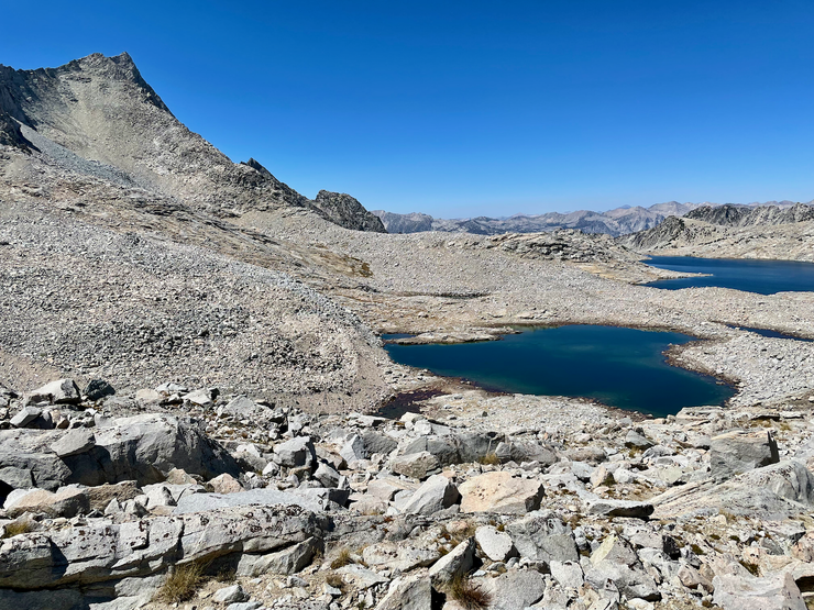
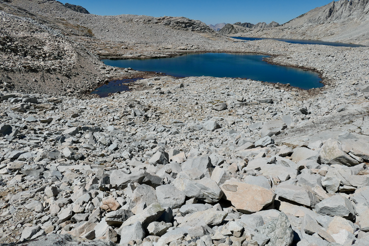
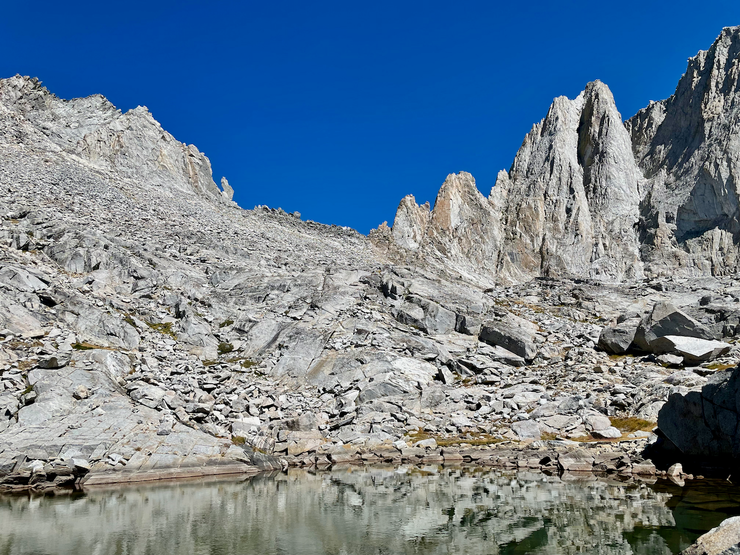
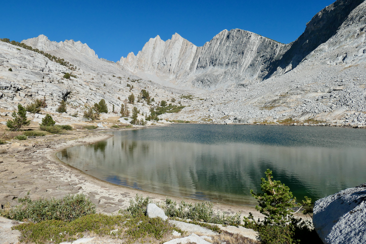
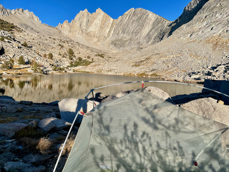
When I got over that last rise of boulders and beheld the largest of the Granite Lakes, though, all my annoyances were immediately washed away. The lake I was looking at was simply enchanting. I found a great place to set up my tent,
and perhaps an even better place to take a dip and dry out my clothes.
Drying off in the warm afternoon sun, all my frustration from the boulder crossing completely evaporated and I felt a sense of total content. I had the basin all to myself, and the fading sunlight

looked like it was shaping up to provide some magnificent alpenglow. And boy I'll tell ya, I enjoyed the heck out of that alpenglow that evening while I ate my dinner.
Perhaps more dazzling than the purplish-orange light refracted onto the mountainside, though, was the dying sunlight leaking through the gap in the silhoutte of the rock at the lake's northern edge.
I simply couldn't take my eyes off the constantly changing scene in front of me while I pumped my water bottles full. I stayed up for a bit longer to enjoy another spectacular display of the firmament above. The Milky Way was just magnificent.
The day had been a success in many respects. But as I crawled into my sleeping bag and closed my eyes that night, the feeling of contentedness I had been basking in gave way to some mild anxiety about the pass I'd have to navigate the following day. I knew it was going to be the toughest day of the trip.
I woke up that resplendent morning feeling refreshed and ready for the challenge ahead. I quickly packed up my tent, ate breakfast, and finished my tea. I then sat down on a large slab of granite on the lake's edge to put in my contact lenses. That's when the worst moment of the trip happened. As I was bringing my right contact towards my eye, a powerful gust of wind blew it from my fingertip, and then down into a small crevice in the rock. I spent about 15 minutes with my headlamp seeing if there was any way I could recover it, but it was hopeless. For the rest of the trip I'd be wearing both my straw hat and my prescription sunglasses. No use crying over spilled milk, right?
When I had gathered all my belongings, I started the short stint up the slope to the southwest of my camp,
which was a pretty easy stretch. I was sad to leave the confines of that exquisite lake.
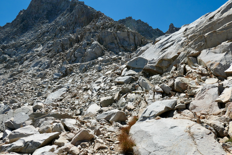
I still hadn't gotten a clear look at the pass I would be taking to get into the next section of Gardiner Basin. When I reached the crest of that slope, I finally got a good view of it. And I must say, it was mighty intimidating.
You can just barely make out the "Rabbit's Foot" in that picture. If you view the full size image, you can see it as the small protrusion next to the broad peak that is basically dead center horizontally. I should note that I actually crossed the pass a substantial distance to the left of the Rabbit's Foot.
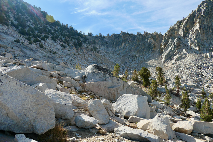
There was still a substantial obstacle to overcome, and that was getting down the steep slope in front of me into the broad northwest-stretching valley to a point where I could attack the pass. At first glance I was apprehensive because it looked like I might need to downclimb a series of ledges. But after walking back and forth to explore all my options, I found a nice, easy, gradual course down over some boulder fields and granite slabs.
I even had the luxury of following a few grassy pathways down the slope.
As the terrain flattened out,

I found a few active streams and stopped to fill up my bottles. I could see an obvious point of attack to use for starting my ascent up to the col.
The initial part of the ascent was quite enjoyable. Nice grassy stretches peppered with granite.
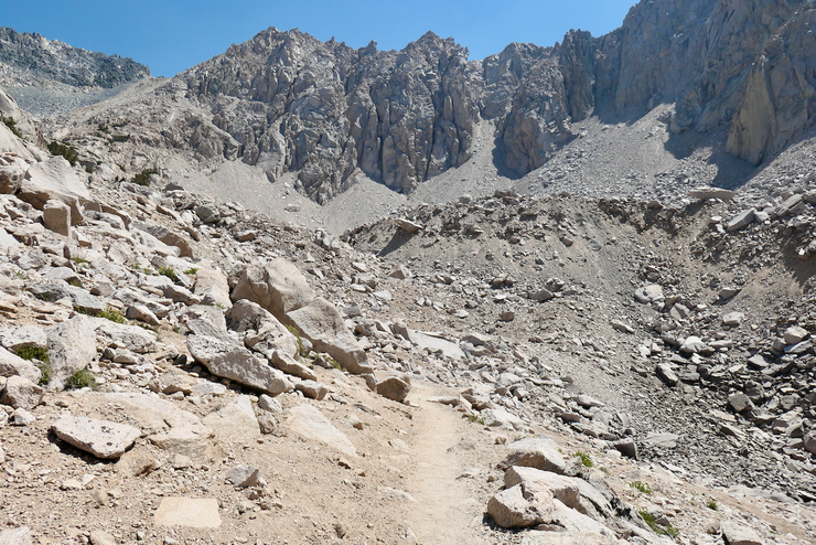
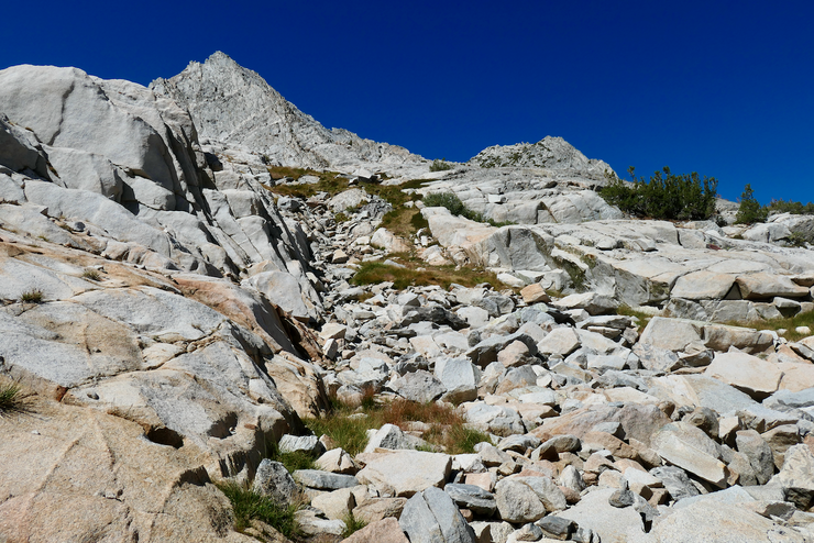
But when I had gained about 400 feet, the going got much tougher. Lots of loose boulders stretched out in almost every direction, disrupted here and there by vertical walls of rock.
It wasn't entirely clear what the easiest route would be. In fact, it would be highly ambiguous the rest of the way up. As you can see from this photo,
from down below it looks like heading towards the Rabbit's Foot is not the easiest path of ascension. So I focused on trying to make it to the little nook at the lowest point of the saddle. For the first several hundred feet I was having a decent time. The boulders were flat and mostly lodged in place. And every once in awhile I'd encounter a stretch that practically begged to be walked upon.
When I neared 12,000 feet, though, I got a lot more anxious about whether or not I had made a mistake. It looked like it would be possible to head south along the east-facing wall and make my way towards that little nook from where I was standing.

However, the terrain was such that every time I made my way up or around a new section or rock, I'd discover a new section that looked like it was almost impassable. There were a few times where I had to take off my pack, lift it up onto a rock, and then climb up onto the rock after because it was too steep to do otherwise.
After finally overcoming this short southward stretch, I got my first peek up the final little nook I had been aiming towards this whole time.
It was quite steep. And what made it worse was the fact that the sandy ground would slide out from underneath me with almost step. Luckily, I was able to maintain a decent grip on the southern wall as I went up to prevent a real slide. Near the top, I could see the Rabbit's Foot to the north of me. It certainly looked like it would be easy to surmount near the top, but lower down it looked much trickier.
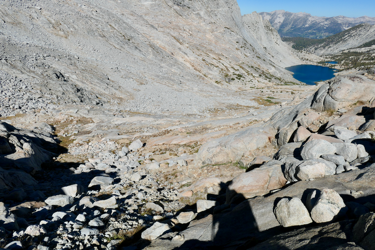
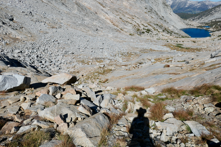
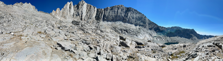
I breathed a huge sigh of relief when I finally got to the very top of the col. The view into the western reaches of Gardiner Basin were absolutely exquisite.
As I took a moment to drink and snack, I felt a bit of relief in seeing that the western side of the col looked far easier to tackle. And damn was I glad I didn't have to descend the way I had just come, because that did not look fun.
Getting down the western slope did indeed prove to be far easier than it would have been to get down on the eastern side. At first the sand was sliding out from me in large bursts with every footstep.
But after about a hundred feet of elevation, I had the option of climbing down a medium sized boulder field, so I took it.
Eventually the boulders transitioned to some nice granite walkways. Looking back up at the pass, I felt incredibly good knowing that the most difficult part of the trip was behind me. From where I was standing on this side of the pass, it looked like both the south and north sides of the broad saddle would be perfectly fine to take.
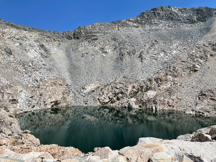
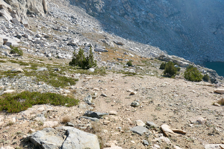
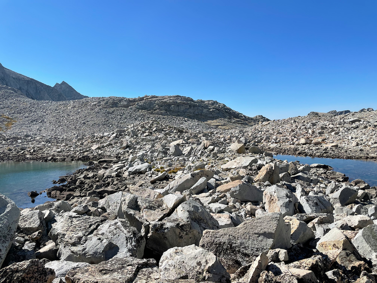
I made my way down a bit further, setting my sights on the first small tairn just a bit northwest of my current location. I was ecstatic to see that it still held plenty of water. And even more ecstatic when I found that the rock wall on the south side provided a decent amount of shade for me to enjoy lunch.
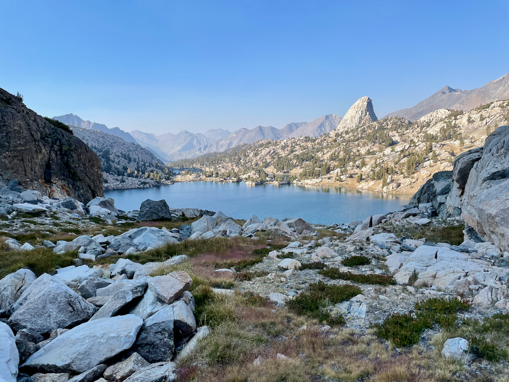
That lunch was incredibly relaxing. I felt like a huge weight had been lifted off my shoulders, both physically and figuratively. When I slowly got going again, I found I was already quite enamoured with this section of Gardiner Basin. The lakes in front of me looked like they would be perfect for a swim, and the south headwall kept drawing my attention like a tractor beam.
Descending to the large lake at the western end of the basin proved quite easy. I stayed high on the northern slope and followed a series of granite slabs and bunch grass. I took a much-needed break underneath the first available shade: a lovely whitebark pine that smelled heavenly.
Part of me wanted to just stay right there and take a long nap, but I also felt like a refreshing swim would hit the spot. I began climbing down to the south just a bit
to where I had a very simple route to the two large lakes in front of me.
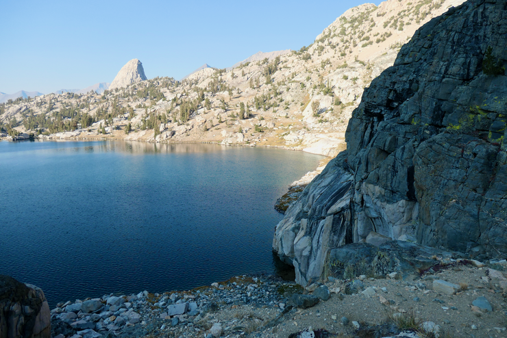
Looking back up the stretch of the basin, I could see that ascending on the northern side of the large, central draw would have been just as easy as the way I had taken.

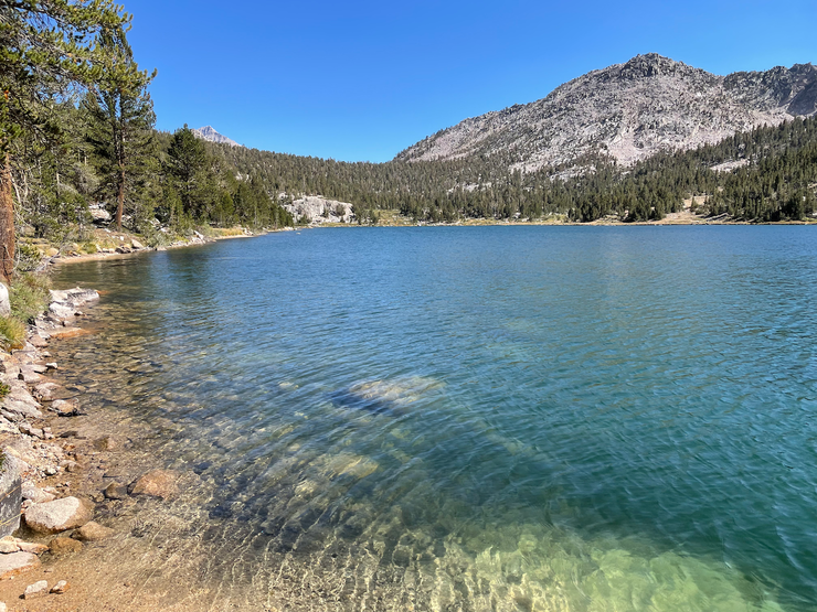
When I reached the larger of the two lakes, I shed my clothes and took an invigorating dip. The shore of the lake was perfect for entry and exit.
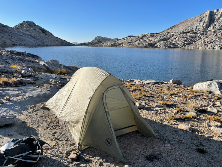
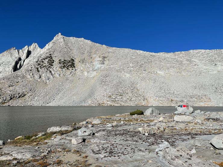
By the time I was done swimming and drying off, it was already late afternoon. No part of me wanted to attempt Gardiner Pass before the next morning, but I wasn't sure exactly how much closer I wanted to get to it. The lake I was at was almost too enchanting to leave. I decided I'd go check out the smaller bodies of water to the west of the lake and see how they looked, but after only a few hundred yards, I found a small patch of ground at the very western side of that lake that was too good to pass up. So I set my tent up there.
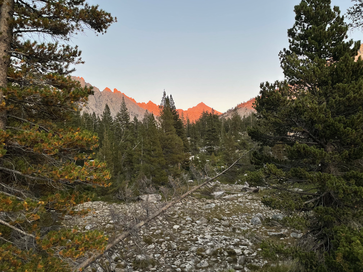
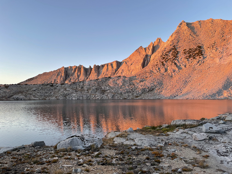
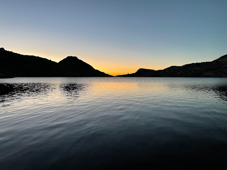
The evening that followed was perhaps one of the best sunlight spectacles I've ever witnessed. When the sun began to set, the views to the west
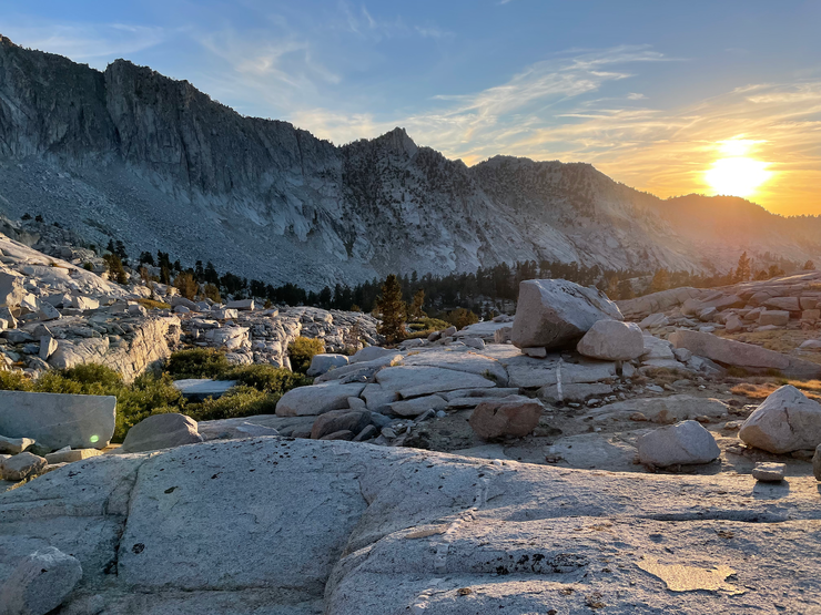
and east
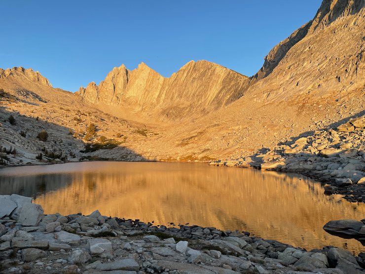
were brilliant. But it would only get better as the sun sank further into the horizon and the alpenglow shined through in all its glory on Mt. Gardiner.
Thinking back, that was one of the best nights I've ever spent in the Sierras. The scenery, the stillness, the cool temperature, the most challenging days behind me...it doesn't get much better.
One more challenging pass before I was back to safety. That was the central thought running through my cerebral cortex on this superlative morning in Gardiner Basin. I tried to stave off the mild feelings of apprehension about confronting Gardiner Pass for a short while so I could enjoy my breakfast and tea in the graces of the brilliant Sierra morning.
I was quite excited that I was so close to Gardiner Pass. All I had to do was cross the dry stream bank at the outlet of the last Gardiner Lake, climb over a small collection of talus,
and I could see what was in store for me.
The initial part of the ascent was highly enjoyable. There was a fairly distinct use trail that I was able to follow, and the views towards the north were truly impressive.
The use trail and the gradual nature of the terrain made the going pretty easy initially,
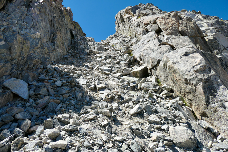
but as I got within a few vertical hundred feet of the pass, it got much steeper and much trickier. This picture gives you a good idea of just how steep it is.
I was relieved that the large boulders and saplings near the top provided plenty of good handholds to counteract the very loose dirt and rock. I'd say that, overall, getting up to the pass was not that bad. But if I had to descend on this side, my adrenaline would have been kicking very hard.
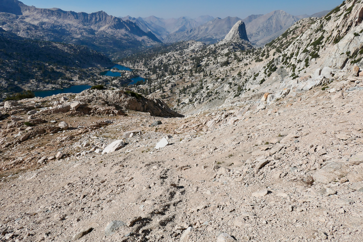
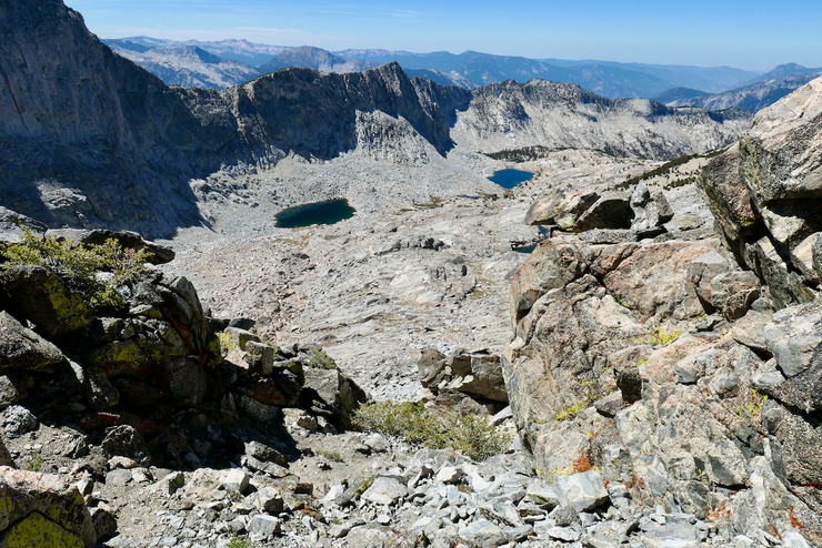
Finally reaching Gardiner Pass, I was simply stunned by how amazing the views to the south were.
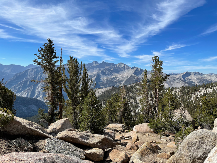
I could make out Mt. Brewer and the North Guard as clear as day, and this brought back excellent memories of Brewer Basin, where I had been the previous year.
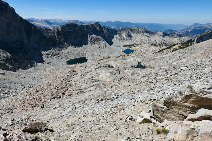
The views back to the north revealed a series of new lakes that I wished I had the time to explore.
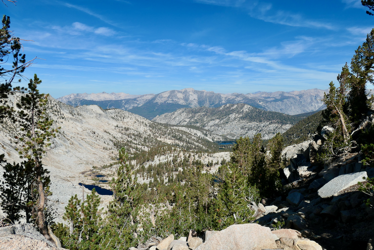
The views back to the north revealed a series of new lakes that I wished I had the time to explore. I took my sweet time reveling in the beauty, greatly comforted by the gentle look of the slope on the south side of the pass.
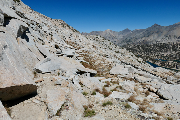
I enjoyed that southward descent from Gardiner Pass so very, very much. The thoughts running through my head were pleasant and serene. I had put all the most difficult challenges of the trip behind me, the short route back to trailed territory was unambiguous, and the trees that lined the way were simply brilliant.
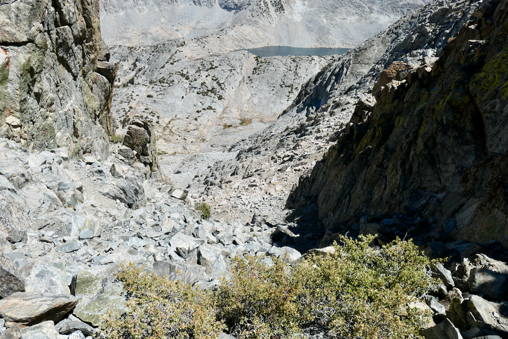
I recalled reading a forum where people discussed how difficult it was to follow the old Gardiner Pass trail, so I didn't even bother. The terrain was so forgiving that I basically just followed my compass on a southeastern course without incident. At around 10,000 feet, I took a little break and considered some possibilities for the next ~24 hours of my hike. Should I (a) bushwhack all the way down Charlotte Creek until it joins back up with Bubbs Creek, staying off the beaten path for as long as possible? (Here's what that looked like from where I was sitting...)
Should I (b) first make my way down to the seemingly flat terrain around Charlotte Creek, and then follow it up towards Charlotte Lake? Or should I (c) stay on the old use trail that meanders high above the reaches of the Charlotte Creek and follow that back to Charlotte Lake? There were a lot of possibilities.
I ended up doing the latter, and part of me regrets it. When I first started on an eastward course, I was thrilled with how lovely the open forest was.
But the last two or so miles before Charlotte Lake were not that pleasant. First of all, I was tired from the climb over the pass and I was eager to make it to Charlotte Lake for lunch. But second of all, this part of the trail is heavily overgrown with manzanita at certain points,
it's very poorly maintained and somewhat difficult to follow, and there was almost no water in the creekbeds intersecting the trail. What made it even worse was that when I did stop to fill up at the one creek that held water, I got stung multiple times by a bee or wasp that somehow managed to sneak up the leg of my pants while I was pumping. It hurt like a bitch and stung like one for the next 4-5 days.
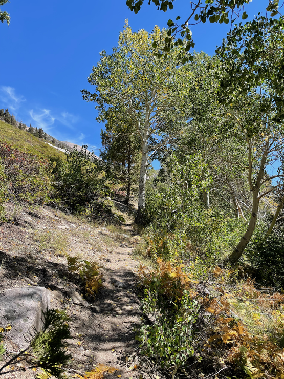
The trail is not all bad, though. There were a few sections with great views up and down the canyon, and several stands of beautiful aspen trees.
When I finally did make it to Charlotte Lake, all my frustration and soreness simply melted away. I found one of the many fantastic spots along the southern shore to have lunch and take a dip in the water.
And then I just laid out on the largest granite slab I could find, basking in the beautiful day and the tremendous sense of relief and accomplishment that I felt. I'm not sure if I believe in heaven or not, but the way I felt just then is how I like to imagine the place.
The remainder of the day was rather eventful. I was simply backtracking on the trail to Bubbs Creek, with another gorgeous sunset lighting the way.
I was a tad worried that the good campsites around Junction Meadow—where I was likely to reach around sunset—would all be taken. My fears turned out to be warranted, as there were tons of groups spread about the open forest floor when I got there. So I continued on for another mile or so and found a decent spot that looked to be a large, sandy horse camp. For the first time during the trip, I felt the presence of mosquittos. But luckily it only took a short walk away from my tent to escape their torment.
The high cliffs to the north gave me one last spectacular show of alpenglow that evening while I chowed down on a hodgepodge of my remaining food items. When I curled up in my sleeping bag I almost immediately fell asleep, overwhelmed by exhaustion and gratitude.
On the last day I woke up well before sunrise, packed up my tent, ate a Clif bar, and started hauling ass down the trail. I was very excited to get back to my car and back to my pregnant wife. It was a splendid morning on a splendid trail.
I got back to the parking area well before noon and took one last dip in the Kings River before I started driving. Although I was looking forward to a decent meal and a warm bed, the breathtaking drive through Kings Canyon had me thinking about my next adventure.