


TRIP DETAILS
TRAIL MAP
OVERVIEW
Notes:
- Brewer Basin is a phenomenal place to find solitude in the High Sierra. I did not see anyone for three straight days on this trip.
- If you haven't done the drive down 180 into Kings Canyon, I highly recommned it. In some ways, I think this area is even more spectacular than Yosemite Valley.
- Roads End is possibly my favorite trailhead in all the Sierra. They've got bear lockers, restrooms, a water bottle fill station, and some of the best trails ever. Plus, you don't have to deal with the Yosemite traffic to get there.
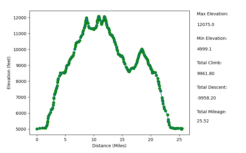
Elevation Profile (Mileage Slightly Underestimated)
TRIP LOG
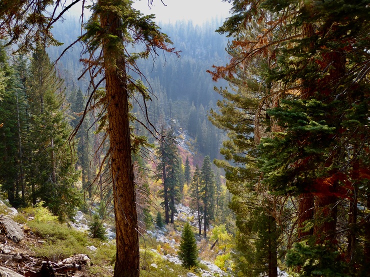
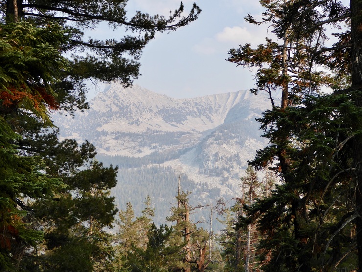
Leading up to this trip, I had been monitoring the forest fire and smoke conditions in Sequoia/Kings Canyon like a hawk. The Shotgun and Castle fires had started burning in late August of 2020, and they were still active during the first week of October, when I was set to do this trip. The forecast for the first two days called for moderate conditions, but I was slightly apprehensive about what to expect. Luckily, when I started descending down into the canyon on the majestic 180 Scenic Byway, the smoke wasn't all that bad; I could still make out remote peaks through the haze.
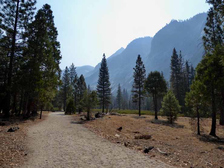
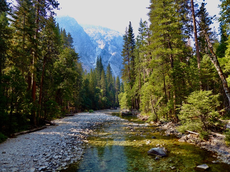
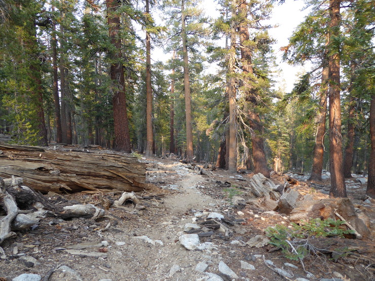
I arrived at Roads End right around 1030 am, and after getting my pack fully loaded and storing all my scentables in the bear lockers. I was on the trail by about 1130. Cedar Grove was looking extremely inviting despite the smoke,
but the canyon walls were a bit shrouded.
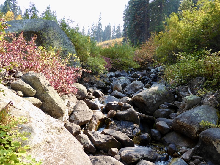
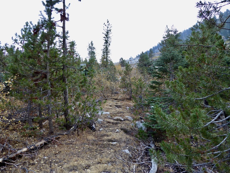
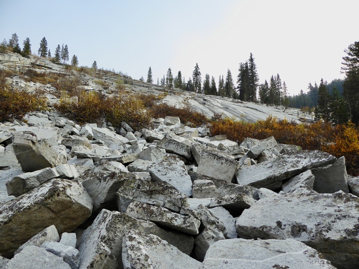
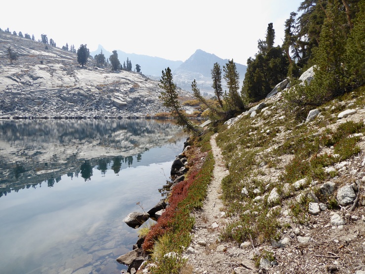
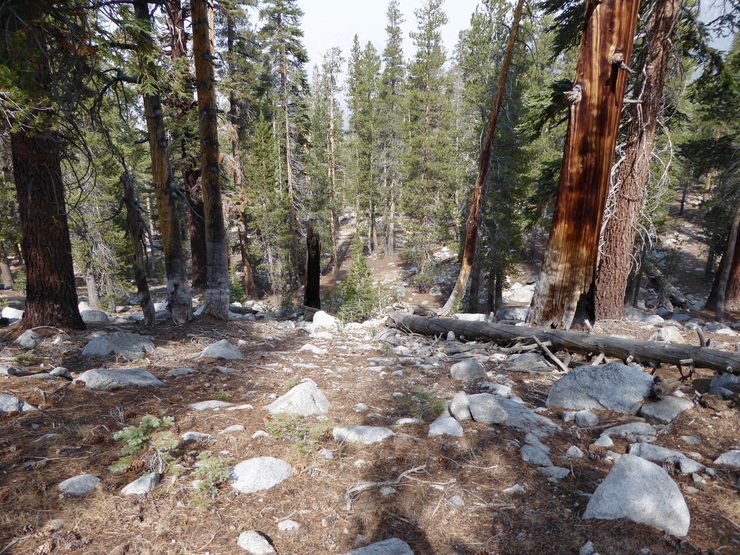
It took me just over a half an hour to make it through the first two miles of flat, sandy trail before the first trail junction. When I crossed the bridge over the South Fork of the Kings river, my expectation of late season water levels was confirmed. But still, it looked as if the creeks I was going to be traveling along would still be holding some water.
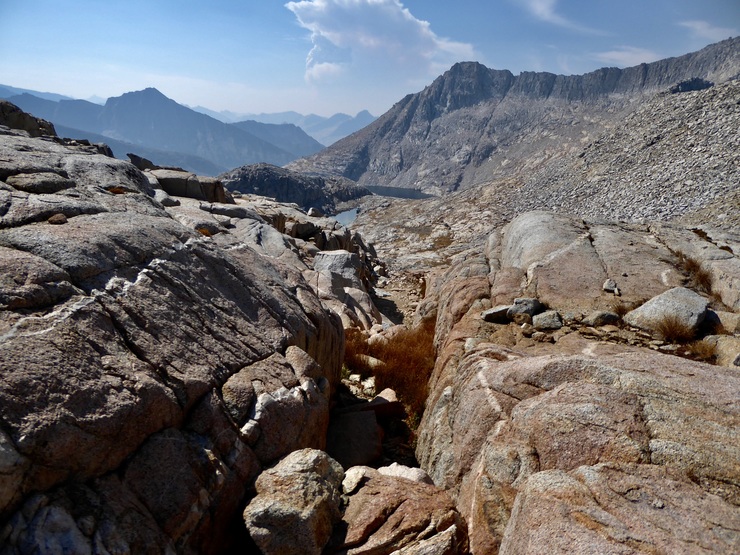
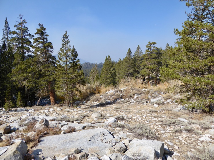
As I ascended the switchbacks up the Bubbs Creek trail toward the Sphinx Creek trail, I could see that the smoke toward the south was a little bit worse than what I had been seeing from 180.
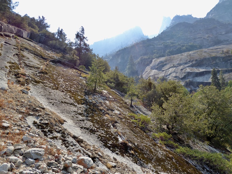
My pack was fairly heavy, and I was taking my sweet time, stopping to enjoy the fantastic views back down into the central canyon.

At about 1230, I reached the junction with the trail that goes up to Avalanche Pass. During the previous hour, I had encountered perhaps 10 or 12 people on the trail. I imagine they were all coming back from the very popular Rae Lakes Loop. It seemed like the park was crowded! As it turned out, though, those would be the last humans I'd see for the next ~96 hours.
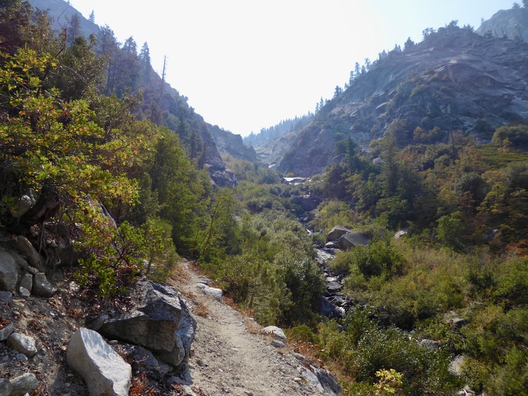
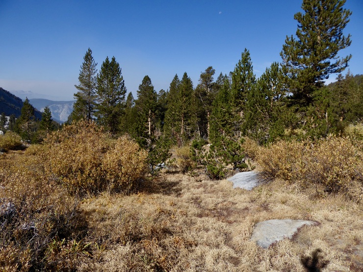
I was pretty excited since I had never gone this way before (I'd been down Bubbs Creek a few times, but never turned in that direction). I was immediately taken with the dramatic feel of the trail as it climbed up Sphinx Creek.
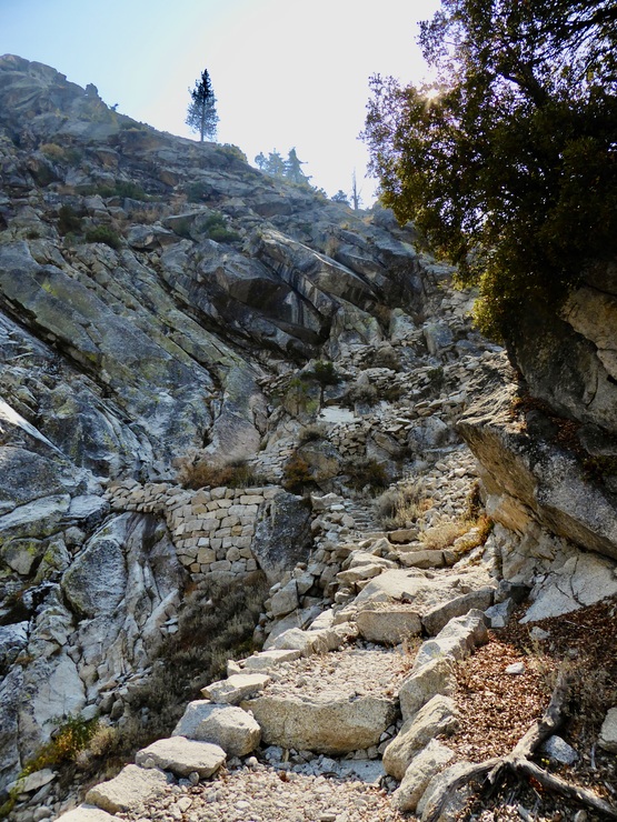
And as I started up the switchbacks, I was even more impresssed with the fantastic stonework of the men that built the trail. Quite a feat if you ask me.
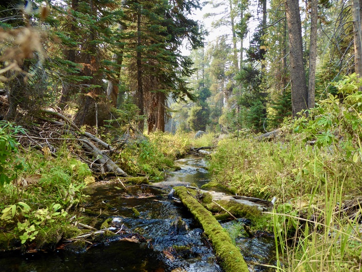
The switchbacks were nothing to joke about. After about 1200 feet of climbing, I was running low on water and ready for a break (I started off carrying a very small amount of water to reduce the initial weight of my pack). I could see that the trail would get pretty close to Sphinx Creek at around 7600 feet, so when I reached that point, I began searching for a place to fill up my water bottles and have lunch. I had to climb over a few fallen logs and such to get down to the creek, but I ended up finding an absolutely gorgeous spot that met my needs. While I ate lunch, I continually reminded myself of how pleasant it was to not have any mosquittos pestering me. God, I love Autumn in the Sierras.
When I got going again, I was well energized to handle the next round of switchbacks. This set brought me up another ~1000 feet into the gorgeous elevation zone where orange-yellow aspen trees speckled the landscape.
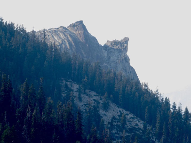
I also took some time to admire the "Sphinx" for which the creek was named.
A mix of excitement and apprehension hit me when I arrived at the crossing of Sphinx Creek, knowing that I was about to say goodbye to the easy ways of the beaten trail. But my apprehension subsided a tad when I saw that—at least initially—there was a pretty nice use trail on the west side of the creek. I had skimmed a few trip reports while planning out my hike, and I was planning on taking Bill Finch's advice to stay on the west side of the creek for as much of the way up as I could.
The obvious wear of the trail didn't last long, however, as the terrain was overtaken with lodgepoles and baby aspen trees.
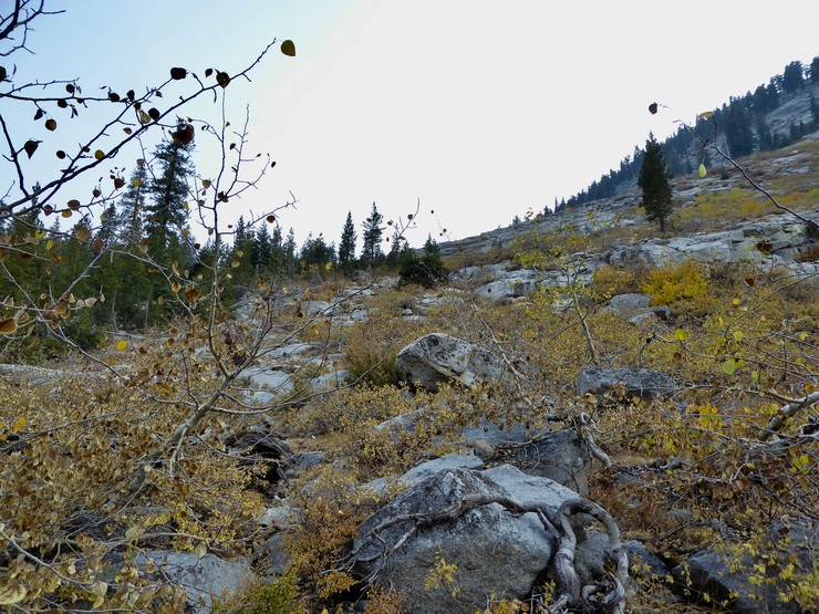
Still, aside from pushing aside some tree branches, I wasn't really bushwhacking, and for this I was thankful. I was even more thankful when I encounted lovely granite ramps that let me completely bypass the overgrowth covering the creek bed at the bottom of the canyon.
When the cluck struck 1700, I was right around 9100 feet in elevation. I felt pretty tired. I was satisfied with my progress for the day, and since the canyon appeared to be flattening, I thought I'd return to the creek and see if there was a decent place to camp. The trees and shrubs became a bit thicker as I neared the creek, though, and when I finally reached the water I didn't see anything resembling a nice spot to set up a tent...or to fill up on water.
Up ahead I could see a steep stretch of rock that I'd have to climb to continue moving south in the canyon. And even though my intention had been to stay to the west, it looked easier to stay on the east side to get up to the next copse of trees. Unfortunately, right when I was ready to quit, I had to deal with my first slabbing experience of the trip.
It wasn't terrible, but it took every bit of concentration I had to make sure I didn't slip up and do something stupid. Thankfully, when I reached the top of that collection of slabs/boulders, I came to a beautiful stretch of open forest where the water in the creek was still running.
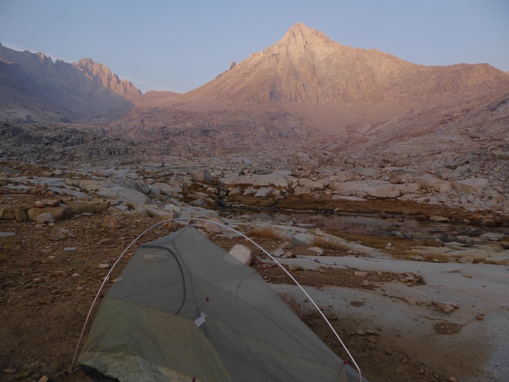
The ground wasn't terribly flat, but I did find a small patch of dirt where I could set up my tent, not too far away from the creek. It turned out to be an excellent campsite overall. A lovely trickle of water filled the otherwise calm, silent evening. And when the sun finally set, I was shocked to see the stars appear in nearly full brilliance. The Milky Way streamed intensely across the open stretch of sky framed by the towering trees above me.
The next morning I woke up with a high degree of excitement for the day ahead. I had a feeling that the lakes and alpine scenery I would see today would likely be the highlight of the trip. The morning started off perfectly, with the sunlight filtering in as I filtered water from Sphinx Creek.
I took my time eating breakfast and drinking tea, trying to soak up the pleasant morning. And when I finally got going, I was thrilled to find another noticeable stretch of worn earth that made traveling uphill quite easy.
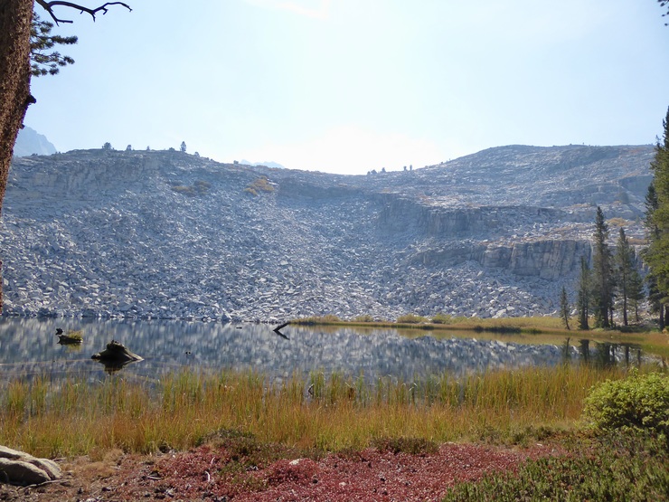
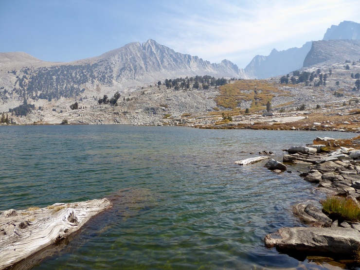
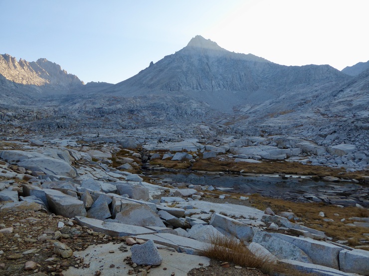
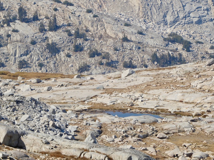
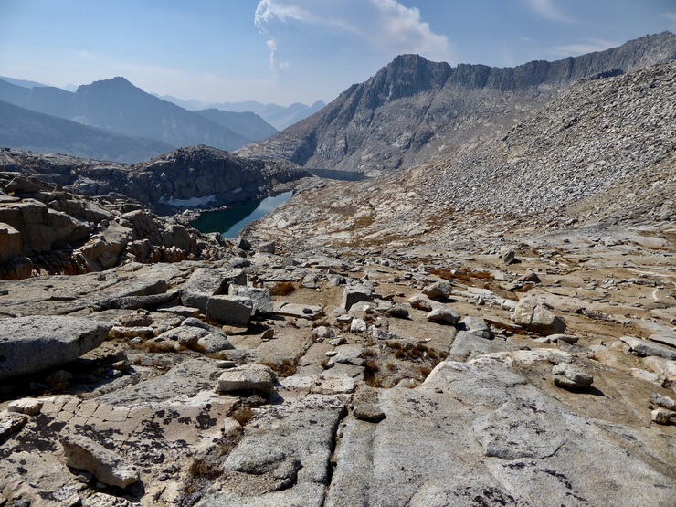
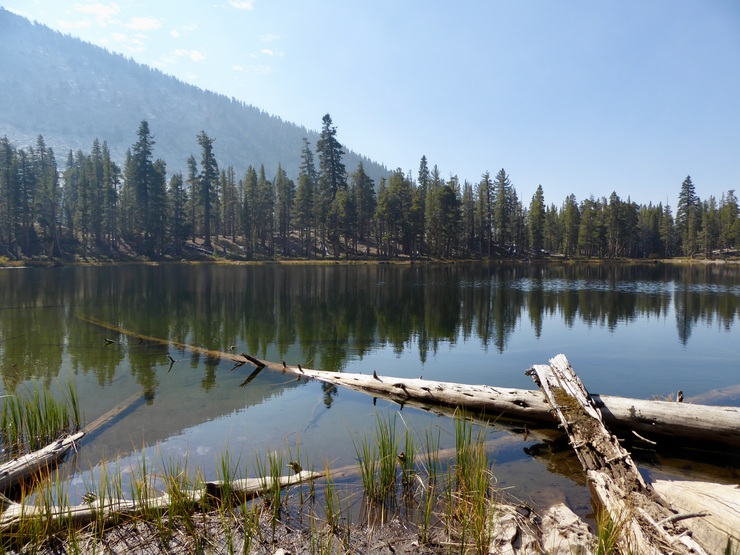
I only had to go a half a mile or so before I came upon the unnamed lake (or pond) at 9700 feet.
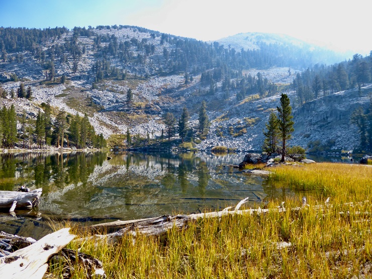
It looked lovely in the morning sunlight. I decided I'd stick to a westward course and circumvent the lake on its western side, curling around Sphinx Creek as it split up the meadow I found myself in.
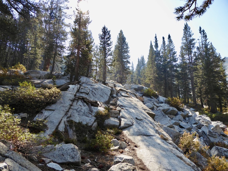
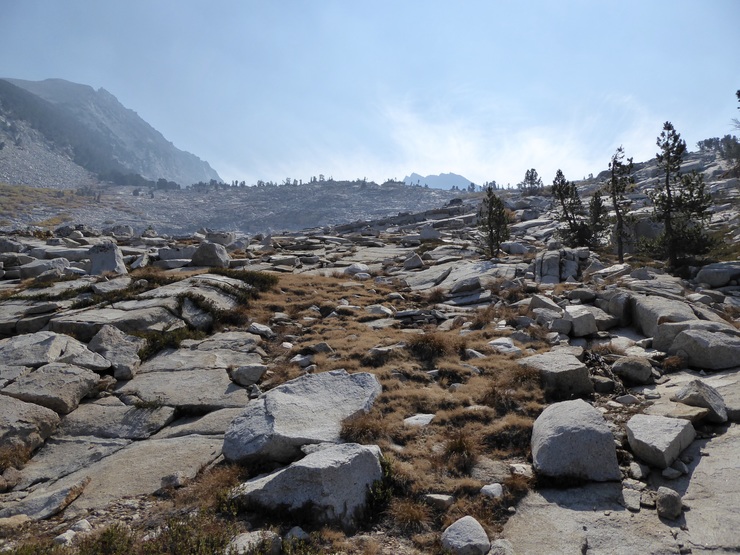
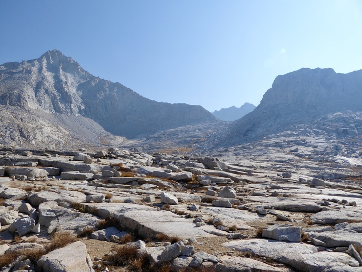
When I got to the base of the next uphill slope, I realized it wouldn't be such an easy time getting up. After a brief stretch of granite walking,
I found myself trying to weave in and out of thickets of Jepson's willow (or at least what I believe is Jepson's willow), making progress slow.
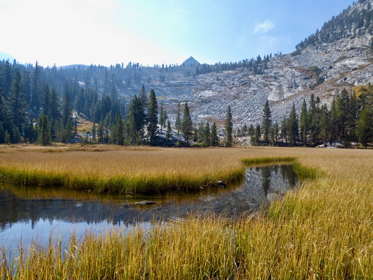
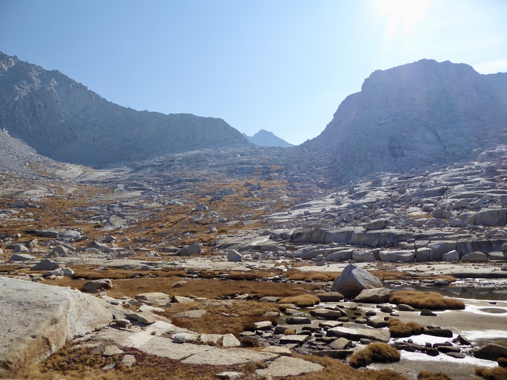
After a short while, I got to the next unnamed lake.
At this point I took a break to study the map and try to determine the best route forward. I was already leaning towards the western shore, but it became apparent that it would be much easier to make my way up and around on the southeastern side. I'm glad I took the time to backtrack slightly to get to this side because it was ended up being an easy ascent along a floor of granite slabs and bunch grass.
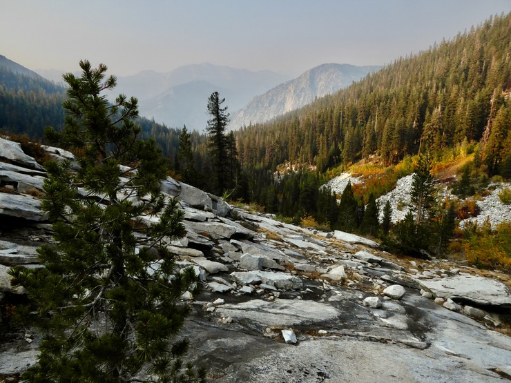
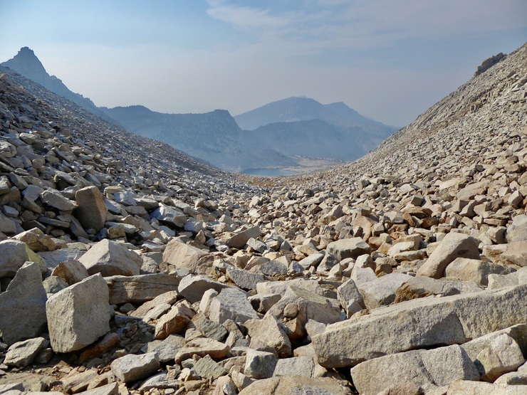
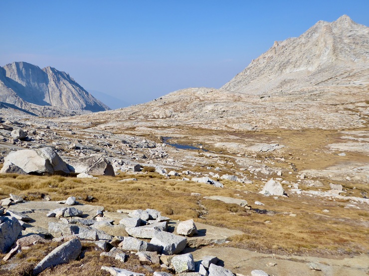
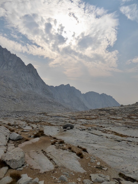
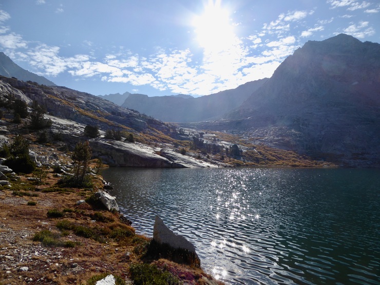
The view back towards where I came was pretty smoky, but I could still make out some of the peaks surrounding Paradise Valley.
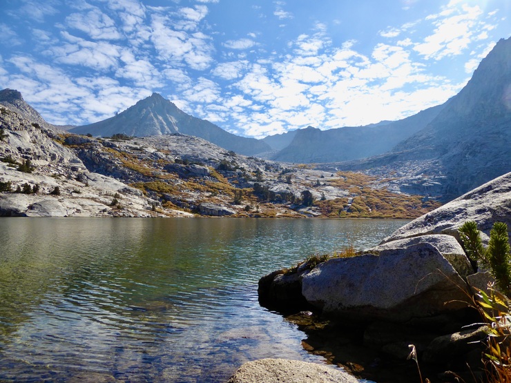
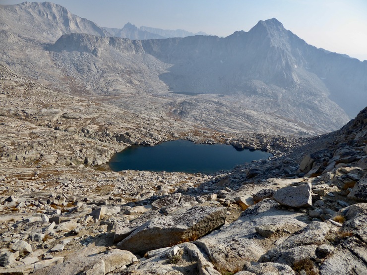
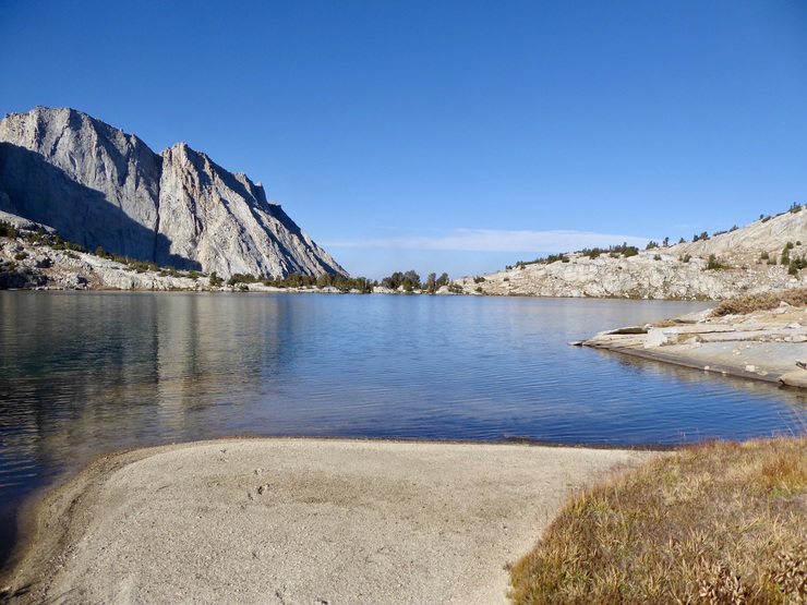
When I reached the northerneastern shore of the eastern Sphinx Lake, I was absolutely delighted at how gorgeous it was. Picturesque red heather dotted surrounding the calm water
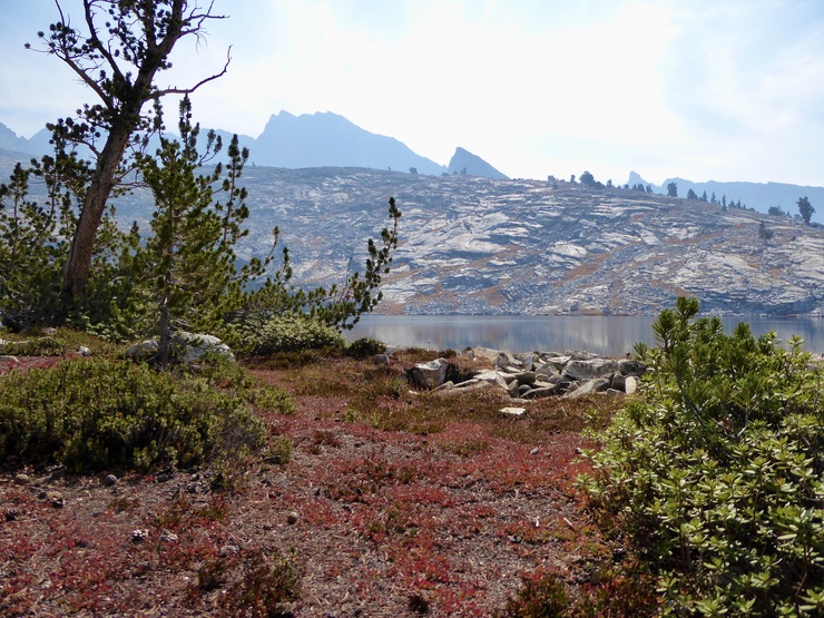
and serene reflections off the calm water made me feel extremely content.

I was a bit surprised at just how well-carved the use trail on the northern shore of the lakes was.
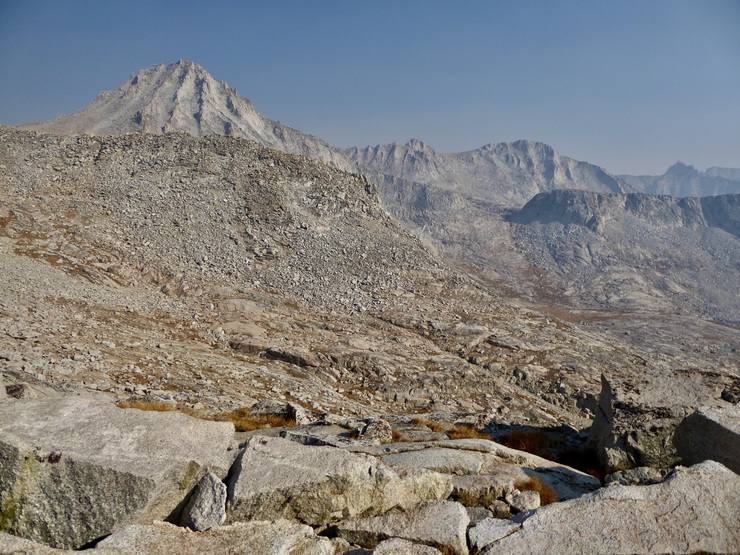
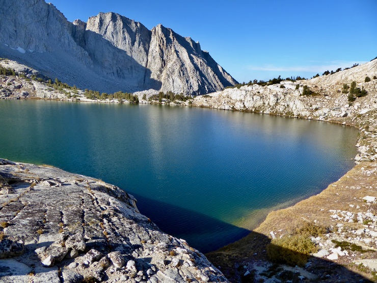
It was clear where I wanted to eventually get to, and although it might have been a longer path, I decided to circle around the western side of the lake to reach the gradual slope to the south (on the right side of this picture beyond the lake).
I was feeling like I was on cloud nine strutting up the granite slabs, taking notice of the pretty whitebark pines speckling the area.
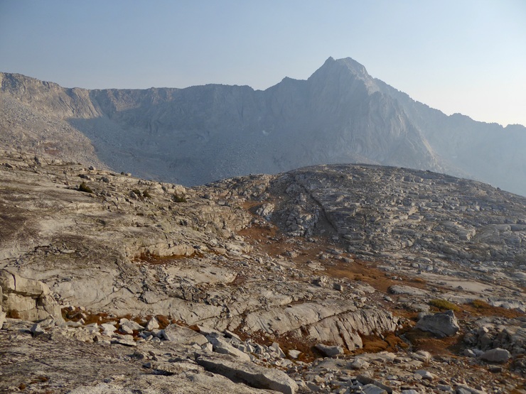
Eventually, I got my first glimpse of Sphinx Pass.
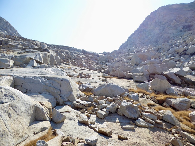
Based on the trip reports I had read, I was expecting a relatively easy time going up and over the pass. But as I got closer to the tairn at its base, I realized that it was not going to be a walk in the park like I was expecting. In fact, it was a real pain in the ass navigating the boulder field in front of me.
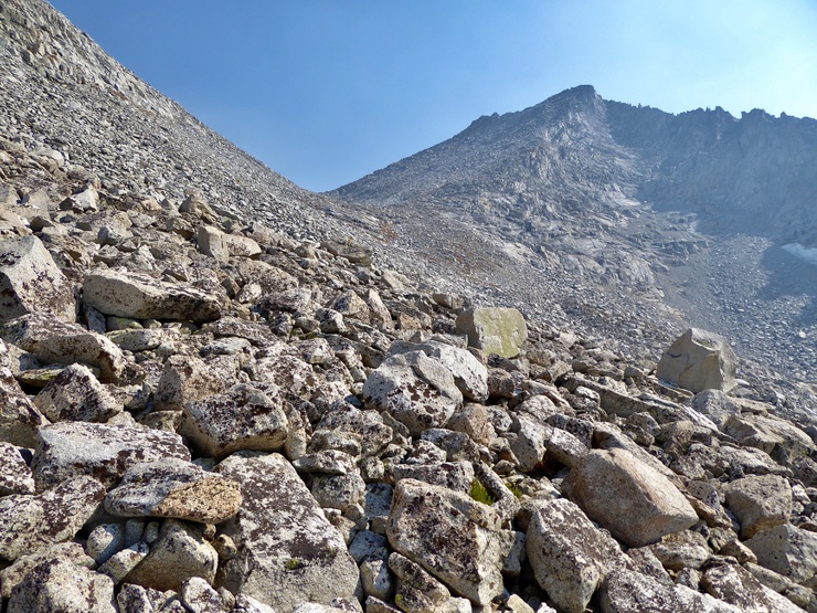
There did not seem to be any obvious "easy" way to get across this first boulder field, although I can't say I took the time to explore the low point near the tairn. I stayed a bit high on the northern side and patiently climbed over the countless rocks before me. Around 1500 hours, I finally reached the last stretch of maybe 200-250 feet of elevation gain, which turned out to be no picnic at all.
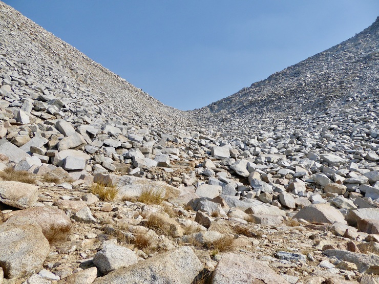
Admittedly, it's not like this is a class 3 route (it's probably class 1 all the way up). The biggest danger is stepping onto an unstable boulder and turning your ankle or accidentally disturbing a rock that slides down and breaks your leg. But to make sure these things don't happen, you obviously want to take your time and examine all the steps you're about to take, which makes it slow going. On top of that, there is no clear, obvious way to most easily get over or around the huge boulders and slabs here. But with a bit of zigging and zagging, it's definitely doable. Here's a look back down from near the top of the pass to give you an idea of what you'll be up against.
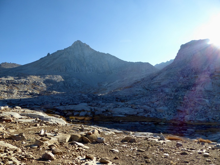
I was quite thrilled to finally reach the top of the pass and look into Brewer Basin for the first time. I set my pack down and took a moment to enjoy a snack and the views I was afforded from the pass. Mt. Brewer, North Guard, and South Guard were everything I hoped they would be. It was a glorious sight to see.
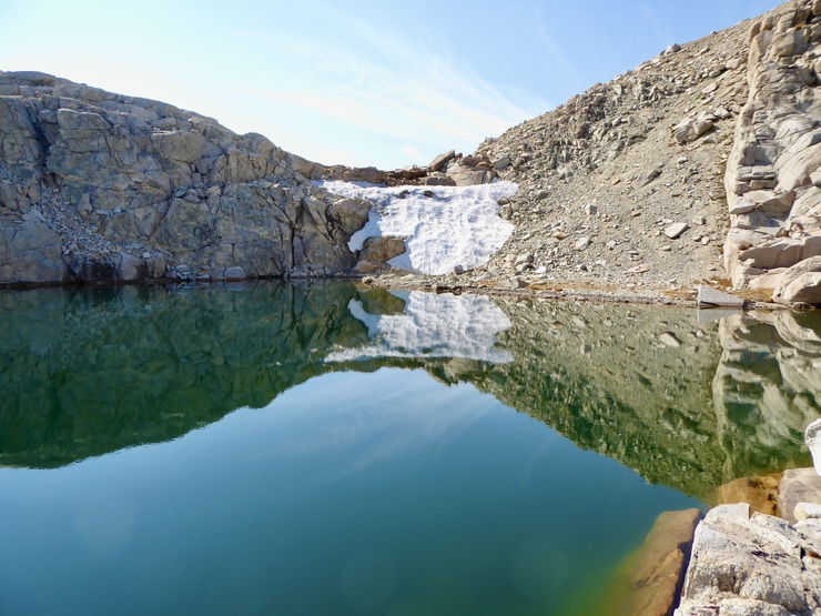
To my elation, the route down on the southern side of the pass looked much easier and shorter. When I got going, it wasn't long before I was walking almost completely upright as I descended to the first tairn.
I took another break here to appreciate the stillness and solitude of the place I had just entered, and to marvel at the reflection of the late afternoon sun.

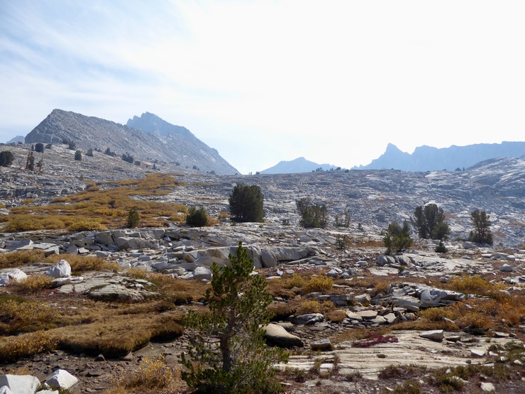
I had some loose ideas about where I'd like to camp while I was in Brewer Basin. From what I had read in "High Sierra" by Arnot, I thought Big Brewer Lake sounded like a nice spot. But part of me wanted to stay a bit higher in the basin so I could be closer to Mt. Brewer and the alpenglow show that was about to occur. I was running low on gas (metaphorically), and as it turned out, descending further into the basin wasn't a cakewalk. There were a few steep shelves that I had to circumvent as I headed south.
For the most part, though, the basin is filled with sweet stretches of flatness that make for simple movement.
I was getting closer to Big Brewer Lake,
but as I did, the sound of the Brewer Creek drew me towards its grasp, and before I knew it, I was ascending back towards Mt. Brewer. I eventually found a pretty good spot right next to the lake at 11,400 ft and set up camp there. Almost immediately after I had finished setting up my tent and emptying my backpack, I was treated to a breathtaking illumination spectacle on the face of Mt. Brewer,
as well as a brilliant view of the sun retreating underneath the veil of smoke that enveloped the sky to the west.

The evening would prove to be extremely pleasent. The temperature was in the low 50's, so with only a few layers I was perfectly comfortable sitting and drinking some post-dinner tea and watching the stars arise from the darkness. And once again, the Milky Way was spectacular.
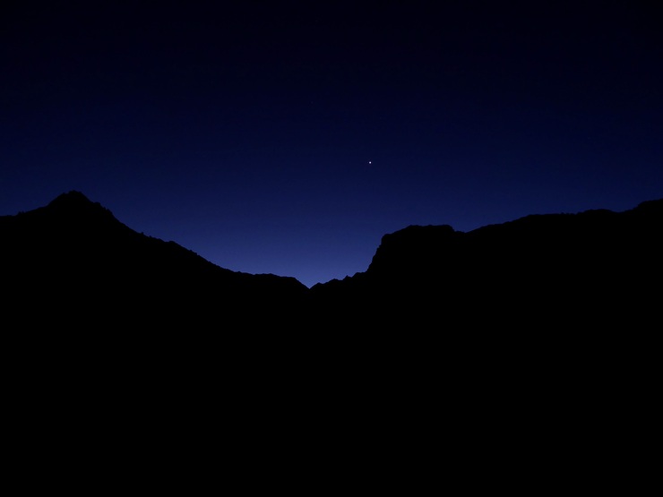
The moon was waning, just a few days past full. So around 2300 hours I awoke to an unmistakable glow on all of the exposed surfaces in the basin. Although the stars were subdued, the beauty of the moonlight reflecting off the granite walls was more than enough to compensate. You just can't go wrong on a cloudless evening in the High Sierra, can you?
On this third day of the trip, my only real plan was to take it easy. Part of me wanted to achieve the gratification of reaching the top of Mt. Brewer, but another part of me wanted to just swim and meditate along the shore of South Guard Lake. I figured I'd have a nice breakfast, start moving, and then let the fates decide.
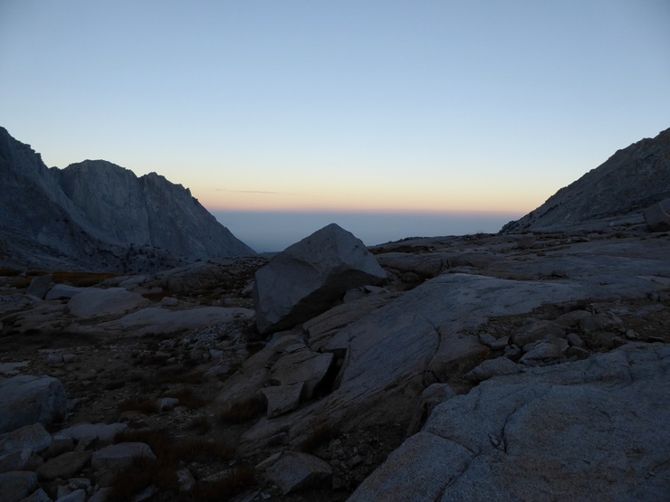
I took a decent while to watch the sun put on its post-dawn show in the basin.
Similar to the previous evening, the morning temperature was quite pleasant. There were small pathces of ice on the surrounding tairns, but I was totally comfortable with my down jacket.
When I finally got going around 1030, I found myself reveling in the simple traversal of the preliminary stretch up to the "pass" to South Guard lake.
As I got closer to the ~500 foot slope, I was quite happy to see that it looked entirely straightforward the whole way up. There were a few small shelves, but it was easy to see how one would get around them in every instance.
When I had gained a bit of elevation, I took a moment to look back and try to identify my campsite. I eventually made out my tent, although it wasn't easy (my wife actually pointed out that I should probably get a brighter solo tent just in case of an emergency)
Staring back down into the heart of Brewer Basin,
I felt a huge sense of ambivalence, as I always do when I'm the High Sierra. On one hand, these basins are majestic, inviting landscapes with plenty of fresh water, fresh air, and peace and quiet. On the other, they are barren, somewhat hostile places. And I'm saying that based on my experiences in the Spring, Summer, and Fall. I can't imagine what it's like to spend an entire winter in a place like Brewer Basin.
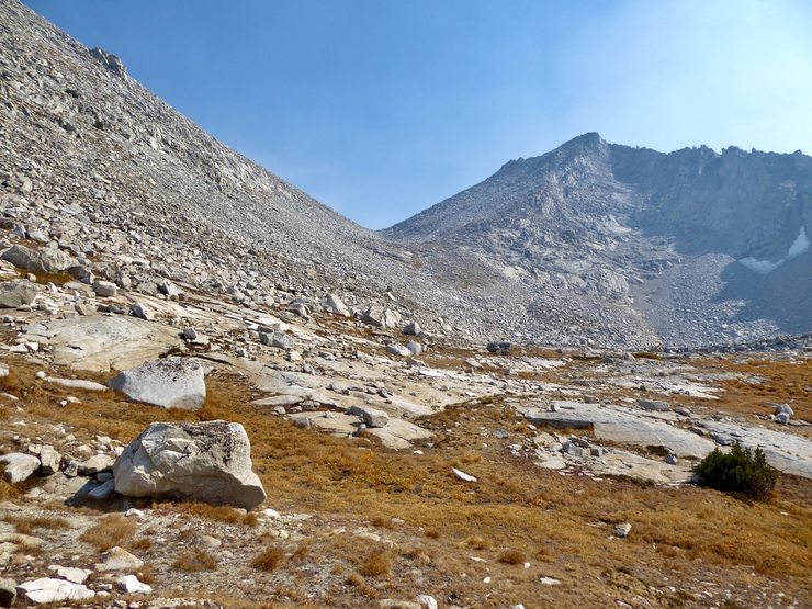
My impression of how easy it was going to be to get to the base of Mt. Brewer was largely correct, although in the last ~200 feet of elevation, things did get a bit trickier.
Nothing dangerous, of course, but it required a bit of thought to make sure I wasn't leading myself into an impassable section that required backtracking. When I finally got to the tairn that separates the central portion of Brewer Basin from the portion that South Guard Lake occupies, I was quite taken by the body of water located there. It was the most superlative turquoise green, and I felt as if it was beckoning me to jump into its depths.
The depth drops off precipitously from the shore, and there are plenty of spots where you can jump off rocks perched 15-20 feet above these deep areas. At this point I faced a major quandary as to what I should do for the day.
11 When I stared up at the southern shoulder of Mt. Brewer, I could tell that summiting it would be pretty straightfoward. Sure, there's a bit of scree to deal with, but nothing to make me fear for my life. I felt like it would be a good challenge and a satisfying feat to reach the summit. But on the other hand, my ~40-year old knees and body were really craving at least a few hours of relaxation. And I had promised my wife that I wouldn't suffer any injuries that prevented us from doing the Lost Coast a few weeks after I returned. So after almost a half an hour sitting on the shore of that heavenly tairn and deliberating, I decided I'd go down to South Guard Lake, swim, and enjoy the perfect quiet of Brewer Basin.
Crossing the tairn was actually a bit of a challenge. There's a nice bridge of rocks that splits the middle,

but it required some climbing down some steep rock shelves to get there. I found similar circumstances on the other side of the tairn on the way back up. When I had finally gotten to the top of the saddle that leads down into the South Guard Lake basin, it looked like there were a couple of ways to get down to South Guard Lake. The first was to follow this narrow little trench down.
But I opted to go with the more gentle approach on the southwestern side.
I'm glad I did, because that narrow trench looked a lot more difficult. As I was headed down, I noticed an enormous plume of smoke off in the distance to the southwest.
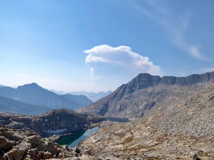
I took a moment to get a bearing on where it was originating, hoping that it wasn't in the direction I was planning on going the next day. Luckily, it looked like it was a bit further south than where I was headed.
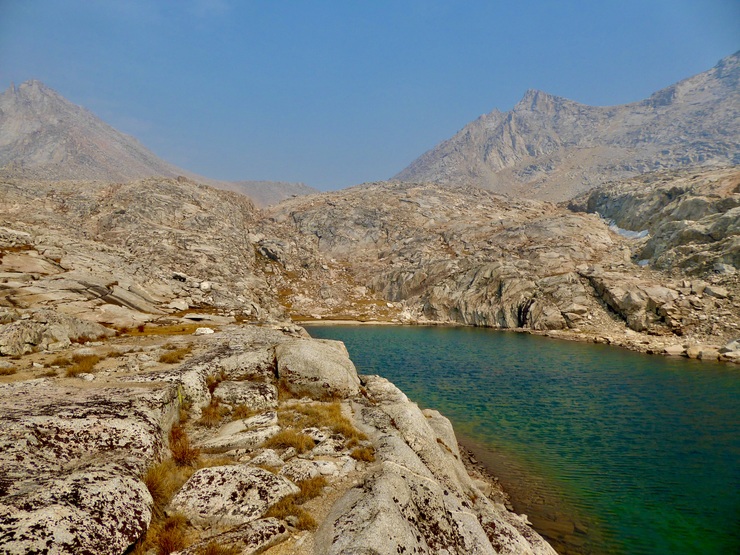
As I passed the unnamed lake at 11,900, I was shocked at how gorgeous the turquoise water looked in mid-day sun.
I noticed there was a really nice sandy beach on the northerastern shore where I could potentially have lunch and take a nap, but I figured South Guard Lake would probably have spots that were just as good. As it turns out, I was wrong. When I finally reached the northwest tip of South Guard Lake, I found that it was occupied by large boulders and a rocky, slippery bottom.

Not exactly the best place for swimming, I thought. But still, I was ready for a break, and I there was a nice flat stretch of granite where I could eat and nap after I took a dip in the water. So that's what I did. The smoke actually became so thick that it heavily obscured the sun, which kind of ruined my favorite activity of air drying on a hot granite slab after swimming in ice cold water. But I put on my layers and closed my eyes, and basked in the perfect quiet.
After a short doze, I started my way back up towards the saddle. I proceeded very slowly back to camp, taking as much time as possible to enjoy the views and my surroundings, imagining the millions of years of activity that led to this place's existence.
When I got back to camp, my goal was to try to fix a hidden leak in my thermarest. So after settling in, I spent a really long time peering examining all of its surfaces. But I couldn't find anything besides a cosmetic scratch near its side. Thinking that maybe air was somehow leaking out of it anyway, I tried coating it with sap from the nearest pine tree and then covering that spot with duct tape. I felt proud of the MacGyver'esque job I did, but it turns out it didn't work. So after another delightful, warm evening of dinner, entrancing clouds,
and alpenglow, I retired to my tent, prepared to wake up every 1.5 hours to reinflate the thing.
Despite getting pretty lousy sleep, I woke up in a great mood. I took awhile to admire Venus leading the sun over Mt. Brewer's neighboring peak,
as well as the Earth's shadow intermingling with the hazy skies to the west.
I thoroughly enjoyed watching the shadow of the surrounding walls creep across the basin floor as I ate breakfast.
I was a bit nervous as I ate, though, since I had decided to take a different route back and I didn't quite know what I would be up against. Initially I thought I might try to go over Longley Pass or just return the way I came, based on the way I felt. I felt like I might need an extra day to try Longley Pass, and going back the way I came was extremely unappealing. Not only because I would be seeing the same thing, but because going down Sphinx Pass would be a real SOB.
So I had decided to head down Brewer Creek and then follow the spur between Brewer Creek and Morraine Creek until I joined back up with the trail to Avalanche Pass. From the topo map, it looked like it would be straighforward. But since I hand't done any research on this area, I was worried I might be bushwhacking through thick aspen groves or manzanita bushes. I felt a bit of comfort, though, since I had been able to send my wife a text with my Garmin Inreach device and let her know this was my plan. If something happened to me and the Inreach somehow stopped working, at least the search and rescue team wouldn't be searching in the wrong spot.
When I got going, I was thrilled to find that the route down to Big Brewer Lake didn't was very simple.

Big Brewer Lake was really quite splendid. There was a lovely sand beach on its eastern shore that would have been a great place to go swimming the day before.
I remembered Arnot saying that one shore was much easier than the other to follow in order to get to the west side, but I couldn't remember which one. The northern one looked like it was more doable, though, so that's the one I followed. There is one spot where you have to climb over a large rock outcropping,
but aside from this, you can pretty much stay along the shore the whole time.
Arriving at the outlet of Big Brewer Creek, I was mesmerized by the unbelievably picturesque scene back to the east.
I started wishing that I had stayed here (Arnot recommends the area just to the east) for the last two nights, but I think the area I chose had it's own plusses.
The next ~1.25 miles down to the pond/lake at 9800 feet wasn't bad at all. For the most part, it's open granite,
interspersed with some conifer stands.
Really, there was only one barrier of small aspens I encountered.
But luckily, all I had to do was follow it down to the south and I found an opening I could pass through. I took a thoroughly enjoyable break when I got to the unnamed lake at 9800 feet,
still a bit nervous I might run into more difficult barriers, but satisfied I was almost half-way through the untrailed portion of the day.
When I got going again and I had made it 50 meters to the west of the lake, I was absolutely elated to find that the path ahead of me was like a wide open highway through the most delightful hall of fir trees.
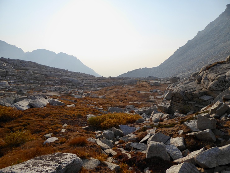
The rest of the way would be equally enjoyable. There was some challenge in trying to avoid the temptation of following the easiest looking path, which leads to the southwest (and eventually to a very steep grade down to Cloud Canyon). I had to force myself to keep looking at my compass and making sure I was headed toward the gradual spur that points southwest. I had to do a bit of an up and over to get over a little manzanita-infested hump in between me and that spur, but after I did, it was extremely smooth sailing.
There were moments where the forest was so open and welcoming that I just wanted to sit down and spend hours laying and relaxing on the soft ground.
I made a concerted effort to stay at the top of the spur the whole way so that I could avoid the marshy area at the bottom of the little gully to the northeast. Luckily, this wasn't difficult. I just had to make sure I kept my heading on my compass.
It wasn't long before I finally reached some flat ground. There was a decent amount of brush and fallend trees I had to slog through through before I finally got to the bank of Avalanche Creek.
I spent a really long time eating lunch next to the creek and basking in the feeling of knowing I had completed the most difficult portion of my journey. Once I got back on the trail, the only pending worry I would have would be the possibilty of running into areas that were actively burning. I felt like that possibility was very slim, but boy was I wrong.
I quickly joined up with the trail when I got going again, and it was a real joy not to have to think about every step I was taking. But after a few hundred meters, I started to observe sections of forest around me that had burned quite a bit.
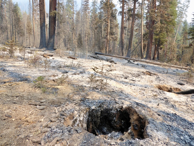
Not being well versed in the forensics of forest fires, I couldn't tell how recently the Earth arond me had been scorched, but it did seem like the ashes looked pretty fresh. And as I continued walking and pondering this question, I started to see smoldering logs on the east side of the trail, which freaked me out a bit.
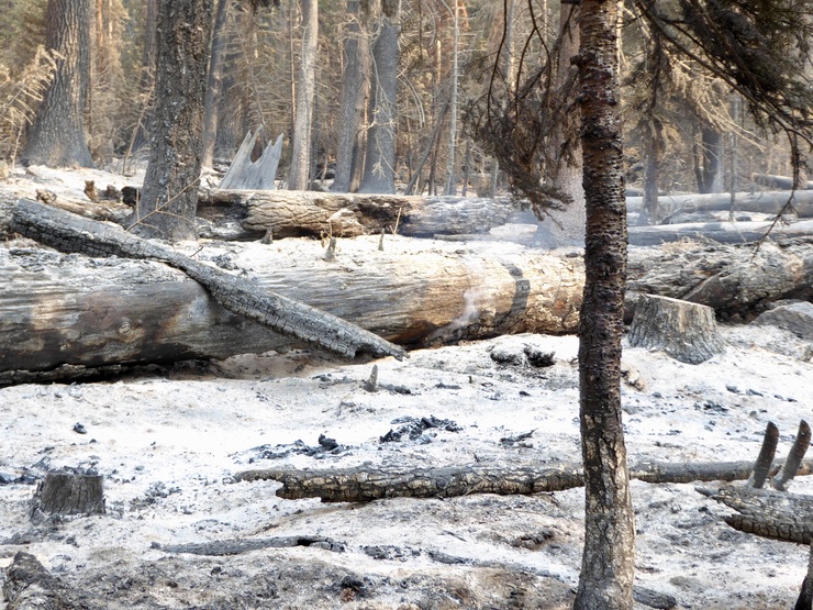
Apparently I was walking in an actively burning area...
I could see that the sky to the north of me was getting a bit smoky, which didn't help calm my nerves at all. And then I started to notice popping sounds and flames bursting from the bases of trees.
At this point, I was actually pretty freaked out. Continuing along the trail, I found myself next to fallen trees that were burning all the way through. The air around me was also getting pretty hot, and as a result, I started sweating heavily. Luckily, everything that was burning was confined to the eastern side of the trail, so I figured my fallback plan would be to just divert to the west or turn around if I needed to. But I was still very nervous that my passage up to Avalanche Pass would be thwarted. I was anxious enough that I didn't take any pictures as I hurried past the smoke and the flames and the heat.
Thank God, within just a couple of minutes, I had completely escaped the danger. The air to the north of me was pretty clear. I breathed a sigh of relief knowing that the area ahead of me when I saw the aspens free of any sign of smoldering.
The 1300-1400 foot climb up to Avalanche was not bad at all. The scenery back to the south wasn't great since it was pretty much just a blanket of smoke, but there were some pretty copses of aspens that lifted my spirits.
When I got to the top of the pass, I was surprised to see just how flat it really was.
I hadn't studied the map that closely for this portion of the trail, but with the name of Avalanche Pass, I had anticipated a more rugged and dramatic landscape than this. Still, it was a great place to rest and enjoy the satisfaction of knowing that it was mostly downhill from here.
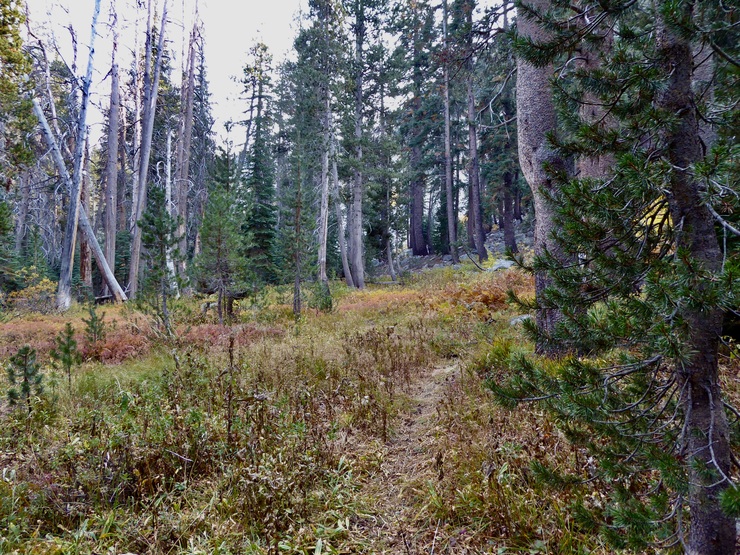
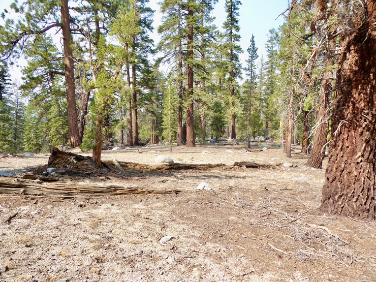
The remaining few hours or so of hiking in the day was really more of a leisurely stroll through lovely forest.
I took my sweet time going downhill since I kept stopping to look back at the now distant reaches of the walls surrounding Brewer Basin.
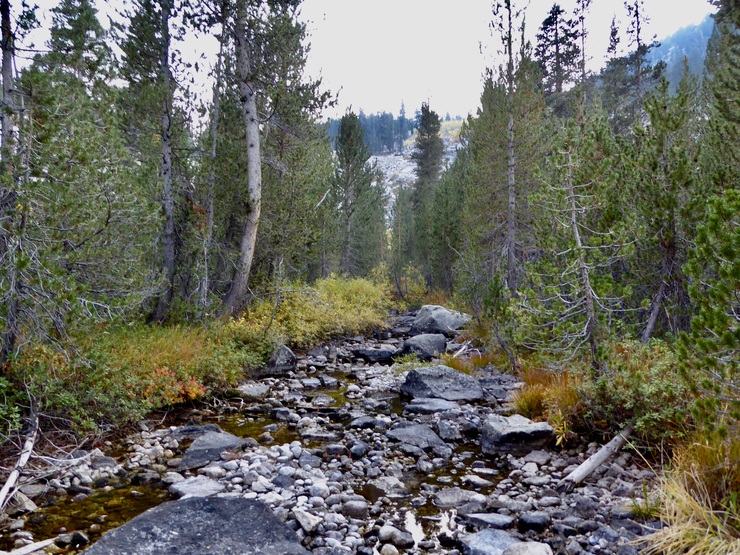
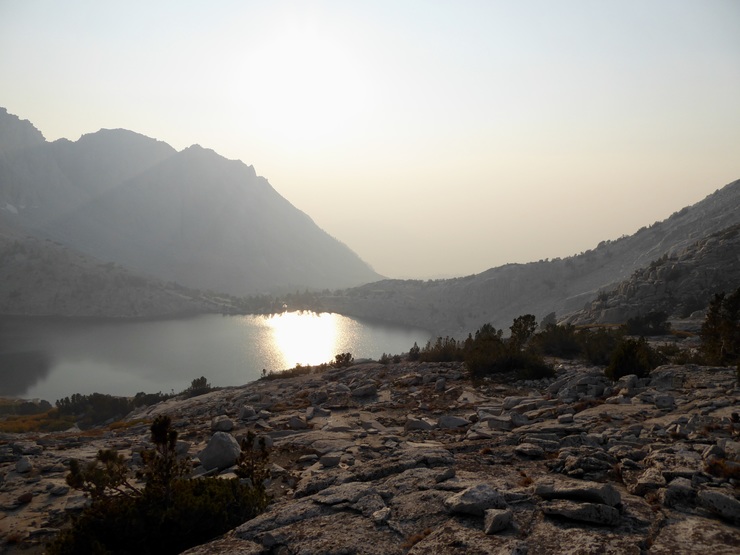
My goal was to make it to Sphinx Creek for the evening. I had noted that there was just enough running water there to make it a decent place to camp. I arrived there with just about an hour of daylight to spare, and quickly set up my tent and fetched water. It was a gorgeous evening. Again, the stars were simply spectacular despite the smoke.
I spent an hour or so trying to capture a picture of the Milky Way using the "Starry Sky" and manual features of my Panasonic Lumix camera, and eventually killed the battery doing so. I never did get a decent shot. That camera was just incapable of delivering a quality long exposure. I decided that one of my first points of order when I got back was to upgrade to a new camera.
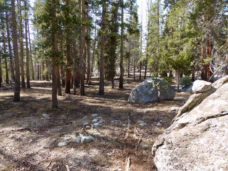
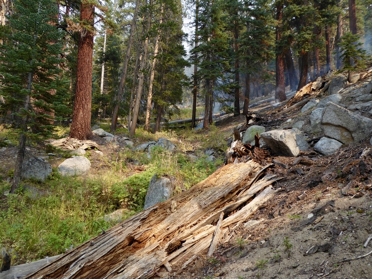
There isn't much interesting to report on the last day. It was primarily just a repeat of the route I had taken on the first day of the trip. However, I did end up taking the route that travels along the southern side of the South Fork of the Kings Canyon this time. I had never done this before. Usually when I get to that junction at the base of the Bubbs Creek Trail I don't have the energy to want to do the extra ~0.6 miles or so required to get back to Roads End.
It was pretty pleasant, though. Just a flat trail going through the beautiful cedar forests. As I got closer to my car, I started to wonder where I would be able to cross the river. I couldn't see an obvious bridge on my GPS or my map. I decided I'd just find a shallow part of the river to cross, and luckily, there was one just to the south of the parking lot.
I was able to walk across the river in hip-deep water thanks to the shallow October water level. When I got across, I took off all my clothes and took a much needed bath. That made the drive back to my house much more enjoyable.