


TRIP DETAILS
TRAIL MAP
OVERVIEW
Notes:
- Getting to Upper Kern Basin via Shepherd Pass was exactly as described in the trip reports and books I had read. It's a slog, especially if you're not acclimated. Anvil Camp is fairly well positioned for an overnight resting spot, though.
- I had read at least one trip report stating that an AWD vehicle was not needed to get to the trailhead. This is totally false. The road to the backpackers trailhead is one of the worst I've encountered in the Sierras, and a high clearance vehicle is necessary. The stock trailhead (which adds a bit more than a mile to the hike) is probably doable with a sedan, though.
- While reading the description of Upper Kern Basin in Arnot's "High Sierra", I was envisioning a healthy dose of solitude in Upper Kern Basin. And although I didn't see anyone for almost 48 hours during this trip, somehow I never really felt like I was truly alone in its reaches. This is probably because a person standing at the top of the pass just north of Lake South America has a view of almost the entire basin.
- One drawback to being immediately east of the Great Western Divide and the Kings/Kern Divide is that the alpenglow after sunset is basically nonexistent. When the sun dips below the horizon and provides that well-scattered sunlight, it just gets blocked by all the peaks to the west.
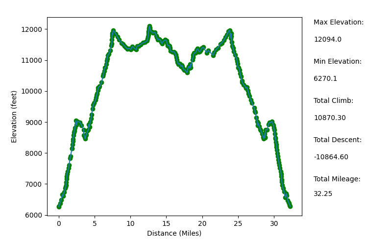
Elevation Profile (Mileage Underreported)
TRIP LOG
I managed to get the early start I had hoped for on my way out to the trailhead. I left the house around 3:30 am, and after a stop for tea, a stop for gas, and a bathroom break or two, I was in Independence, CA around 9:30 am.
I had read on a trip report or two that the dirt road to the Shepherd Pass trailhead didn't really require an AWD vehicle, so I wasn't shocked when I got on Foothill Road and saw a Toyota Camry driving the other way. But when I reached the turn off for the road leading to the hiker trailhead (just past the stock trailhead), I was quite glad that I had rented an AWD drive for the trip. There is no way that my minivan would have survived the last mile of the drive. Hell, even with a high-clearance AWD car I was terrified that it would tip over at times with two wheels riding 12-18 inches higher than the others.
It was a great relief to finally pull up to the parking area.
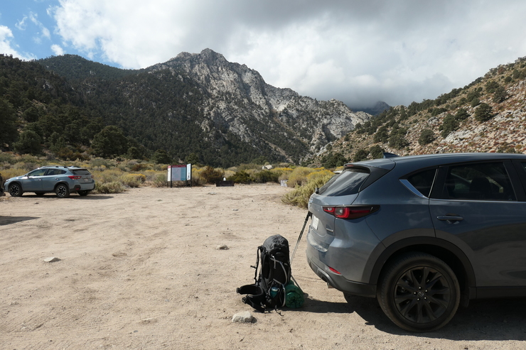
I was surprised at the number of cars that were there on a Monday morning. I think I counted 10. I'd later find out that most of them belonged to climbers headed up to Mt. Williamson.
When I finished the last bit of pack prepping and whatnot, it was exactly 11 am. The beginning portions of the trail were quite neat. The soft sand trail navigated through nicely colored sagebrush and other low-lying shrubs.
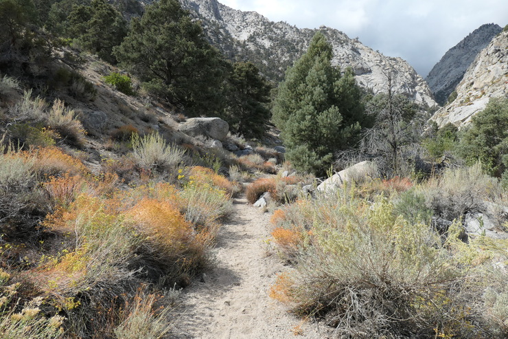
Over the first mile or so, the trail follows Symmes Creek while it weaves around various obstacles on the canyon floor.
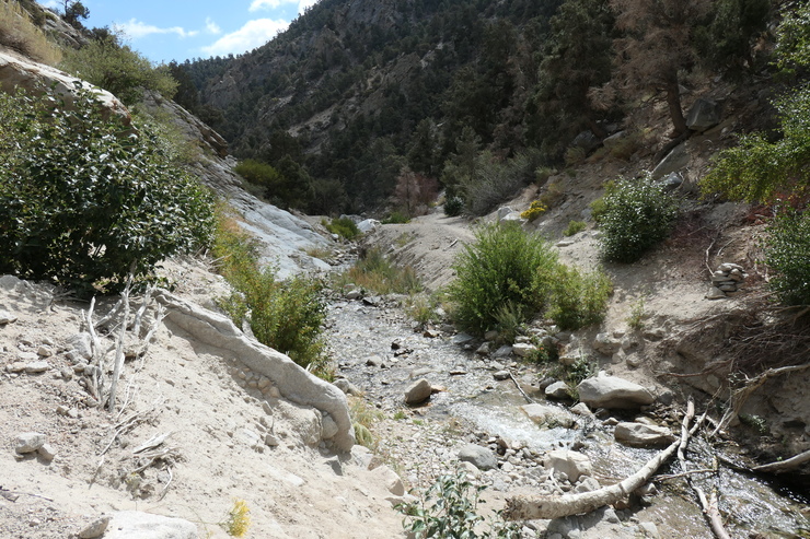
I believe I counted five separate creek crossings during this time; some easier than others. Given that the water level was fairly low at this time of year, I imagine the crossings are even more challenging during the spring and early summer. It was also a bit of a surprise to me that there was water at all since Arnot advises that one should bring at least a quart of water into the trip. If I had to do it again, I would have emptied my water bottles completely and filled up at the point where the trail finally steers away from the creek and starts climbing southward.
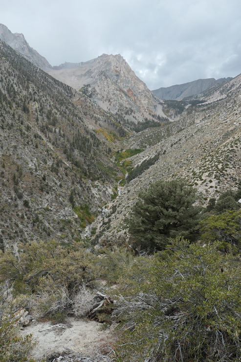
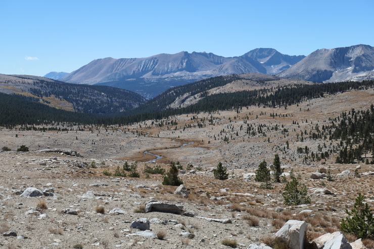
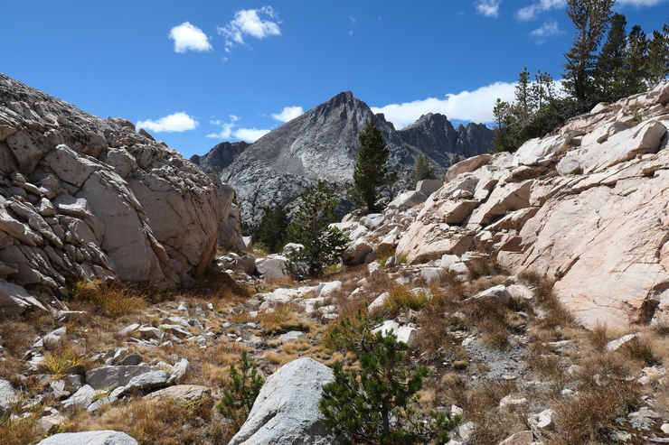
It's at this point where you won't see water for another 4 miles (and about 2500 feet of climbing) or so while the trail switches back and zig-zags in a seemingly never-ending fashion. The views of Owens Valley get better and better during the ascent, although it's really only a small window of canyon walls you can see it through.
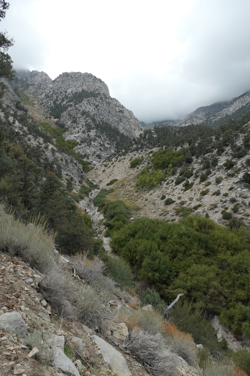
I was well in need of a short break when I reached the saddle between the Symmes Creek Canyon and Shepherd Creek Canyon. And boy, was it a lovely place to take a break. The clouds blanketing the mountains ahead of me were simply mesmerizing.
I watched as the tendrils of precipitation wrapped themselves around the granite peaks before me. It was quite a breathtaking sight.
The next portion of the trail was the one that I had been unexcitedly anticipating. After a relatively shallow decline over half a mile or so, it begin to drop rapidly through switchback after switchback, negating 600 feet of gain that I had made. Once at the bottom (but not quite at the creek), you get a view of where you will be heading.
Just before reaching the local minimum in elevation, the trail does cross one of tributaries to Shepherd Creek, offering a chance to fill out water before the final march up to Anvil Camp. Just beyond this is Mahogany Flat,
which looks like it does offer a few flat stretches of ground to set up a tent on.
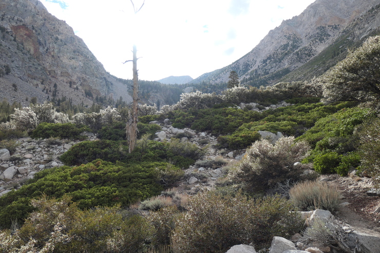
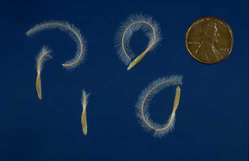
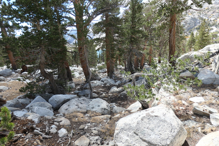
The remaining 1,400 feet of gain before Anvil Camp are not exactly the most pleasant. It's a dry, dusty trail fenced in by tall manzanita bushes and mountain mahogany. I did enjoy seeing the neat little spiral seeds that the mahogany trees were producing.
I remember continually looking up towards the plateau where Anvil Camp is situated
and repeatedly thinking I was almost there, only to find I was many switchbacks away. I was thoroughly exhausted when I finally reached the sign that told me I had arrived. It was just after 5 pm, putting the total duration of my day's hike at around 6 hours.
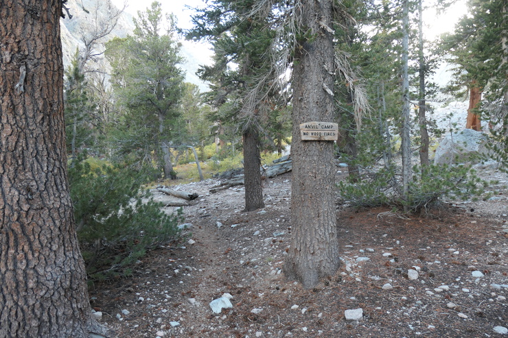
There were a handful of good campsites that were already occupied by climbers. But after crossing the creek on the main trail, I found a perfectly suitable place to set up my tent for the night. I got some very good–and well-needed–rest that night, even with the winds howling outside my tent. And boy oh boy, did they ever howl.
The outrageously loud winds overnight died down to a faint hum somewhere in the pre-dawn hours. And when I finally got up to pack my tent and make a spot of breakfast, it was quite a pleasant morning.
I managed to get on the trail just past eight o'clock. The sun wasn't quite reaching the canyon floor,
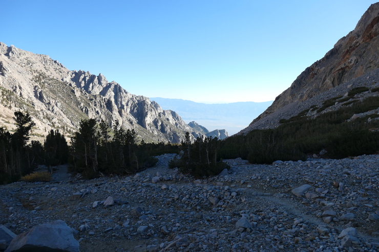
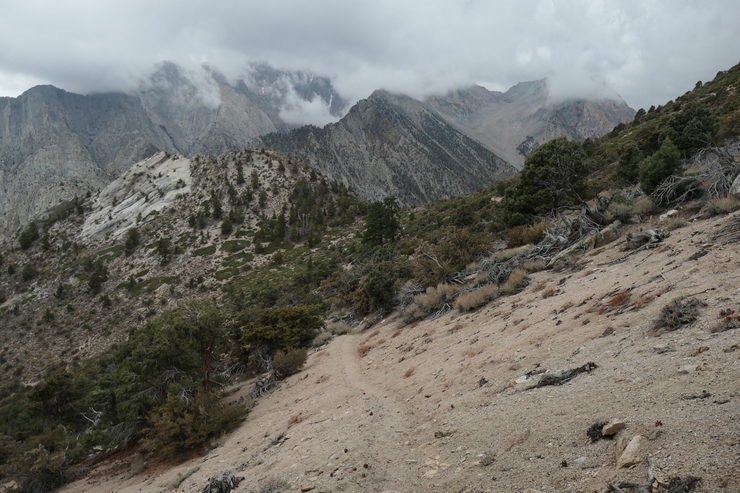
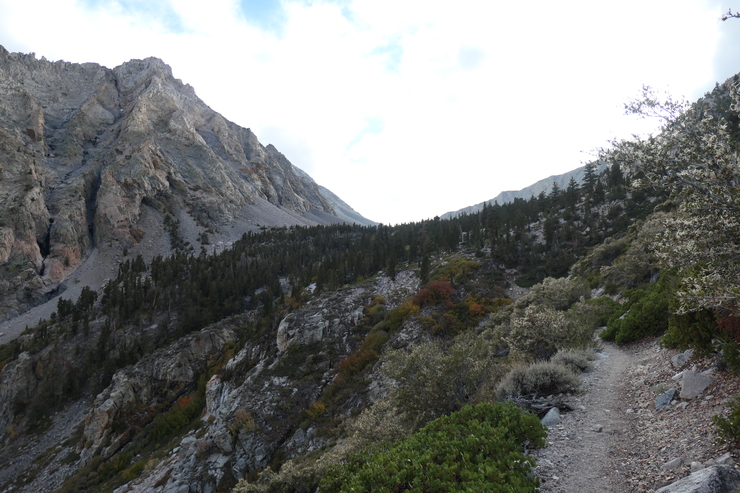
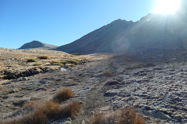
so it was quite cold. But with a gradual elevation gain over the first mile and change, I quickly warmed up. Right around 10,500 or so, the lack of trees and vegetation became noticeable as I surveyed the surroundings.
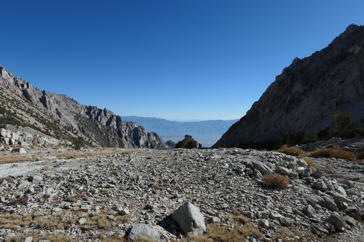
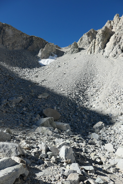
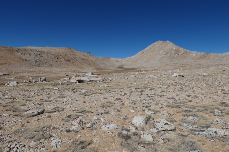
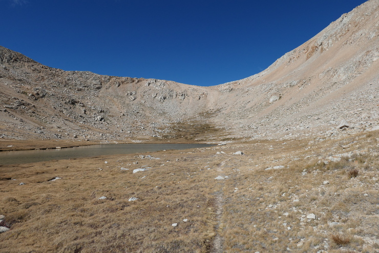
After looking extensively at the map and studying the area leading up to Shepherd Pass the previous night, I was curious to see what "The Pothole" looked like. I think the name is appropriate given the way the flat stretch of rocks and boulders seems to be encased by steep walls on all sides.
Given how late it was in the season, there wasn't much water flowing in the little gully to the north of the trail, and there weren't many tairns that were filled either. But I'd gladly accept this shortage of water with the accompanying lack of ice and snow along the trail.
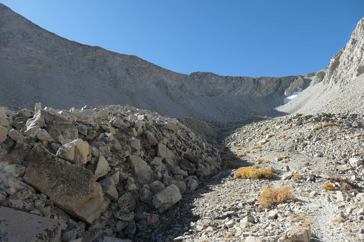
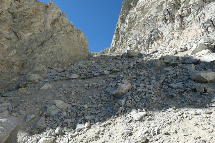
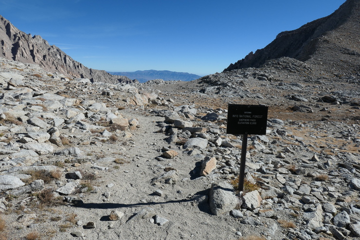
I stopped to take a rest on a big boulder when I was well within the clutches of the pothole. To be completely honest, I wasn't entirely sure just where the actual pass was. There looked to be several places along the ridge above where one could feasibly get up and over. But thankfully, as I followed the trail it became totally obvious where I needed to go.
The climb up to Shepherd pass was not easy. My pack was still very heavy with 3-4 days worth of food, and I hadn't completely acclimated to the elevation. I took my sweet time putting one foot in front of the other, and resting ever so slightly at each of the many switchbacks as I made my way up.
What made me anxious was not a fear of falling at the present moment, but rather the thought of having to go down these switchbacks in a few days when I was on my way out. This fear was not unwarranted given the 20-30 mph winds I'd encounter when I made my return. Again, I was just so thankful that I didn't also have to deal with ice and snow!
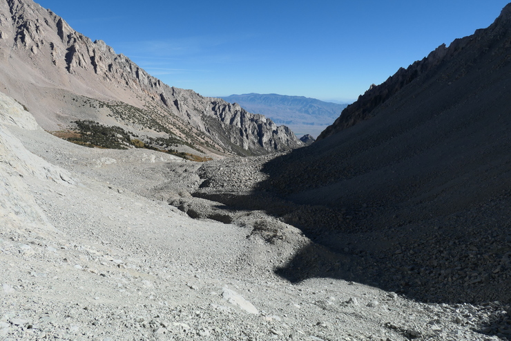
At the top of the pass is a large tairn that I was tempted to stop at.
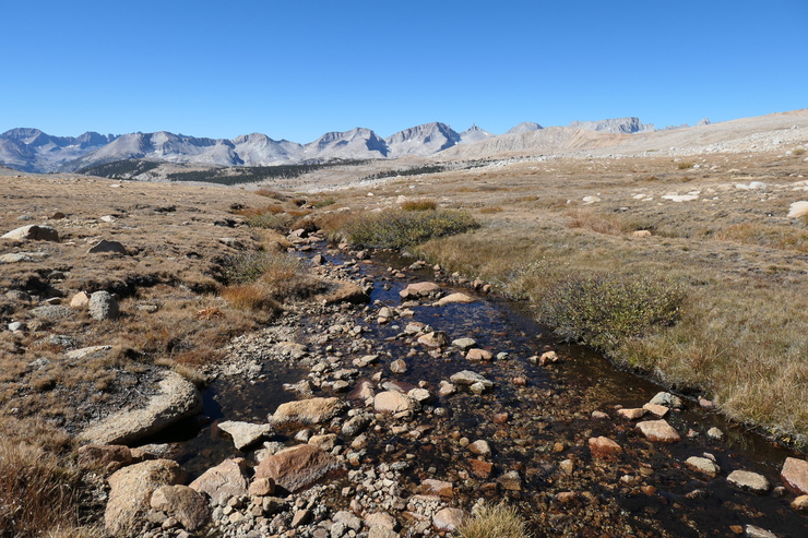
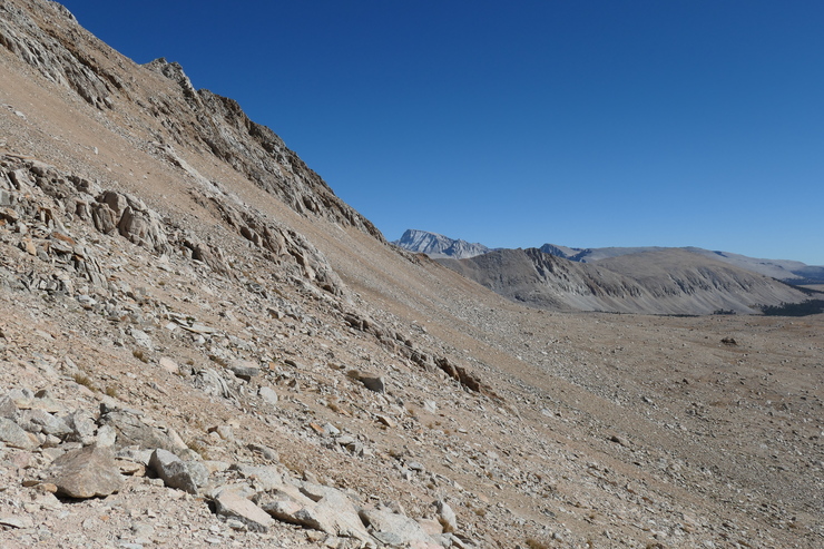
But given how frigid and windy it was, I elected to continue walking until I found a more subdued place to take a break. My plan was to follow the gently descending trail along Tyndall Creek until it started heading south. At that point I would split off and take a direct course to the west, so as to avoid an extra 1-1.5 miles of walking.
I think it was a good choice. The terrain was extremely easy and forgiving. There were just a few locations where the ground was soggy, or where the braids of the creek got deep enough that I had to figure out where I could cross.
All along the way, the view to the west was striking.
With the most challenging portion of the trip behind me, I was finally beginning to feel a sense of calm and relaxation from being in this majestic landscape.
It took me about an hour and change to reach the small lake just to the northeast of the three-way trail junction at the end of the Tyndall Cutoff.
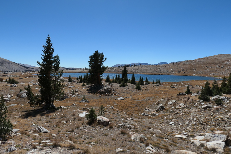
I stopped here to fill up on water and have a bite to eat in the very pleasant afternoon autumn sun. When I picked back up, I started to climb a small slope to the northwest, and eventually came upon the larger lake just to the west of the trail.
At this point I could see exactly where I was headed. At the end of the long, flat corridor to the north, the saddle that would take me to Lake South America was obvious; even if it did look like a completely vertical wall from this distance.
The closer I got, the less intimidating and steep it looked, though.
As I climbed up the switchbacks towards the saddle, I had some good views of the flat valley behind me. And when I neared the top, I finally caught my first glimpse of Mt. Whitney poking out behind the ridge to the east.
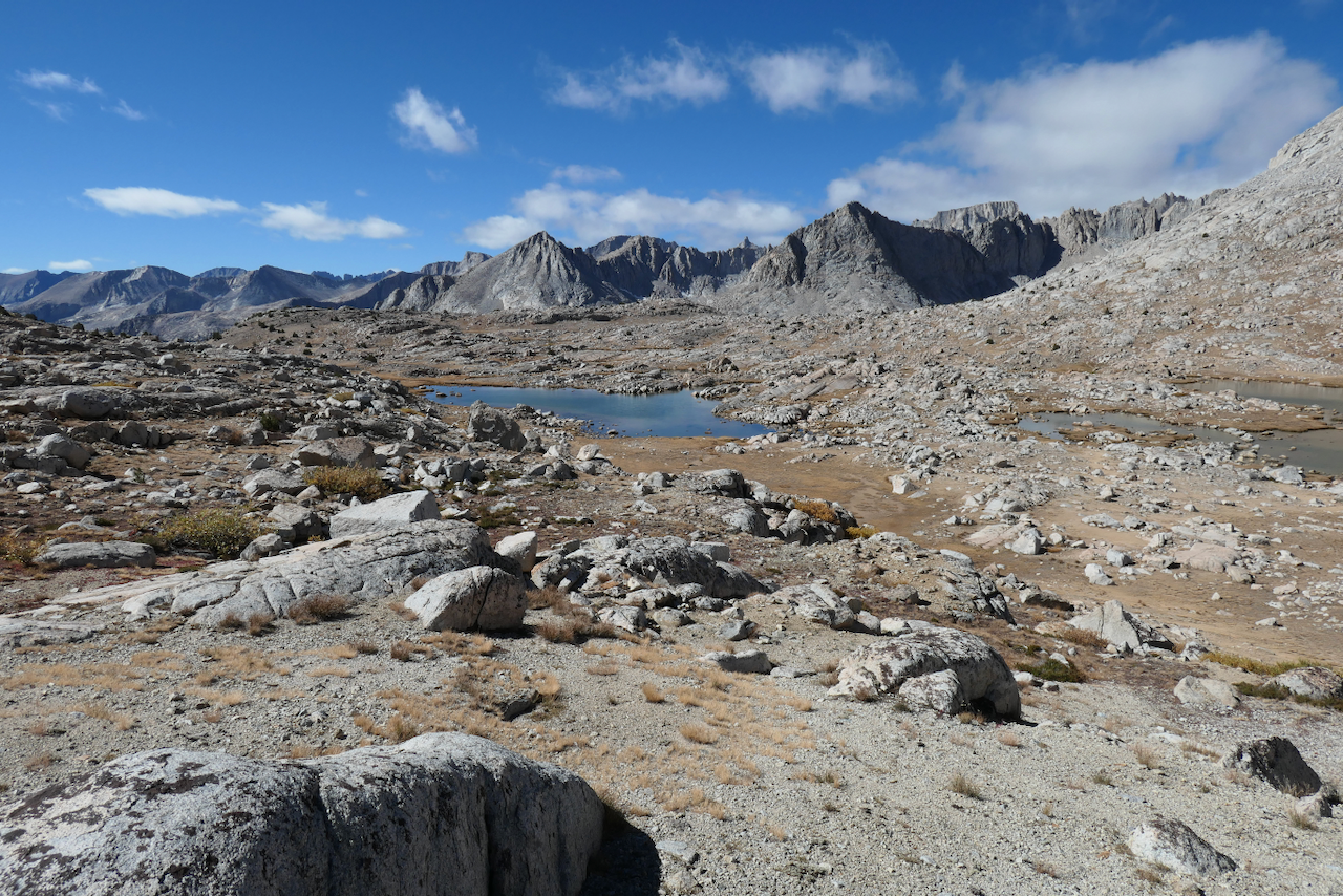
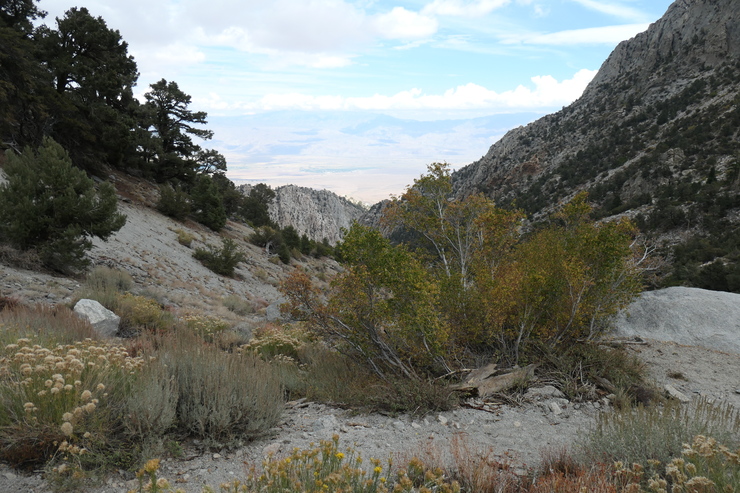
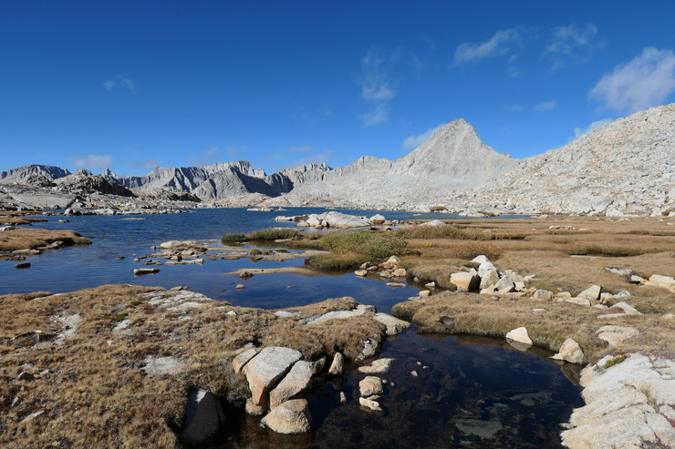
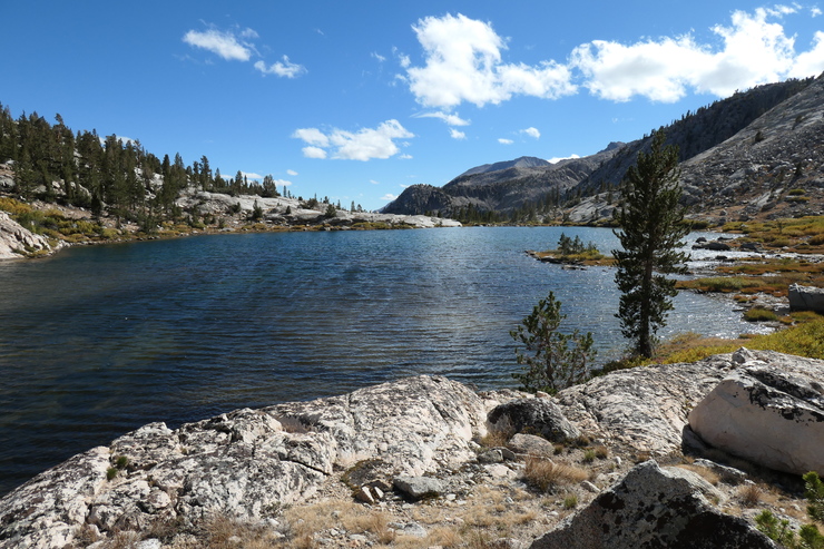
And at long last, I finally took in my first views of Upper Kern Basin at the top of the pass.
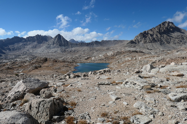
It was a truly beautiful sight: the type of vista that is worth every step of a heavy, grueling journey. The views were so sweeping that I felt as if I was peering into the entirety of the basin at this point. And I wasn't far off. As I'd learn the next day, you can see this saddle from almost every spot in the northern portion of Upper Kern Basin, which means someone standing up there can see you while you traverse its reaches.
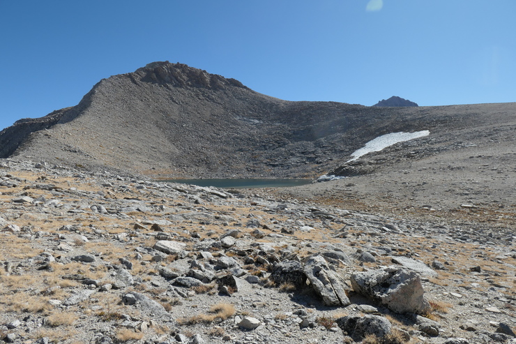
Once I had enjoyed those super sights, I descended the switchbacks on the north side of the saddle and stopped at the small lake just to the north of Lake South America to fill up my water bottles.
At this point it was only about 16:00, and there was ample daylight left for me to make it a few more miles into the basin. But the overwhelming feeling I had was one of exhaustion. I knew that I would enjoy my time walking in the basin far more if I did it after a good night's rest.
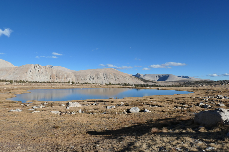
So I decided to just make camp here in one of the many pockets of flat rock and grass that had clearly been used as campsites before.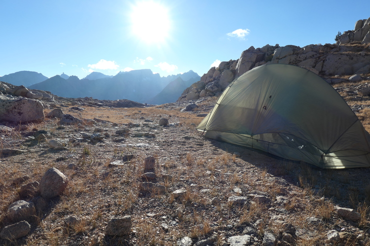
After I put up my tent, I had more than enough time to take a much-needed bath in the cold water and dry myself off in the setting sun. Once I had warmed up with all my many layers, I cooked some dinner and enjoyed the final rays of sunlight climbing up the mountainside to the east before crawling into my sleeping bag for the long night.
I woke up this morning with a feeling that the day ahead would be one of extreme enjoyment and merriment. I was in no hurry to get going given the short distance I was planning to travel while the sun was up. I was going to take it nice and slow, and just enjoy being in the basin as much as possible.
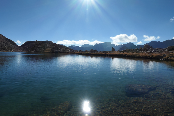
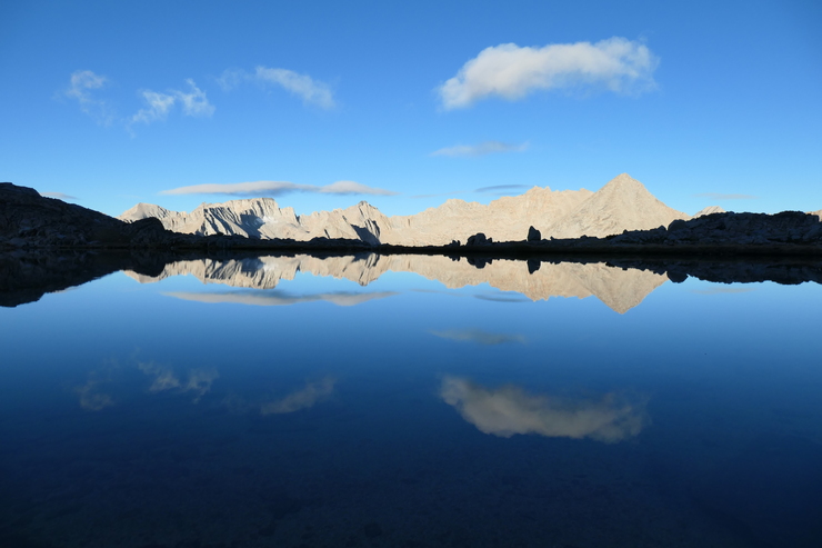
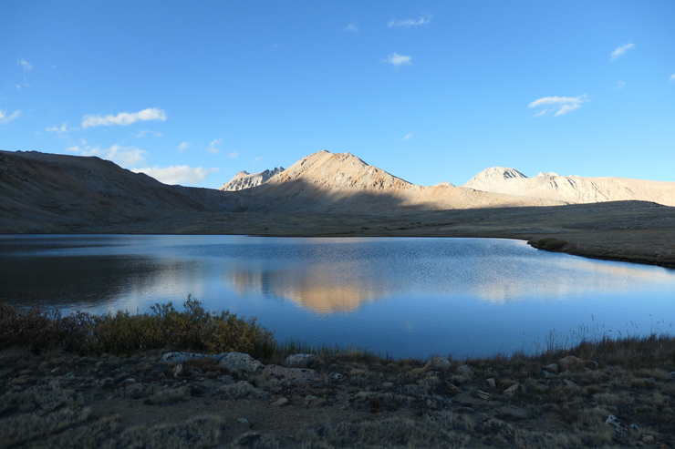
It was very cold outside the tent. Nothing around me had frozen solid, though. As the morning sun was trying to make its way onto the basin floor, I spent a very long time filling up my water bottles and admiring the gorgeous reflections coming off the tranquil surface of the lake. I must have taken two dozen pictures of that beautiful backdrop before getting up and going back to my tent.
After a fairly big breakfast and a cup of tea or two, the rays of sun finally reached where I was sitting and allowed me to shed some layers and pack up my tent without the need for gloves. Shortly after I got going, I was standing along the shore of Lake South America.
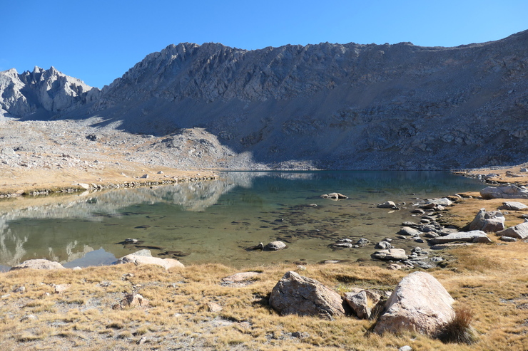
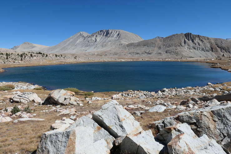
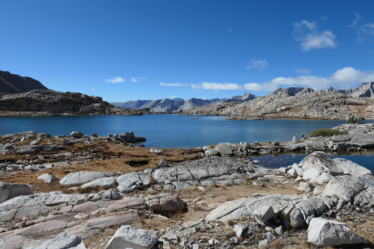
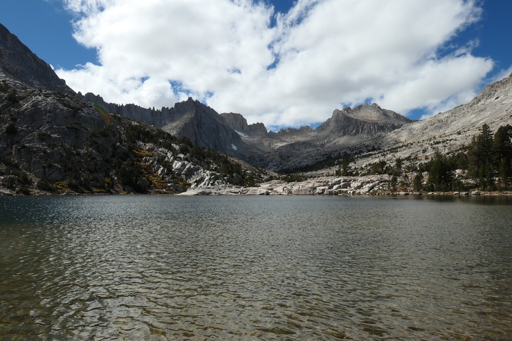
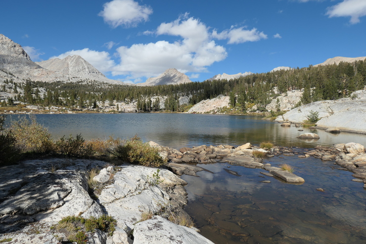
The lake was very neat, with a handful of good spots to set up a tent. I continued on a course due west towards the next big lake, taking my sweet time crossing the gentle alpine landscape.
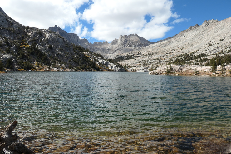
Here again there were almost no obstacles to impede progress. The only question I had was whether or not there would be any pockets of water that were uncrossable. It sure looked like it would be easy to just follow the north shore of the large lake immediately to the west of Lake South America.
And indeed, there were no impediments other than a few big boulders and rock falls that needed to be circumvented. The view to the south was super cool, as you could see where the first stages of the Mighty Kern River began.
Standing there and admiring the water, it dawned on me that the Kern River was almost certainly my favorite river in the world. I thought hard about all the rivers I have visited in my life, and which ones have brought me the most joy. I couldn't come up with any that beat the Kern. From here at its source, all the way down to the quaint comforts of Kernville...I just love being anywhere near it.
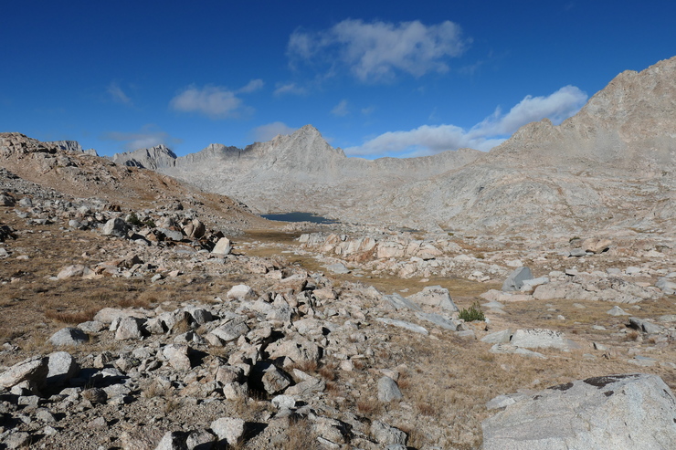
I stayed the course and continued on a westward trajectory towards the next set of large lakes in the basin.
Of particular interest to me was checking out the long, elongated lake nestled within the jagged cliffs at the very upper west part of the basin. So I tried to stay as close to the northwest slope as I could. I didn't have the desire to follow this dried up waterfall to its source, which is likely the "truest" source of the Kern.
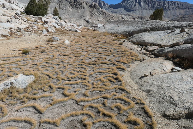
The terrain was still quite inviting for most of the way. And I was very intrigued by some of the shapes made by the grasses along the flat stretches of ground.
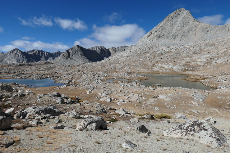
Eventually things became a bit more challenging as the gentle landscape gave way to a large boulder field and scree slope below the lake I was trying to reach,
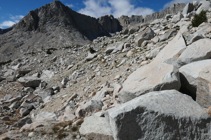
but nothing at all formidable. I was glad I took the time to climb a few hundred feet (and around a handful of obstacles) to get to that lake tucked away at the northwest portion of the basin. Staring it at from the shore, it seemed so large and ominous with the clouds forming overhead, but at the same time so incredibly peaceful.
I ate a makeshift lunch while watching the sun spangles dance on the surface of the lake, and then started en route to the series of tairns located just to its south. As is customary in High Sierra during the late season, a lot of the tairns and stream beds were totally devoid of water. I had no hesitation in just walking along the barren, cracked ground that had been totally submerged just months before.
There were two options of how to proceed at this point. One was to follow the little streamlets that were destined to become the Kern River. The other was to follow a series of granite "hallways" to the southwest. I don't know the exact geological term for these landscapes composed of small granite outcroppings surrounding flat stretches of grass and shrubs—or the phenomenology that gives rise to them—but they are ubiquitous throughout the High Sierra and they are one of my favorites ways to make progress through untrailed territory.
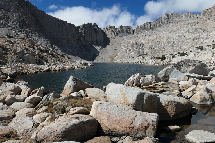
After a few hundred meters of going along these corridors, I could see the very large lake shaped like a ghost to the south.
I'm not sure if this lake has a name, but it was by far the most beautiful and enjoyable body of water I visited during the trip.
A pang of hunger and sense of fatigue hit me when I finally stopped along the sandy shore of the lake. I happily acquiesced by taking a couple of hours to swim in the frigid water, sunbathe on a nice bed of granite, fill up on water, and eat a fairly sizeable lunch. This was the first time of the trip where I felt a true sense of solitude and serenity. It was heightened by the absolutely gorgeous backdrop of the lake and the mountains that envelop it .
When I got going again, my main concern was how to cross over to the eastern side of the (presumably more swift and voluminous) Kern River. There weren't many stressful portions of this trip, but I will say that I did start to worry a bit when I saw just how well it was flowing and how steep the walls of rock that surrounded it were. Around 10,800 feet of elevation, I made several attempts to see if I could cross it, but it just wasn't feasible. Finally I decided that the best thing to do would be to just get to the large lake at 10,700
and see if I could make an easy crossing at the inlet or outlet. As I suspected, the outlet was quite an easy spot. Shallow water, virtually no current, and plenty of stepping stones to help get me to the other side.
Once I joined up with the official Upper Kern Basin trail, I felt a nice sense of relief knowing that most of the uncertainties of the trip were behind me. I took a few minutes to fill up my water bottle and enjoy the beauty of the Kern River after it had collected plenty of steam.

It was right around 15:30 or so when I picked up and started hiking east on the Kern Cutoff Trail. This was pretty straightforward: a fairly gradual, uphill climb. There were a few spots where it became difficult to follow the trail, so I ended up just hiking up straight to the east with almost no regard for where the trail was.
An hour and a half later, I was finally nearing the large lake at 11,400 feet where I had been two days before.
I contemplated staying at the large lake immediately to its west,
but opted to continue on since it looked like a pretty bad spot to fill up on water (too much grass and soil in the mix). I ended up finding a really nice area just to the south of Lake 11,400 where I could set up my tent.
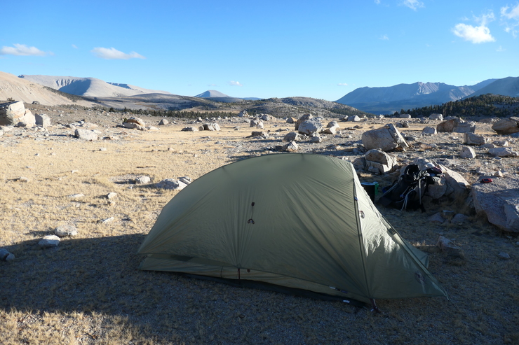
There was more than enough flat, soft ground, and the lake was a truly pleasant backdrop for the evening. I enjoyed a relaxing dinner before the temperature really started to drop.
The only prolem was that I had developed some sort of nasty sinus infection that made it almost impossible to sleep that night. I could only breathe the cold, viciously dry air through my mouth since my nose was completely clogged. I think I only managed to sleep from about 2-5 am. It was most definitely one of the least enjoyable nights I've ever spent in the Sierras.
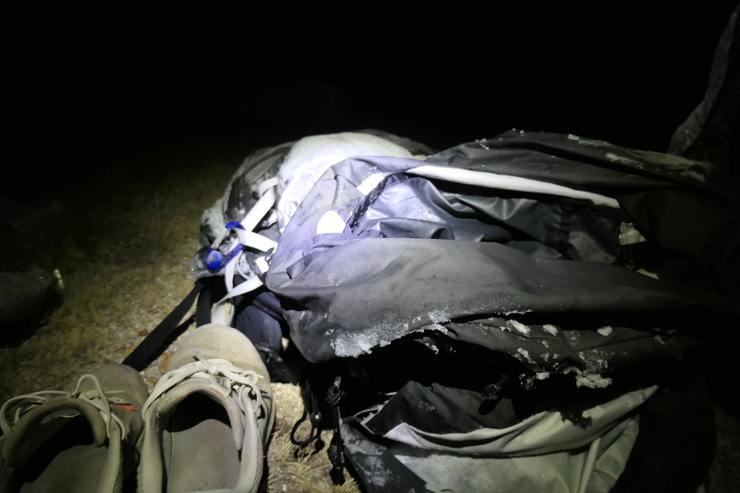
When I said I slept until 5 am, that's partly because I was fully intent on starting my exit hike as early as I could manage. I woke up well before the sun had risen above the eastern crest. Most of my gear was frozen solid.
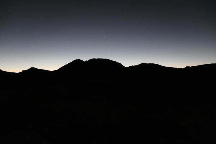
At this time, Venus was easily visible in the eastern sky.
I tried to be as swift as I could making my way back to Shepherd Pass. I took a slightly less direct route, though. I was basically maintaining a due east heading, which meant I descended a few hundred feet and had to make that back up on my way to joining back with the Tyndall Creek trail.
When I reached Shepherd Pass, it was right around 0930.
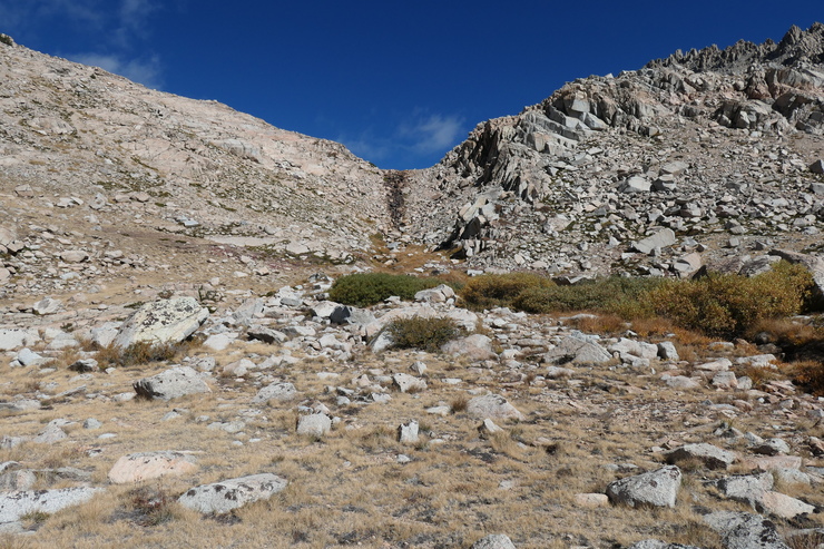
The remaining 10 miles or so took me a full 8+ hours to complete. Two things really stood out on this return portion of the trip. The first was just how steep and windy it was getting down from Shepherd Pass to The Pothole.
That was not a fun, relaxing walk. The second was just how hard it is to descend 6,000+ feet in a single day with 44-year-old knees. The uninterrupted, 3,500 foot descent back to Symmes Creek Canyon was the worst. At the very end, I just dipped my legs in the cold creek water and tried to forget about how my body would feel the following day.
I finally made it back to my car around 1600, and boy was I glad to be done with the walk. I ended up staying at the Best Western in Bishop that night. My knees were quite sore the following day, but when all is said and done...I would gladly do this same trip again in a hearbeat.