


TRIP DETAILS
TRAIL MAP
OVERVIEW
One of my favorite movie characters once said, "...I says, 'The Rocky Mountains is the marrow of the world,' and by God, I was right!" After spending 5 days in this section of Rocky Mountain National Park, I can't help but agree. Spruce Canyon is raw and rugged, but at the same time smooth and serene. I don't know RMNP well enough to compare it to other routes in the park, but I'd certainly do the trip again.
Notes:
- For you anglers out there, all of the lakes mentioned in this report hold vast amounts of fish: cutthroat trout, rainbow trout, and brook trout abound. I'd be shocked if you stood on the shore of Spruce Lake and didn't see one swimming right by you within a couple of minutes.
- There was a large moose and her small daughter that visited us regularly at Spruce Lake. This made the campsite absolutely spectacular in my opinion.
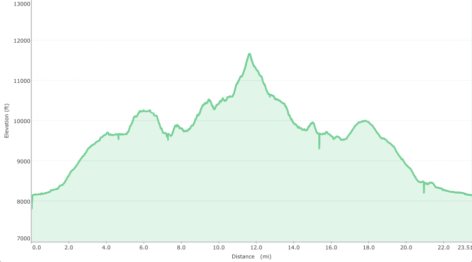
Elevation Profile
TRIP LOG
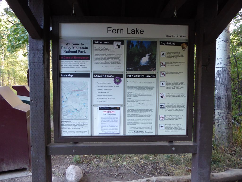
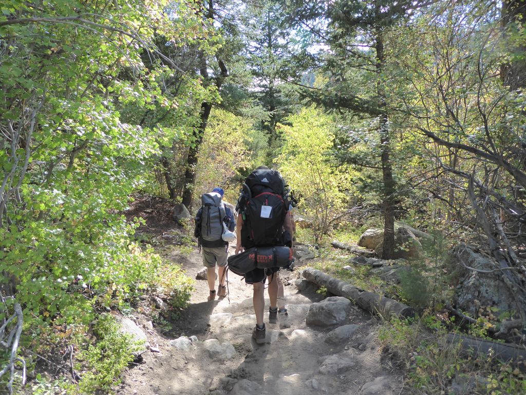
For the second time in a row, Jason, Eric, and I got a fairly late start on the trail. We arrived at Fern Lake trailhead around 1800, shortly after picking up our permit at the Beaver Meadows Backcountry Office. Not an ideal time to start a trip, but that's how our flights into DEN positioned us. The rangers in the office had been exceptionally helpful and enthusiastic, which got me pretty amped for the trip. I snapped a quick pic of the sign at the end of the parking lot for good measure.
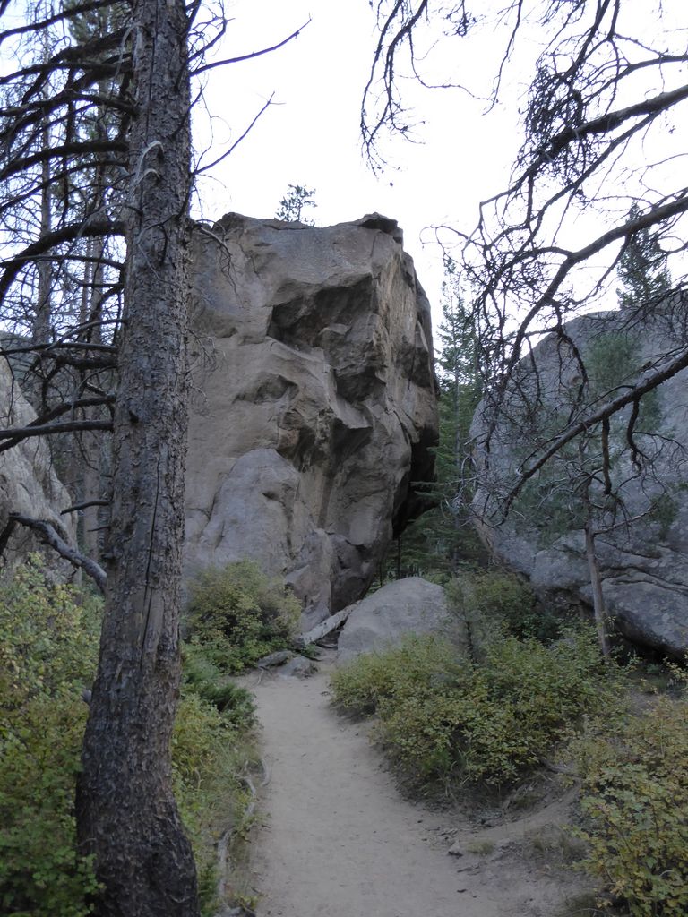
While packing up our stuff in the parking lot, the clouds and setting sun were providing some dramatic photo-taking conditions, but I failed to capture anything because my camera was out of reach. The sun was already getting pretty darned low by the time we started walking, so my pictures from the first night aren't exactly the greatest. Still, Arch rocks —which comes up pretty quickly on the trail— looked fairly impressive in the low light, in my opinion.
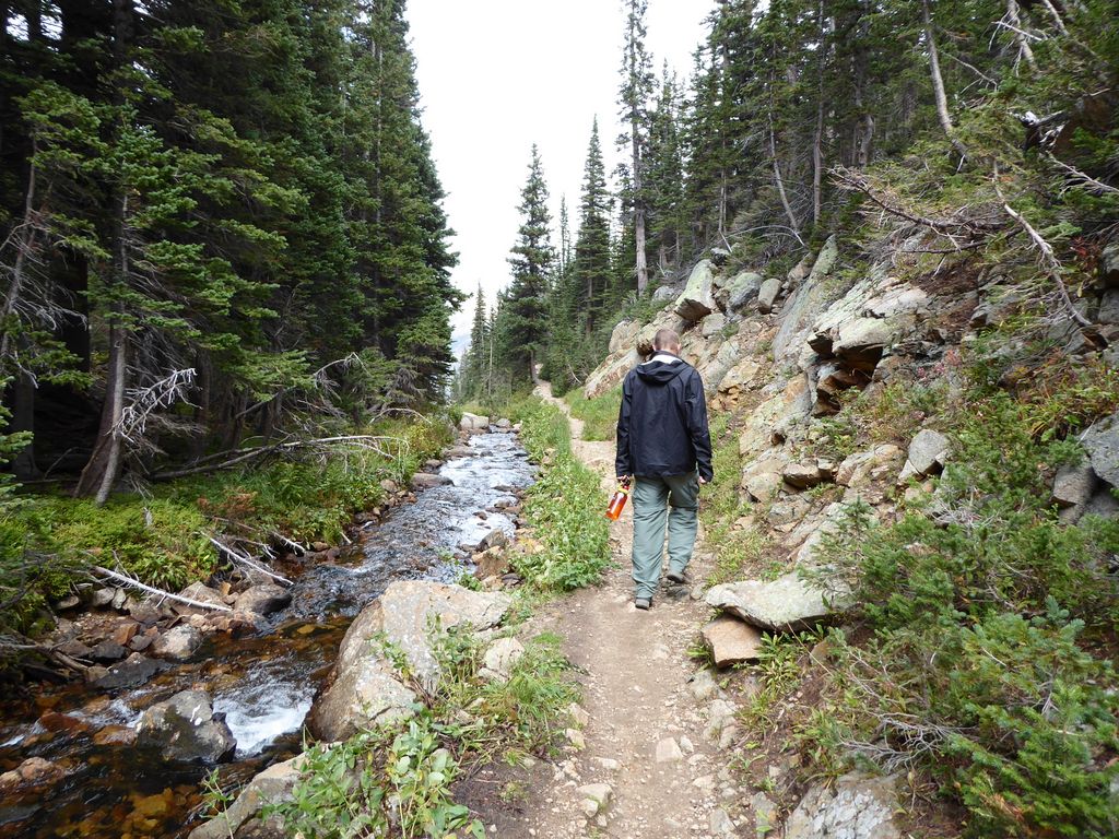
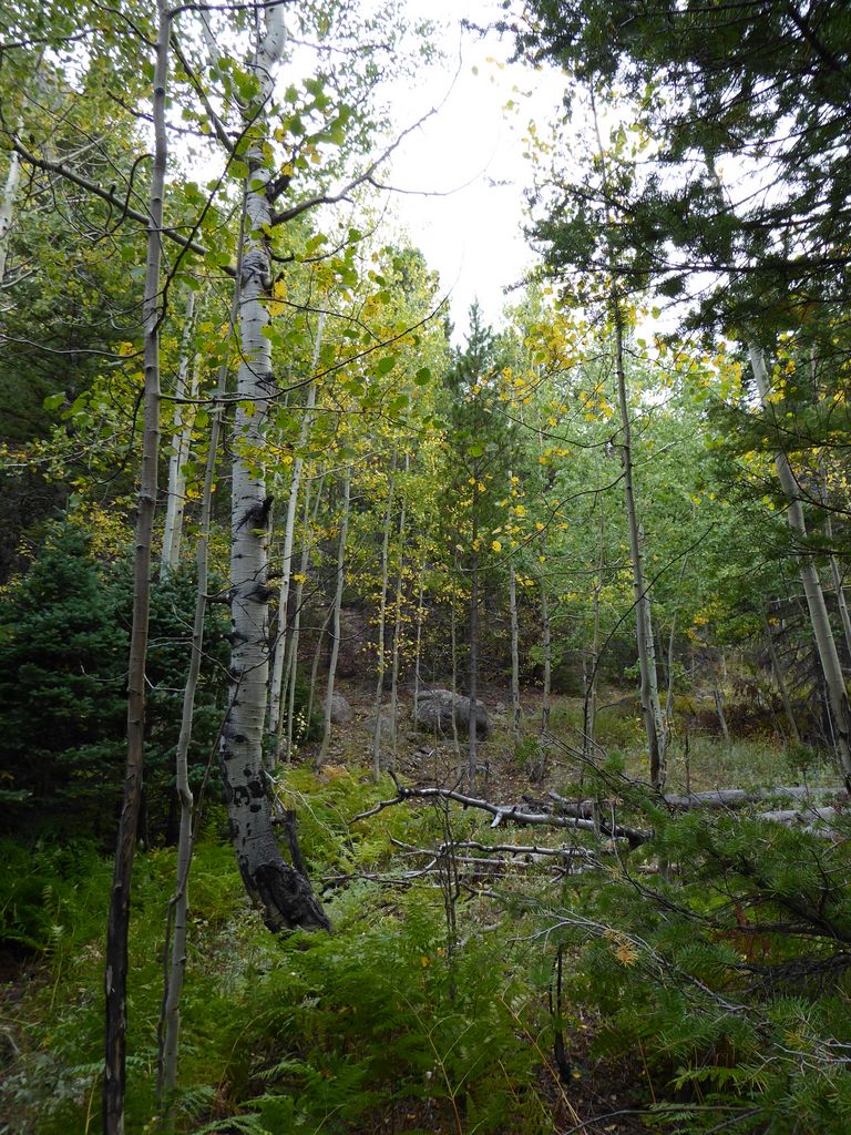
The trail parallels the Big Thompson River for the first few miles,
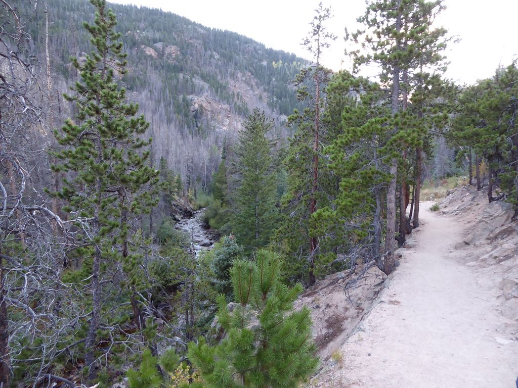
and affords plenty of great opportunities to see beautiful quaking aspens and cottonwoods (you can see the pictures from the last day of the trip for a glimpse of the full spectrum).
There are several interesting things that we passed by without much thought on the first mile and a half, including the Old Forest Inn campground area (which we'd be staying at on the last night) and the Big Pool. Both were pretty cool to see during the light of day when we were headed on our way back. In fact, we all agreed that Old Forest Inn would be a wonderful place to bring a first-time backpacker due to its proximity to the trailhead and the cool stuff within a day hike's reach. It'd also be a good place to adjust to altitude.
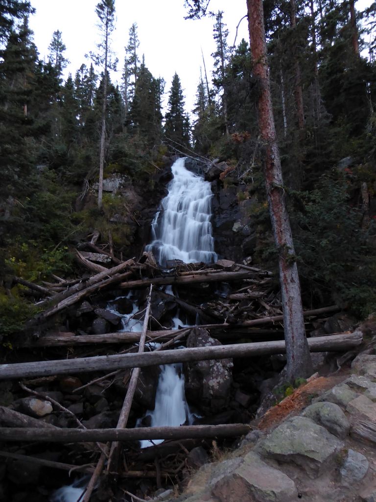
After this mile and half of westward traveled, we started climbing the switchbacks on a southward course. A few hundred feet up, we came upon Fern Falls, which was pretty cool.
After a good push on the first few sets of switchbacks, we started to slow down quite a bit. We just weren't properly adjusted to the elevation. We'd hike a couple hundred meters and take a break for water–and to put on additional layers for the dropping temperatures. After factoring all the breaks in, we were probably moving at about a mile per hour. So it probably took us about an hour and a half total to climb the 1000 feet up to the trail junction that leads to Fern Lake.
We took a little while at the junction to decide if we should just wrap it up and camp at Fern Lake, but our decision was to forge ahead to Spruce Lake. I think all of us were keen on getting to Spruce Lake so that we wouldn't have to break camp in the morning. So we decided to hoof it the additional mile or so to Spruce Lake.
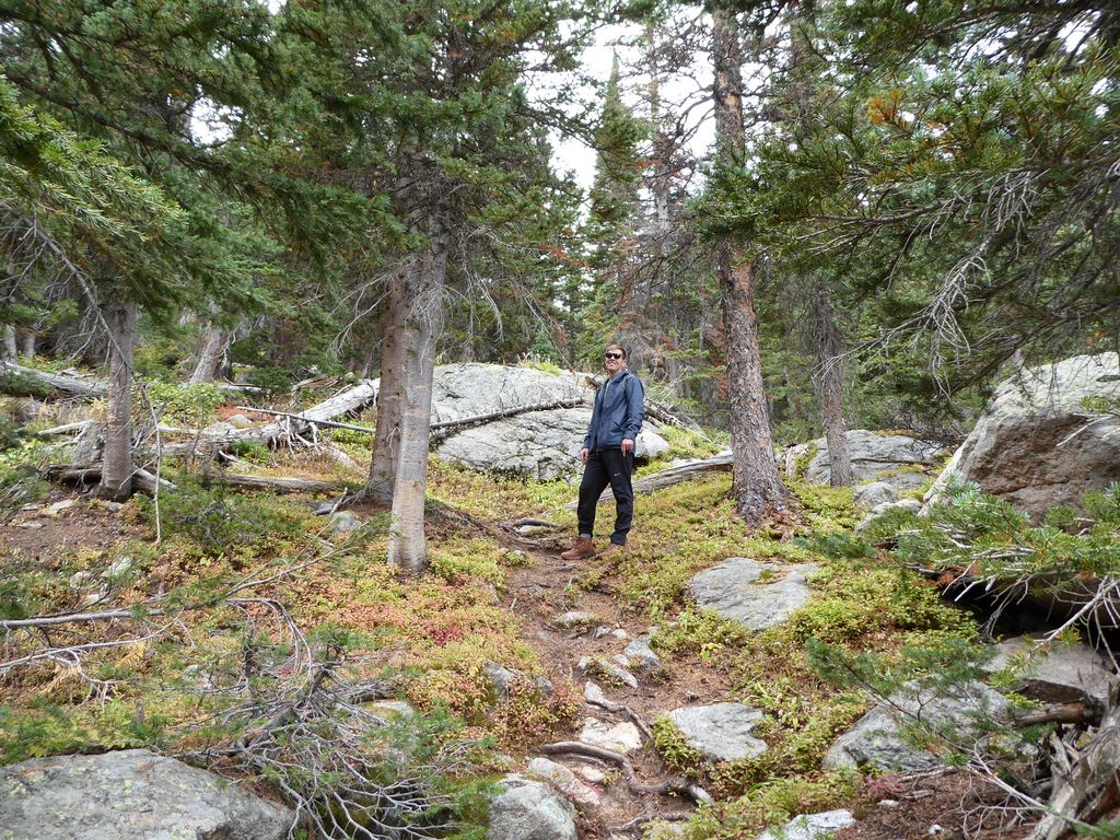
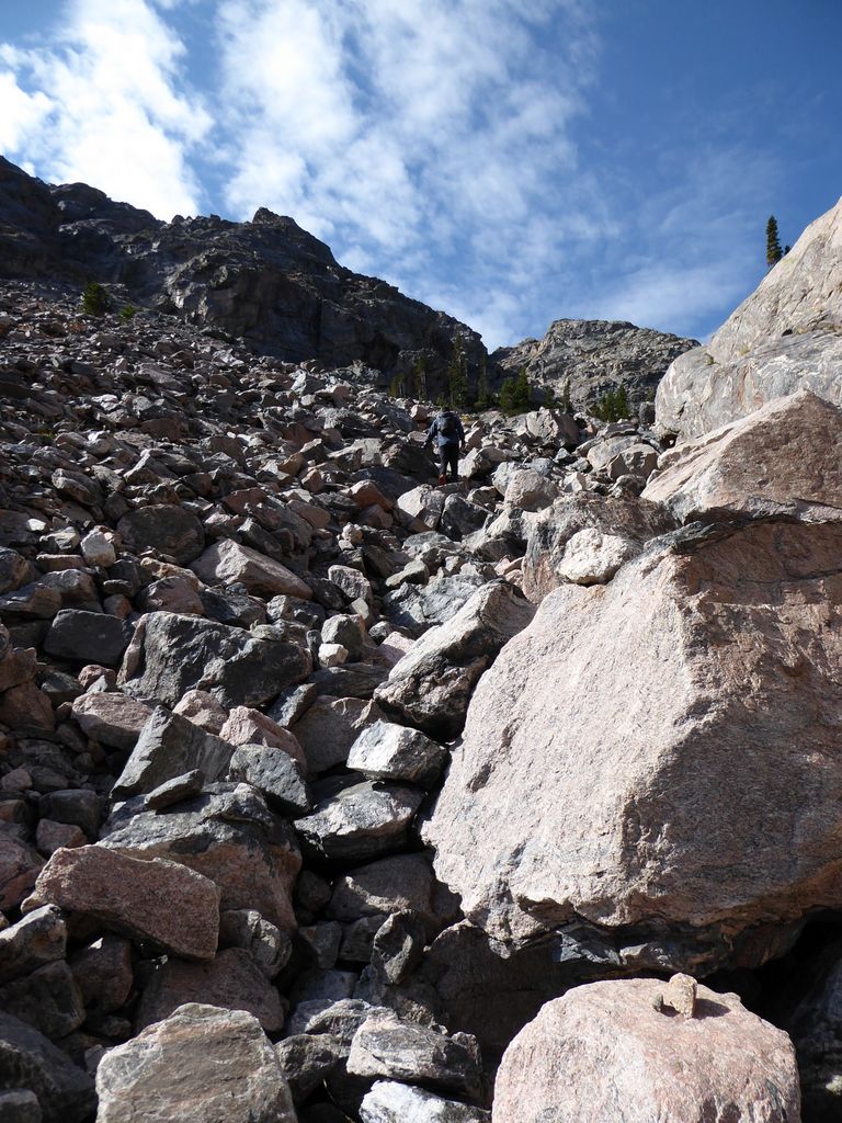
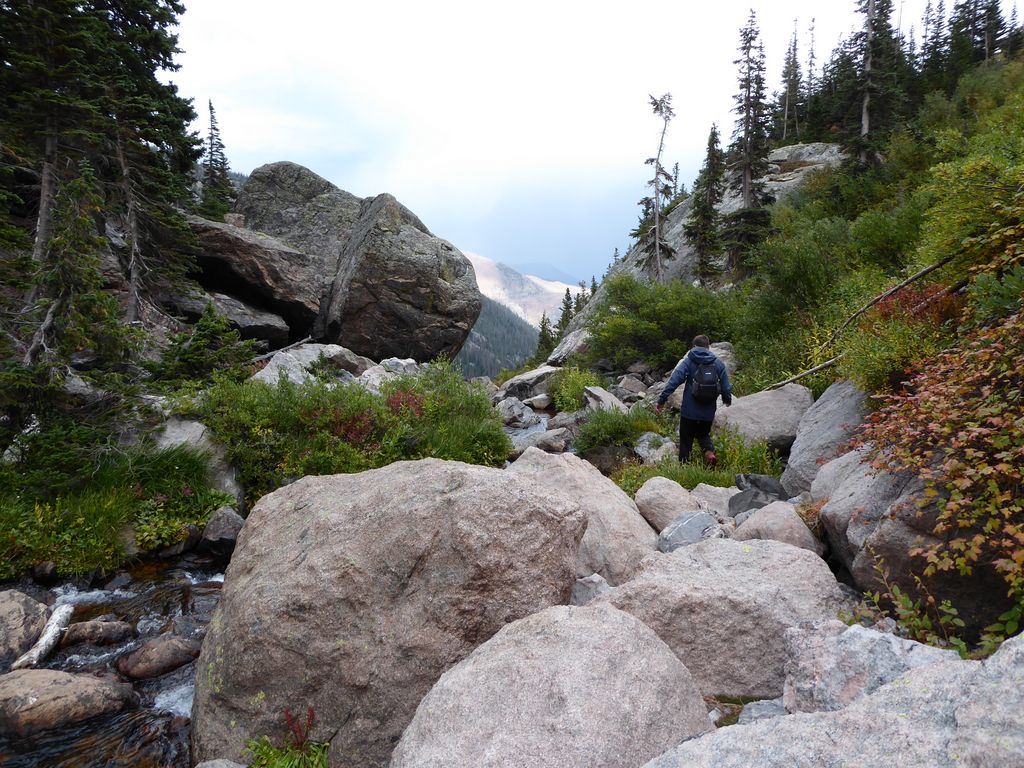
The trail from Fern Lake to Spruce Lake is not officially maintained, and it shows. There are some sections where it is well worn enough to be obvious, but others where it cuts around boulders and gets a tad confusing (especially in the darkness of a moonless night). Luckily, there wasn't much climbing required to get to over the crest separating the two lakes. But we were still moving quite slow due to the lack of altitude adjustment and the weight of our fresh packs.
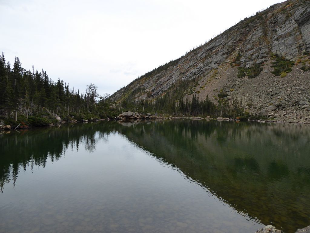
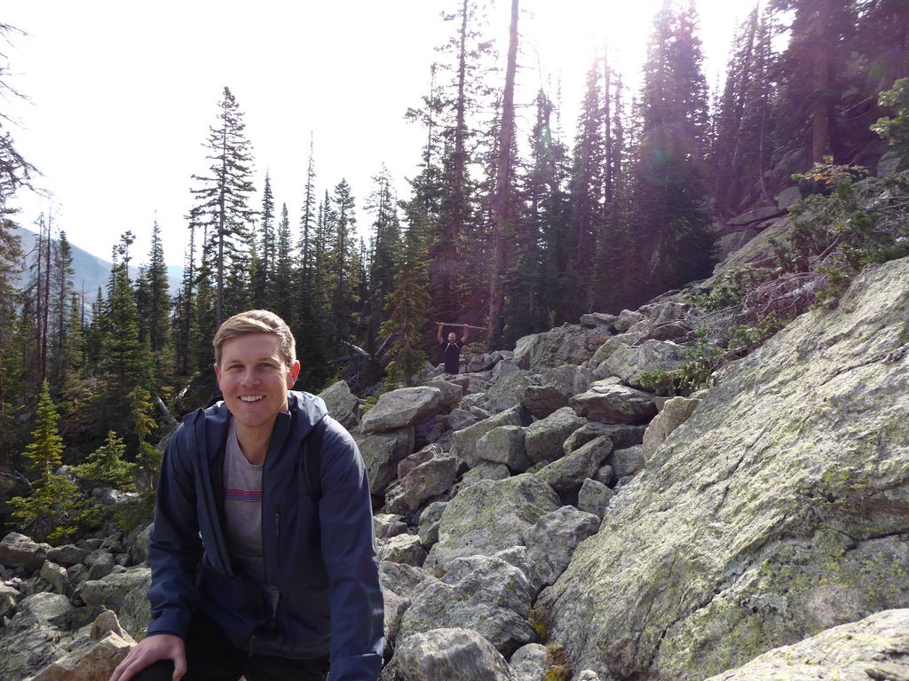
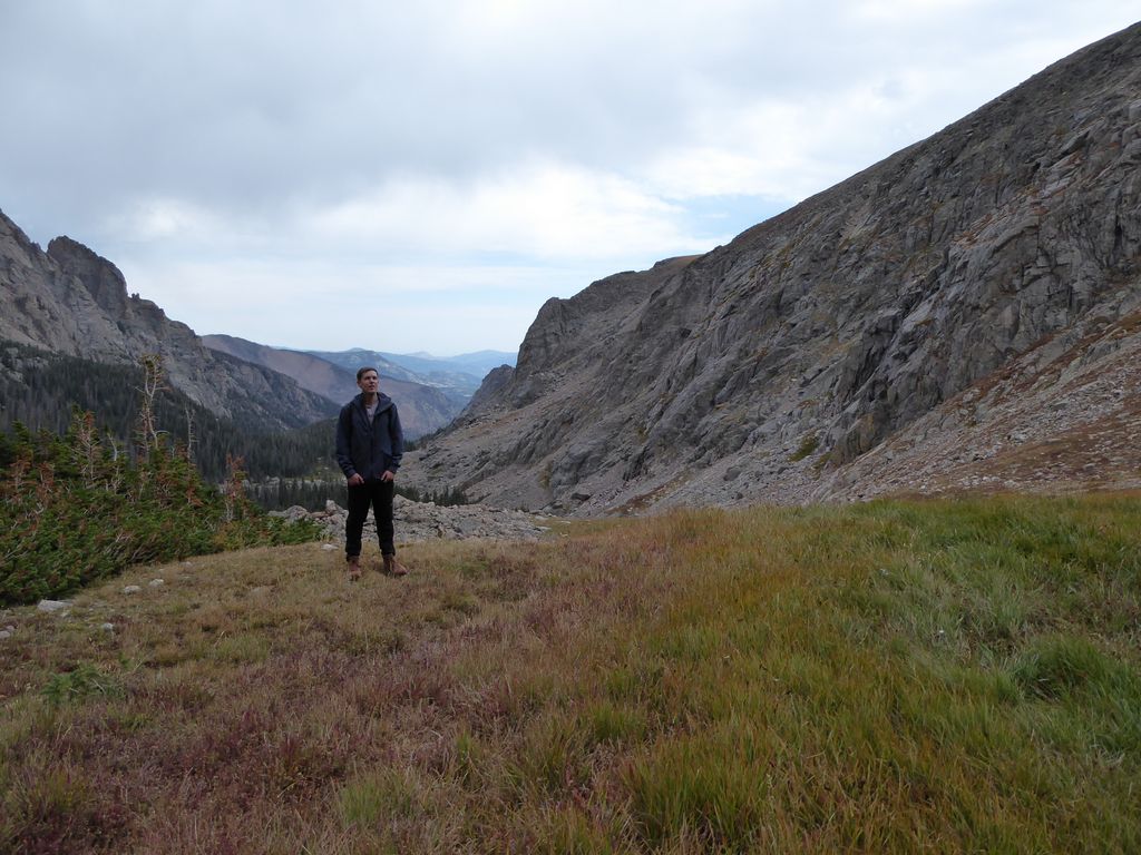
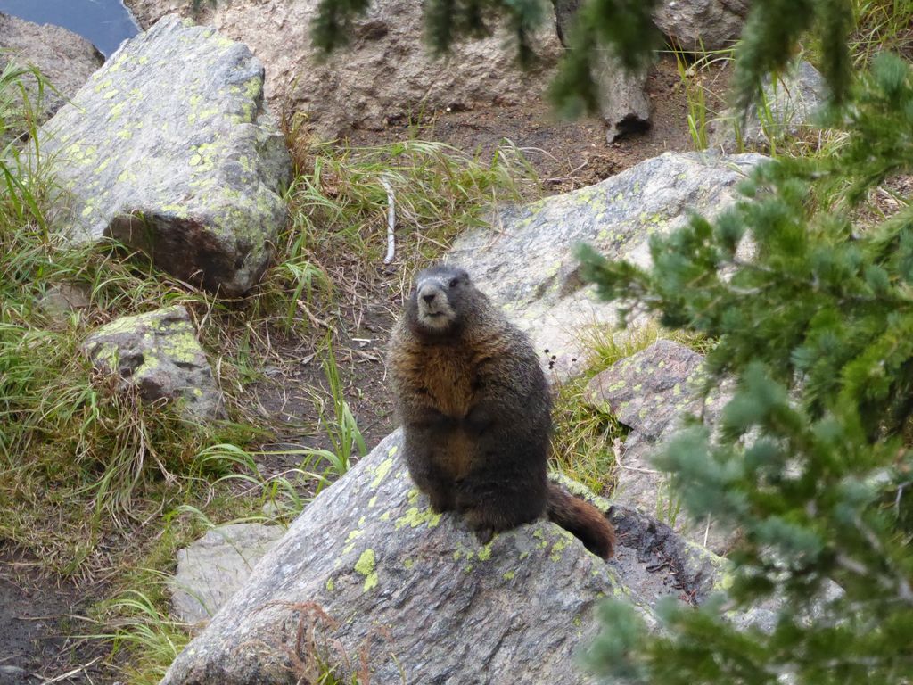
When we finally neared Spruce Lake, we saw one of the endangered boreal toads that are featured on the numerous signs we had passed by on the trail (in fact, the entire northeastern shore of the lake was deemed off-limits for their protection according to the signs).
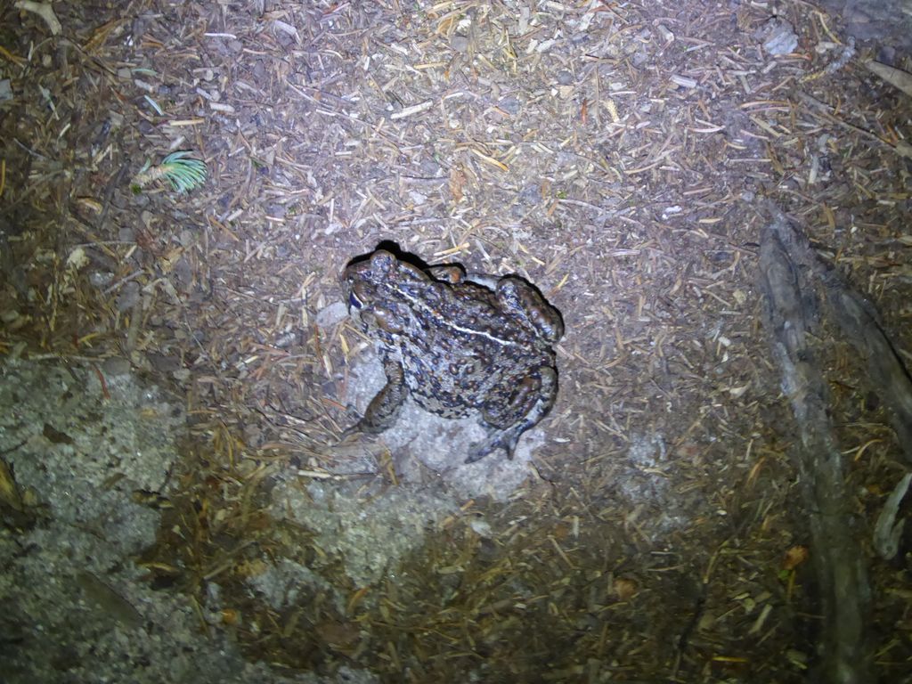
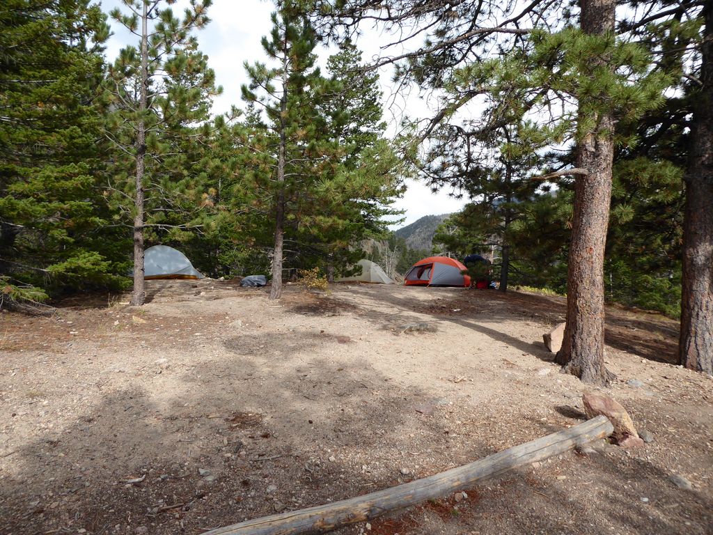
We took that to be a positive premonition. He was a cute little guy, after all. And sure enough, after a few more steps we came to the sign pointing to the Spruce Lake privvy, which meant we were right there. It actually took us awhile to find the designated campsites, but once we did, we quickly set up camp, ate some dinner, and turned in for the night.
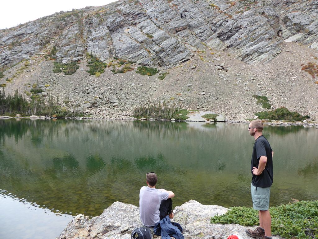
On day 2, we took it easy. And it was glorious. No breaking down a tent. No struggling to get over a pass with heavy packs. Just a short hike, a nice swim, and some exceptional fishing. Topped off with a lovely fresh fish dinner, it was a day to remember.
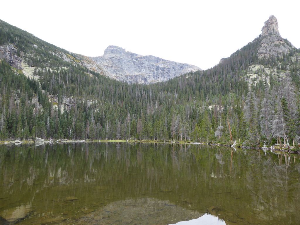
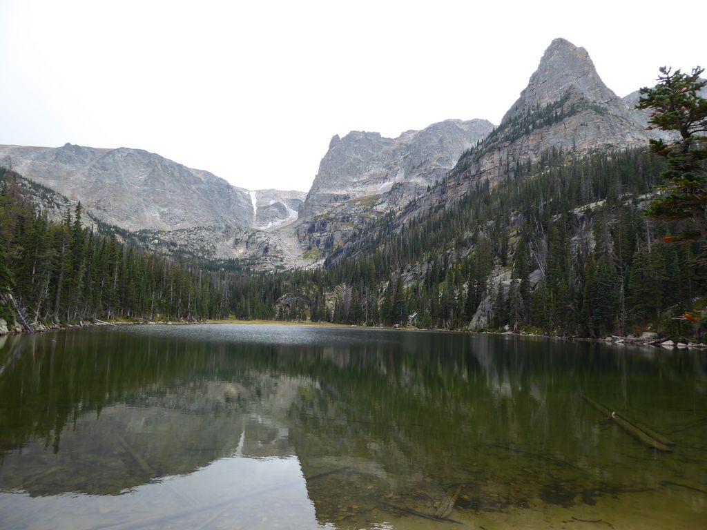
The plan for the day was to check out Loomis Lake, which looked like it would be a straightforward task based on the contour map. We slept in a bit and took our time eating breakfast and packing up some food for the hike. It was a bit of a grey morning, but we were excited to get our first look of the lake in daylight. Castle Rock, which is the large spire of rock on the right of this picture, was quite an impressive feature to look at.
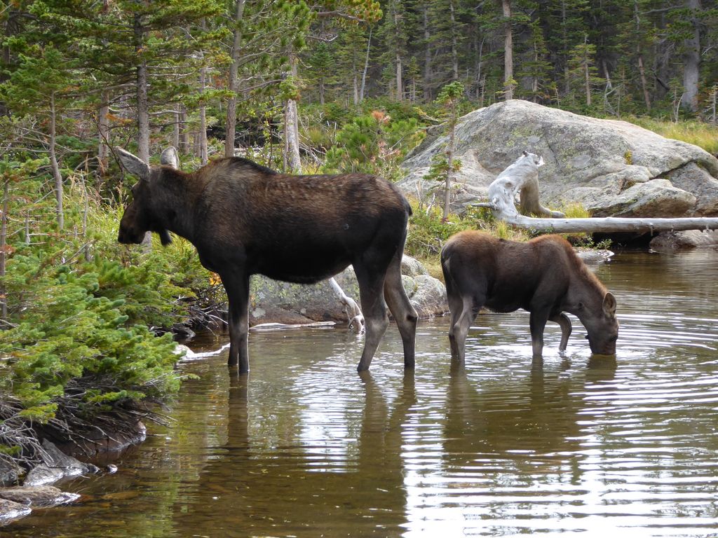
While exploring the shoreline after we finished our breakfast, Eric spotted a moose and quickly alerted us to its presence. At the time, I was so pissed off that I didn't have my camera with me. Before this trip, we had basically been hosed when it came to moose sightings in the wild...always talking about seeing one, but never actually seeing one. So yeah, I was a bit frustrated that I didn't have my camera to capture this momentous occasion. But in less than 24 hours, all of my frustration would be forgotten. The moose—which Eric decided to name Bertha—would basically be the fourth member of our party she spent so much time hanging out around the lake.
When we initially set out on our trip to Loomis Lake at about 1030, we were paying very close attention to the path around the northeastern shore, thinking it would might be a bit of a bushwhack to get up to Loomis. As it turned out, though, there was a quite well defined use trail to follow.
And even better, the trail was loaded with ripe raspberry bushes! We stopped each time we found one to graze a bit, which was quite a splendid treat. I mean, think about it. Free lodging AND free food? It's hard to understand those people who don't like backpacking.
The views back to the northeast weren't that exceptional on the initial climb up, especially because of the overcast conditions,
but the clouds were keeping the temperature nice and cool, so it was pretty hard to complain. After about 600 feet of climbing through spruce and pine forest, we finally reached a little clearing with a substantial pond.
It wasn't at all difficult to get around to the west side of the lake and pick up the remainder of the trail since it was so shallow . From the pond it was just another few hundred feet of gradual climbing until we reached the eastern shore of Loomis Lake.
There was another group of people parked along the eastern shore of the lake, so we decided to head around to the north shore and look for a decent area to eat lunch and fish. Luckily there was plenty of great real estate on this side
so we set up shop there. While Eric got his rod all set up, I decided to take a dip in the water. It was pretty damned cold, especially since there was no sun to heat my body up after I got out of the water. But it was well worth the effort of doffing my clothes and climbing down the rocky shore.
We spent a bit over an hour eating and taking in the exceptional views of the surrounding cliffs. I think Eric got a couple of nibbles on his line, but the fish weren't really biting for keeps. I was keenly studying the slope on the northwestern side of the lake,
which looked like a possible way up to the continental divide. The last bit would probably be a bit of a scrammble, but it looks like that chute to the left of the sharp rock face might be doable.
We were closely monitoring the clouds in the distance all the while, and the incoming weather wasn't looking too good. Around 1300 we decided it'd probably be best to get back to our tents in case of an afternoon thunderstorm, so we headed back. It was an extremely pleasant walk back.
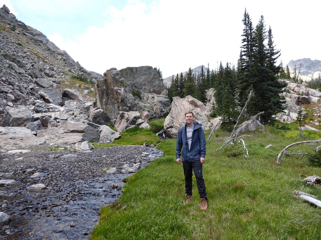
At one point we stopped along the stream that runs down from Loomis to Spruce, and we saw something that was just incredibly cool. This healthy looking trout—it must have been about six or seven inches long—jumped over a small barrier of rocks directly in the middle of the stream and into a narrow pool on the opposite side. He quickly darted under the embankment on the opposite side of the stream from where we were and did a damned good job of hiding. We got a kick out of the idea of this brave little fish setting out on the adventure of its lifetime, heading out into completely unknown territory. Pretty damned cool to see these animals doing what they were born to do.
When we got back to camp, I decided I'd lay down for a nap and hopefully sleep through the upcoming rain. I got a good snooze (and managed to avoid a little downpour), but was surprised when I awoke to this shrill voice and laugh. I was pretty puzzled as to what it was. Later I'd learn that Jason was talking with this eccentric dude who had just come up to Spruce Lake for a day hike. The guy was quite familiar with the park. He had quite a few stories that J would later relay to us, but J found it very odd that the cat was basically spilling his life story to a total stranger.
Not long after I got out of the tent, we had our first repeat visit from Bertha.
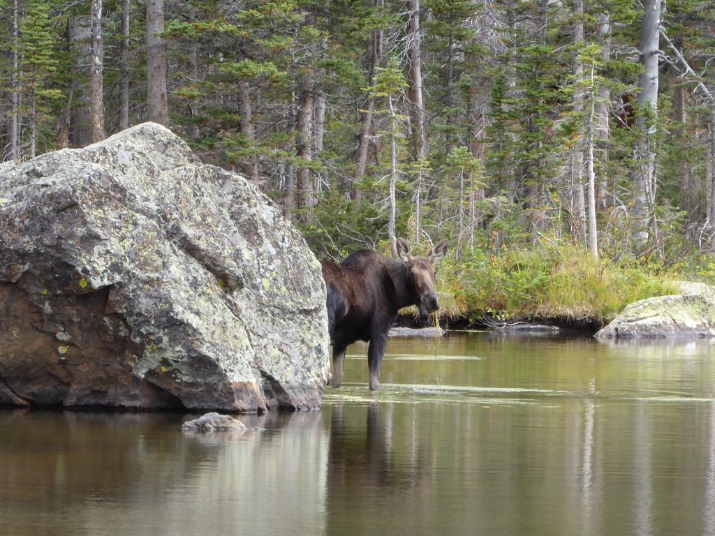
As you can see from the full set of trip pictures, we had no shortage of great photo opportunities with this lovely creature. But really, the best part of it all was just being able to watch her do her daily routine of coming down to the lake, eating, drinking, peeing (damn was it a lot of pee), pooping, and checking things out. She seemed very accustomed to humans. I mean, we were only like 20 feet away from her at times, but at no point did any of us feel like she was getting irritated by our presence.
Around 1700 or so, we all decided to heat to the south side of Loomis and do some fishing over there. It seemed like a much better option than the north side. The bottom drops off faster and there are more rocks to get a good cast from. The good news was that the fish were going pretty nuts now. Almost every five seconds one would jump out and grab something above the surface. And they were biting our lures. I mean really biting. It wasn't long before we had nabbed three pretty good sized keepers (technically we were supposed to catch and release, but with the abundance of fish in the lake we had no problem breaking the rules). There were a few big ones hovering around, but they didn't seem nearly as interested in our lures as the smaller guys.
Right before heading back, we got our first real break in the clouds. The reflections off the lake were simply superb.
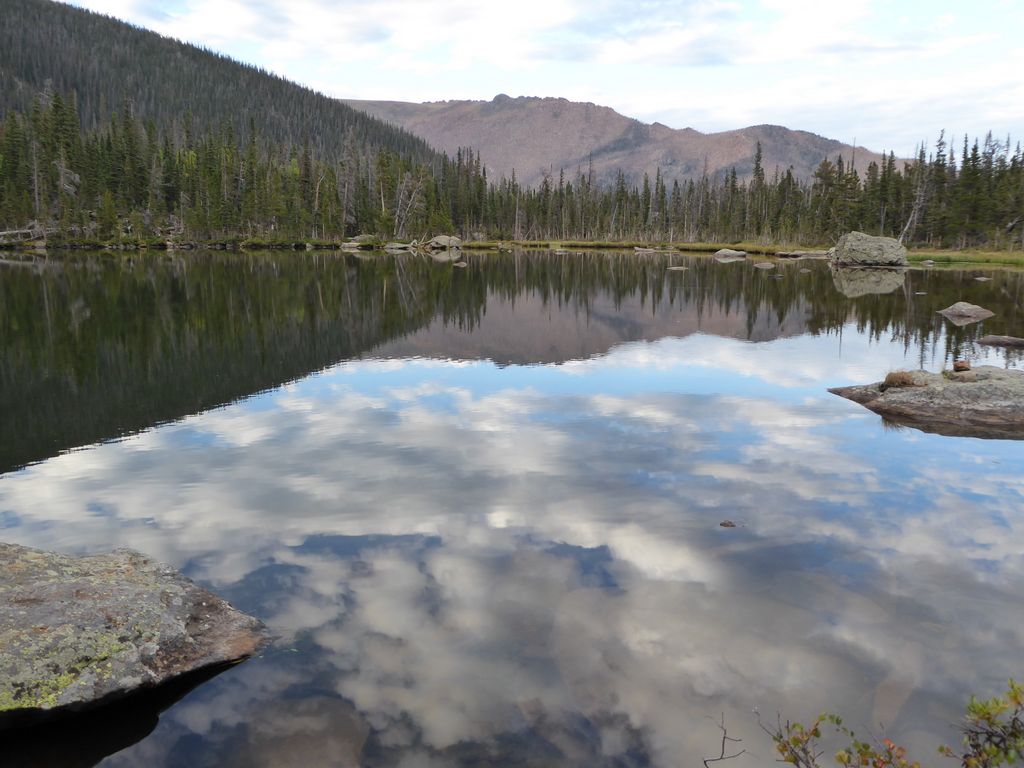
It was the kind of perfectly tranquil conditions and gorgeous optical stimuli that make you wonder why you don't just build a nice solid shelter in the middle of the Rockies and pray that nobody finds you for a few years (footnote: I say that, but the truth is I don't think I'd last more than a couple of weeks past the first snow).
When we got back to camp, we got right to cooking our catch. Now I'll admit that I am the furthest thing you'll find from a foodie. To me, food is just a way to satisfy the craving of hunger and to provide some good energy as a result. But damn did that fish taste good going down, tiny bones and all. No seasoning or additives needed.
As the early night came to a close, we started to conspire about our plans to attack Spruce Canyon the following morning. I was pretty excited about making it up to the Continental Divide, and I was extremely glad to see that Jason and Eric were both up to try and attack it as well. It would be a long and harrowing day ahead, but at least we'd be well rested.
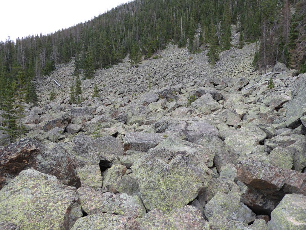
Today would be—without a doubt—the most strenuous and mentally taxing day of our trip. The route from our camp at Spruce Lake to the Continental Divide looked like it would be somewhere between 3.5 and 4.5 miles depending on how many obstacles we'd have to avoid and how much backtracking we'd have to do in the canyon. But I was not anticipating the level of difficulty of terrain we'd find in Spruce Canyon. Part of this had to do with the route we chose on the way back—basically following the creek at the canyon's bottom. So take warning, if you decide to make your way through Spruce Canyon, you will encounter a grueling situation if you do the same thing we did.
Having stated all this, I must say the morning began in a most brilliant fashion. We got our first extended sunshine at daybreak:
That had to be a sign of good things to come, right? Our breakfast was also highly satisfactory. We talked about everything from our favorite way to prepare coffee to the underpinning of religion to the seemingly inherent nature of sleazy car salesmen.
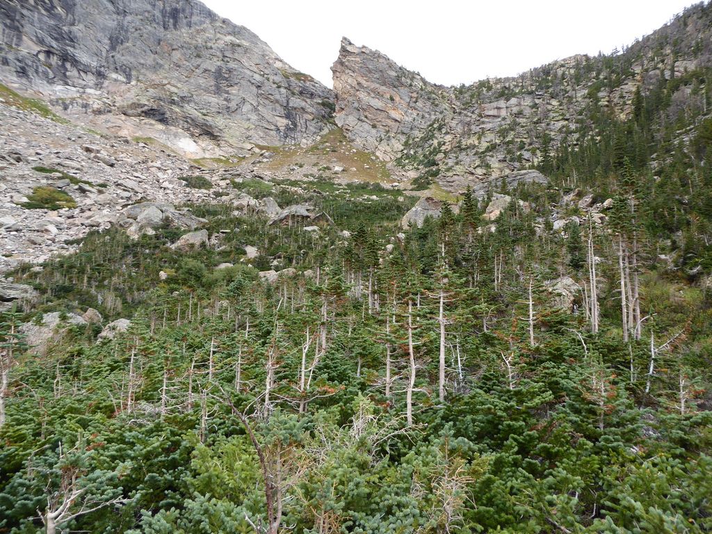
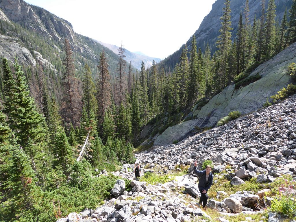
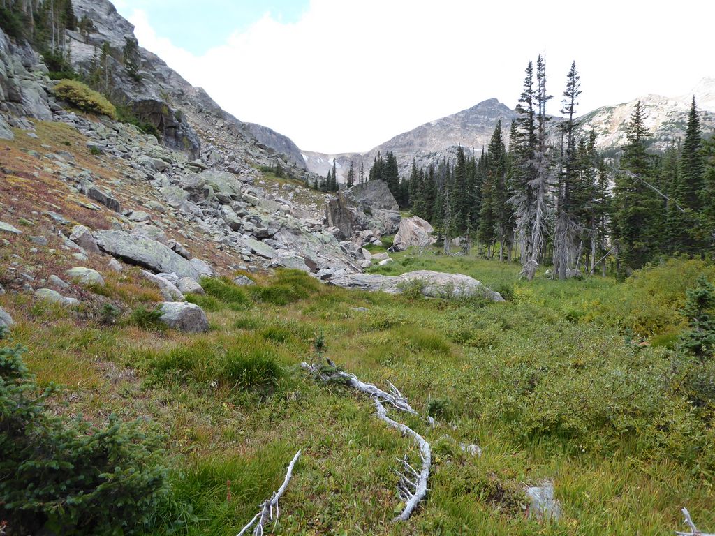
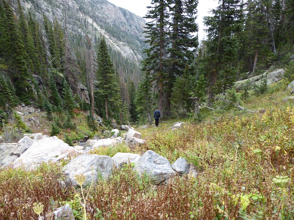
We got going shortly after 0800. We basically followed the same initial trail we had followed the day before to get to Loomis, but this time, we'd break off to the northwest shortly before we had the day before. There was not much of a use trail through this heavily wooded area, but it was relatively easy to follow the right course since we were bounded in by the east face of Castle Rock. This is what the terrain looks like.
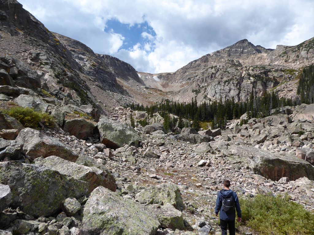
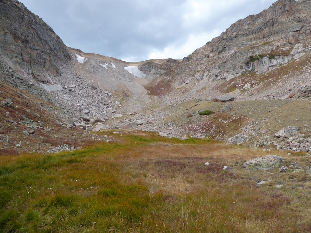
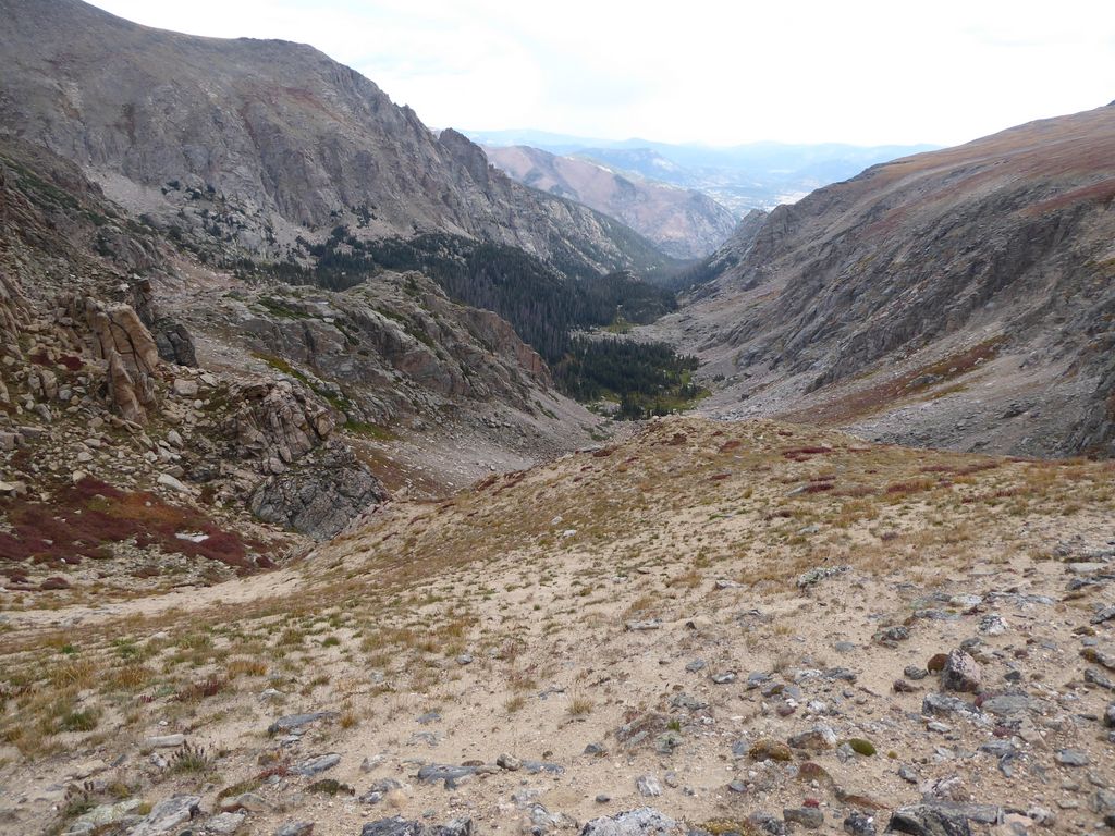
A lot of fallen trees, but it's a fairly soft, gradual way up to get to the "pass" that will drop you into Spruce Canyon. There's not much of a trail on the southern side of the pass, but once you get to the high point and enter the canyon, there are several use trails that you can follow. The high point provides a decent view of the lower reaches of Spruce Canyon, and we took a moment to enjoy the view.

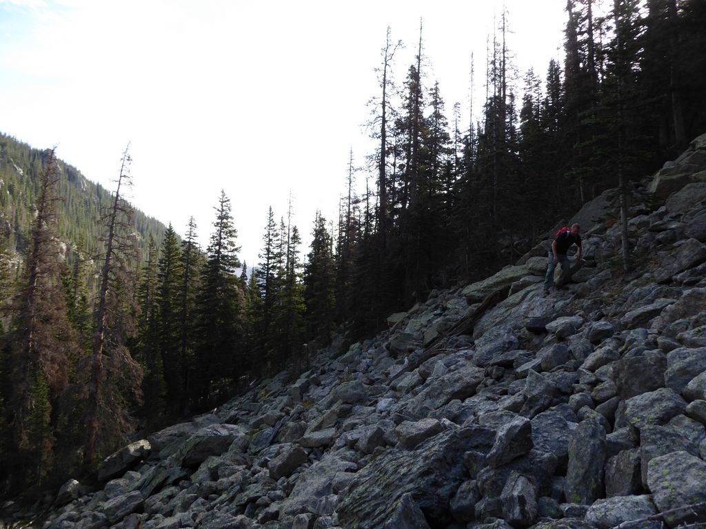
The first half a mile of our westward trajectory up the canyon was a complete blast. We didn't have to drop down to the bottom since it was easy to advance up the canyon about 100 feet or so above the floor. It was mostly small boulder fields and some sparse spruce/pine forest. Everybody was all smiles at this point.
It did get a little bit hairy further down the line, but nothing that gave us any reason to fear for our lives or anything like that. At the most we were skirting along some class 1 slopes. We were taking it nice and slow to minimize the possibility of injury.
At one spot during this stretch, we saw an incredibly cool graveyard of trees.
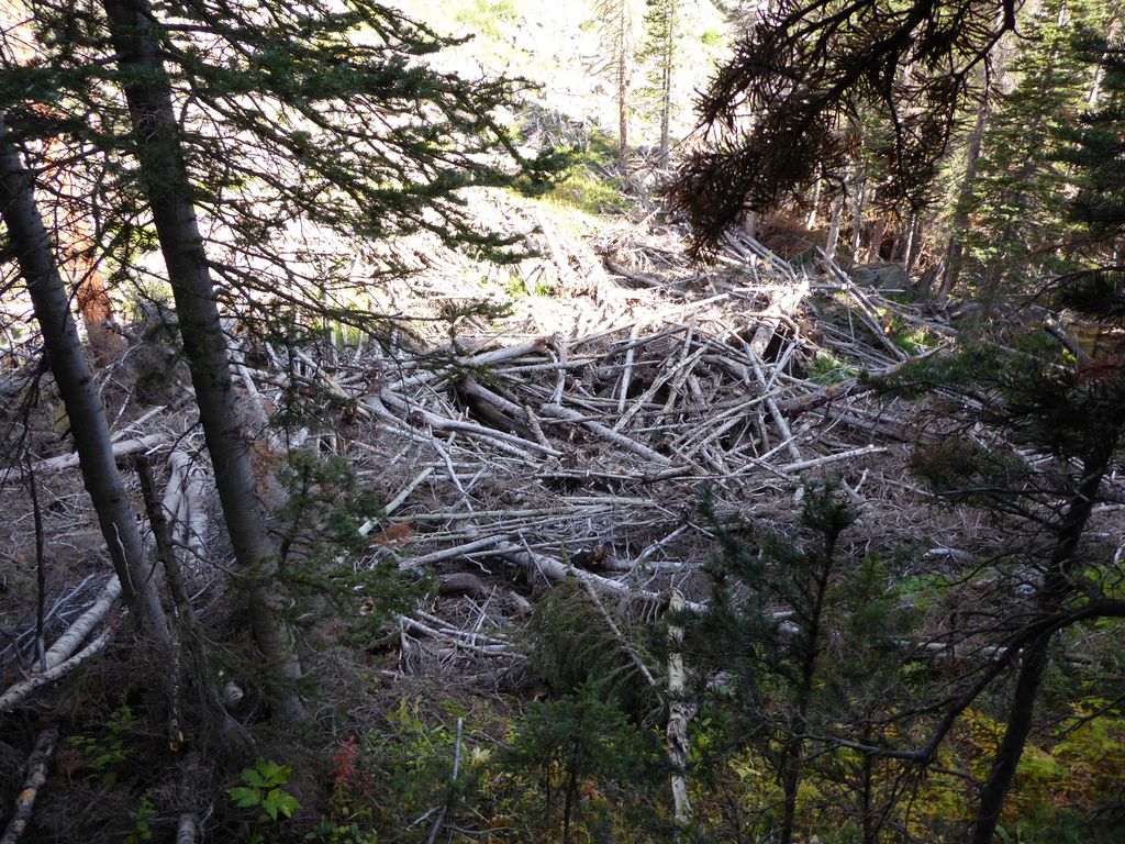
I mean, how cool is that? They are buried like 6 feet deep. God, would I love to see a time lapse of how they all piled up like that.
While we were walking, a guy who looked to be about our age appeared behind us. He was moving a lot quicker than we were, but he slowed down to chat with us. It turned out he was a geologist from Colorado State. He was on his way up to Sprague Glacier to take some pictures of it. We were really interested to hear about his research. Turns out Sprague Glacier was one of the rare glaciers that is actually increasing in size, and they were trying to understand how and at what rate.
Not long after talking to him, we came upon a very lovely rock staircase that would bring us about 200 feet higher, which was good because the canyon floor was also starting to go up.
At this point, things started to get a little more strenuous and tricky. Eric was still feeling some effects from the elevation, so he told us to go ahead without him. We took a moment to discuss a gameplan for splitting up, and after just a few minutes of strategizing, we decided Eric would just wait in where we were, and Jason and I would go ahead. So that's what we did.
But after walking just a few hundred yards up the boulder field, we realized it was going to be really tricky to get down to the canyon floor on our current route. Things were getting pretty steep, and we were encountering a bunch of sharp rock cliffs. It's not really obvious on the contour map, but you can see where our waypoints do a little zigzag (the orange ones right around 10,400 ft). About a hundred feet below, the canyon floor looked like easy going. So we decided to backtrack and take an easier route down to the bottom. I also thought this was a good idea because the more I thought about it, the more of a shitty situation it was for Eric to just sit there and wait. He would probably be waiting for a really long time for us to get up to the Divide and back down again. It would probably be better if he just went back to the campsite without us, which he was completely fine with. He had a GPS and he's a very competent outdoorsman, so I wasn't nervous at all about this.
When we got back to him, we all joined up and started making our way down towards the floor of the canyon. It wasn't very difficult, and it was nice because we could finally fill up on water. We discussed a new gameplan. Eric was going to follow the canyon floor back to the east until he got to the area just north of the pass we had come down on, and then head over that. Meanwhile, Jason and I would go up on our way to the Divide. The first part of this plan was not good, as I'll discuss later, since the canyon floor was pretty friggin nasty. But that's Eric did. And that's what Jason and I ended up doing later.
For the moment, Jason and I decided we'd stick to creek. It was pretty nice at first. We were climbing up a waterfall on some smooth granite that led us into a lovely meadow. But then the landscape changed into a big old boulder field that hid the creek.
After we cleared this boulder field, the terrain alternated between some thick brush, some thin brush,
and more giant boulders.
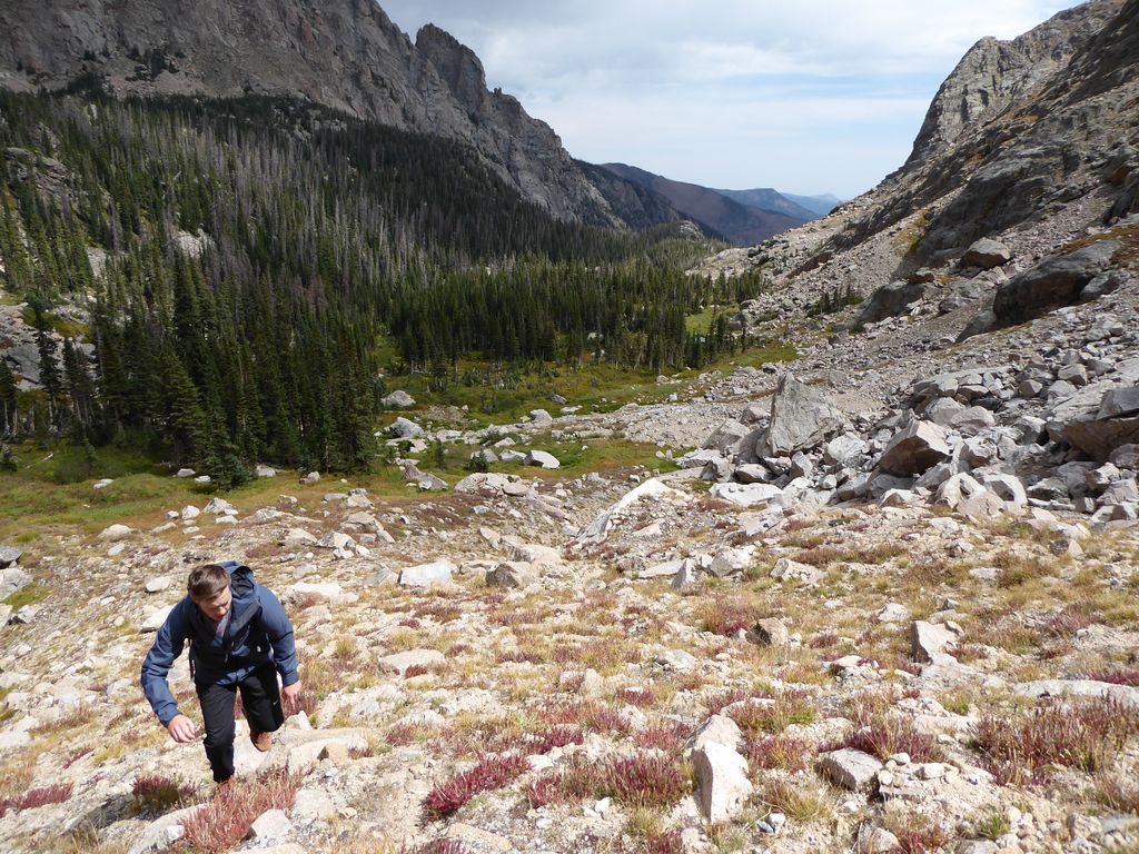
It was physically and mentally taxing, but there wasn't too much backtracking required. I could have sworn, though, that the Divide was getting furhter away from us. On the map it looked like we were only a mile or so away from the steep talus slope that would lead us up there, but it looked more like five to my eyes.
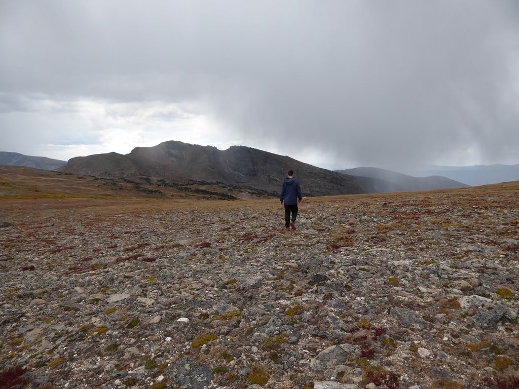
At around 10,800 ft or so, we finally got out of the trees and brush, and into some pretty gentle and open terrain, which was nice. The landscape was dominated mostly by red heather and dirt and rock; almost better for walking than a city sidewalk in my opinion.
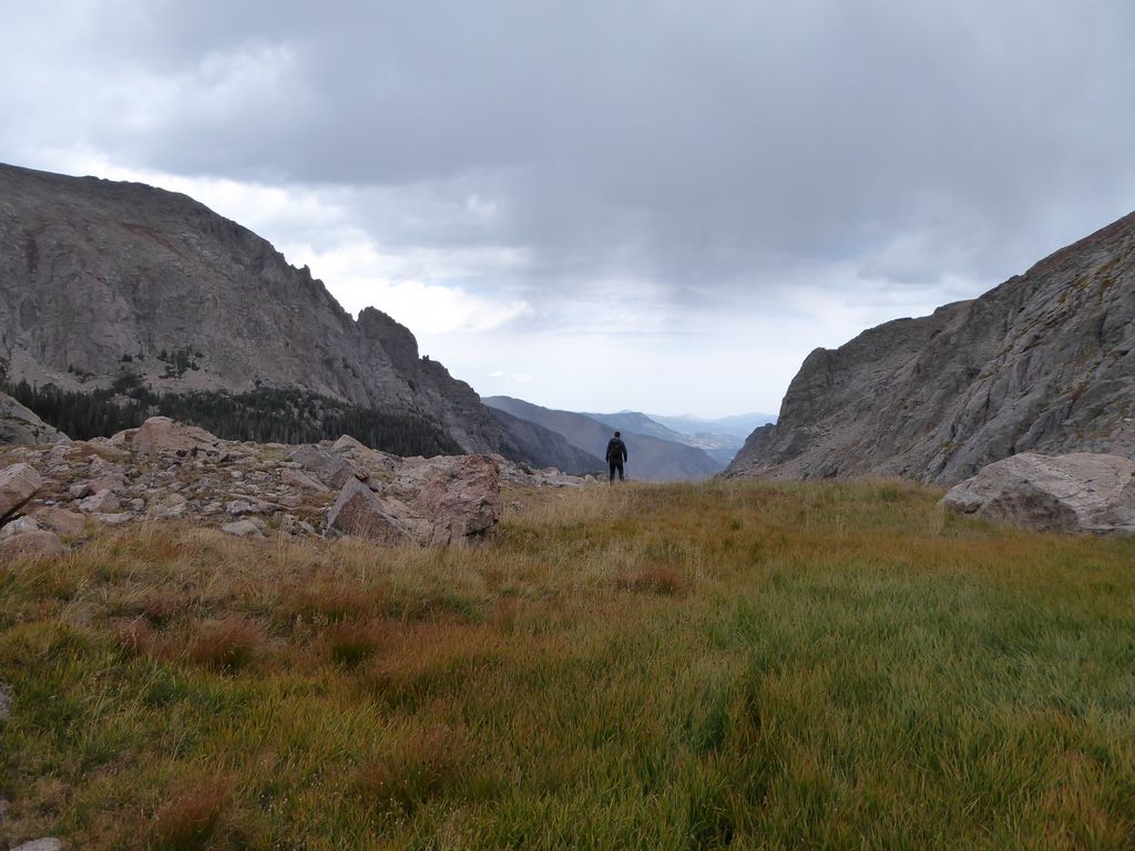
When we finally reached the last flat before the ultimate ascent about to the Continental Divide, we took a moment to breathe and assess the situation.
My initial thinking was that we would ascend along a southwestern path where the contours seemed to be the furthest apart—almost on top of the stream coming out of Eureka Ditch. However, it was immediately clear from our present position that the easier route would be to ascend towards the slot right above the patch of red in this picture (right in the middle horizontally), which is almost due west.
The first 300 vertical feet or so of the ascent was fairly easy. It is a simple class 1 slope where you can stay on two feet.
But after this, it shifts over to class 2 for the remainder of the climb, and it's definitely "all fours" territory.
It was a tricky climb. There were a few times where J and I almost lost our footing, and we probably would have been a bit banged up if we had. But getting up was much easier than getting down would be.
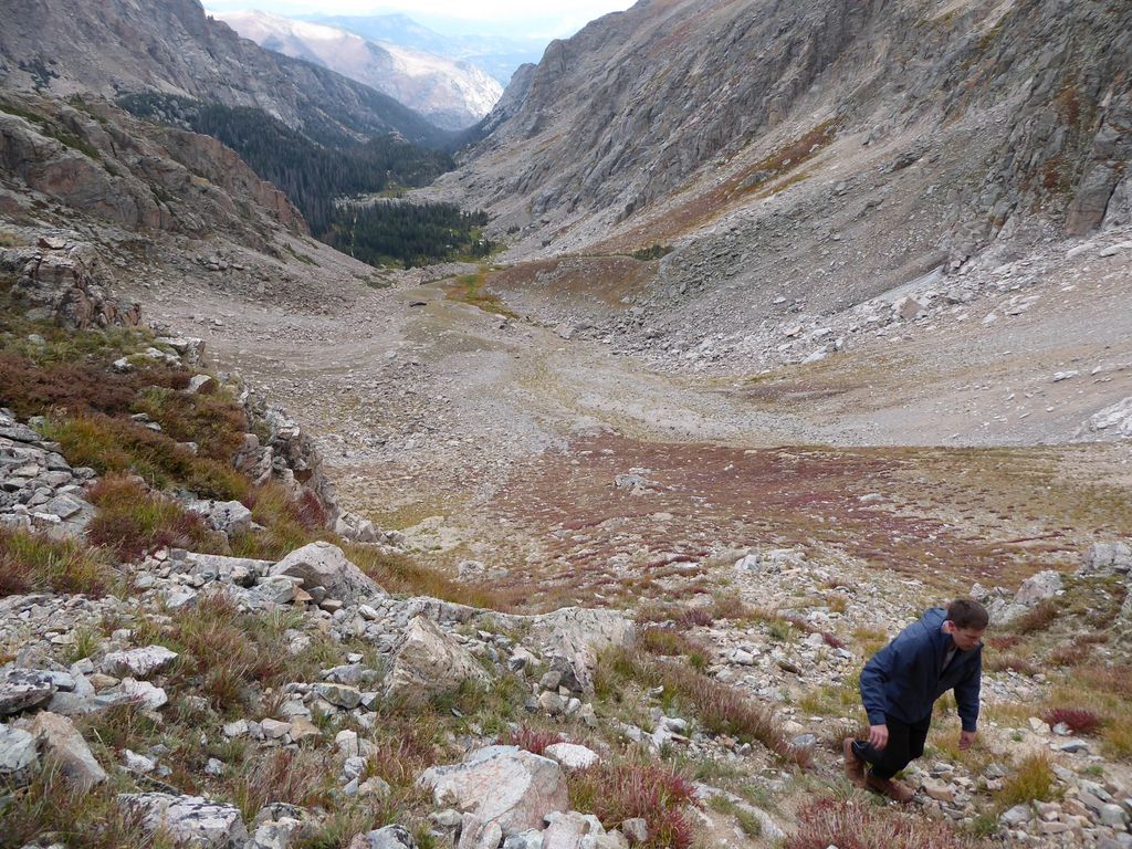
As you might expect, getting to the top felt really damned good. The views back down the canyon were superb,
and so was seeing the otherworldy terrain up on the Divide.
I was very eager to keep going just a bit further to the west so we could see what was on the other side of the divide, and I could see in Jason's eyes that he was as well. The problem was that we were clearly in for rain. Possibly thunder and lightning as well. It was already about 1300, and as you may be aware, in another hour or so we'd find ourselves in the prime time for intense Rocky Mountain storms. So we decided to turn around and begin our descent immediately.
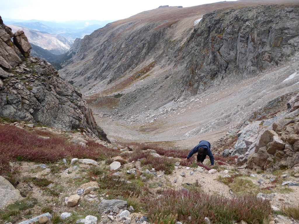
The getting down part was no fun at all. I was on my ass pretty much the whole time. I just didn't trust the footing because of how loose the soil and rock were. Jason is a bit more nimble than me, so he was a lot quicker on the descent as a result. But I was in no rush to catch up. I've taken enough spills to know that I don't trust my foot-eye coordination on a steep descent any more than I trust a Russian spy. The ground was pretty easy on my rear, except for the little spikey shrubs that would pop up here and there.
We both breathed a sigh of relief when we got down to the bottom.
The rain was somehow still not upon us, and we both agreed that a bit of a lunch was well-deserved. So we took a very pleasant break to get some food in our stomachs and fill up on water. We were both pretty damned happy that we had accomplished our goal of getting to the top. And we (or at least I) was feeling pretty confident that the return trek to get back to the campsite would be an easy one.
It definitely started out that way. The first half mile or so was absolutely gorgeous. We were following Spruce Creek along some very lovely, flat ground.
We both agreed we'd stick to the bottom of the canyon since we hadn't seen any really nasty stretches on our way up. There were a few places where we got pinched in a bit and had to descend along some rocky waterfalls,
but there was nothing too nasty yet.
After this half a mile, though, things quickly turned. The rain started to come down and we found ourselves continually pinched in by the surrounding canyon walls (which were basically pretty close to 10-20 foot sheer vertical rock). The ground was coated with thick weeds like this pretty much the whole time.
And by God, were they slippery! I must have skidded and nearly ate shit half a dozen times. I remember continuously clutching on to whatever tree branches I could to control myself. I was literally saved by the trees numerous times. Looking back at the map, it was probably only about 0.4 miles or so of this type of steep, choked passage. But damn, it felt like a lot more than that. A few times we had to cross the creek due to impassable dropoffs, and that was scary. The rocks were so slippery from the rain.
I really would not recommend following this same course (which is pretty much waypoints 1000-1010). The rocks just 150 feet above us to the south, although difficult in their own way, would have been orders of magnitude more pleasant—and probably less risky—than what we did.
Eventually we reached a point where we could ascend to the south to get back to the path we had taken in. Once we did, things immediately got better. We were both feeling beat to hell, but we still had enough energy to keep going at a fairly good pace.
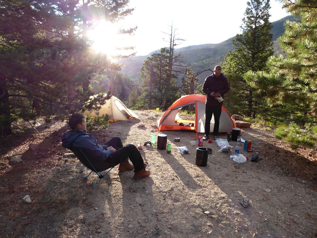
We got back to camp at about around 1600 and were so damned relieved to find Eric chilling and enjoying a cup of coffee. We both commended him for braving that treacherous canyon all by himself, and luckily he wasn't upset with us for our lousy game plan. What was pretty nice was that the weather had cleared up enough where we had some sun peaking through the clouds! So Jason and I went for a swim to clean off all the sweat and debris we had picked up bushwhacking through that god-awful mess.
It felt so damned good to get clean and dry off in the sun. To top it off, we took a couple of slugs of whiskey that helped erase the feelings of the little knicks, aches, and scratches. Sitting on those rocks on the shore of Spruce Lake after such a long, rough day...it was a moment of extreme content.
Once the sun vanished behind the canyon walls, that contentedness turned quickly into cold. I immediately put on all my dry layers to help warm up, but my shoes were still damn wet, which sucked. Nothing a good meal and some warm flames couldn't solve, though.
That night we were blessed with the wonderful gift of a clear Rocky Mountain sky. My goodness were the start brilliant. They inspired some deep philosophical conversations and bonding with two of my closest compadres. All in all, this was a day that I'll cherish for as long as I live.
The second to last day would be another splendid experience. All we had to do was hike about 3.0 miles to get down to the Old Forest Inn campsite, and we had all day to do it. While sitting around and eating our breakfast, we all agreed that a trip up to Lake Odessa would be a fine side adventure for the day.
Since we weren't in any rush, we were taking our sweet time to pack everything up. But what really made us slow to get going was the incredible experience we had that morning.
Bertha was back (or at least we think it was Bertha), and this time she had brought her little daughter! Our introduction to the youngster came with a series of splashes caused by her running in circles in the shallow water of Spruce Lake. I didn't have my camera out for this, but I didn't have to rush to get picture since they would be hanging around for the next hour just eating and drinking along the shore of the lake. At one point, they probably came within 20 feet of me while I was standing on a little rock outcropping.
What a morning. What a great, great morning.
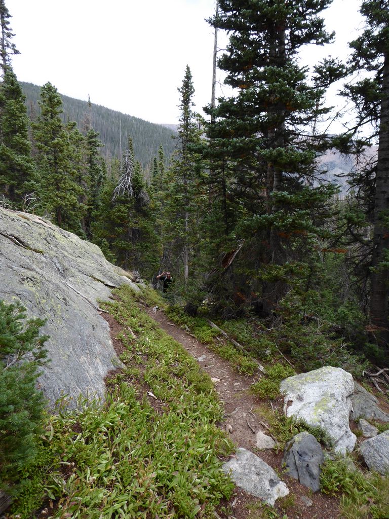
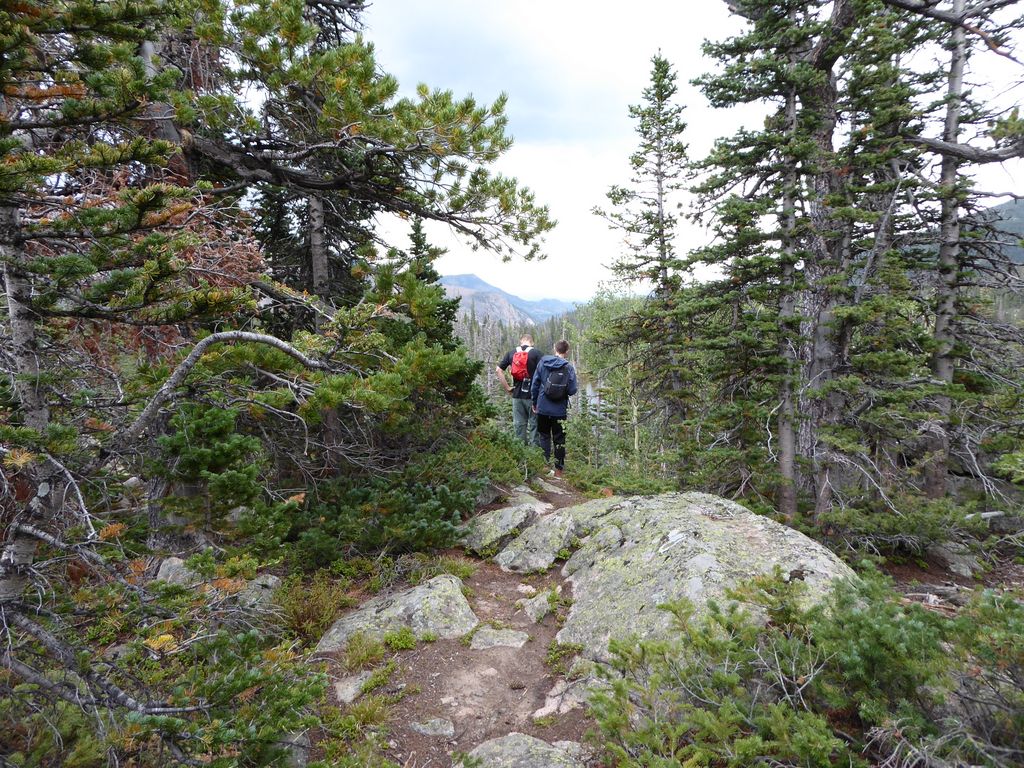
It was about 1100 when we finally got going. The trip back towards Fern Lake was pleasant, although we did get a little bit "lost" trying to get down to the shore. I thought it'd be fairly easy to just cut southeast through a series of trails to the campsites there, but it turned out we needed to do some mild bushwhacking to do so.
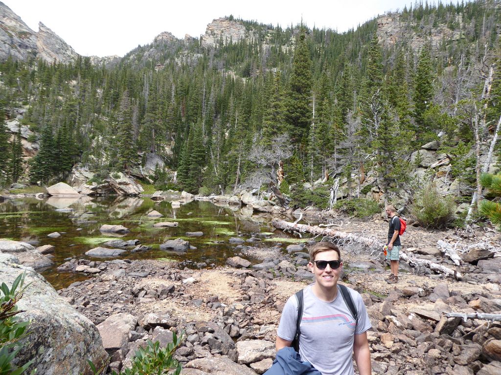
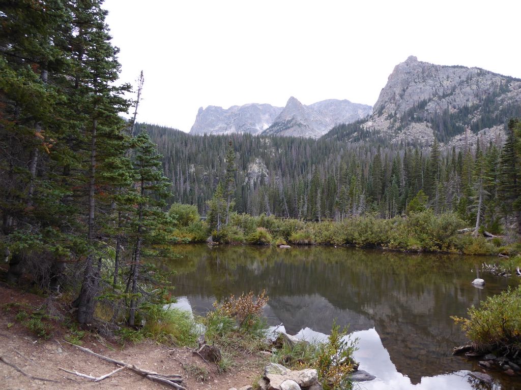
Fern Lake looked nice, and based upon some conversations we had with other hikers, the fishing also seemed to be decent.
I think the campsites at Spruce Lake were much better than the ones at Fern Lake due to their greater level of privacy, but the latter are by no means bad. Just a little less private.
On our way around the eastern side of the lake, we came upon a group of people that had spotted a little beaver. Goodness gracious was he fun to watch.
Jason and Eric dropped their packs just short of a really impressive boulder field
that had an amazing trail carved through it. I've been doing volunteer trail building for about three years now, and I must say I was thoroughly impressed. They had basically created a smooth bench straight through a whole mess of rock that was as nice as any nature trail I've ever seen. The trail work on the section leading up to Odessa was similarly impressive.
The flat section right before the lake is super cool as well.
Odessa was worth the extra 1.5 miles for sure.
We enjoyed some beef jerky along the north shore before heading back down the trail. The descent back towards Old Forest Inn was pretty uneventful, although it was cool to see the things we had missed on our way up to Spruce Lake in the dark.
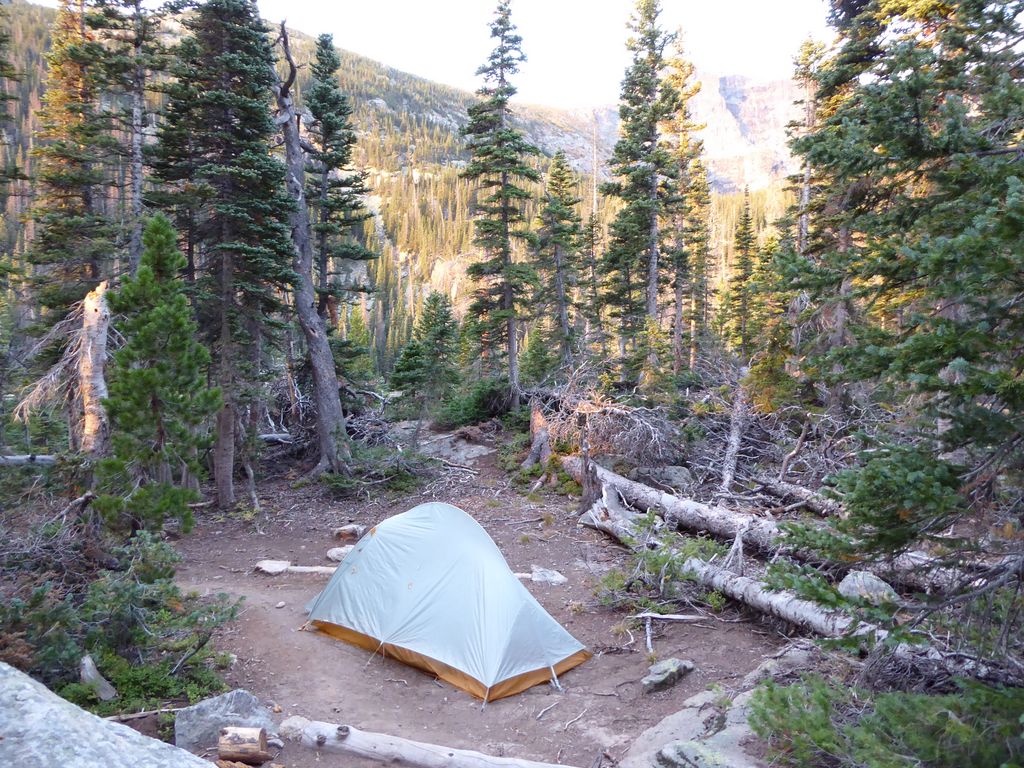
When we got to Old Forest Inn around 1400, we found the campsites to be very satisfactory. There is a lot of open space and flat ground to go with it.
Again there was a privvy, which is always a plus in my opinion.
After setting up our tent, we were all gearing up for another downpouring. The clouds were creeping in from all directions. We wanted to go for a little hike down to Spruce Creek and check out the confluence with the Big Thompson, but we didn't want to get caught in the anticipated downpour. Luckily the clouds cleared up within an hour or so, and so we did explore the surrounding area. There are a lot cool spots right around here to check out with some nice aspen groves.
We made it down to the Big Pool and then headed back to have some dinner and finish off the remaining whiskey in our possession. It was a lovely evening, but bittersweet since that was our last one in the backcountry.
On the last day, I woke up pretty excited that we only had about two miles to hike to get back to the trailhead. The morning was a bit cold, but when that first sun hit, Good Lord did it feel good.
Once again we took our sweet time packing up. The remaining two miles were ridiculously beautiful due to the low sunlight filtering through the aspens, which are abundant through this part of the trail.
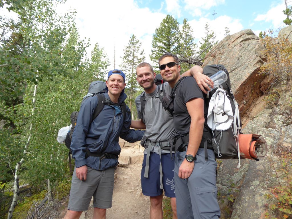
Perhaps one of the most memorable and impactful moments of the trip came when we were getting close to the trailhead. We happened upon a group of three women who must have been in their late 60s or so (but very energetic and spry nevertheless). We were hoping they would take a picture of the three of us, and they happily obliged. When we got to talking with them, they revealed that they had been friends for many decades and still managed to do hiking trips together through all of the years. I thought that was so cool. It made me really appreciative for the many years I've enjoyed with two of my favorite hiking companions, and perhaps even more excited for the years to come.