


TRIP DETAILS
TRAIL MAP
OVERVIEW
This is a fantastic trip for novices. Rowell Meadow trailhead provides easy access to 7000+ foot territory and through the entire route you'll never be more than a day away from help. There are no sweeping views or vistas along the trail, but at Ranger Lake you can climb up to Mt. Silliman and at Seville Lake there is easy access to 9500 ft. territory.
I did this trip with three of my friends in September of '10. We had originally planned to make our way up to Mt. Silliman on the second day, but by the end of the first day some of us were fatigued enough that we decided it would be better to start a journey back to the trailhead instead. If you're in decent shape and have backpacking experience, making it up to Mt. Silliman shouldn't be a problem. But if exhaustion does set in, there are plenty of other options to make the hike back exciting.
Oh, I should mention that the road up to the trailhead ain't the prettiest I've seen. There are plenty of places to bottom out or get stuck if conditions are wet, so I'd recommend taking a 4WD vehicle that's nice and high off the road. You can definitely get away with a Honda Civic, but you're gonna be cringing every time you hear the sound of it scraping against the ground.
Elevation Profile

TRIP LOG
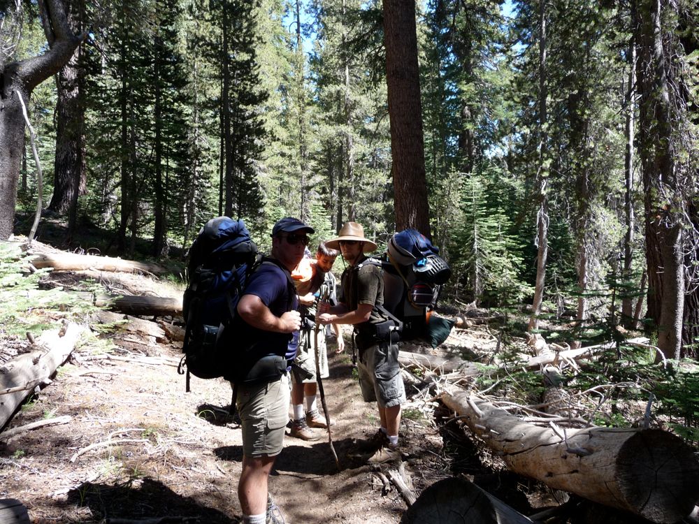
At 4:30 am on Saturday morning, three of my good chums from UCSB: Mark, Kambiz, and Mike and I left my apartment in Livermore on our way to Sequoia Kings Canyon. After a stop in Merced for breakfast (Merced has evertyhing a growing boy could need, btw), and another in Squaw Valley for gas, we were in the park around 9:00 am. Our first stop was at the Grant Grove Visitor Center to pick up our permit. The line for the backcountry permits was pretty long, and when we got to the front we figured out why. The ranger handing them out was one of the most talkative guys I've met. He looked a little like Santa Claus, to tell the truth, and this put me strangely at ease.
Finding our way to Rowell Meadow wasn't very difficult, but the drive up was painful. My four month old Nissan Altima was taking a bit of a beating on the rough, dirt road. She made it up in once piece, though. And aside from a thick layer of dirt, no damage was done. By the time we got to the trailhead it was about 11:00 am. Parking was actually on the scarce side, but we managed to find spots for our two vehicles. After some usage of the pit toilet (there's no running water at the trailhead), we were on way up the trail.
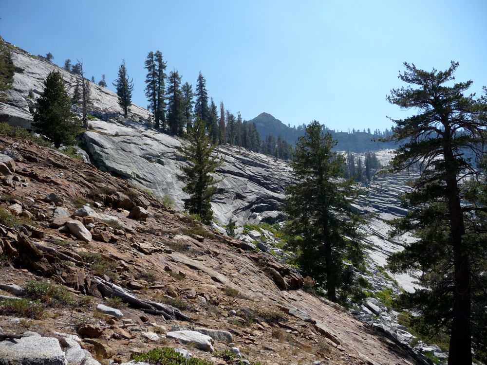
The trail begins with a set of switchbacks that parallel Rowell Creek. After an initial climb of about 600 feet, there are several good places to collect water, which was good because I was pretty much empty. When the trail levels off at 8800 feet, there are several clearings along the path, and then you find yourself in Rowell Meadow. There's a three-way fork at this point, and my initial plan had called for heading right along the south one to cut down on distance traveled. But we ended up going along the middle fork heading east instead. Sure, I made a mistake. But I always tell people if they want to walk the shortest distance possible, then they've gotta be the ones paying attention and doing the navigating because I have no qualms with walking an extra three or four miles. I'm not saying I do it on purpose, just that my gut usually takes me along the more challenging path.
After stopping for lunch just
east of the fork , we were greeted by another group of people that were headed in the same direction as us. They were a little confused, so I helped them figure out where they were. Turns out they were headed in the same direction and going about as far as us, and since two of them were tiny ladies, I used this as motivation for our group to press on even though we had to hike an extra two miles to reach our campsite at Ranger Lake.
After making our way through a scorched section of forest, we started
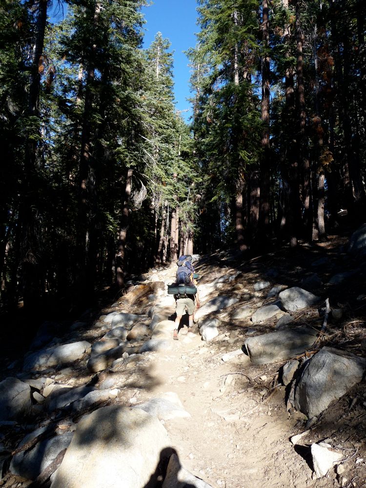
climbing to the southwest. The guys were pretty tired by the time we got up around 8500 feet again. We had made it up to 9400 and then back down to 8000, so on this climb the morale was a little lower. It was made worse by the fact that everybody but me had nasty ass blisters.
In the end, we persevered and made it to Ranger Lake. Once we filled up with water and sat down for some dinner, everybody was content again and we all slept great.
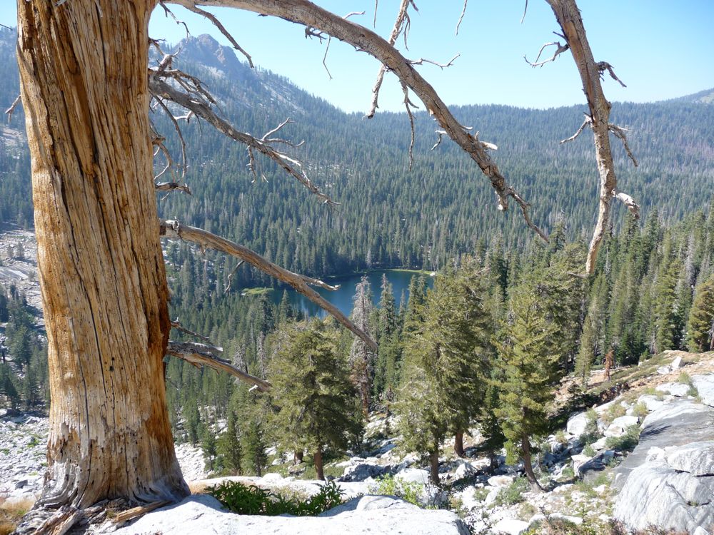
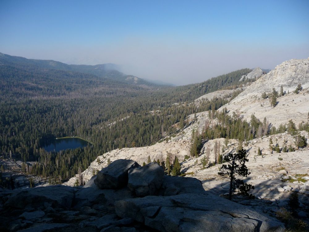
The morning at
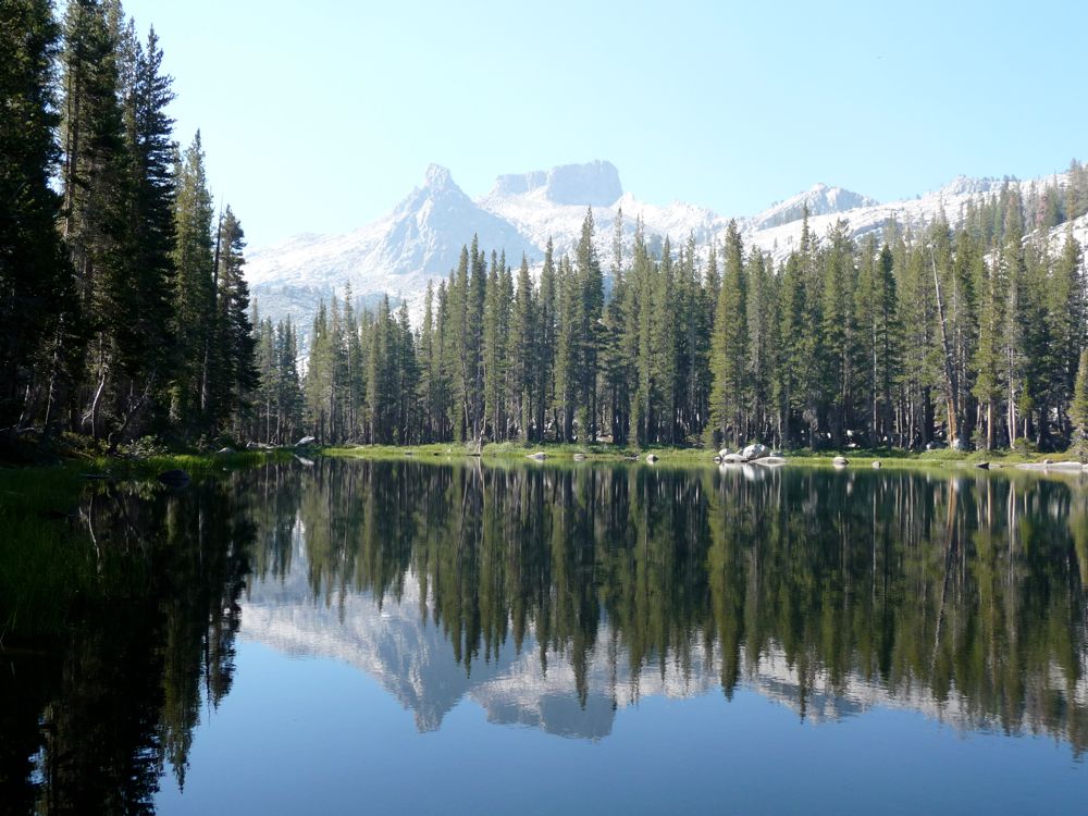
Ranger Lake was as gorgeous as could be. There was a strong smell of smoke in the air from the Sheep Fire
burning to the north, but that is one smell I truly love. While filling up on water, I was really craving a climb up to the flat top of
Mt. Silliman, but at the rate we were hiking I realized this wouldn't be possible. The

guys were cool with the plan I proposed of scratching off Mt. Silliman and heading back the way we came, so that's what we did. I'd love to get back there and get to the top of that thing.
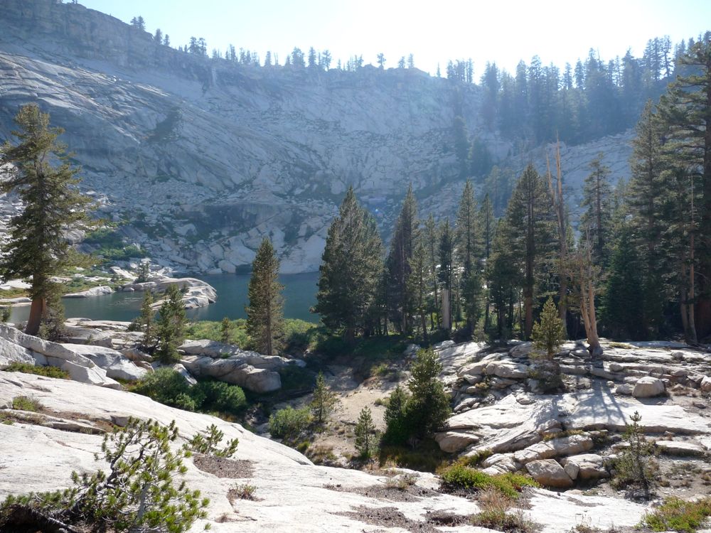
Unfortunately, the waypoints I show above don't reflect the hiking we did very well on the second day. Basically, in the morning we hiked back the way we came and then took the left branch of the trail to Seville Lake. It was a pretty quick hike, and we at

Seville just after noon. The rest of the guys wanted to swim and mess around camp, but I was still itching to do some hiking and climbing. So they stayed at camp and I took off up the mountain to the south. The waypoints shown above are from this little expedition I did.
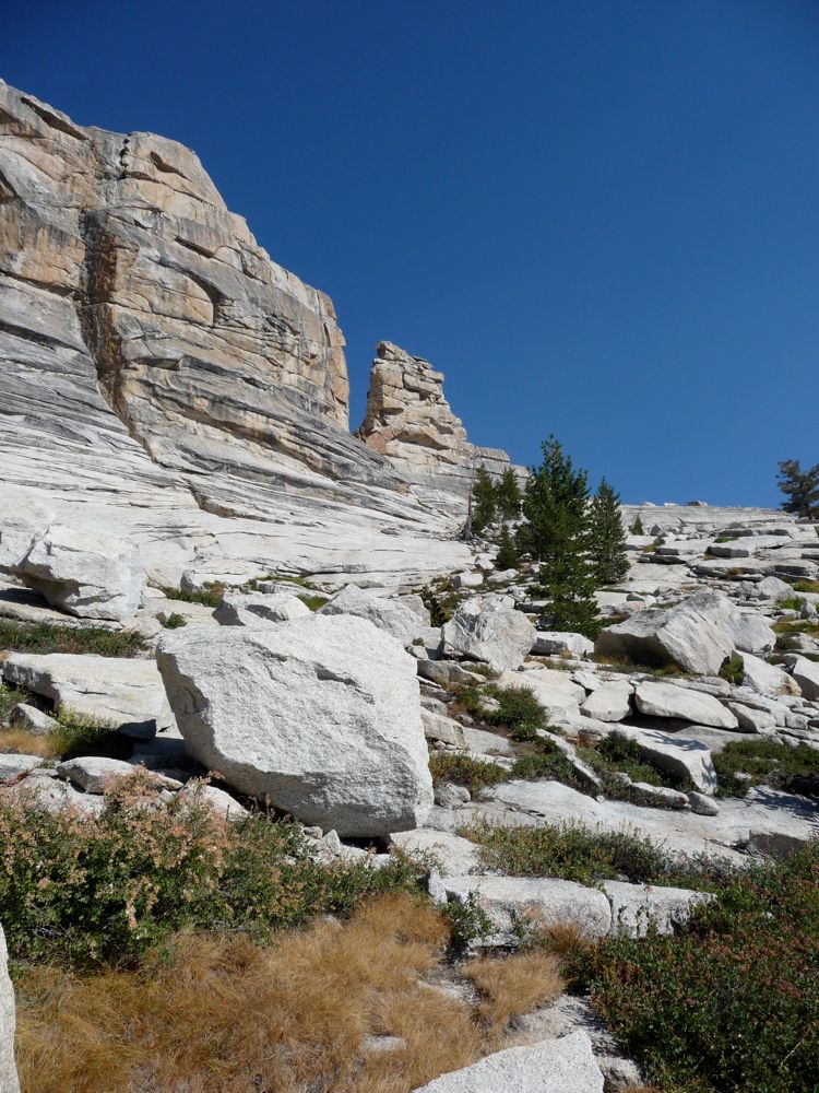
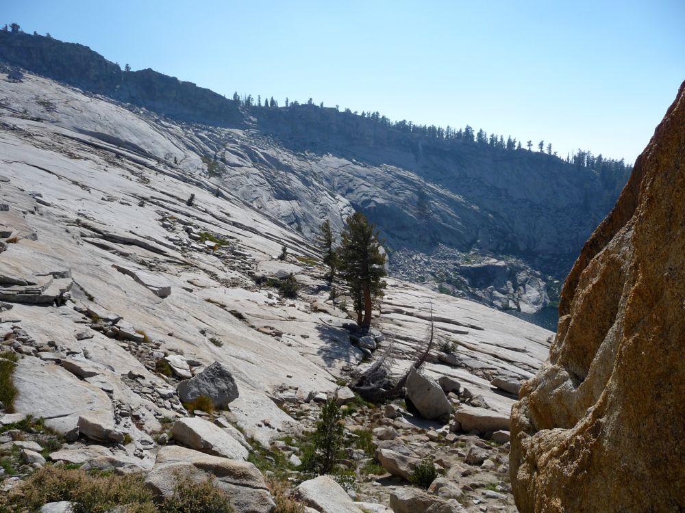
It consisted of traversing the east side of Seville Lake and then scaling the south wall of the lake. It looked incredibly steep from the north side of the lake, so much so that the other guys thought they wouldn't be able to do it. But it turns out that it was actually relatively easy: maybe class 2 at most.
Here's what the slope looks like on the southern part of the cup of the lake, along with a shot back down at the
lake.
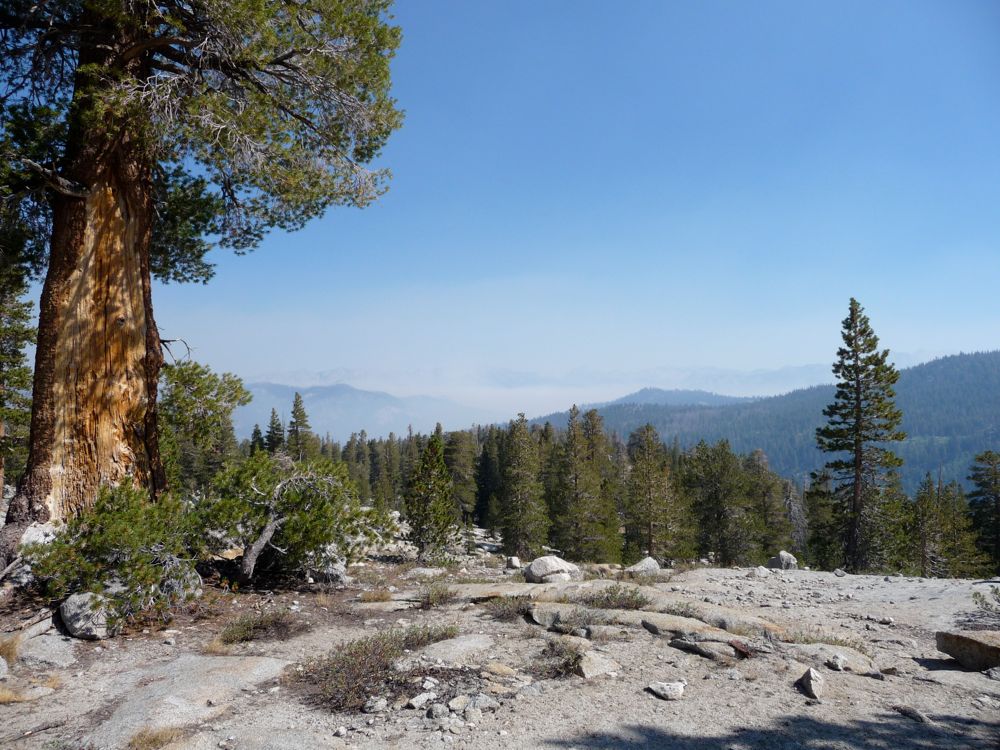
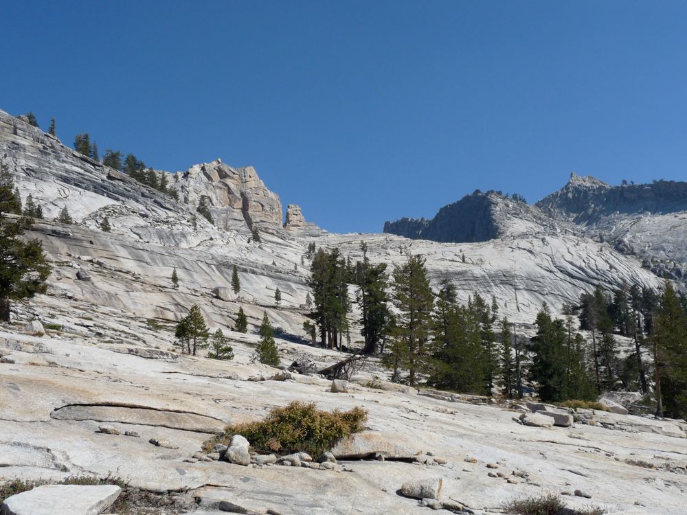
Once past the initial 500 feet of ascent, the terrain
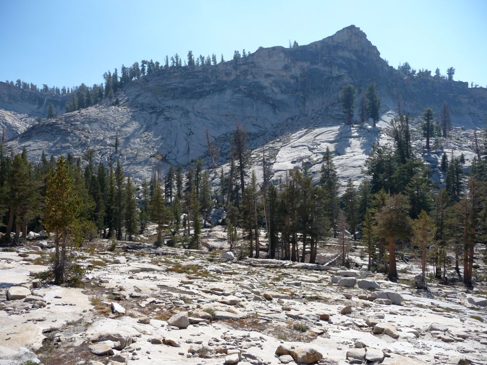
flattens out quite a bit, and at about 9200 feet it becomes a
swath of granite. I was intrigued by a
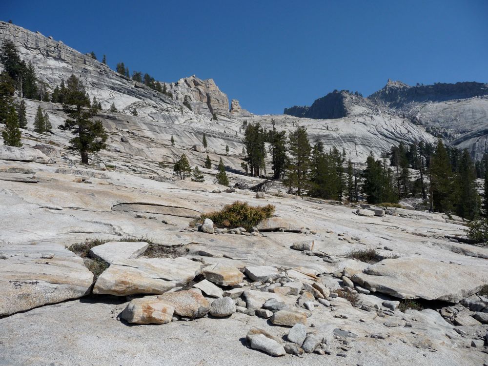
crack in the southeast face, so I started in that direction. I could see that there was a nice
smooth staircase leading
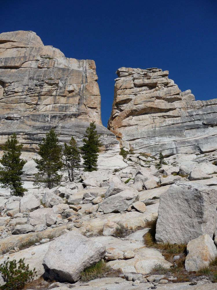
up to it once I got closer, and it wasn't long until I could see that that it led

clear to the other side. Peering through the crack, I could see down to

Lost Lake. I wondered how many people had tried going through and rapelling down. It wasn't in the cards for me, but I bet it would be a hell of a lot of fun to do it. Done with the crack, I headed to the southeastern end of the flat and caught a view out to the
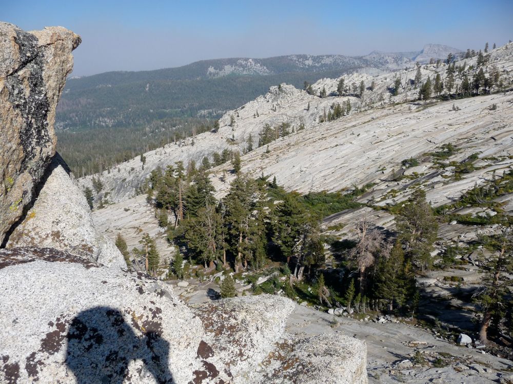
route we had taken in. It looks like you could pretty easily climb down that way if you were so inclined.
After a nice break and a protein bar, I was ready to head to the
west. I wanted to return back to the lake along the southwestern shore this time so that my route was somewhat of a loop, but it looked like it would be too steep to stay at my current elevation and skirt the south face of the ridge in the last picture. So I ended up dropping down 500 feet to the
mini-lake below and then climbing back up 400 feet or so to the ridge on the west. Once on the ridge I had a great view back down to
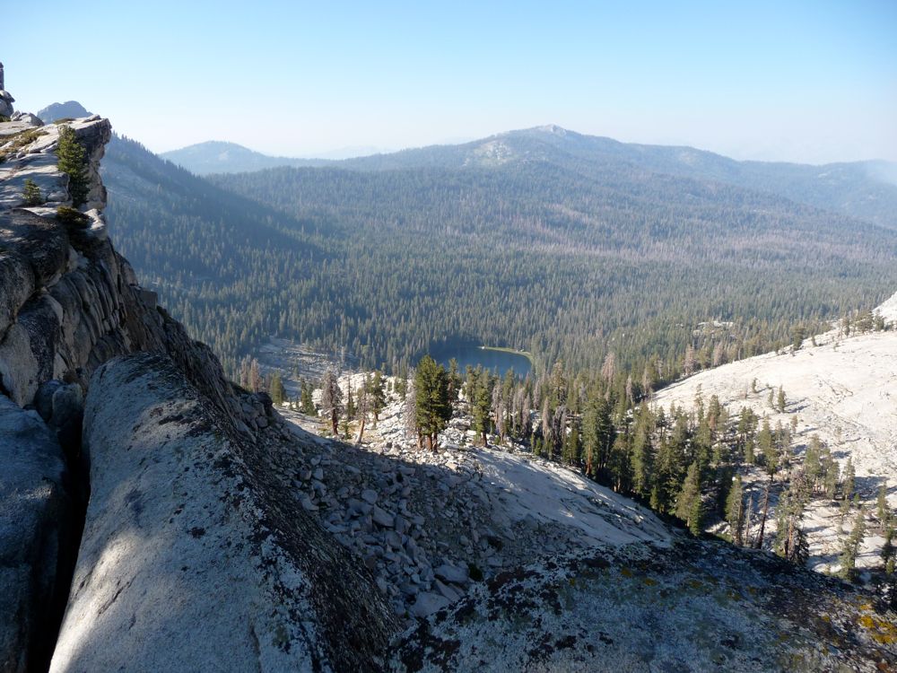
Seville Lake where my friends were lolly-gagging around and to the east where the
smoke seemed to be growing.
Getting back down to Seville Lake proved to be incredibly fun. You can see one of the waypoints from the route I took in the map above. To get down from the ridge at 9600, you have to first climb down a steep little gulch directed to the northwest. Luckily, there's almost no bushwhacking involved. Once you're at 8800 or so, then it's a nice gradual descent to the northeast through open forest and marsh.
When I finally got back to camp the guys were sitting around a nicely built fire, which gave me an opportunity to do one of my favorite things on earth. I jumped in the lake and washed off, and then dried myself over the open flames. I don't know what it is about using a fire to dry off in place of a towel that I love so much, but damn does it feel good. The rest of the night featured dinner and some great jokes from Kambiz. I was really happy because it was his first trip and he seemed to really be enjoying himself so far.
The only goal we had for the last day was to get out to the trailhead with enough time to get Kambiz to San Jose airport. I thought it was going to be a walk in the park, but it turned out to be more a walk in the backcountry. On the map I had brought along, there was a maintained trail that starts off just to the north of Seville Lake and leads back to Rowell Meadow. Problem was: we couldn't find it.
So rather than hiking east to get back to the trail we had taken in, we decided we'd just head north and see if we could intercept the trail we were looking for. I had my GPS on, and according to it, we were standing on top of the trail for a good mile and a half of our northward bushwhack through dense pine and marh. Either my GPS map was incorrect or that trail hadn't been maintained for a decade. Every once and a while we'd see something that resembled trampling by humans, but no tell-tale signs like sawed logs or horse droppings.
Finally, just before Rowell Meadow we were able to pick up the trail going northwest. Once we hit it, it was an easy descent back down the trailhead. I had to do some backtracking on my own after I lost my sunglasses. I was fortunate to find them where I had taken off my backpack about a half a mile back. After a refreshing shower in Grant Grove (I always forget the name of the lodge they're actually at, but anybody at the gift shop or visitor center can tell you where they are; they say it's $1.00 for two minutes, but it's more like five minutes), we said our goodbyes. Kambiz made his flight and spent the next few weeks healing tennis ball sized blisters.