


TRIP DETAILS
TRAIL MAP
OVERVIEW
Notes:
- I can say without the slightest hesitation that South Lake Rd—the one leading up to the South Lake trailhead—has the most spectacular fall colors I have seen in California. Granted, I haven't seen every part of California. But I do make it a point to seek out aspen groves whenever I make a trip in autumn. So I was blown away on the drive up to the trailhead.
- The descent from Thunderbolt Col down into Dusy Basin is every bit as gnarly as I was expecting it to be based on other trip reports and forums I read. Be prepared to go quite slow, especially with a heavy pack.
- The eastern side of Potluck Pass is very close to being class 4, in my opinion. When I got to the top, the thought of descending down to the Glacier Creek basin made me dizzy.
- I was looking forward to solitude in Palisade Basin, and luckily I got it (I didn't see another person for ~72 hours). But this probably had to do with how late in the season I did the trip. The use trails around the Barrett Lakes show extensive wear. The good news is that the basin is so large you could easily be sharing it with other parties and not even know it.
- This was my first trip using the Garmin inReach Explorer Plus, which I purchased to serve as my primary navigation and emergency communication device (replacing my old ETrex 30 for nav). Overall, I was very impressed with the interface. The navigation tools easily served my needs on the trail. I also think their subscription policy is really cool (you can go month-to-month with a small annual fee). However, when I got back from the trip, I was really shocked at just how lousy the utilities to export waypoints are.
The waypoints you extract with their web-based interface don't even include the bloody elevation!!! I mean, come on, Garmin! Are you kidding me?! Perhaps the most important 3-D coordinate for hiking purposes and you leave it out? I'm just simply at a loss as to what they were thinking. In addition, the waypoints aren't properly sorted by number when you extract them, which causes more problems when plotting routes. I can't help but wonder: is this just a ploy to make more money by having you buy more of their software products?
Ok, I'm done ranting. I eventually bit the bullet and came up with a solution. What I ended up doing to overcome these deficencies was to write a quick Python utility to sort the waypoints and insert the elevation (using the freely available elevation.py function). If you face a similar dilemma, you can download my SortWaypoints.py script. [Warning, you'll need to get your own Google Maps API in order to use elevation.py.]
Elevation Profile

TRIP LOG
Palisade Basin had been on my list of destinations for many years, I think since the day I bought a copy of Arnot's High Sierra back in graduate school. The long drive to the trailhead (6+ hours from the Bay Area) had always made me give priority to options on the west side of the Sierras when choosing destinations, but after doing Mt. Whitney the year before, I realized the drive wasn't all that bad. There are plenty of great places to stop, and the scenery along 395 is just phenomenal.
I arrived in Bishop right around 10:30 am and stopped at the White Mountain Ranger Station to pick up my permit. It's in a very convenient location: right there on 395, which is nice. The rangers told me I was in for some nasty weather that night, which I had already been anticipating from the weather forecasts. I felt that I was well prepared with my gear to sleep comfortably, but little did I know one of my tent poles would crack and my thermarest would pop later in the trip. So yeah, it didn't end up being so comfortable. But nothing that made me fear for my life or anything. Just enough to deprive me of quality sleep.
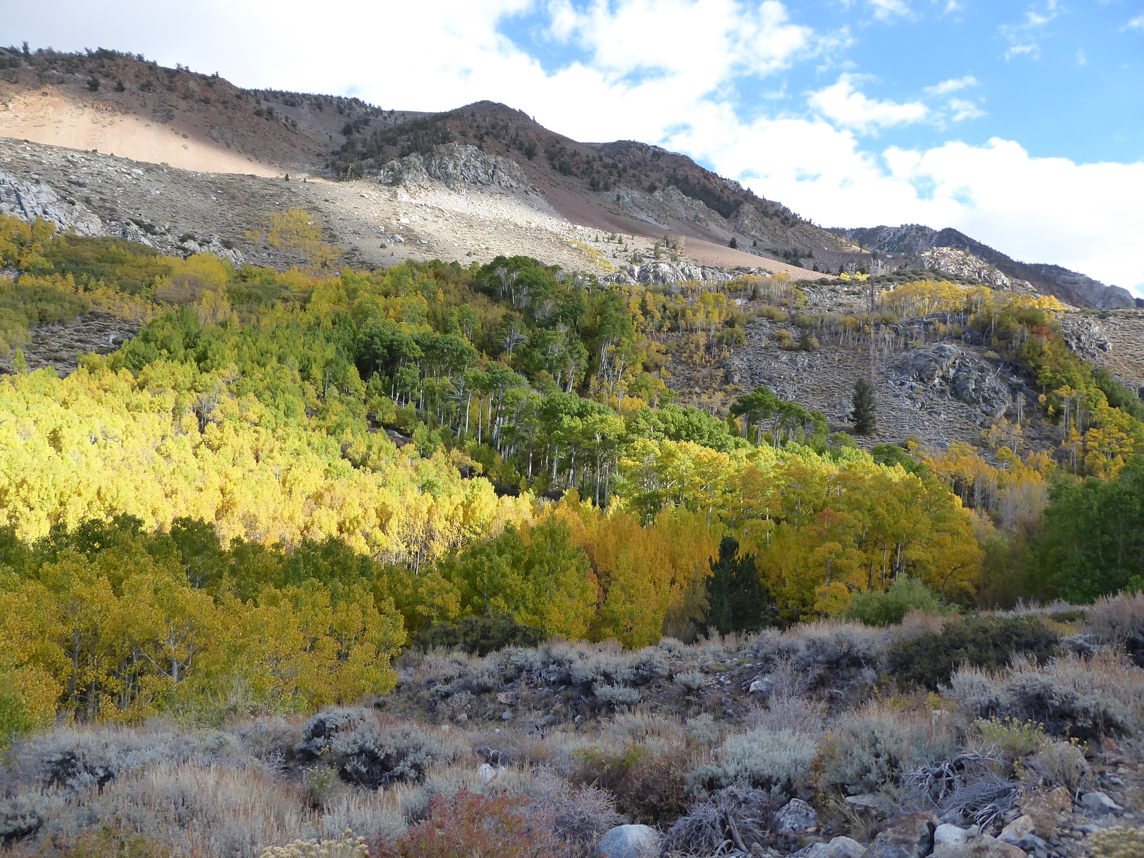
After making a quick stop for some food and fuel in town, I began the drive up to the Bishop Pass Trailhead. As I mentioned in the notes above, this turned out to be one of the higlights of the entire trip. The fall colors were simply astounding. Right after turning off 168, I was stunned by the reds and yellows and oranges surrounding the road. I was really wishing I had brought my girlfriend, Tina, but alas I chose to do this one solo. I am really looking forward to returning with her and enjoying the brilliant hues in the very near future, though.
There was plenty of backcountry parking available at the South Lake parking lot. Once I got all my gear in order, I asked some nice tourists to take a picture of me with my backpack that felt way too heavy.

The colors along the initial portion of the trail were just as lovely as the ones I had seen on the road,
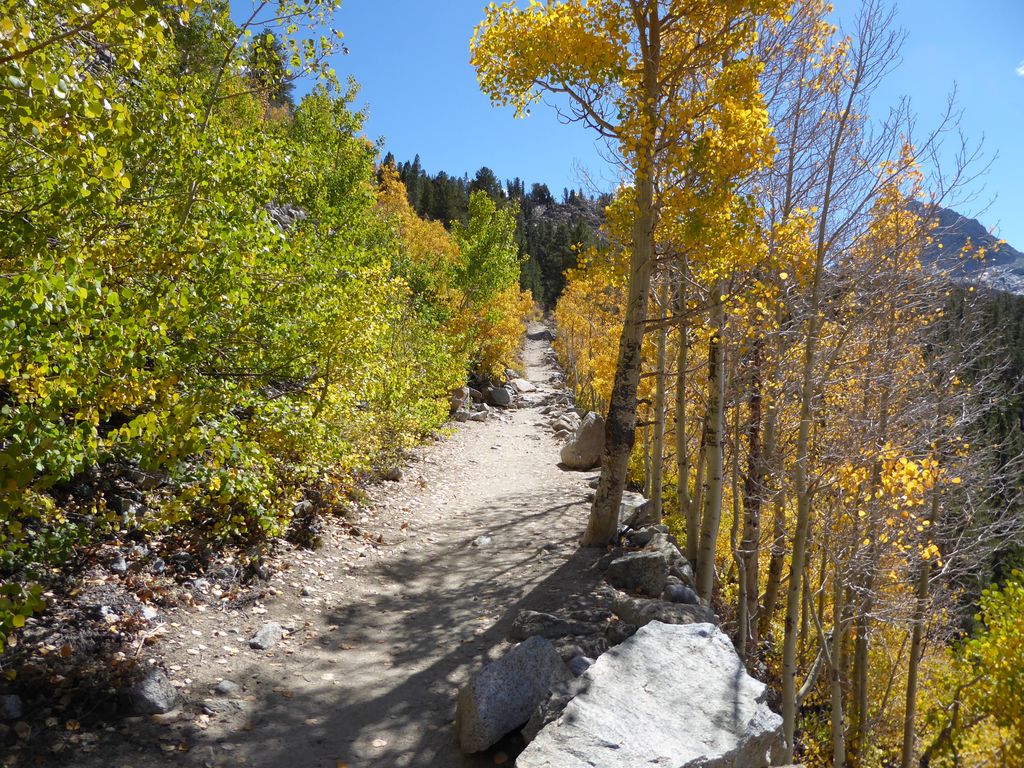
and while slowly hiking along, I was thinking to myself South Lake looked like a great destination in and of itself.

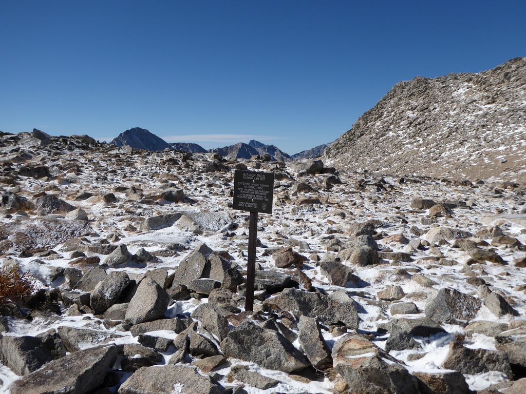
The trailhead is pretty darned high up there (~9700 feet!), so I was already feeling the elevation a bit. After a short while, I came across the sign telling me I was entering the John Muir Wilderness.
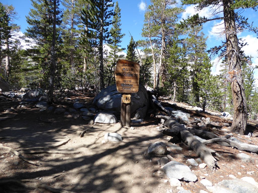
But interestingly, the boundary for Kings Canyon is quite a ways in from the trailhead. The good thing about this for all you dog lovers out there is that it means you can have your little friends on about the first 6 miles of the trail. I saw plenty of people with their dogs enjoying the nice weather.
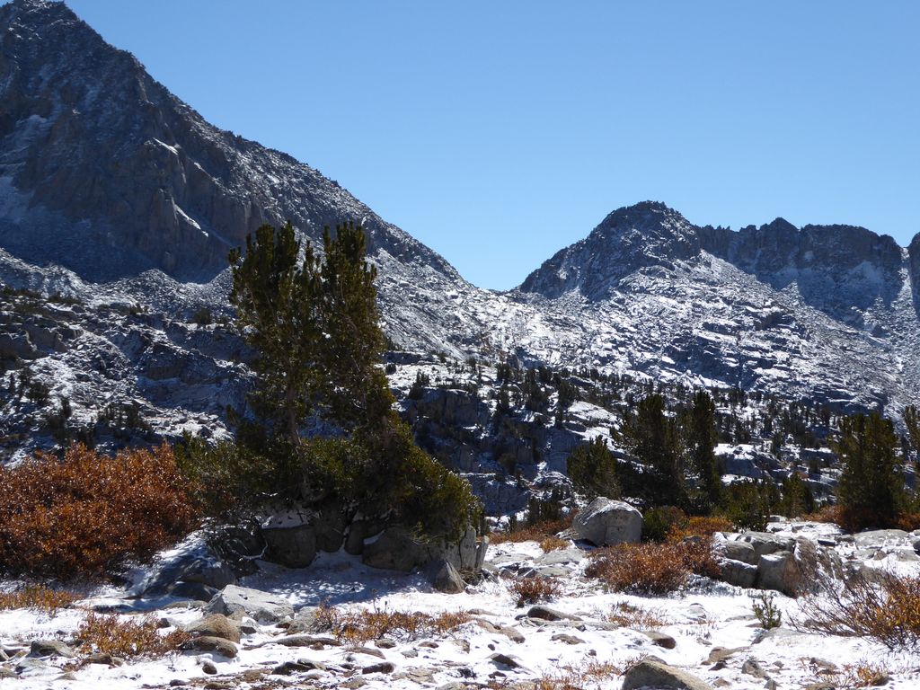
The first several hundred feet of elevation gain were quite gradual and pleasant. A few aspen groves here and there, plenty of juniper trees, and the scent of Jeffrey pine filling the air. There are a few spots to admire the view back toward the lake, although it's hidden behind the trees.
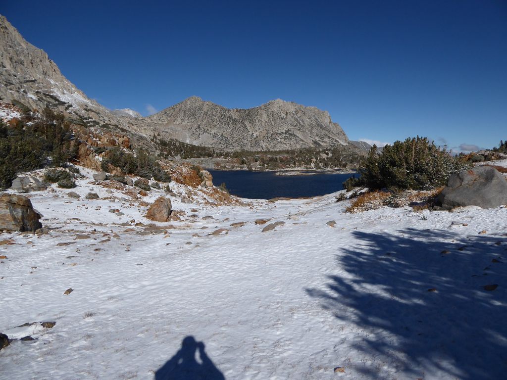
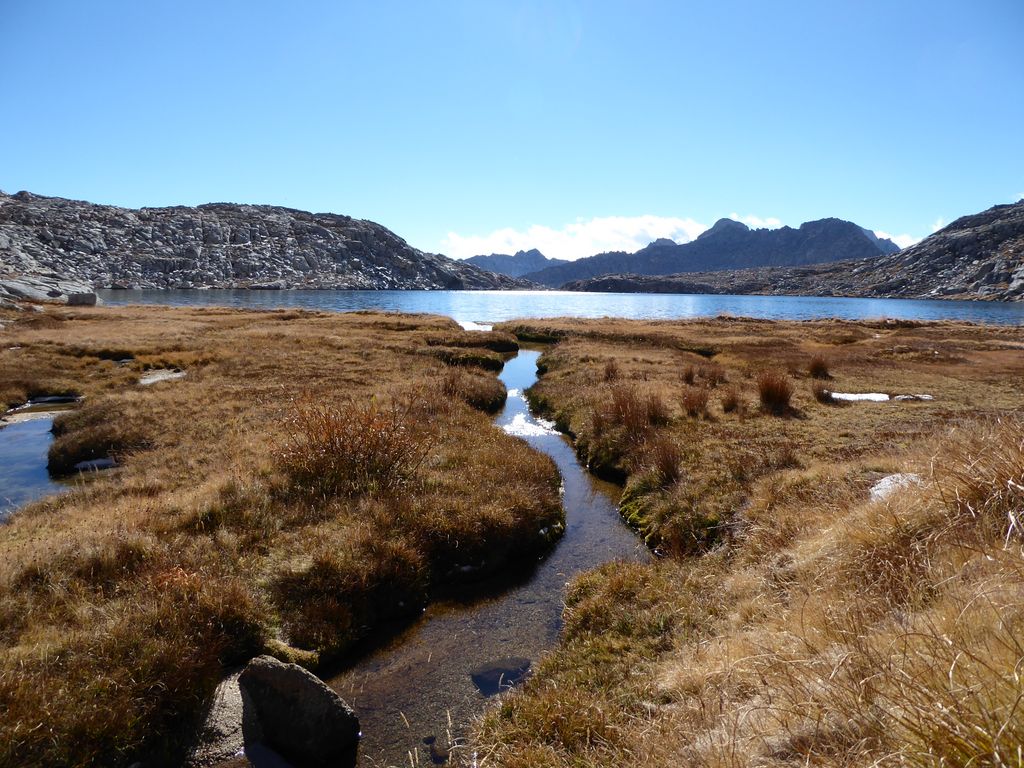
When the trail finally levels out around 10,800 feet, things open up a bit and the scenery takes a nice turn.
I found Long Lake to be really beautiful. And it is obvious why they gave it that name. It really does seem strongly stretched out along the north-south direction.
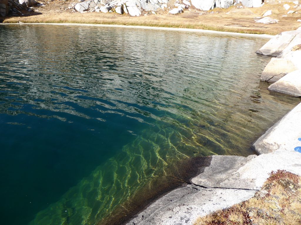
Traveling along the eastern shore, I noticed a few really great spots to jump off rocks into the water; places where the bottom just drops out a foot away from the shore. The water temperature actually didn't seem that bad for October, either. Obviously not the bahamas, but it'd be tolerable on a sunny day. I noticed on the opposite shore that the terrain looked very inviting. It wouldn't be too bad of a spot to set up a tent for a short one-nighter.
Just past Long Lake, the trail starts climbing a bit. It was at this point that I noticed people hurrying past me in the opposite direction. It made sense, as the weather was clearly starting to turn just to the north of us.
I ran into an older couple who had just come from the John Muir Trail. They said they decided to duck out a few days early because of the weather report. Not exactly the best news to hear when I was just starting my own trip, but I was trying to keep a positive attitude. I wasn't quite sure exactly when the precipitation would start, but the temperature was definitely starting to drop. Too bad I couldn't make a friggin fire.
When I got in view of Saddlerock Lake after some more climbing, the weather to the southwest was also looking crappy.
I was wearing a short sleeve t-shirt, and I wasn't all that cold since I had been my blood was pumping hard from the uphill. But when I ran into a young couple headed down, they looked at me like I was crazy. "Aren't you freezing?", the young lady asked. I told her that I wasn't, but that I was fully prepared to layer up the moment I stopped moving.
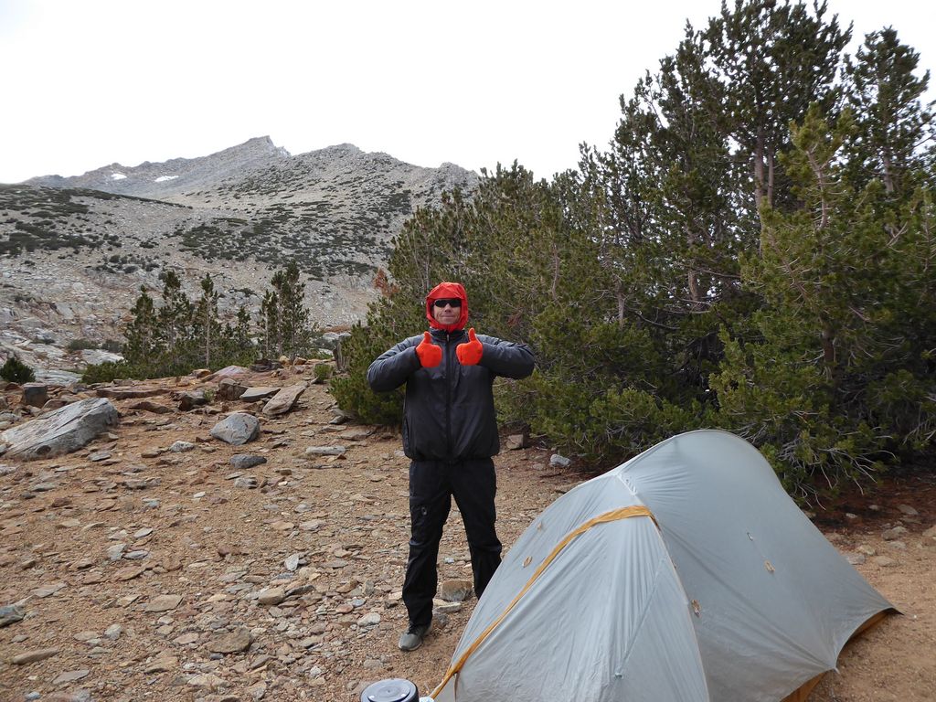
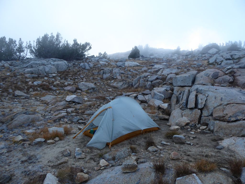
The winds were picking up quite a bit and now the clouds were coating every piece of sky I could see, so I decided it'd be a good time to call it quits for the day. It was just after 3:00 pm, so I'd have to pass the time in my tent for awhile, but I figured that was better than getting hailed or rained or snowed upon (I wasn't quite sure what form the precipitation would take at this temperature and elevation). Fortunately, it wasn't at all hard to find a very nice spot to set up my tent in the stretch of land between Saddlerock Lake and Bishop Lake.
Here comes the really crappy party. In my haste to erect the tent, I snapped one of the pole segments that attached to the central ring. The pole I broke was already warped, and it didn't like being bent back towards its intended shape. Luckily it held up pretty well in its current position. And even more luckily still, I had brought the field repair tube that would allow me to use it for the rest of the trip without any real structural instability. But at that very moment, it was not a good feeling knowing that my shelter was compromised.
Once I got everything set up, I just sat back and enjoyed the grand theater that is mother nature: clouds moving in from all directions,
thick fog rolling in,
and magnificent reflections off the still waters of the tarns surrounding my tent.
I put on every layer I had. Five up top and three down below. I was feeling good despite the close-to-freezing temperatures.
Since I couldn't have a fire, I decided to eat inside my tent. Admittedly, maybe not the smartest thing to do in black bear country, but I didn't really think bears would be much of an issue at this elevation at this time of year.
I was feeling relatively cozy with my sleeping bag on top of me as I sat there enjoying my teriyaki beef jerky and garlic nan dinner (footnote: I will never again eat these two items exclusively for four consecutive nights–for reasons that do not need further elaboration). After finishing my meal, I took a quick peak outside and saw that an appreciable amount of snow had fallen.
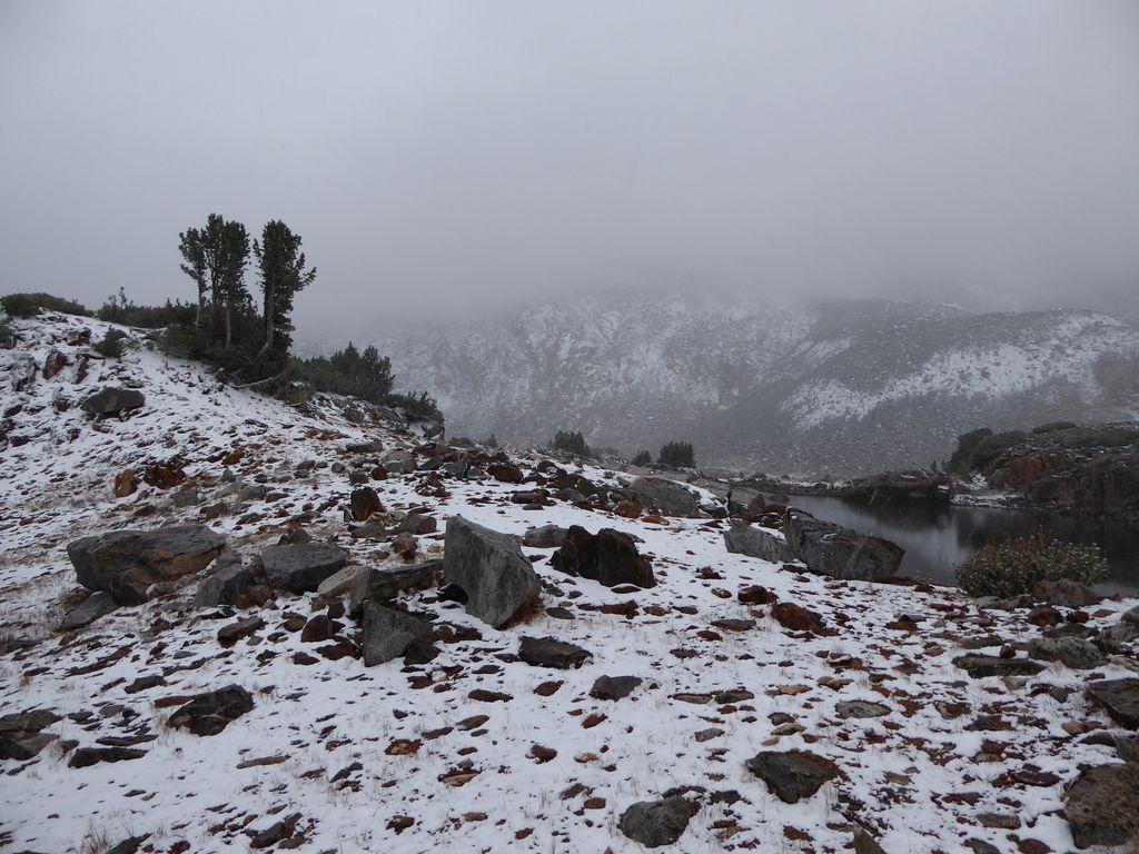
But that was just the beginning. Over the course of the night, I continually had to knock the snow off the fly of my tent to prevent the roof from caving in. The sides were well buried by the time it stopped. It wasn't the most enjoyable of nights, but it could have been a lot worse. It sure beat going to the dentist office.
If I was pressed to come up with the one thing that I dislike most about camping in subzero weather, I'd probably say it's dealing with packing up a tent in the morning. You combine subzero overnight temperatures with a little bit of a condensation, and you've got tent poles that are frozen together like the dickens. Not only that, but any attempt to take them apart without gloves on (which is sometimes necessary due to the lack of friction that gloves yield) immediately saps all the warmth from your hands. This is what I was treated to on the second morning of the trip. Some of the segments were stuck together so badly that I simply gave up trying to break the poles down and instead just put them in the sun.
This all took place after having a quick breakfast in the tent. It was still too cold to eat comfortably outside, but my spirits were bouncing back due to the lack of clouds in the sky, which I thought might possibly be a favorable sign from the gods (I think it's highly unlikely that this was actually a divine sign, but I can't rule out that possibility).
I took enough time getting prepared for the day ahead that my tent and fly had a bit of time to dry off in the morning sun. But not quite enough time. They were still fairly damp. Man did that sun on my body feel good, though. I was still wearing the majority of my layers when I got back on the Bishop Pass trail,
but I rapidly shed one or two of them when I started to climb up the plentiful switchbacks. There was not that much snow accumulated on the trail, which was good.
What was not good, however, was the plethora of ice pockets that had formed in various parts of the trail. I knew I'd have to take it slow or I'd end up eating s#$! (which I nearly did three or four times on the way over the pass).
Ice patches and all, I was really enjoying the morning and the excellent views back down towards the lakes below.
I was also enjoying the amazing trail work that had been done on those switchbacks. I must say, the retaining walls were a thing of beauty. And the route was extremely well chosen in my opinion.
After about 500 feet of climbing or so, I heard an alarming yell. Laughter quickly followed that shrill sound, though, which was relieving. I couldn't see where the noise was coming from, but after another several hundred feet of gain, I came across a large party of people who appeared to be on a guided trip. From the looks of it, it might have been the first for most of them.
"Did you guys spend the night over the pass?", I asked.
"Yeah, it was so windy I thought we were going to die for sure!", one of them replied. The smile on his face indicated any fear he had at the time was now a distant memory supplanted by excitement. We shared a bit more back and forth for a couple of minutes (they were definitely an entertaining group) and then went on our separate ways. The guy at the back of the line, who I am assuming was the guide, gave me a fist bump when I passed. I took that as sort of a vote of confidence. I felt like, in the past, the experienced folks I would run across felt compelled to ask me the type of questions that indicated they thought I wasn't properly prepared. But this dude was giving me the type of signal that said, "Rock on, man. Go have some fun." So that was cool.
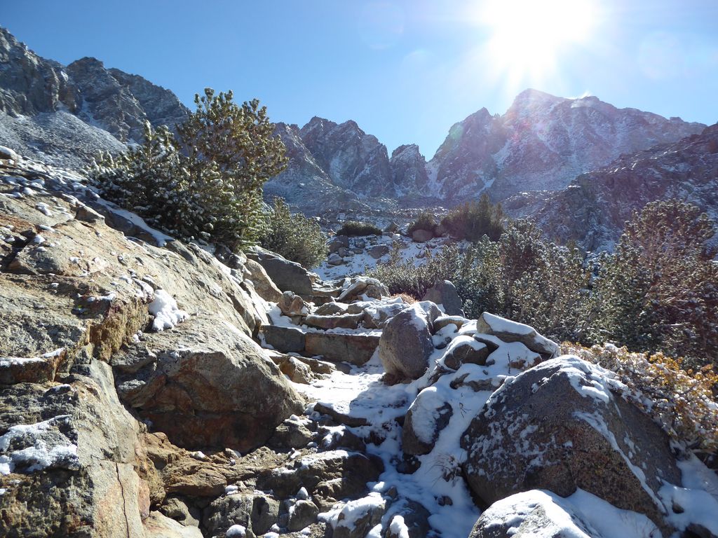
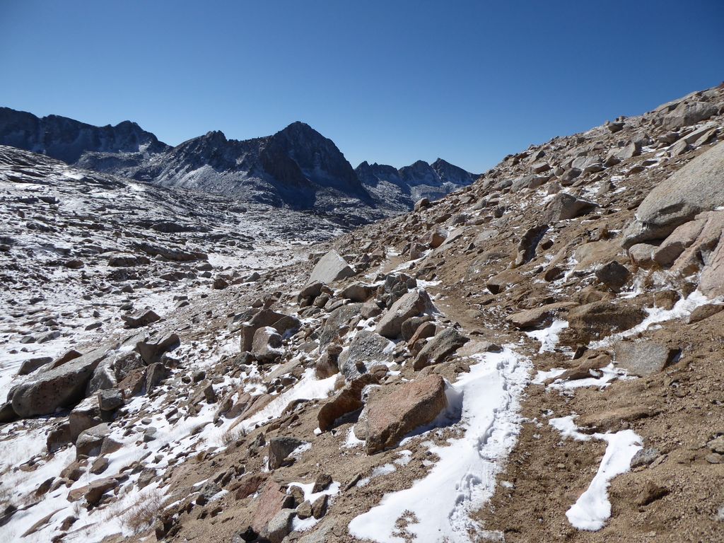
After about an hour and change, I reached an area where the trail flattens out quite a bit
It looked like I could easily go cross country southeast, which I took note of for my eventual return from Palisade Basin. The official "pass" was a couple of zigs and zags and a short climb ahead.
Right after the pass, I overtook two guys that I recognized from the previous day at the ranger station. They were planning to climb some of the peaks surrounding Palisade Basin, but luckily for me they weren't going to be camping down in the basin. They said the weather had changed their plans a bit, so they were keeping their base camp down by Bishop Lake. They seemed cool (and I guess you can call me greedy...), but I was happy that I wouldn't have to share the basin with them.
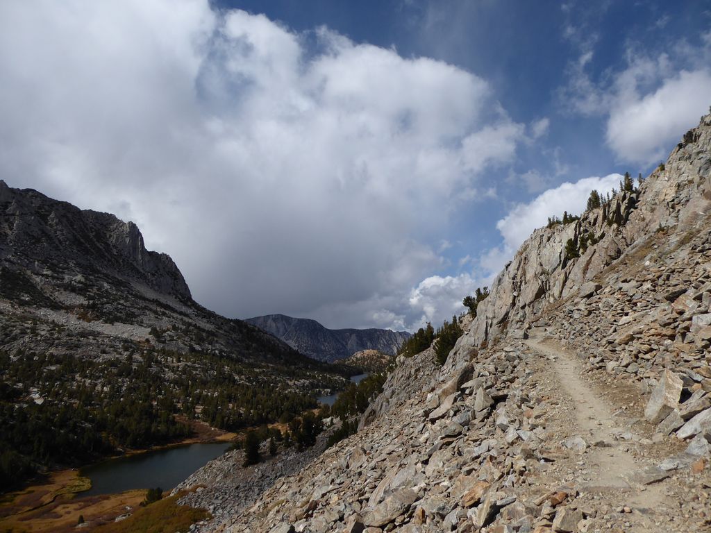
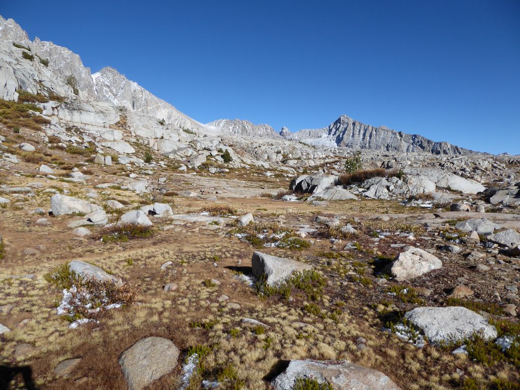
As I headed south on the trail,
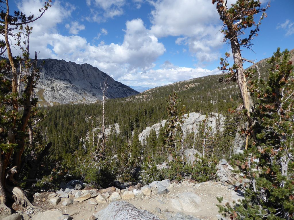
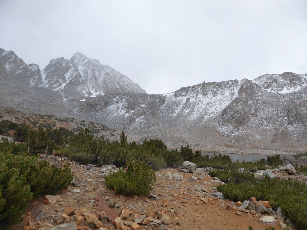
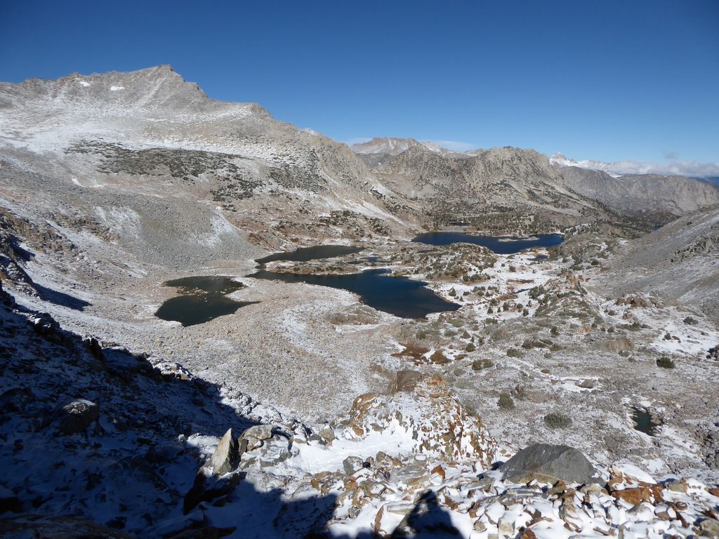
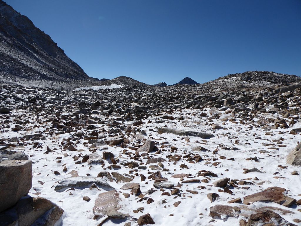
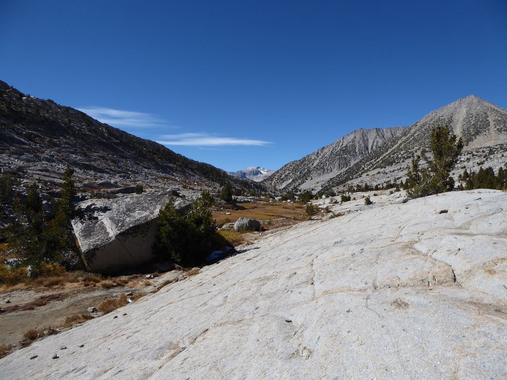
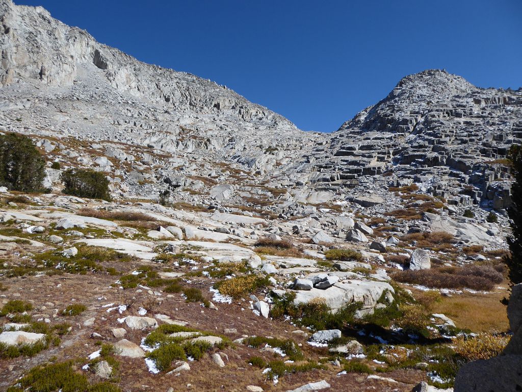
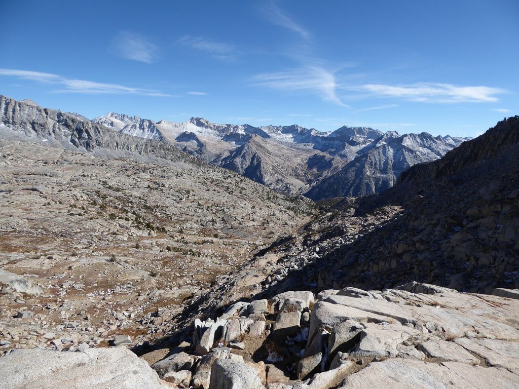
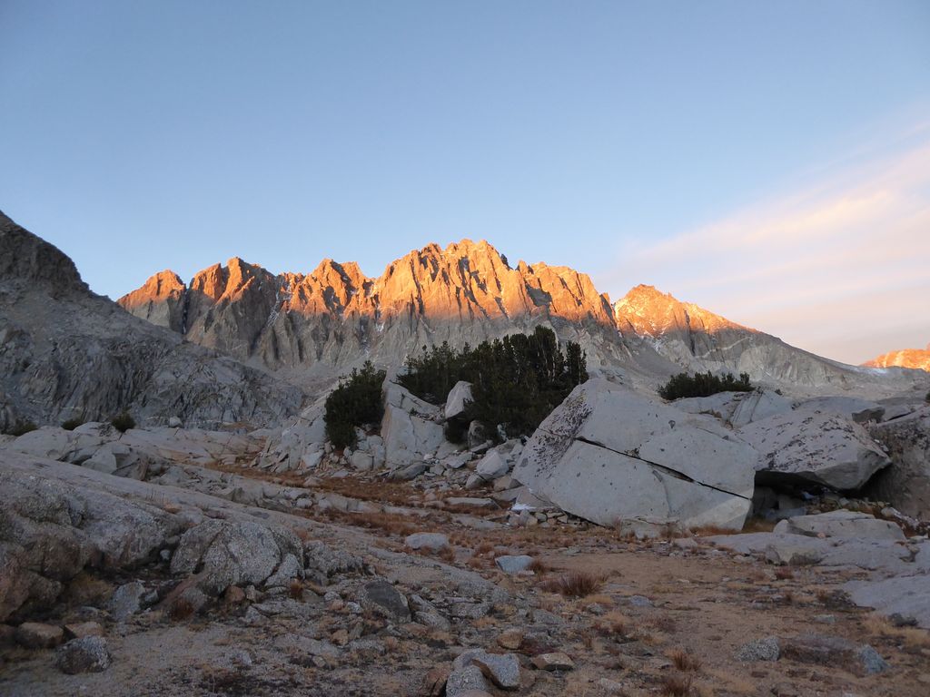
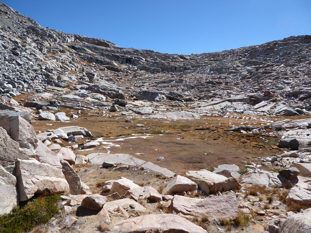
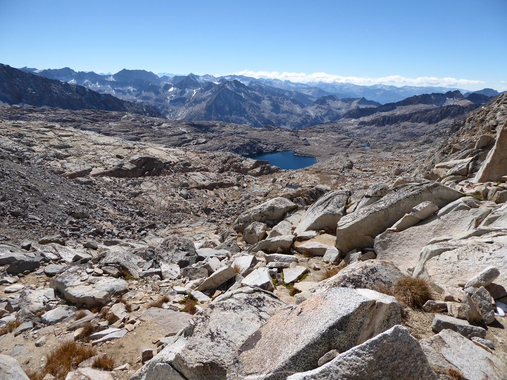
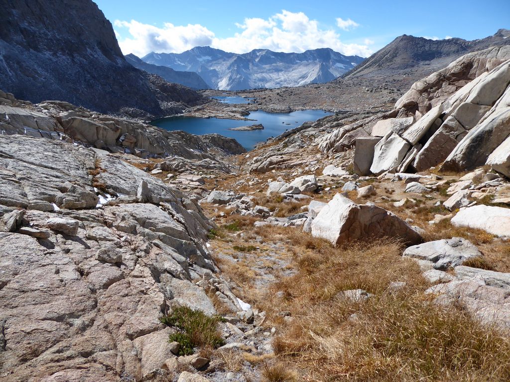
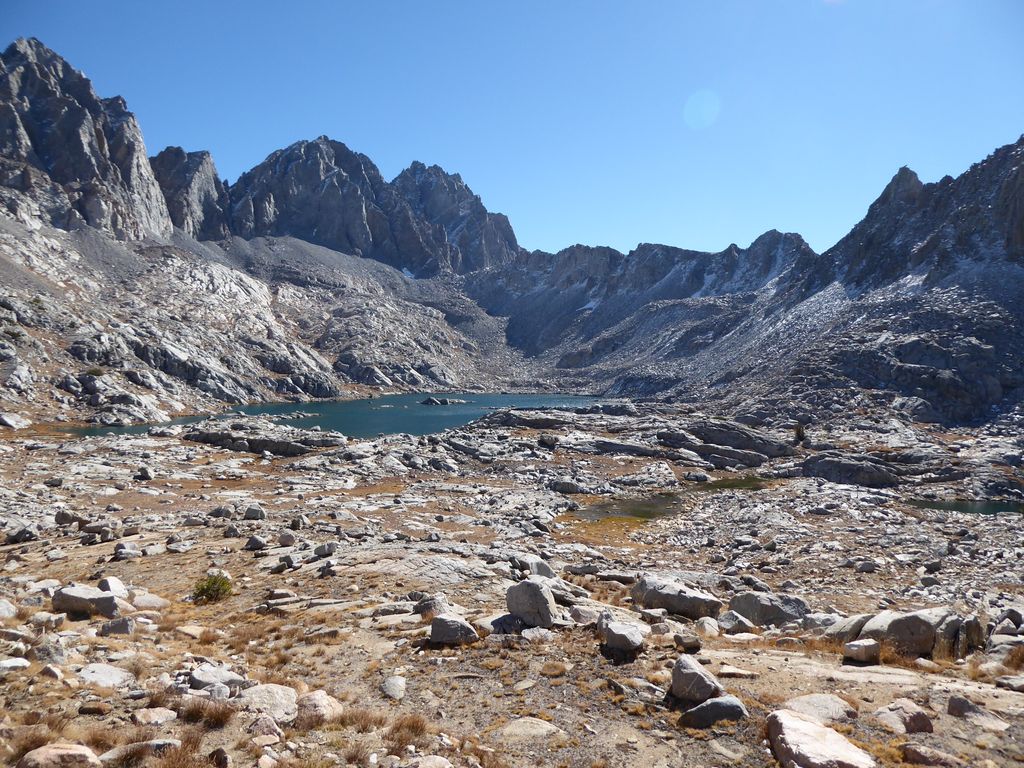
I was excited to get my first glimpse of Dusy Basin.
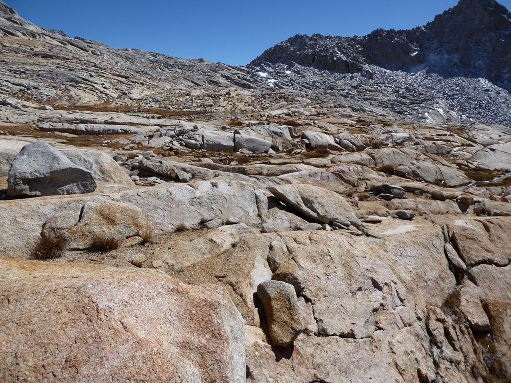
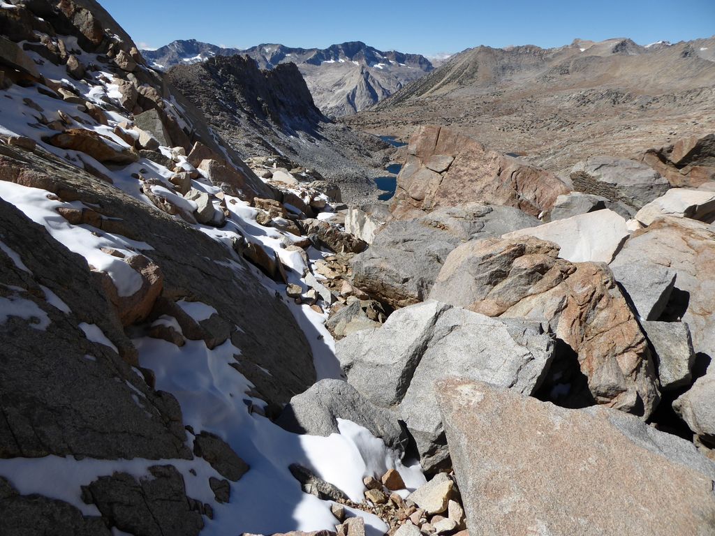
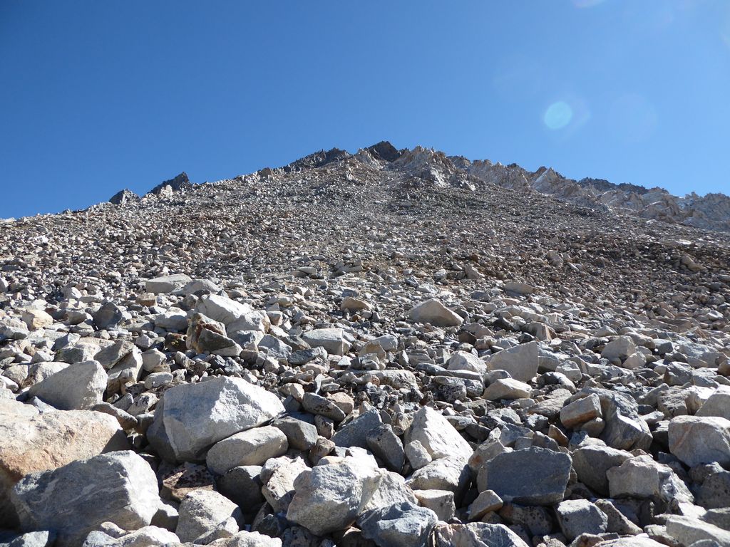
To me it seemed vast but inviting. The downward going trail was gentle enough. The only thing that made the descent into the basin a challenge was the patches of ice scattered about. Off in the distance, I could see what I thought was Thunderbolt Col (the large notch just to the left of center in this picture),
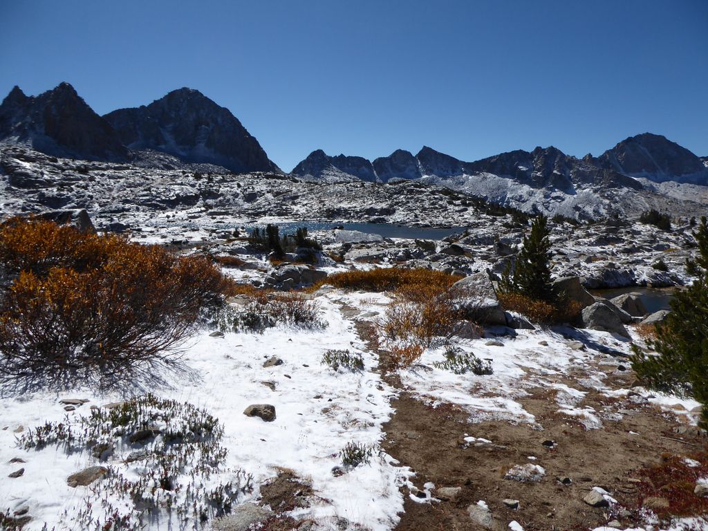
and I must say it looked intimidating. When I had traveled another kilometer or so, I got my first view of Knapsack Pass, and that looked much, much less intimidating.
From the map, it looked like there were plenty of good places to break off from the trail on the approach to Knapsack. To me it was logical to leave the trail right when it starts to take a westward trajectory, so that's what I did. The terrain was not difficult at all (save the aforementioned slabs of camouflaged ice). Lots of big slabs of granite,
scattered rocks, lodgepole pine, and juniper.
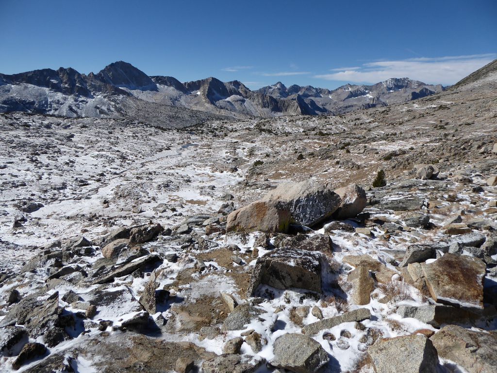
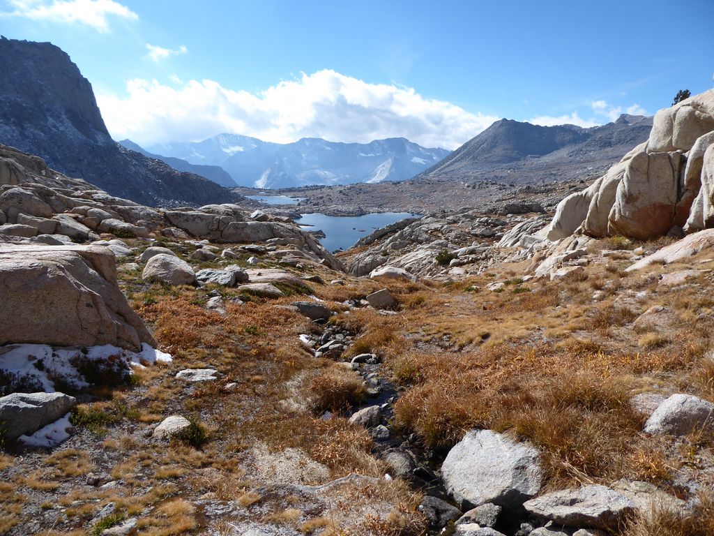
I ended up stopping for lunch along the shore of the unnamed lake at 10,800 feet. From this vantage point, the view back up the valley to the northwest was really tranquilizing.
The wind was the only thing to interrupt that tranquility, as the stuff I had laid out to dry was constantly trying to fly away despite the many rocks I had used to weigh it down. From where I was standing, the approach to Knapsack Pass was about as clear cut as could be.
I was in a very good mood because of this, and perhaps because the weather was excellent at the moment, with perfectly blue skies ahead of me. When I finally cleared the shore of the unnamed lake, I was surprised to find a very recognizable trail heading up towards Knapsack Pass. I wasn't expecting a bushwhack or anything; just a bit less tread on the ground.
The trail wasn't exactly well-established the whole way up to the pass, though. It disappeared under snow and thick brush from time to time,
and it also diverged at points, leaving me with the decision of which way to go. But really, I don't think there's a way you can go wrong. There are just a couple of sharp dropoffs on the way up, which are easily visible from below.
For the most part, I could easily make my way up on top of grass with good traction,
but there were a few spots where I had to cross some slippery granite slabs at a bit of an incline. I think if I was willing to backtrack a bit, I could have avoided these altogether. But they didn't make me shiver in my boots or anything. As I continued, the views back down towards Dusy Basin were becoming more and more inspiring.
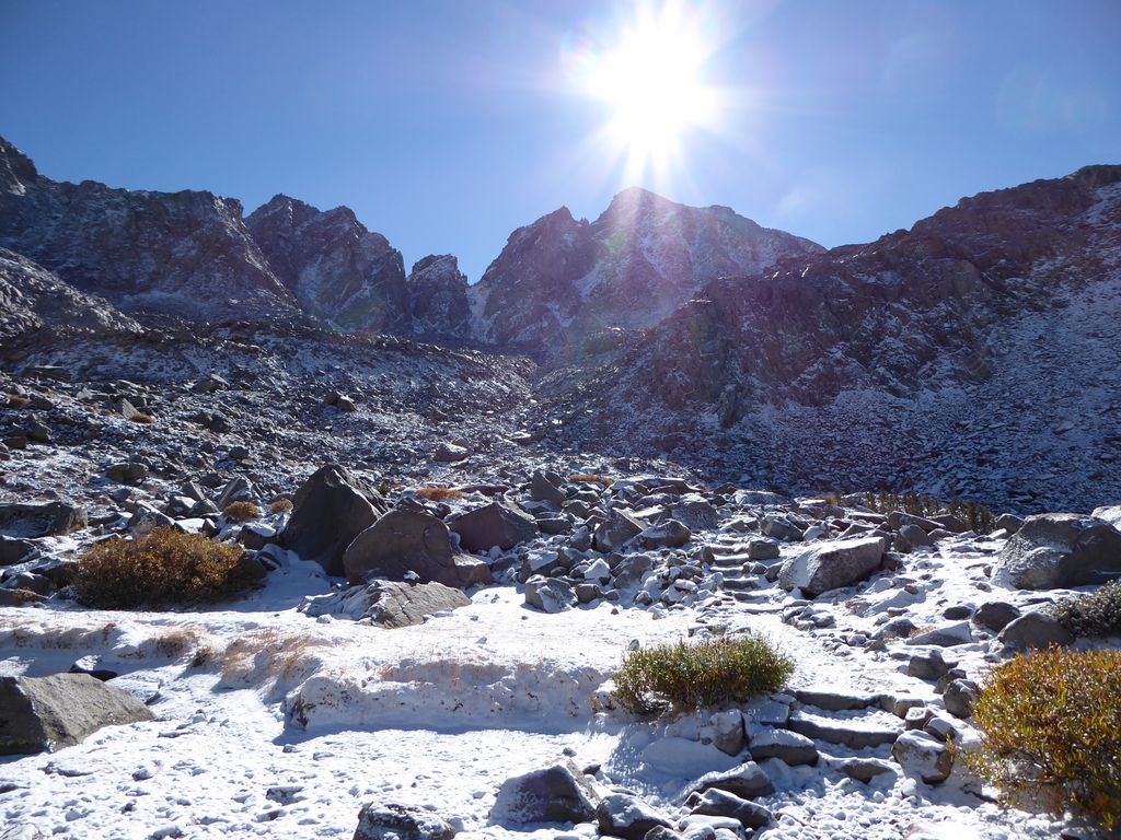
Before I knew it, I had reached the top of the pass. As always, it felt very rewarding to get to the highest point. And the views to the northeast
and east/southeast
were highly satisfactory.
I wasn't anticipating much of a problem getting down to the bottom of Palisade Basin, but it actually turned out to be more difficult than I expected. From where I was standing, it looked like the descent down to the northeast would be slightly more challenging than the one to the southeast. But there was a noticeable trail going northeast, so that's what I started following. I was taking these hairy little switchbacks to descend—using my hands to support my weight just as much as my feet. When I had descended about 100 feet or so, that southeastern course started looking much more inviting than the one I had chosen. So I slowly and carefully proceeded to make my way over there.
If I had to do it again, I'd probably recommend steering that way initially. Once you get down about 200 feet or so, it becomes very straightforward to make your way down on that southeastern course.
When I neared the basin floor, I was thrilled to finally have a straight shot that didn't involve using my arms to lower myself between boulders.
Of course, I was even more thrilled when I finally reached the floor.
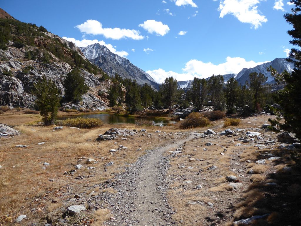
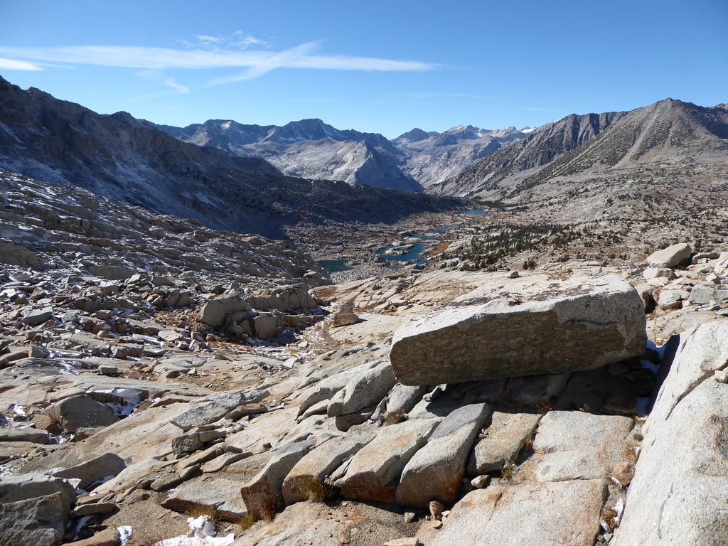
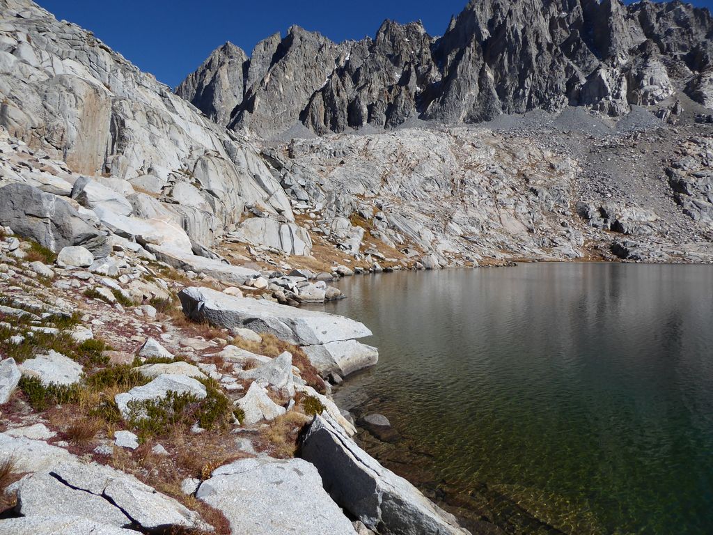
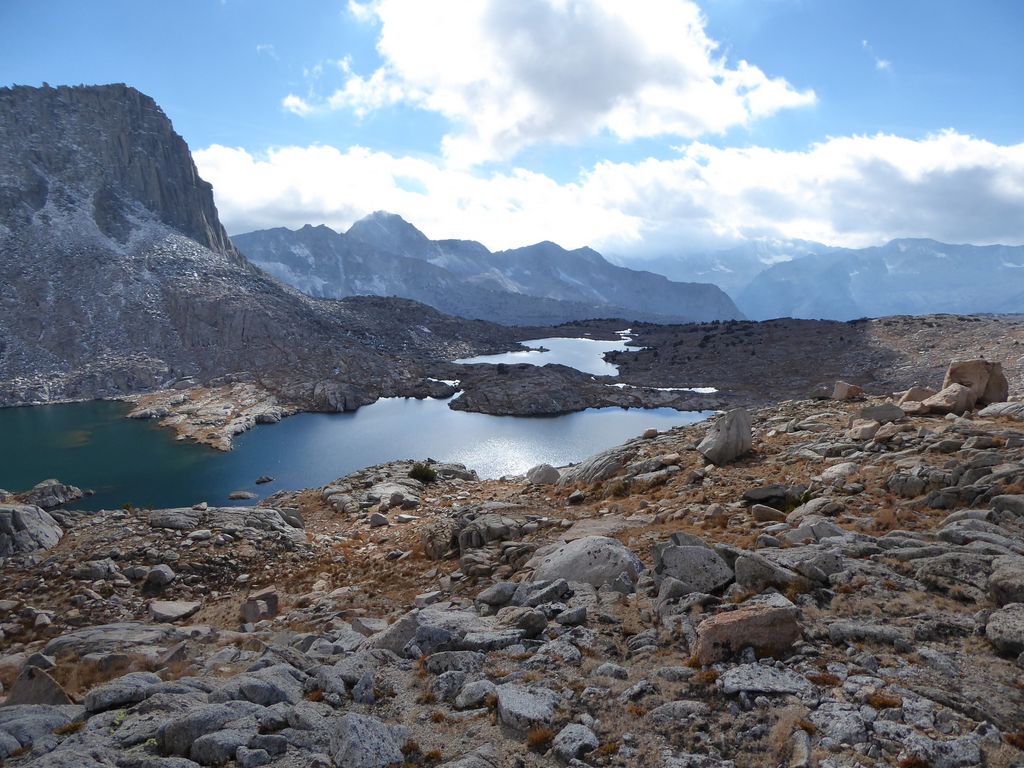
I didn't have any particular spot in the basin in mind for a campsite, but at that point I figured the first of the Barrett Lakes was as good as any. It didn't take me long to get there due to the extremely forgiving terrain on the basin floor.
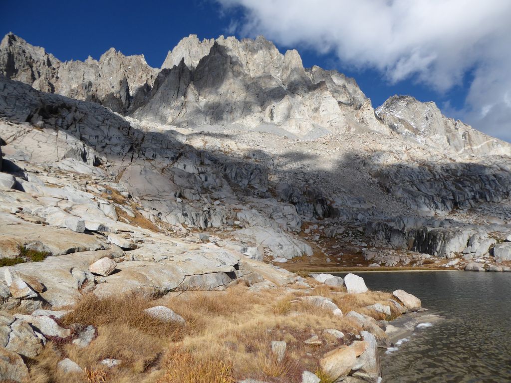
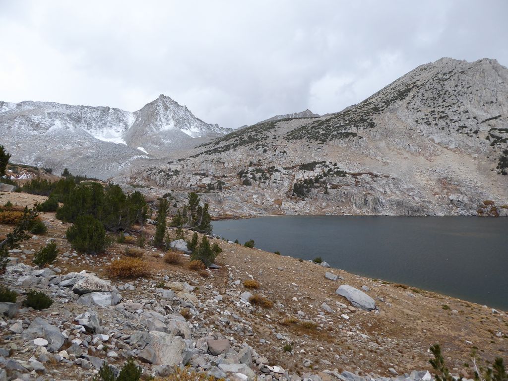
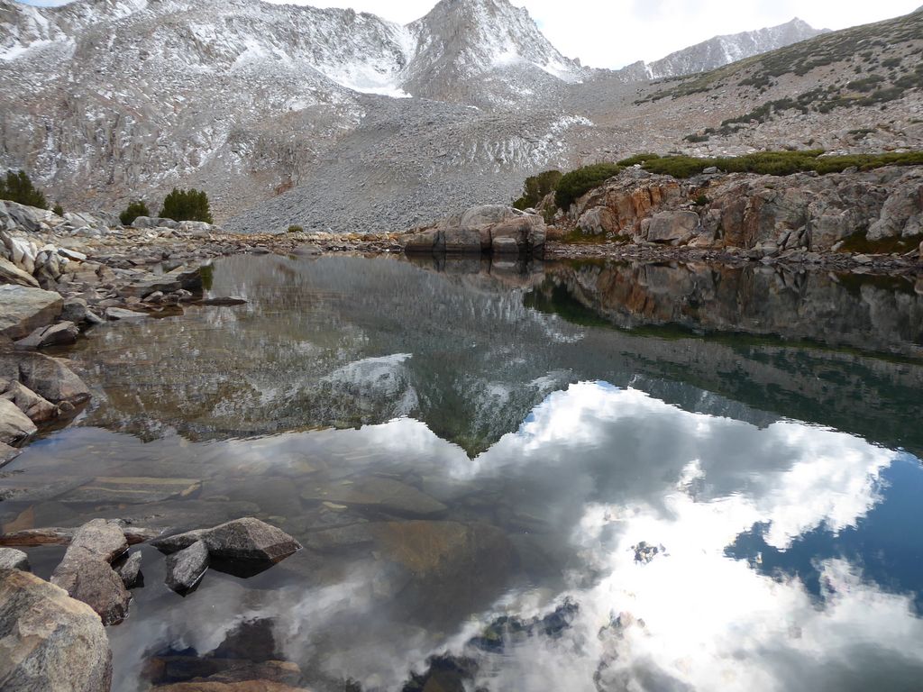
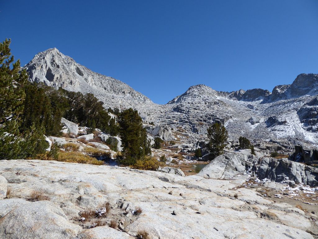
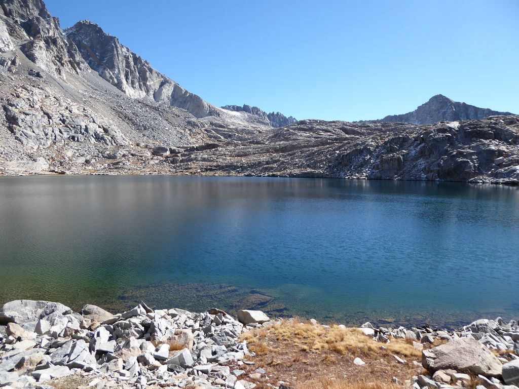
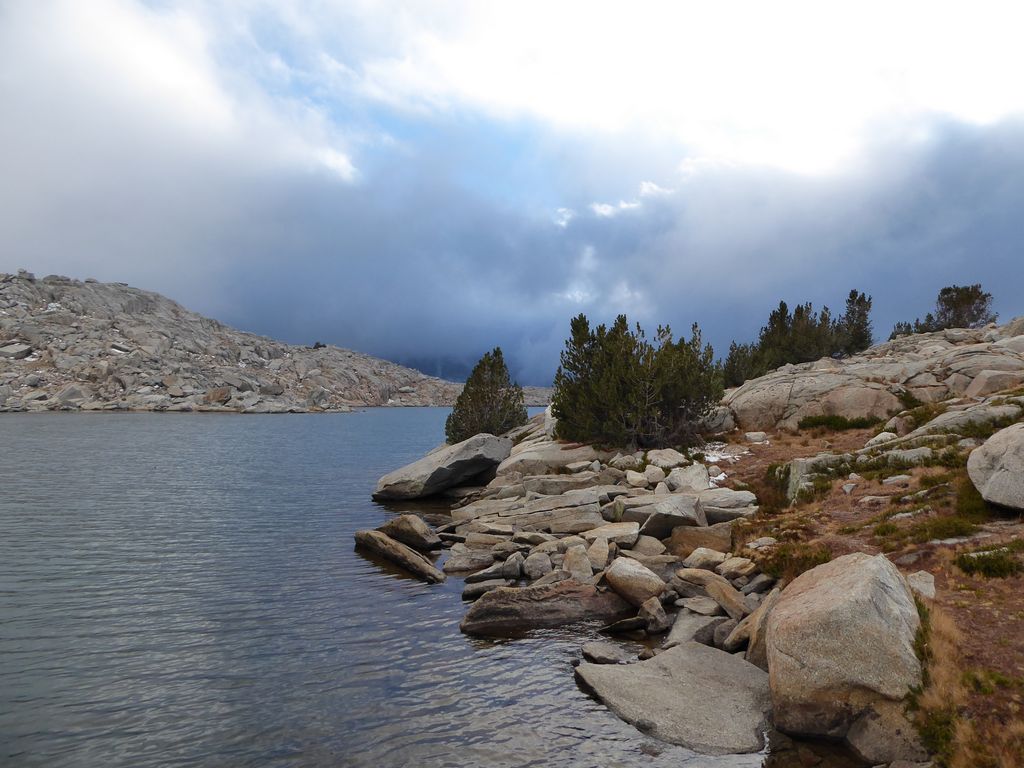
The scenery at the smaller of the Barrett Lakes was simply lovely.
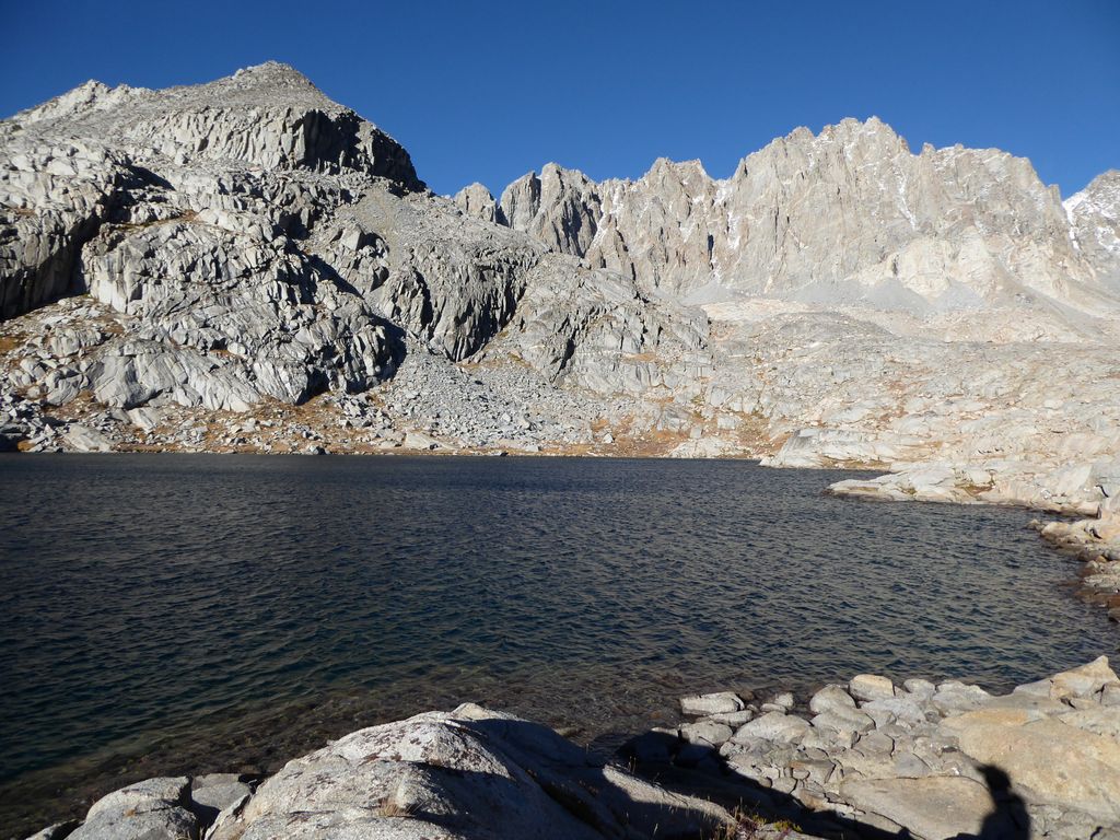
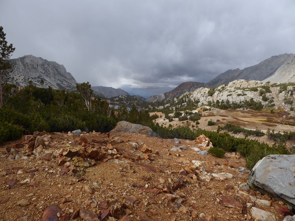
As a sidenote, this is probably as good a place as any to mention that throughout my time around this lake, I was intrigued by the possibility of a third pass over to Dusy Basin that looked almost as easy as Knapsack. You can see it here, between Columbine Peak (left) and Isosceles Peak (right).
In the parking lot after the trip, I spoke to a guy who had just come from Palisade Basin (he got there the day after I headed out). As it turned out, he had mistaken that pass for Knapsack Pass. He had been over Knapsack several times before in his life, and he confirmed that it was not any more difficult. Next time I visit the basin, I'll probably check out that pass.
Now, what WAS very challenging was finding a suitable spot to set up my tent where I wouldn't be exposed to the wind that seemed to be getting more ferocious by the minute. I found a spot with a rock shelf and a juniper tree to offer some shelter.
But it wasn't the best. The wind raged against me while I set up my tent, uprooting the stakes and heaving it away twice during my efforts to get it set up. It would get even worse that night. I'm guessing 40-50 mile an hour gusts. And that's a conservative estimate.
I ended up eating dinner in my tent once again, partly to keep warm and partly to provide some more weight to keep the thing from blowing all the way to Fresno. It was a god awful couple of hours sitting there and hoping it didn't collapse on itself. But even with those awful conditions, the alpenglow against the Palisades was enough to settle my mind and provide a hint of inspiration for the days to come.
By god, I was hoping the gusts would die down soon. But the wind was simply relentless that night. I think I got about two hours of sleep total after it died down around 3 or 4 am. How quickly a pleasant day can turn into a terrible night.
Despite (or maybe because) of the fact that I got almost no sleep the night before, the third day of the trip would turn out to be the most relaxing one of all. I woke up with very minimal ambitions for the day. My primary goal was to find a nice, easy-to-get-to spot with good views where I could enjoy lunch and go for a swim. Of course, the latter part wouldn't be at all difficult since I was surrounded by lakes. But what I didn't realize at the time was just how perfect Barrett Lakes are for an afternoon dip.
I really couldn't complain about the spot I had breakfast either.
I was surrounded by whitebark pines and snow-capped mountains, and the weather was absolutely beautiful. The wind had all but disappeared, leaving me with some of the most intense silence I have ever experienced in my life. I know there are plenty of expressions out there to describe very quiet environments; "the silence was deafening" is one I've heard a lot. But I don't know if it was deafening so much as it just made me feel like I might have actually completely lost my hearing. I guess the thing that stuck out in my mind was just how noticeable that silence was. No birds chirping, no wind, no cars rushing by or voices chattering. It made me feel like things—including myself—were just stuck in time. But then when I started to feel immersed in that stillness, it would be totally disrupted by the incredibly loud sound of a rockfall. Part of me just wanted to bask in that stillness the entire day.
Once I eventually got on my way, I was delighted by how easy and gentle the terrain was.
My first destination was the largest of the Barrett Lakes. After that I thought I'd head up to Potluck Pass to do some reconnaissance. I still wasn't sure what route I'd use to get out of Palisade Basin. The adventurous side of me wanted to head over Potluck Pass and down the Glacier Creek drainage, but the more cautious side of me was still apprehensive about it due the descriptions I'd read on the east side of the pass. I was anxious to see for myself.
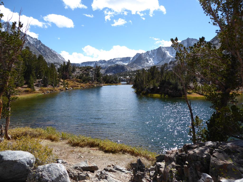
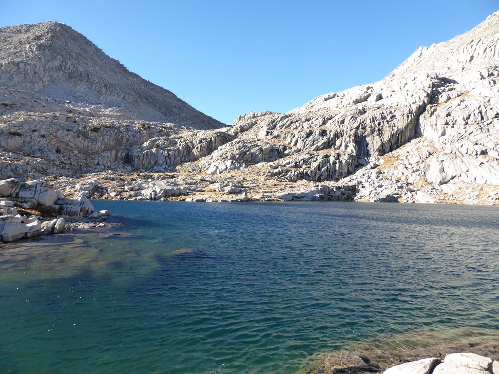
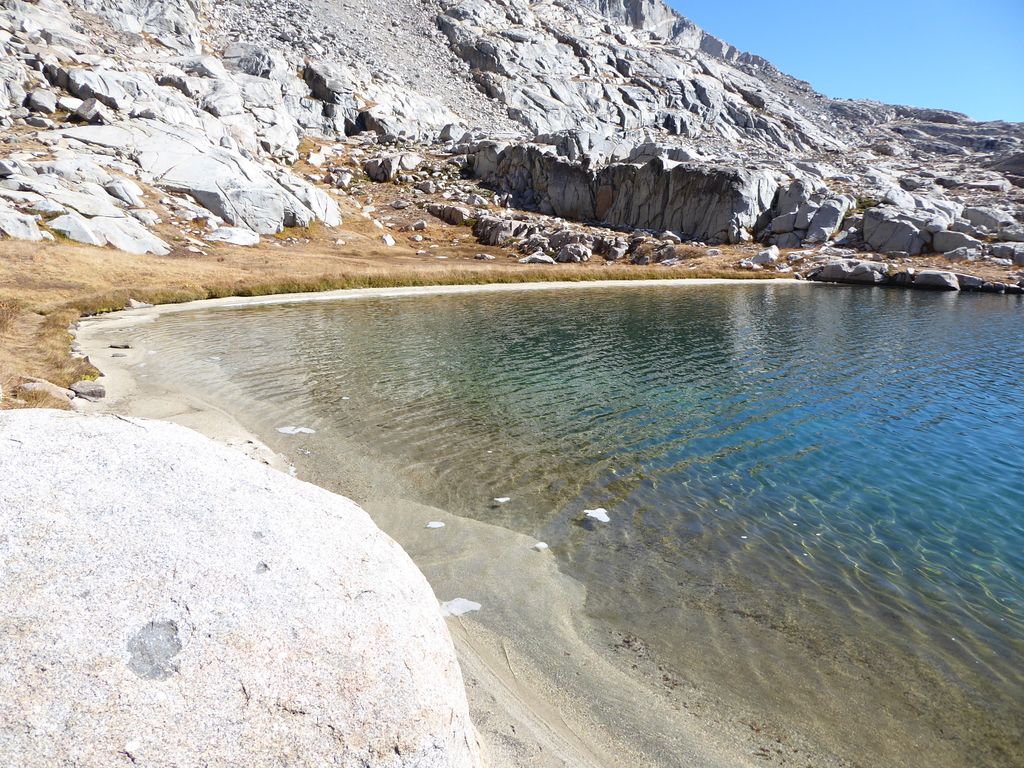
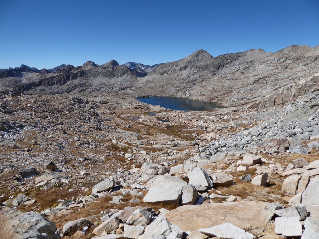
The largest, most northern Barrett Lake is an absolute gem.
A pure, pristine lake with an inviting, sandy shore, surrounded by awe-inspiring peaks of granite. You can't ask for much more. Oh wait, you can...you can ask for fish. Well, guess what. There are tons of fish as well!! Let me tell you, this lake has got it all folks. And I'm not even getting paid to say this ;)
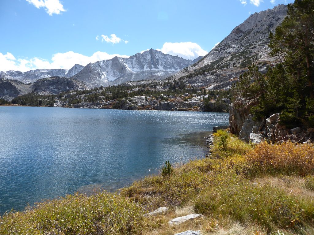
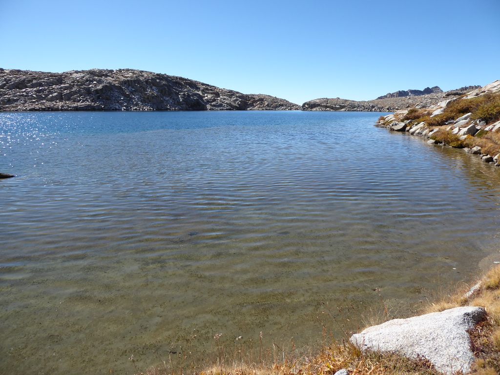
When I finally arrived down at the shore on the west side, I found a well-established use trail that made it extremely easy to circumnavigate the lake. Looking across to the east side,
I felt a nice sense of relief. It looked like it would not be at all tricky to make it the first half of the way up to Potluck Pass. On the northwest side, I took note of the way I would go if I wanted to get up to Thunderbolt Col. That didn't look too difficult either.
The sandy beach on the northern side really got my spirits up. I was already eagerly thinking about basking in the sun after a quick swim later on that afternoon.
The view back to the south was cool as well. It looks like the world just drops off beyond the lake.
As you can see from this photo,
the initial ascent up towards Potluck Pass from the east side of the lake is not very intimidating. There are a variety of ways to proceed that likely won't involve getting stuck and having to backtrack. Sure, there are some little cliffs, but nothing worth sweating over. The view back down shows how smooth the going is.
As you can see from this photo, however, there is a little bit of a challenge at the the end of this first ascent, near 12,000 feet.
I had to do a bit of climbing/shinnying up and over some rocks. Nothing too intimidating, though. When I had gotten over these rocks, I was a bit disappointed to find that I still had quite a ways to go to get up to Potluck Pass. My mind must have been drifting off and not paying close enough attention to the map. I thought I was basically there!
The good news is that the remaining stretch up to the pass was fairly trivial. Just some high-stepping and zigzagging to get over and around large blocks of granite,
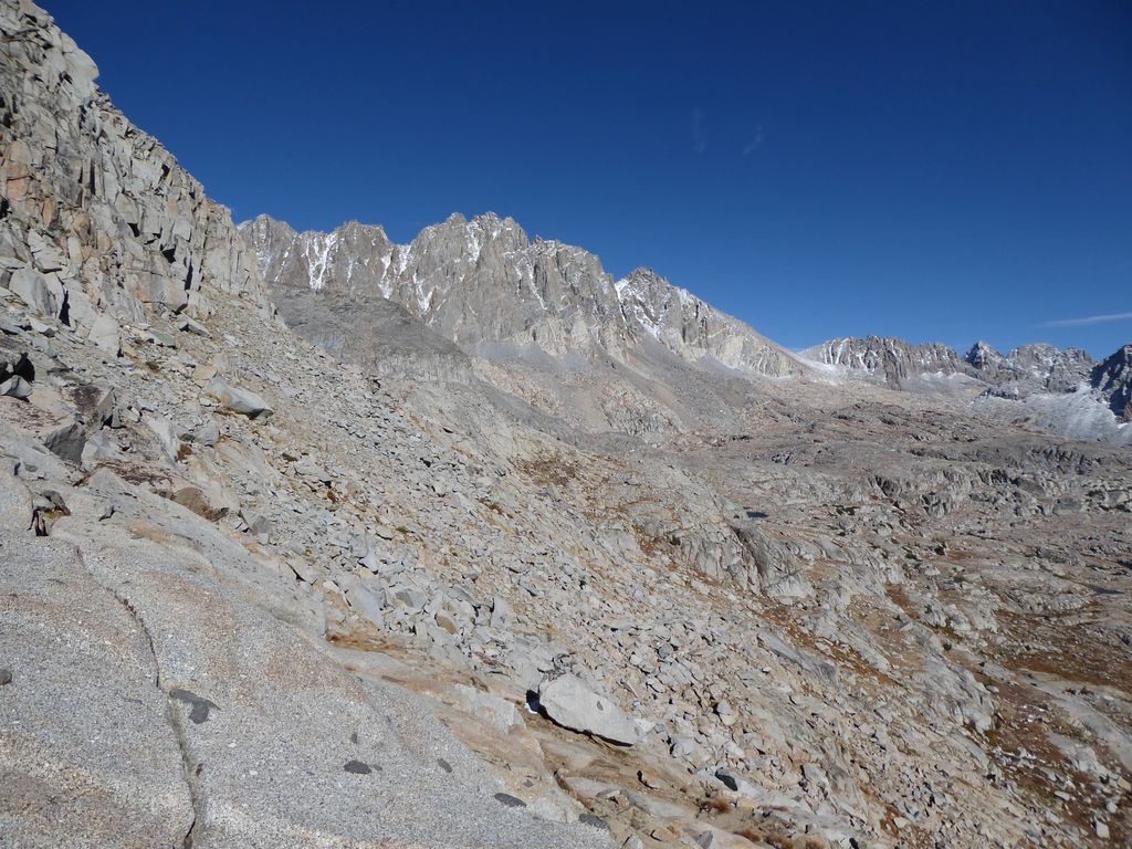
and all the while I was being treated to stunning glimpses of the Palisade Range.
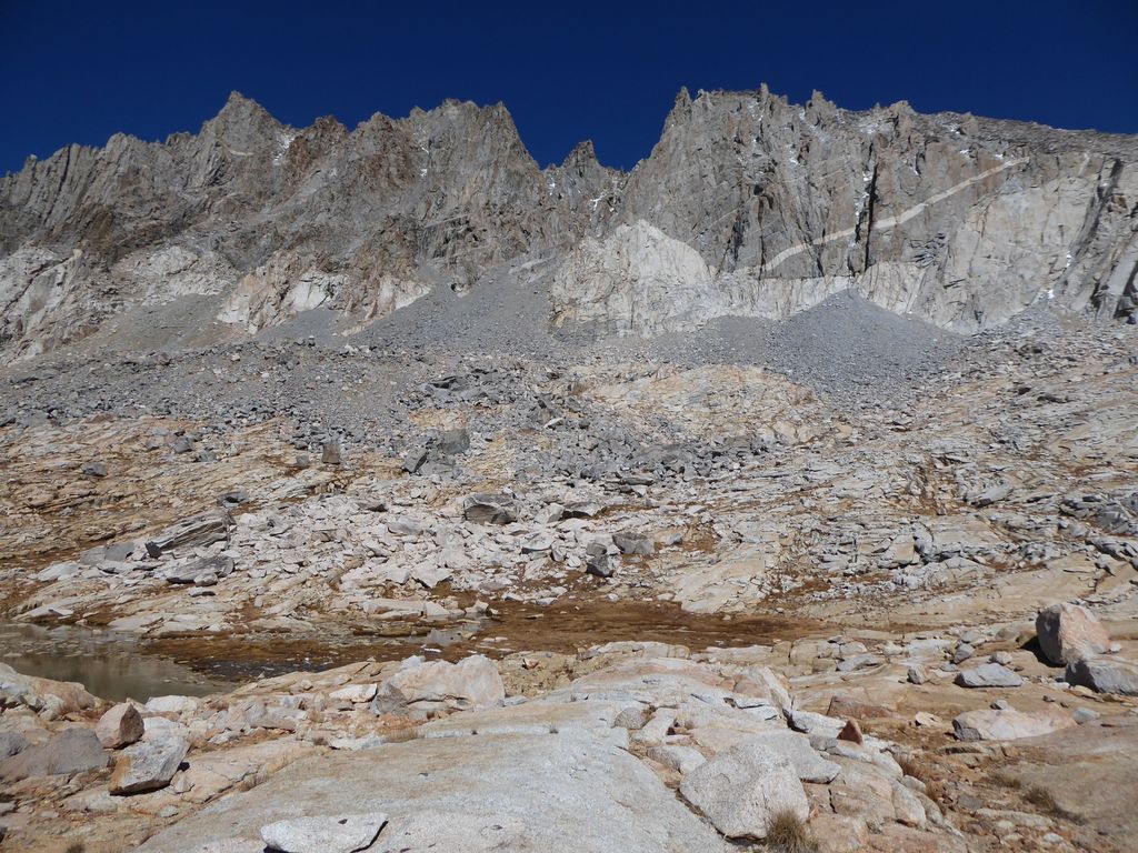
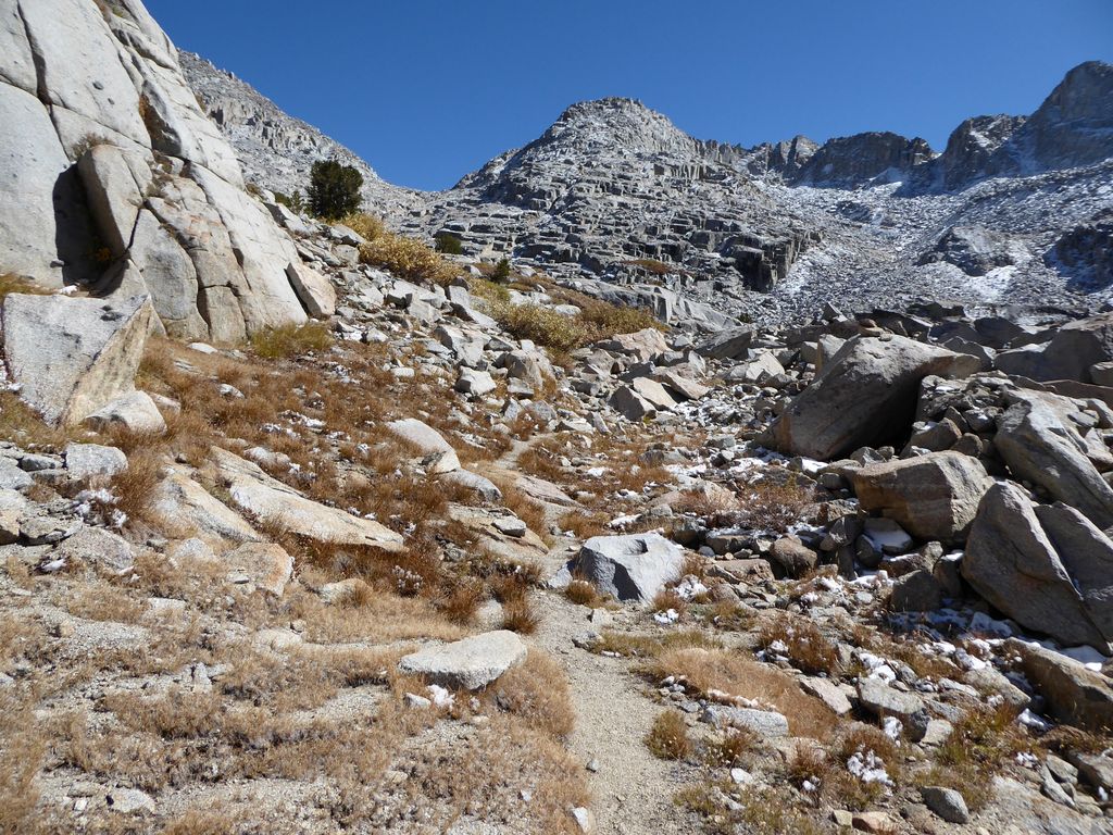
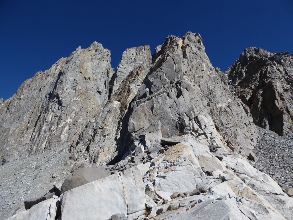
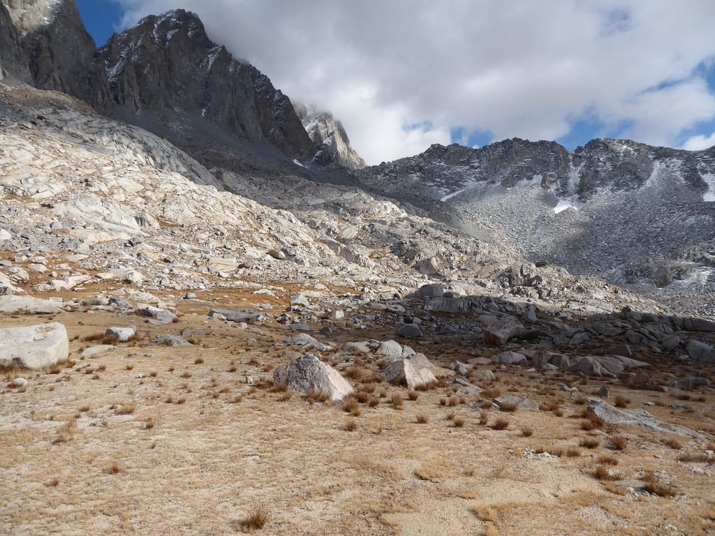
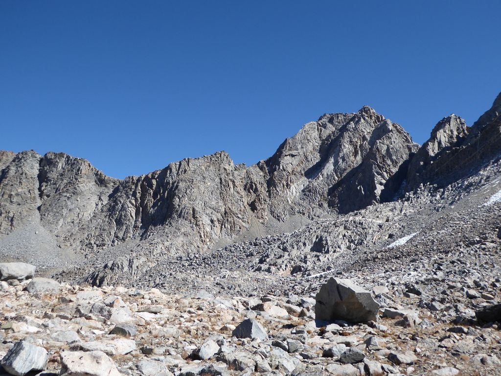
I have to be perfectly honest, when I finally reached Potluck Pass and peered down into the basin below, my heart started racing a bit at the thought of descending that eastern slope. This picture doesn't quite do it justice,
but I vividly remember thinking that I wouldn't dare try to descend that eastern face with a heavy pack by myself. Ascending it with a heavy pack? Maybe. Descending it with a lot of rope? Maybe. But it looked way too precarious of a free descent for my tastes. I believe Arnot says it's class 2-3, but it looked much more like it was on the upper class 3 side to me.
So it didn't take me long to cross off the idea of going down the Glacier Creek drainage on my return. I figured I could still make Day 4 interesting if I went over Thunderbolt Col or the pass next to Isosceles peak so I wouldn't have to backtrack completely.
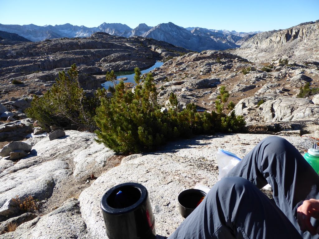
I spent a good hour or so admiring the views from Potluck Pass while I ate some lunch. I had considered climbing Mt. Sill as well, but I was just too exhausted from the lack of sleep over the last two nights. As I sat there, I tryed to identify peaks and features in the surrounding mountains. I think I was able to find the Ragged Spur,
which holds a dear place in my heart after the trip I did to the Enchanted Gorge years ago. What a perfect place to eat lunch and enjoy the view.
My return to that beautiful Barrett Lake was a slow one. I was in absolutely no hurry to get back. In fact, I kind of wanted to time it perfectly so that the I arrived at the water when the daytime temperature would be at its maximum and I still had a sweat going (i.e. optimal swimming conditions). When I arrived on the eastern shore of the lake, the sun spangles on the water's surface were absolutely mesmerizing.
I found an excellent place along the northern shore of the lake where I could dive into the beautiful turqouise water and easily swim to the sandy shore.
It was sufficiently cold that I didn't have much of a desire to stay in longer than it took me to swim to the shore and wipe myself down a bit. Yeah, it was hella cold. But my Lord, did it feel exhilarating to lie down on those thick slabs of granite and dry off in the sun.
Lying there, my mind drifted off in many different directions, all of them extremely disparate yet positive. It was somewhere between a meditative state and a psychoactive trip, I guess, but man was it beautiful. When I had finally dried off completely, I started to feel pretty cold, so I put on my layers and got moving. Clouds began to creep in from seemingly everywhere, and they were creating wondrous shadows on the Palisades.
I got back to camp well before sunset, leaving plenty of time to set up a nice dining area down by the western Barrett Lake. I finally had an evening with decent weather, and I planned on taking full advantage of it. I figured the alpenglow show would be quite captivating. Especially because of the wildly shaped clouds creeping in and out of existence around the Palisades. Indeed, it was captivating. I took somewhere near 30 pictures of the transitioning light and its reflections off the lake.
None of them turned out to be frame-worthy, but I was content that I captured the memory. When I headed back to my tent, I was so excited at the prospect of finally getting a good night's rest. The weather was very calm and the temperatures weren't that extreme. Unfortunately, my expectations were destroyed about a half hour after I dozed off, after discovering a leak in my thermarest. I don't know how or when it happened, but it meant my back would be cold enough over the next two nights to prevent me from getting the decent sleep I craved. Oh well, I thought. I'll survive.
In spite of the extensive nighttime difficulties I had faced up to this point in the trip, I was feeling very enthusiastic when I crawled out of my tent in the morning. Warm rays of sunlight shined down upon me, brightening my spirit and washing away any of the troubles that were on my mind.
While tossing and turning overnight, I had decided I'd make my way back to South Lake via Thunderbolt Col. The decision left me both nervous and excited, as I was anticipating a very challenging day ahead. I would have felt much calmer had I decided to return via the easy, known path of Knapsack Pass. But the small bit of anxiety didn't bother me. As Aldis Snow says, "I feel nervous. It's good to feel somefin!" (if you don't know what movie that's from, you should watch Get Him to the Greek).
My inkling from the previous day regarding the initial ascent up to Thunderbolt Col turned out to be correct. It was a piece of cake. Or maybe a cake-walk? Either one. I'm not picky when it comes to cake.
The red heather felt like it was beckoning me forward with each step.
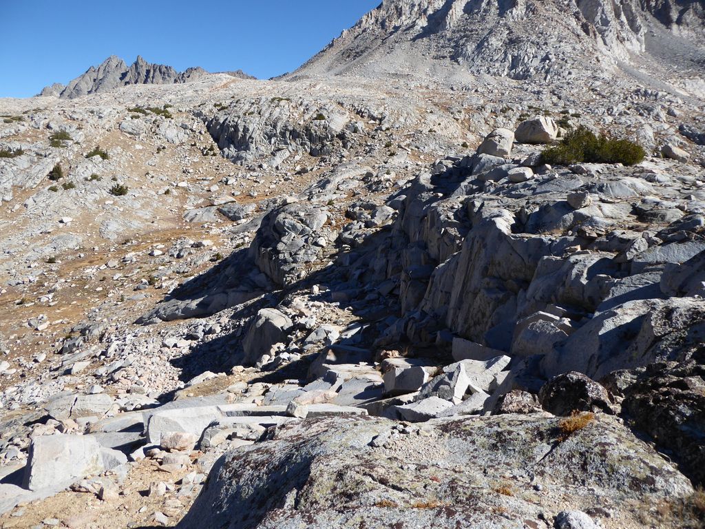
At this point, there are several intertwining use trails following the creek that leads up to the col. At first, any of the trails are as good as any of the others. But at about 12,000 feet, it seemed to me that a very definite decision had to be made about which way to proceed. From where I was standing, it looked like I could either proceed almost due north along the lighter granite slabs in this picture:

Or I could stay stay along a course slightly east of north and then cut west when I reached the darker grey talus at the base of the mountains ahead. The former option looked very steep at the moment, but I was pretty sure once I got closer it wouldn't be too bad, so that's the way I took.
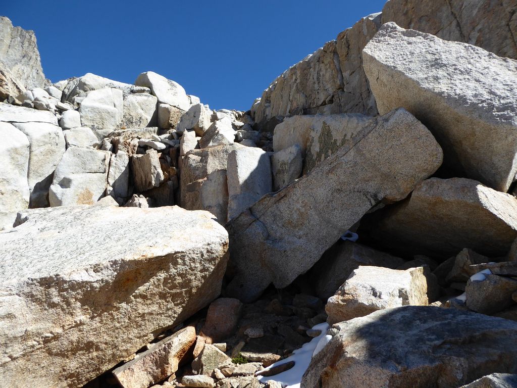
And indeed, the route I chose wasn't all that bad. For the most part it was a bipedal exercise. It was only near the end that I had to really use my hands to keep moving forward. The trickiest part was this steep slab of granite:
There were plenty of cracks in the rock for hand and footholds, though. That was probably the toughest part. But come to think of it, there were a few steep ledges I had to get over near the very end. Nothing that requires climbing gear of steep cliffs, however..
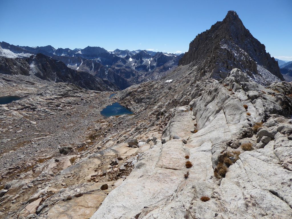
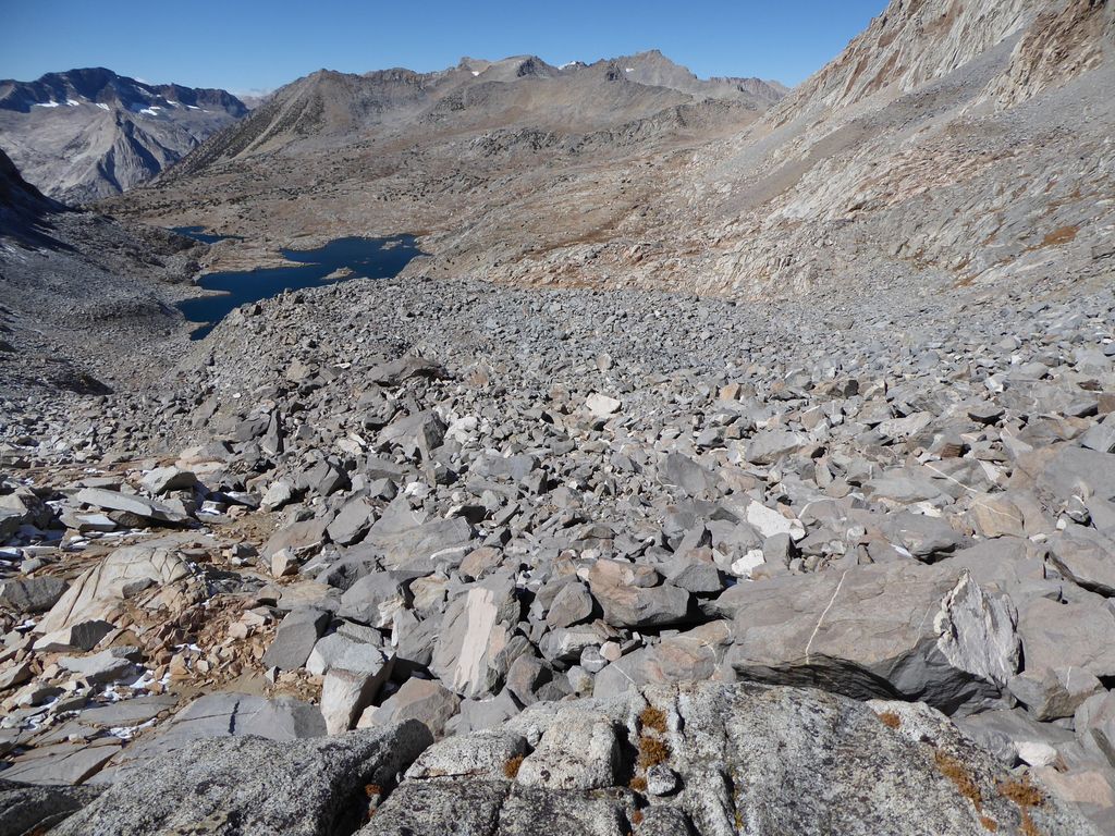
Up at the col, the view back down toward Palisade Basin was exquisite.
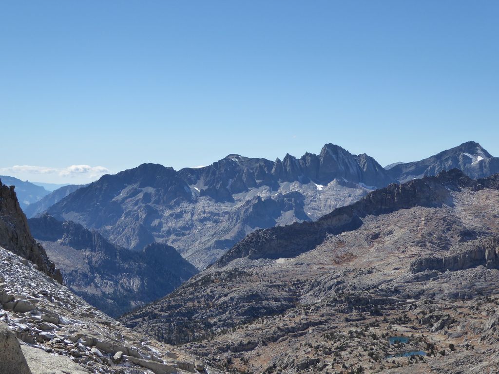
The view down the other side was damned intimidating, on the other hand.
I knew it was not going to be an easy descent, but luckily I had plenty of time to do it. It was just past noon, and my stomach was really growling, so I took the time to eat a decent lunch up at the pass. The wind wasn't bad and the temperatures were fine, but the insanely steep walls of the Palisades next to me kept me from feeling too at ease.
High above me, I noticed some large birds soaring through the perfectly blue sky. I was absolutely amazed when I saw them fly around the spires of rock hundreds of feet above where I sat. I don't know why that had such an impact on me, but it did.
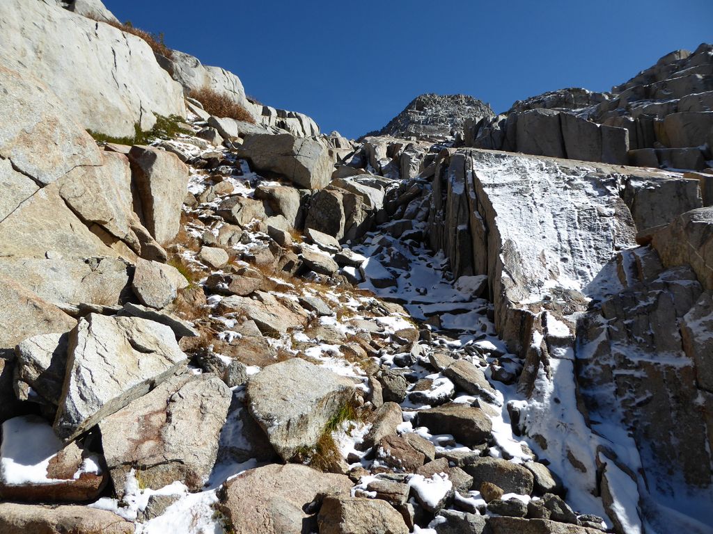
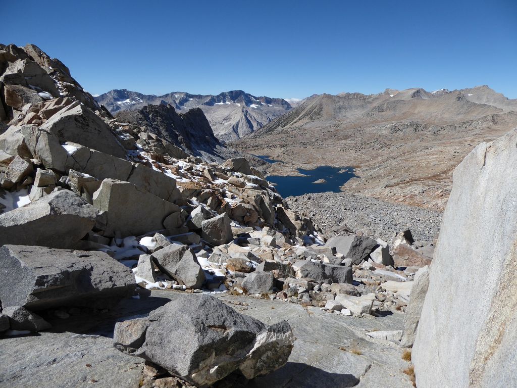
When I got going again, I have to say I was not at all thrilled about the amount of snow piled above the enormous boulders below.

It didn't necessarily surprise me since it was clear from the map that the northern side of the col would be receiving very little sunlight at this time of year. But I guess I was hoping that somehow it had magically melted away.
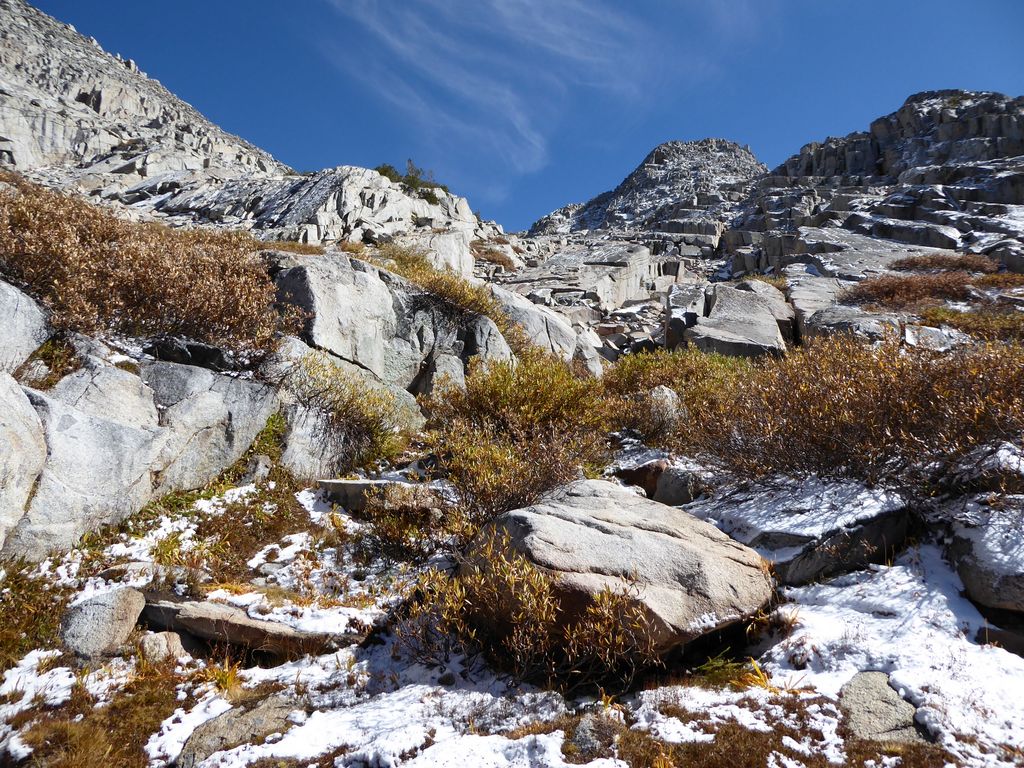
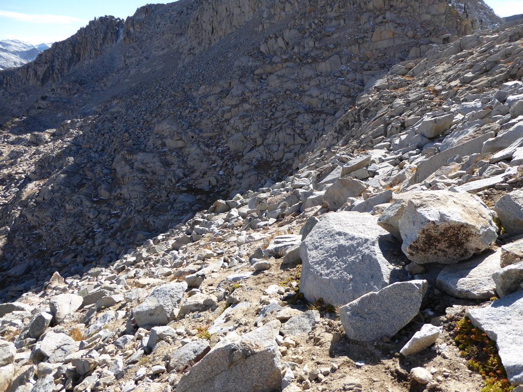
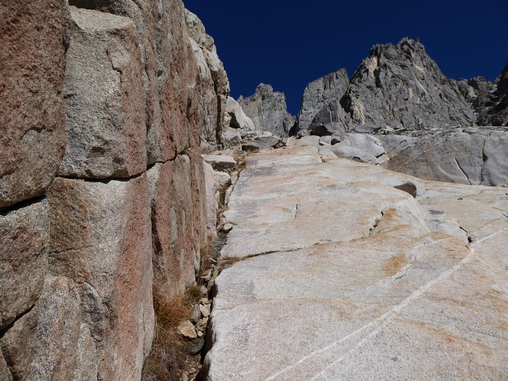
The first 200-300 feet of elevation loss were a true pain in the ass. I mean, just a raging, sharp, stinging pain in the ass. I was pretty much crouched down on all fours the whole time. Lowering myself between two rocks to another one below. Testing each patch of snow and potentially ice-covered rock with very careful footsteps. Wishing I did not have a heavy backpack to weigh me down.
Detailed maps of this area west of Thunderbolt Col show it as a boulder field, and that's exactly what it is. Boulders of all sizes and shapes, precariously perched and improperly balanced, blatantly telling you that this is no place for human beings to get comfortable.
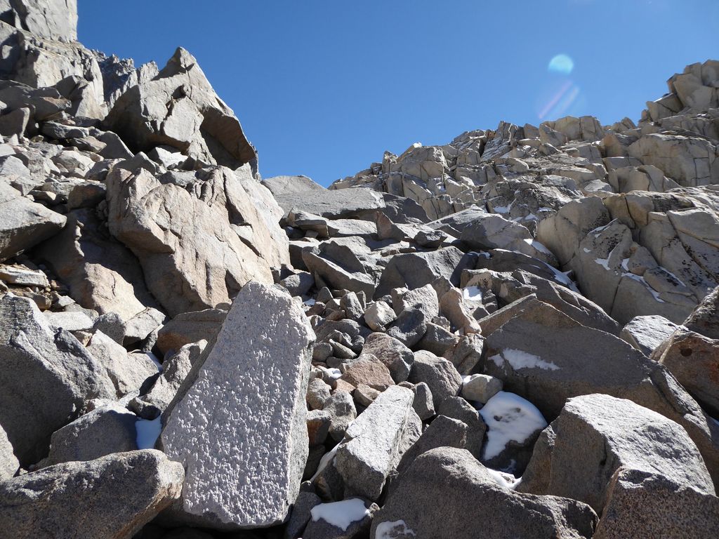
There were a few times I had to go underneath enormous ones that looked stable, but I was well aware that any significant tremor would have probably meant disaster. Still, people take that same risk every time they go across any of the bridges in the Bay Area, right? (At least that's how I convinced myself what I was doing wasn't stupid).
I was quite thrilled when I had finally cleared the nasty section I just described. But looking ahead, I could tell things weren't getting that much better.
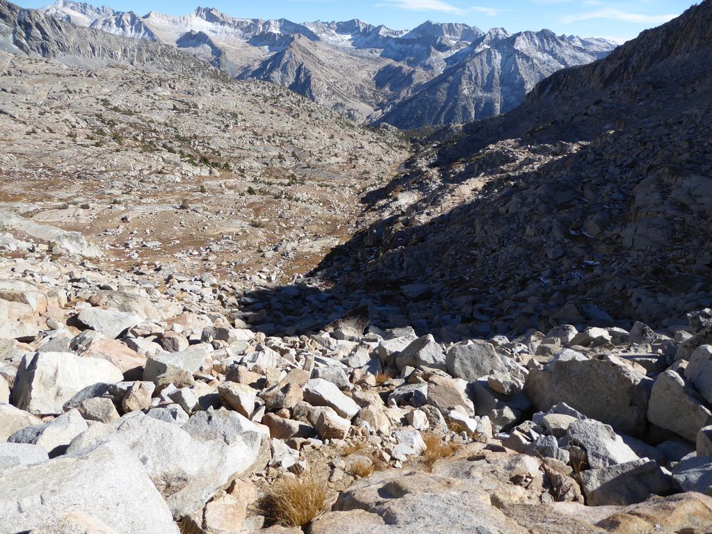
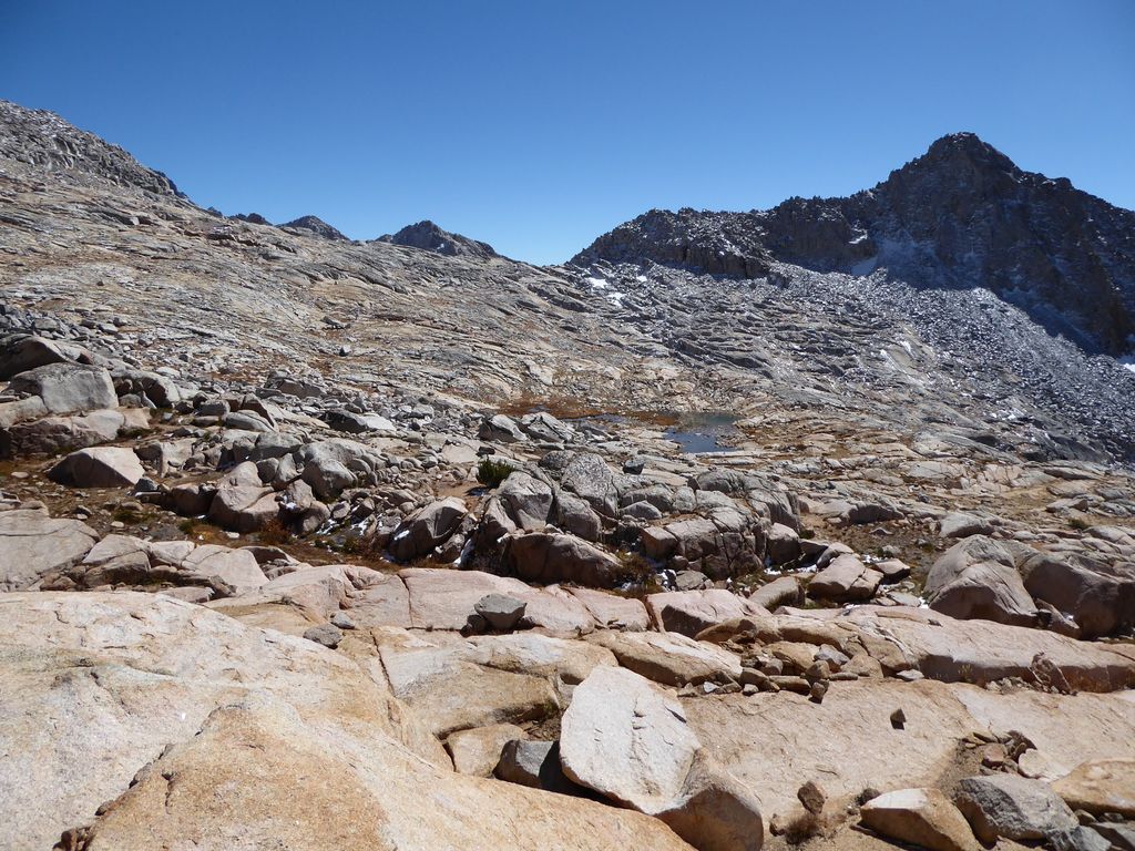
It looked to me like the best course would be to stay perched a few hundred feet above the lake to the west/southwest instead of taking an immediate path down. Going straight down to the lake looked like it would get really tricky really quickly. The route I chose seemed to be less tricky. It felt like I was moving at a small child's pace, so when I finally reached solid ground a couple hours later, I let out a huge sigh of relief.
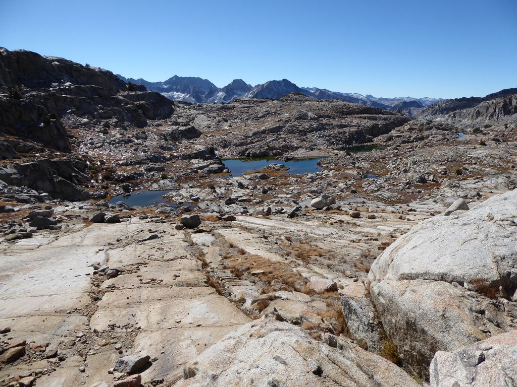
Although I didn't have any concrete destination for a campsite, I figured I'd try to find something good around one of the lakes in Dusy Basin. There were clearly a large number of options for how to get down to the lake closest to the pass, but it looked to me like staying on an isocline until I got to the area north of the lake just below would make for the most gradual descent. It turned out to be a very decent route. In fact, there were a couple of stretches that looked like they were perfectly carved for a hiker.
At around 300 pm, I stopped to gather water along a gorgeous little creek.
I got cozy resting up against my pack, and felt compelled to close my eyes and take a short nap. I think I only dozed off for a few minutes, but boy did it feel like just what the doctor ordered.
When I got going again, the clouds started rolling in. They would get more and more impressive as the day wore on.
Looking back in the direction of Thunderbolt Col, I just felt so damned glad to be down from there. I felt like it looked a lot tougher from this vantage point than it did from the same elevation on the other side,
but perhaps that was because of my experience over the last four hours.
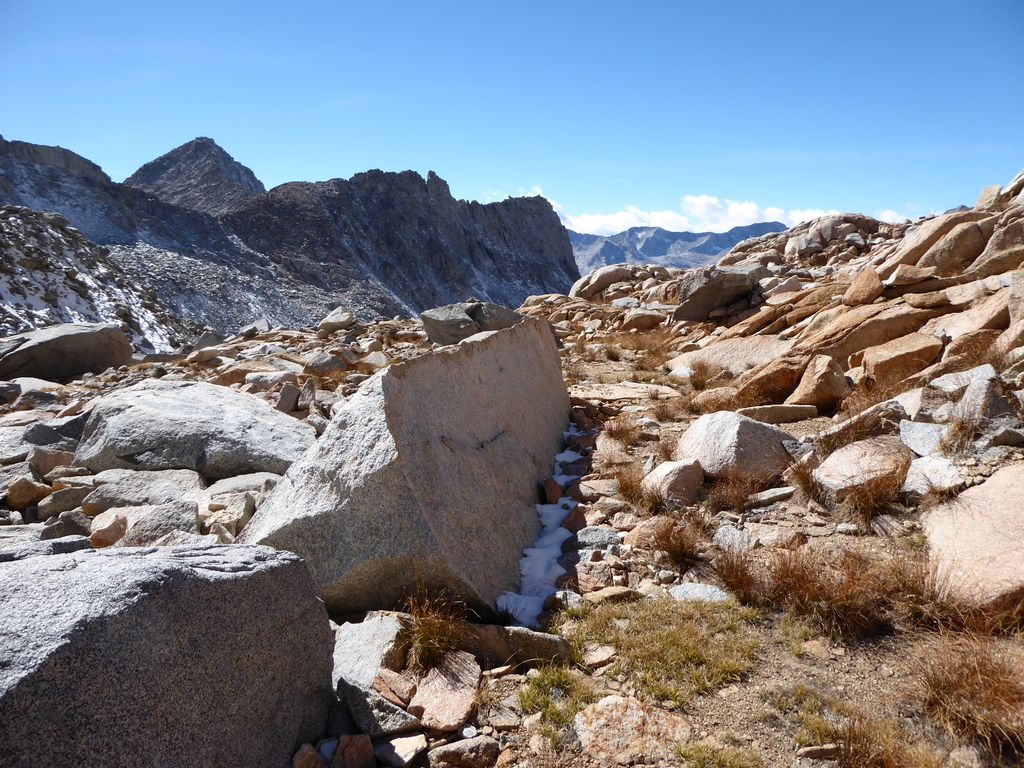
One of the cool things I happened upon while I was making my way down was a very impressive rock wall that someone had built underneath a strangely placed boulder.
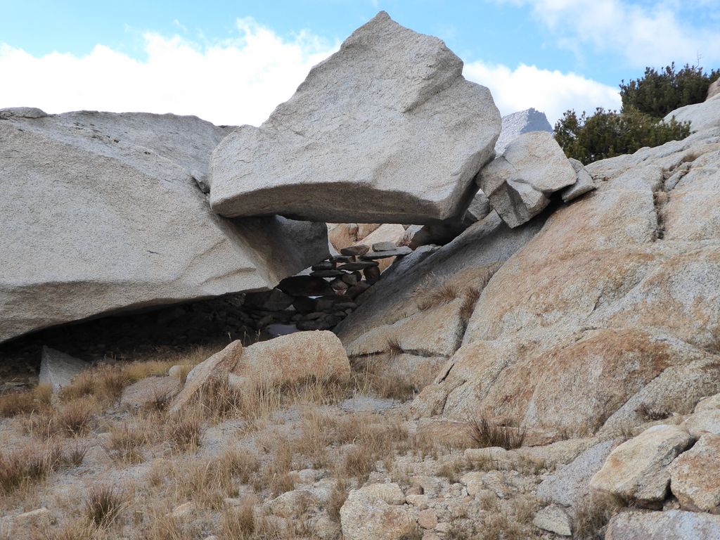
I imagine that would have been a pretty nice place to have dinner a few nights ago.
When I reached a point a few hundred meters north of the lake, I found an extremely easy slope to descend to the west.

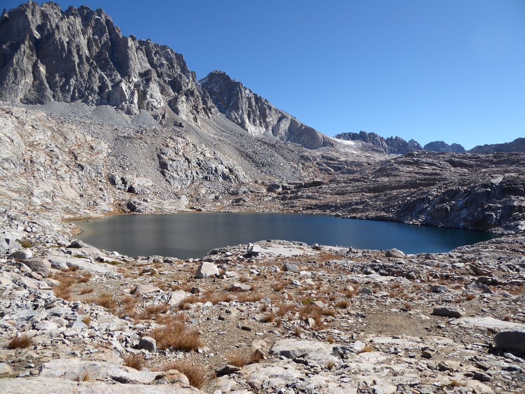
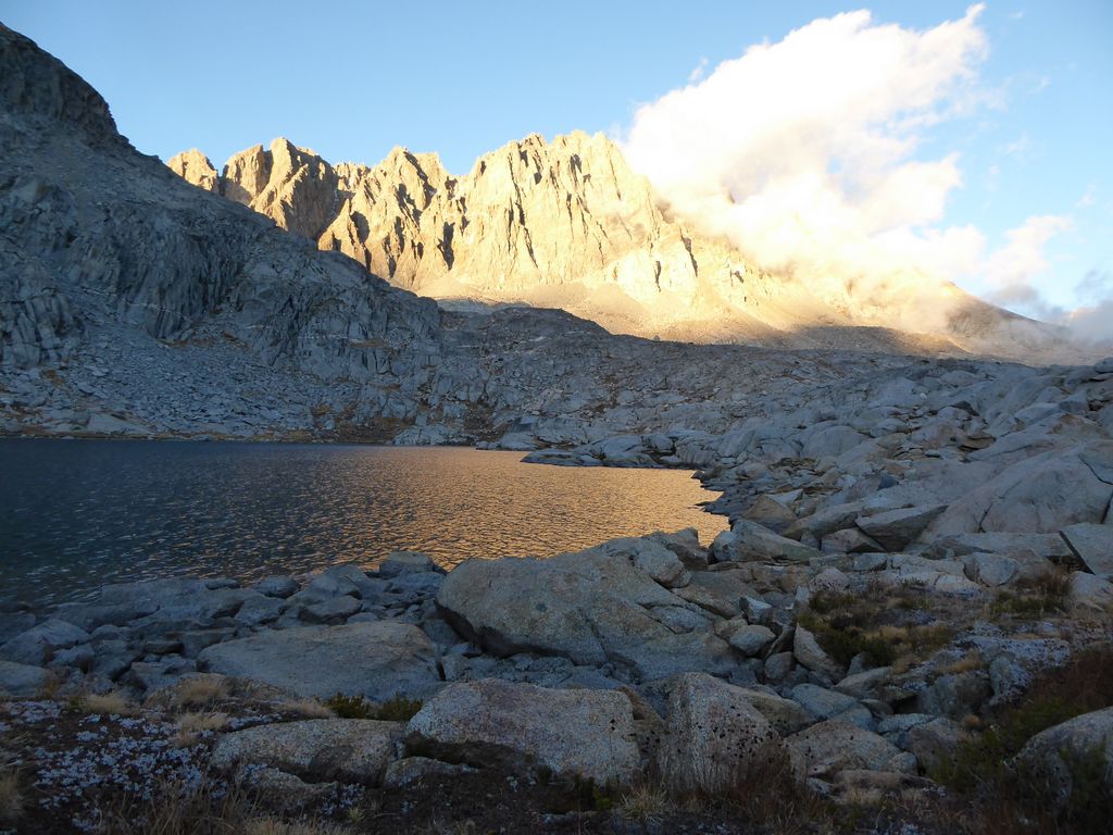
Within no time, I was hugging the shore of the lake I had been staring at for the last four hours. Thunderbolt Col was now enveloped in thick cloud cover. Damn, did I feel happy that I had made it down in one piece.
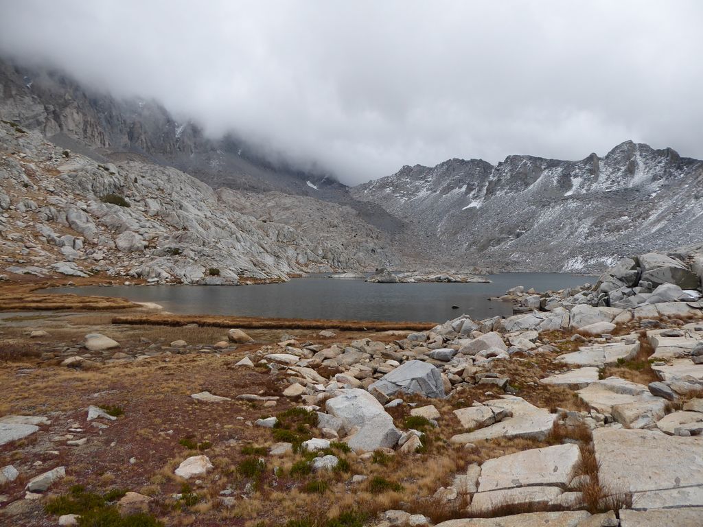
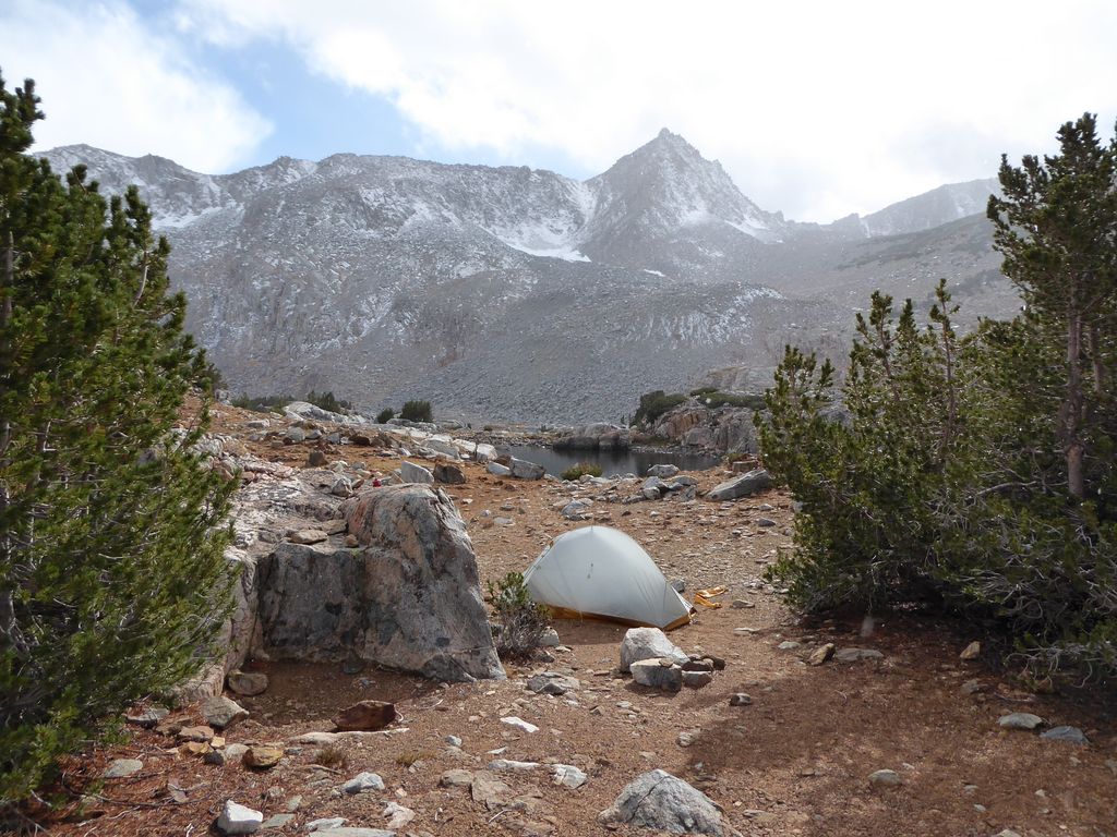
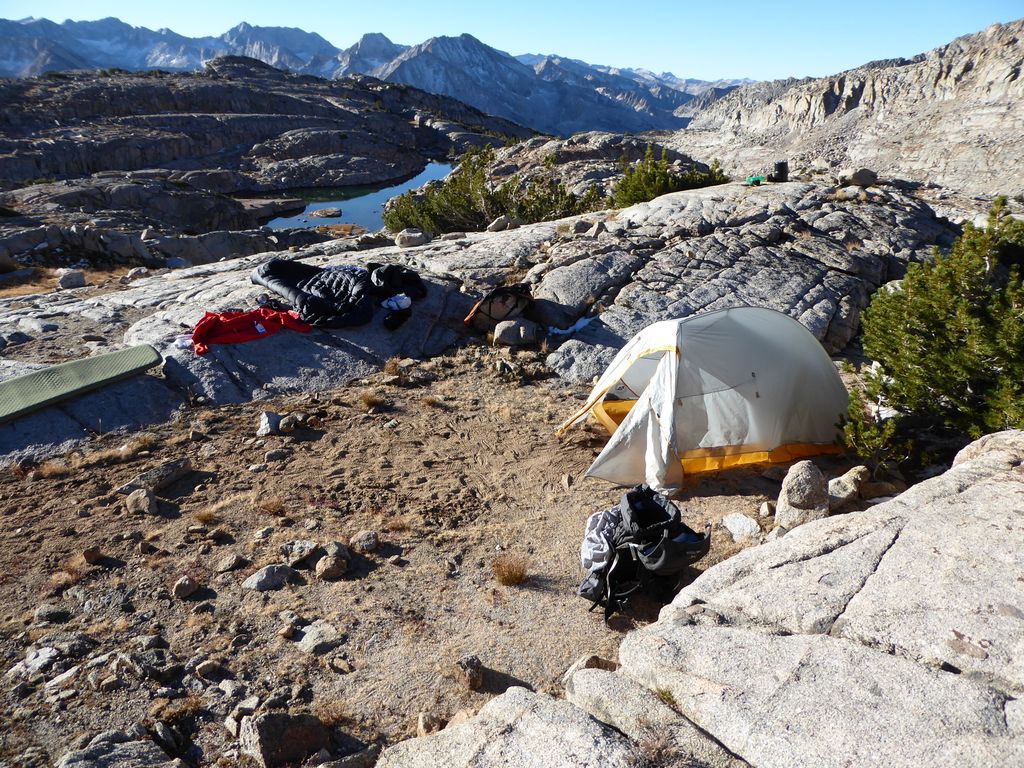
Although there was plenty of flat ground, there weren't any nice, sheltered spots along this lake. So I headed west until I got to the shore of the adjacent one. I was excited to see that it was far more ideal for a campsite. I found a nice flat square of dirt and set up my tent.
The clouds put on a repeat performance that night, making for some highly enjoyable dinnertime entertainment.
Even with all my layers on, however, the cold was seeping through to my body. So I got in my tent well before the sun had set completely. I entertained myself by opening the only book I had brought—The Really Useful Little Book of Knots—and tying a few of the ones I had never tried. It was a pleasant way to wind down the evening.
Initially I had planned to spend five nights exploring this area, but with the lack of sleep I'd experienced up to this point and the fact that I had a leaky Thermarest, I was damn ready to get out of dodge. As I drifted off to sleep, I couldn't help but smile at the thought of getting back to a warm bed.
That last morning was a cold one. Really, really cold. I spent a long time trying to do a rough calculation of when I'd finally get my first ray of sunshine based on the topography and the time of year because being outside of my tent was not very pleasant. I also spent a bit of time thinking about how I should write an algorithm for my GPS that calculates when that first sunlight will hit your current location. I'm surprised they don't include that as one of the little apps on there. The calculation wouldn't require that much processing power or memory.
When the sun did finally hit, it felt incredibly good. I took a few moments to warm up and pack my gear and I was off. When I had warmed up a bit and it was time to shed a layer, I took a moment to appreciate my last look at Thunderbolt Col.
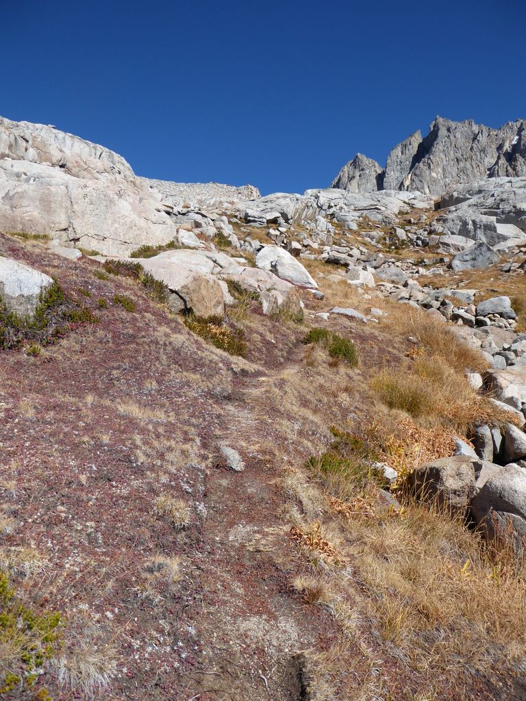
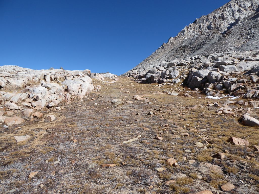
The path ahead of me was very clear cut. I could basically see the exact northeasterly route I would take from where I was standing, and it looked quite easy.
It was quite easy, indeed. And I couldn't have been more thrilled at the lovely stretches of flat ground that paved the way back towards Bishop Pass.
One of the highlights of the day was my first encounter with the White-tailed Ptarmigan.
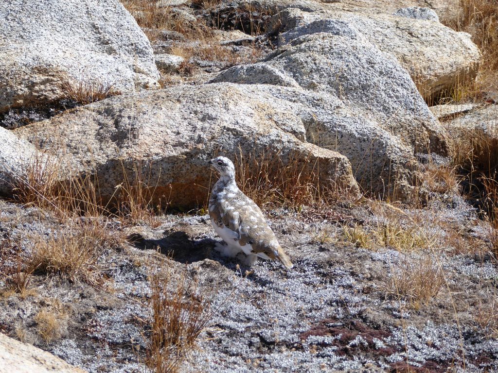
There was a family of them hopping around on the rocks. They didn't seem too scared of me, which I thought was cool. And they had some good colors to camouflage them against the high sierra landscape, which I also thought was cool.
I decided I'd proceed almost due north and try to delay joining up with the Bishop Trail pass for as long as I could. I'm happy I did. I came across some spots where it looked pretty easy to climb up towards Mount Agassiz. Spots that beckoned me to come back for a repeat visit.
The best part was that I got an incredible view of Aperture Peak and the vast morraine below it. I must have stood there and stared at Jigsaw Pass for ten minutes trying to figure out how the hell one gets up there without doing some hard core rock climbing.
After those 10 minutes, I still don't know how. Is that like a pass only for rams and goats or something?
My return to South Lake after rejoining the Bishop Pass trail was highly enjoyable, but uneventful. It was another brilliantly gorgeous day in the Sierras. I was sad it would be my last for at least a few months.
I did have a highly memorable moment once I reached the parking lot, however. While I was loading my gear back into my car, a dude that looked like he had been out for several days rolled up and opened the trunk of the car next to me. We got to talking a bit, and it turned out that we had missed each other by probably just a couple of hours in Palisade Basin. I had started up Thunderbolt Col likely just while he was heading into the basin. But that's not the really memorable part.
The part I'll never forget is the story he told about how his father passed away in that very basin several years before. He said that his father used to go fishing up there all the time, but on that last trip he never returned home. They didn't find his body until the following year (or maybe it was the one after that). Apparently he had frozen to death, likely because in his old age he was a bit absent minded and simply forgot to adequately prepare for the elements. While it was a sad story, the fellow agreed that it was probably a pretty good way for his dad to go. In my mind, the High Sierra is as good a place as any to pass on. I hope there is an afterlife, and it's just like a perfect day in the High Sierra.