


TRIP DETAILS
TRAIL MAP
OVERVIEW
Notes:
- Pictured Rocks National Lakeshore—and the whole Upper Peninsula in general—might be the jewel of the Midwest, in my opinion. Less than six hours away from Chicago by car, it offers fantastic scenery, camping, and dazzling views of the heavens.
- Like most places, the bugs can be very bad during certain times of the year. We hit the beginning of mosquito and black fly season, but luckily missed the peak.
- Both Cliffs and Potato Patch are very nice camping areas, each with an open pit toilet. Not much privacy, but at least there's fresh air while you're doing your business.
Elevation Gain
Little to no elevation gain
TRIP LOG
We started our journey north from my brother's house in Orland Park, IL, around 7 am. The drive up to the UP was very smooth, with just a touch of traffic in the Chicagoland area. After getting through the flat grass of Wisconsin (which was beautiful in its own right), the scenery became very appealing as we drove along the western shore of Lake Michigan. A lot of neat little towns and short bridges peppered the way.
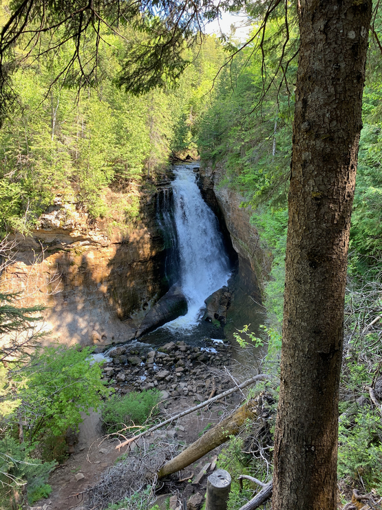
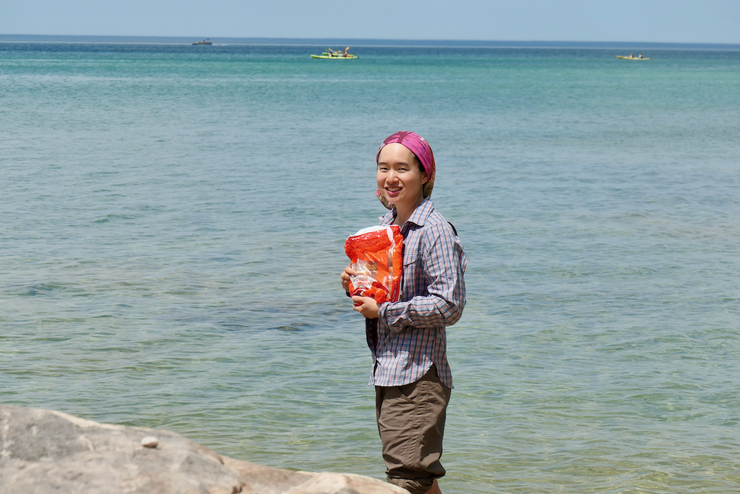
We stopped in Munising for some last minute provisions. Eric wanted to buy a steak to cook over his portable stove and Tina, who was about 9 weeks pregnant, wanted to get some kiwis. After picking up these items and a few others, we headed first to the trailhead for Miners Falls. Eric and I spent a lot of time fishing and exploring rivers in the UP during our childhood (especially the Silver River, where some good friends of ours owned a cabin), and based on that experience I was expecting a fairly modest cascade. So when we reached the end of the short, mile or so long hike, I was quite shocked by how tall and sweeping the waterfall was!
Our collective mood was quite high at this point as we enjoyed the pure, pine-scented (and so far mosquitto-free) air.
After getting back to the trailhead, we jumped in the car and made the short hop over to the Miners Castle parking lot. That's where we'd station the car for two days while we were out on the North Country Trail (NCT). Due to COVID-19, the bathrooms next to the parking lot were shut down. There were a few pit toilets still available, but no drinking water. We weren't too concerned about this since Eric recalled a few creek crossings near the Cliffs campsites where we were headed that evening. He had done been up to this area quite a few times in the last ten years, so he was a valuable guide for our small crew.
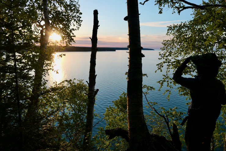
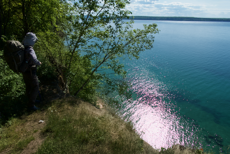
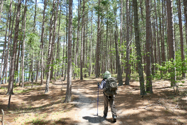
With our gear all packed up, we set out west on the NCT. It was nice knowing we had just a short ~two-mile walk to our campsite. Within just a few minutes, we came upon an opening that gave us clear shots down to the gorgeous turqouise waters of Lake Superior. The water looked extremely inviting, although the sheer ~200-foot drop to get to it was anything but.
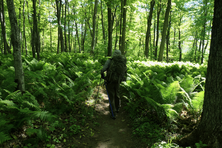
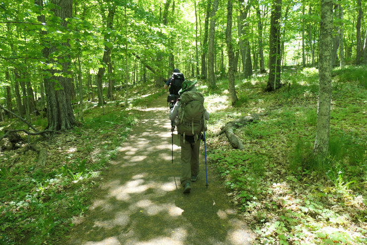
The couple of miles between the trailhead and the Cliffs campsites was rather splendid. The mosquitos and black flies still hadn't besieged us, so we were able to fully enjoy the beautiful path through the fern covered forest.
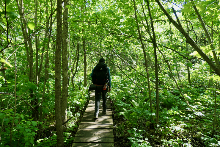
There were plenty of wooden boardwalks on the trail to keep you off wet ground.
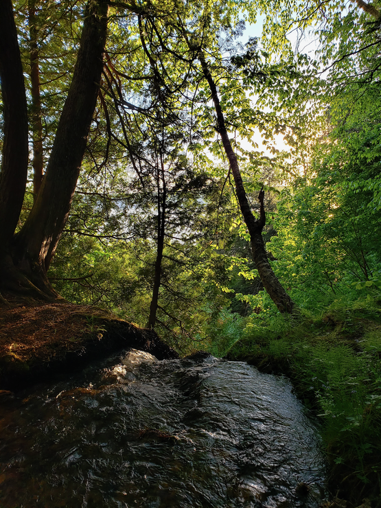
There were also some bridges to help cross some of the streams. Unfortunately, the streams were so tiny they weren't running much at all at this point in the year.
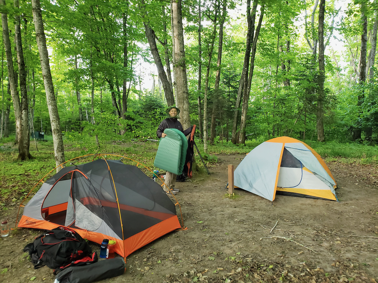
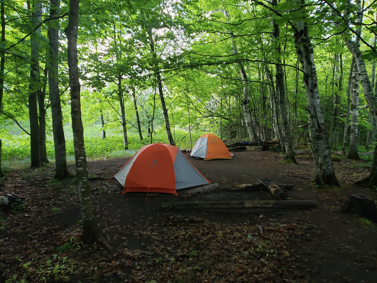
It wasn't long before we came upon the trail junction for Cliffs. When we reached the actual camping area, we found two of the three sites were already occupied. We quickly dumped our packs and began to set up our tents at the remaining one. Although this didn't take us long, it was just enough time for a few mosquitos to find us and tell all their little mosquitto friends we had arrived. We all donned our mosquitto hats and applied bug spray right away.
The time was just around 5 o'clock, and none of us felt like sitting around and waiting for the bugs to expose the weaknesses in our defenses (they had managed to bite me three times through the small, repellent-free patches of my socks within about 15 minutes or so). So we decided we'd head west to see if we could find a decent water source, and also maybe check out Sand Point.
Once we got going again, the mosquitos lost our scent and we were able to once again enjoy the serene forest. In my opinion, this section of the trail was far more impressive than the two miles we had just done. We passed over several large streams that were bounding down the cliffside in cascades that issued a loud roar. The birch and pines seemed larger in number and size, and the views across the lake became increasingly attractive.
We eventually reached the long, steep staircase that heads down to the beach near Sand Point. Eric hadn't recalled the stairs from his previous trip along this section, and the relatively fresh wood seemed to reflect that it was a newer construction. The formations in the cliffs along this part of the trail are magnificent. In the slightly cooler air, the bugs seemed to be less prevalent, which afforded us the opportunity to take some photos of a small waterfall above the trail.
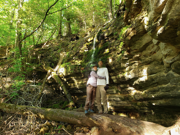
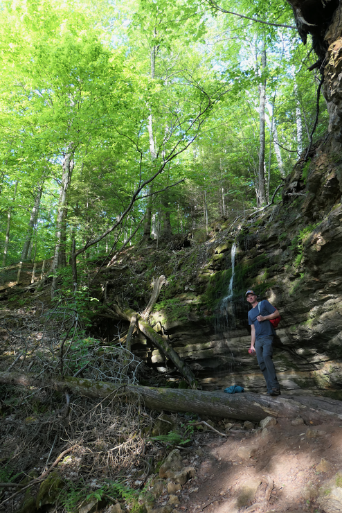
It felt great to finally reach the shore of mighty Lake Superior. Down here, the mosquitos and other insects seemed to abate long enough for us to enjoy a snack and take some photos in the perfectly fresh breeze.
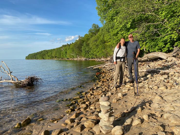
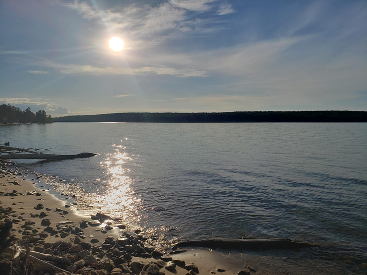
We enjoyed the pleasant water for another 10 minutes or so and then started the return to our campsite. The sun was beginning to sink near the trees in the northwest, imparting its magical glow on the natural structures around us. We stopped at one of the larger creeks to draw water
right next to a steep dropoff where the flow fell down for at least 20 meters to the floor below. As we got nearer to our camp, the sun was putting on a dazzling show of colors before us. We spent a good moment trying to soak in every bit of beauty we could.
When we came upon our camp, we saw that the other hikers had already started a nice fire in the communal firepit. As we were all tired and hungry, this was a much welcome surprise.
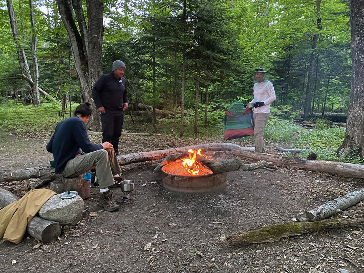
Some good conversation ensued with our temporary companions as we cooked our dinner and enjoyed the temperature drop and fresh breeze that seemed to have warded off the mosquitos. Eric successfully got a fire going in his stove and cooked up his steak,
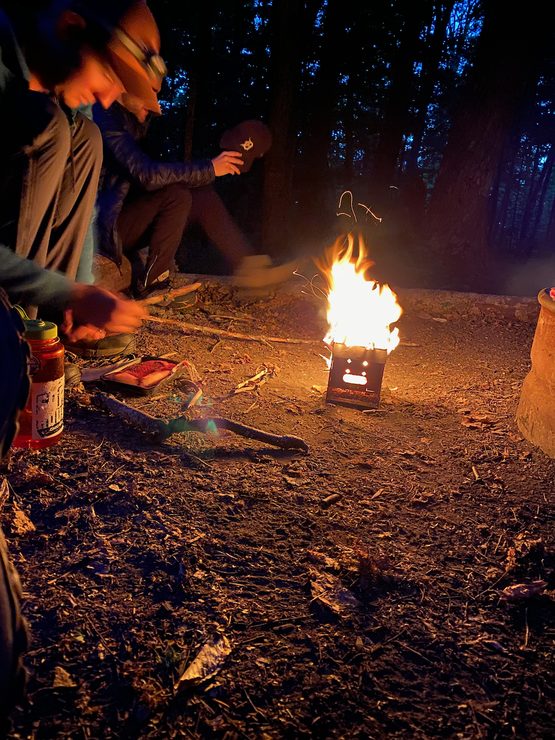
experiencing only one minor hiccup when the piece of meat momentarily fell to the ground. After letting our dinner settle, we headed back to the cliffside to take in the stars. As expected, the northern Michigan skies were glowing brilliantly. Unfortunately, we had only a small window through the trees to view the heavens directly above and to the north. But still we could see the pale trace of the Milky Way before twilight had fully come to a close.
We slept in a bit on the second day. When day broke, the cold wind that had kept the mosquitos at bay was all but gone. The little vermin were perched sporadically on the outer wall of the tent. We took our time eating breakfast and packing up since we didn't have much ground to cover at all during the next 12 hours of daylight.
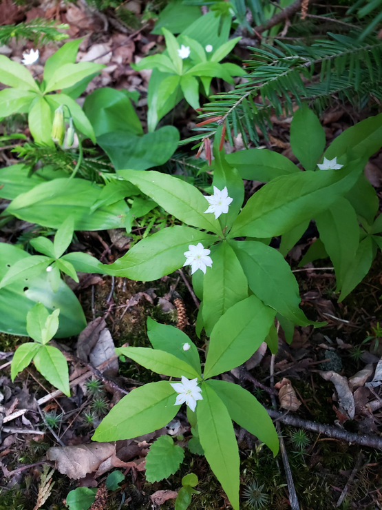
The trip back to the Miners Castle area was short but sweet. We were taking in as much as we could of the pretty wildflowers covering the forest floor.
We decided to stop at the car and offload some of the unnecessaries we were carrying. I had brought way too much food for just two nights. A pit toilet visit later and we were back on the trail, ready for a slight detour to the Miners Castle rock formation. I have to say that when we arrived on the final platform in front of Miners Castle, we were a little underwhelmed. The structure is rather tiny.
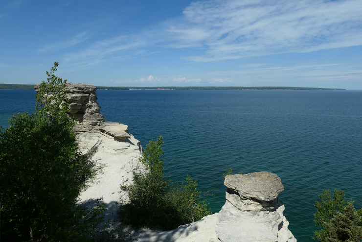
However, the views down towards the lake and the information on the signs about the geological history made the detour well worth the effort.
When we got going on the NCT again, we found the region just to the east of Miners Castle was very enchanting. Enormous birch and maples surrounded us on the wide, inviting trail.
Within a matter of minutes, we came to our first "major" elevation change on the NCT. We dropped about 150 feet as the path bent to the southeast and led us furhter away from Lake Superior. When we reached flat ground, we had our first glimpse of Miners River since the day before when we saw it at the Miners Falls area.
The trail led us away from the river not long after our encounter with it, and then exploded into a labyrinth of offshoot trails that all seemed to be going towards the beach, but in different directions. We headed north along one of these for a hundred meters or so before realizing that it was probably not the easiest way to proceed. After doubling back we picked up the main trail and continued along that.
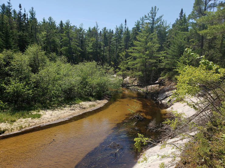
The water in the river looked very clean, despite the slightly brown tincture so common to the area.
After crossing a small wooden bridge, we were greeted with the sights and sounds of some minor rapids.
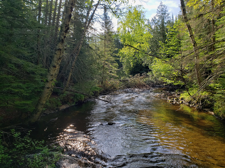
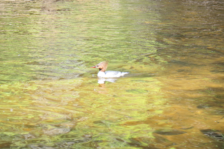
We took the opportunity to fill up our water bottles in the cool shade on the nice slate rocks along the riverbank. While we did so, I got to watch a couple of ducks as they waddled upstream and pecked at whatever food they were after on the riverbottom,
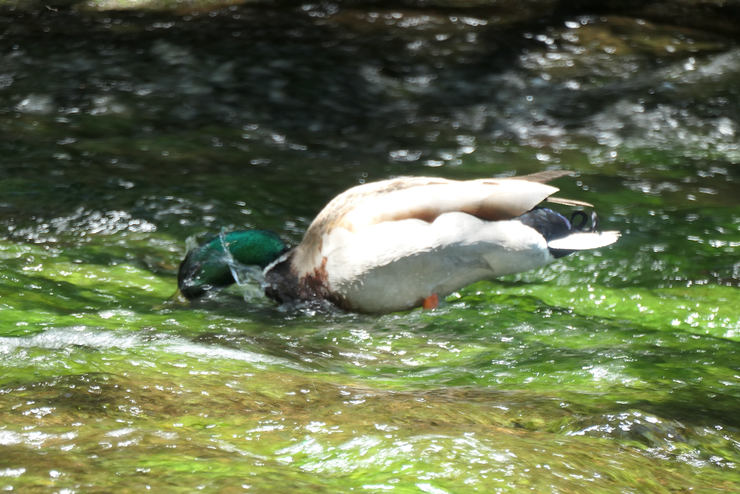
and the odd-looking common merganser (which is much less strange-looking than the hooded mergansers around us in the Bay Area).
In a short while, we were in an open stand of tall pines next to the waterfront.
And right after that we were next to another parking area opposite the beach. At this point, the trail becomes a very soft and fine sand.
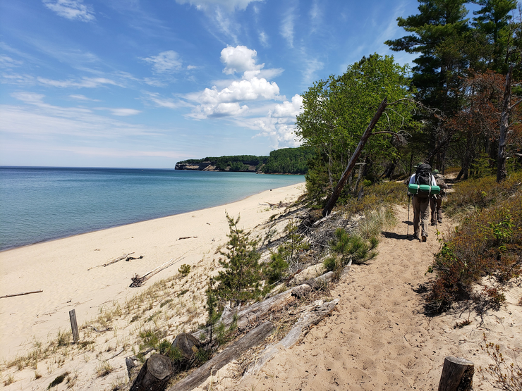
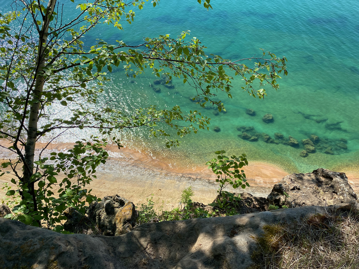
The look of water with its brilliant colors and the powdery sand almost made me feel like I was in some tropical paradise. The weather was also perfect at this time, which made it even more splendid. Off in the distance, we could see some thick clouds that made the predicted 30% chance of rain seem like a bit of an underestimate.
In about a half hour, we arrived at the point where the NCT breaks off from the shore again and heads back south towards a dead-end road. We decided we'd make it to Potato Patch and set up our tents so that we wouldn't have to deal with potentially doing it in the rain later in the afternoon, and once that was done, come back to the beach and enjoy lunch. There was a short climb up a rocky path to get back onto the bluffs. And right after we got to the top we found the trail toward Potato Patch.
We were the first group to arrive at Potato Patch, so we had our pick of the three sites. There was plenty of flat ground to choose from, which was really cool.
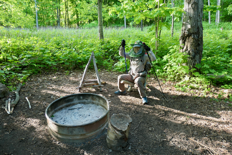
The site had another fabulous open-air pit toilet, and it also had a nice firepit equipped with some sweet Robinson Crusoe style log chairs.
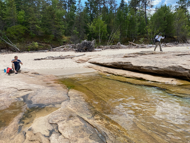
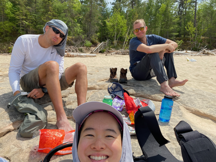
I'd say we were all highly satisfied with the digs at Potato Patch. As planned, we headed back down to the beach with our lunch supplies, ready to take a dip in the cool water. The beach area was absolutely superb. Nice, soft sand interspersed with wide sandstone outcroppings perfect for an afternoon repose.
I jumped in the water and washed off a bit, and then walked back up on shore with a great amount of excitement for lunch. Just as I was about to praise the lord for the lack of mosquittos near the water, I felt a sharp sting on my foot as a black fly took a small chunk out of my skin. It turns out we had escaped the wrath of the mosquittos in the forest only to enter the open-air den of the vicious black flies along the beach. They weren't the worst I've seen, but bothersome enough to make you focus your attention on swatting them away from your body. Still, we were able to enjoy a pleasant lunch.
Tina eventually had the right idea as she ate her lunch sufficiently far in the water to escape the bulk of their terror.
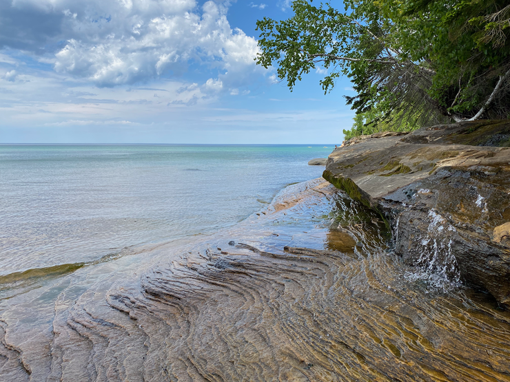
After some rest and relaxation, we filled our water bottles at this really neat waterfall that drained directly into the lake. I was quite mesmerized by the patterns in the sandstone.
While pumping from the small flow, I'd be so transfixed that I'd forget all about the flies buzzing around my ankles for a short moment, only to be abruptly reminded of their presence by the feel of them sinking their teeth into my flesh once again.
The 30% chance of rain we had read about earlier in the day seemed to be headed towards the 100 mark as evidenced by the showers in the distance across the lake.
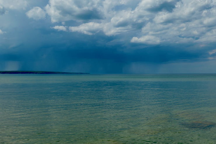
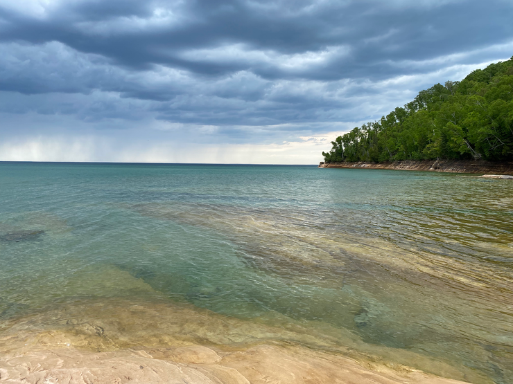
The clouds and sheets of rain gave the water a surreal appearance that we all took our time appreciating. At some point, a sharp, intense gust of wind blew across our faces and brought a 10-15 degree temperature drop. It was amazing. It went from feeling slightly hot to making me want to grab another layer almost instantly.
The wind continued to intensify, and the storm seemed like it was surely coming our way. There was a group of folks with kayaks that had settled next to us, and they were listening to instructions from their outfitter's guide. He claimed that the storm wouldn't reach us, but dang was he wrong. They must've gotten soaked out there on the water.
Not long after that, we collected our equipage and headed back up to Potato Patch. We heard a bit of thunder and saw some lightning in the distance, but it was still far out on the water. We actually managed to get a nice fire going and eat some dinner well before the rain hit us. When it did, Eric informed me after making a trip back to his tent that I had left the fly door on our tent open like a regular old dummy, so our tent got a tiny drenching. It dried up pretty quickly, though.
We hunkered down in our tents for the next couple of hours while the rain and win beat down upon us. Tina and I decided to try and go to sleep even though it was only 8 o'clock or so, and we succeeded. Eric ended up staying awake a bit longer and doing a short hike east after the rain had subsided. I'm jealous that I didn't get to enjoy it with him. The sunset looked brilliant from some of the photos he took.
When we woke up the following morning, things were fairly dry. We decided not to do spend our time cooking and eating breakfast since the mosquittos had really honed in on our spot. It was just a short, hour or so long hike back to the car. Eric and I decided to go for one last dip in the lake, and then we made some coffee and tea before we started the long drive home.
Although it was a long drive for just a couple of days, it was well worth it. I certainly want to get back to Pictured Rocks and explore more of that gorgeous shoreline.