


TRIP DETAILS
TRAIL MAP
OVERVIEW
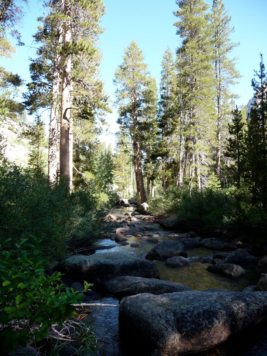
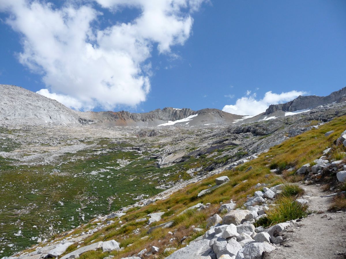
Nine Lakes Basin is an absolute marvel of the Sierras. When we hear climate change experts predicting catasrophic water shortages within the next few decades, it's quite refreshing to visit a place with such abundant, pristine, crystal clear water. Nine lakes of varying sizes and shapes, interconnected by small streams and cascades occupy one of the most colorful places I've seen in the high country.
Getting there is a challenge, there's no denying it. Although a nicely carved trail will take you all the way, your feet and lungs may still balk at the idea of ascending 4000+ feet over a distance of 12 miles. But for those who do want to venture into the basin, great things await. The entryway from the west lays claim to one of the most beautiful lakes I've ever seen in my life: Upper Precipice, a destination in itself.
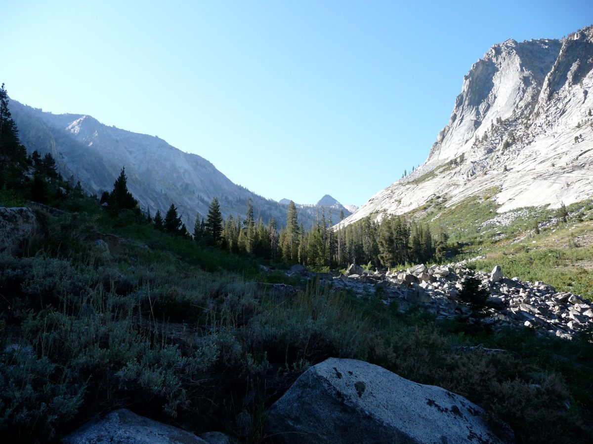
Once you pass Kaweah Gap and descend into the basin, you're on your own in terms of seeing the other eight lakes because there are no trails. However, the terrain is easy and forgiving, allowing one to explore without any technical gear or sore joints. My trip report describes an exploration of five of the nine lakes, along with an adventure over Lion Rock Pass and Lion Lake Pass to the north into Cloud Canyon. The latter is another phenomenal place. Arnot claims that the canyon has an eerie presence to it, as if it's haunted by some sort of spirits. But I had no feeling of the sort. My guess is that he and his partners were just camped too far from running water and there wasn't any wind. If there were any spirits in there, they would be joyful, happy ones that decided to stay in one of the most beautiful landscapes on earth.
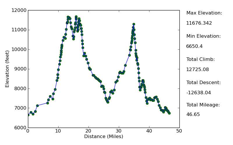
Elevation Profile
TRIP LOG
Well before I started this trip, I had ambitions to make quick work of the High Sierra Trail. I wanted to make it to Upper Precipice Lake by the first night so that I could have the entire second day to explore Nine Lakes Basin. In retrospect, this was almost too ambitious. If I hadn't been in very good shape, I might have passed out on the switchbacks after Hamilton Lake.
I knew that if I was going to make it to Upper Precipice before sundown, I had better get an early start. So I set out from Livermore at 4:15 am, and with traffic and bathroom breaks, I was in Sequoia National Park around 8:15 am. I knew that each minute of the hike was going to count, so when I actually crossed the park boundary, I made the decision to forego obtaining a wilderness permit. In my experience, the process can take anywhere from 5 minutes to a half an hour depending on the crowds and the aptitude of the ranger handing it out.
Unfortunately, the one time I neglected to follow the rules, I ran into the long arm of the law. After leaving Crescent Meadow at 9:15 am, I was stopped by a ranger around 11:30 am on the High Sierra Trail. I told her I lost the permit and she asked me where I had picked it up. I told her that I got it at the Lodgepole Permit Office, so she called them up on her walkie-talkie. I was sweating quite a bit while listening to the static on the radio, ready to get into a heated argument or bolt up the trail. Luckily, nobody responded. They were out to lunch. She asked me for my last name and license plate and let me go on my way. I'm not gonna lie: I was pretty worried I'd get stopped at Bearpaw after they realized I was lying. But this never happened, and I didn't see another ranger for the whole trip.
I stopped just past Bearpaw Meadow at 1:30 pm for lunch. The day had heated up quite a bit, but in the shade it was still very pleasant, allowing me to enjoy my first backcountry meal of the trip. Oh, how I love peanut butter and honey for the first few days. After I was finished, I decided I'd turn on the jets a bit. It was hard to pay attention to my footing, though, as the
clouds flooding in from the east put on a dazzling show. After the not-so-brief descent just before the lower Hamilton Lake, I got a brief surge of energy that got me to the shore of
Upper Hamilton Lake by about 4:15.
There were a good amount of people parked at the campsites around the lake. After dipping my feet into the water for a second and then breaking out a protein bar, I sat down and had some good conversation with two of them. They were a couple from San Diego, and when I told them that I had started at Crescent Meadow and was going to head up to Upper Precipice before dark, they thought I was mildly insane. They had taken two days just to get to where we were. I can definitely respect that.
The lake really is a destination in itself.
At about 4:50, I realized I should get going, so I said my goodbyes. On the way up to the switchbacks, I started pumping myself up for what I was about to do: a 2000+ foot climb up steep switchbacks into continually thinning air at the very end of the day. I think I can honestly say that this last stretch was the most difficult stretch I've ever done. Not because of the terrain or the grade or anything; just because I was spent. It was like trying to defend the goal line when it's 1st down with a minute left to go in the fourth quarter.
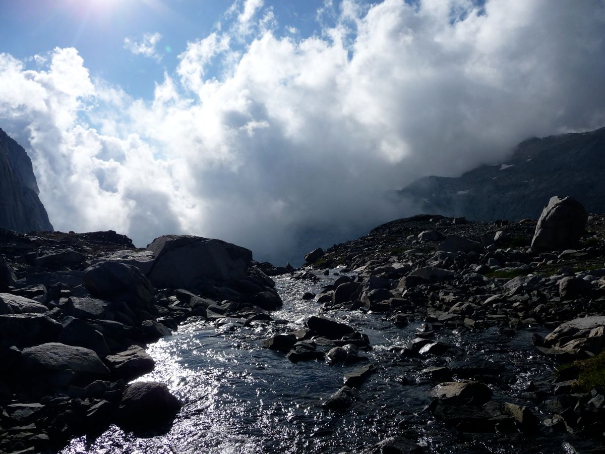
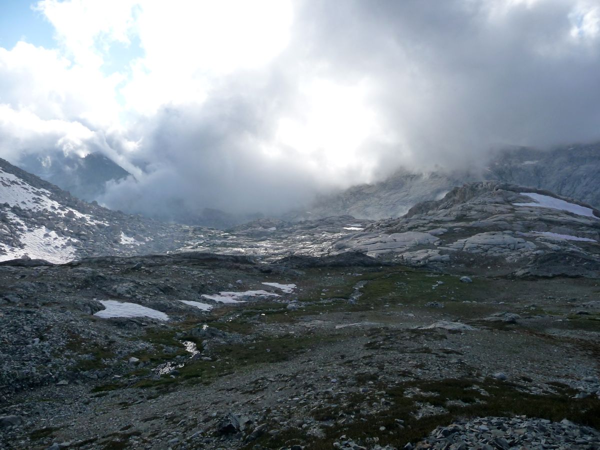
As I started the ascent, I could see
clouds rolling in above Upper Precipice. They were a little thicker when I made my way past
Hamilton Gorge. And by the time I got to Lower Precipice, I was
all up in them. I could hardly see 30 meters in front of me.
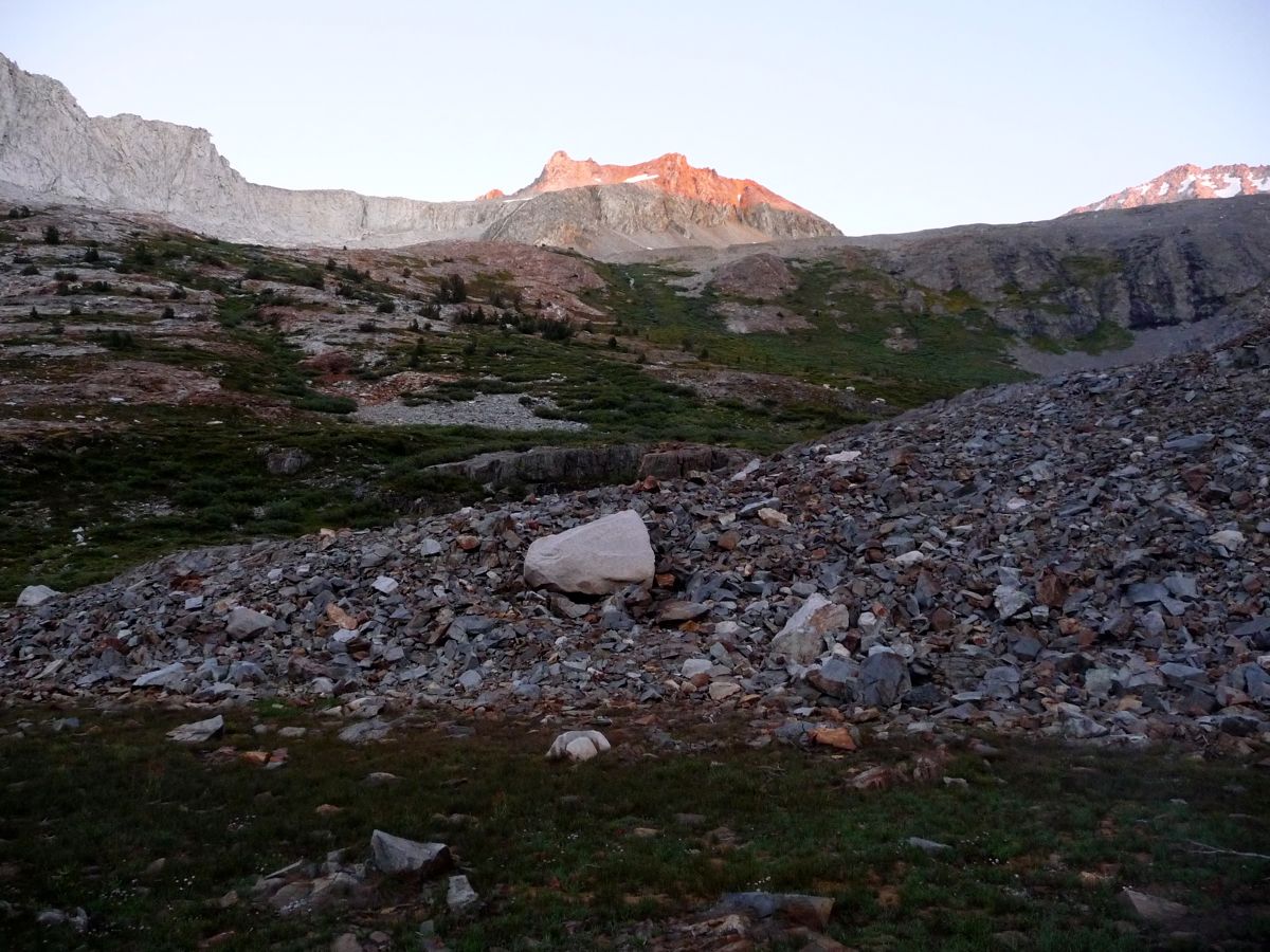
Gasping for air and stepping at a snail's pace, I finally reached Upper Precipice at 7:10. The
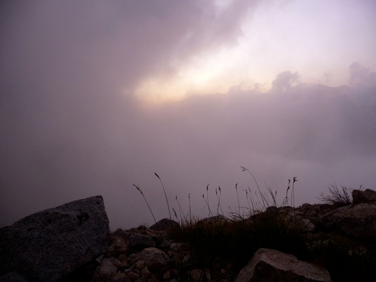
thickness of clouds had probably reached its maximum just as I set my pack down, and over the next hour, they would put on
a fantastic show as their wispy fingers
crawled down into Hamilton Gorge. And as quickly as they had crept over the mountains, they dispersed, leaving a clear sky above Upper Precipice.
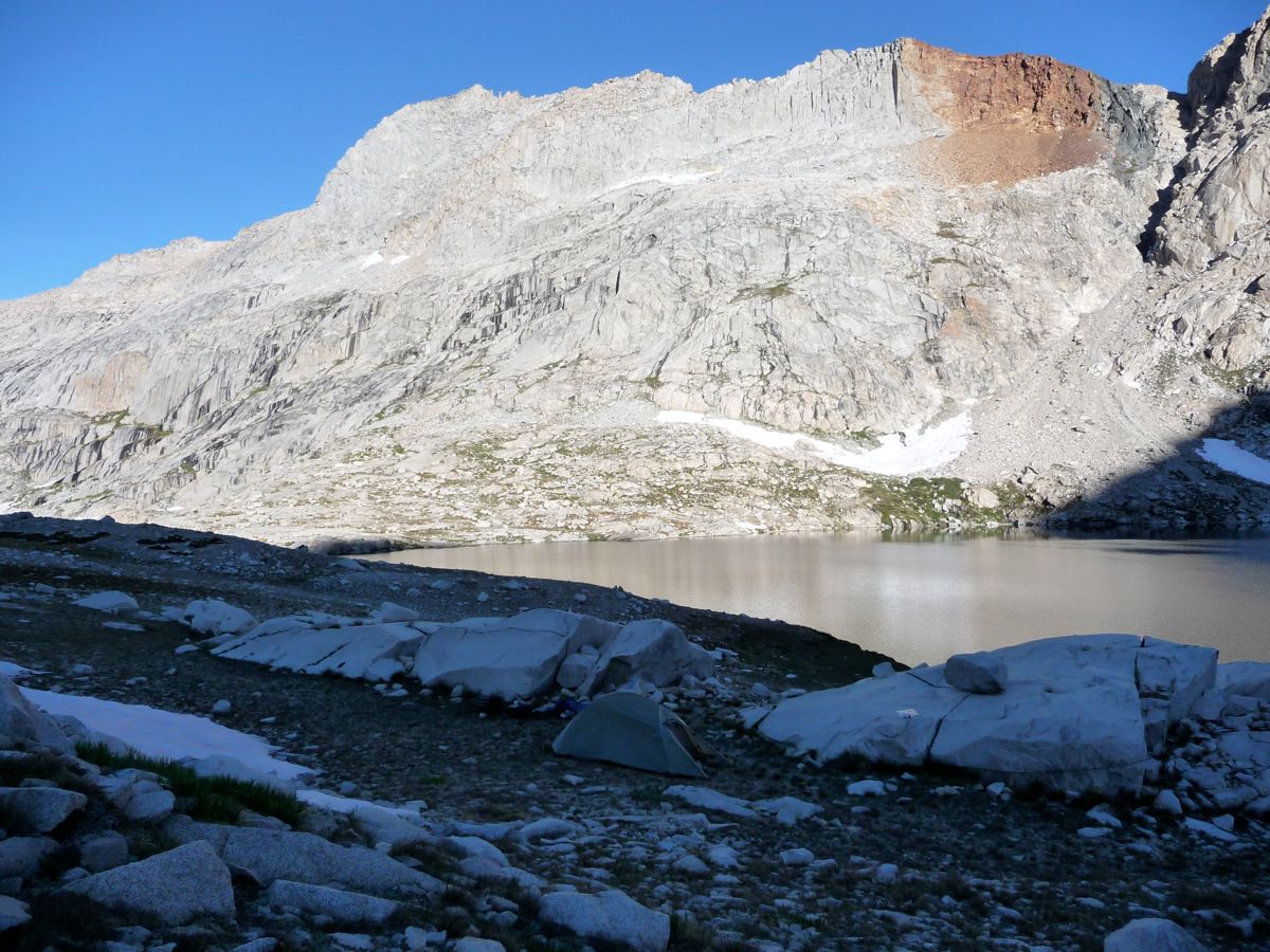
There was a considerable amount of snow around the
lake and some patches of ice near its outskirts, but it was no difficulty getting drinking water. After setting up camp, I cooked some dinner. Sharing the relxing moment with me was a tiny little mouse that had come out of hiding. Anytime I took my headlamp off him, he would try and get at my bear canister. The stars were absolutely ridiculous that night. Even though the dropping cold and lack of fire had me putting on every layer I had to stay warm, I still stayed out for another hour to look above.
It wasn't the coldest night I've ever been through, but it was chilly enough to leave a
layer of frost on all my gear. What really made me crack up after I had unpacked my bear canister and prepared to cook some oatmeal was that the little field mouse had been hungry enough to
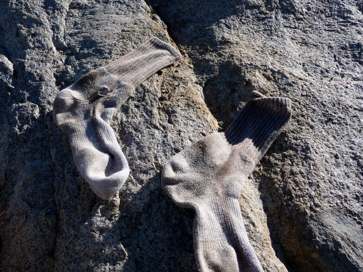
eat part of my sock! I'm positive that the hole wasn't there when I took them off the night before. They were brand new for crying out loud.
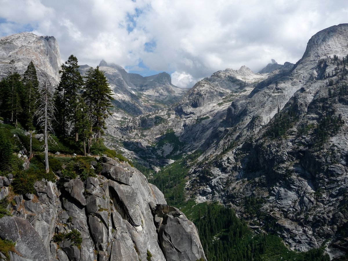
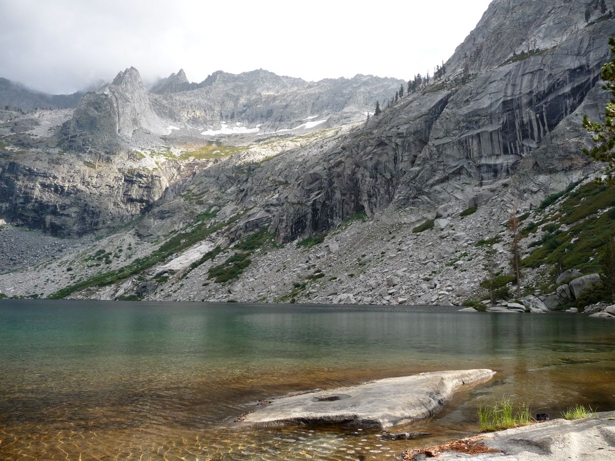
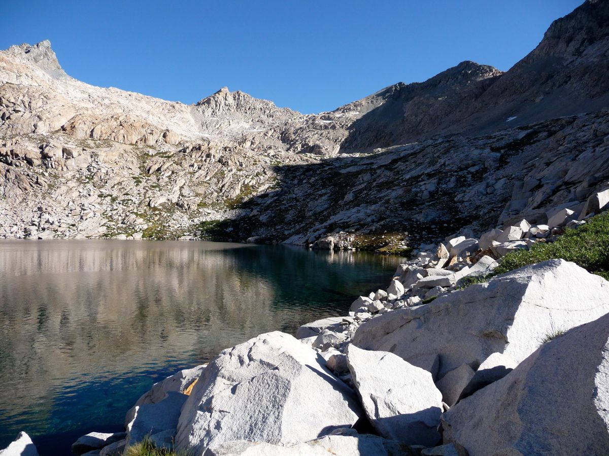
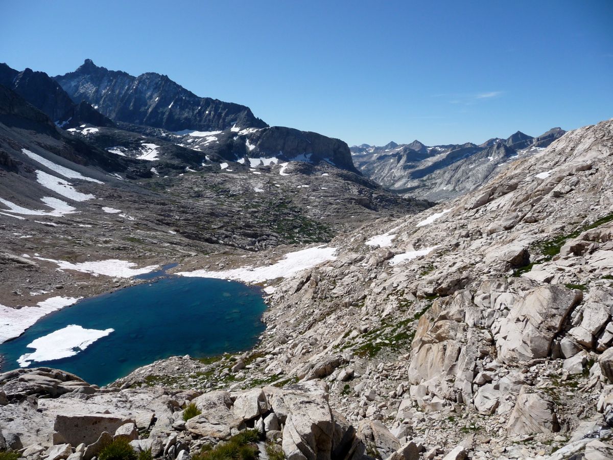
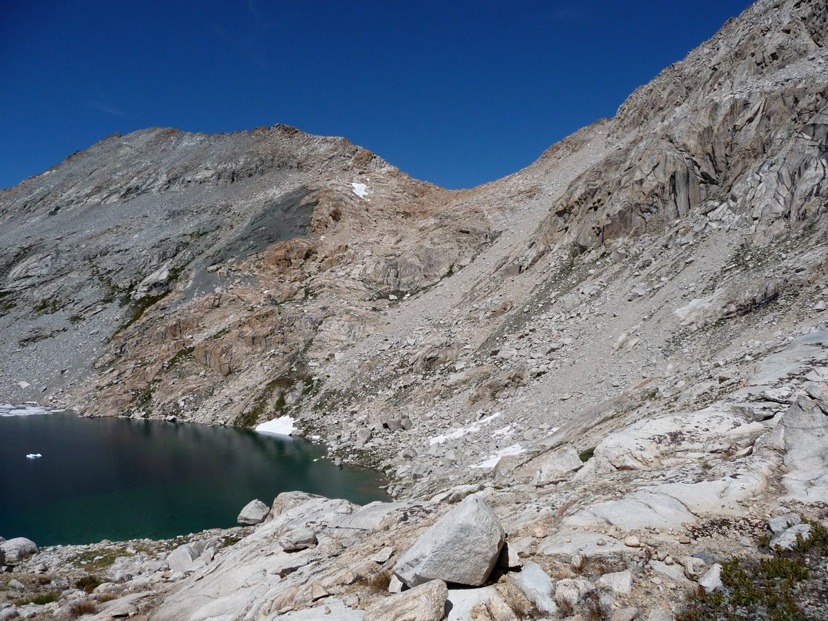
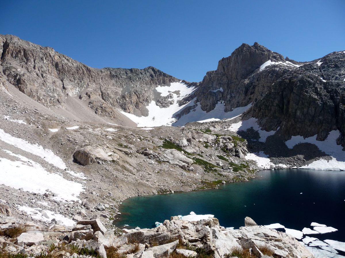
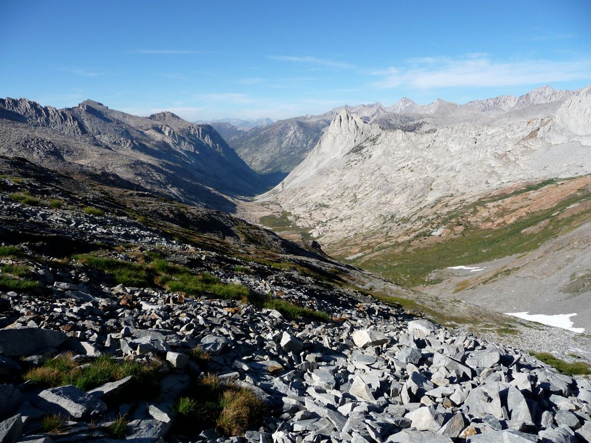
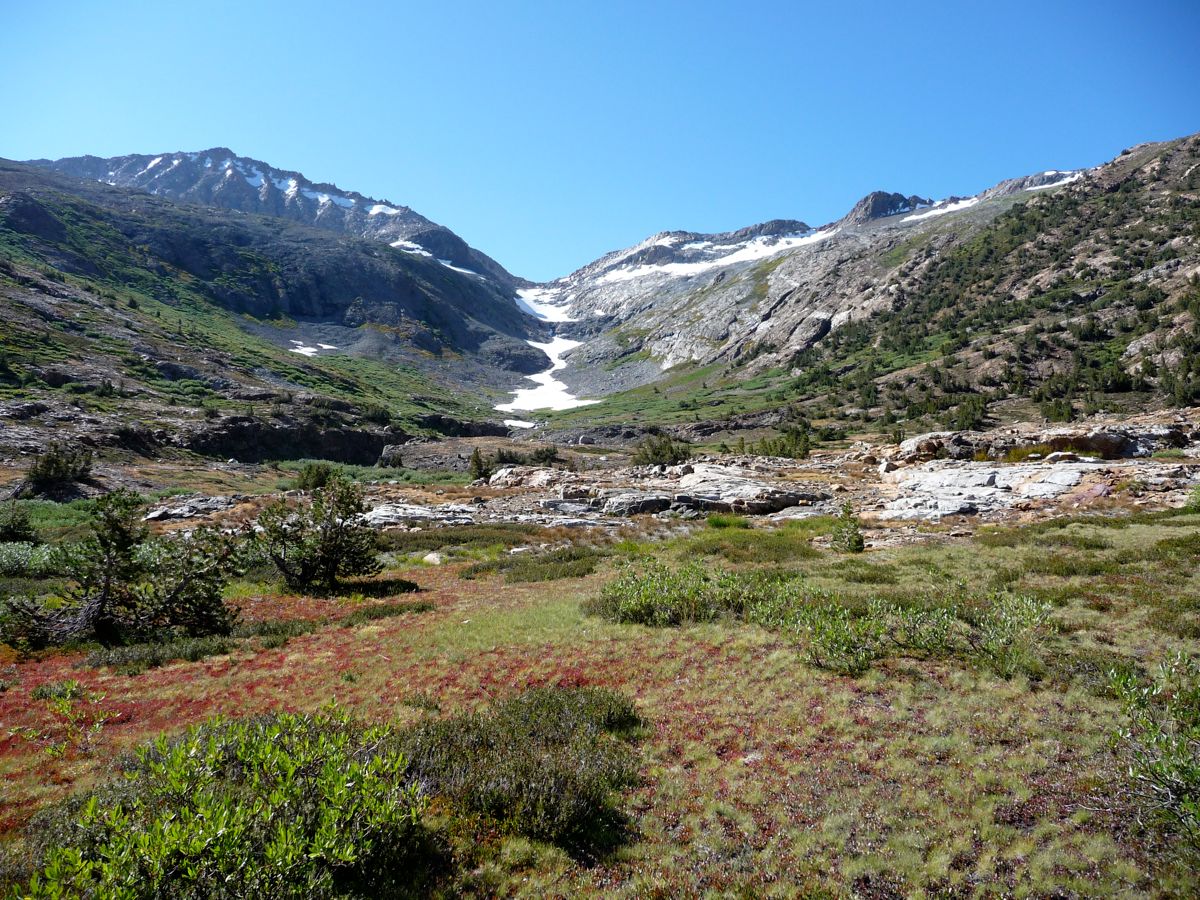
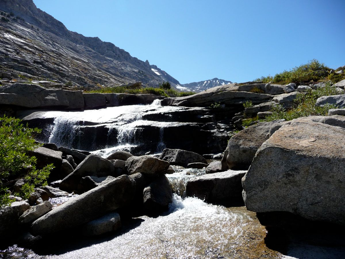
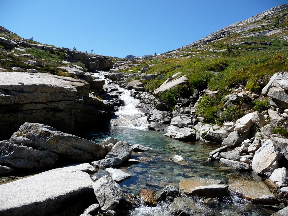
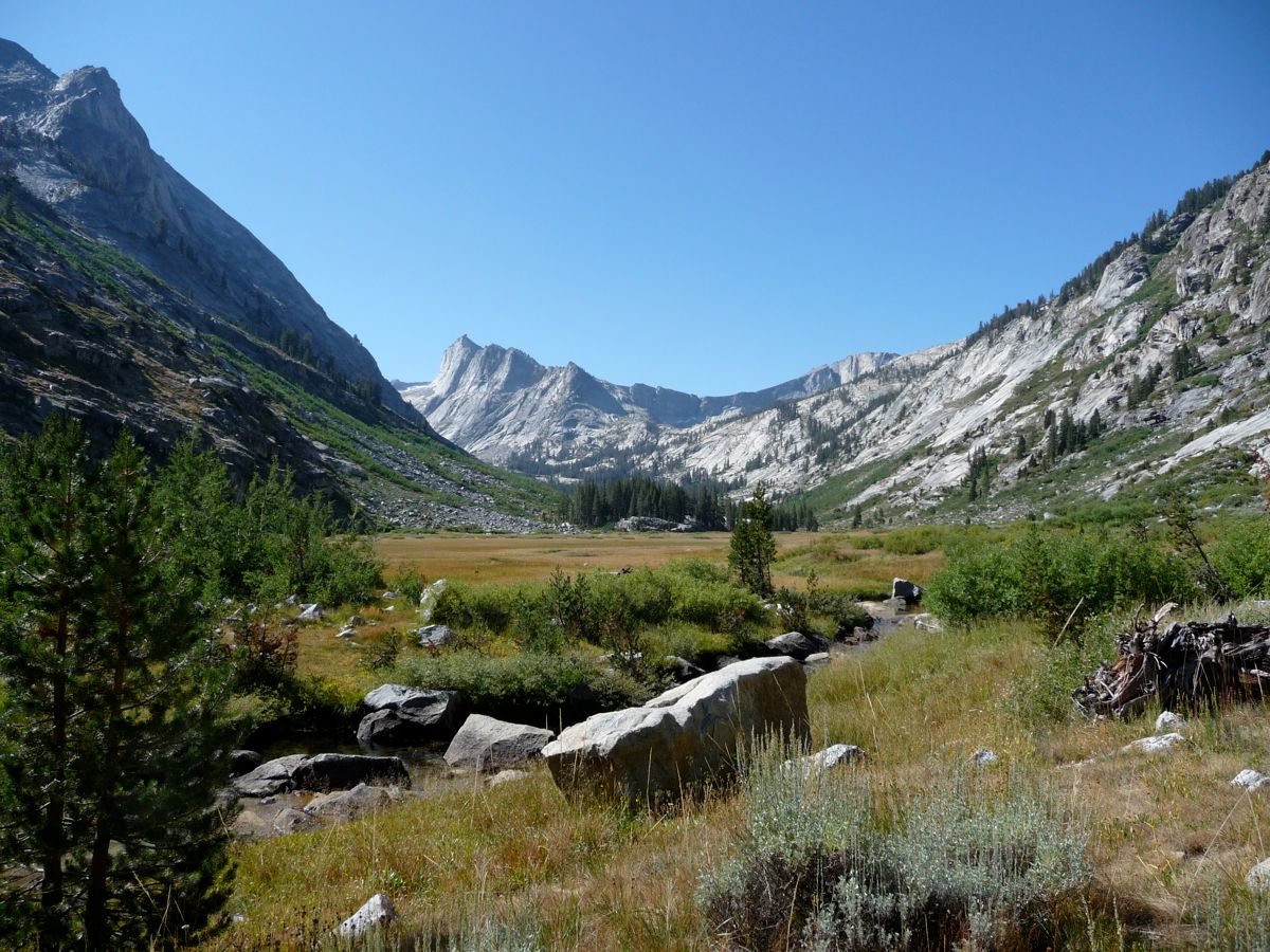
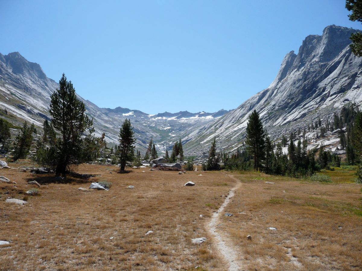
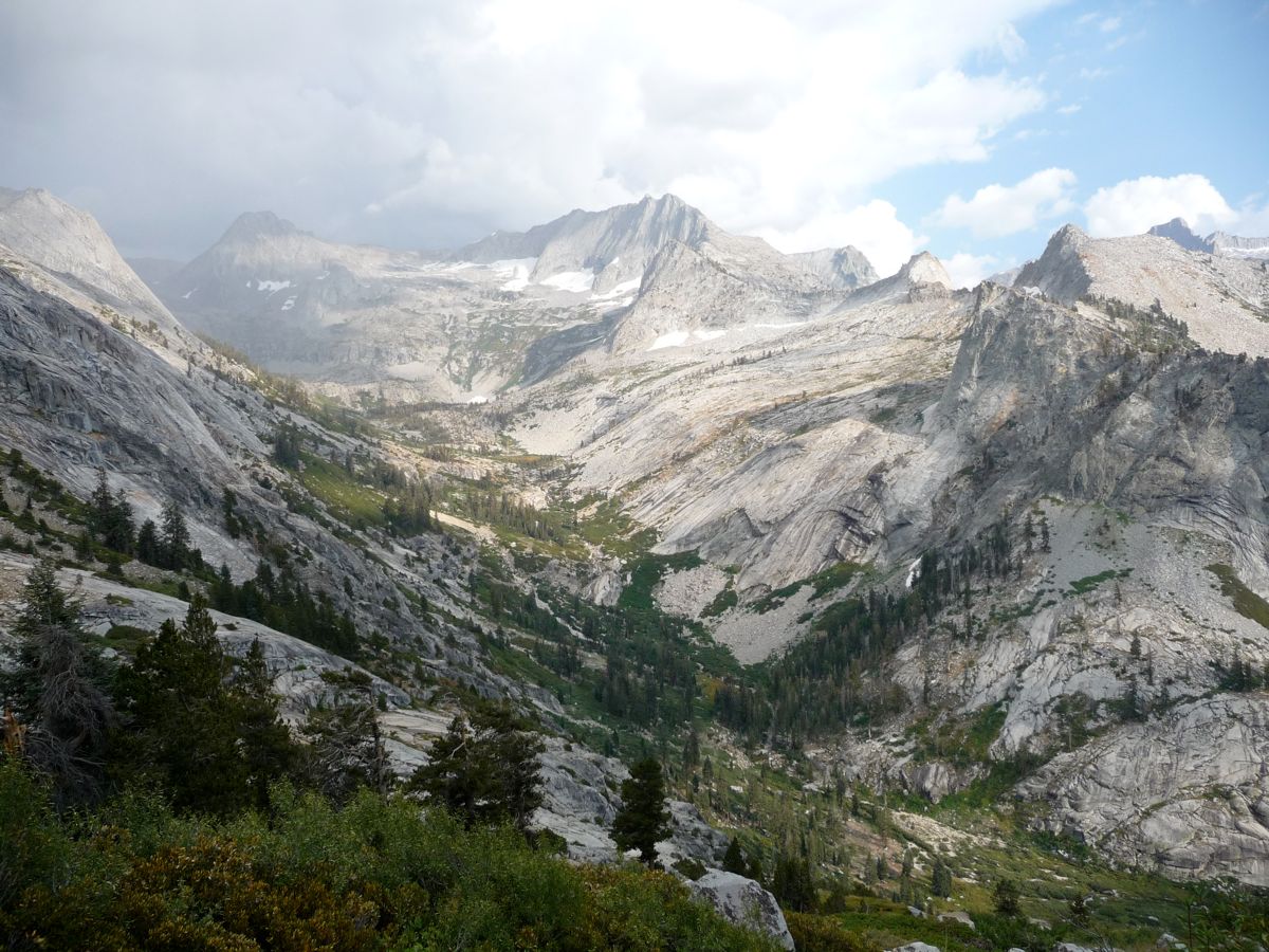
The trip up to Kaweah Gap was pretty quick, and soon I was staring down at the
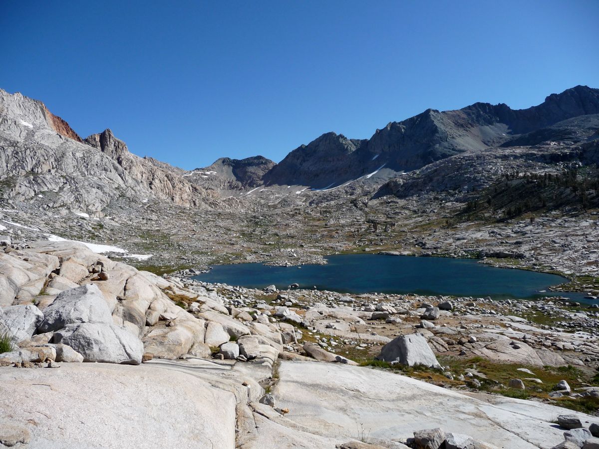
Heart-Shaped Lake and down the
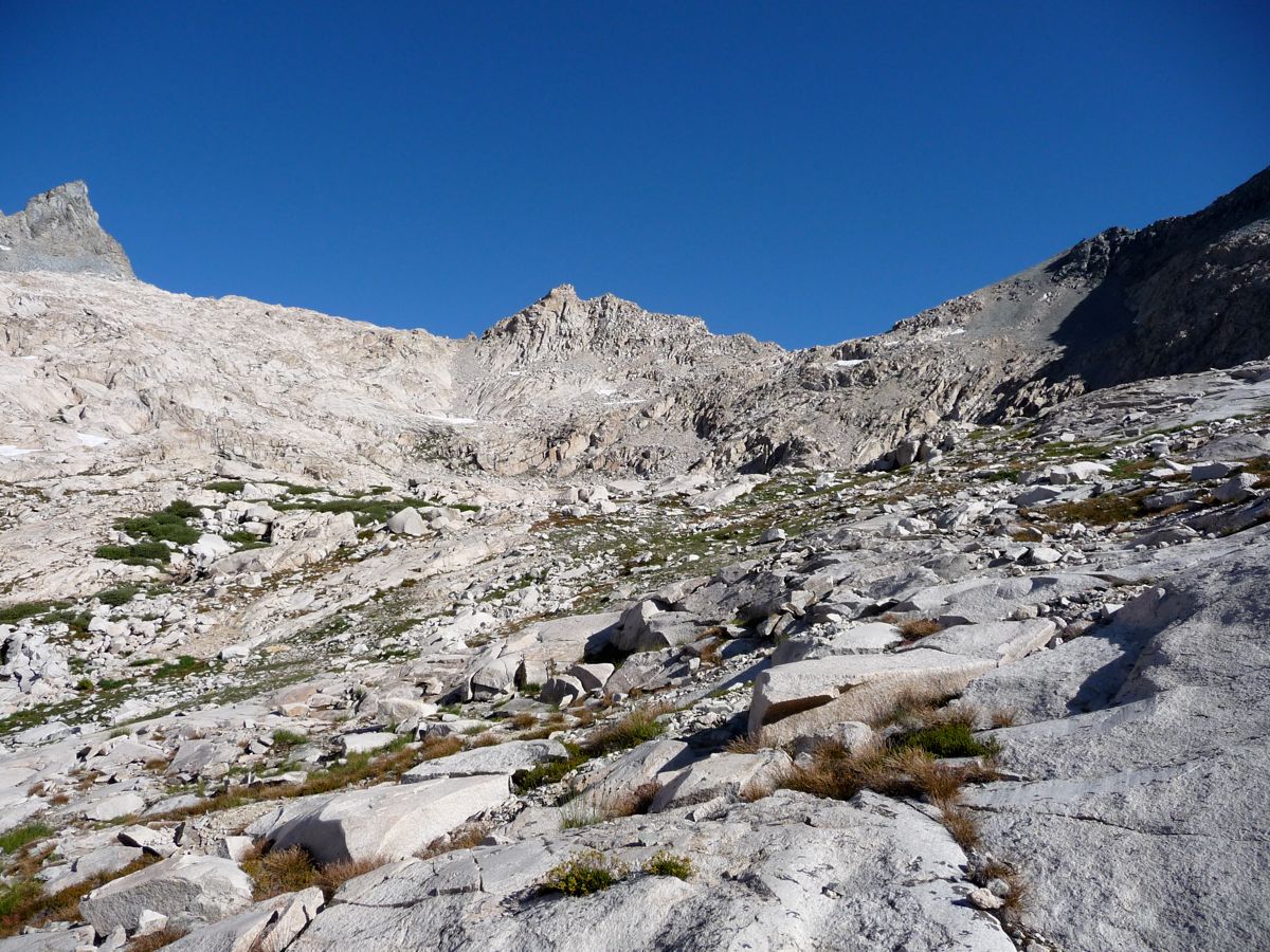
Big Arroyo. I descended to an area just south of the Heart-Shaped Lake, and crossing the stream at its outlet proved to be trivial. As I stared east, I deliberated about the best way to go to get up to the highest of the nine lakes. When I was I was in this area with my brother and cousin a few years ago, we met a guy who said you could make it up to the next lake in the chain by climbing up the rocks around a trickling waterfall. I think he was talking about
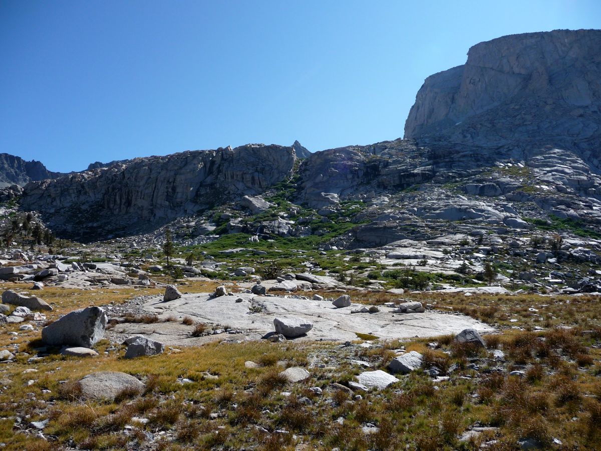
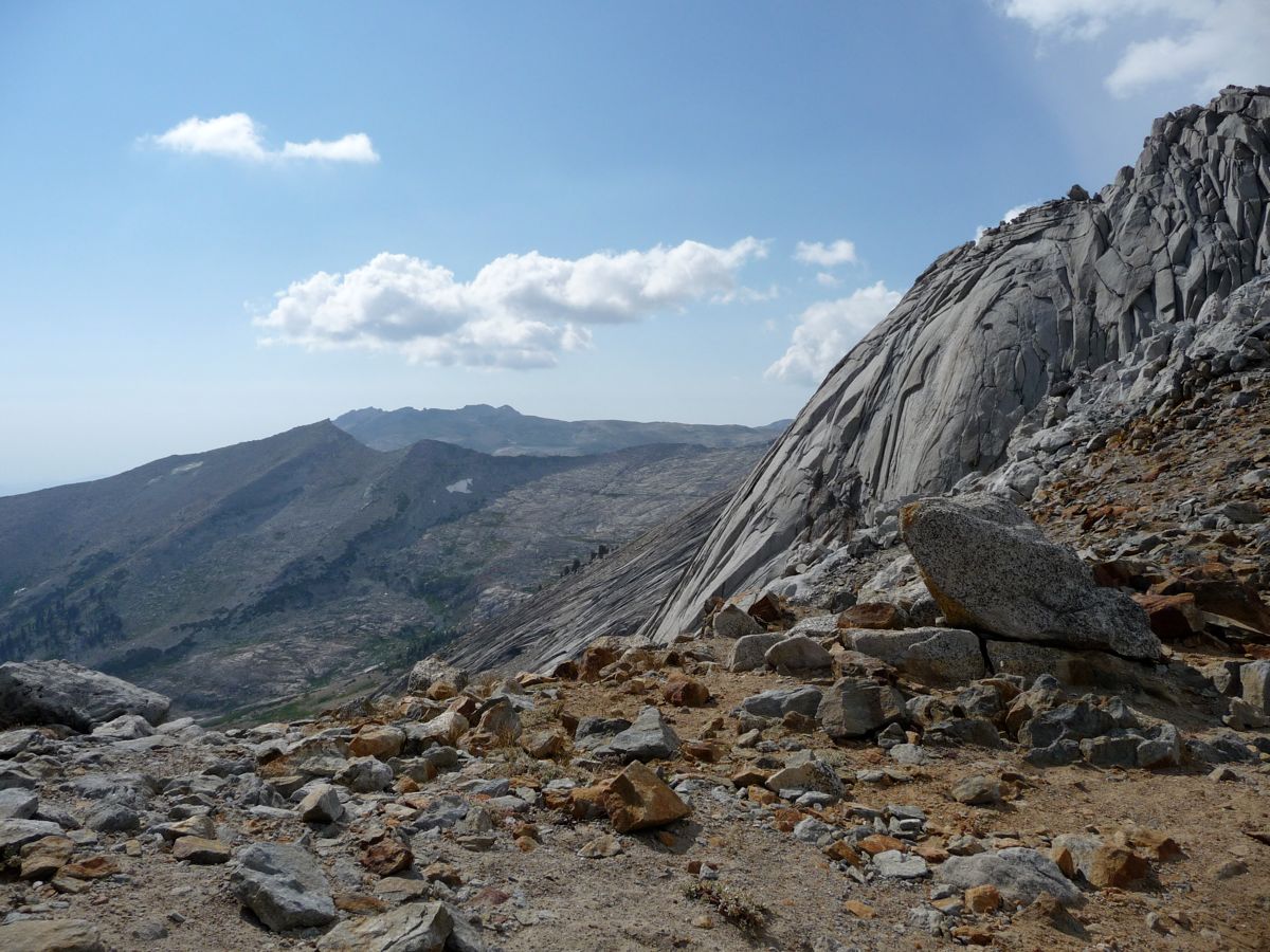
the little strip of green in this picture, but the closer I got to it, the more difficult it looked like it would be with a heavy pack.
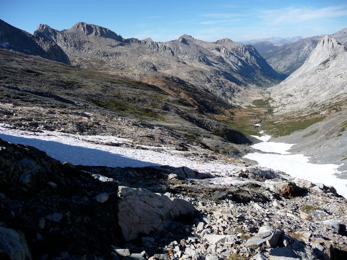
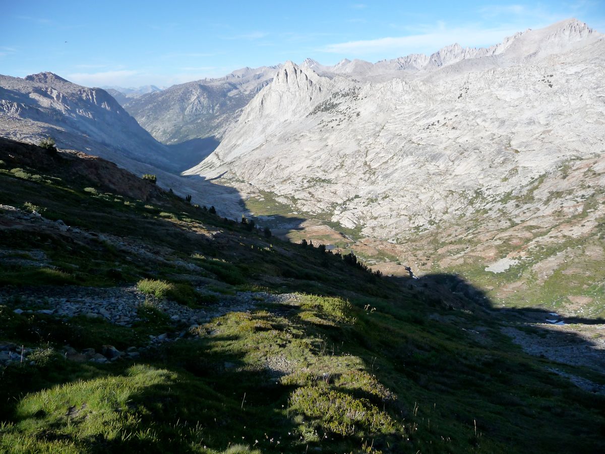
So I decided I'd head towards the
gradual slope to the northeast, which appeared to be a considerably easier route. I'm pretty sure I chose wisely because the
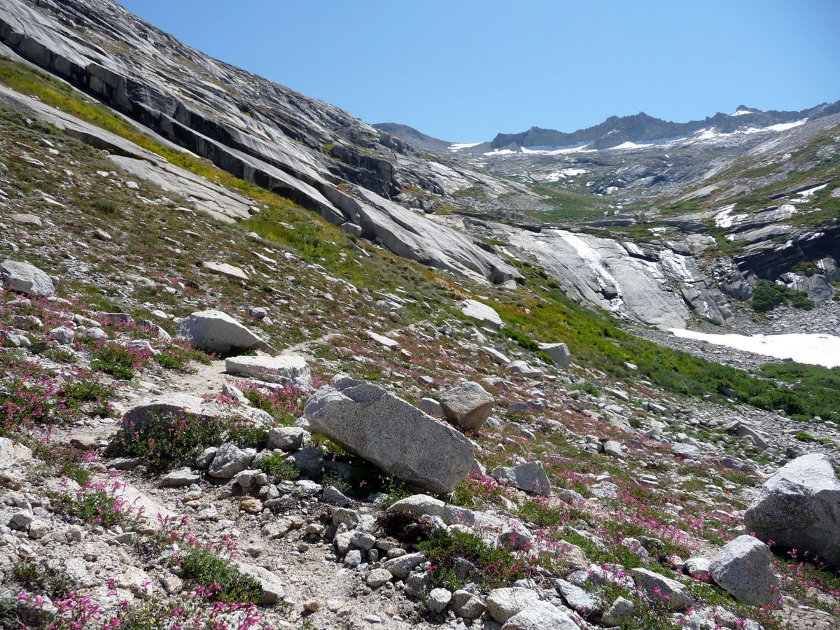
terrain in that direction made for smooth sailing. Everything that morning had been going perfectly: perfectly crisp temperatures, easy stream-crossing, and very low winds. I couldn't be happier with the conditions. But when I reached a
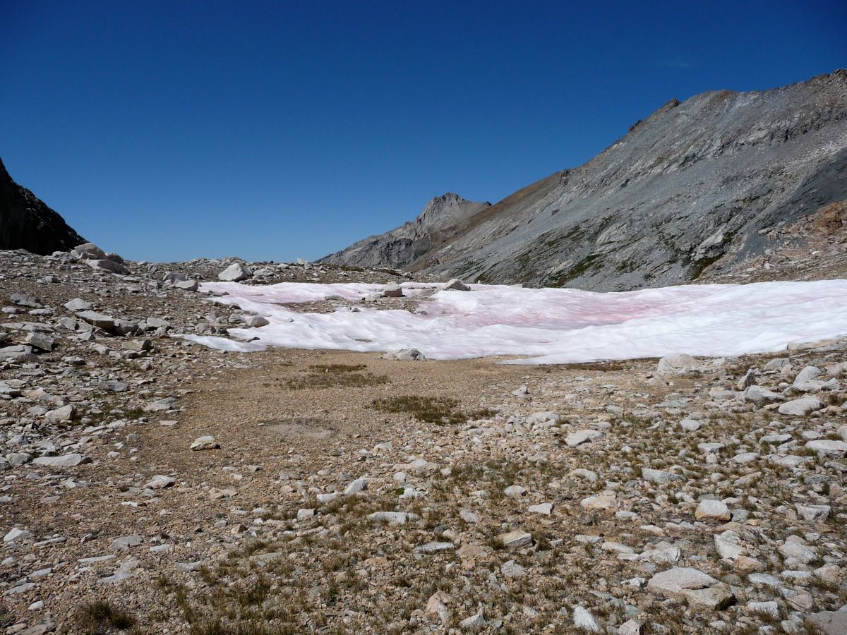
little wet spot at around 11,000 feet, the mosquitos changed my outlook on things. They weren't horrendous, but enough to make me stop and apply some repellant before continuing on.
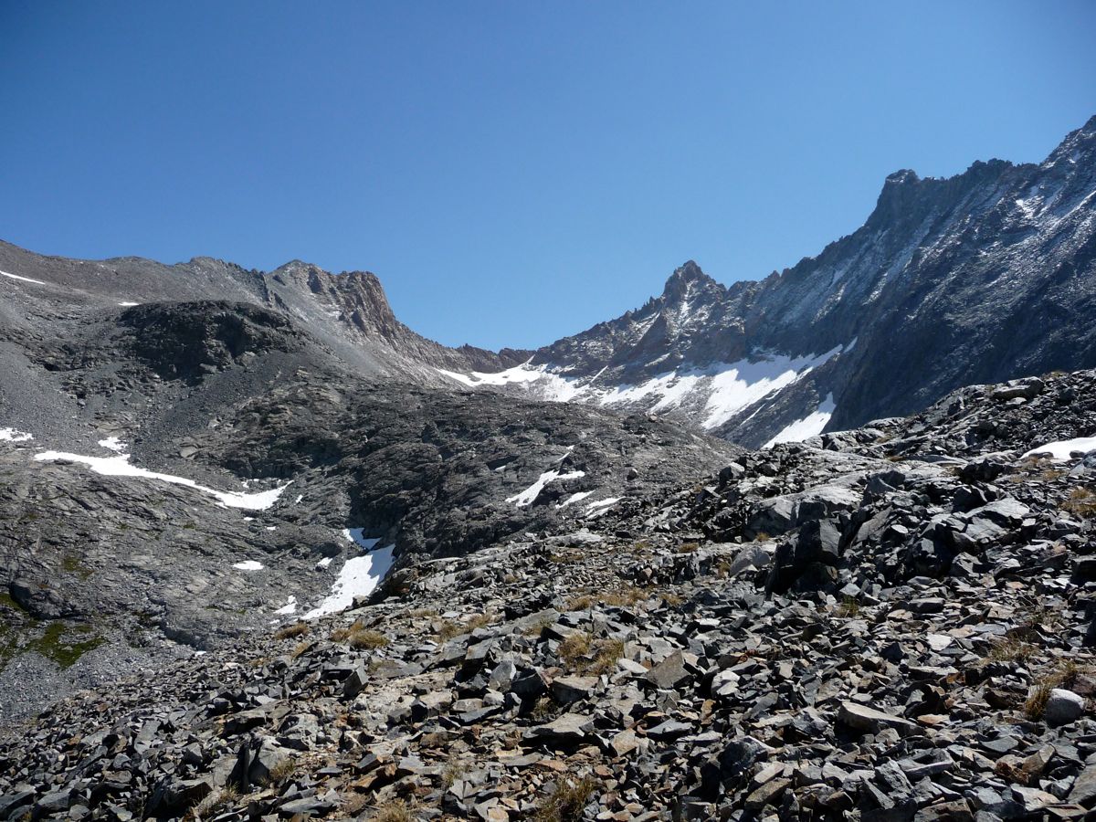
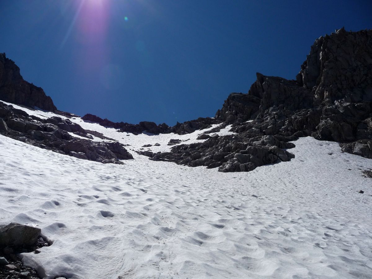
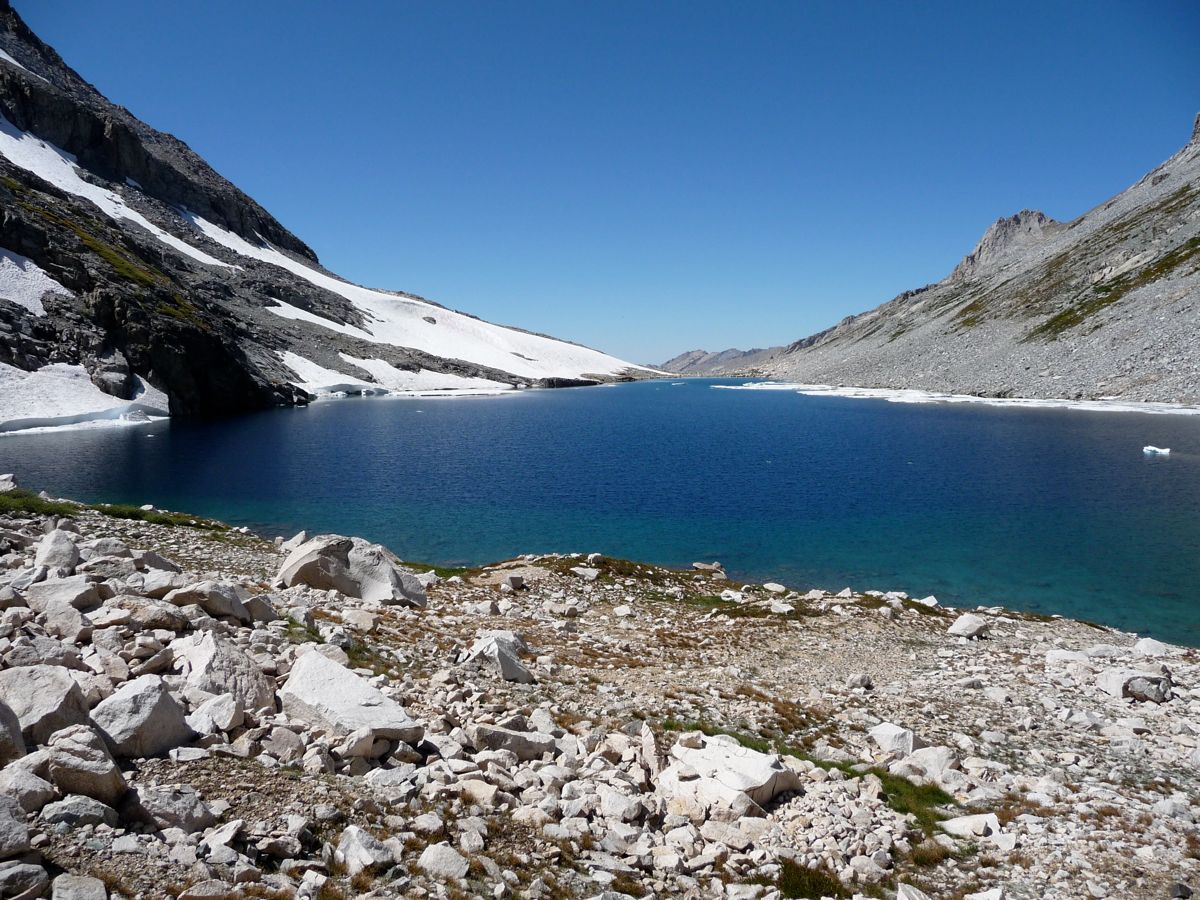
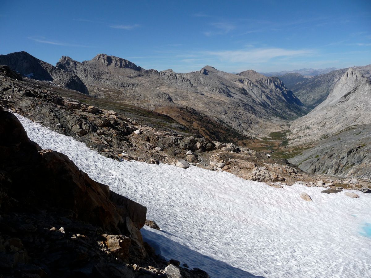
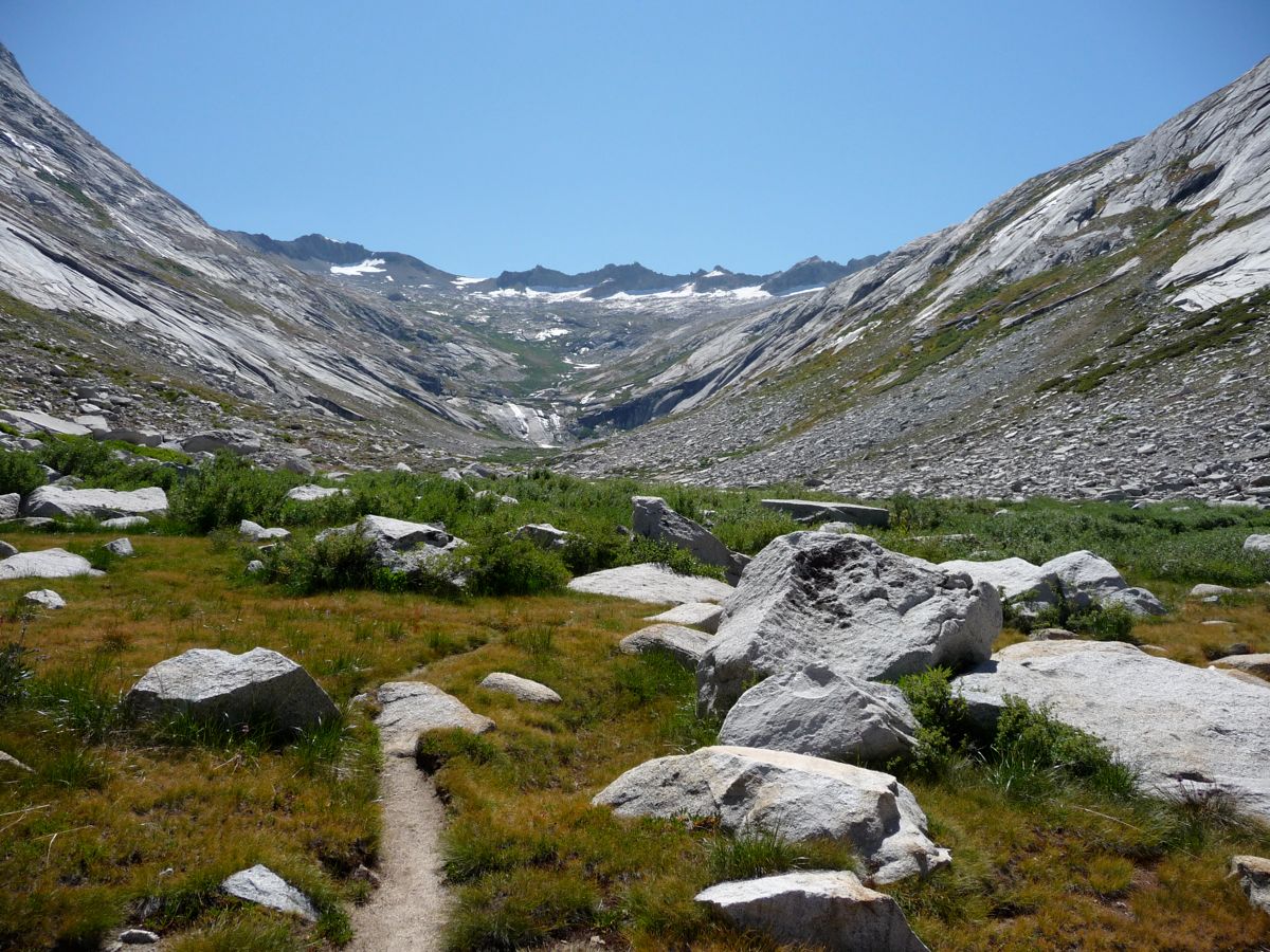
After making a little more progress, I reached a
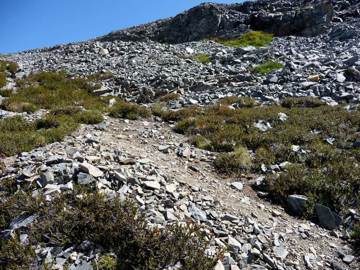
fairly steep slope. The going wasn't tough, though, as there is a well worn trail (visible in the picture) that takes you up and over the notch to the upper right. Once I had made it over that notch, I had a view of
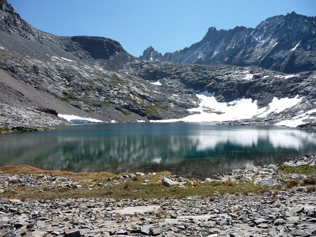
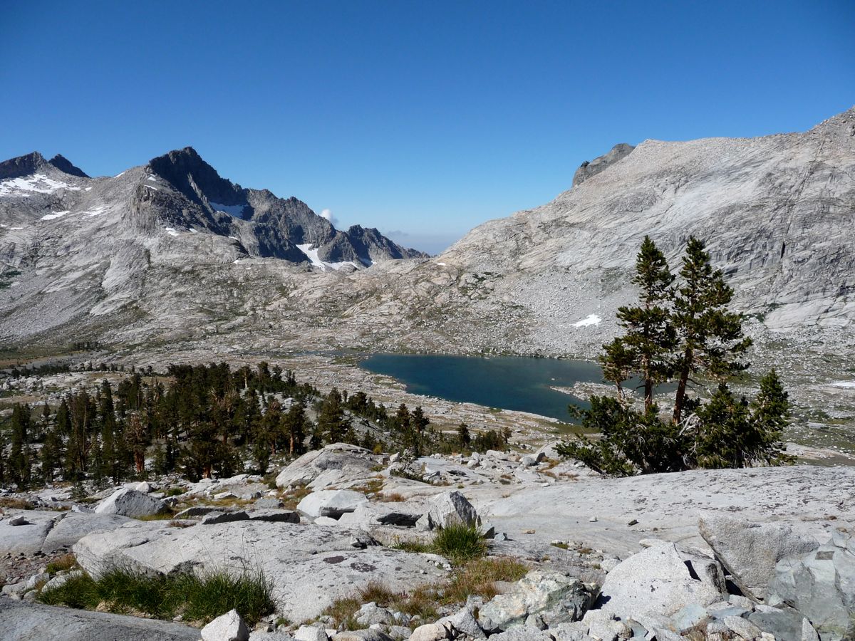
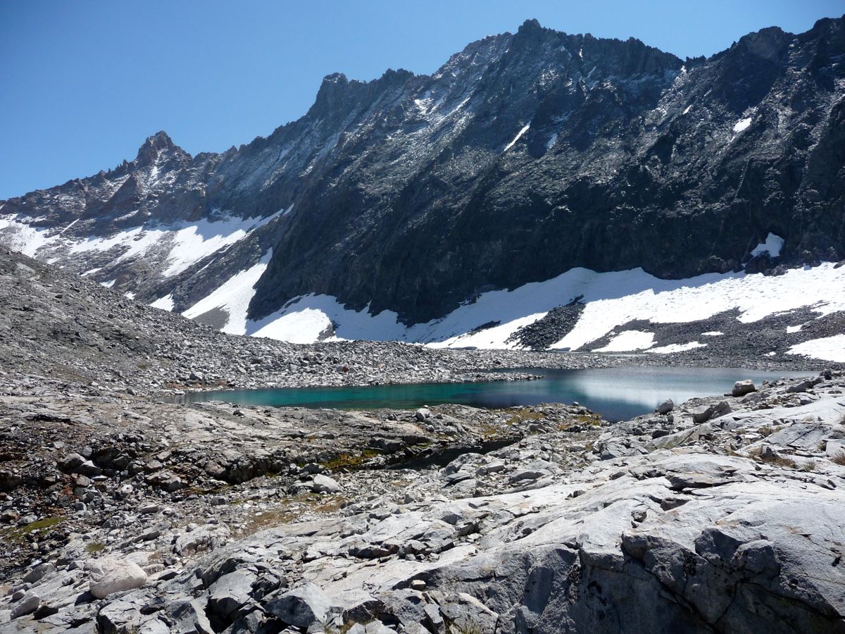
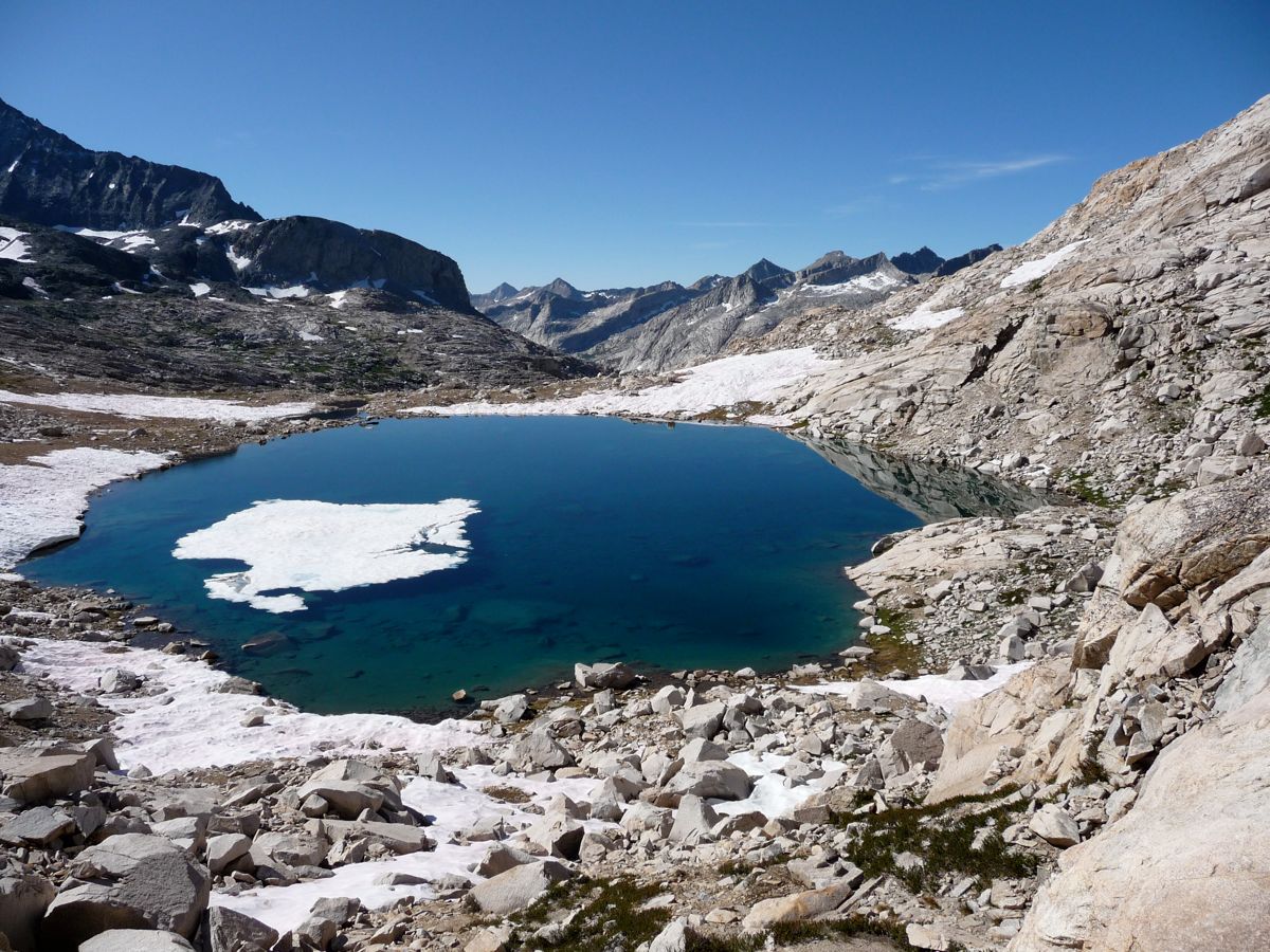
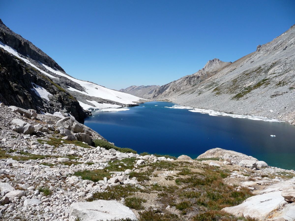
the second of the Nine Lakes. Simply gorgeous, I tell you. Looking
southeast, I could see where I was headed. I followed the southwestern shore of the lake and made an easy crossing of the
outlet stream that empties into that waterfall I mentioned before.
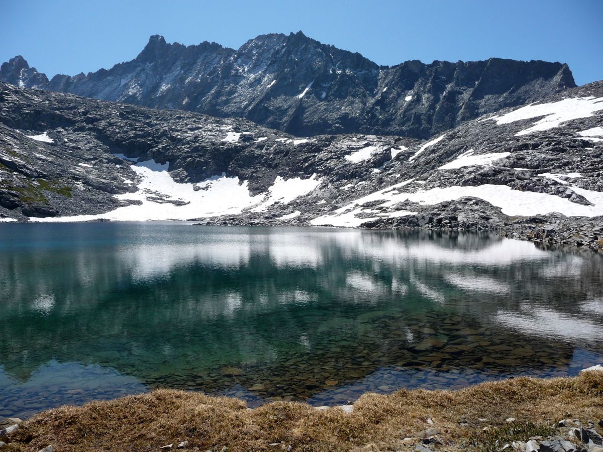
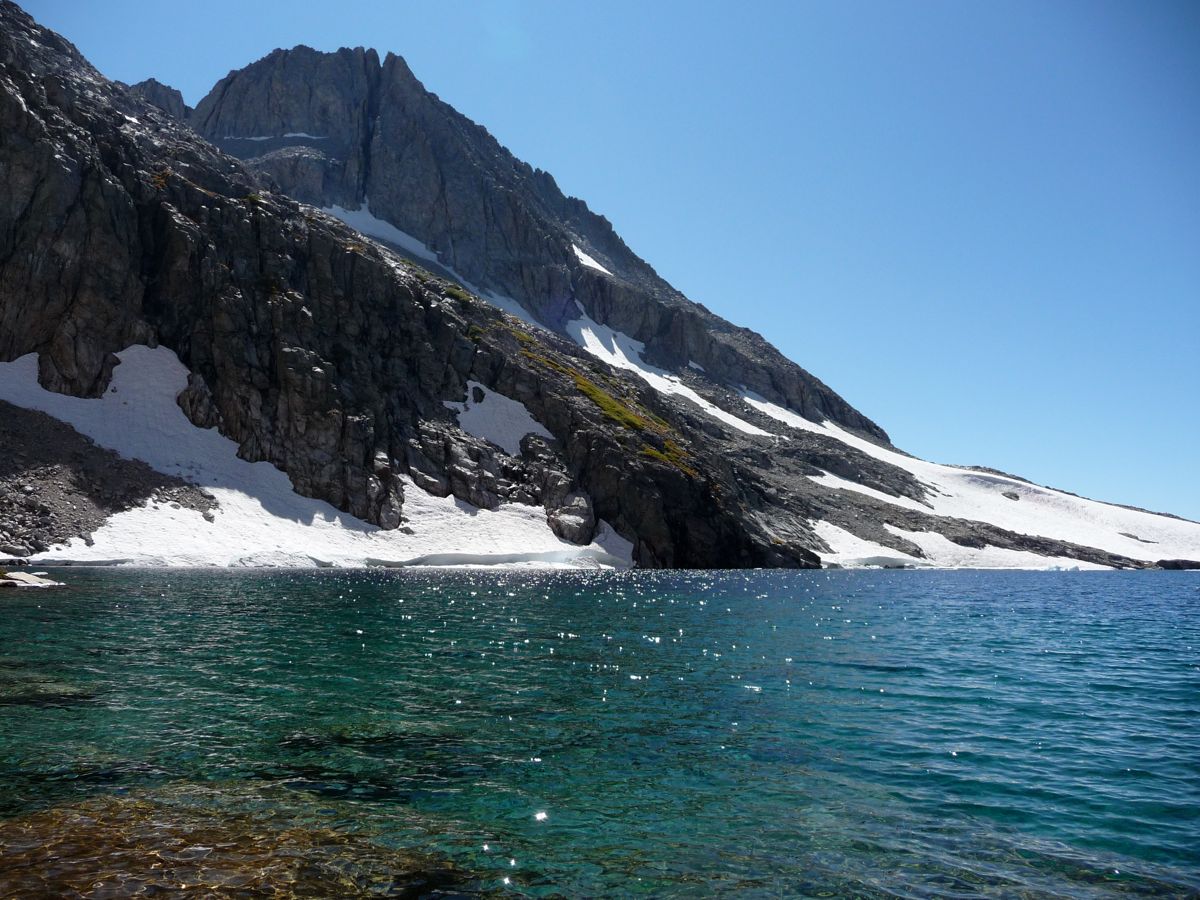
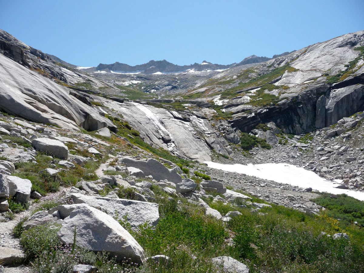
The ascent up to the next lake was not that difficult. There are a number of routes that would be suitable, but the one I ended up taking was the one that went
straight south (the image points east, but I'm standing on the southern route). This led me to the
northwest shore of the third lake.
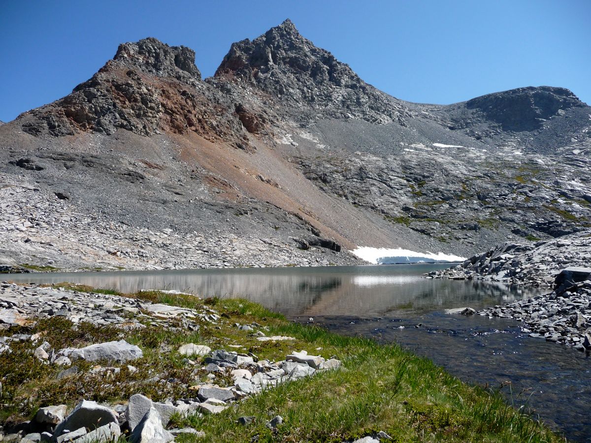
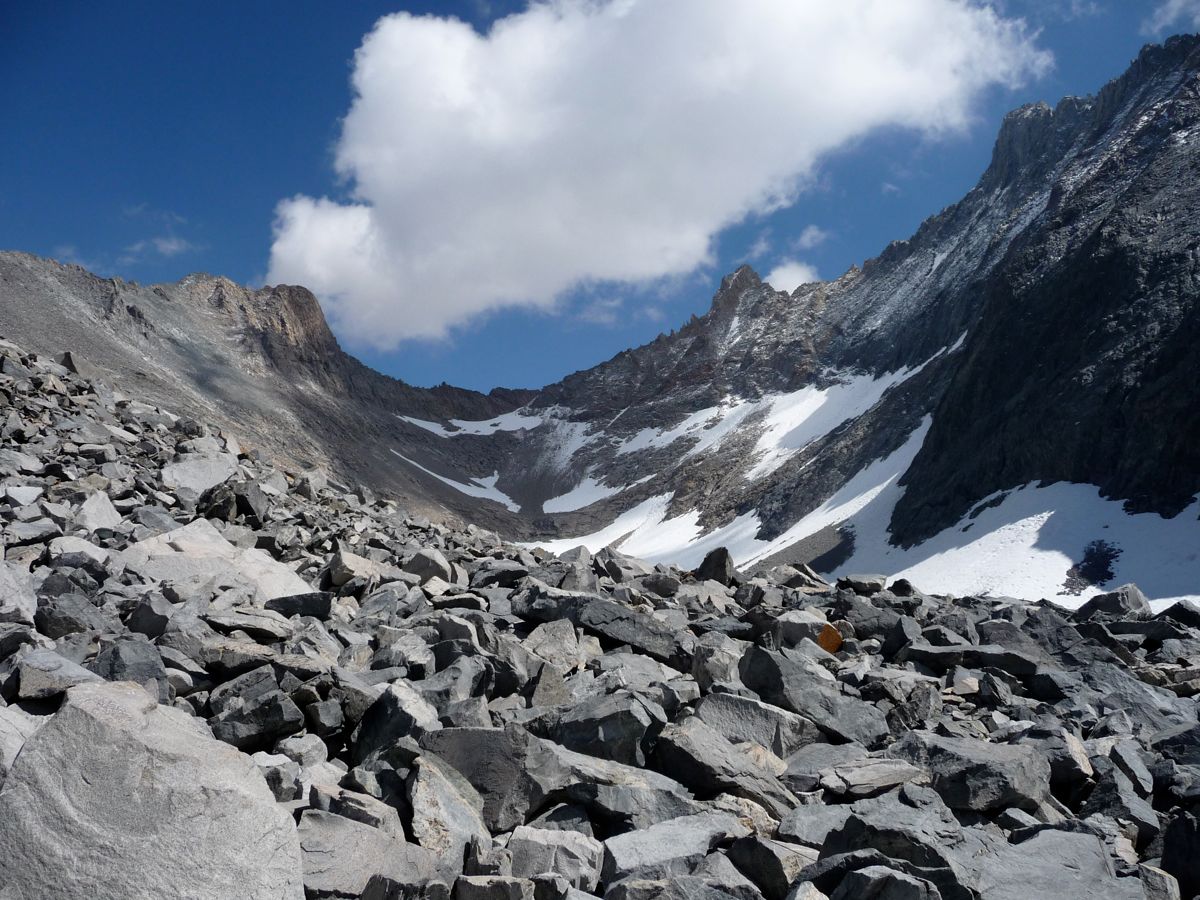
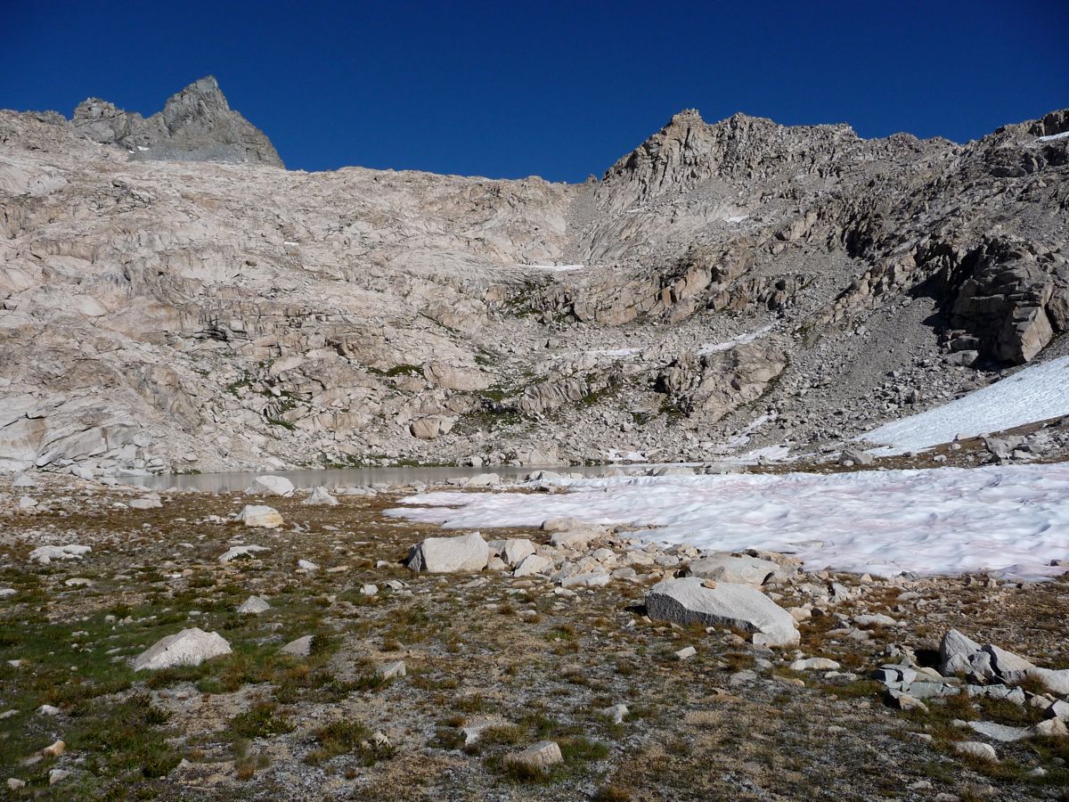
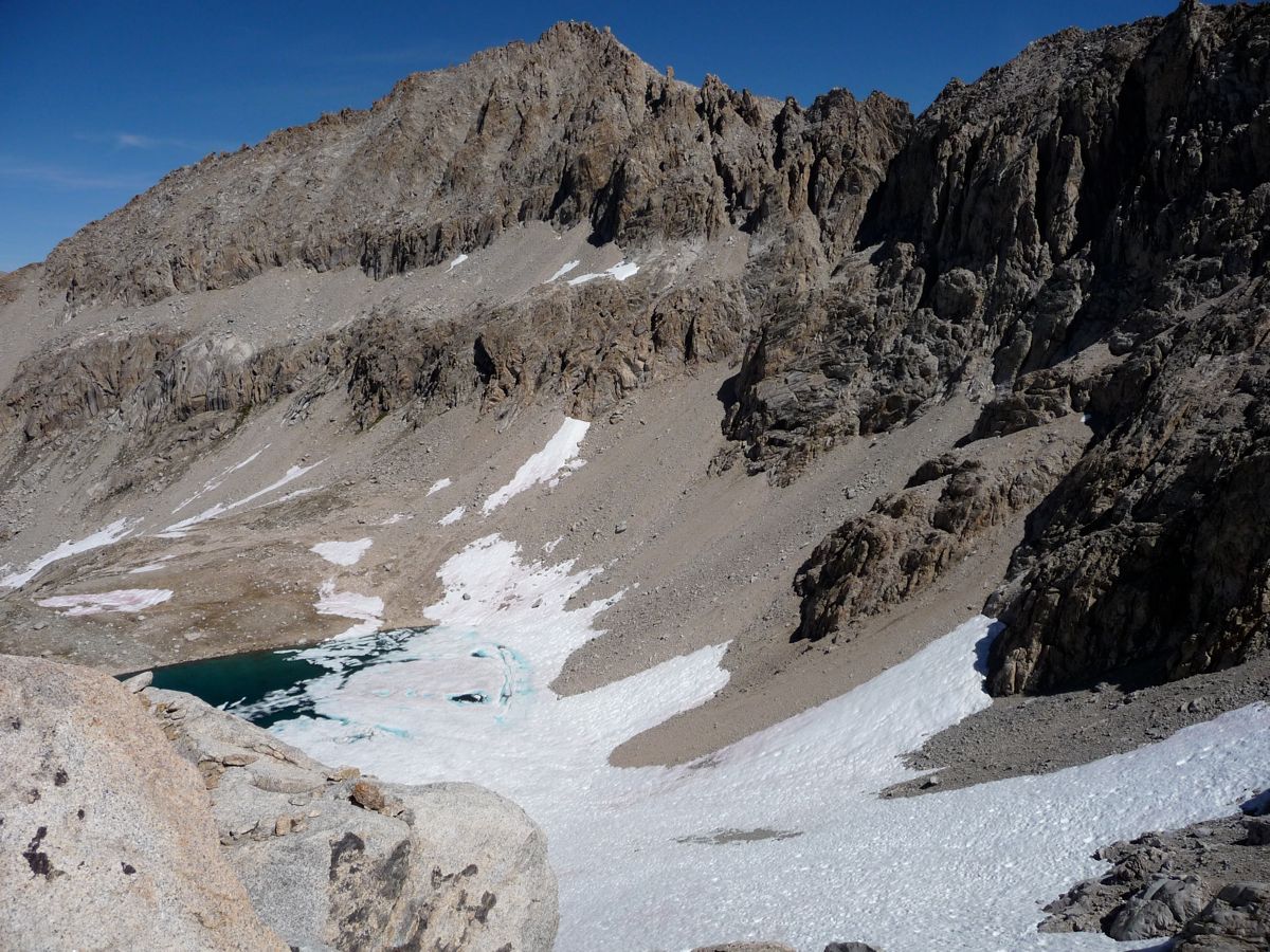
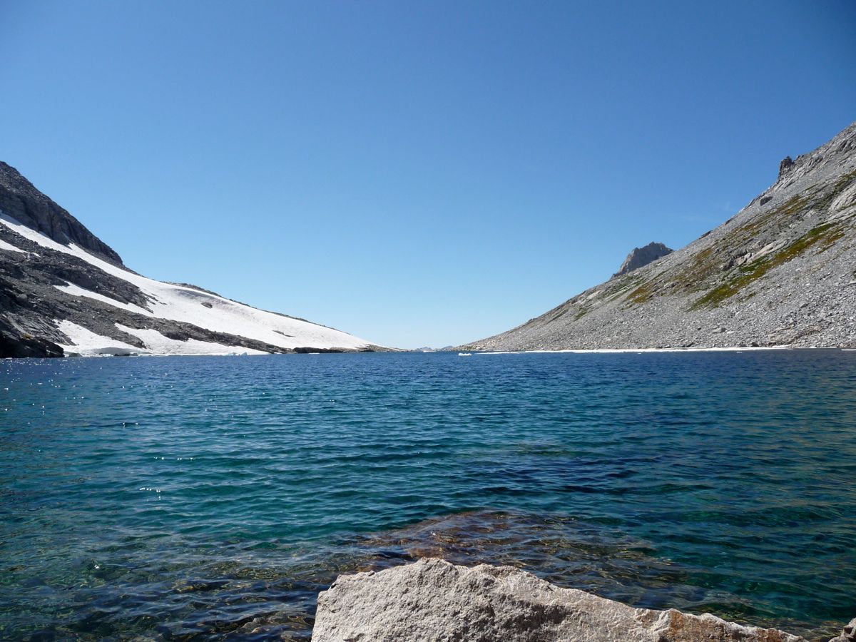
At this point I was pretty tired from a morning of ascending at +10,000 foot elevations, so I stopped to eat lunch and take a nap. When I opened my eyes about twenty minutes later, an appreciable amount of
cloud cover had formed overhead, mostly to the west. I couldn't hear any thunder or see any lightning, so I started my trek to the east, aimed at
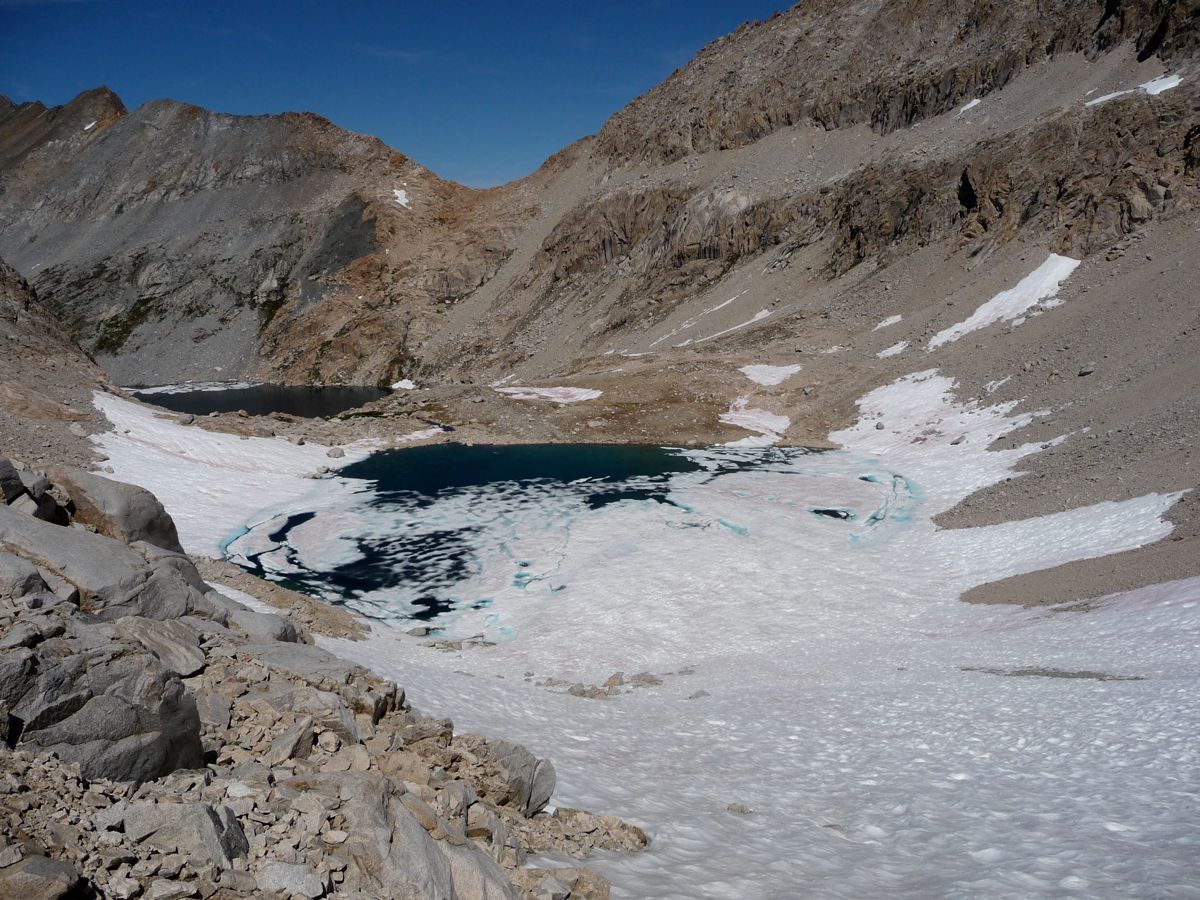
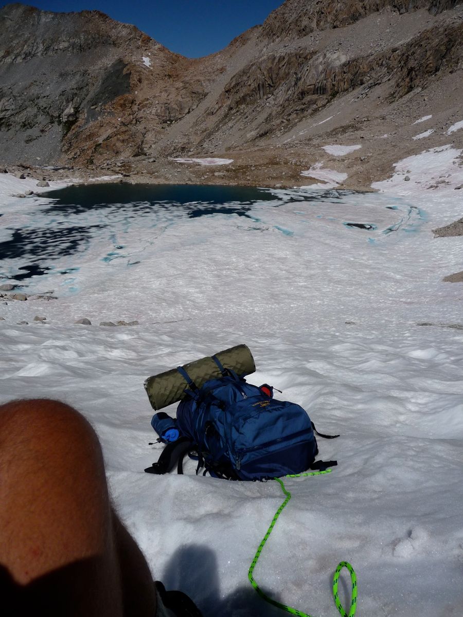
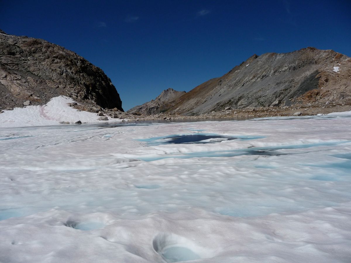
the Kaweah Queen Gap. There was still a ton of snow and ice along the north shore of the lake, which made things a little tough. But there were also a number of
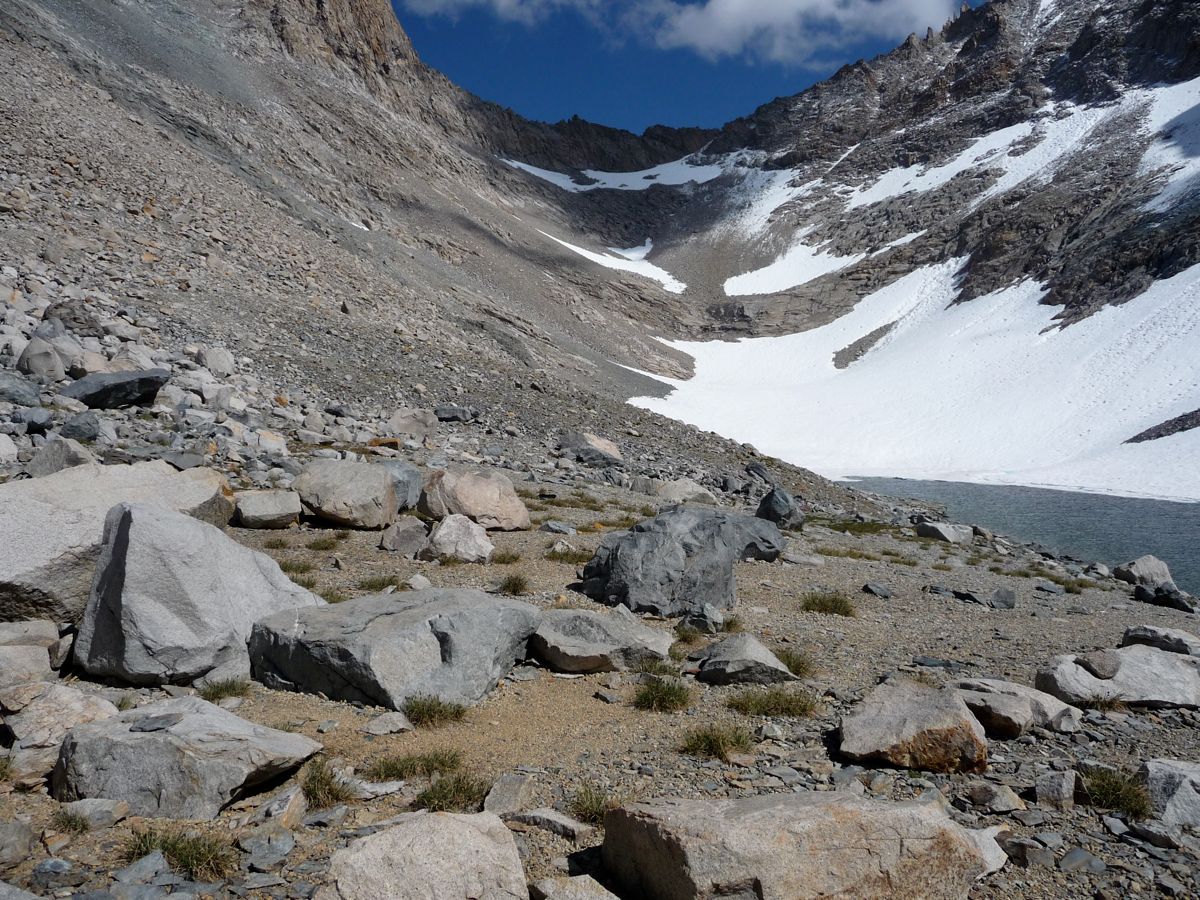
flat patches of ground not covered by snow that would have made for a perfect campsite.
As I drew nearer, with the clouds creeping in from all directions and
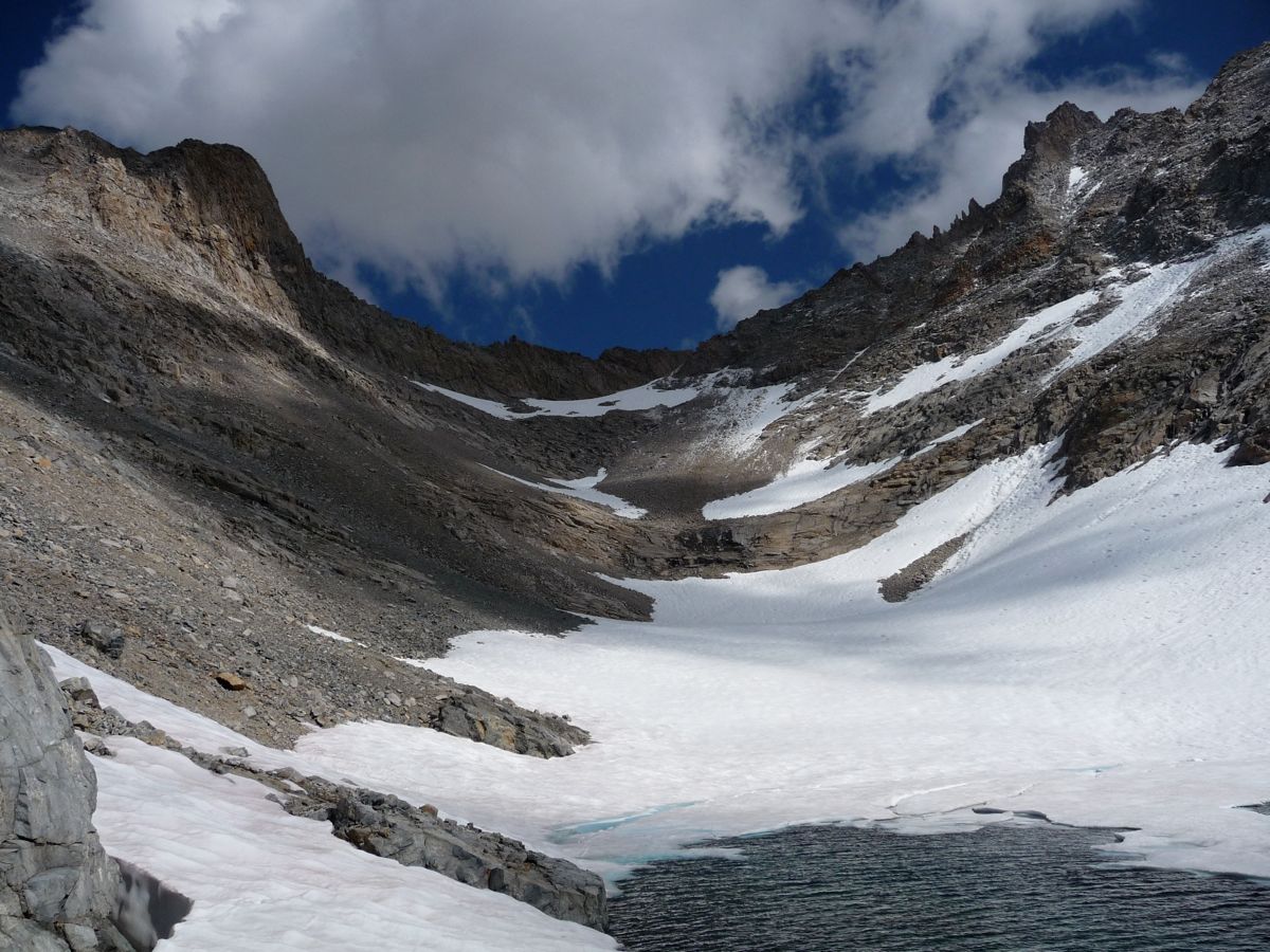
the snow and ice looming in front of me, I started to doubt the safety of going over the gap without crampons and an ice axe. From where I was standing, it looked like a very steep approach to the gap. I studied the topo map and compared the contours to other passes I had done before, and the more I thought about it, the more risky it became to me. So I decided I'd try Kaweah Basin next year when I was prepared with the proper gear. It was dissapointing to have to turn back, but I believe it was the right call.
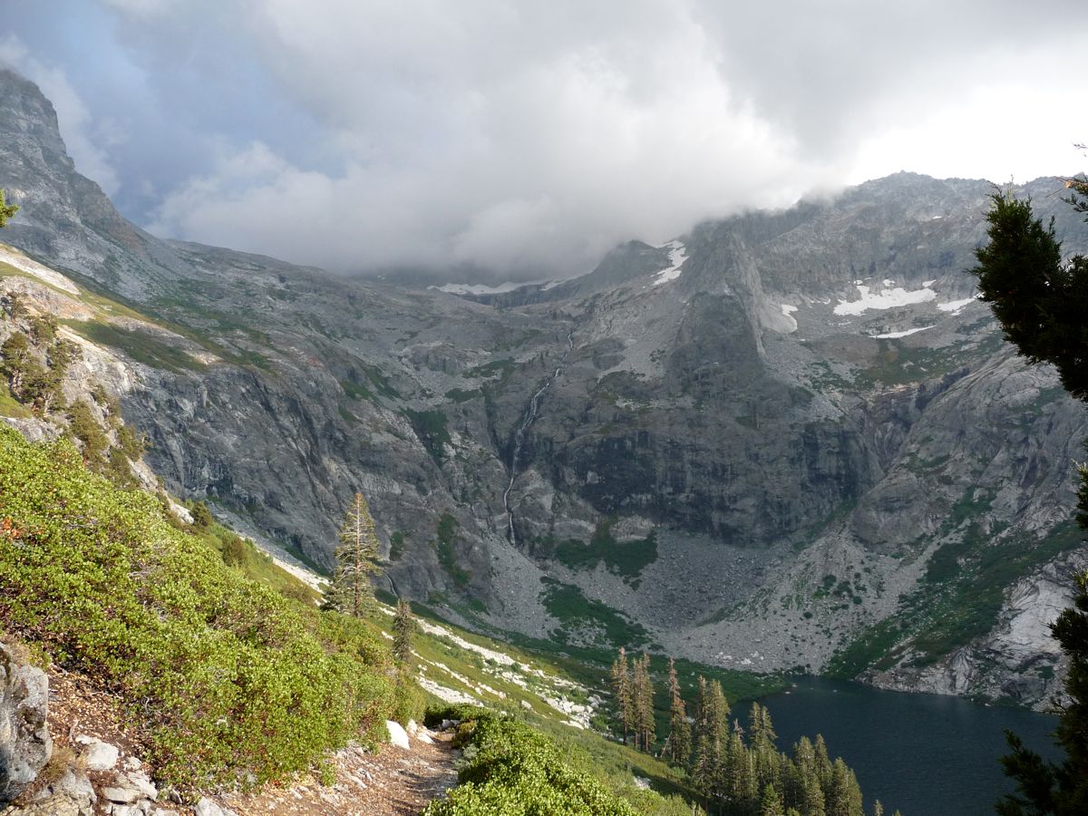
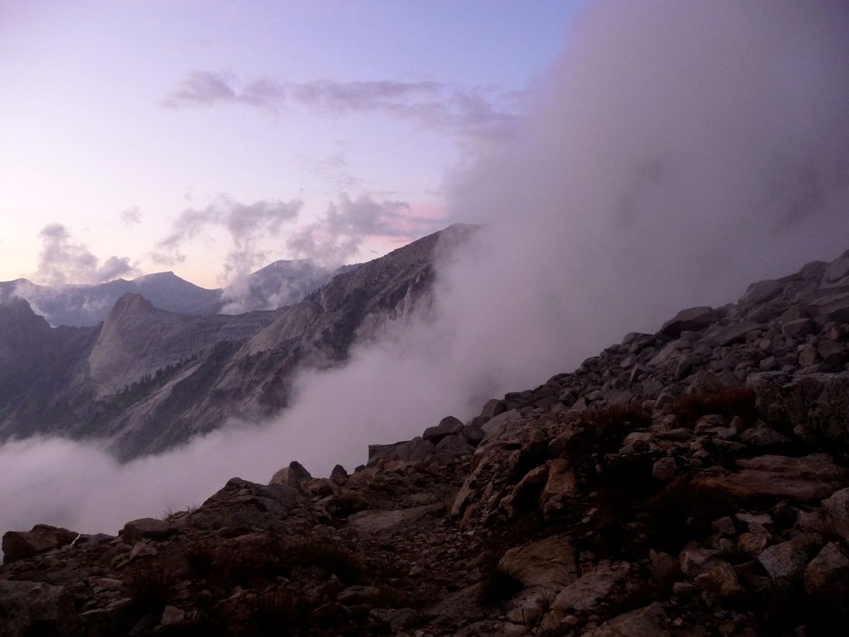
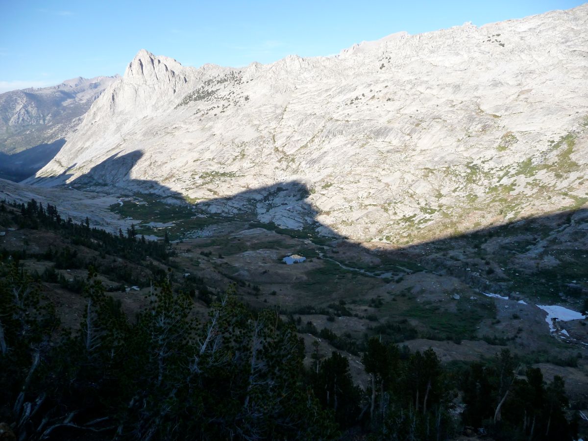
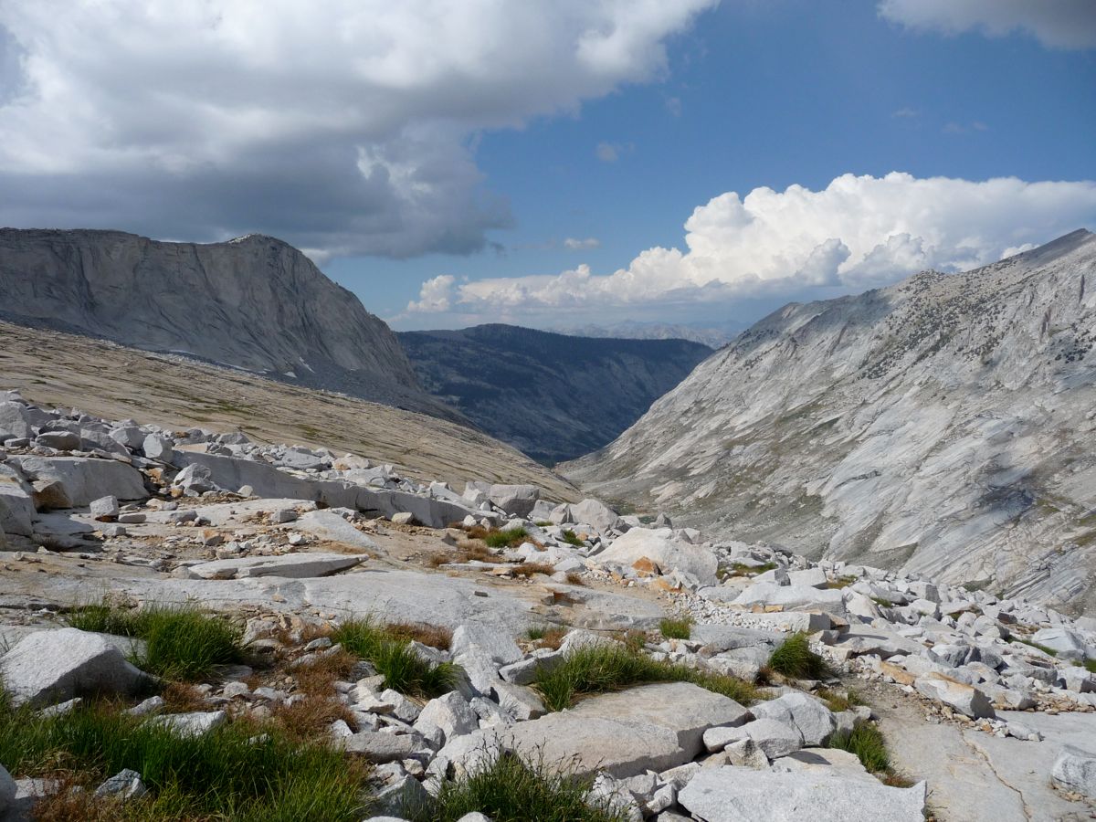
What I decided I'd do instead of going over into Kawaeh Basin was to check out Lion Lake and hit up Cloud Canyon, both of these being high on my list of places to visit in the park. So I followed the same route back down with the intenion of making it to the lake just north of the Heart-Shaped Lake by nightfall. I was treated to some
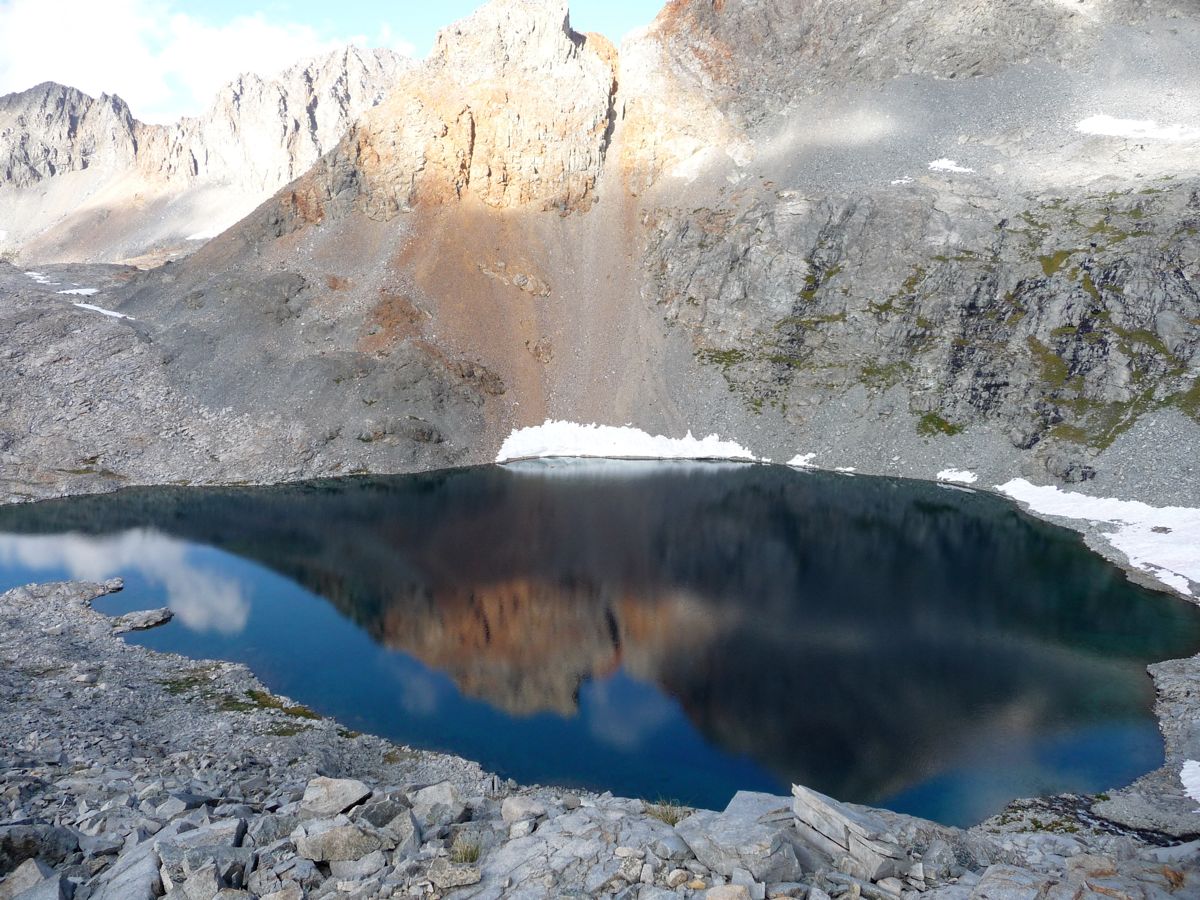
spectacular reflections from the Bean-Shaped Lake as I descended, and when I stopped at its outlet, I caught one of the most spectacular visions I've ever had as the
clouds crawled over me from the valley below.
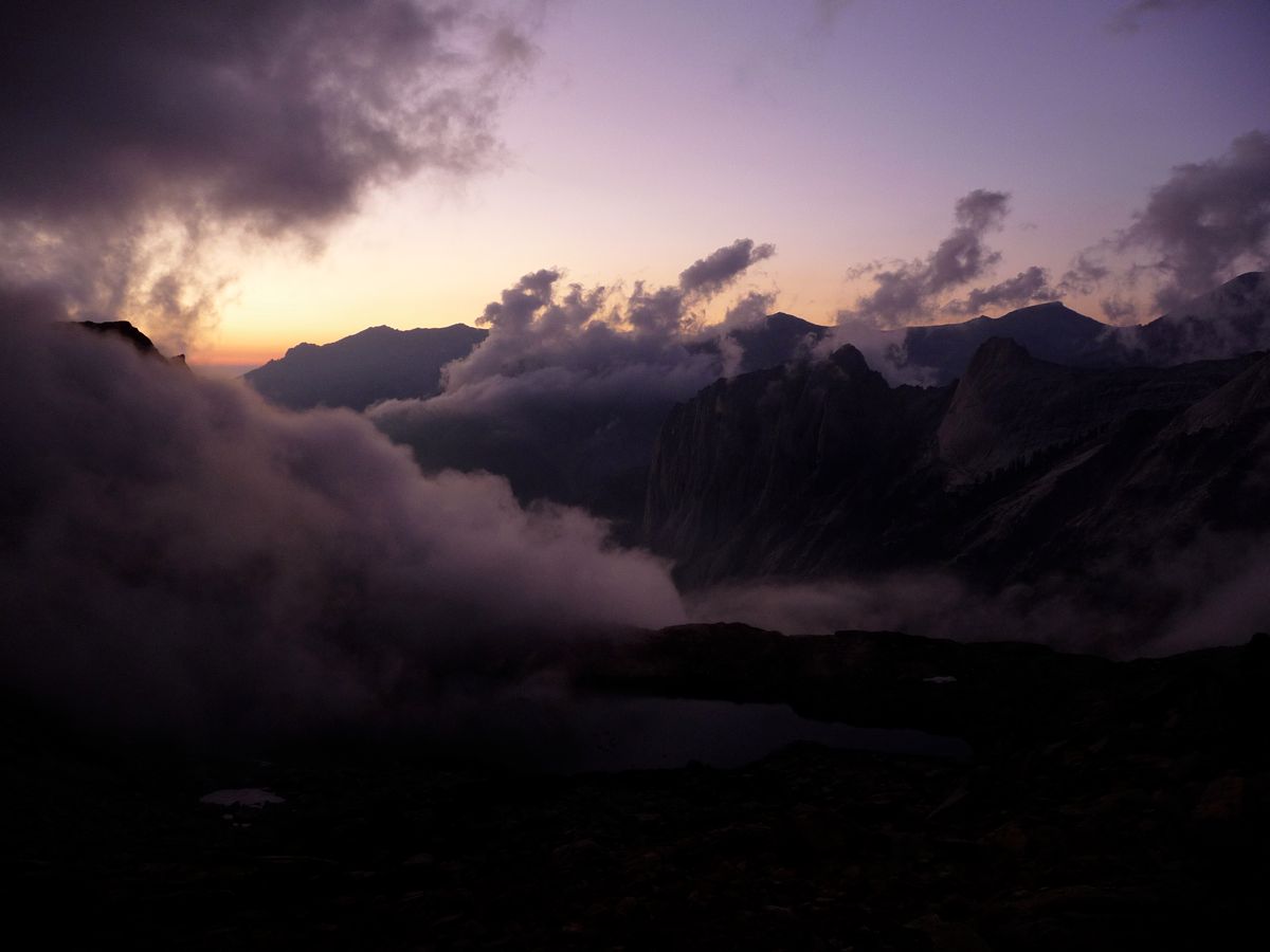
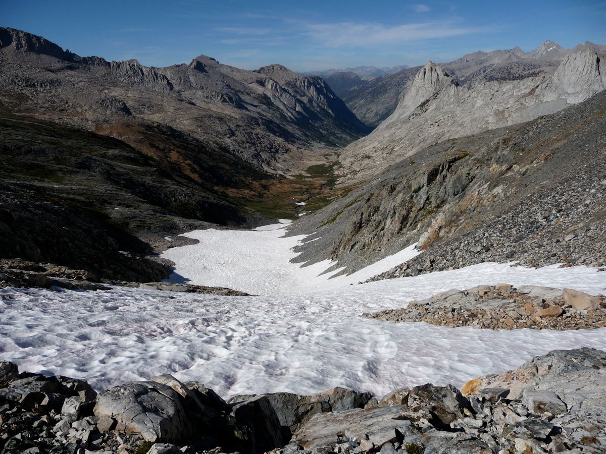
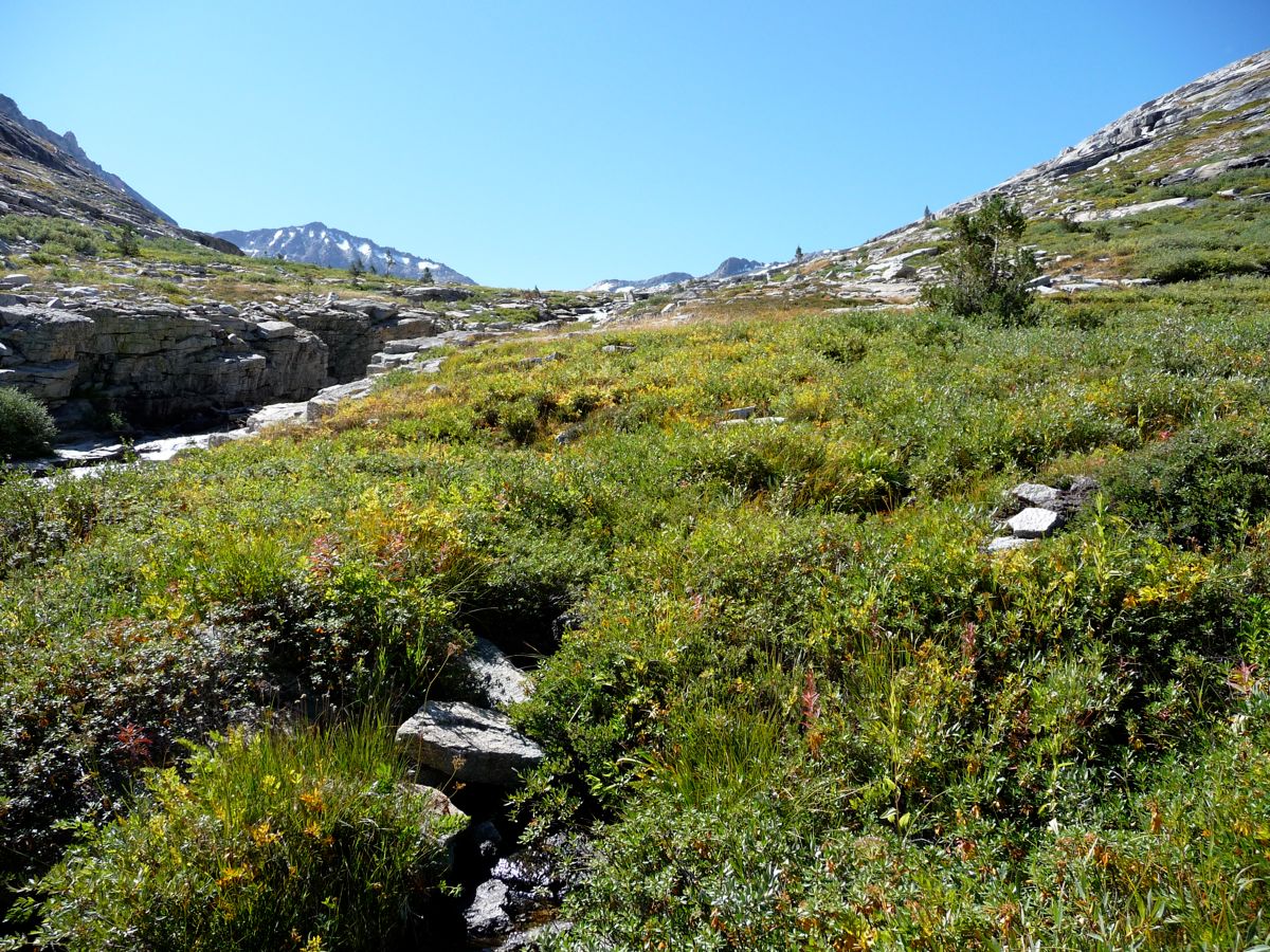
Getting down to the lake proved to be an easy exercise of boulder hopping and trotting over
easy terrain. You can see the route I took from the GPS waypoints above, but there are plenty of possibilities due to the fact there are nearly no sharp drops in this upper reach of the Big Arroyo. On my way down, the clouds continued to
put on a show all the way until I finally reached my
campsite for the night. And the
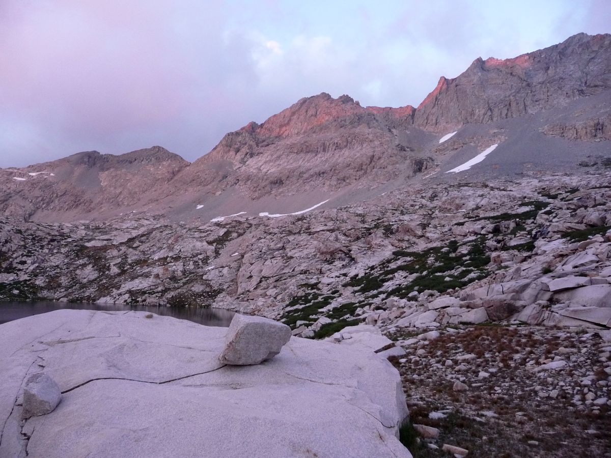
alpenglow made a wonderful substitute for television that night as I enjoyed my dinner without a fire.
I woke up this morning knowing full well that this would be the most challenging day of the trip. I remember that while I was eating breakfast, my eyes and mind were fastened on Lion Rock Pass. How best to approach it and how much ice and snow would there be on the north face? And what about the pass going to Cloud Canyon? Was this going to be just as treacherous as the Kaweah Queen pass? These were the questions that rolled through my head. The only way I was going to find out, though, was to get up and see for myself.
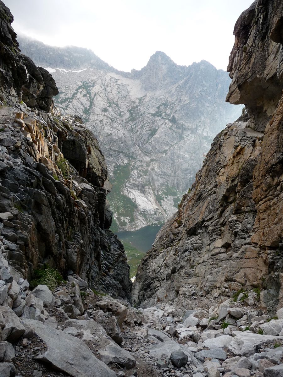
Traversing the
east side of the
lake proved to be a lot easier than I expected. Just a bit of boulder hopping and I was at the northern shore where I
easily made my way up to the
northernmost lake in the basin. There was a field of snowcups on the eastern side of the lake that I had to walk over to get to the northern edge of the lake, but with a slow pace I made it without putting myself in any sort of danger.
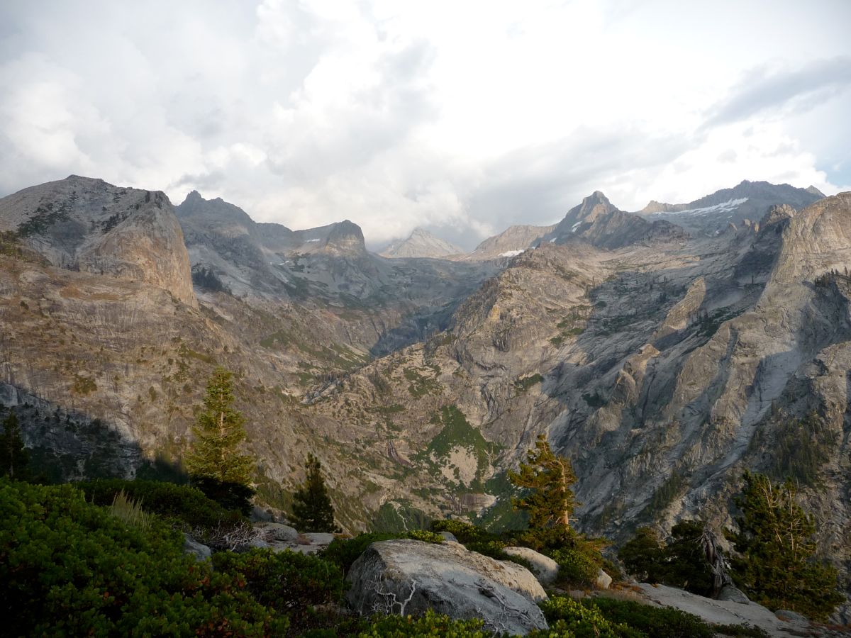
Switching between staring to the north and studying the map, I still wasn't sure what the best route up to the pass would be. And furthermore, I wasn't completely certain that there was just one pass. It looked like I had the option of going to the west or east of the little notch to the east of Lion Rock. But what I could see was that the stretch just to the north of the lake would be the easiest way up for at least the beginning. So I started to climb, taking my time to enjoy the
phenomenal view back toward Kaweah Gap.
At about 11,500 feet, I reached a
point where I had to decide whether I was going to attack the east or west side of the notch. The map showed they were about equally difficult on the north side, so I chose the one that looked easiest on the south side, and that was the eastern route. After some huffing and puffing, I finally reached got to the little saddle I had been aiming for. But when I got there and saw the
view below, I was a little dismayed. The nicely sloped section I was planning on descending was completely blanketed with snow. And that wasn't all; the first part of the descent was this incredibly steep little chute, maybe 60 or 70 feet worth of vertical feet. My guess is that it is somewhere between class 3 and 3.5.
Luckily there are plenty of places to anchor a rope on the wall to the west, and in my mind this extra support is fully necessary to descend this little chute. The talus is extremely loose and it's just too steep to do it without something to grip in case you slip. For my descent, I took off my pack first, knowing that it would be far safer to attempt it without the extra fifty pounds on my back. I then began to repeat the process of lowering the pack with the rope, retrieving the rope, and then using it to lower myself. With about 30 feet of rope, I made it about 15 feet each time. It was slow, but better than breaking my leg and laying there for days on end waiting to be rescued.
After about 20 or 30 minutes, I reached a spot where the talus flattened out enough so that I wasn't constantly thinking about falling to my bloody death. But there was still no safe way to get down to the snow field. Plus, the latter was too slick and steep to attempt without crampons. So I winded my way down southwest through a corridor of rock, carefully clinging to a wall on the north and testing each section of rock before I proceeded. There were a couple of really tough spots, I'm not going to lie. But after about an hour or so, I finally got to an
area where I could "safely" descend the snow field.
The reason that I put safely in quotes is that the snow wasn't loose enough to kick-step, and it was so slick that I couldn't get any sort of footing. Instead of risking a nasty fall, I decided I'd ride down the snow field on my ass. So I took off my pack again, tied my rope to it, and
slid it down in front of me. It doesn't look that steep from that picture, but
this one does it a little more justice. Let me put it this way: the grade was high enough that every time I dug my feet out of the ground, I'd begin to accelerate. And if I didn't immediately dig my feet in again, I'd speed up to the point where I was out of control. Only one time did it get bad enough to the point where I had to flip over on my stomach and use my hands and feet to stop myself. Ended up with a nice little chunk of my skin burned off by the snow on my right hand, too. Like I said, I should have brought my ice axe and crampons.
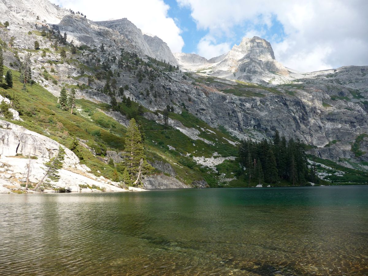
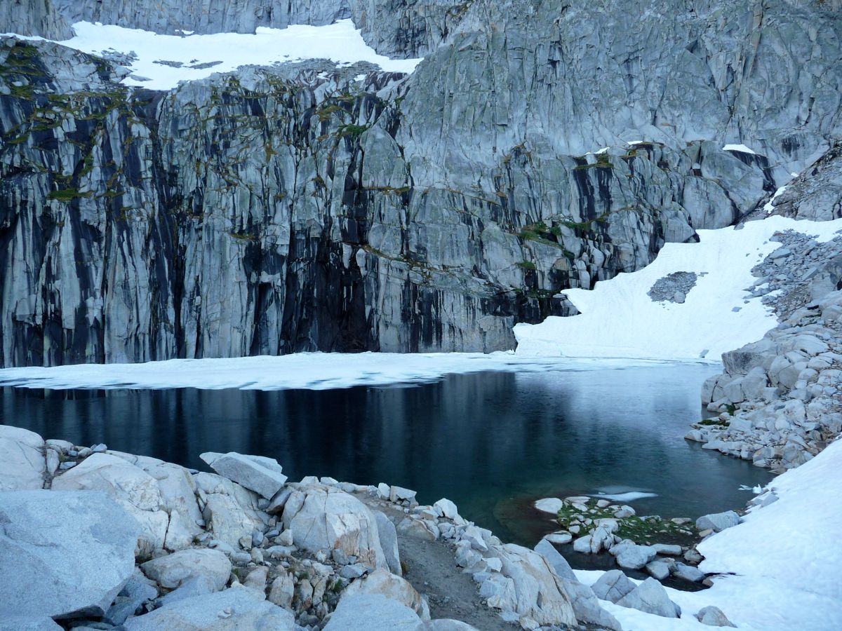
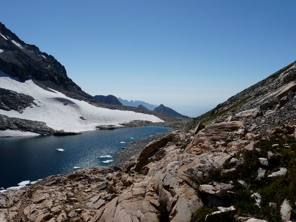
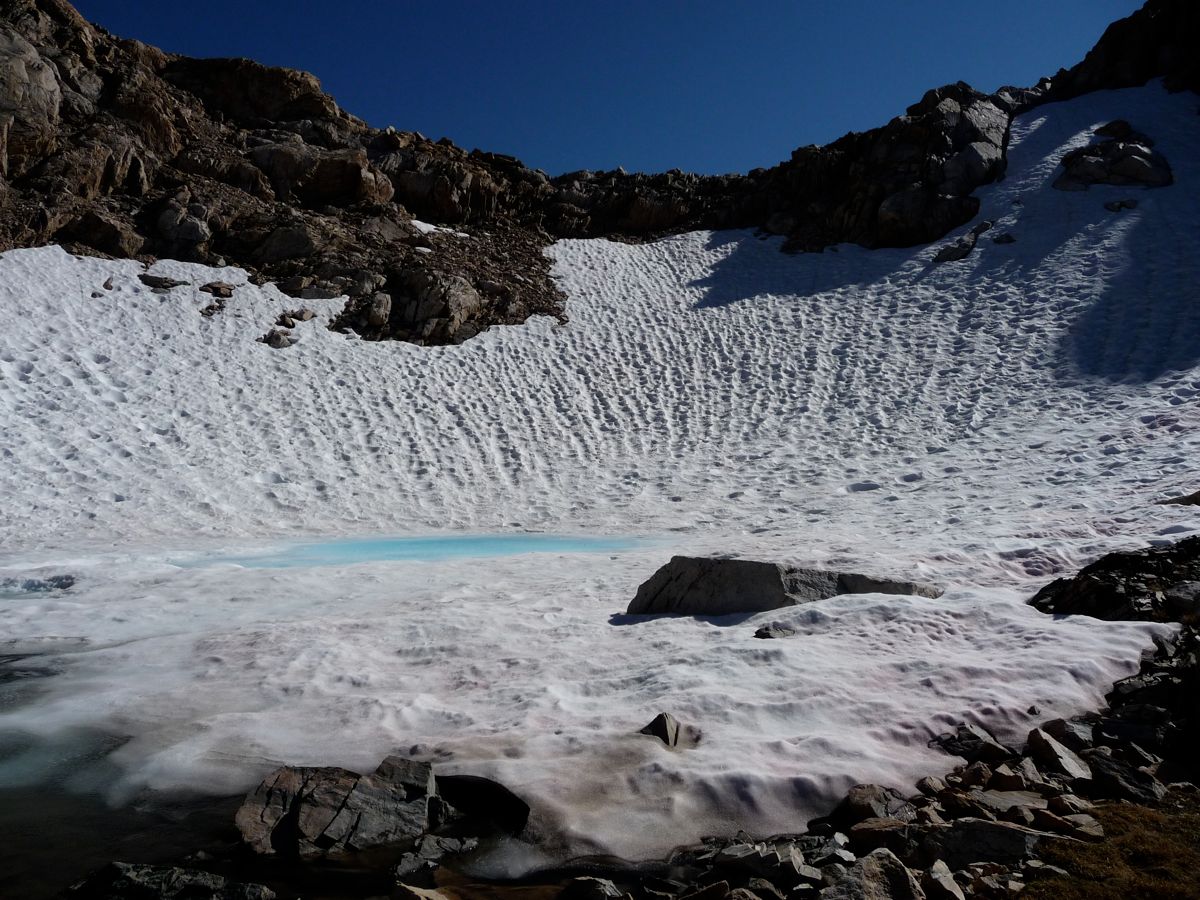
After nearly two hours of this painstaking process, I was finally
at the bottom. I had run out of water about half way down, and my mouth was bone dry. It was made worse by the fact that I had been applying lip balm the entire way down, so there was this stale, chalky taste of if it on my tongue. I circled the tiny lake (this one is unnamed; Lion Lake is to the west and below it) on the northeastern shore, and I'm pretty sure this was a better path than getting around it on the west. I heaved a big sigh of relief when I finally got to
solid ground again.
I was thrilled to see that the
route down to Lion Lake was nice and easy and snow free. About half way down, I took a moment to examine the
route up to Lion Lake Pass. It was mighty intimidating at the time, but I knew that this was a result of fatigue and hunger. Once I had some food in my stomach and a chance to rest my legs, it would seem a lot less ominous. So I took a long lunch break and a short nap along the
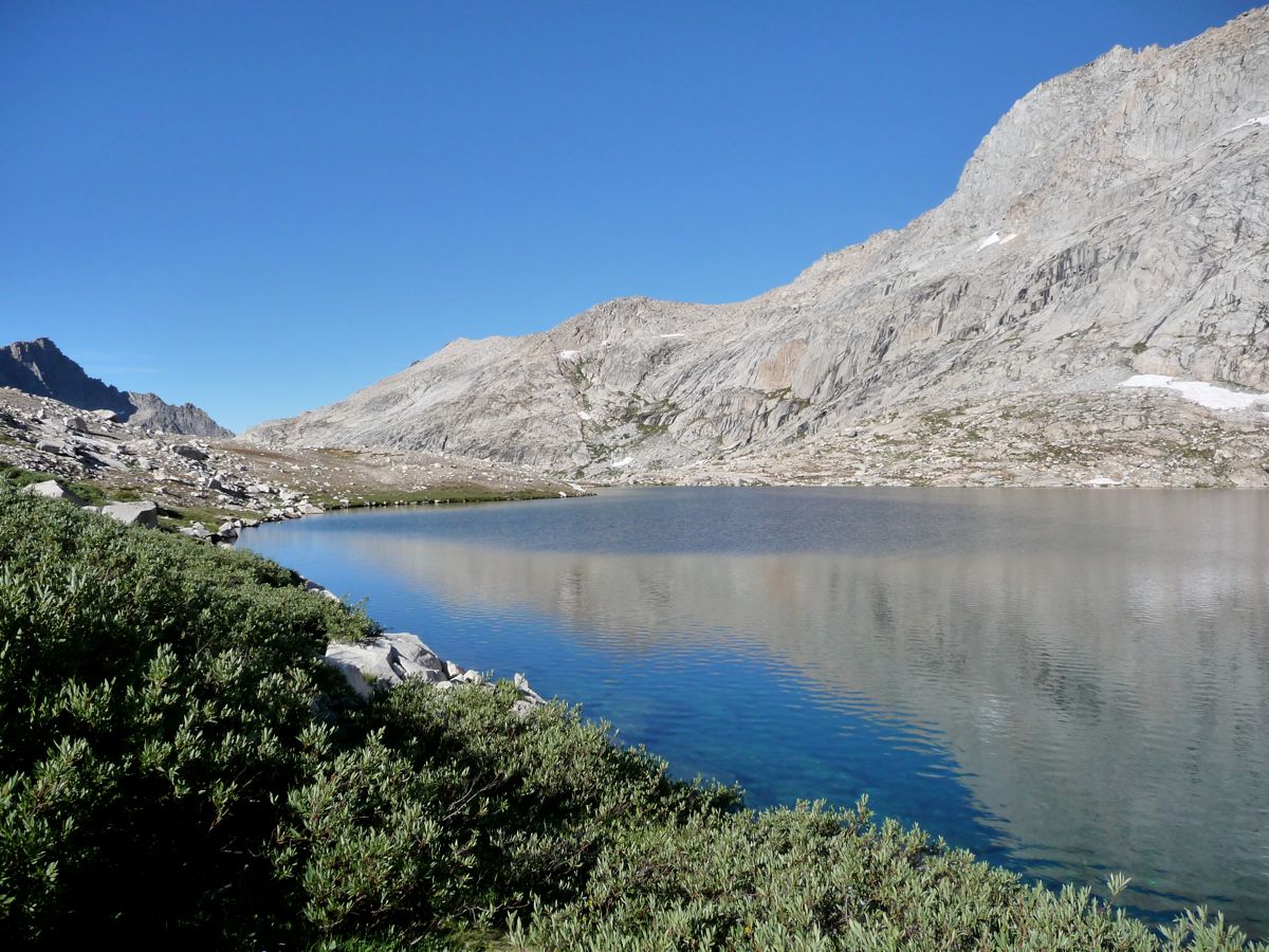
shore of Lion Lake, taking the time to enjoy the views of the sharp wall at its
south end and the contrasting flatness at its
west end. It was pretty clear that if you're trying to circumnavigate the lake, the south shore is not the one to pick. And for my purposes, I was in luck, because the northern side was snow free.
After the relaxing break, it was time to get chopping again. So I did a bit of easy boulder hopping to get to the base of the depression I'd be taking to get to Lion Lake Pass, and then started on my way up. The going wasn't too tough. There were a lot of cases where I had to climb these steep little chutes and use my arms and legs equally to propel myself. But there were no sections higher than class 2, I'd say. When I had gained a few hundered feet, I stopped to take in the
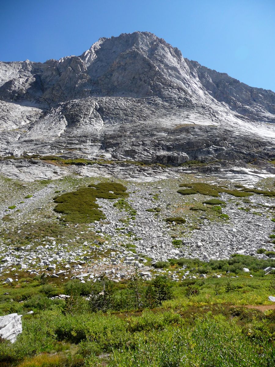
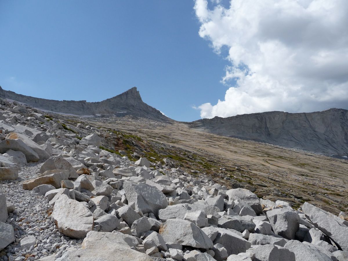
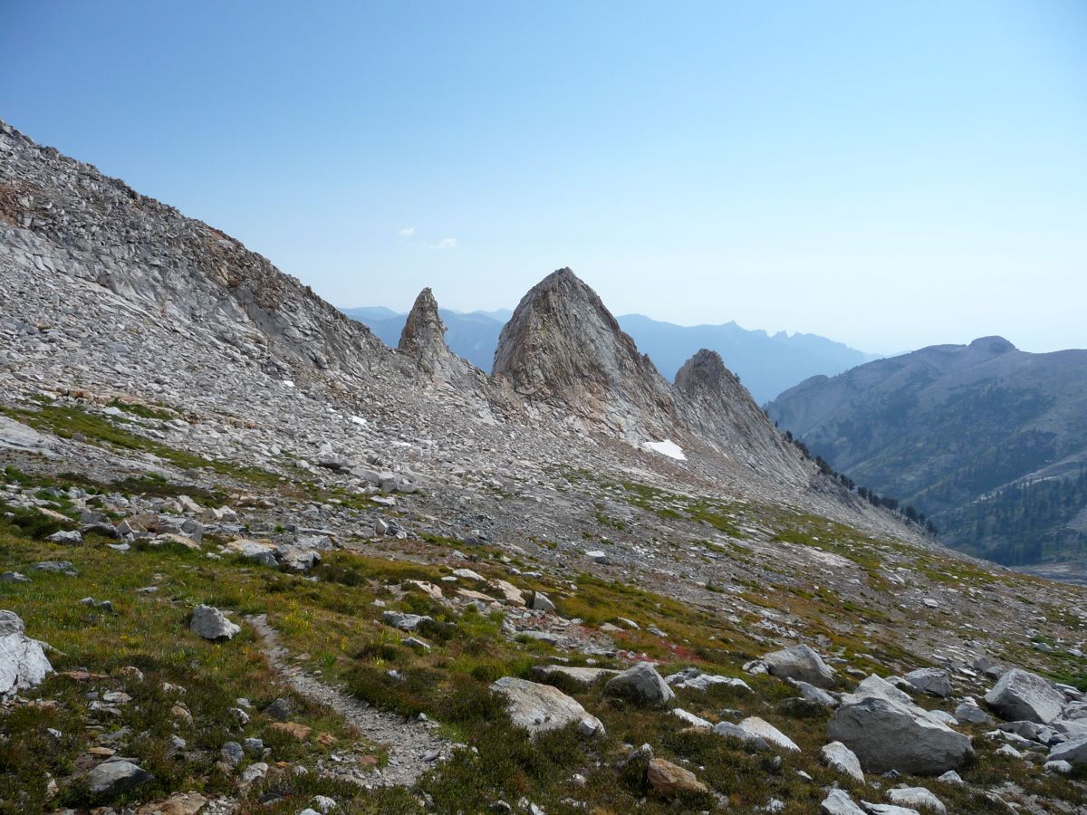
view of Lion Rock Pass. The pass is at the upper right of the little u-shape near the center of the picture, but you can't actually see it because it's blocked by the protrusion in front. What you can easily see is that there was no way to get down without crossing some snow, which is why I would recommend bringing an ice ax and crampons if you are trying this, even in late season.
With another few hundred feet of ascent done, I took another long break. Even though I had been applying sunscreen like a madman, my
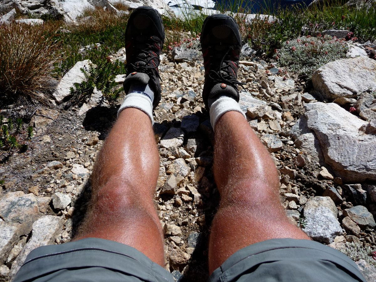
legs were about as dark as they've ever been. Goes to show you how powerful the sun is up in the Sierras, especially when you're outdoors all day. You can get a sense of what it's like on the way up to the pass from
this photo. Sure, it's strenuous, but nothing like what I had just been through earlier in the day.
The whole time I was climbing, I had a nagging sense of worry about what the other side of the pass would look like. My worries became reality when I got to the pass and saw that the
entryway into Cloud Canyon was completely buried in snow. The good news was that this time the north side of the pass was much less steep. I was able to control myself on my feet the whole way down, with my pack on. To get down, I circled around that little pool of ice in the picture and made my way to the rocks on the west, realizing that I would want to attack the canyon either directly at its center or from
the west.
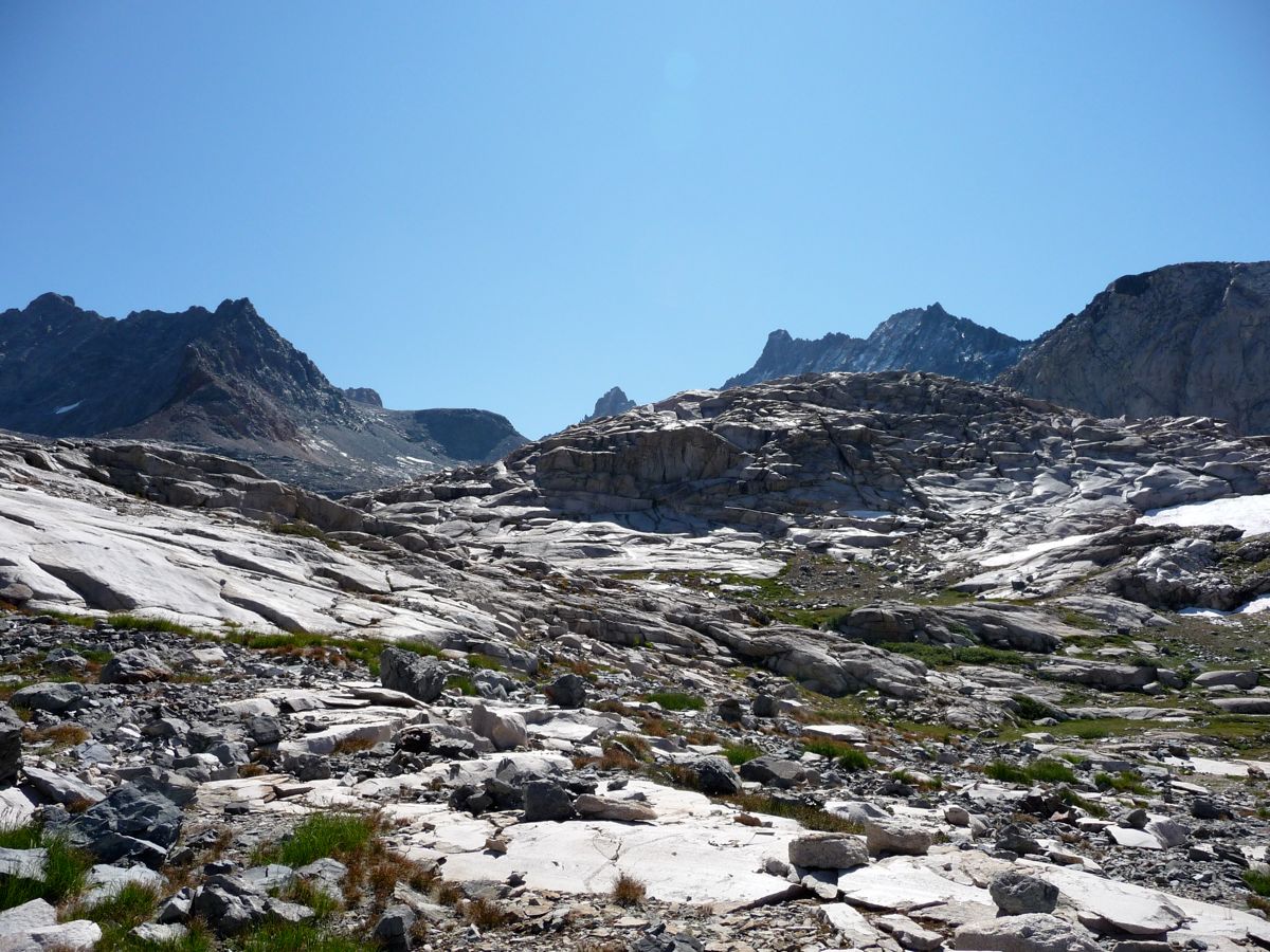
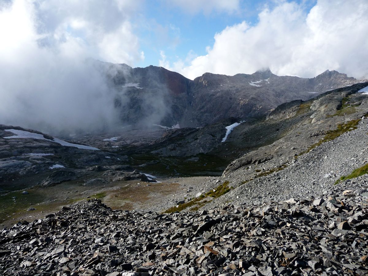
The decision at to how I should go about getting down was made immediately clear when I reached the northern end of the
little bowl I had just traversed.
Straight down the canyon was a steep, nightmarish bank of snow that I wanted no part of. The map showed that I should be able to completely avoid it, though, just by clinging to the western ridge and then descending when I had cleared it. So this is exactly what I did. At first, it was a mix of
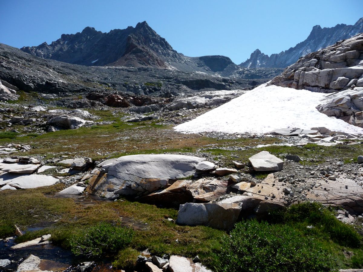
loose rock and thin patches of snow. But after a few hundred meters, the
snow was replace with grass. And with a few more tenths of a mile down,
smooth chunks of green became the norm, making the going extremely pleasant. A number of sub-canyons actually run transverse to the main canyon, resulting in plentiful amounts of water that flow down to the center. Some of them look difficult to cross on approach, but they're all manageable.
About a half of a mile south of the pass, I began to make my way down to base of Cloud Canyon. It wasn't necessarily the optimal place to make the descent, but it wasn't the steepest either. I had to find my way through a handful of
pine groves, but that was actually pretty nice because it gave me something to hold onto while I sank in elevation. I ended up following a little creek for most of the way near the end.
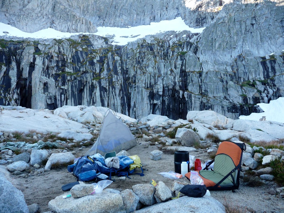
When I finally got to the bottom, I was utterly exhausted. Oh, if only I was walking into my apartment or a hotel room with a bed and a sink. But no, I still had a half hour plus of housekeeping tasks remaining. I set up my
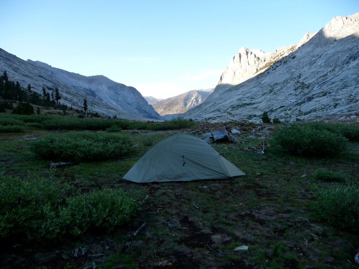
tent, got water from a nearby creek, put on some warm clothes, made a hearty fire. Sitting down afterwards felt so, so good. Then I enjoyed a delectable dinner of tuna and rice along with some lovely
lovely alpenglow before I faded off into sleep.
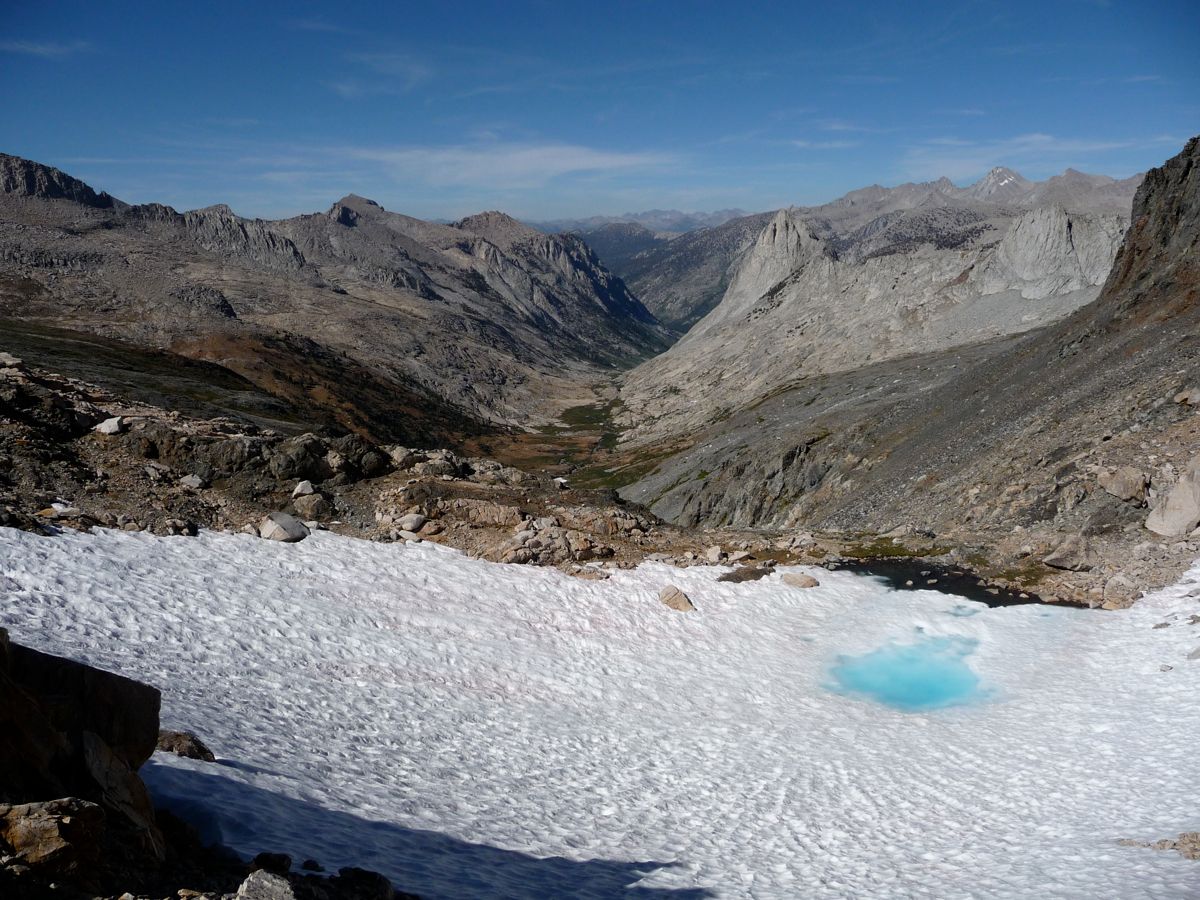
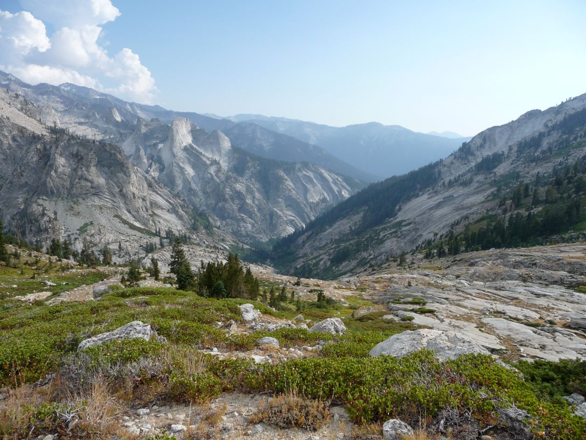
Today, the morning would start off exactly opposite to yesterday. Instead of worrying about snow and cliffs and drops, I was looking forward to lazily strolling along giant swaths of granite and stopping to enjoy azure pools of ice cold mountain water. And that's exactly what I got. When I looked back up at
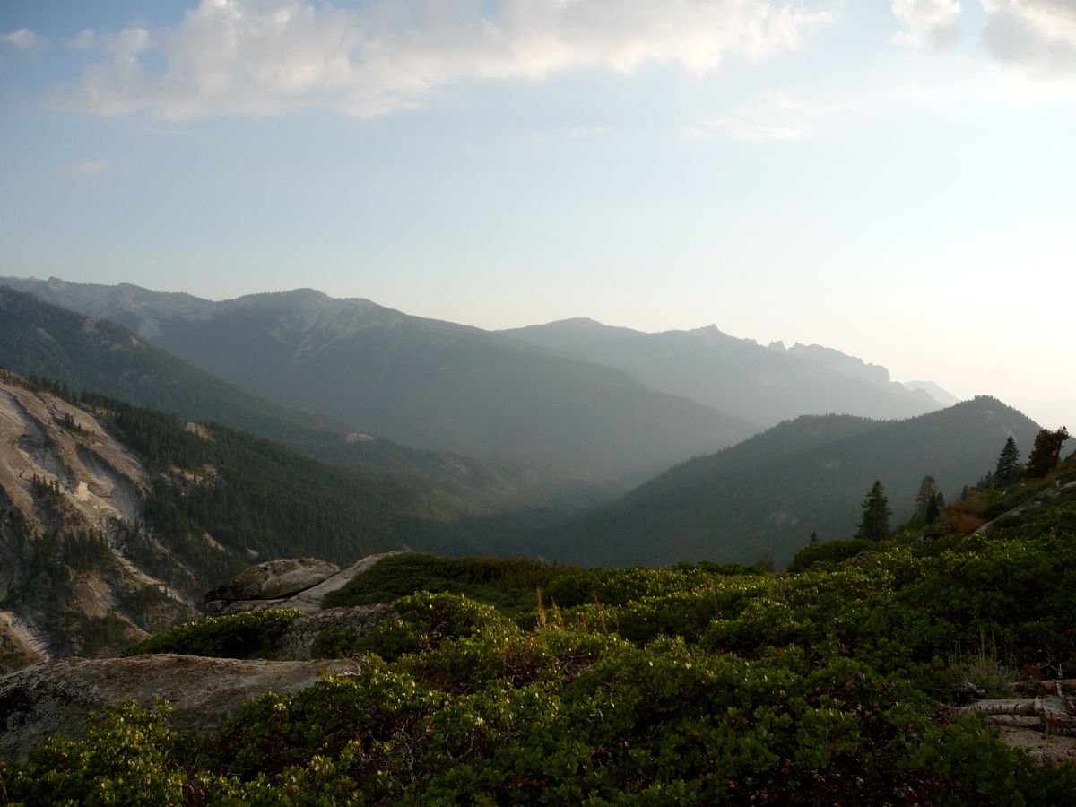
where I had came from, I was thankful that the bulk of the day would be spent going downhill.
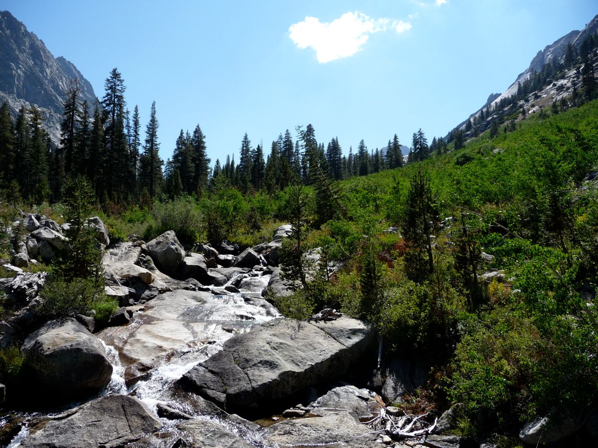
From where I started out at 10,200 feet elevation, down to about 9200 feet, Cloud Canyon was a veritable paradise. Nothing but enormous
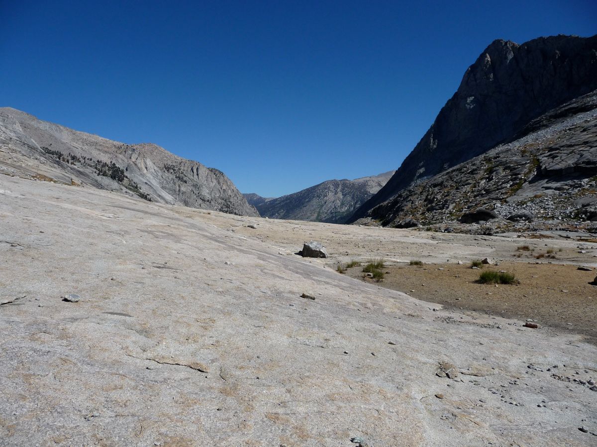
platforms of granite,
trangquil streams, and
tiny waterfalls. Occasionaly you have to cut through some low-lying
weeds, but it's nothing close to bushwhacking. There are a few stands of
pines here and there, but other than that it's all less than waist deep.
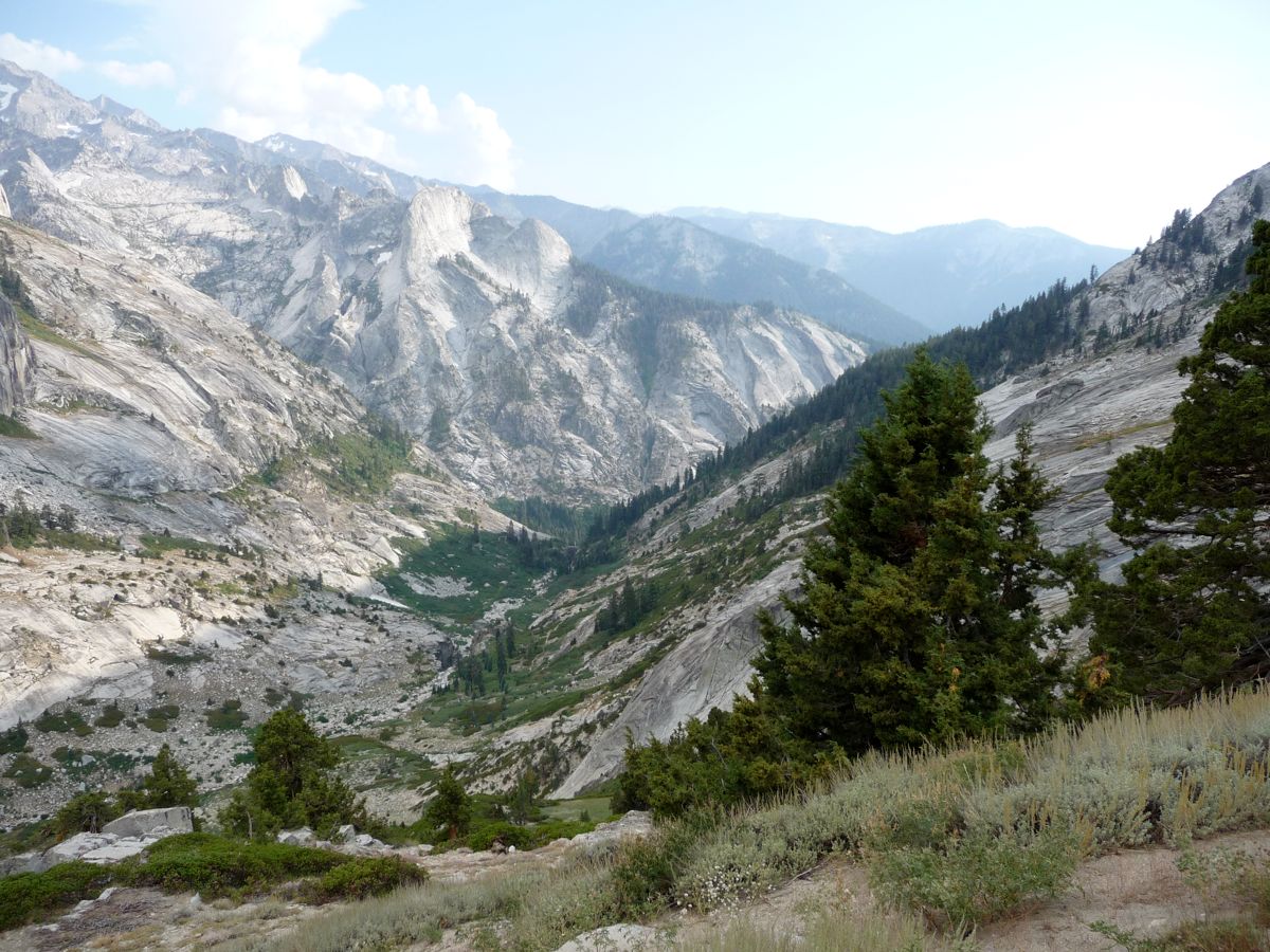
At around 10:30 am, just as I was nearing the
Whaleback I stopped to take a swim in a
gorgeous emerald pool. I laid in the sun for a good half hour afterwards just enjoying the feeling of the rocks heating me up. And then I saw somebody for the first time in two days. He was a trail worker that was doing a little trip up to an abandoned copper mine just to the north of Copper Mine Pass. We talked for about five minutes and then went our separate ways. He told me I'd find a huge camp of trail workers just ahead before I joined up with the trail again.
At this point there was a lot of boulder hopping going on, but progress was still good. Then, around 9200 feet, the
going got a little nasty. The brush wasn't dense enough to call it "bushwhacking" in my opinion. But it was mucky and difficult to make progress. I'd say it's a good quarter mile or so where there's no really decent use trails or open areas to walk through. You have to duck under tree branches, wade through soggy grass, or climb over extensive amounts of fallen pines. But as soon as I was getting sick of it, lo and behold, there was the trail.
A calming effect came over me when I set foot on the well-traveled path, as it always does. I absolutely love going cross-country and getting off the beaten path. But there's always that nagging sense of apprehension that you might run up against something impassable. Or that if you do happen to sprain your ankle, there's noone around to help. When you are on a well used trail, that feeling melts away.
I stopped shortly after that to eat lunch and dry out my socks, which were thoroughly soaked from the muck I had just gone through. To tell you the truth, the rest of the day is nothing to write home about, really. Not to say that the bottom reaches of Cloud Canyon aren't beautiful.
Big Wet Meadow is quite impressive, especially when there aren't millions of mosquitos (I've read that it may be the breeding ground for the entire population of the Sierras). And the trail meanders through
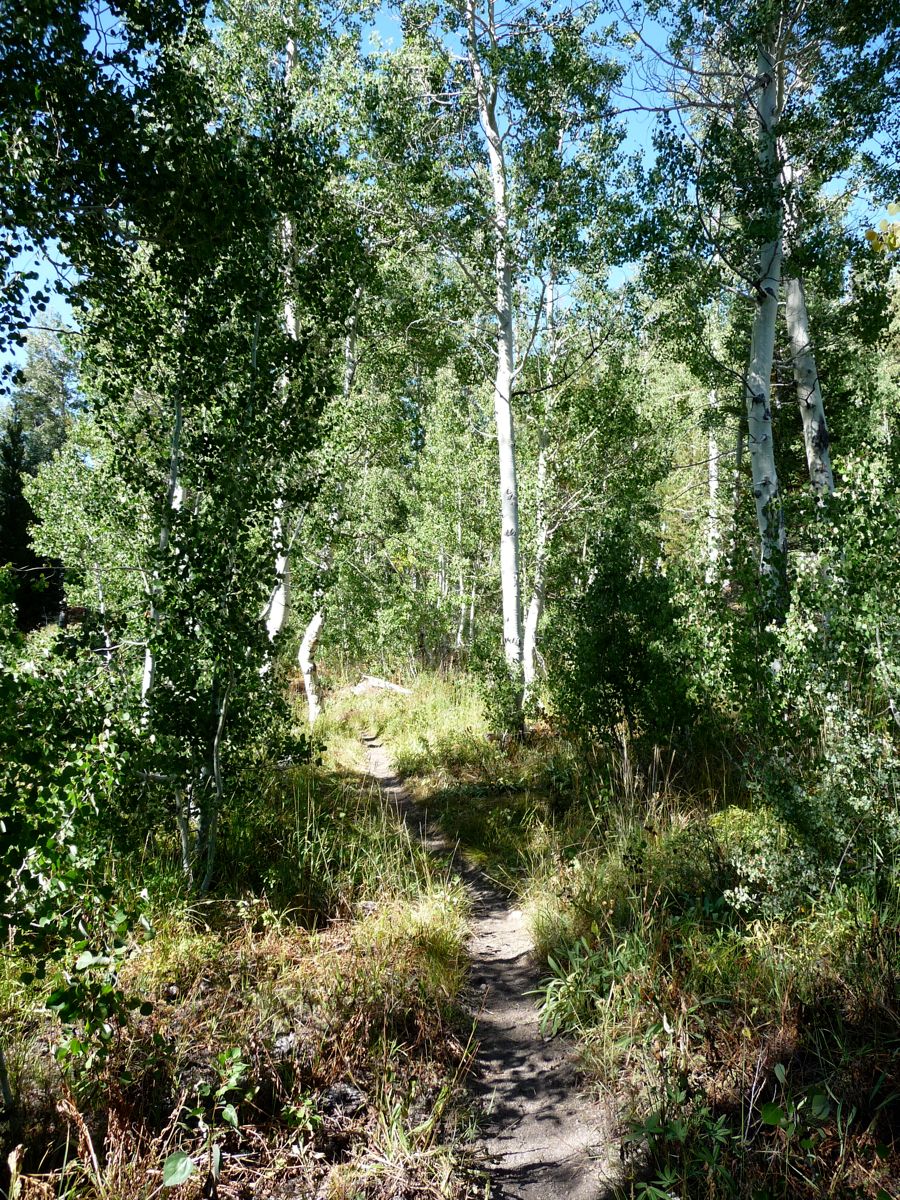
beautiful groves of aspens and pines.
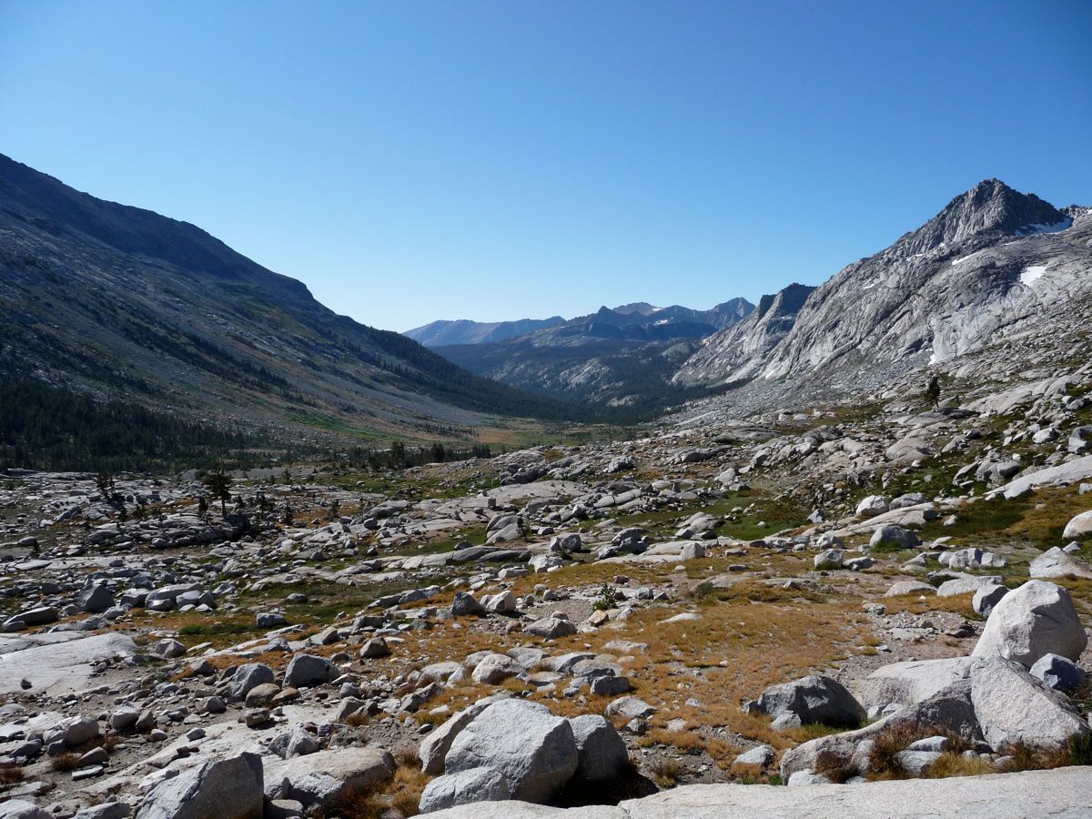
It's a very pleasant ride all the way down to the Roaring River Ranger Station. But for me, it was accompanied by a bit of a scare that the rangers there would be looking for that guy who wasn't carrying a permit and slap some kind of fine on me or something. Luckily, all they did was wave and say hi as I passed their cabin on my way up Deadman Canyon. Once I had passed the cabin, my goal was simply to gain a few hundred feet in elevation so that the following day wouldn't be too intense. I hiked for about an hour and then found a very nice campsite along the stream to hold up at.
I knew today would be a toughy, there was no doubt about it. Sure, there would be a trail. But the elevation gain and loss would be taxing on me; my feet, mostly. I wasted no time when eating breakfast and set out before the sun had made it over the ridge to east, making it a nice, chilly start.
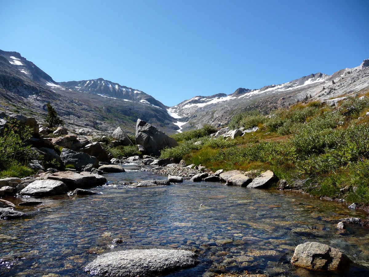
The stretch from about 8,000 to 8800 feet was very enjoyable. Frequent
stream crossings and large stands of
pines entertained me along the way. Just as in Cloud Canyon, at about 9,300 feet or so, the landscape opens up to enormous
granite lots with a few really cool waterfalls. And there are some incredibly enchanting little areas where the stream splits into two and then merges back together around these islands filled with gigantic pines. It it truly beautiful.
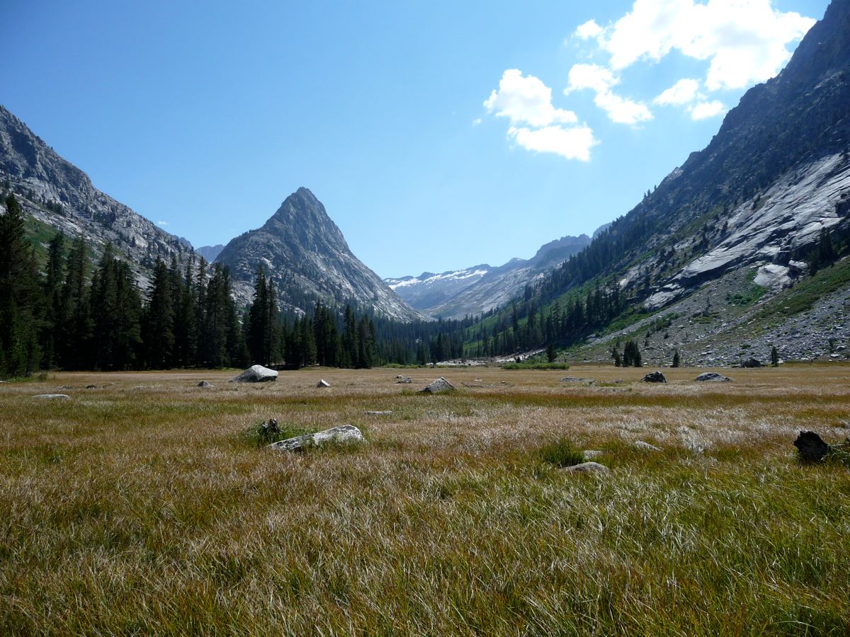
When I finally reached
Ranger Meadow, my feet were starting to burn a bit from the mileage I had put in over the last few days. But it was easy to ignore with all the beauty surrounding me. After the meadow, the trail rises quickly at about 400 feet in elevation over a little more than a quarter mile. And then it opens up in a
large field where you can see
the climb awaiting you.
I was rather impressed with the
colors of the wildflowers growing along the ascent to the
huge granite embankment ahead. When I got there I took about an hour to eat my lunch and dry out my tent, which had gotten damp from condensation on the previous night. There is a perfect little waterall with great seating right where the trail crosses the stream at about 10,000 feet. I knew I needed to get a breather before starting the journey up to Elizabeth Pass.
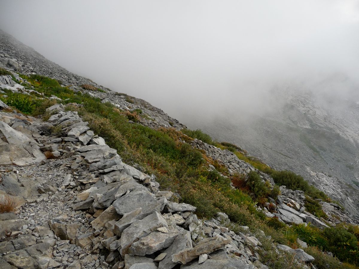
The path up to the pass was great...if you like switchbacks (and yes, I am one of those deranged people that actually likes them). Starting in some
grassy patches, it eventually ends up cutting through
gigantic fields of nothing but rock. It's either been broke apart by hammers and picks or dynamite, and it's really a nicely done trail. I was extremely tempted to go off course and try to make it over the
little notch that leads to Lonely Lake, but I resisted. I had a goal in mind--to make it to Bearpaw Meadow by nightfall. Near the top, I took some time to absorb the
good views down Deadman Canyon and onto Glacier Ridge. By the time I reached
the pass, I was really pooped. I spent about a half an hour just resting on my pack and enjoying the view.
At around 15:30, I set off on my way
down from the pass. At first, I was following the trail through easily, but then it became extremely difficult. The terrain was so forgiving that I decided I'd just head soutwest along the path of easiest descent. And that was working fine until I hit this little gully that was blocked in by thick manzanita and other types of bushes. I ended up tearing through a wall of the stuff, but eventually found my way back to the
trail.
The
switchbacks down to the three way trail junction were pretty intense, and my feet were burning even worse than before (after the trip it took about two full weeks for them to feel normal, and about a month to shed the layer of roughened, dead skin off of them). But I had places to go and there was a
storm approaching, so I kept trucking along. When I arrived at the next three way junction, I took the western fork headed to Bear Paw Meadow. I figured it'd be nice to avoid re-walking the High Sierra Trail. But after encountering a few elevation gains, I started to regret the decision. Especially after I looked at the map and saw that there was about 800 feet of gain in total! I was just so tired that I didn't want to deal with it. But I had already gotten myself about a quarter of a mile deep, so I kept going.
Luckily, my GPS and the map I had were both wrong. The total gain was only about 400 feet, and the scenery is so incredible that I actually forgot about the fact that I was climbing instead of descending. There are amazing Sugar Pines and Jeffrey Pines that cling to the mountainside, and once you pass these, a
spectacular view towards Valhalla. The sun hitting the granite and the
fading mountains made me feel like I was actually in a painting.
When I approached Bearpaw Meadow, the storm finally caught up to me. The clouds behind made everything take on this
crazy red hue. I didn't want to camp at Bearpaw because of the whole permit thing, so I went just past and made it to Buck Creek. I was incredibly happy to find the one campsite along the creek (equipped with bear boxes and everything) empty, and that's where I camped for the night. It was incredibly long day, but worth every step.
The last day was nothing very exciting. Just a 10 mile walk back along the splendor of the High Sierra Trail. I managed to get to the parking lot at about 11:30, and I was ecstatic to see that my car was still there. I don't think the rangers can tow your car unless there's food in open sight (they do this because of bears), but I kept thinking that the one I ran into might somehow find which one was mine and tow it just because I lied to her about having a permit.
As always, the first thing I wanted to do when I got into my car was find a shower. I had planned to use the Lodgepole showers all along, but they were closed for construction. I asked a cashier in the gift shop where the nearest showers that I could use were, and she told me that Stony Creek had some. So that's where I headed, and that's where I got myself cleaned up and groomed so I didn't look like a complete scrub for my return to Livermore.