


TRIP DETAILS
TRAIL MAP
OVERVIEW
Mammoth Cave National Park is not a huge place, but for its size it packs a lot of punch. That's also a bit of a misleading statement since the volume of places to explore is at least doubled by the fact that there are probably tunnels and caverns below the surface along every trail in the park. Unfortunately we didn't have time to take a tour of any part of the cave. If I was to do the trip again, I would certainly allot time to do some exploration down there. I've always wanted to have a cup of coffee well below the surface of the earth.
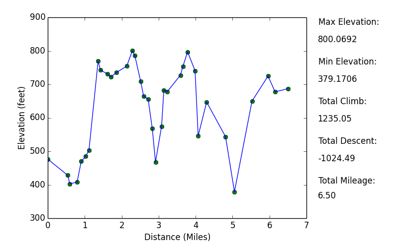
You'll notice the mileage I am reporting here doesn't agree with the mileage in the elevation profile at all. There is a very simple reason for this. The trails never take the most direct route between two given points. They wind around in a very strange way (I'm sure they were chosen this way for some good reason). I place waypoints about every 20 minutes and for any consecutive set of two of these waypoints, we probably did an extra 50% of distance following curves and bends. This is all pretty evident just by looking at the backcountry trail map, but I thought I'd give it a quick explanation to avoid any confusion.
Elevation Profile
TRIP LOG
This trip was pretty spur of the moment. My brother and I were going to be going to our sister's fiance's bachelor party in Nashville, and while plotting his route out there from Chicago, he saw that he'd be passing pretty close to Mammoth Cave National Park. So he figured why not stop there for a night or two before we get weird in Nashville? It took very little convincing to get me on board. I took a red-eye flight into Chicago, he picked me up at the airport at around 5:00 am, and we were on our way south.
After a pleasant 7-hour drive, we arrived at the Visitor Center. We were banking on getting a first-come-first-serve permit and we had no problem doing so. The ranger that helped us was a super cool lady... wish I could remember her name. But anyways, she was very happy to give us all the information we wanted and took even more time to go over some of the history of the park.
For how small the park is, there is actually a good deal of backcountry area and campsites. We weren't really set on any particular trail or place for our adventure, so we asked the ranger what she thought. She recommended Turnhole Bend, but also said the Sal Hollow area is pretty cool. We decided we'd follow the Sal Hollow Trail and then either camp at the Sal Hollow campsite or the Bluffs Campsite. We never did get to check out Turnhold Bend. But I'm pretty sure it'd be pretty cool, especially since it offers views of the Green River, and the route we took didn't offer any of those. We didn't have an official topo map of the area, but we were pretty sure we'd be ok with just the well-made backcountry map they provide free of charge.
After leaving the Visitor Center, we began the short trip to the Maple Springs Trailhead. I must admit we were both pretty shocked when we came to the Green River Ferry. I had been picturing a launch site for a boat that would take you up and down the the river, but instead the
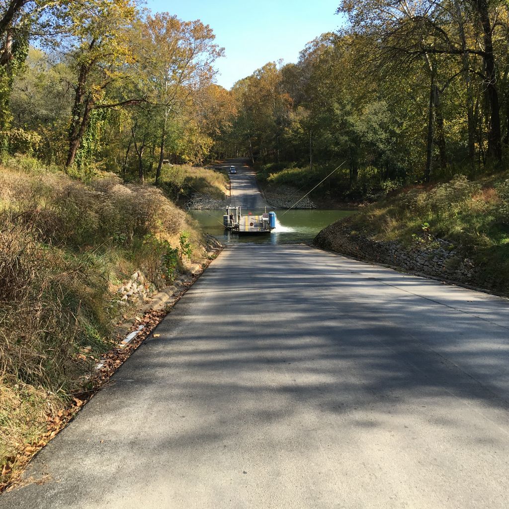
ferry turned out to be a strip of concrete attached to a motorized craft that goes back and forth across the river. My brother and I were just incredilby baffled as to why they don't just put a bridge across the river at this point, I'm sure there is some good reason for it.
To be honest, we had a bit of difficulty finding the parking lot the ranger was talking about due to the fact that there aren't many well marked signs right around Maple Springs. But we eventually found it and got all our gear in order. We took an obligatory
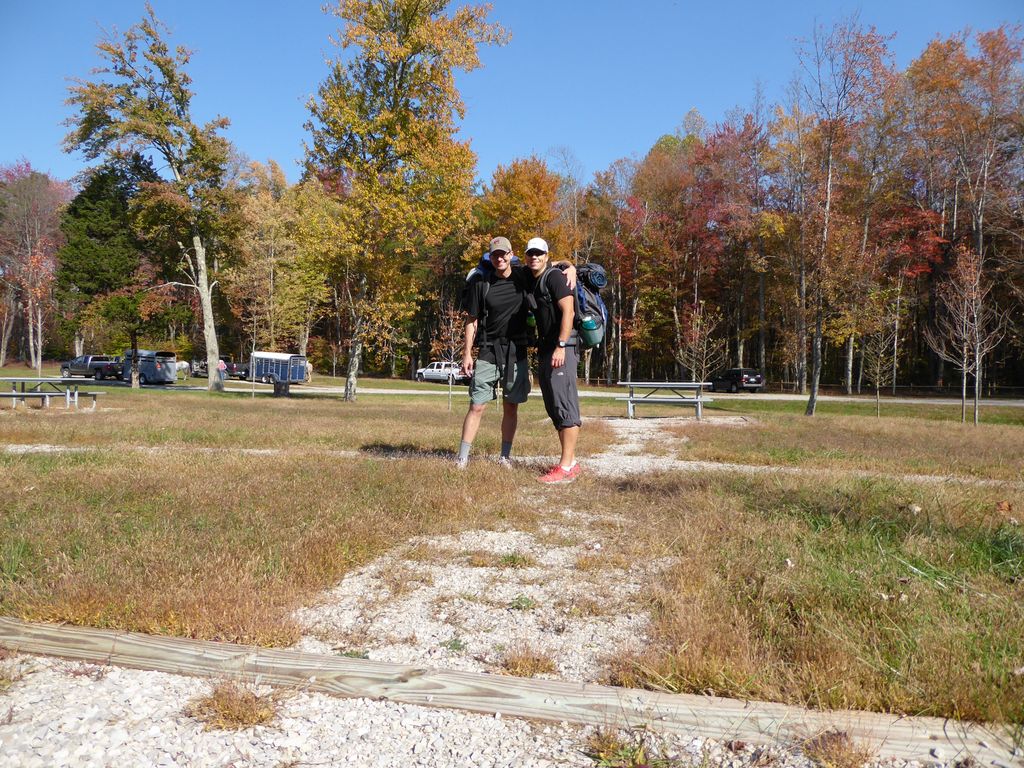
pre-trip photo before setting off on the trail. I've already been made fun of for wearing what look like capris. But the fact is I didn't bring a pair of shorts because the weather report said it was going to be in the upper 60's. Turned out it was about 10 degrees hotter. Man, was it hot for October.
When we were ready to go, it was reassuring to find a very clearly marked
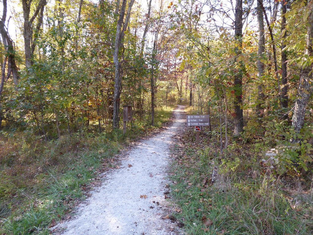
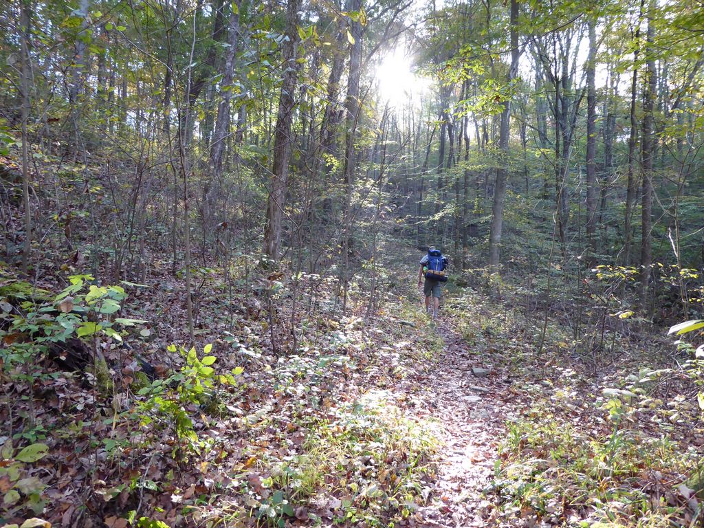
sign letting us know we were on the right trail. The initial part of the trail has almost no elevation gain whatsoever. Just a ton of gorgeous, colorful
trees. We took our sweet time to appreciate the sheer beauty of the forest, taking plenty of breaks and trying to take it all in.
The first really interesting feature we came across was a little

limestone shelf with a small, steady stream of water rolling over it. Going into the trip our assumption was that we'd see little guys like this, along with well-filled streams where they were shown on the map. But that didn't turn out to be true. The only places where we found water were places like this that were not associated with any body of water on the map. So my recommendation would be: if you are planning on filling up water bottles on the trip, take advantage of these micro-falls whenever you see one and don't depend on the streams holding water. Of course, this might not hold true in other seasons.
Just a bit after we passed the junction with the Turnhold Bend Trail, we heard the strangest sound coming from the woods. It sounded like somone was chopping a tree with an axe. I've heard plenty of woodpeckers going at trees and it definitely wasn't that. It was something else, but I couldn't put my finger on it. We both perked up our ears and listened as it went on for a good minute or two. We eventually both tried to approach the sound to see what it was and heard a very large rustling through the forest accompanied by the movement of leaves and branches. But neither of us got a look at whatever creature was making the noise. The best we could figure was that it was a deer, but I still can't imagine how a deer was able to create the sound we were hearing. Could of been a sasquatch, right?
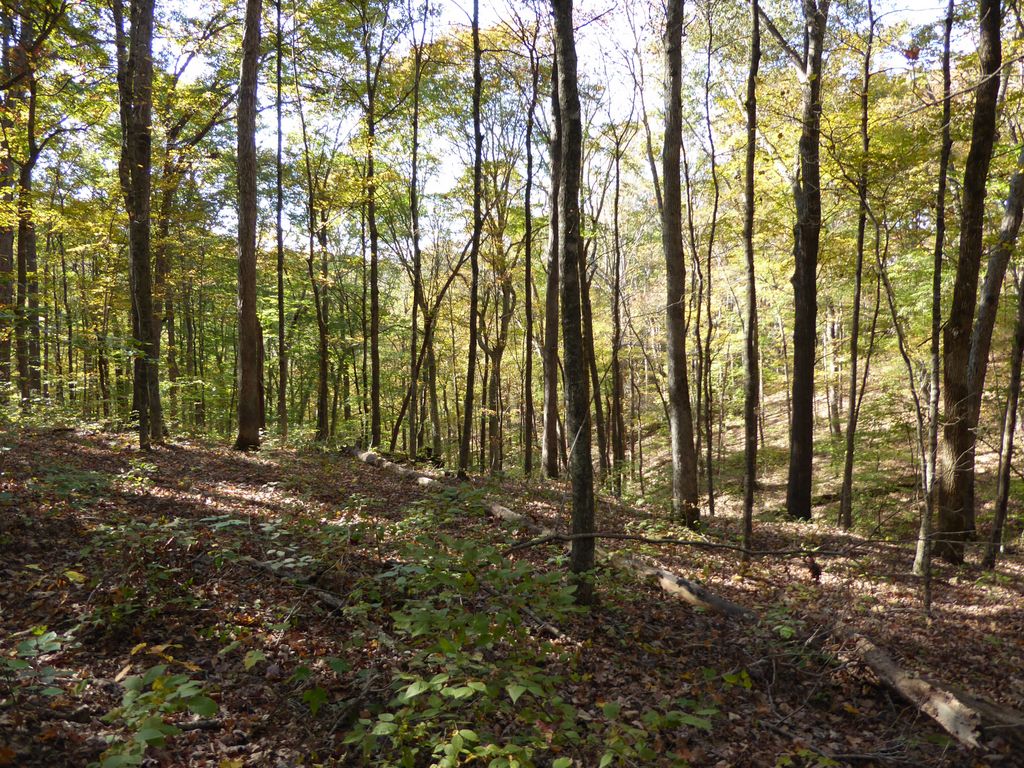
At around 4 o'clock or so, the sunlight was playing amazing games with the
trees. The glowing colors were simply
blissful. I would say that fall is probably as ideal of a time as any to do a trip through this area for this reason alone.
A few miles further down the Sal Hollow Trail, we came across another limestone shelf. This one had a very cool
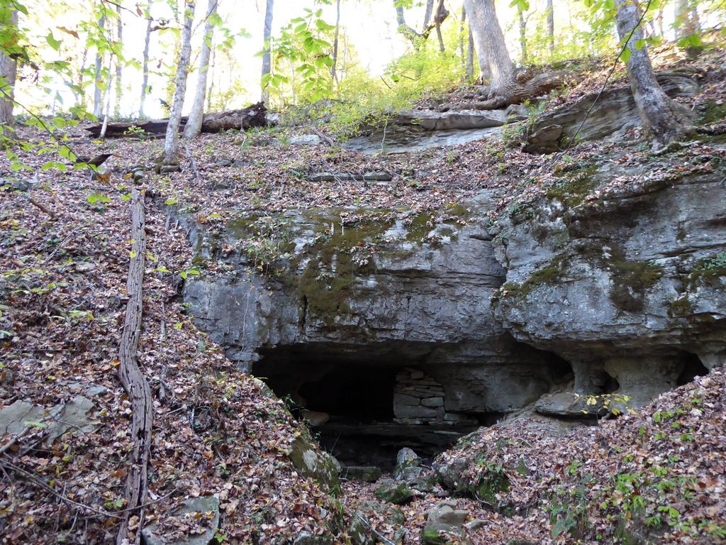
cavern to go with it. The cavern extends far enough into the earth that we couldn't really figure out exactly where it ends, and we spent a few minutes exploring it with our headlamps. Boy was it cool.
Our first real taste of elevation came when we descended into Sal Hollow. Sal Hollow was very, very cool. In just that little bit of time and distance descending, we were brought into an area with completely different vegetation than what we had seen before. It's not quite a marsh, but it feels more like one than a forest when you're in Sal Hollow.
After Sal Hollow we got our first taste of real elevation gain. Not a lot, but definitely enough to notice. It was right around 5 o'clock or so when we came up to the side-trail that leads to Sal Hollow campsite. We took the short trail to the campsite to see how it looked, but we were pretty set on going to Bluffs Campsite in the hope that we'd be able to find water in Buffalo Creek. Sal Hollow Campsite wasn't anything spectacular, but it does have a nice firepit and some decent views due to the gradual slopes that surround it.
Just past the campsite, I took this picture of
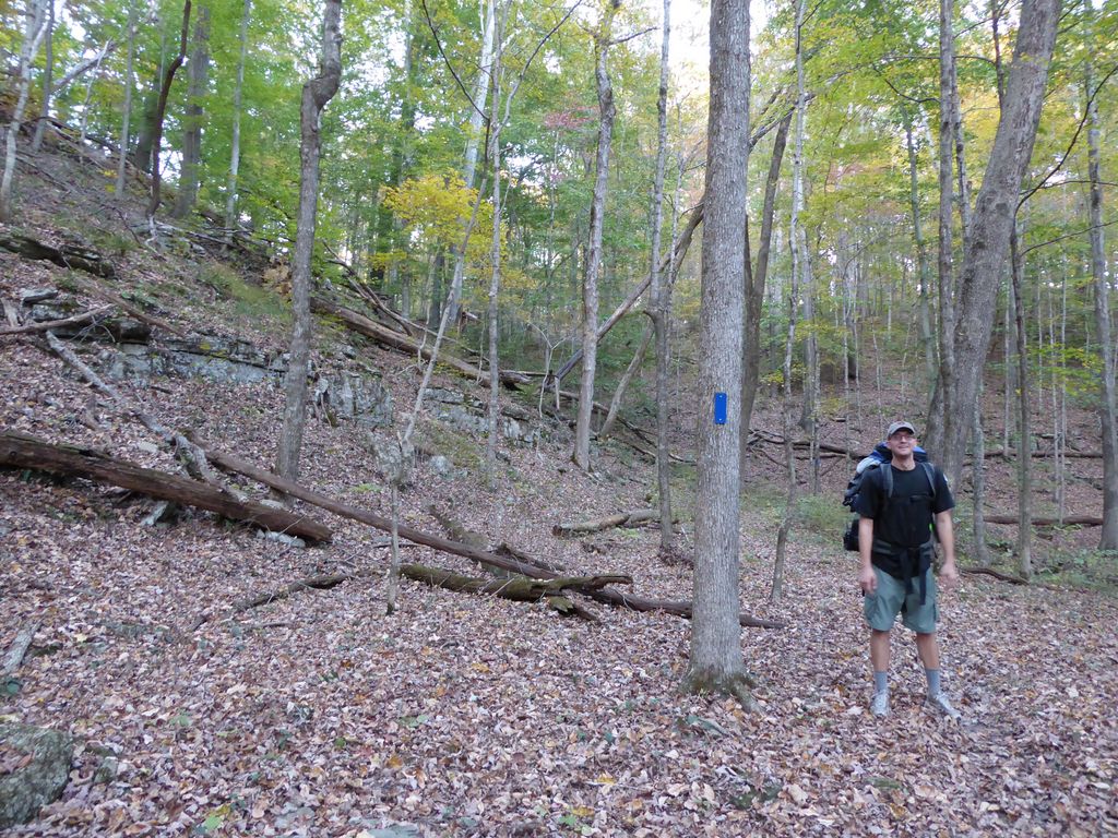
my brother. This would be the last photo ever taken of him with his favorite Cubs hat. He lost it somewhere in between this spot and the Bluffs Campsite. If you read this and plan on hiking this area, please keep an eye out for it. And even better, if you find it you can email me (lance0381 at gmail).
By the time we got to the Bluffs Campsite Trail, the sun was far enough before the trees that we weren't getting much light at all. We were both very surprised by how much elevation we lost before we actually arrived at camp (should have got a topo map) as well as how incredibly sweet the trail was just before the site (pictures to come on day two).
The site has a few nice patches of flat ground for tents, a good firepit, and some rocks for sitting. The outcrops of limestone, along with this huge
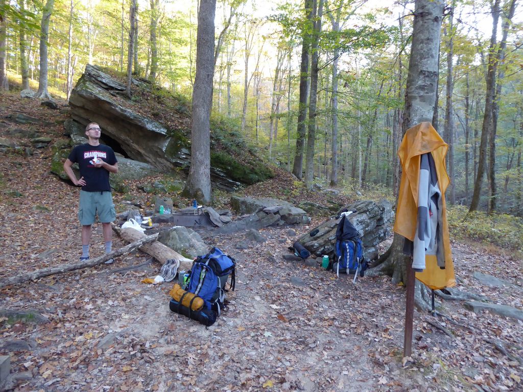
boulder right next to it make it a really neat place. Even though there's a firepit, I wouldn't count on making a brilliant fire. There isn't much fallen wood available around the site. We had to explore for a good half an hour just to get enough to make a weak fire.
Our dinner that night was splendid thanks to my brother really hooking it up. Perfectly cooked bratwurst and sausages accompanied by Pringles and a bunch of other goodies. We also had a good amount of whiskey available, which is never a bad thing. It was a great night if I do say so.
The next morning began with a desparate search of our campground for Eric's hat. With no sign of it in the surrounding 50 yards, we went over all the posibilities of where it might have gone to. At the end of all of our
theorizing, we came up with two distinct possibilities. One, he had dropped it on the trail (he distinctly remembers using it to swat spider webs and bugs during the last mile or so before arriving at camp). Two, some very criminal squirrels or other vermin had snatched it during the night while we soundly slept.
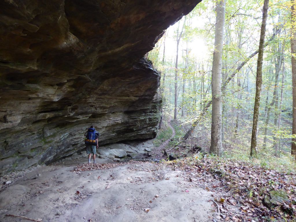
Since there was very little mileage to cover to get back to our car and the weather was great, we both decided it wouldn't hurt to backtrack and see if we couldn't find it. When we passed by the large
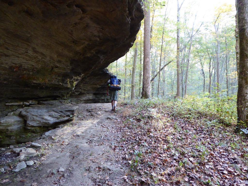
overhang that we had passed by the night before, I was even more impressed. The sunglight revealed a number of new features I had not noticed before, and the sunlight was gleaming off the
trickling waterfall.
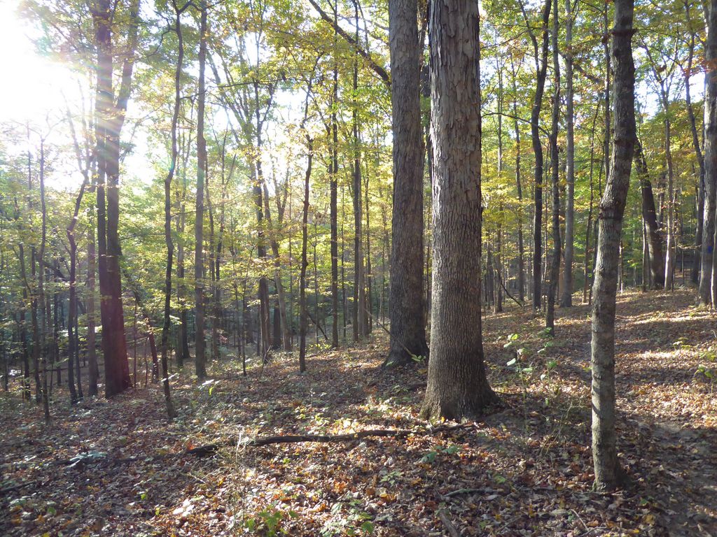
It didn't take us long to make the short ascent back to the trail junction. When we got there, we ended up heading south and following the Sal Hallow Trail south as planned. Alas, we saw no hat during the entire 4.5 miles or so. Fortunately, the brilliant
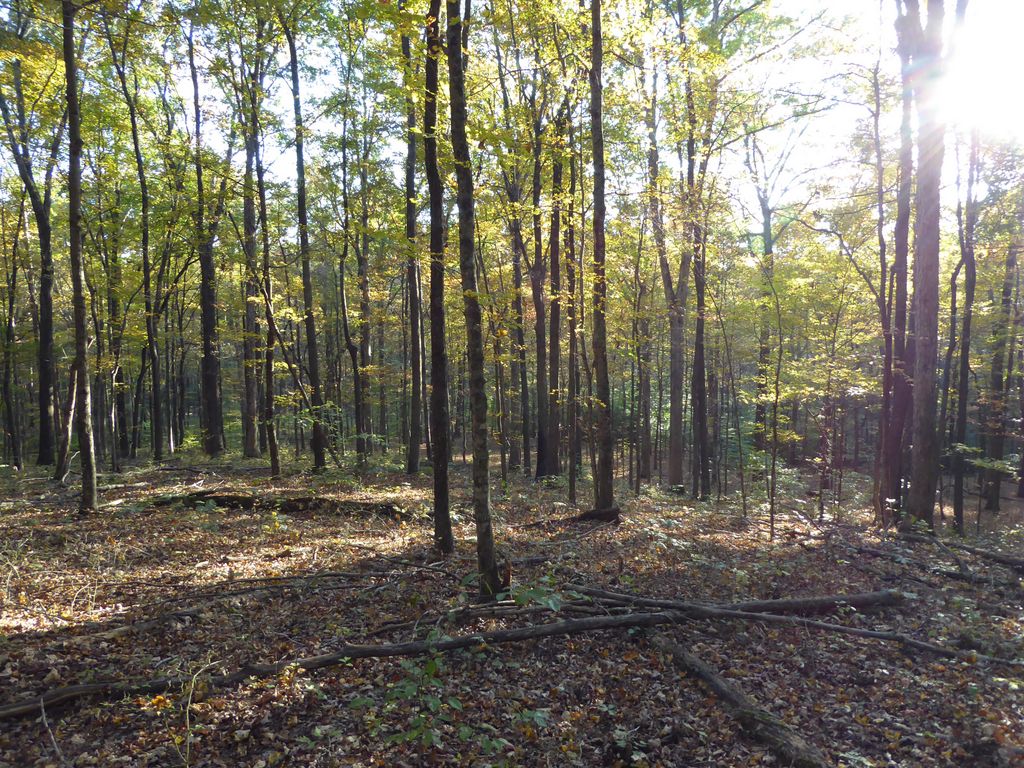
sunlight filtering through the forest canopy made every minute of the hike enjoyable.
The final segment of our journey took us north along the Turnhole Bend Trail and then northeast along the creek trail. I think I can safely say it was the least impressive part of the park we had seen so far. It's pretty flat and the trail is more like a fire road. Still beautiful; just not as impressive as what we had seen over the last 24 hours.
When we finally got back to the car, I was incredibly relieved to take off my super sweaty pants. Before we left the park, we made a quick stop back at the Visitor Center and checked out the
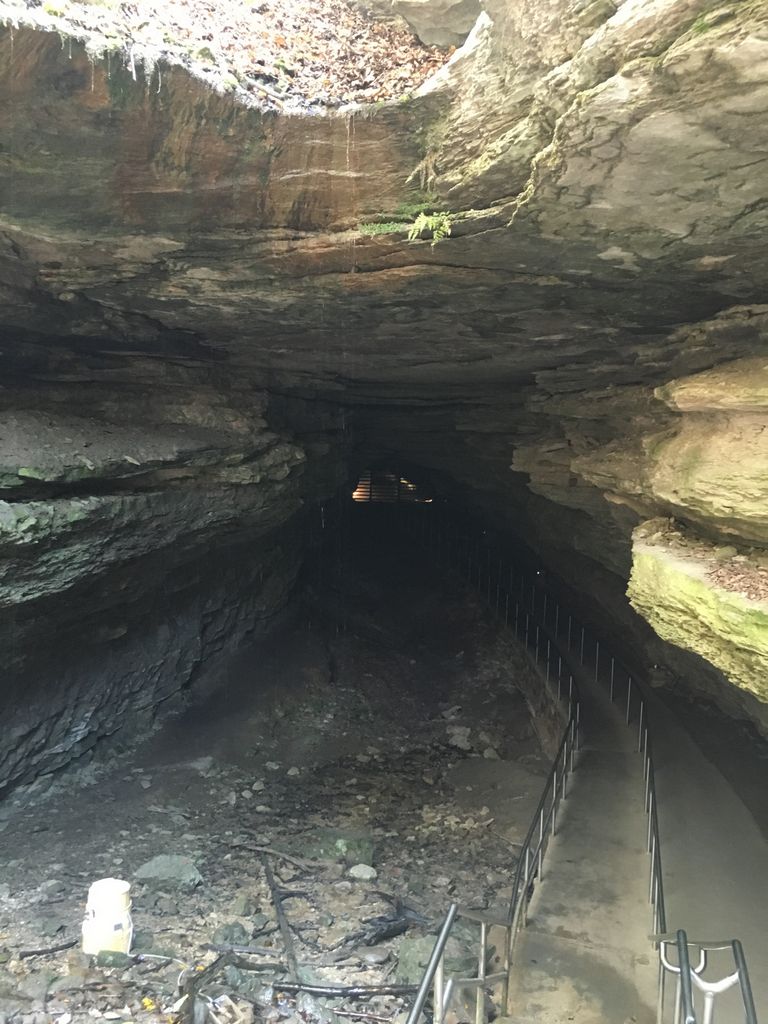
Historic Entrance to Mammoth Cave. Holy Moley was that cool! The temperature must have dropped 20 degrees between when we started our descent off the main road and when we reached the locked entrance. I really wish we could have explored the cave some. All I know is I gotta get back there in the future to check it out!