


TRIP DETAILS
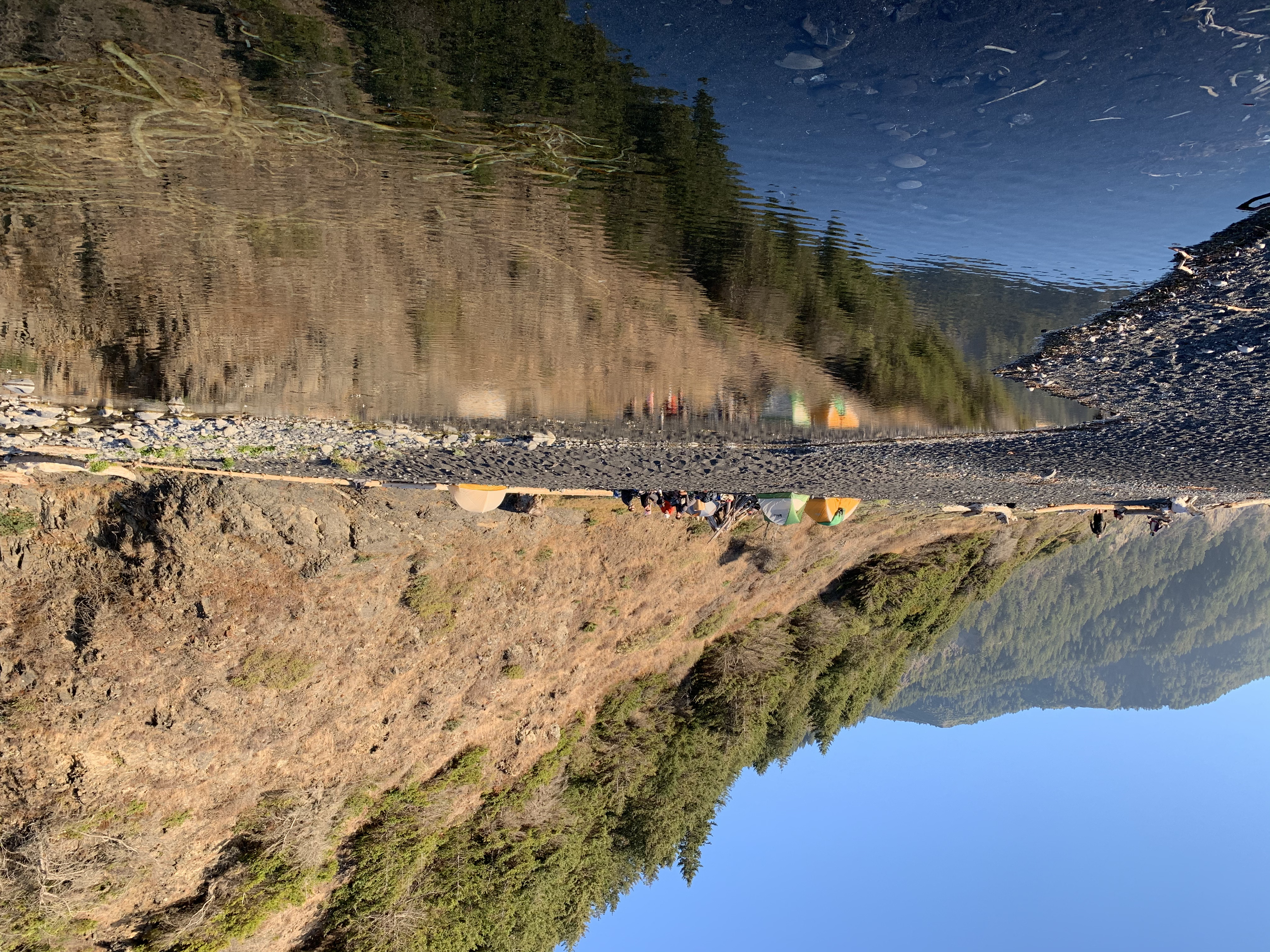
TRAIL MAP
OVERVIEW
Notes:
- The Lost Coast is a truly spectacular place. This ~25-mile hike is well worth the time needed to secure a permit and the planning needed to avoid getting killed by the tides.
- Bear canisters are most definitely necessary. We saw bear tracks upon and down the coastline. A group of hikers also recommended that we somehow secure our bear cans when we store them at night to prevent the bears from accidentally rolling them into the ocean.
- The trail is quite rough for dogs. Our dog, Juniper, has no problem doing 10-20 mile hikes through various types of terrain. But the combination of sharp shell fragments and the rough, coarse sand on the LCT were a little too much for her. The rubber booties we brought for her helped a litte, but we ended carrying her for decent stretches.
- We took Bill's Lost Coast Shuttle Service from Black Sands Beach to Mattole Beach to avoid having to deal with staging or swapping cars. We were all really glad we did this. The drive from one end to the other is not pleasant. It's just under two hours of bumpy, twisting and turning roads. Certainly something I wouldn't want to do after reaching the endpoint of the hike.
TRIP LOG
We got a fairly early start on this trip, starting the drive from Livermore around 6 am before the sun had risen. The drive to Mattole Beach from Livermore was spectacular in itself. On the way to Black Sands Beach, Highway 101 passes through some wonderous redwood forests that make the last two hours or so of driving a complete delight.
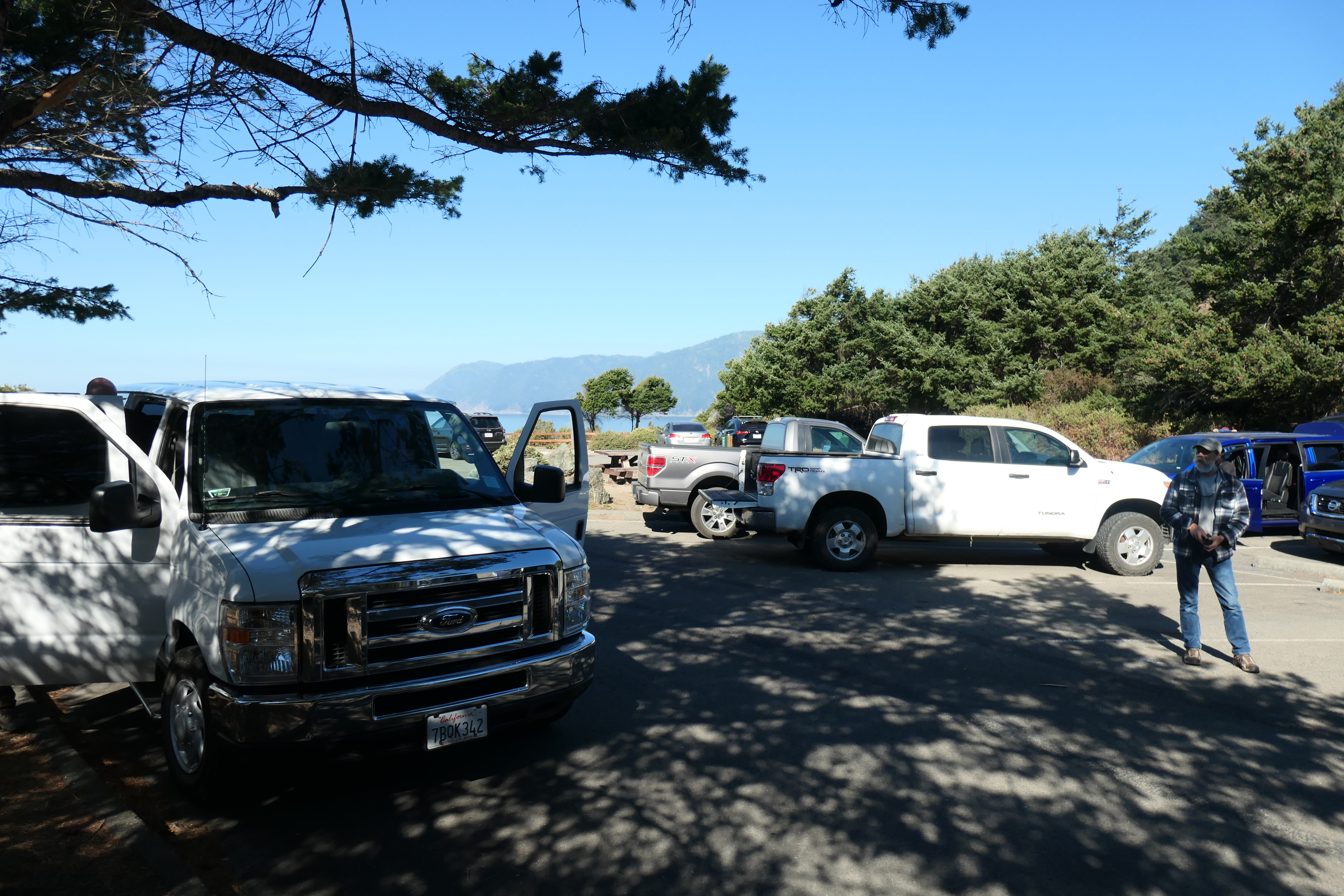
The timing was perfect, as we pulled up to Black Sands Beach parking lot at almost exactly noon. Our good friends Mark and Nikki arrived shortly thereafter in their car, followed by Bill Abram, our shuttle driver. Bill took our money and our temperatures (he used a laser thermometer to make sure we weren't COIVD symptomatic), and we hopped in his big white van with our packs (Bill is the guy packing the pipe in the right of the picture).
The approximately two hour drive to Mattole Beach was not fun. Ellie, Tina, and Nikki are all susceptible to motion sickness, and this ride put them to the test. They were not enjoying the windiness and bumpiness that ensued over the next hour; Mark and I weren't getting queasy or anything, but we weren't having all that much fun either. It was not a smooth ride. At about the halfway point, Bill stopped at a picnic area to give us a restroom break. He mentioned that he had some homeopathic pills that may help with the motion sickness, and handed us a bottle with a label that said "Coculus Indicus". The ladies took two each, and thankfully felt a lot better within several minutes!
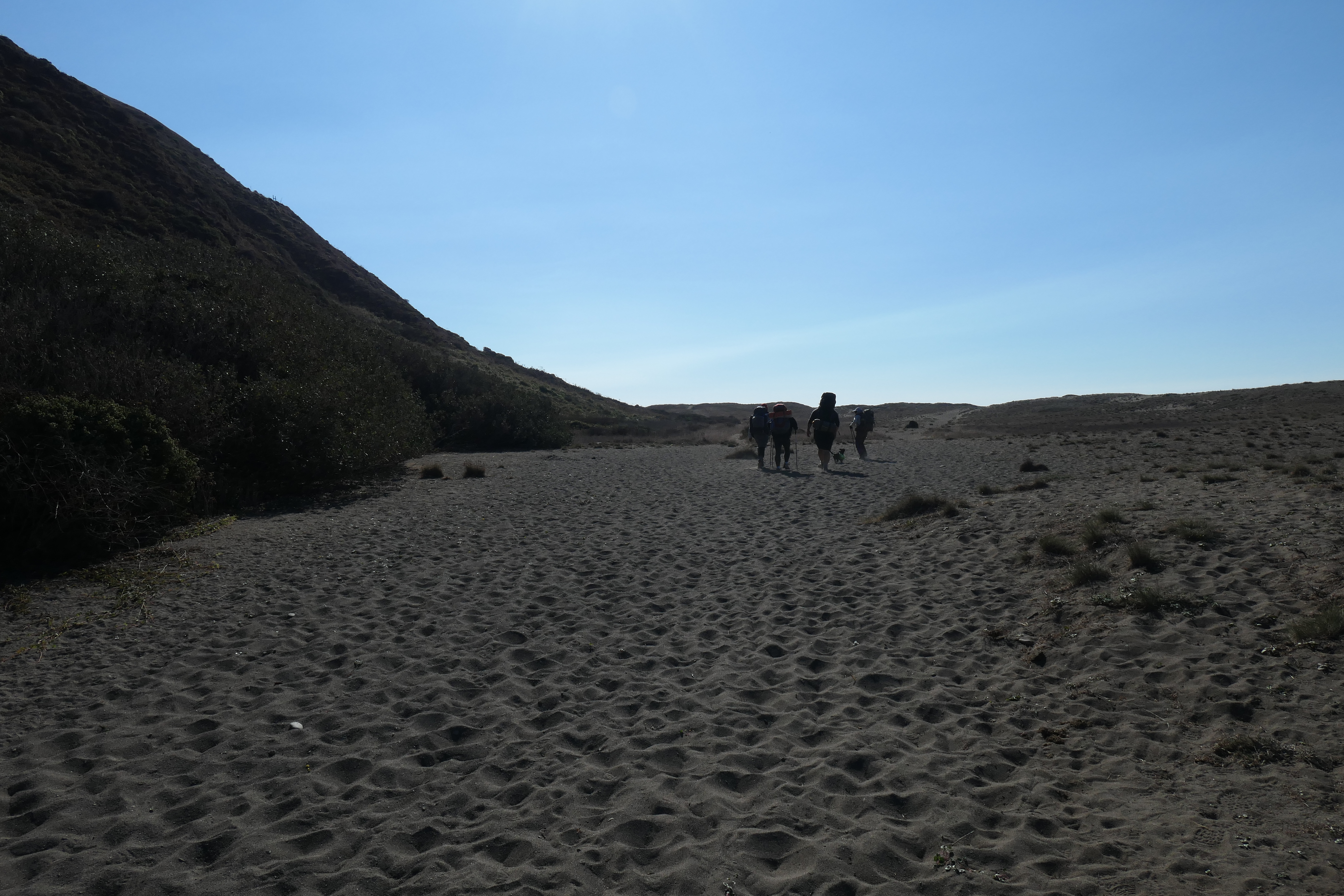
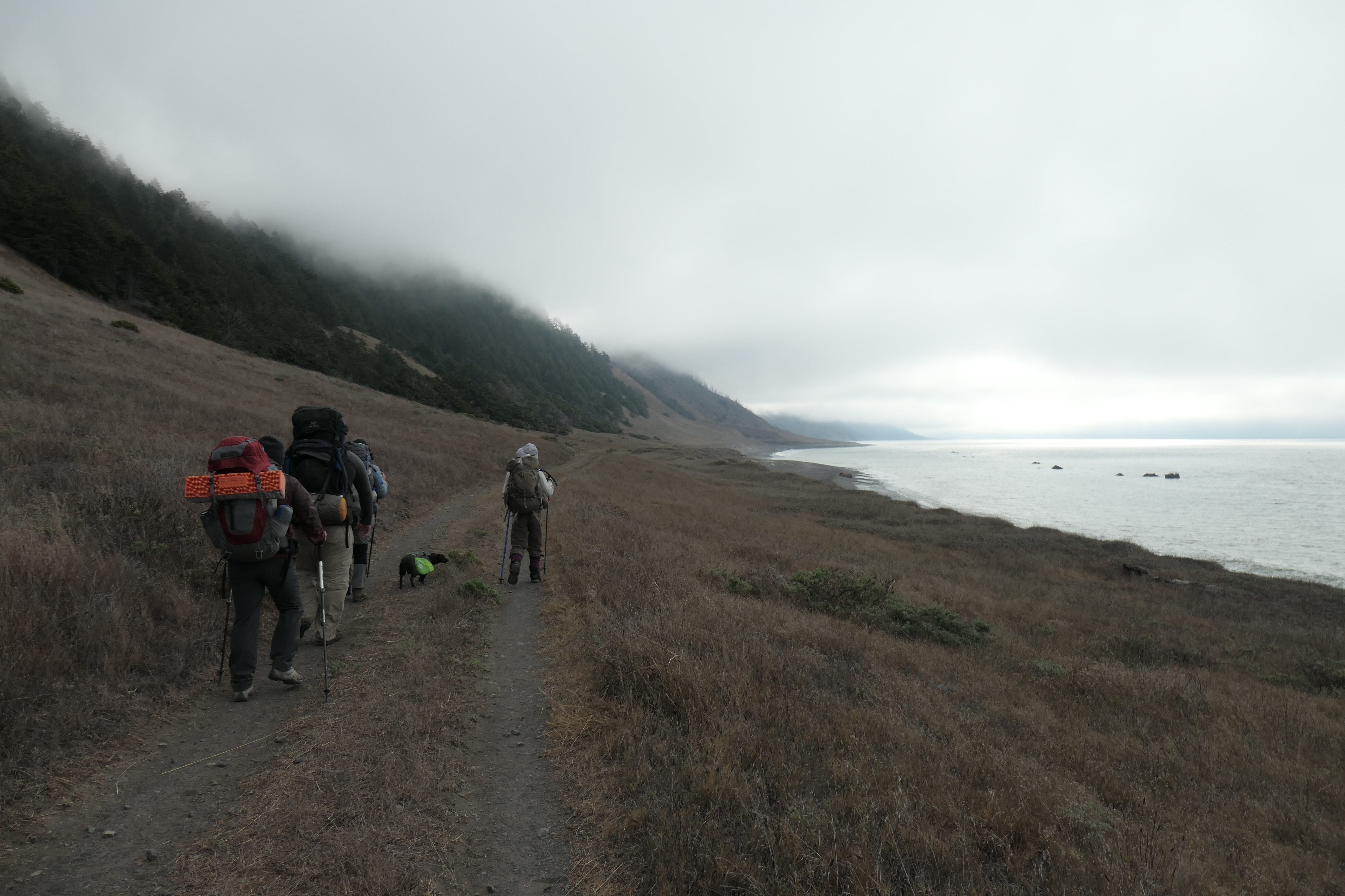
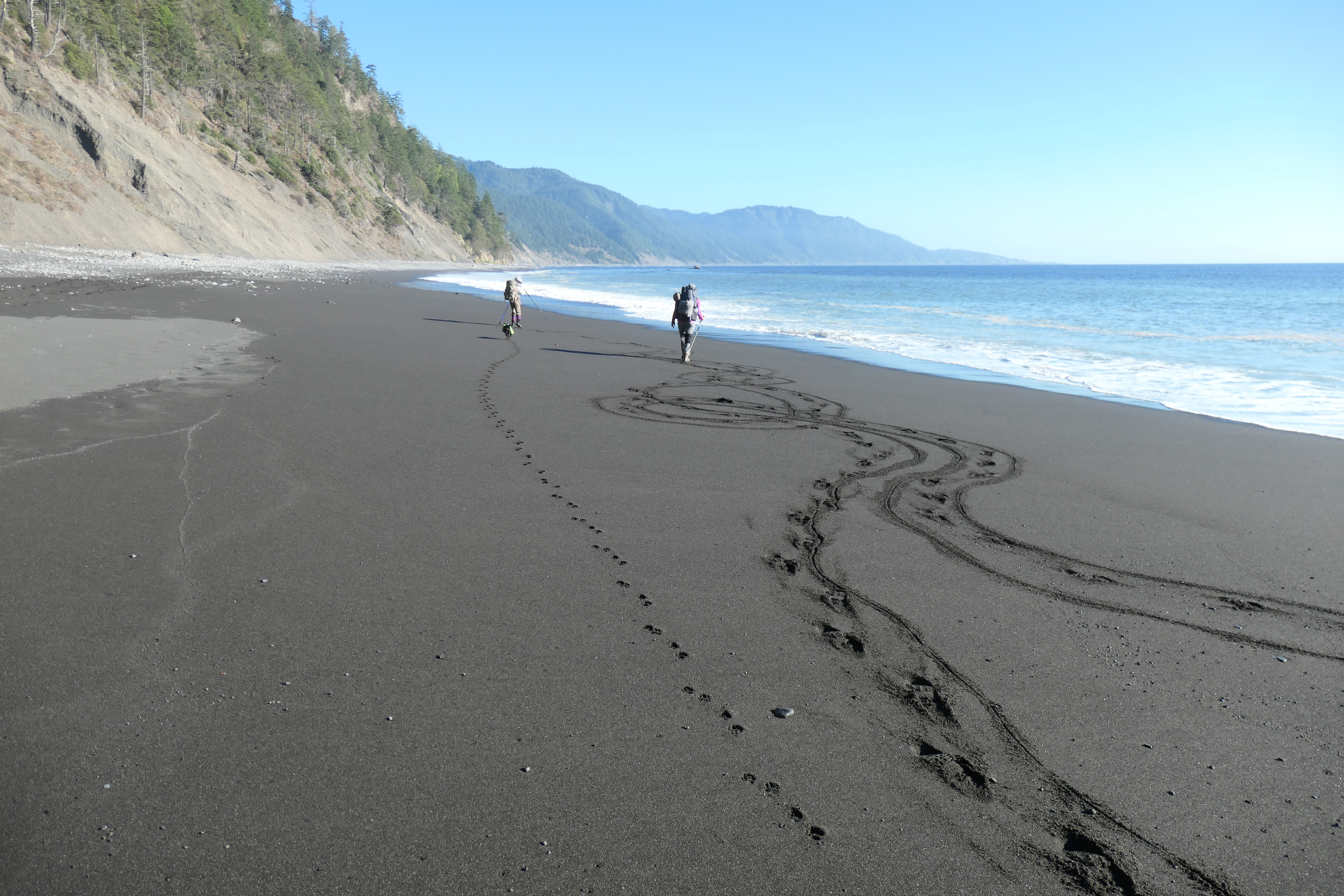
When we finally pulled up to Mattole, everyone was extremely relieved to get out of that van. We did a final check on our packs, consumed the last of our "car food", and set off southward on the sandy shore.
The weather couldn't have been any better, really. Perfect temperature, clear blue skies, a very mild wind...everyone was having an absolutely splendid time.
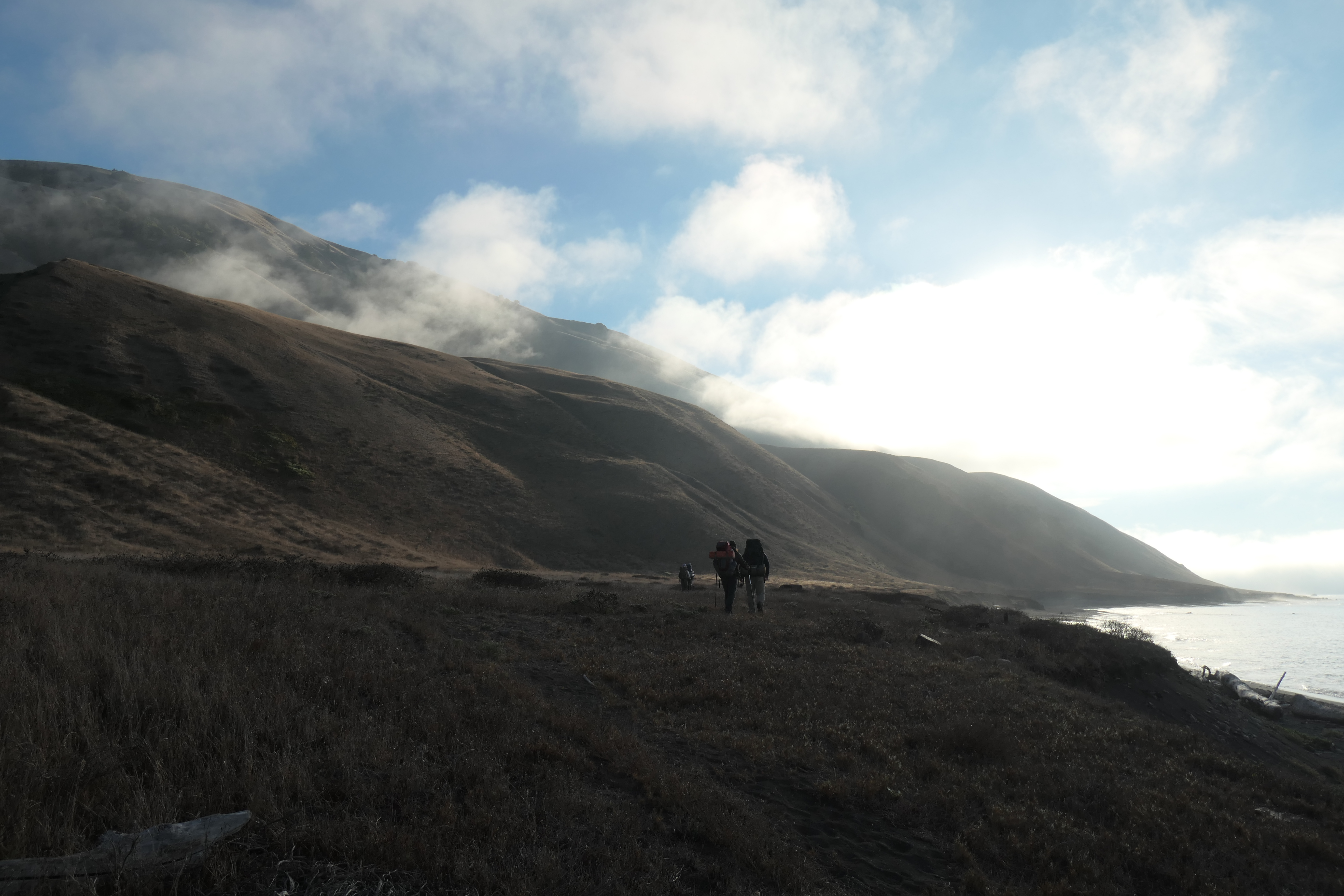
But as we approached the Punta Gorda lighthouse,
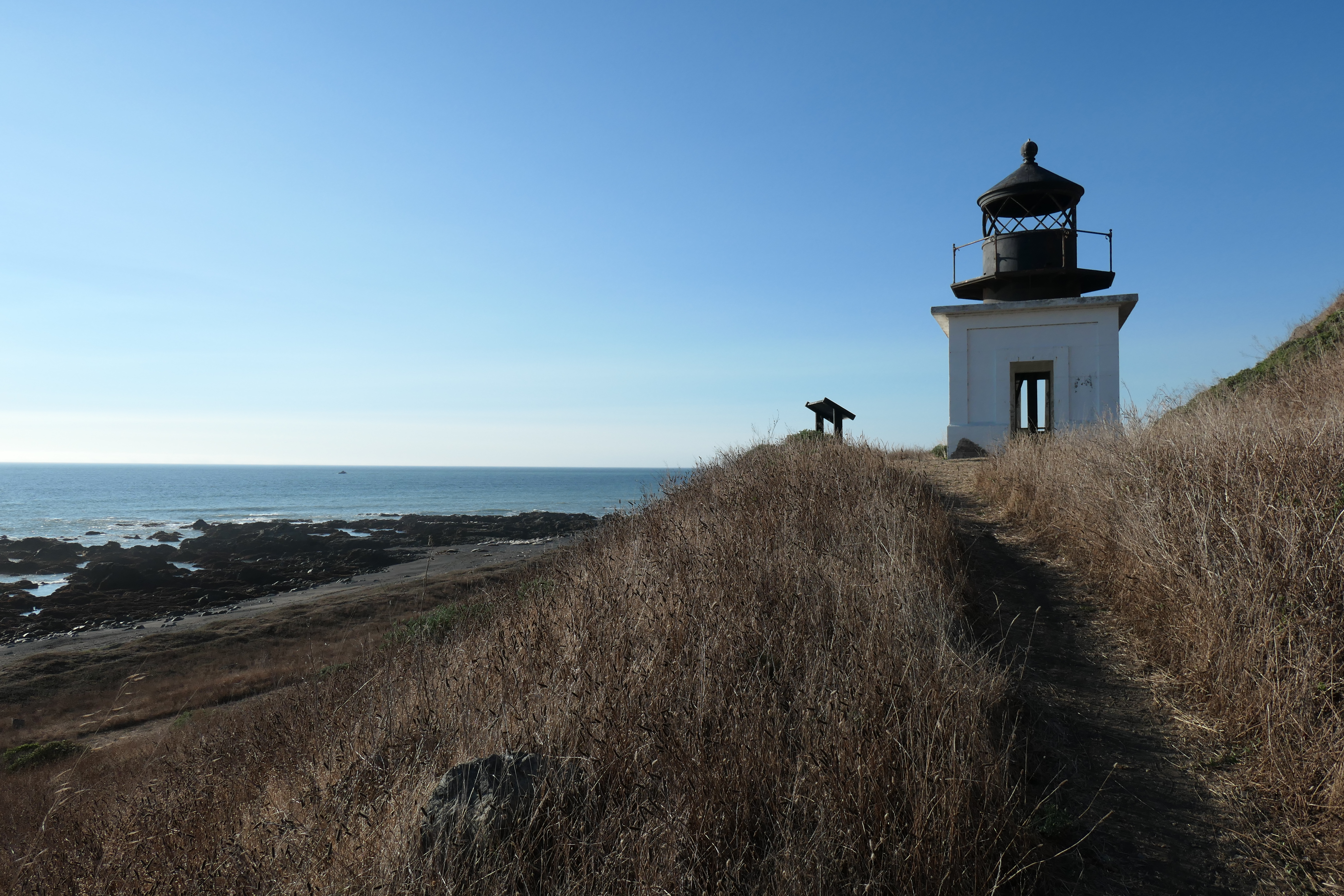
we noticed that our dog, Juniper, had plopped down on the sand and was fervently licking her paw. We had been worried about this leading up to the trip. Tina had read several reports about dogs struggling with the rough sand and sharp rocks and seashells along the beach. Juni has some pretty tough paws with all the hiking she does, but not tough enough to deal with the Northern California Coast, I guess.
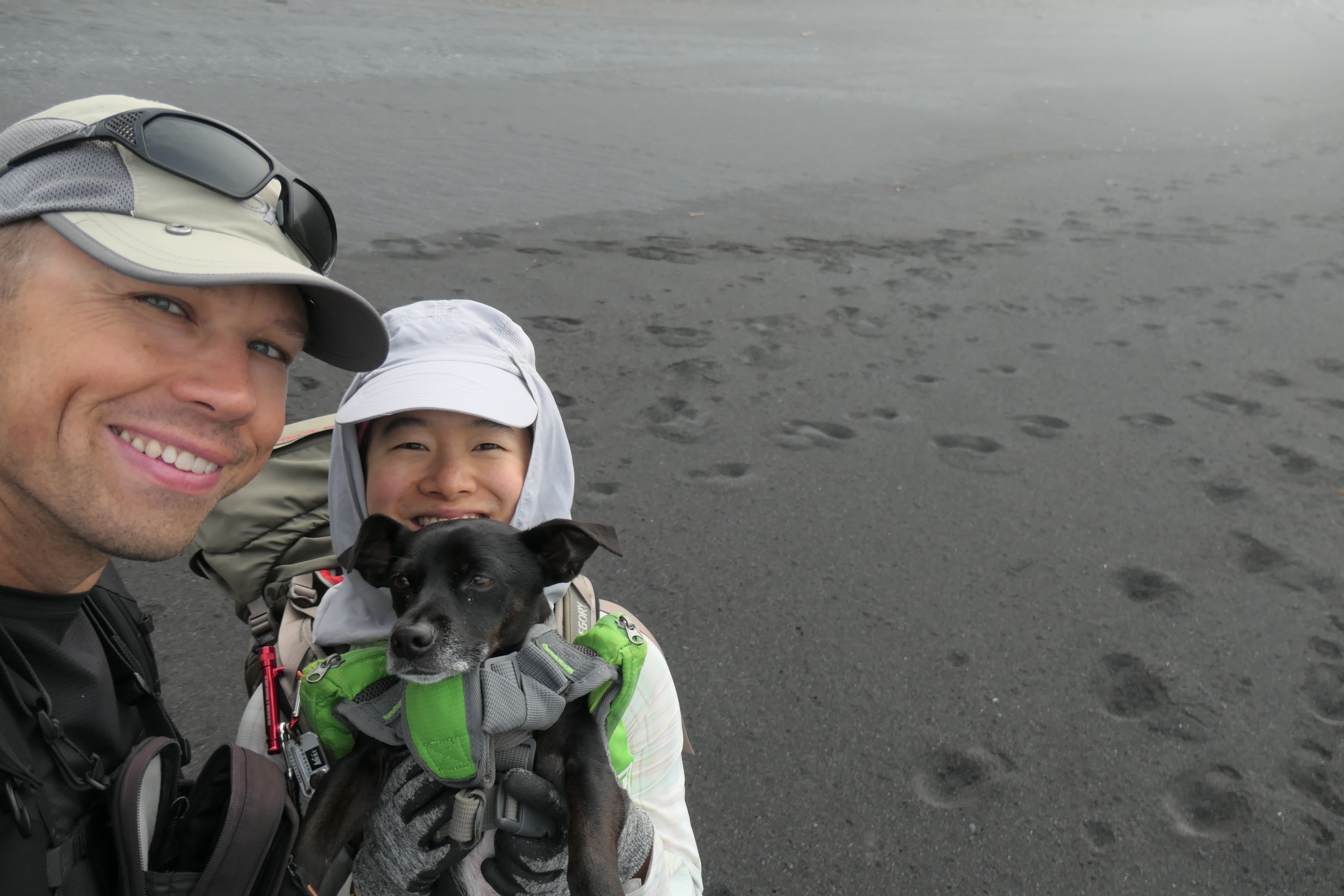
When we picked her up and investigated what it was that was bothering her, we couldn't find anything obvious. The skin on the underside of her paw looked a little irritated, but it didn't look like anything had punctured it. Tina decided to put on her rubber booties in the hope that it would alleviate her pain. And what do you know? They really seemed to help! Even though she seemed to be walking fine after we treated her, we decided that we'd try to carry her through all the nasty, sharp sections of beach going forward. She's only about 20 pounds, so we weren't worried.
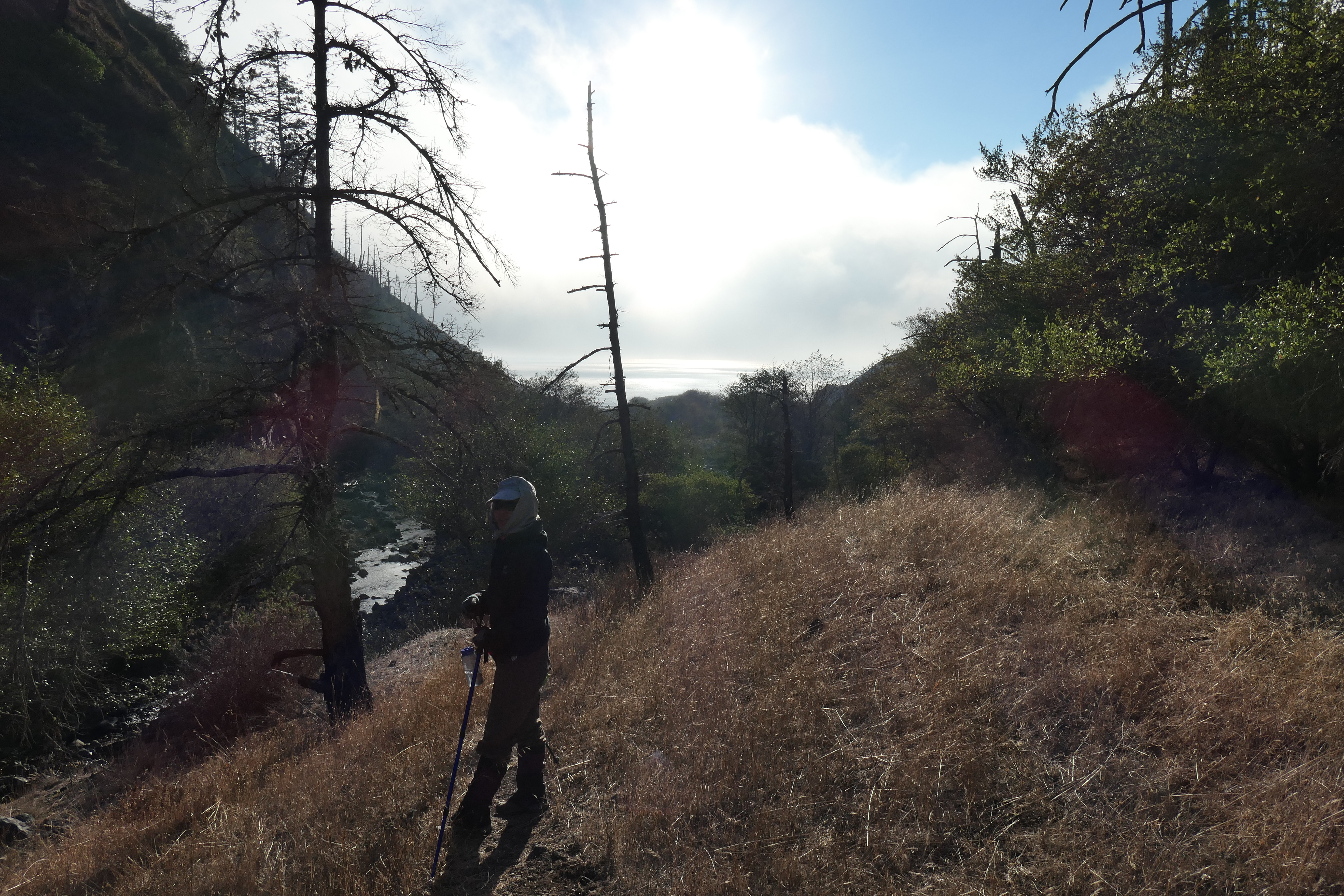
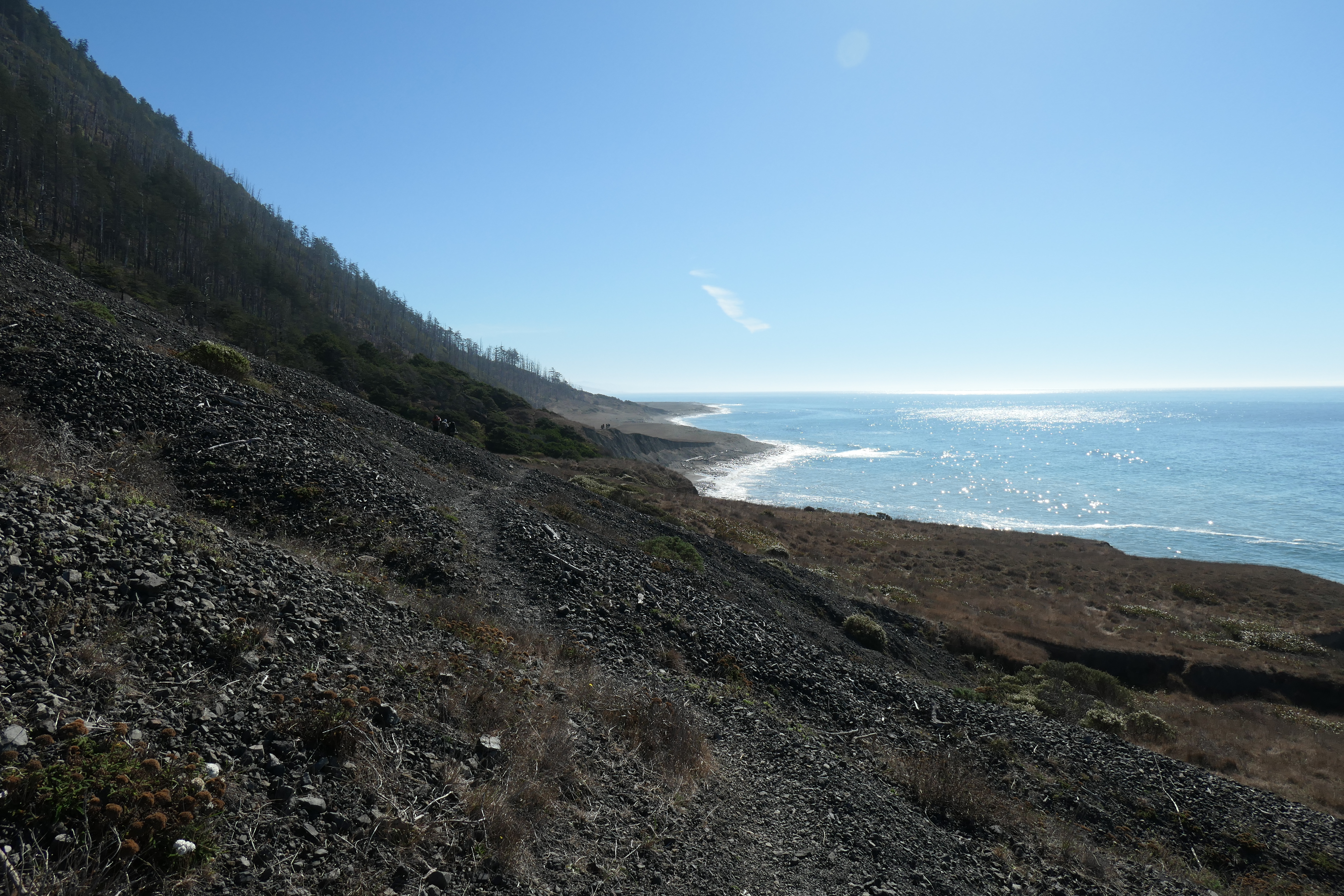
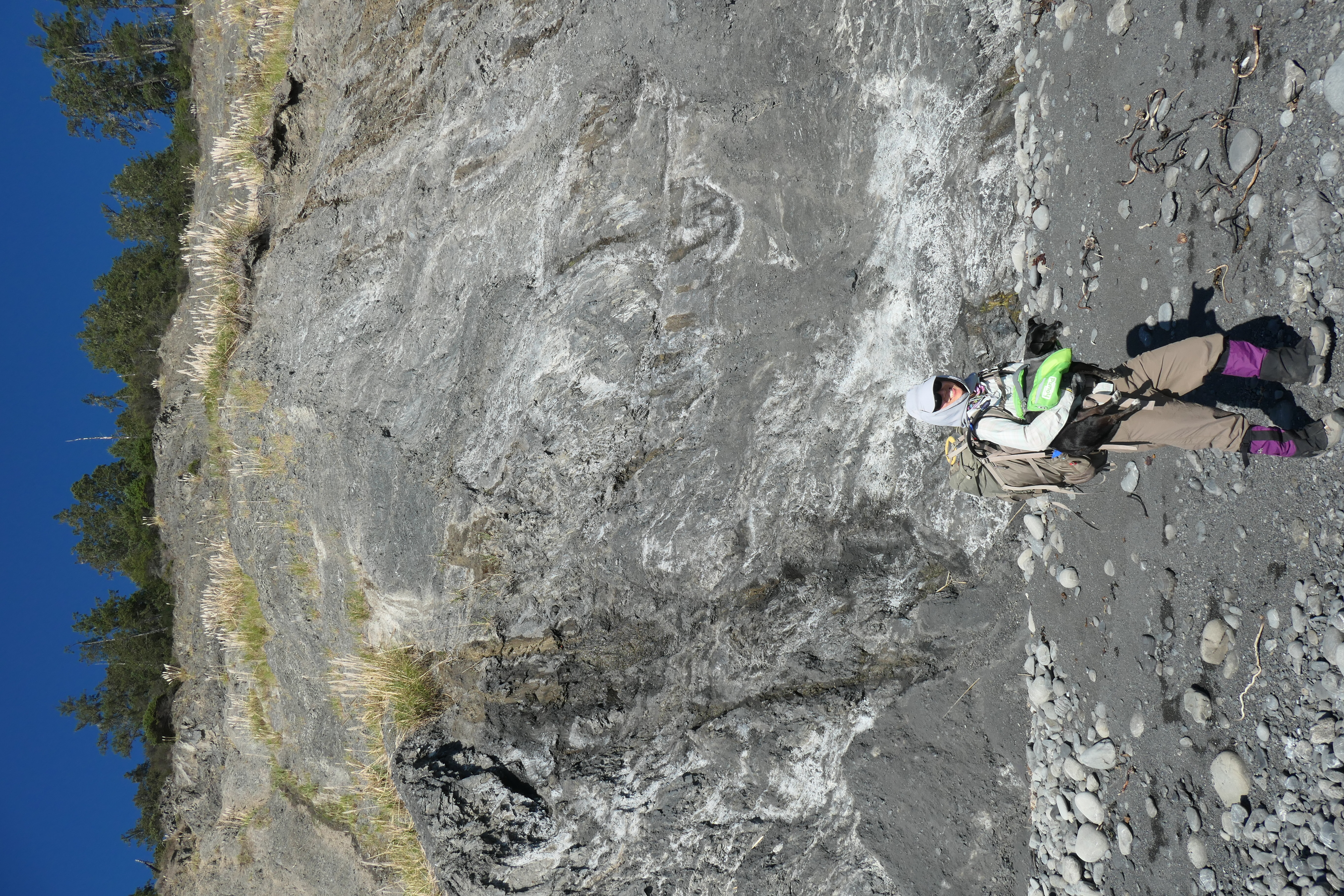
Shortly after the lighthouse, we came upon the only tricky section of the first day. I had read about this one in a trip report, where the author warned about a spot where you're forced to climb up onto the cliffs to avoid an impassable section of shore. There is a little sign that indicates where this is, but it's pretty easy to miss. Luckily Mark and Tina were able to spot it.
Getting up on the cliffside was pretty nice, as the ground was firm and the views were superlative.
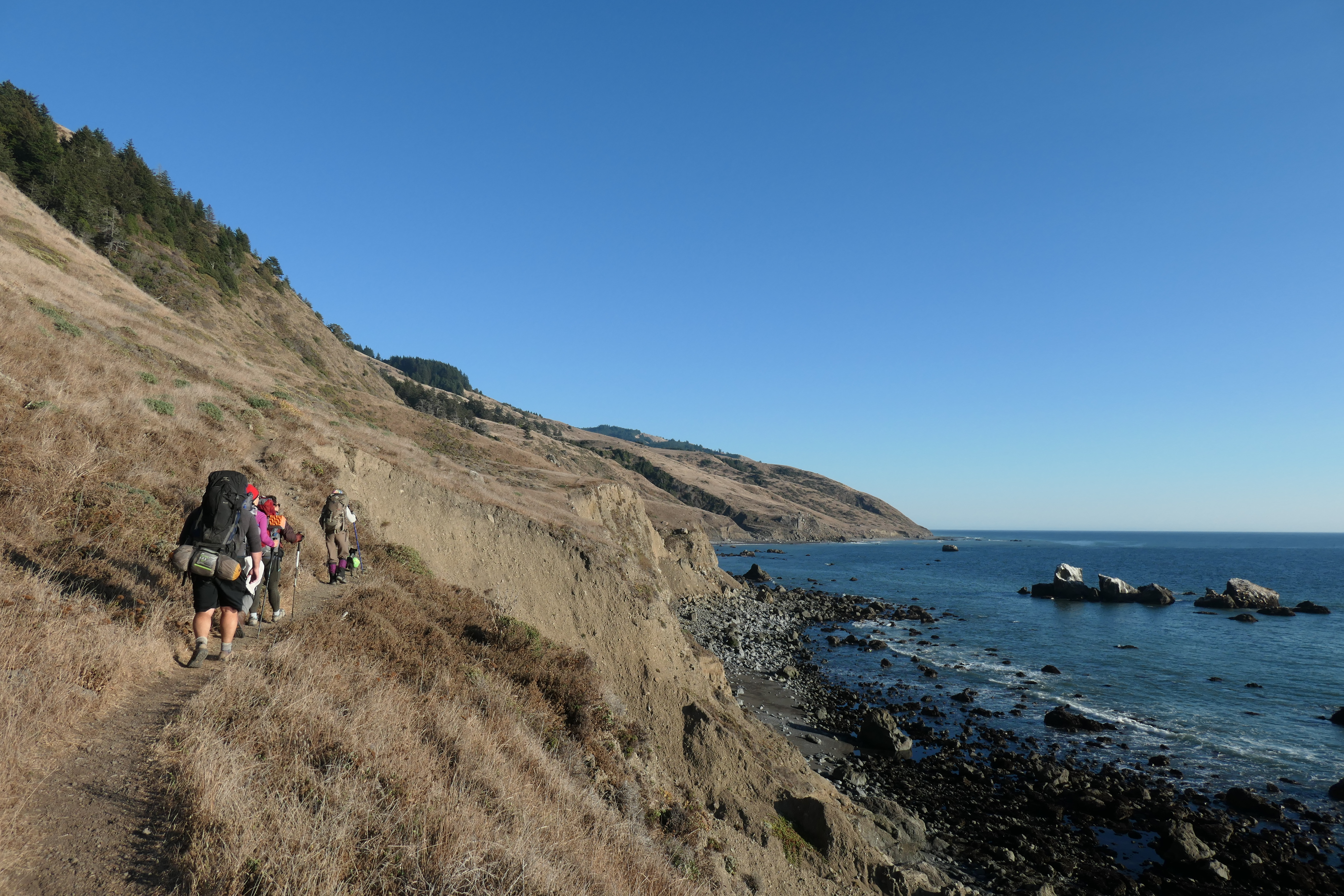
The trail is rather easy to follow along these cliffside sections. There's a decent amount of poison oak growing around the trail, though, which you have to be careful about. The leaves had mostly fallen off, so it was a bit tougher for us to identify what was what. It seemed like there were a few different plants that had the same distinctive forking branch pattern that poison oak has. We just tried to avoid contact with the plantlife as much as we could, and thankfully none of us ended up with any rash during or after the trip.
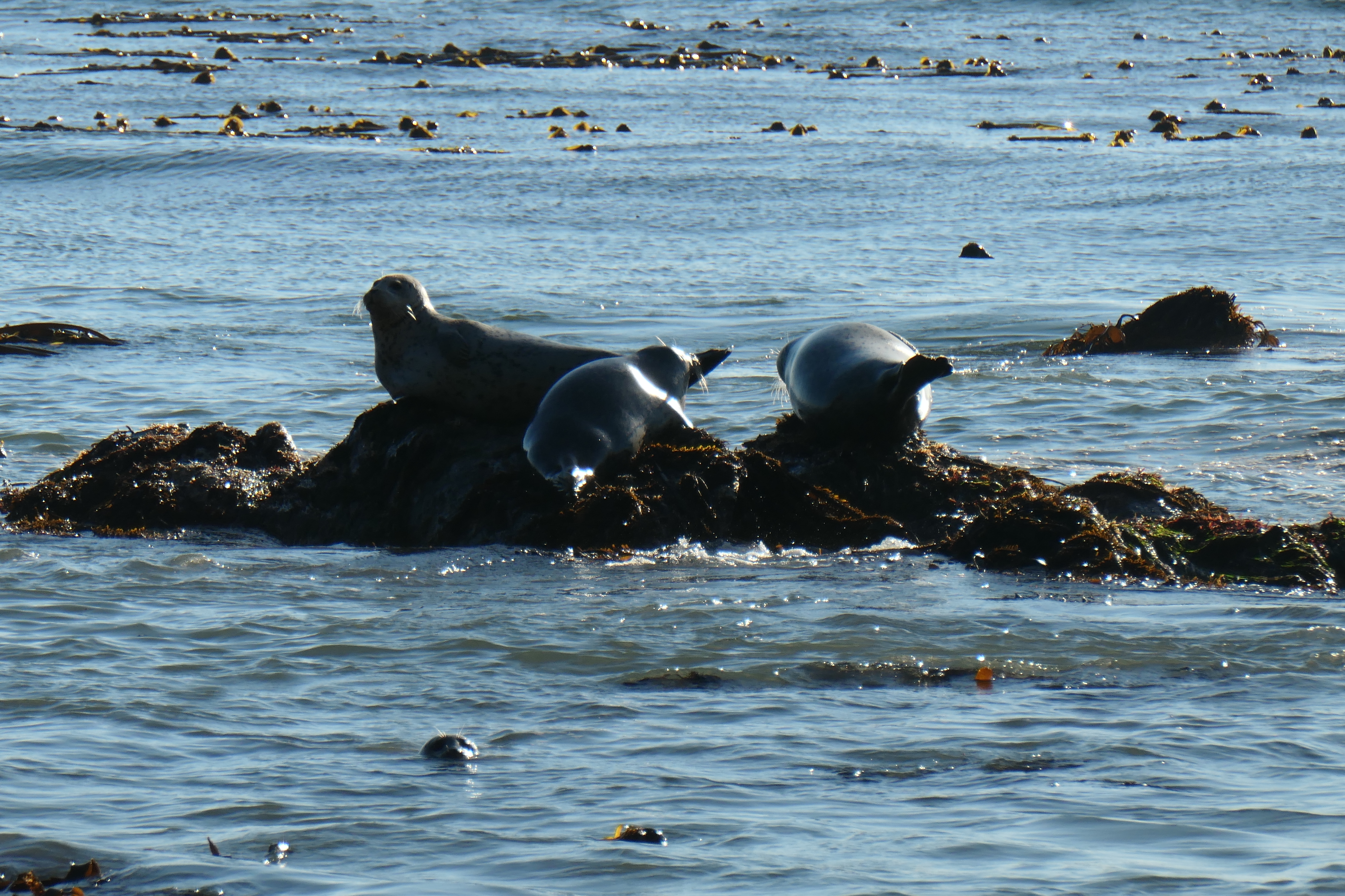
When we got back near the shore, we started to hear some very loud, interesting noises that were difficult to place. I wondered if we were somehow hearing the distant sound of car horns honking from far, far away. But soon it became clear that we weren't hearing cars honking at all. The seals were having themselves a party on the rocks!
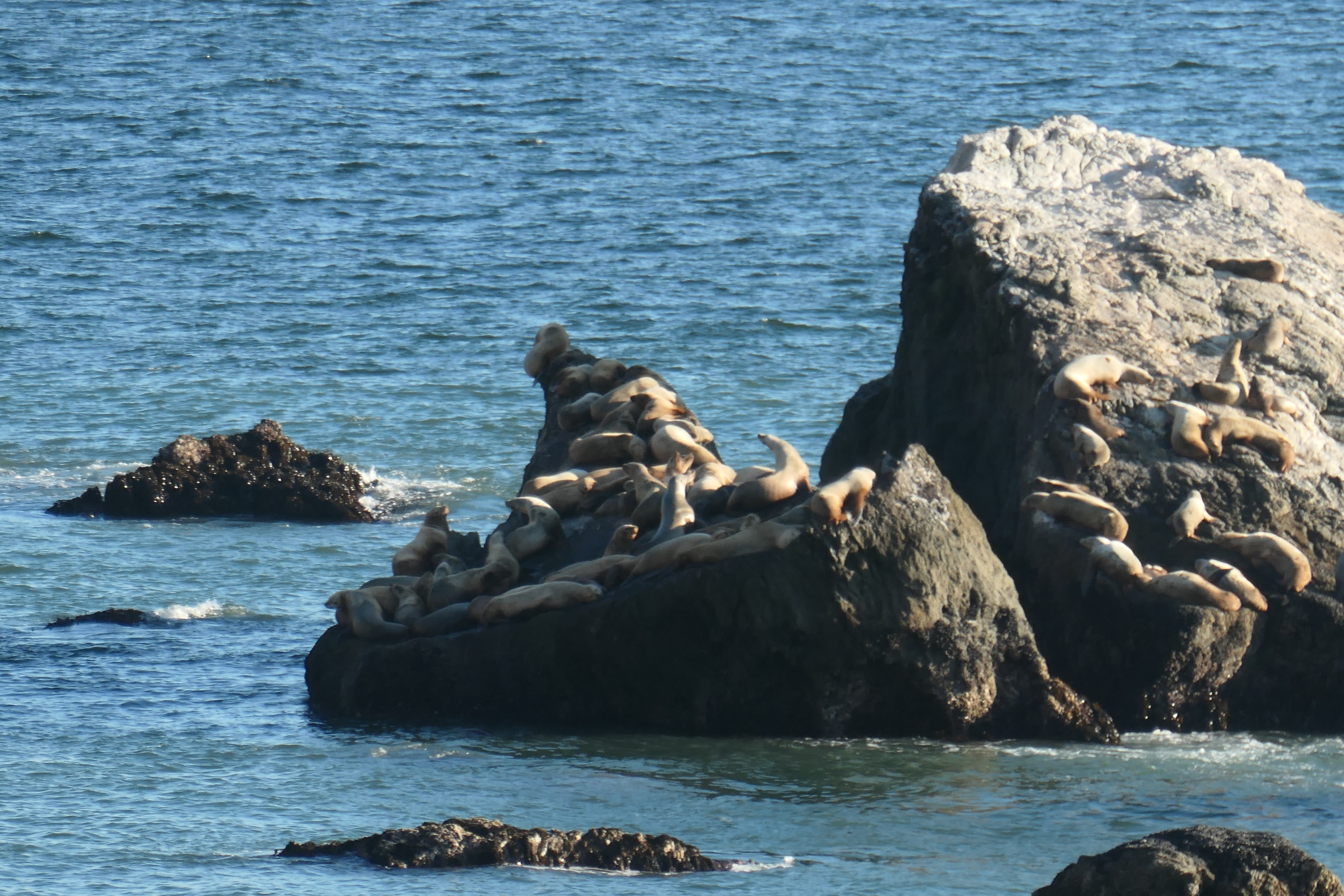
We stopped to watch them and take some pictures. They looked like they were having a grand old time basking in the sun. I was kind of jealous, to be honest. What a great life that would be.
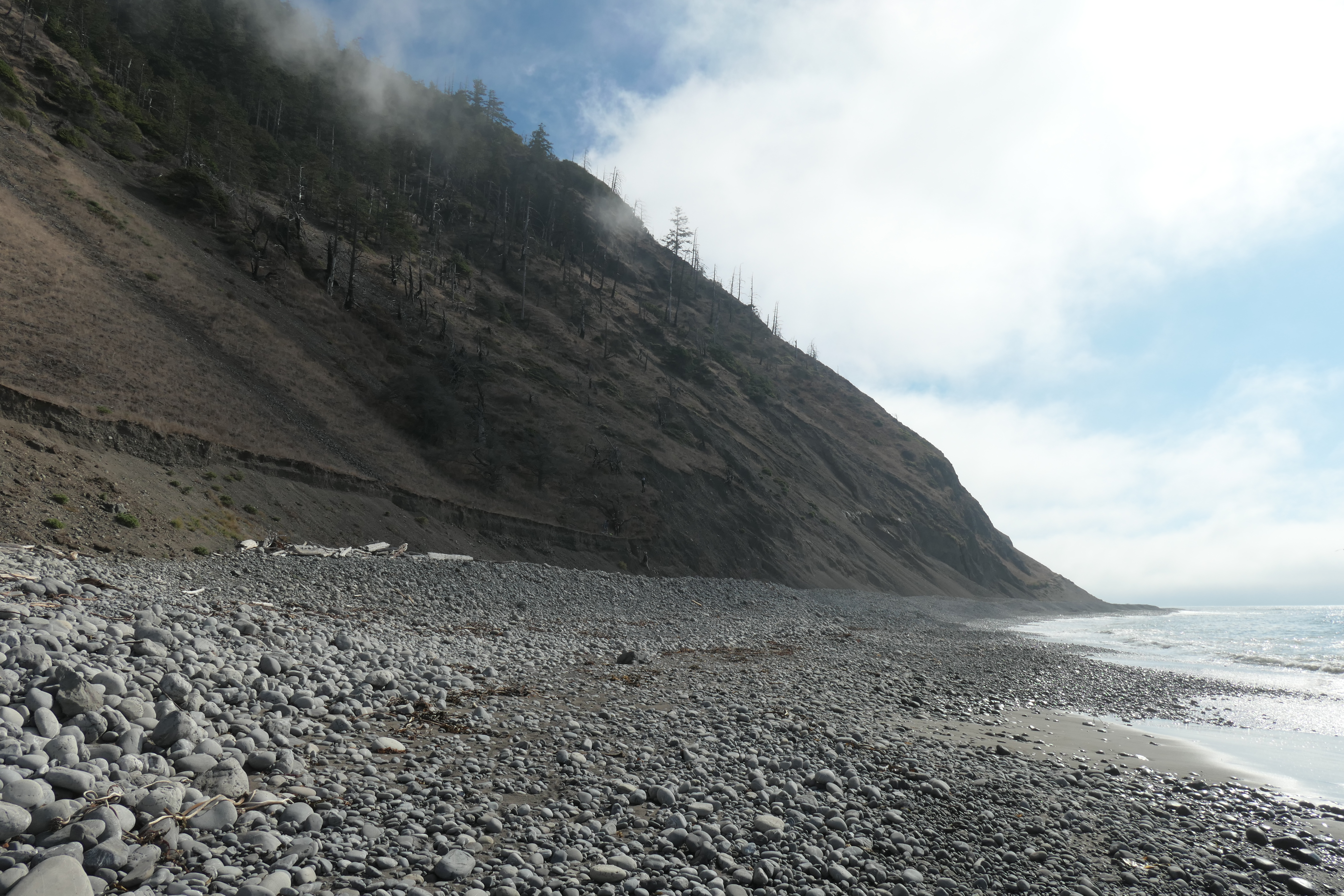
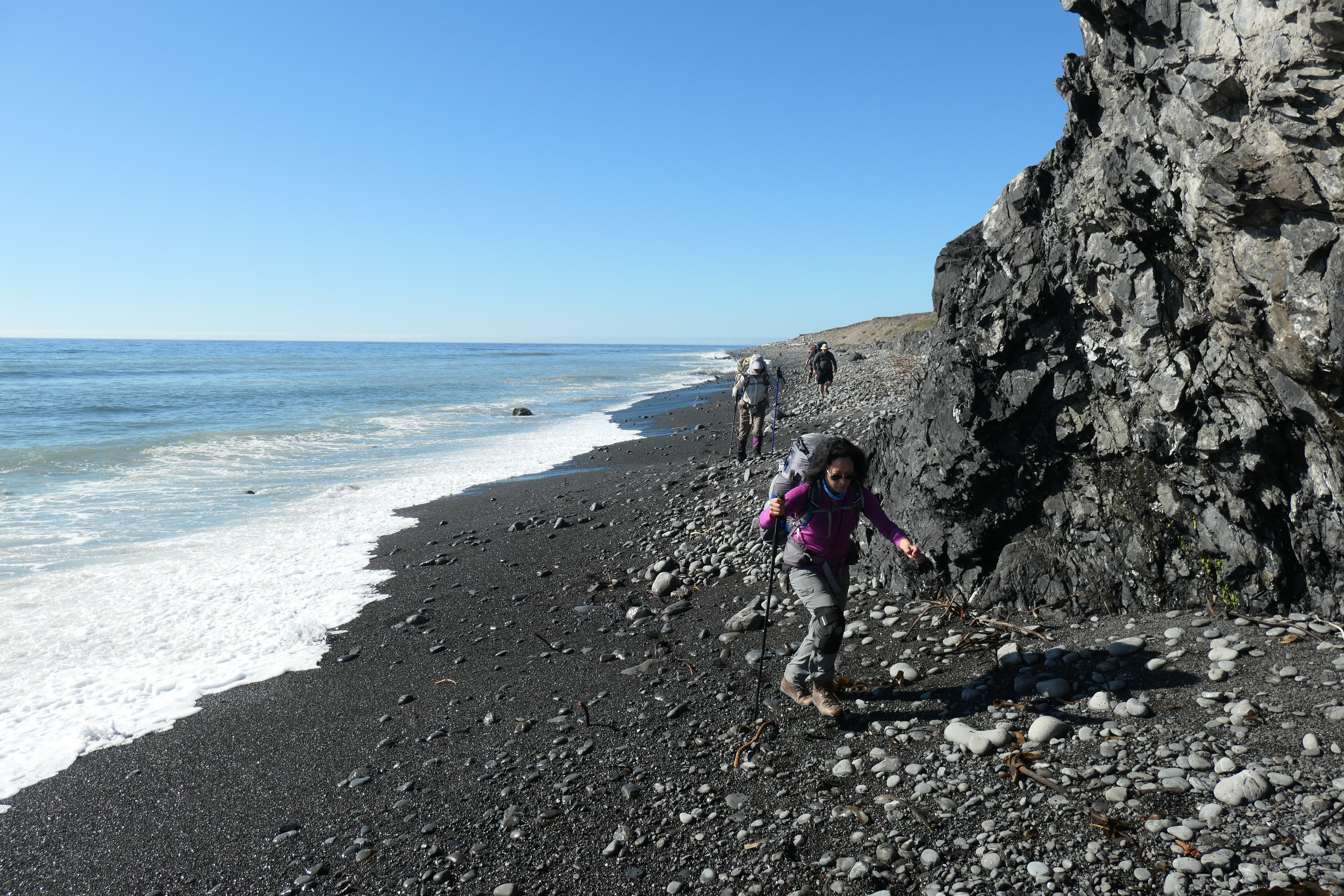
A few miles/hours after we had started the hike, we hit our first tricky-footing section. It was filled with big, fat cobblestones.
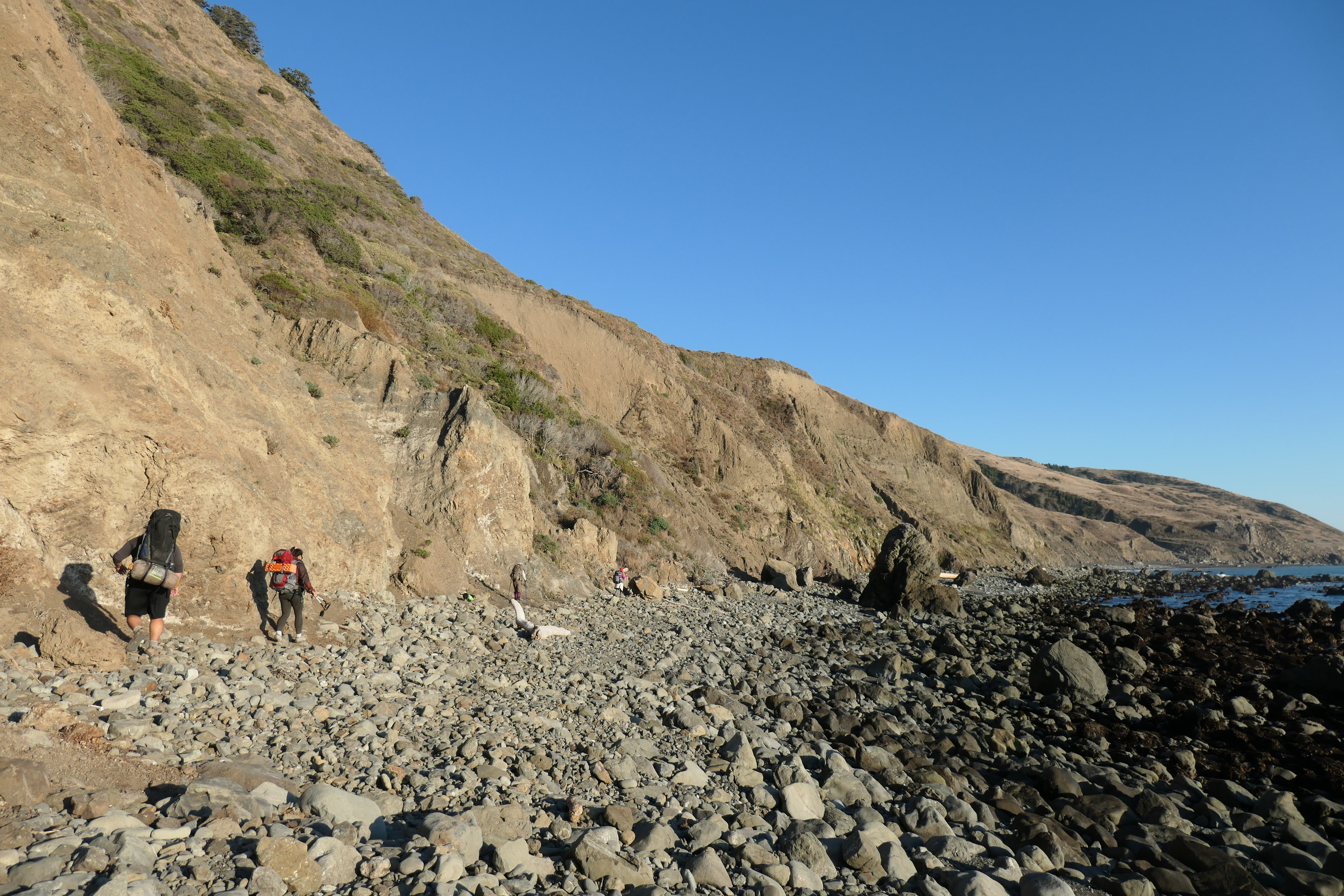
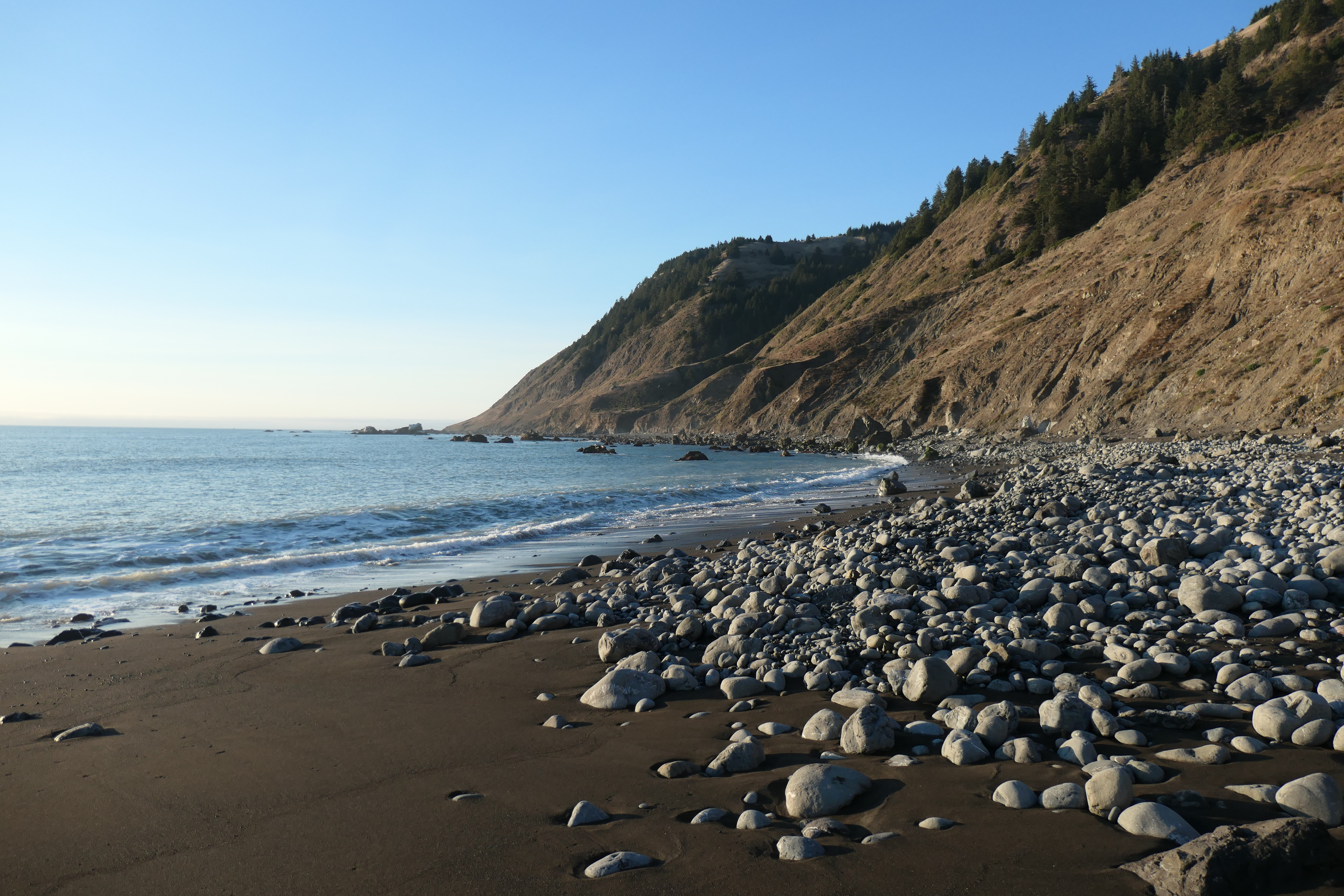
This is the thing that had worried me most about the hike. Everyone seemed to agree in the trips reports I had read that this was what made the trip really tough. After doing the LCT myself, I would not argue with them. It makes for very slow going, with a sprained ankle or hyper-extended knee just waiting to happen.
As the sun began to set about five miles in or so, we climbed away from the beach one last time.

And when we did our final return to the water that evening, we dealt with one of several spots along the hike where you have to descend a steep chute to get back to the beach. It wasn't incredibly difficult or anything, but still tricky with the heavy pack.
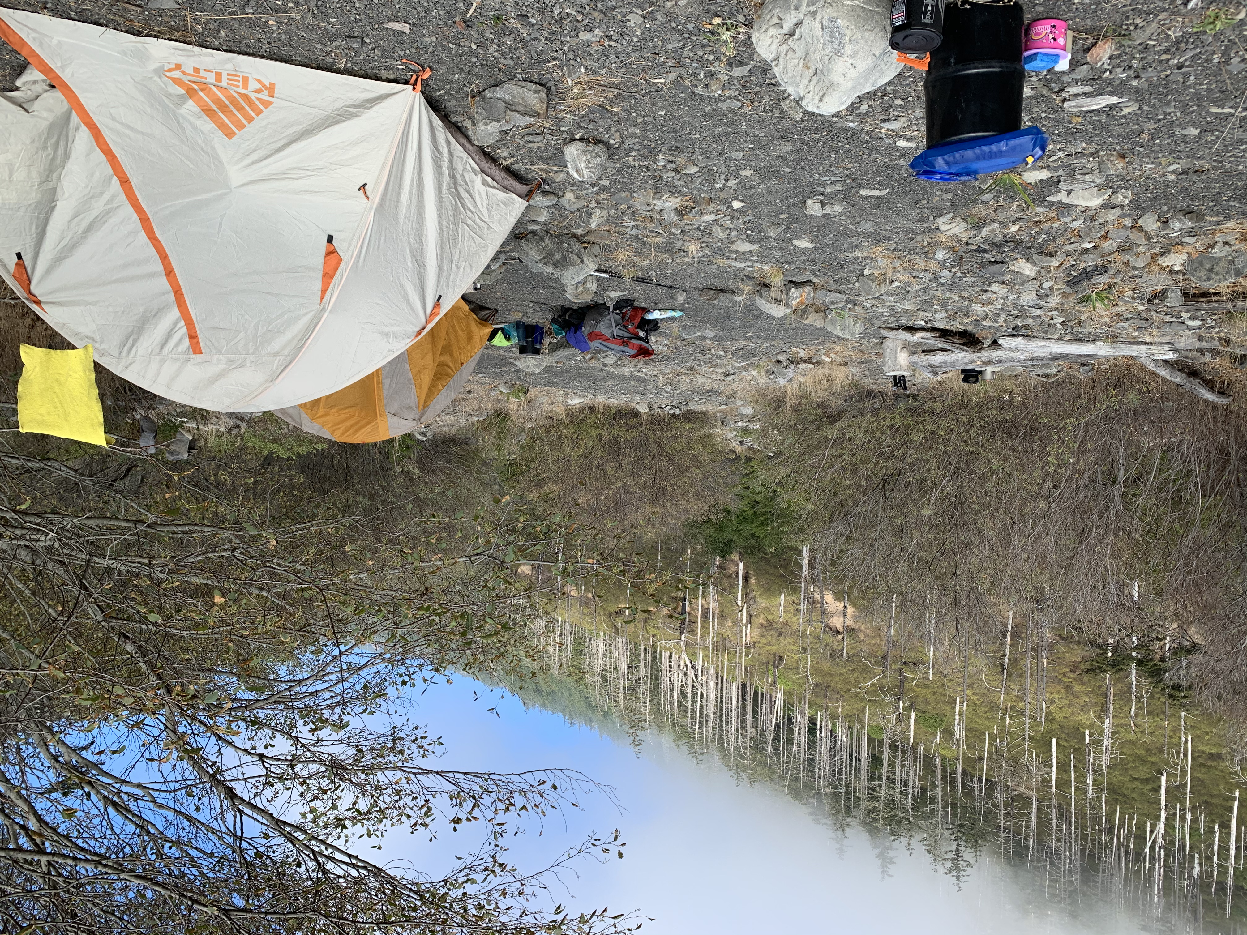
The timing could not have been more perfect for our approach to Cooskie Creek. The sun had just set, and the reflection off the small pool at the creek's end was absolutely brilliant.
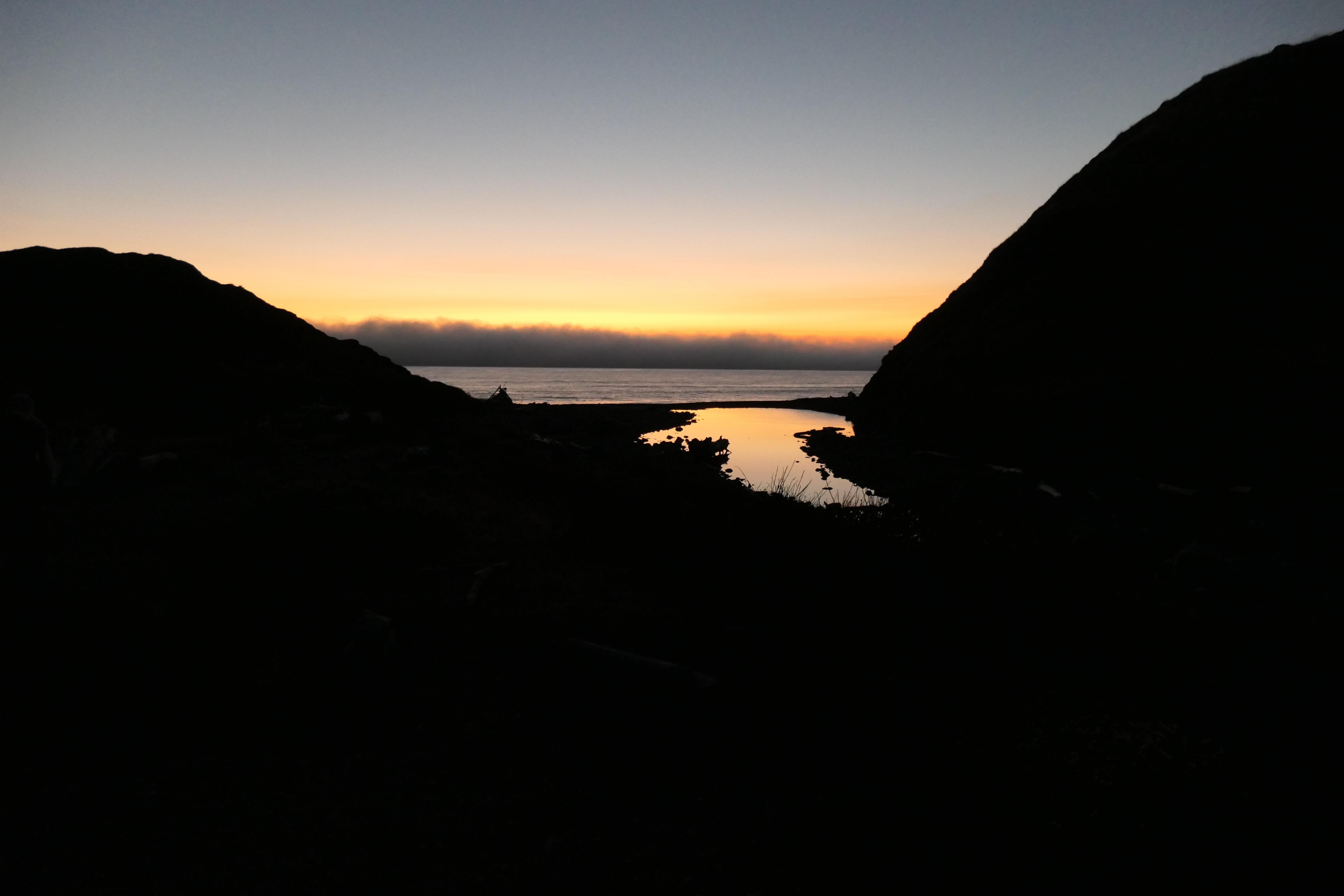
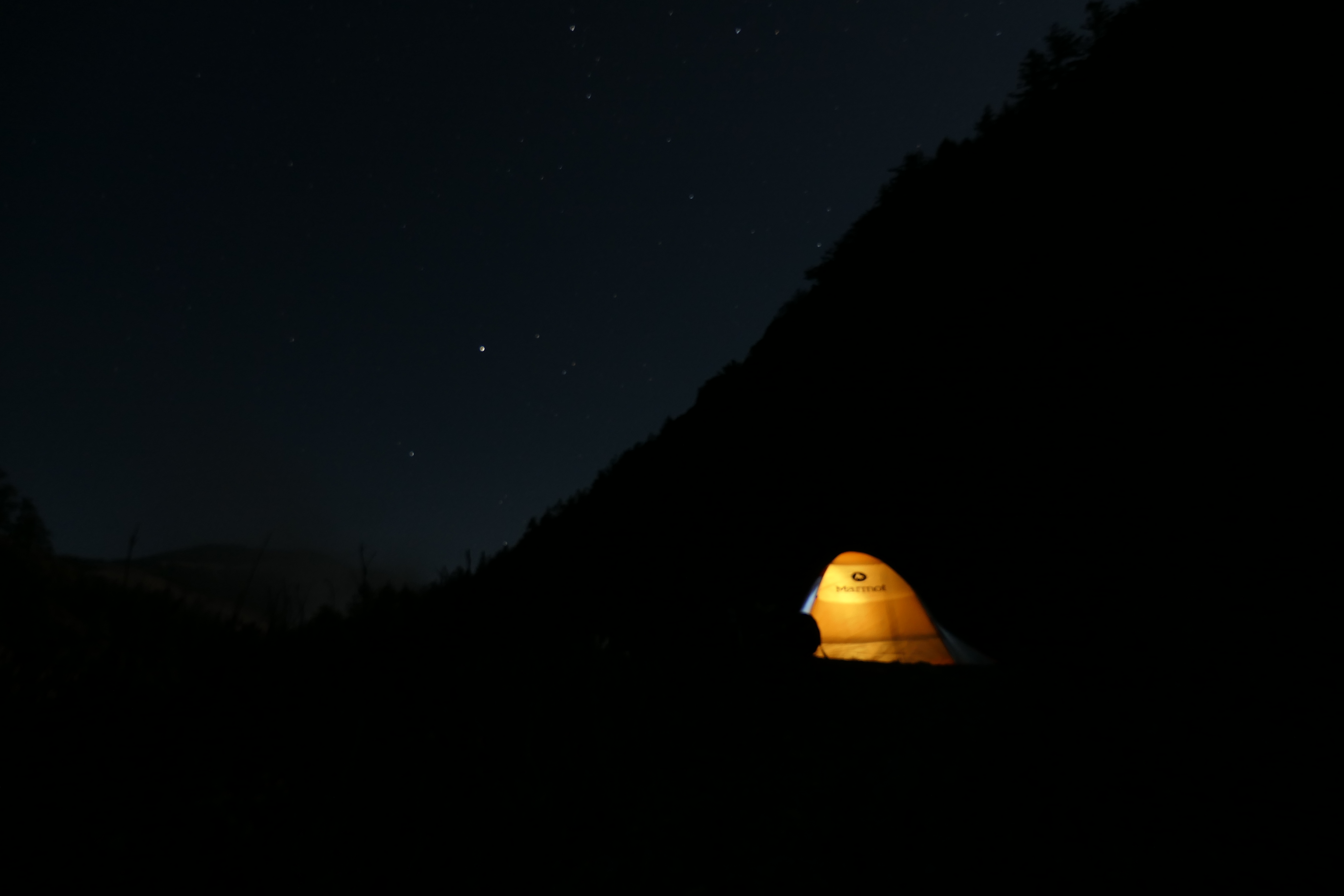
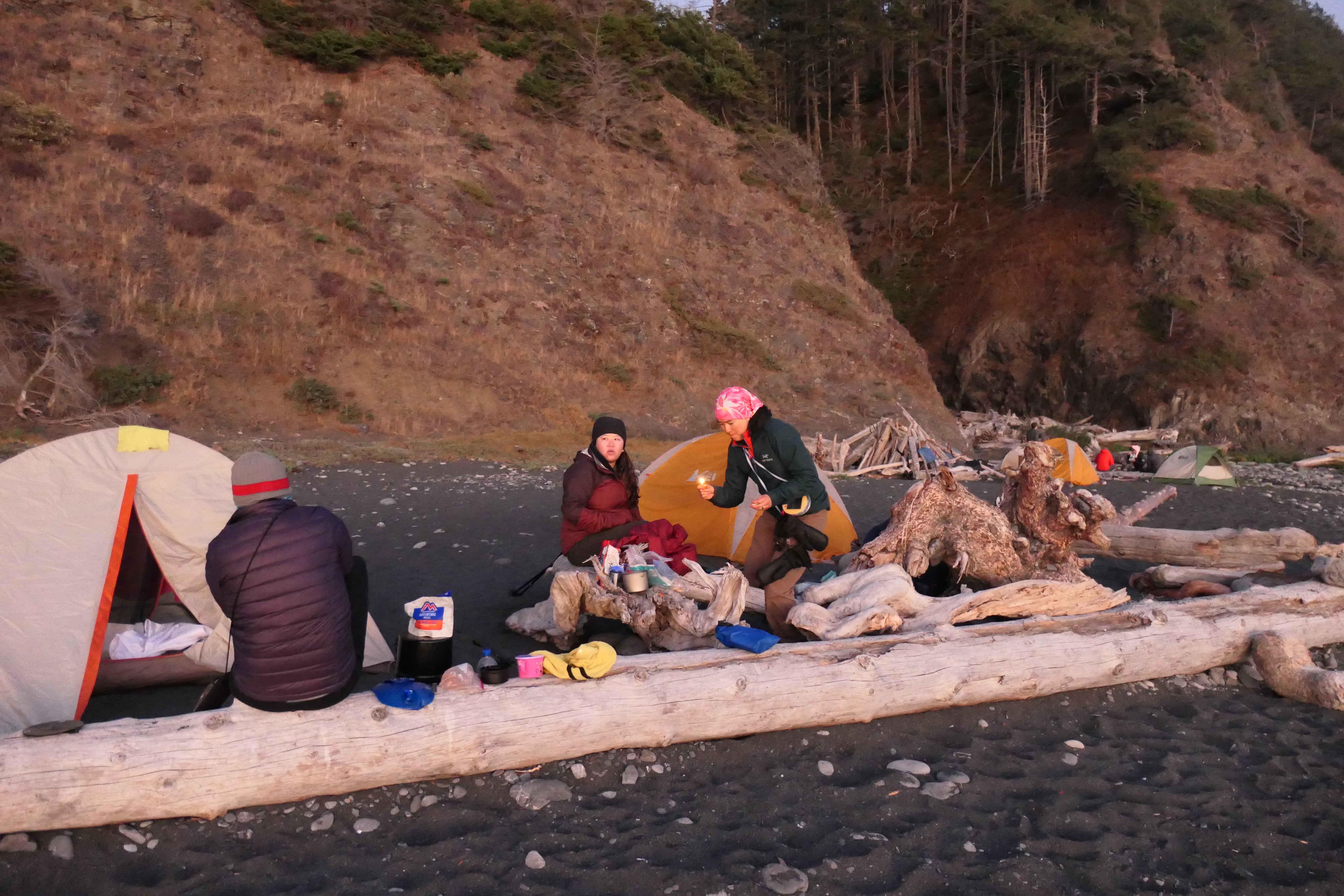
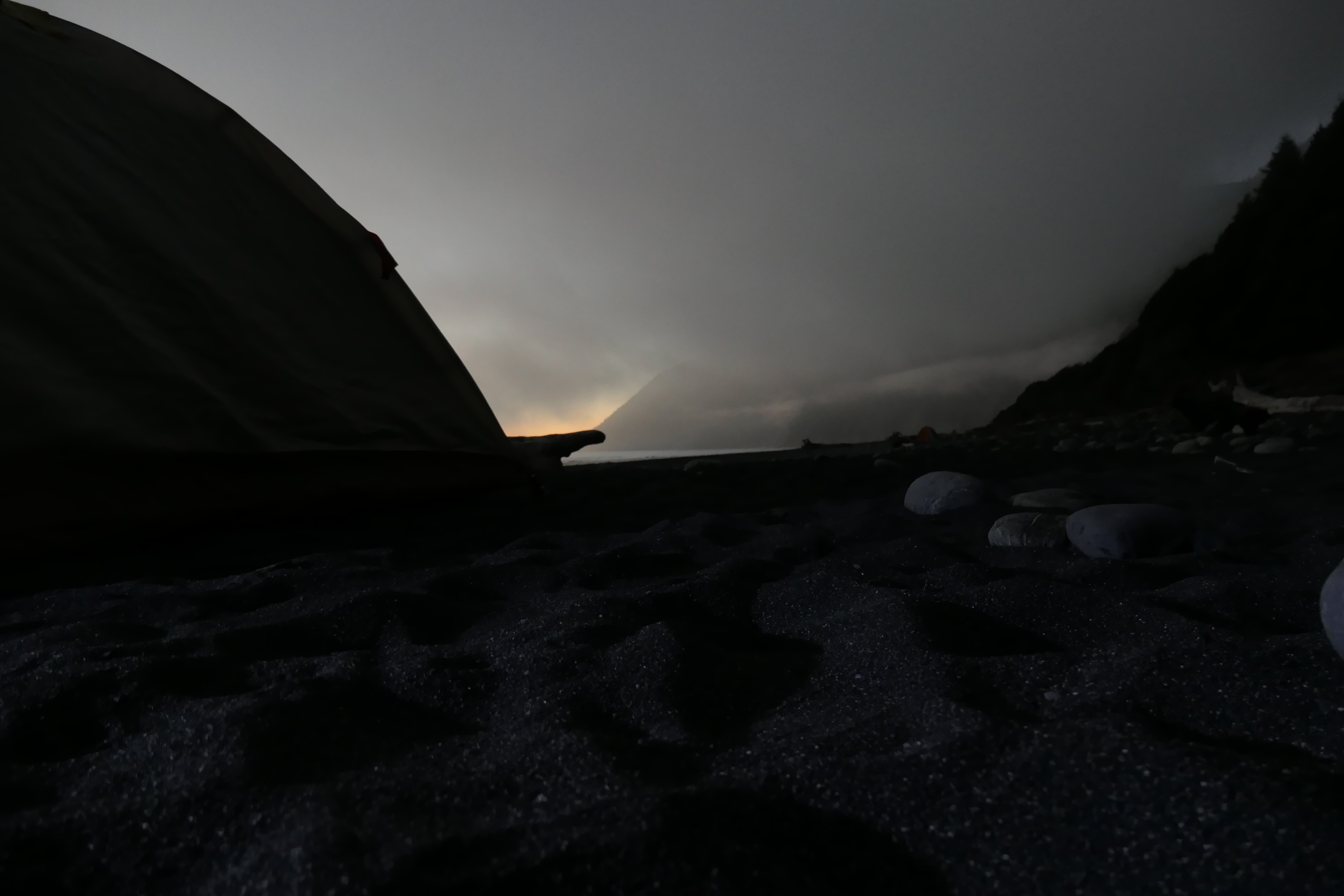
There wasn't a whole lot of real estate for tents at Cooskie Creek, but plenty for the five of us. We set up our tents in the dark, and then had a nice quick dinner. The plan was to get to bed early for the very, very early start the next morning morning. Still, I couldn't help but stay awake a little longer and try to photograph the show we were seeing in the night sky. The descending fog was creating a stunning spectacle with the moon rising over the ridge to our south.
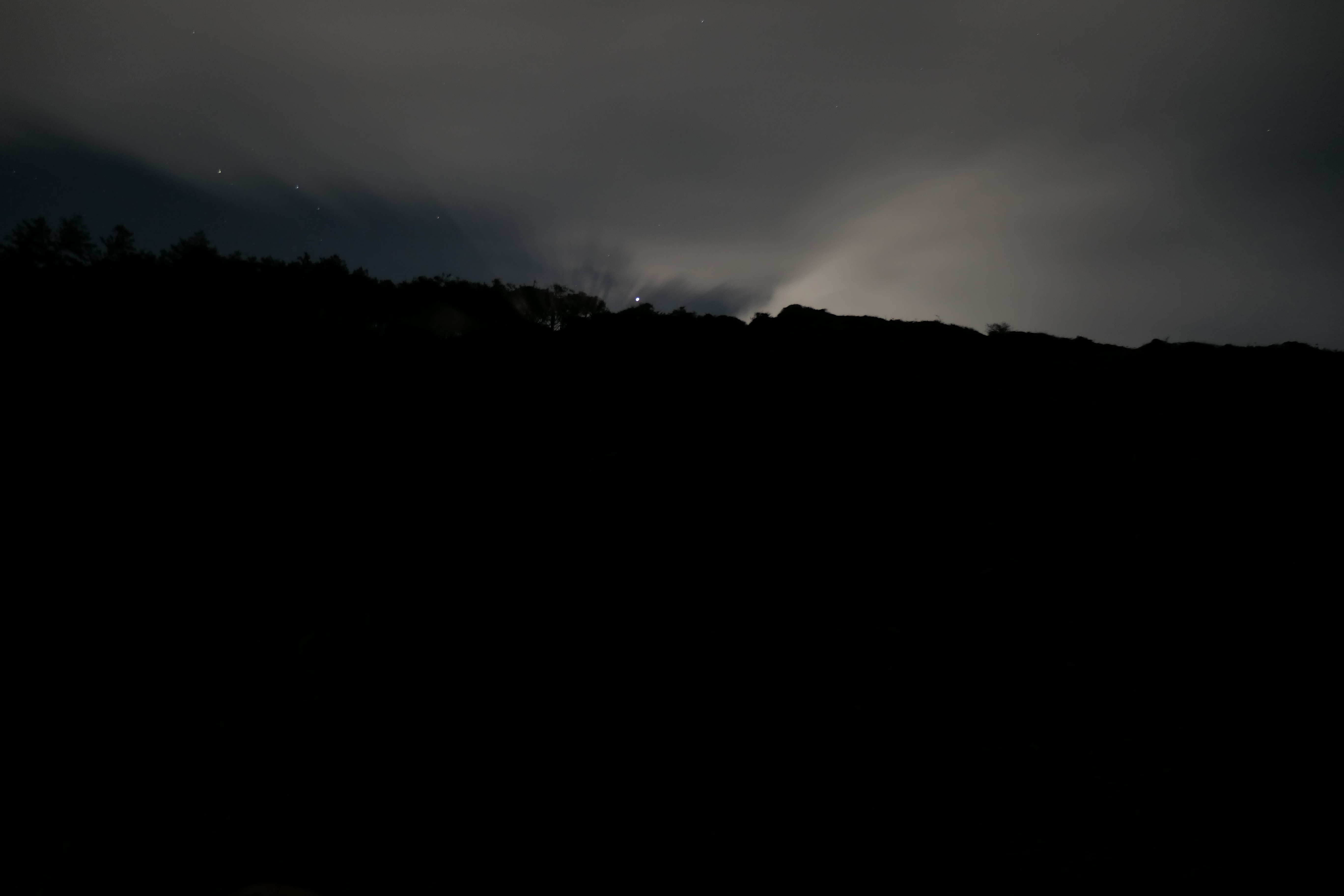
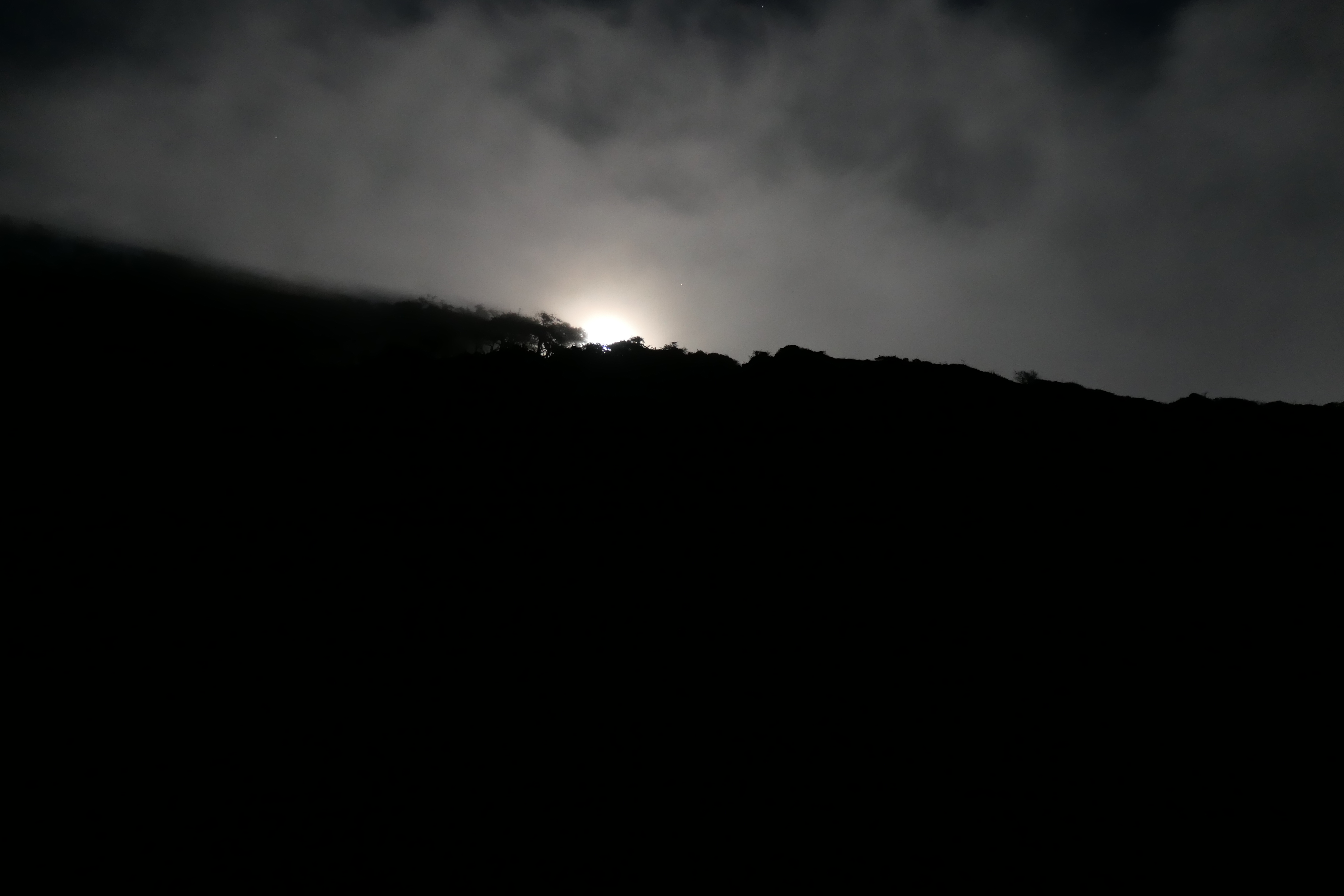
It was like a heavenly cinematic experience. Looking at our tent glowing in front of the crystal clear night sky, I felt thrilled to be alive.
Day 2 was by far the most intense day of the trip. We all agreed that we needed to be hiking by 445 am so we could make it past the first pinch point before the high tide started creeping in. My alarm went off at 4 am, and although I was brimming with excitement for the morning ahead, nobody else seemed to share my excitement when I told them it was time to get up. I happen to be a morning person, but my fellow trip members were not. After realizing I was annoying them a bit, I decided it would be better to just keep my trap shut as much as possible.
Low tide for the morning was predicted to occur at 510 am. We figured that it would take us about 2 hours to hike the 2 miles between Cooskie and Randall Creeks, which would give us a little bit of margin if something were to go wrong. But despite the margin, my adrenaline was pumping pretty hard for these two hours.
The going was not at all easy in this section. Once again, large cobblestones coated the beach, making progress very slow. It was especially challenging since it was pitch black outside (the full moon was in the western sky, but it was completely shrouded by dense fog). As we slogged along, it really felt like we were going slower than a mile an hour. none of
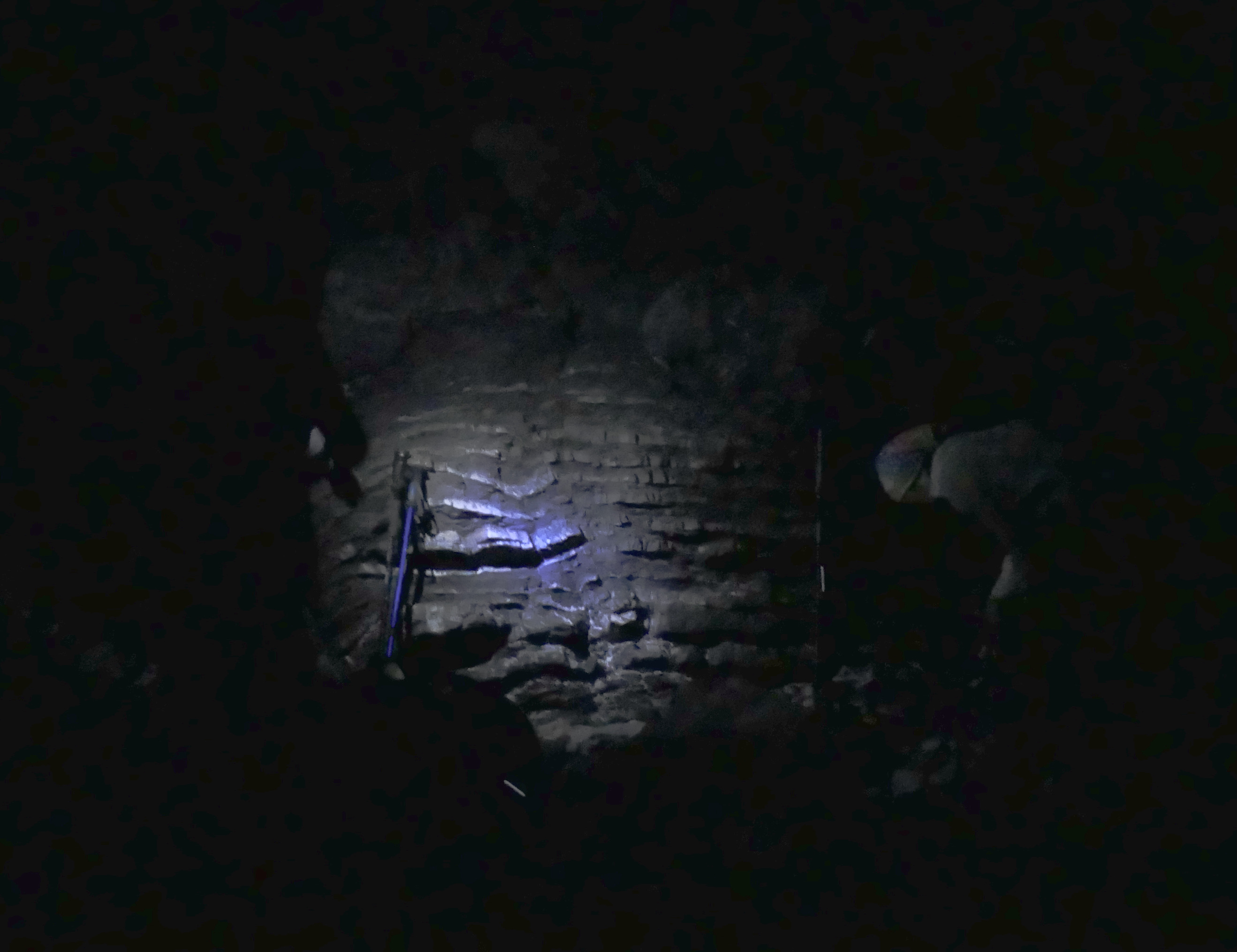
Although we all felt the impending time crunch, we were taking our time and trying to make sure none of us suffered a debilitating injury. We even had time to do a few #2/clothing-adjustment breaks on the beach (this is the best picture I could get from the the pre-dawn chaos).
During the last half a mile or so, though, the encroaching waves and the sound of them crashing against the beach definitely rattled our nerves a bit. At times it seemed like we were never going to reach our destination.
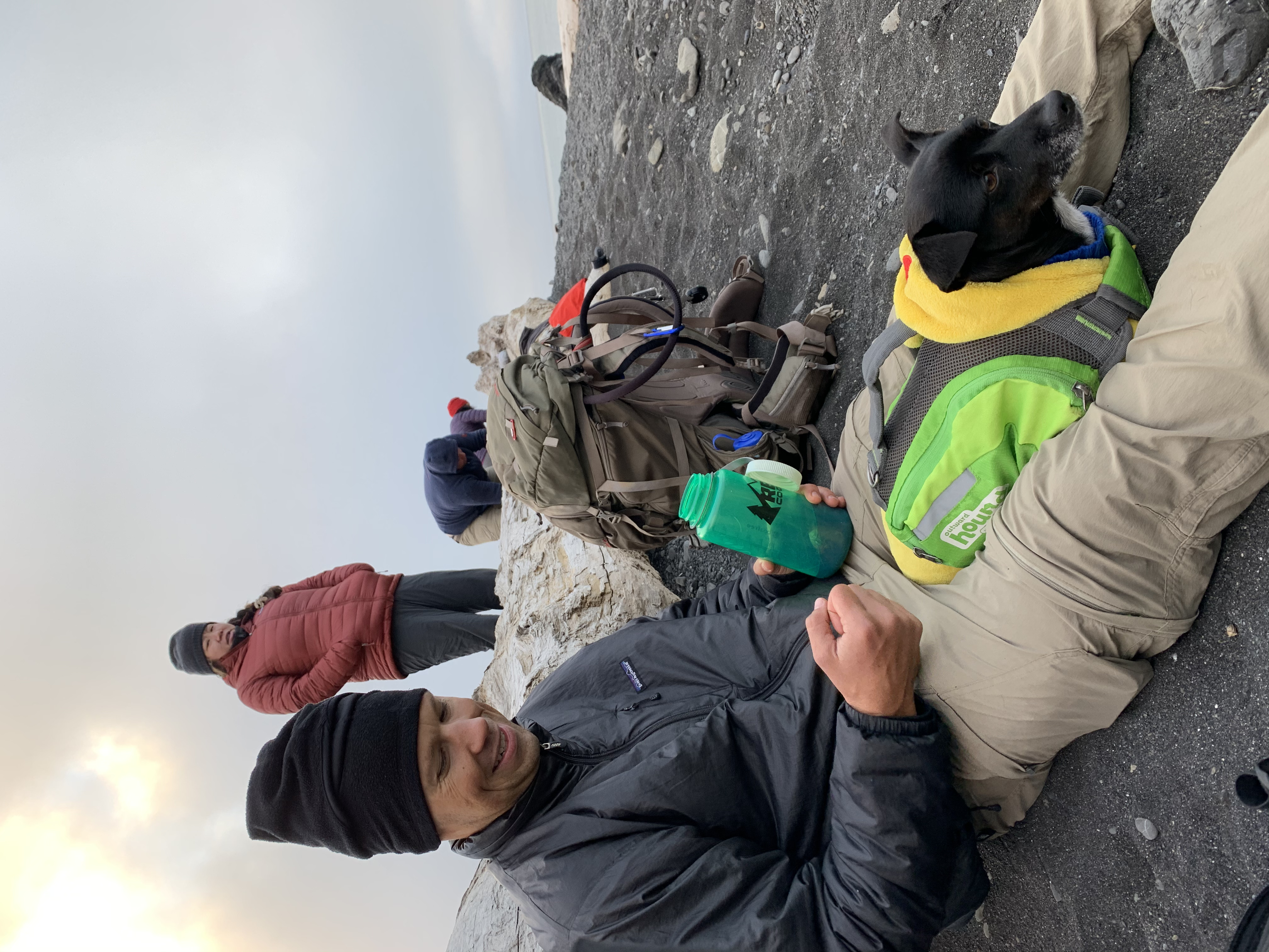
Each one of us burst out with shouts of joy and triumph when we finally reached the canyon containing Randall Creek. Everyone was absolutely elated to have made it safely through the pinch point. The sun still hadn't risen, so we used our headlamps to fill up our water bottles at Cooskie Creek. We ended up walking another half a mile or so to a place that had an inviting sandy beach and took a nice long break on a huge log that had washed up.

Everyone ate a proper breakfast and then some of us tried to take a short power nap on the cold sand. Some of us made coffee/tea to prepare for the next round of walking. Juni was in rather good spirits.
It was tough to get going again, but the next mile or so was really quite stunning. The fog and clouds were creating the most incredibly vivid scenes. It felt like I was on another planet at times.
I will admit that I had been a bit skeptical about how necessary bear canisters were while we were planning for the trip. But my skepticism quickly evaporated when we saw fresh bear tracks on the beach.
And this would not be an isolated incident. We continued to see extended networks of bear tracks for the duration of the trip. So yes, there are plenty of bears that call this place home. In fact, some of the hikers we met later recommended that we try to secure our bear canisters against rocks or logs so that the bears didn't roll them into the ocean while they tried to crack them open!
After the ardenaline-pumping morning we had experienced, we were going at a pretty relaxed pace at this point. We had toyed around with the idea of taking our sweet time and stopping for lunch around noon, well before we got to our destination at Big Creek. But since the going was so easy, we all decided that it would be better to just make it to Big Creek, set up our tents, and then have lunch so we could do some proper afternoon napping in the comforts of our tents.
The majority of the following five miles or so were absolutely wonderful in comparison to what we had experienced in the early morning. There were sections of long, flat trail,
interspersed with just a few areas where we were forced to deal with the rocky shore.
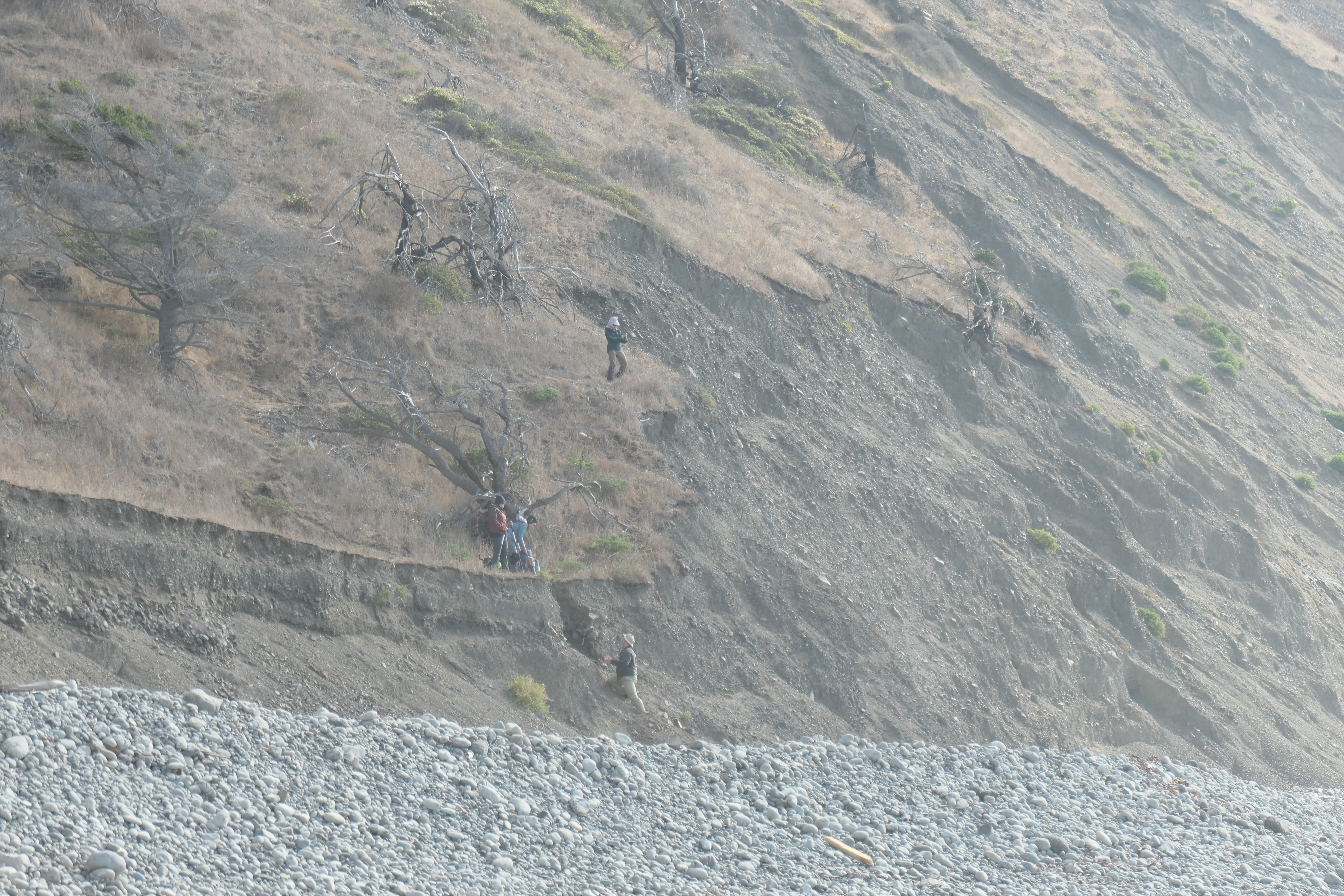
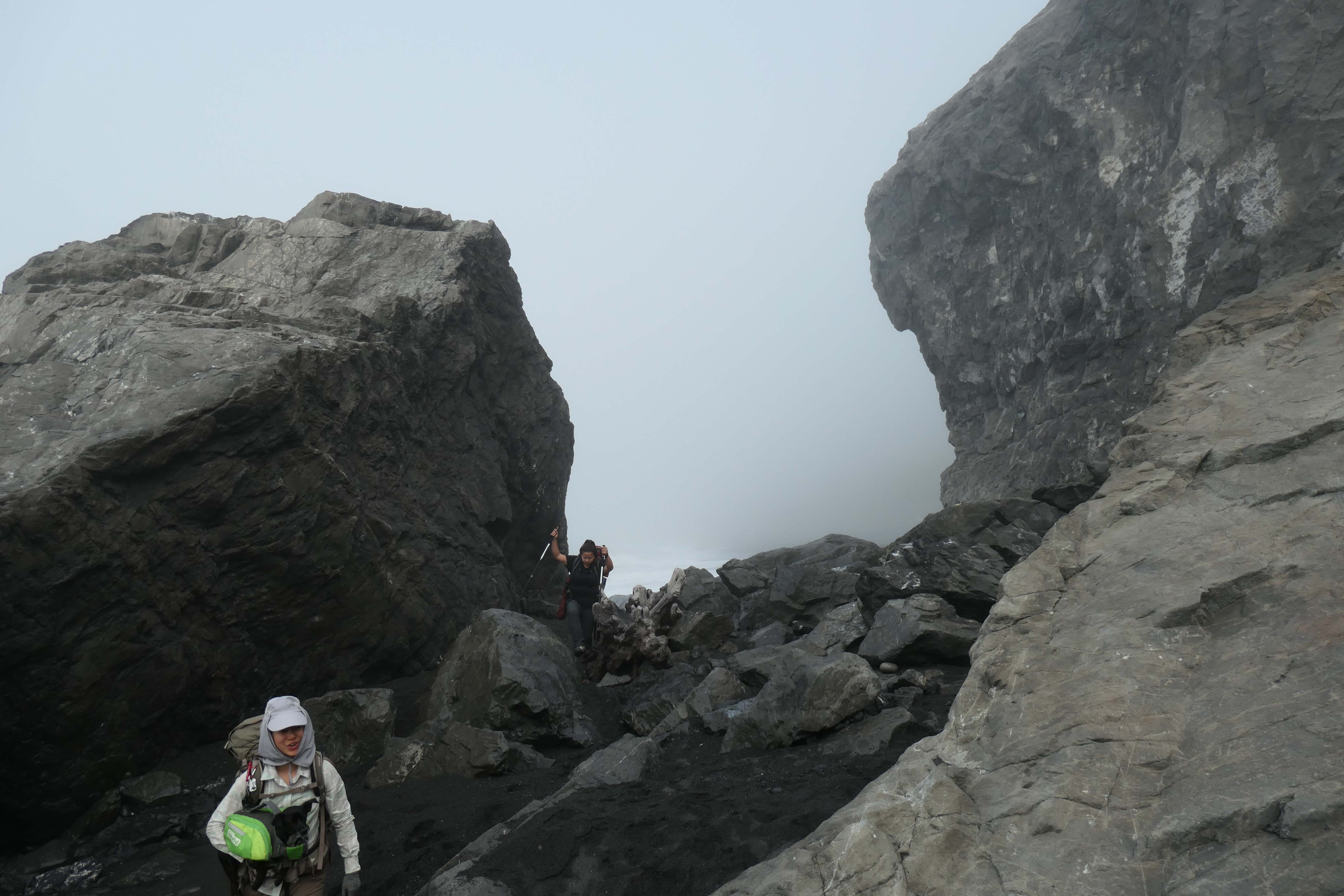
There was one point on the trail just before Big Creek where the rest of the group decided to stay on the cliffside instead of going to walk along the beach. I was pretty far behind them at the time, but I had noticed the trail abruptly vanished not far ahead, so I went down. I got a good shot of them descending the second narrow chute of the trip.
When we arrived at Big Creek, we were happy to find that nobody else had set up shop there. We ended up having a pretty nice camp site.
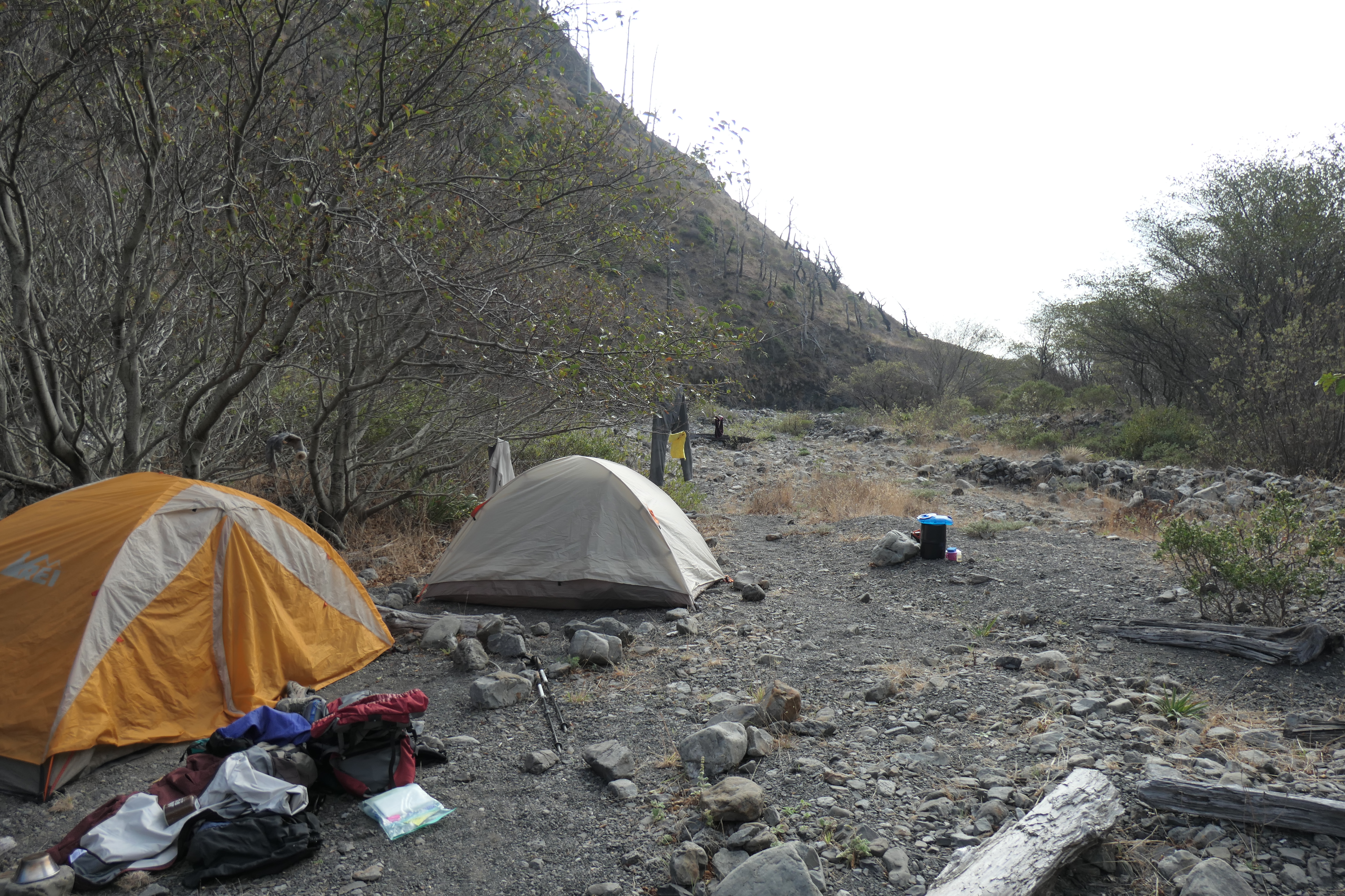
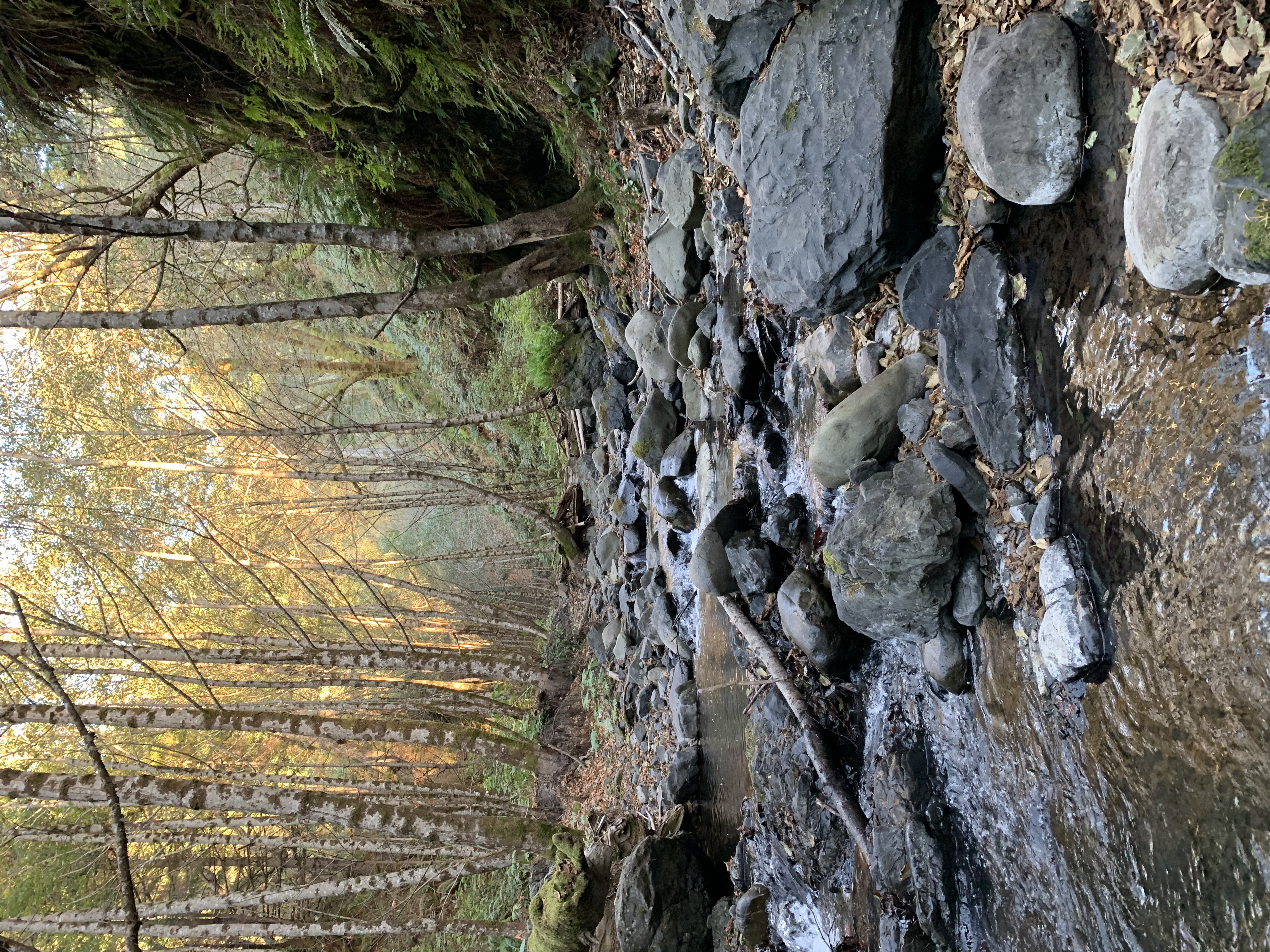
Plenty of logs to rest up against with very easy access to water. The creek was fairly low, but there were still plenty of good areas to fill up.
After a well deserved lunch, most of the group was craving a nap. Mark and Nikki and Ellie retired to their tents. Although I was tired, I wanted to make the most of the day and see what Big Creek had to offer. I convinced Tina to join me on a short hike up the use trail that heads east into the canyon.
After just a few hundred meters of climbing up the trail, we found progress was going to be very difficult. The trail pretty much vanishes, and one would likely be better off just walking along the creek bottom. At this point, we found a nice set of log benches around a firepit where we sat down to rest. Tina fell asleep almost immediately, which made me the last one standing. I was really craving a bath, so I climbed down to the creek in search of an area deep enough to submerge myself. And wouldn't you know it? I was lucky to find a ~3-foot deep pool hidden behind a rock outcropping.
The water was very cold, but quite invigorating. After I got out of the creek I laid on the rocks in the warm sun and passed out for a few minutes. What a perfectly splendid way to spend an afternoon.
The rest of the evening was delightfully uneventful. When we had all awakened from our naps, we enjoyed a long dinner together. And when I got in our tent around 830 that evening, I was so tired I passed out immediately.
Day 3 was going to be a very nice contrast to Day 2. Instead of waking up well before sunrise and immediately setting out on an intense walk, we all slept in a bit and took our time eating and breaking camp. The afternoon/evening low tide was predicted for 6:15 pm and the beginning of the next pinch point at Miller Flat was only 2.5 miles away. So that meant we did not have to hurry at all. The basic plan was to get to Miller Flat, have lunch, and wait until around 3:00 pm or so when the water would be low enough to pass.
The weather that morning was absolutely gorgeous. Clear blue skies and a nice cool temperature in the low 60's. Juni was enjoying it mightily.
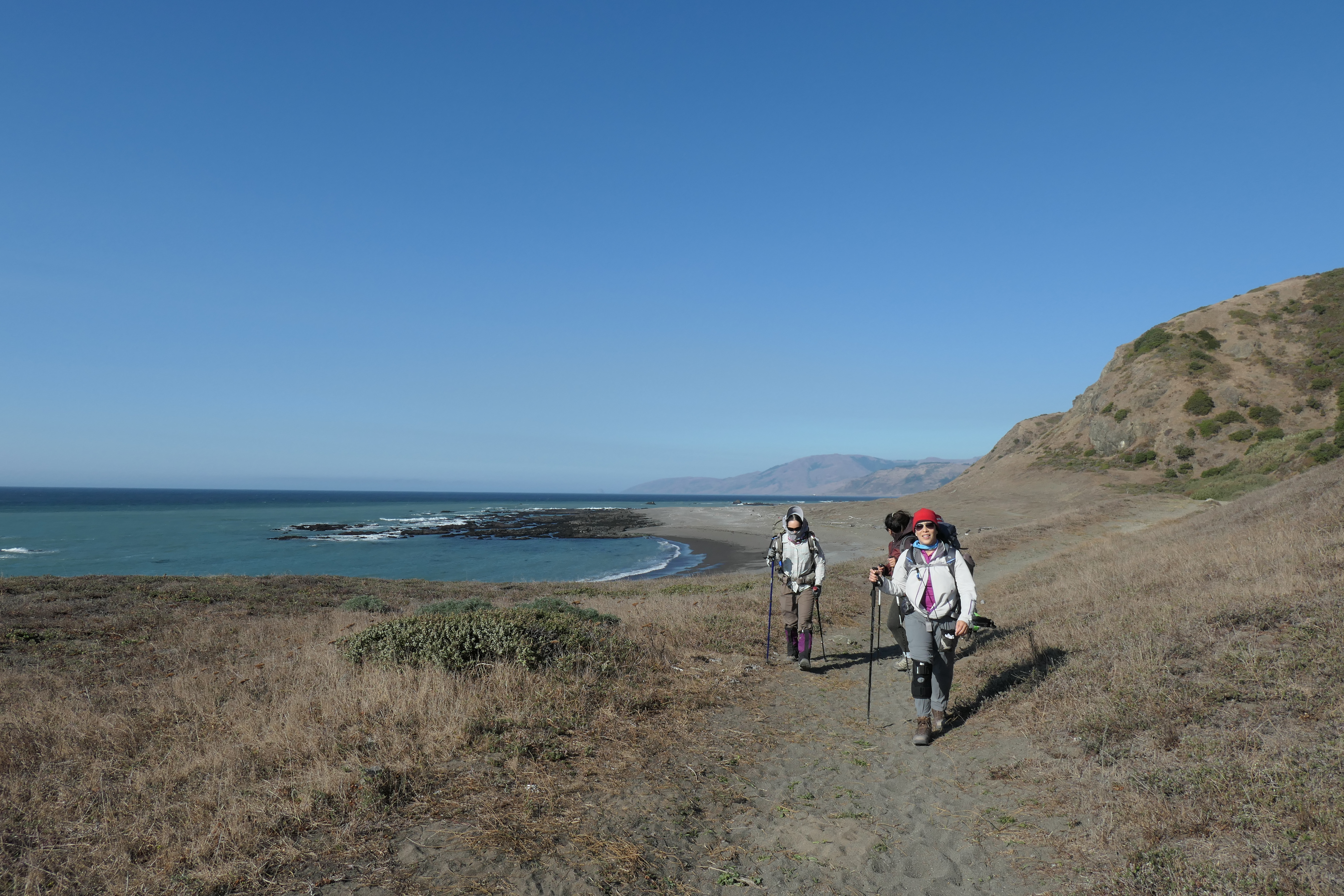
The two and a half miles to Miller Flat proved to a walk in the park. There were exquisite, flat gravel trails

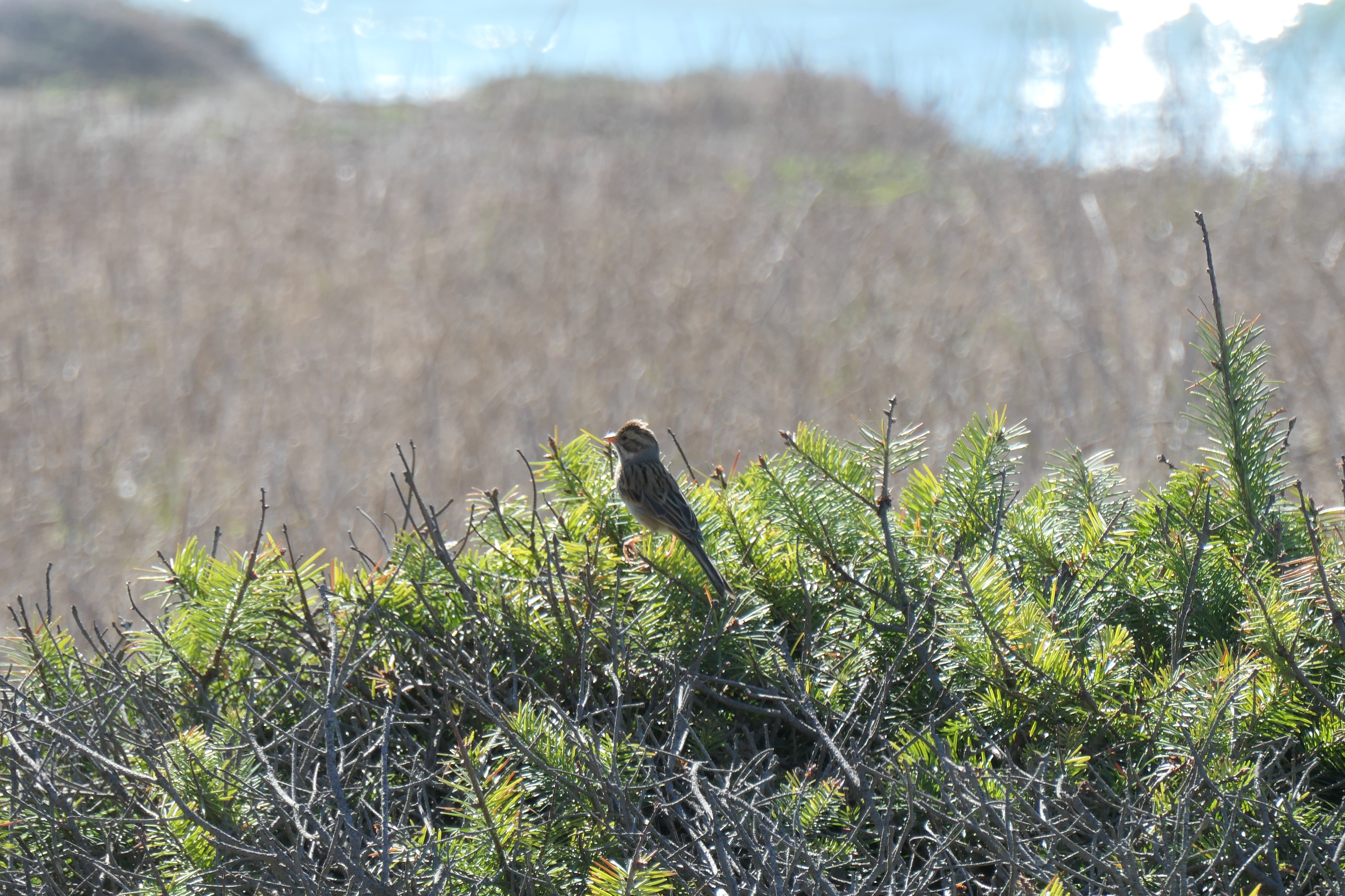
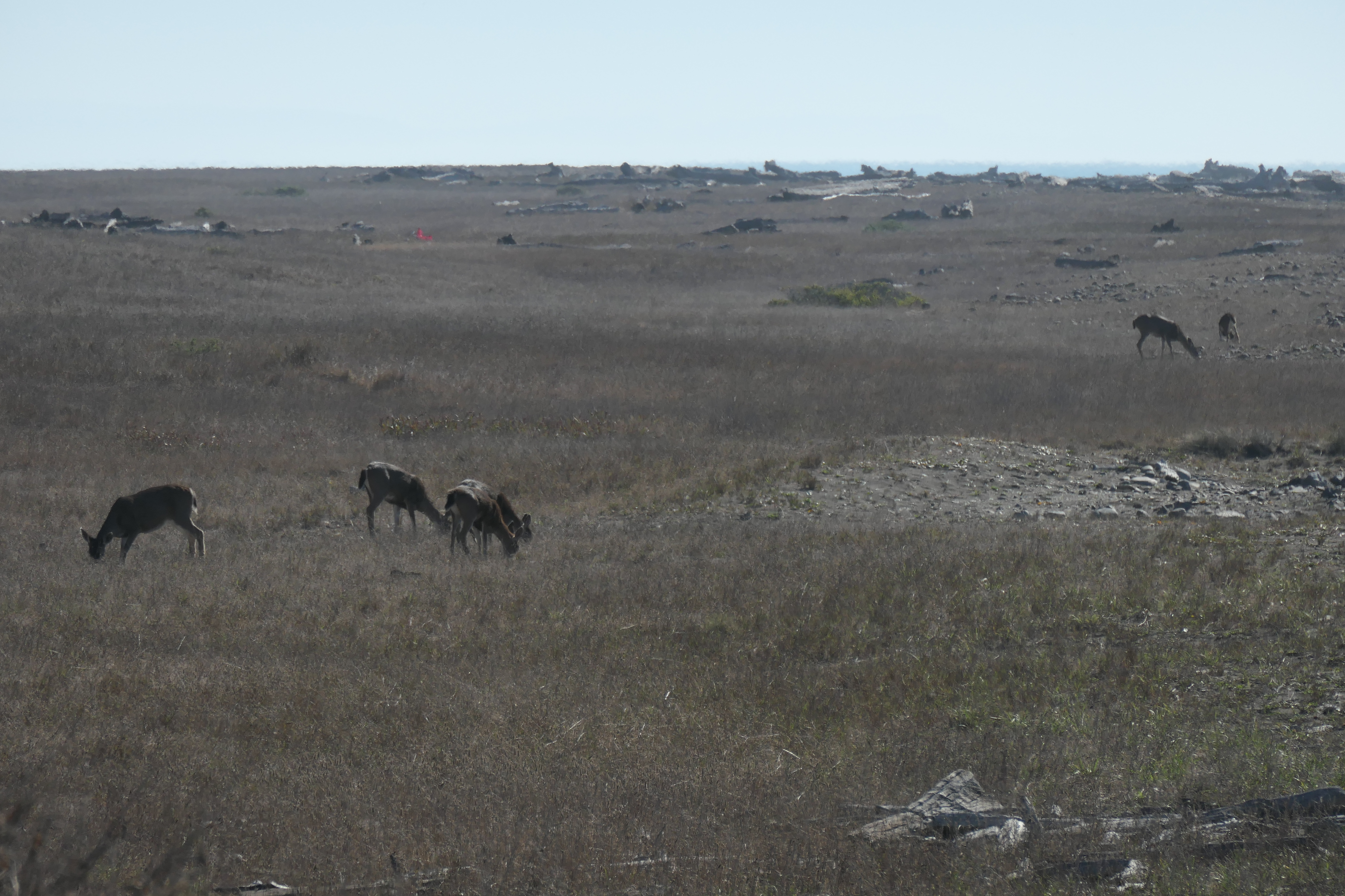
that allowed us to focus on the wildlife inhabiting our surroundings.
This stretch of the trail did not have too many rocky sections, which we were all very, very happy about.
We got to Miller Flat right around 1:00 pm. It was a nice place to have lunch and wait until for the water level to fall. Around 2:00 pm, Ellie and I began to walk south along the top of the sharp cliffside above the pinch point to see how the water level looked (there is actually a sign marking the spot where you should descend towards the water, but from there you cannot see what lies ahead). After we had done our survey, the group that had been walking behind us arrived and decided they'd give it a shot. We waited a bit, and when we saw they hadn't turned around, we decided to join them.
The tide was indeed low enough for us to proceed without incident. And although we were forced to walk very close to the water for a good portion of the next 4.5 miles to Gitchell Creek, the rockiness did not seem quite as bad as the section we had done the day before.
It was cool to see all the water trickling down from the tall rock faces next to us. In fact, there was adequate flow in some areas to fill up our water bottles.
Tina and I continued to trade off carrying Juniper along all the rough stretches. It's probably a good thing since there seemed to be millions upon millions of flies hovering just above the surface. She definitely wasn't a fan of them.
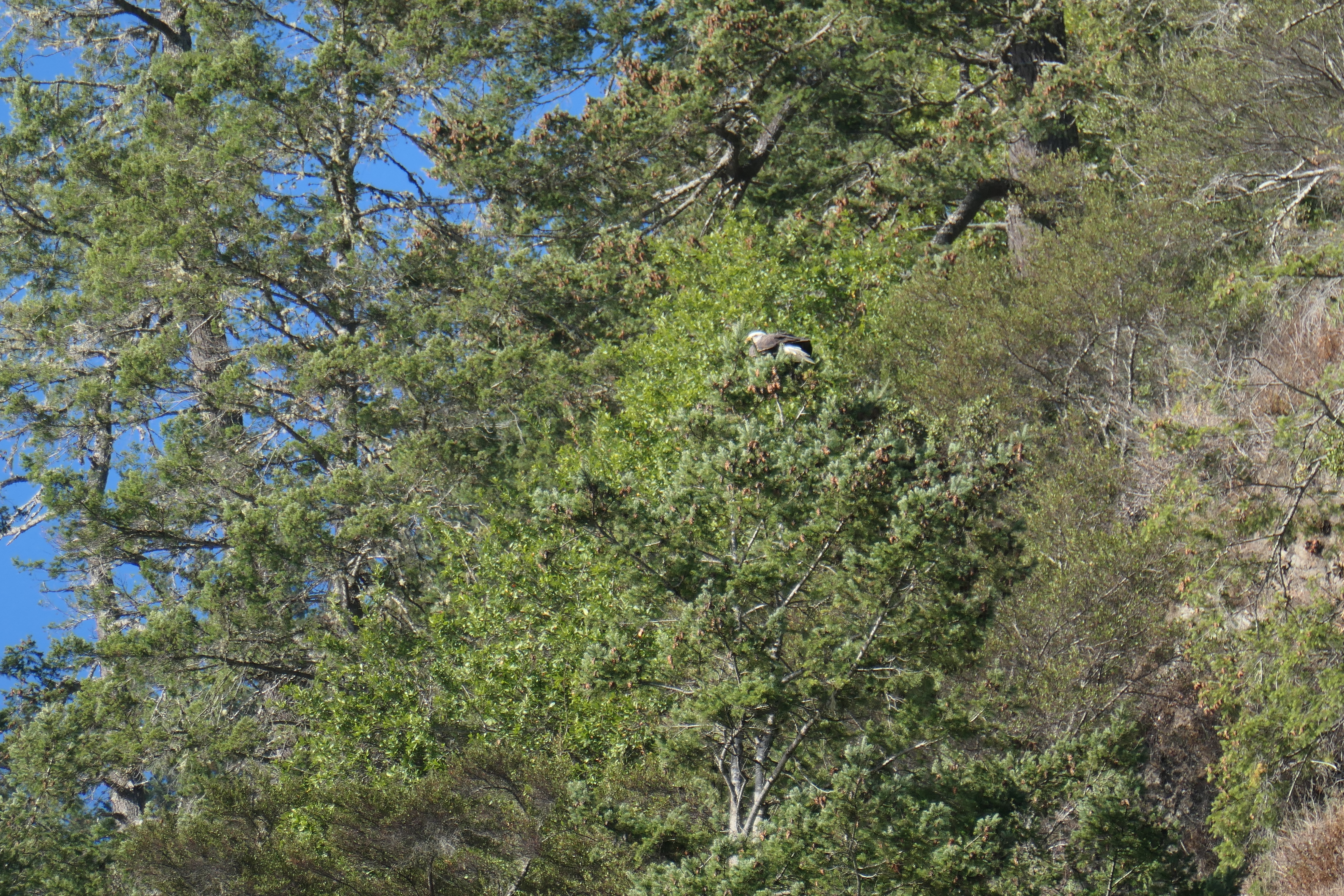
The last couple of miles before Gitchell Creek were some of my favorite of the whole trip. We got to enjoy long avenues of firmly packed sand that felt like heaven.
And we were treated to more wildlife sightings, including a bald eagle!
As we had anticipated, Gitchell Creek was well populated.
It makes sense why. Even though there are a few creeks remaining before Black Sands Beach where one can camp, Gitchell has an expansive sandy beach; not to mention an unbelievably cool canyon that you can explore. Tina and I both took some time to hike up its reaches. The sunlight filtering through the trees as the sun went down was absolutely beautiful.
We both found adequate spots to wash off in the creek, which felt extremely refreshing.
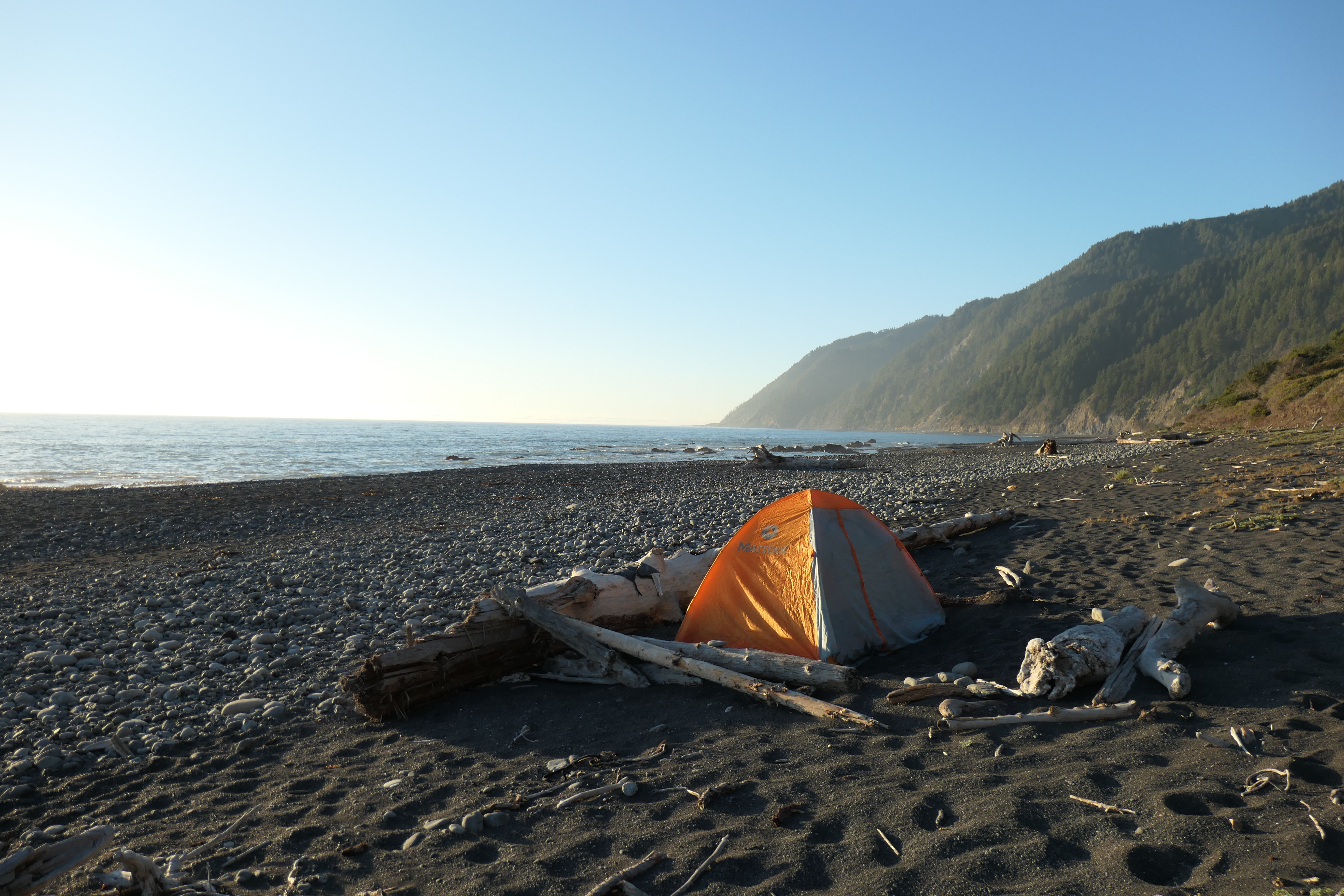
There weren't any spots left to camp aside from the beach, so that's where we set up our tents.
If you decide to do this trip and you are able to get to Gitchell Creek early in the day, I highly recommend trying to secure the spot at the head of the canyon. There is a sweet patch of dirt and gravel just up the trail from the beach where we three women had pitched their tents. I was pretty jealous of their digs.
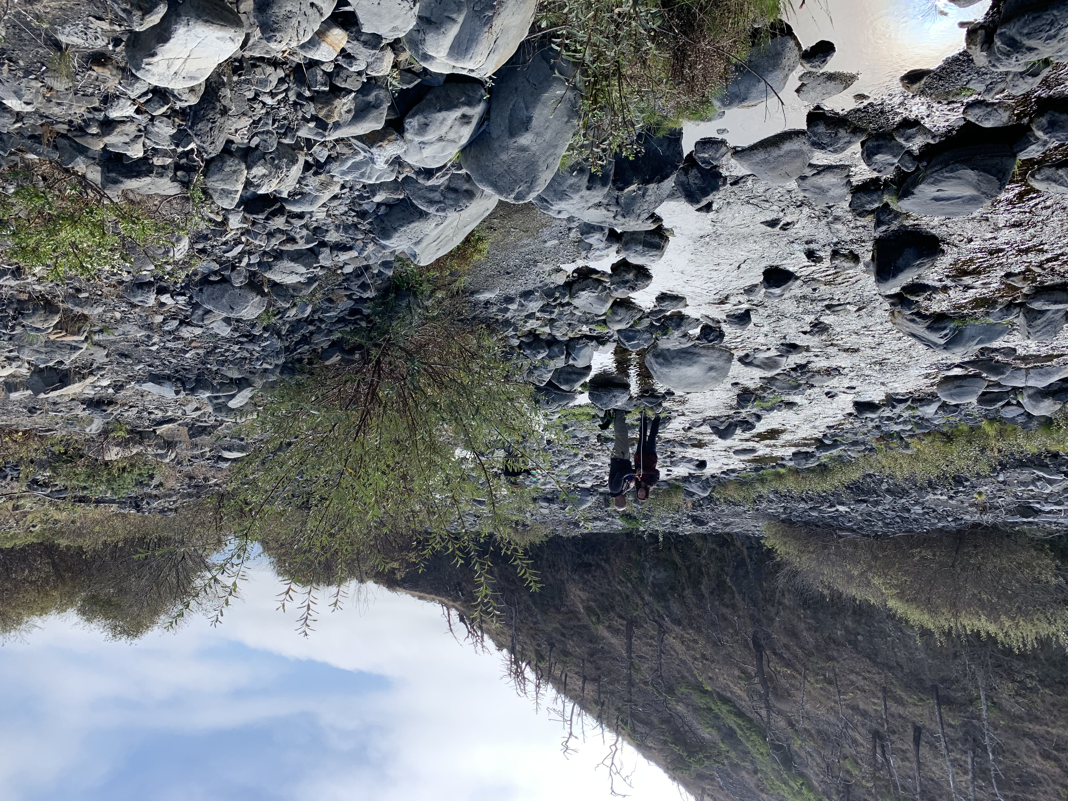
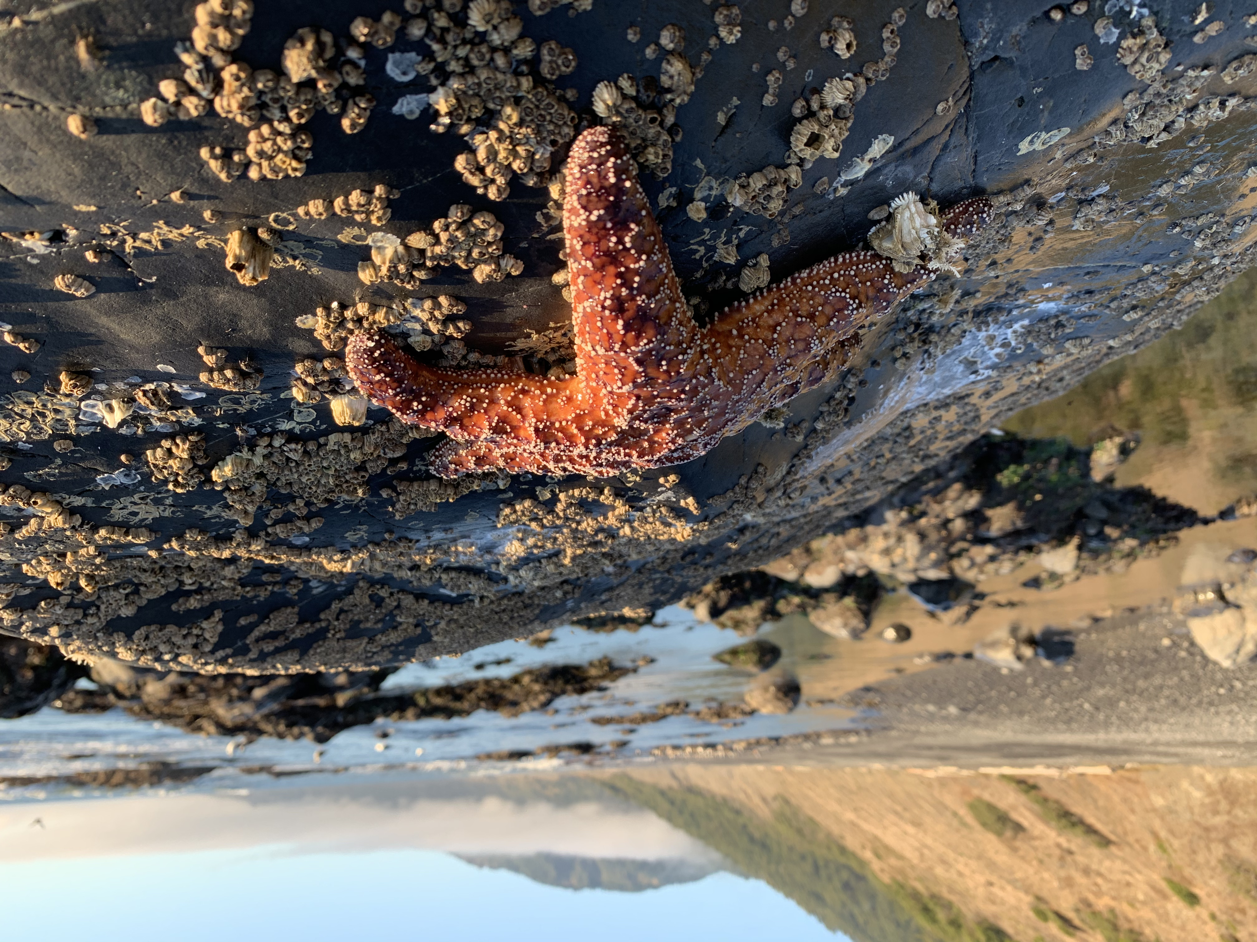
With the tide at its lowest, we were able to observe some very cool marine life, including a handful of starfish clinging to the rocks.
Despite having to deal with the fine black sand entering all the crevices of our gear, I must say that our site was not half bad. We had a great set of logs to sit on while we ate dinner that night.
That evening was one of the most pleasant evenings I can recall on a backpacking trip. The company of my wife and close friends, the tranquilizing sound of the waves crashing against the shore, the lack of bugs in the air, the gorgeous sunset illuminating the dense fog...
it was a surreal experience. We spent a long time telling stories, busting each other's chops (Mark and Nikki couldn't believe that Tina and I share dental floss...it was almost like we were guilty of murdering a child), and appreciating the moment we were in. It was a shame the trip would come to an end the next day.
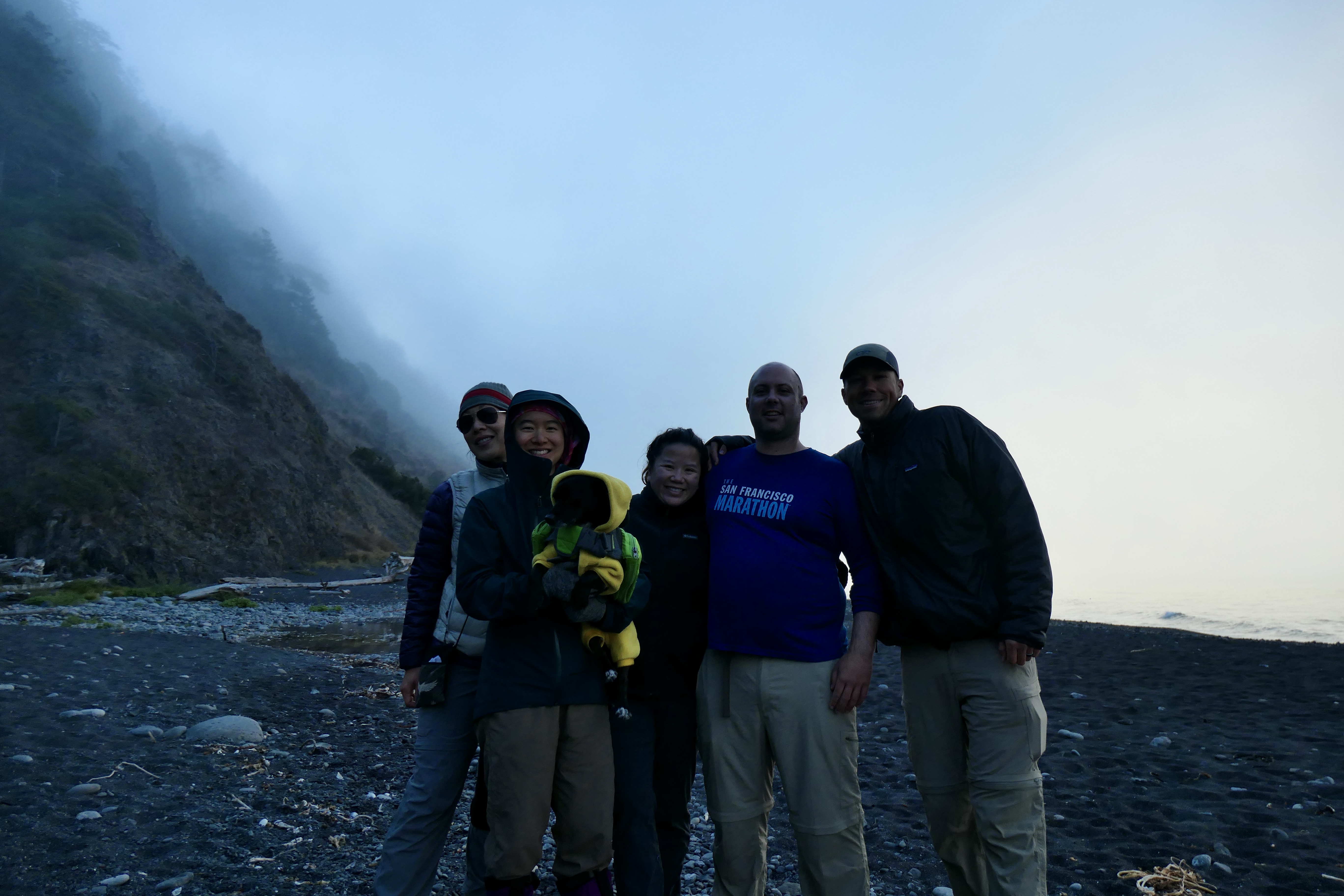
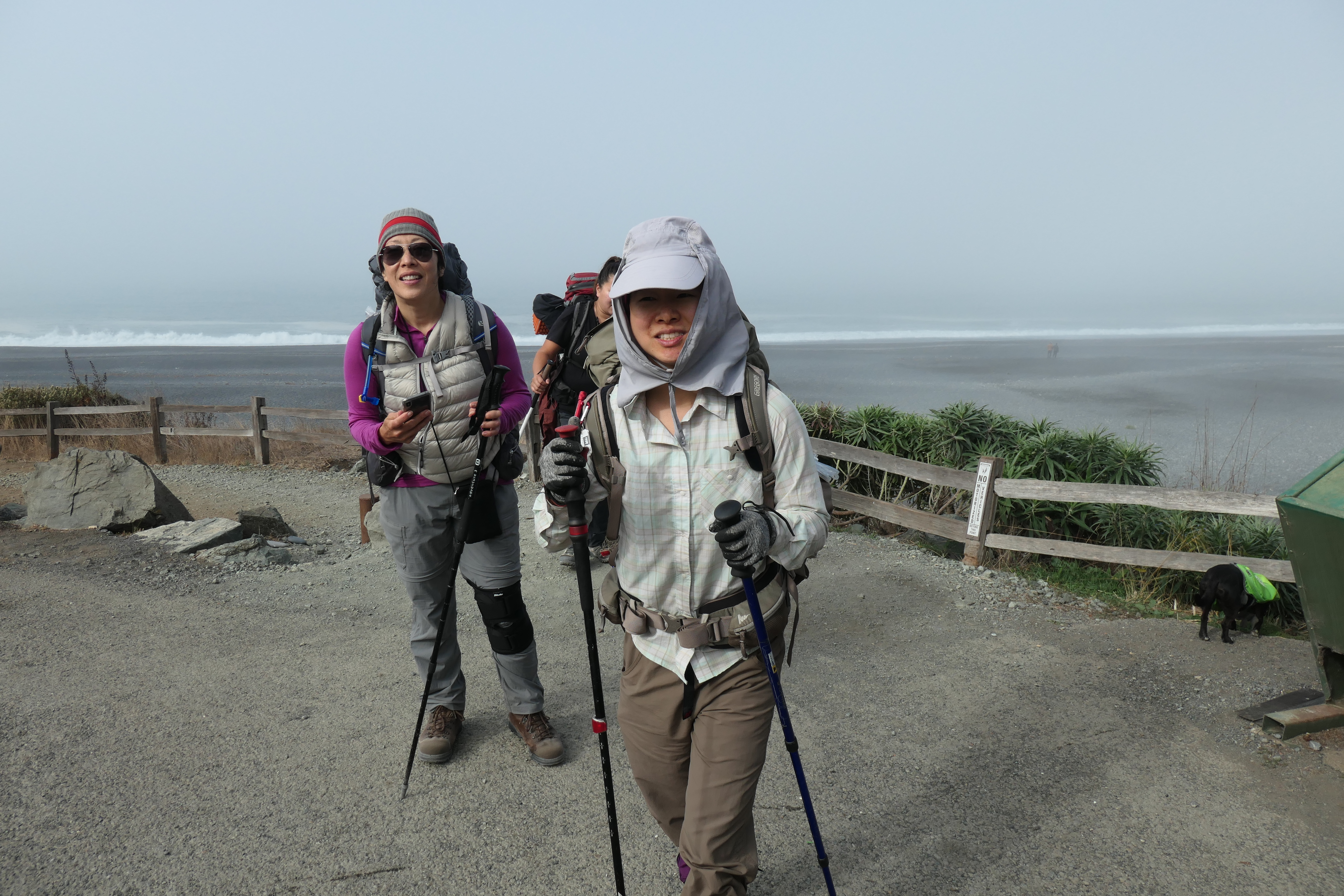
The last day of the hike was a great cap to an almost-perfect LCT experience. We woke up fairly early so that we could try to make it back to our car in time to drive somewhere for a well-deserved lunch. We ate a quick breakfast, packed up, and took a group shot before we started striking it.
It was a very foggy morning, which was a bit disappointing since some of the trip reports I read said the last few miles of the hike were some of the most scenic. Still, the gray atmosphere clouding our way was pretty cool to behold in itself.
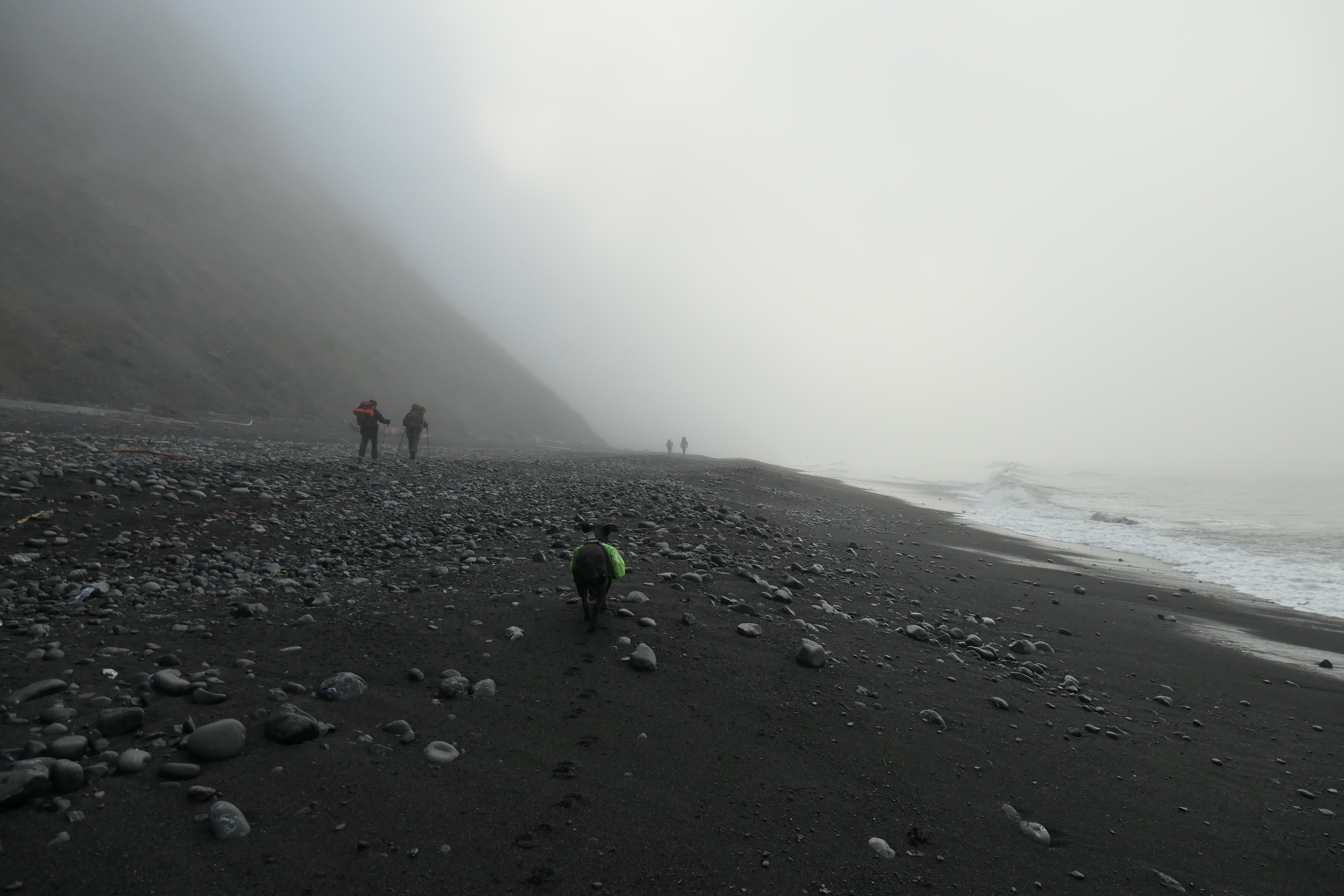
Step for step, I can certainly say that the last day was the most pleasant in terms of footing. Almost the entire way we had firmly packed sand under our feet, which was a real delight. Nothing eventful happened on our way to Horse Mountain Creek. And honestly, Horse Mountain Creek was nothing to brag home about. I don't think it would be a very good spot to camp, although certainly not the worst.
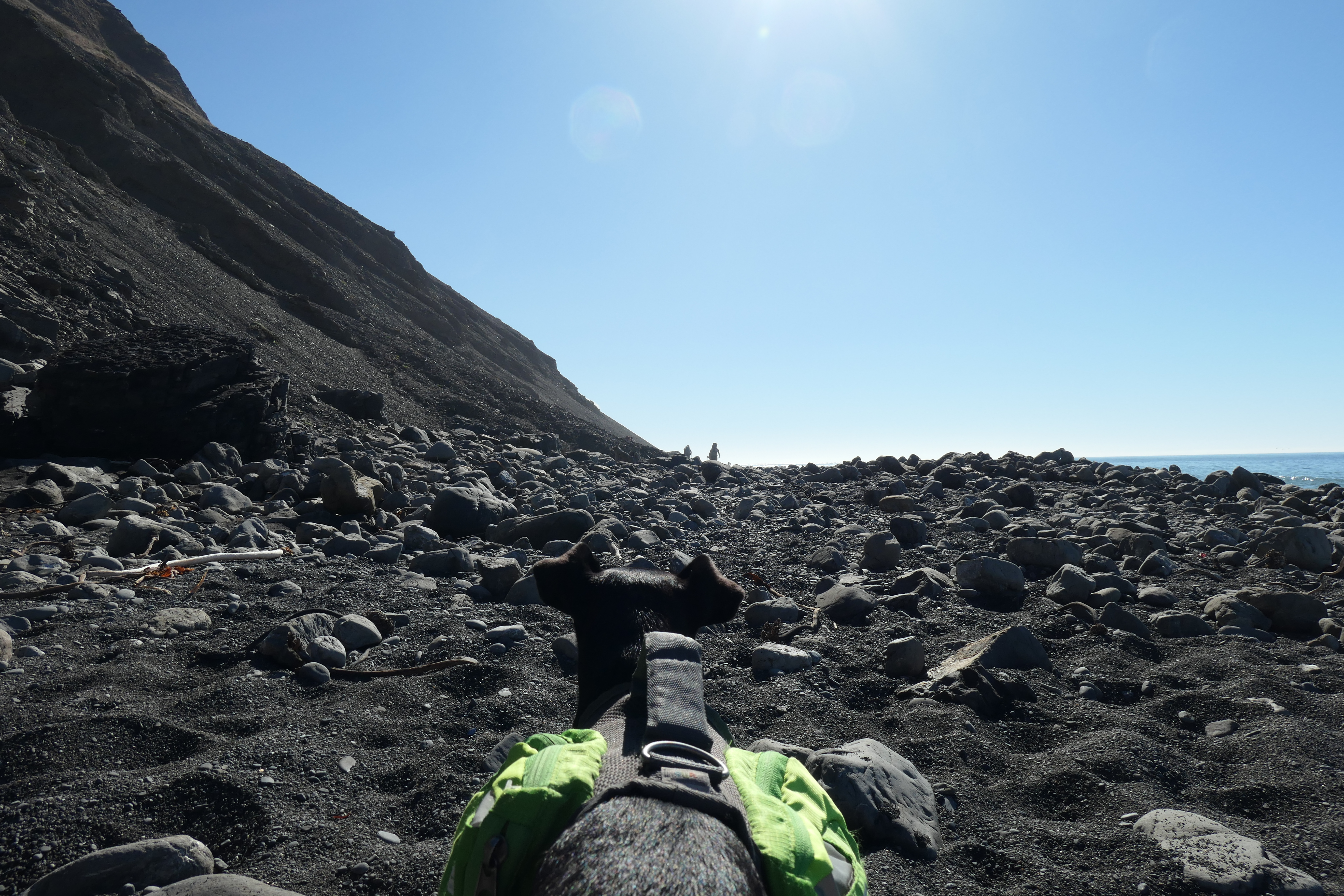
A bit over a mile from Black Sands Beach, things get pretty cool. Smack dab on the beach are these enormous rocks that look like they were placed there by some sort of sophisticated ancient civilization.
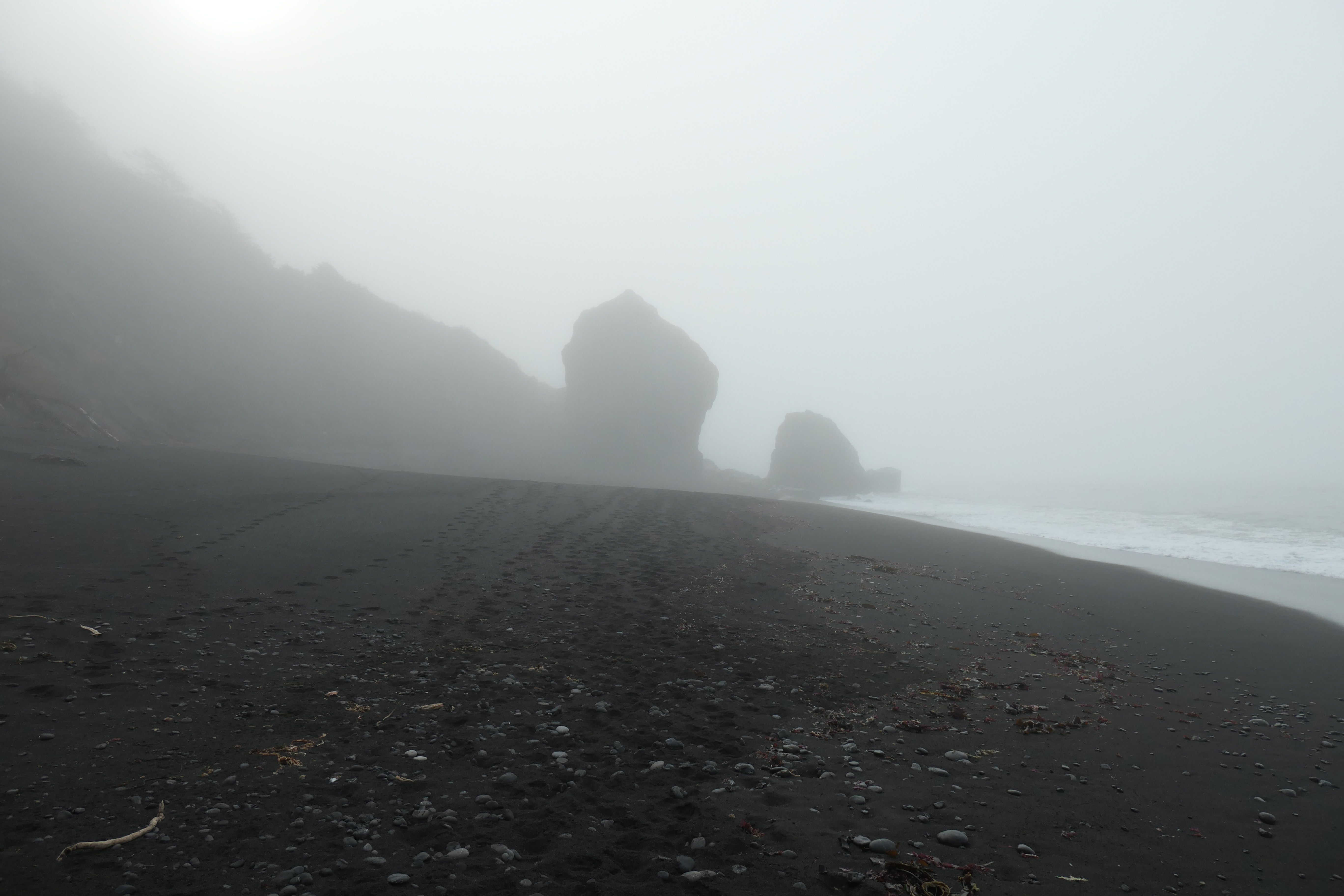
With the thick shroud of fog, it looked like we were entering some kind of fortress.
Tina and I were very happy that Juni had been such a trooper on the hike. She was fit to walk her way almost the entire remainder of the trip.
A few hours after we set out from Gitchell Creek, we started to see day users that had come from Black Sands Beach. I think we were all excited to see other folks, mostly because it meant we were that much closer to a proper meal. It wasn't long before we were at the staircase that brought us back up to where our cars were parked.
Initially we had talked about driving all the way back to Ukiah or some place beyond to grab a nice meal, but we were all so hungry that we started searching for the first spot we could when we had reception. We decided to stop at the Woodrose Cafe in Garberville. I am not the best judge of good food, but I thought it was perfect. I ordered a big slab of pancakes with some bacon and I couldn't have asked for better. A fantastic ending to a fantastic trip.