


TRIP DETAILS
TRAIL MAP
OVERVIEW
Notes:
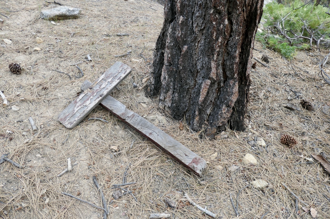
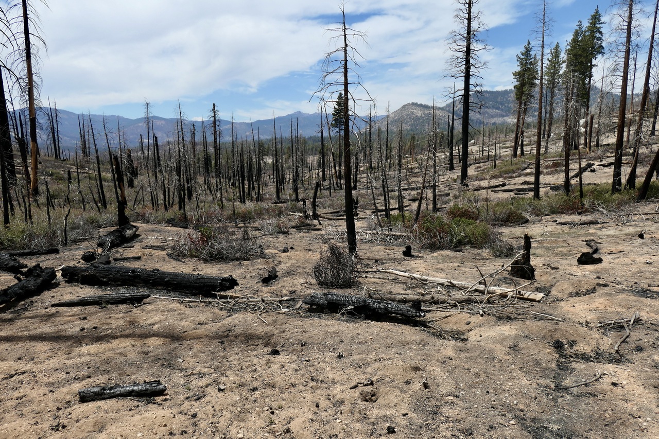
- The trails in this area are NOT MAINTAINED (and/or they were totally decimated by the fires that recently ravaged the area). This is especially true in the areas north/east of the Little Kern River. The reason I am quoting 50% off-trail on this trip is because I was constantly circumventing fallen trees and zig-zagging my way through giant stretches of whitethorn to avoid being poked to death. Below is an example of one of the trail markers around Round Meadow. I'm not sure if it was made before or after 1970.
- If you choose to hike this area and the trail you're on becomes elusive, you're much better off just choosing a bearing and aiming for clear stretches of ground than trying to follow the old trail. There are plenty of sections where getting around a fallen tree is incredibly difficult due to steep transverse gradients.
- The benefit of this lack of trail maintenance is that there are far fewer hikers in the area. At a time of year with perfect weather and almost no mosquittos, I didn't see a single person on these "trails".
- This area was surprisingly dry for late Spring. I was expecting to find some flowing water in the five meadows that I visited. But the only one that had more than a stretch of "puddles" was Grey Meadow.
- I didn't bring my rod or reel, but the Kern River looks like a fisherman's paradise. I saw tons of fish jumping around at my campsite near the Hole in the Ground.
- The two places where the maps show the trail crossing the Little Kern River west of the Little Kern Bridge both involve fording the river. At this time of year the water level was high enough to make it challenging. The crossing further west (Burnt Corral Crossing) was doable, but the other one was not.
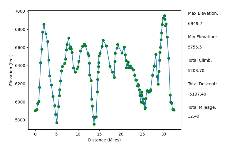
Elevation Profile
TRIP LOG
I'll start right off by saying that this trip did not go as intended. I had big ambitions to make it all the way up to Kern Lake on the first night of the trip, and then try to make it up to Rattlesnake Creek without my pack on the second day to possibly check out the Big Arroyo.
The problem with my plan was that I assumed that Tom Harrison's Map, which was published in 2015, was decently up-to-date. On the map, he makes a distinction between "primary" and "unmaintained" trails. And most of the "trails" I tried to follow were labeled as the former. The reality is they should pretty much all be labeled as the latter. So instead of hiking at about a 2.5-3.0 mph pace as I usually do, I was hiking at more of a 1.0-1.25 mph pace due to lack of trail and plethora of obstacles.
I will say that the ranger that helped me plan the trip (his name was Gabriel) was one of the most helpful guys I've ever dealt with. I just wish he had let me know how bad of shape that place is in.
What made it really deceiving was the fact that the first 4-5 miles I hiked were actually in decent shape.
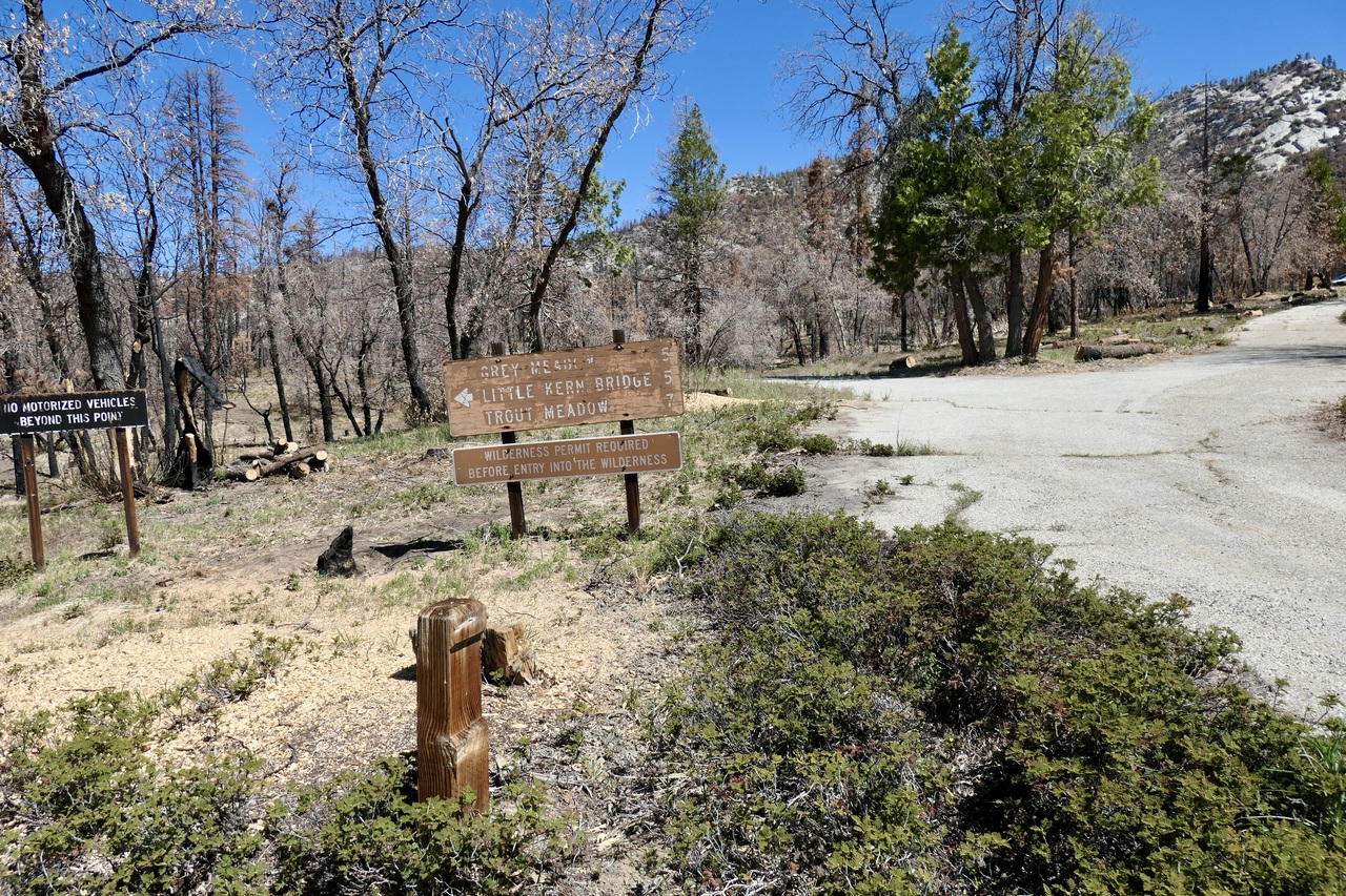
I arrived at the Jerkey trailhead parking lot around 10 am (there were only two other vehicles parked there) and crossed the first trail sign at about 1030.
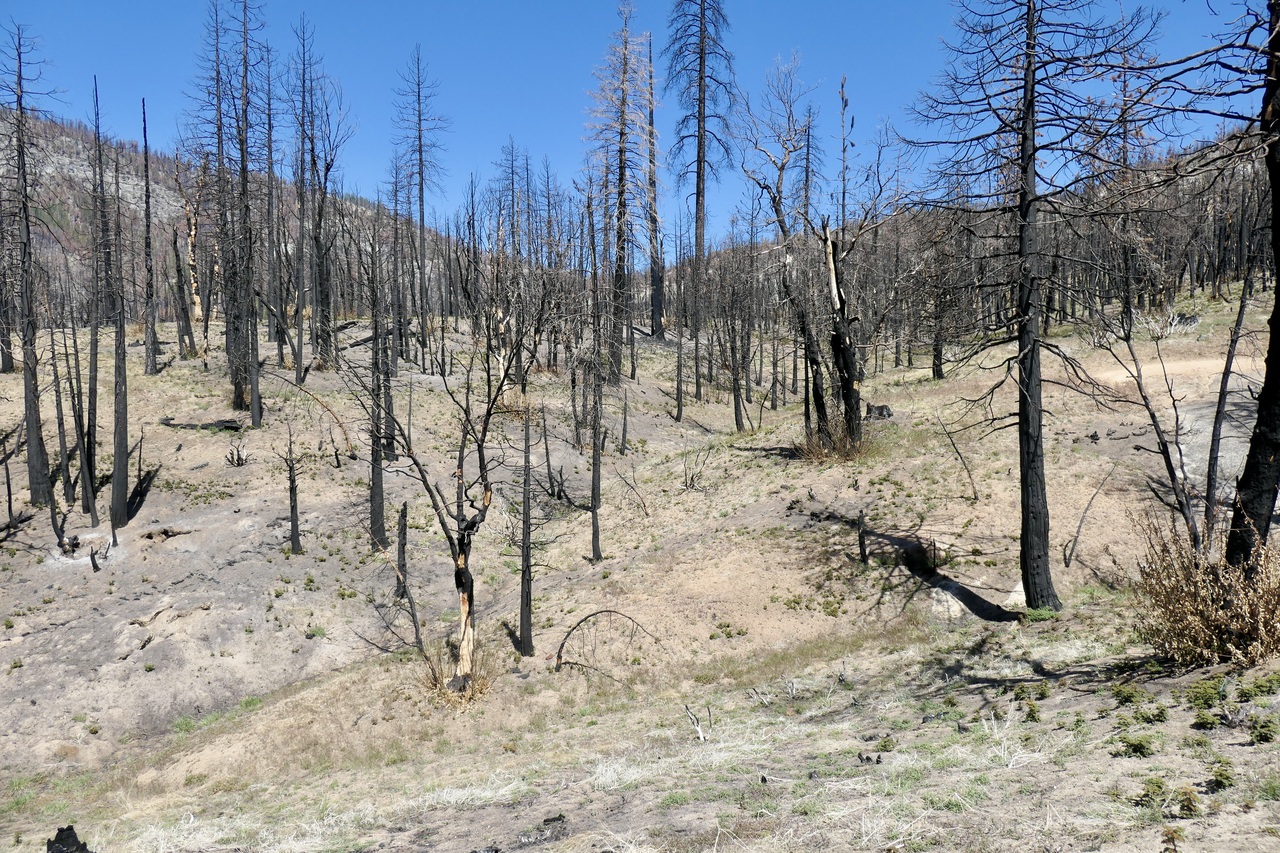
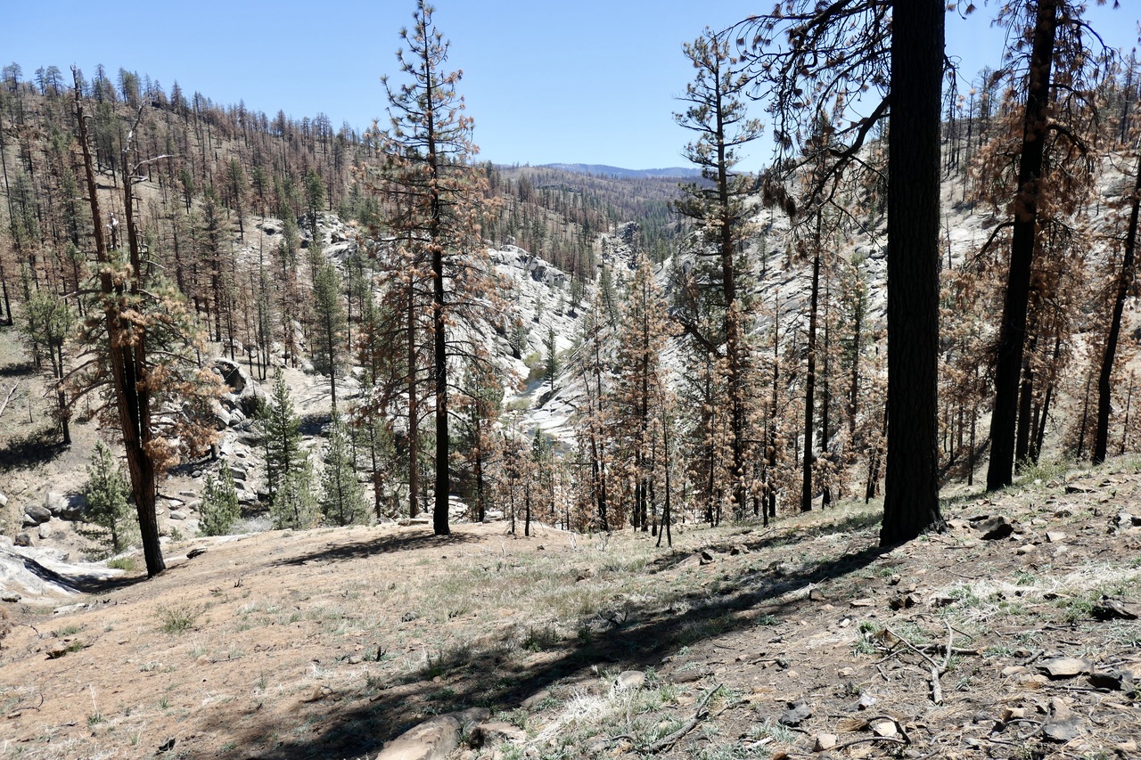
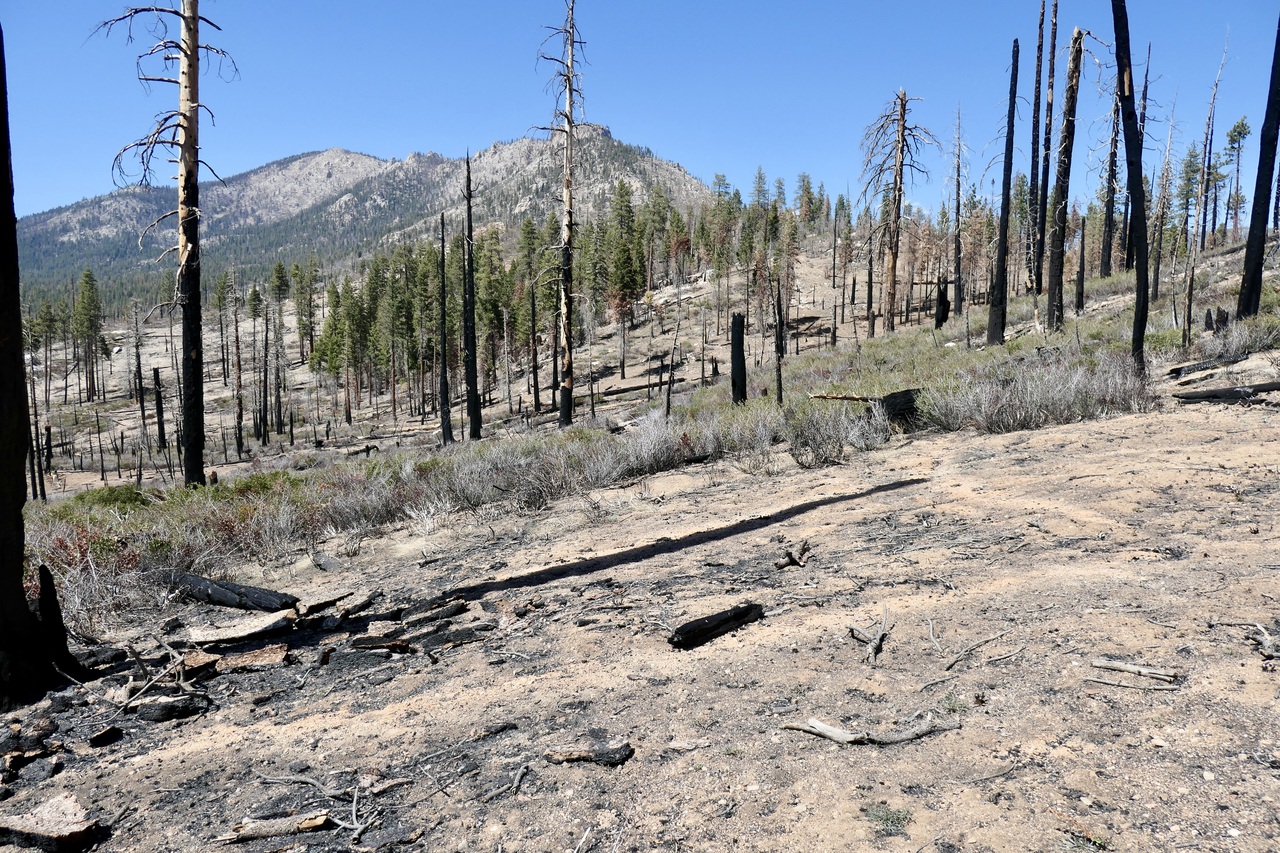
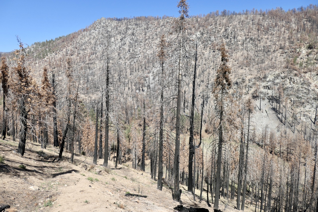
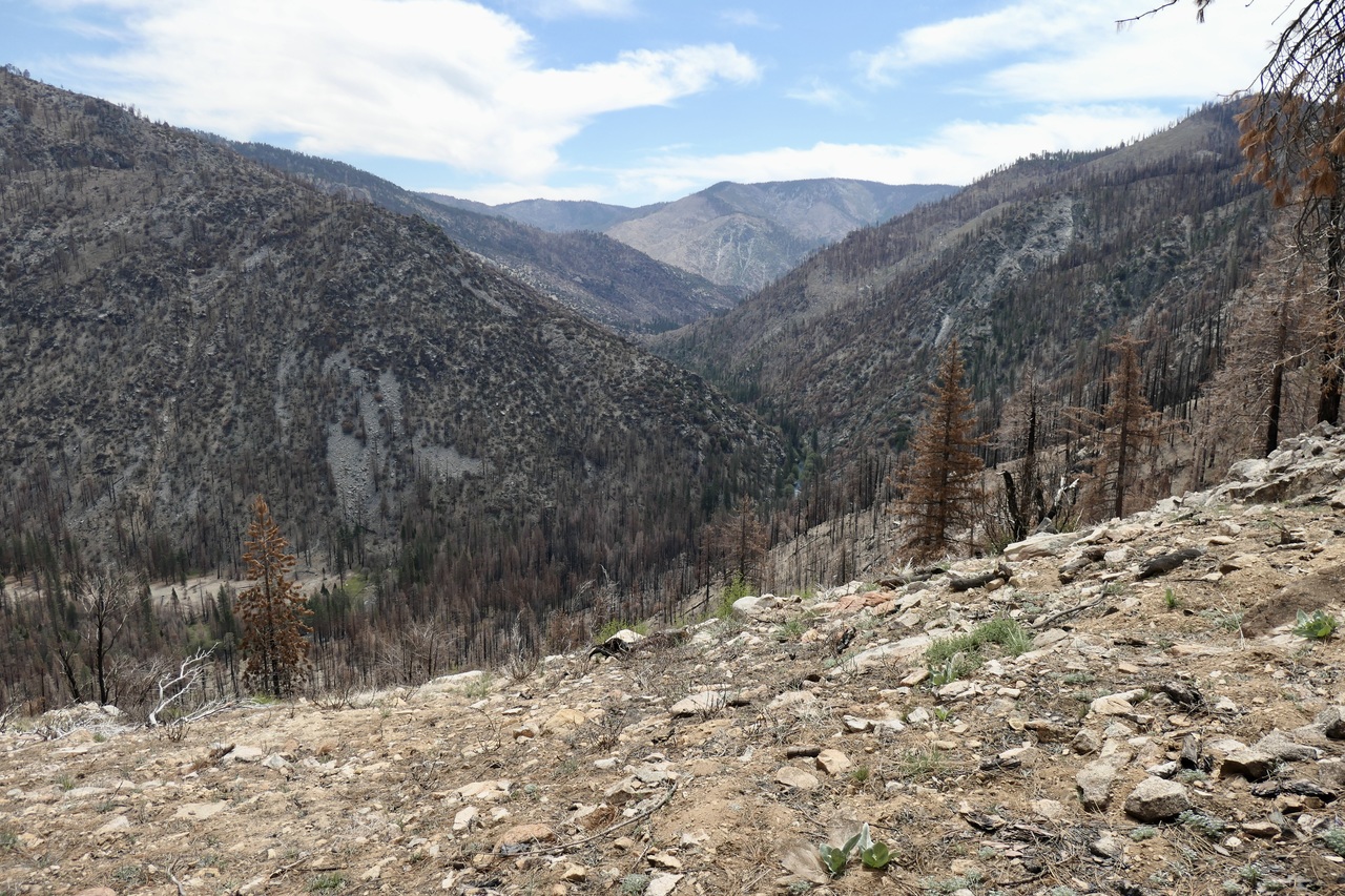
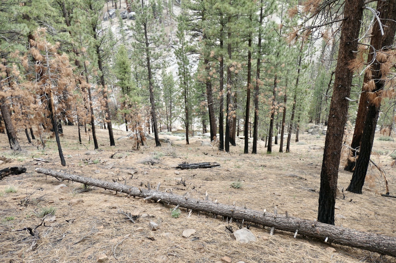
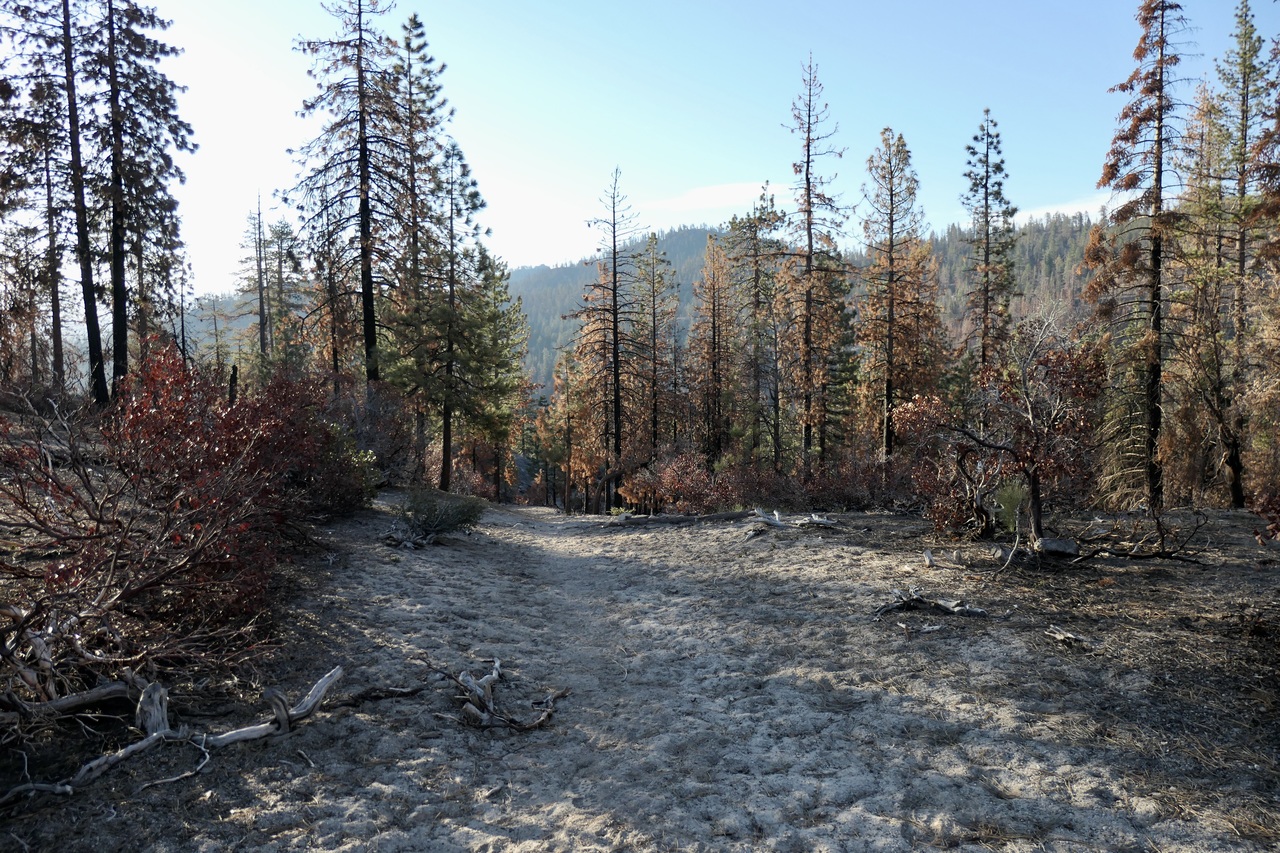
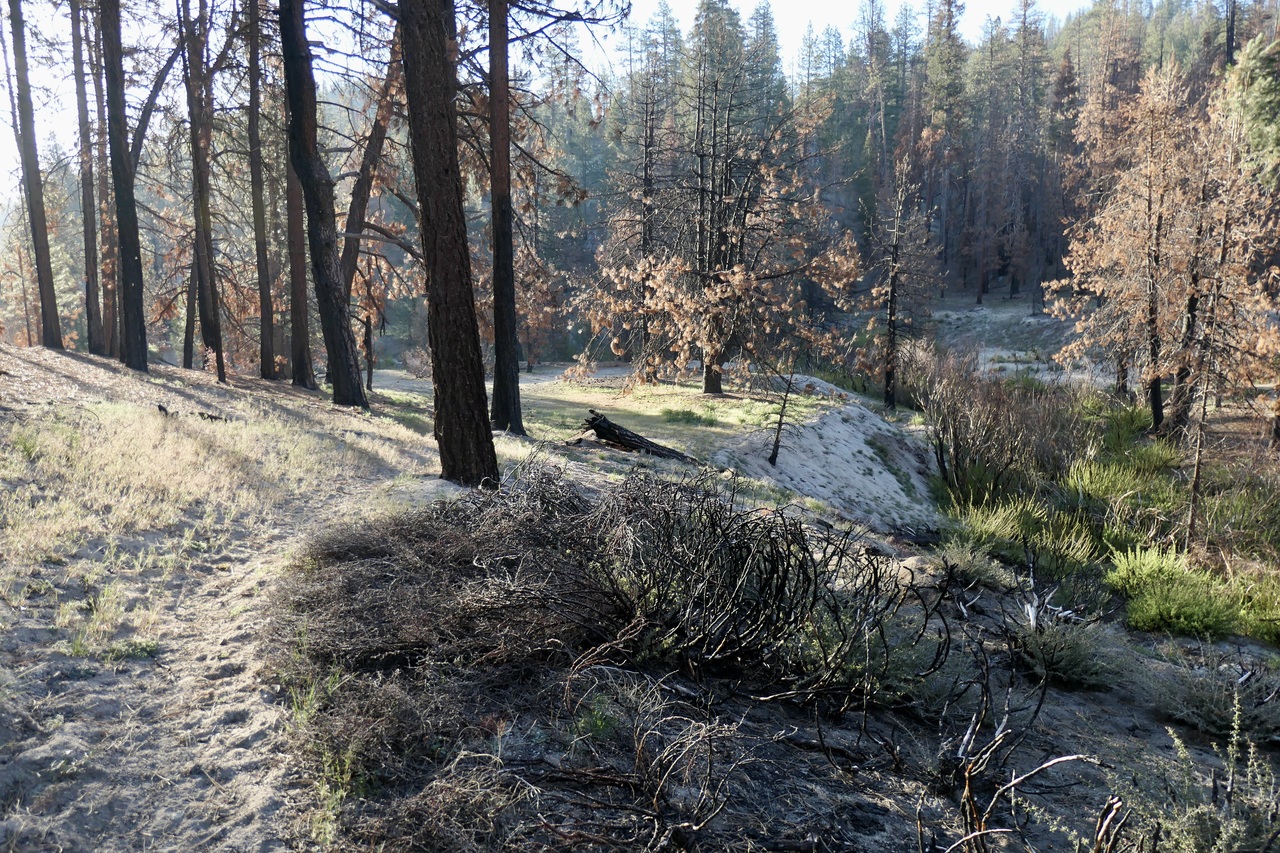
The landscape during these first 3 miles up to Jerkey Meadows was absolutely scorched.
There were just a few places where the trail was hard to follow during those first ~3 miles or so (although one could hardly call it "well-maintained"). I was pretty happy that within just over an hour I was at Jerkey Meadows.
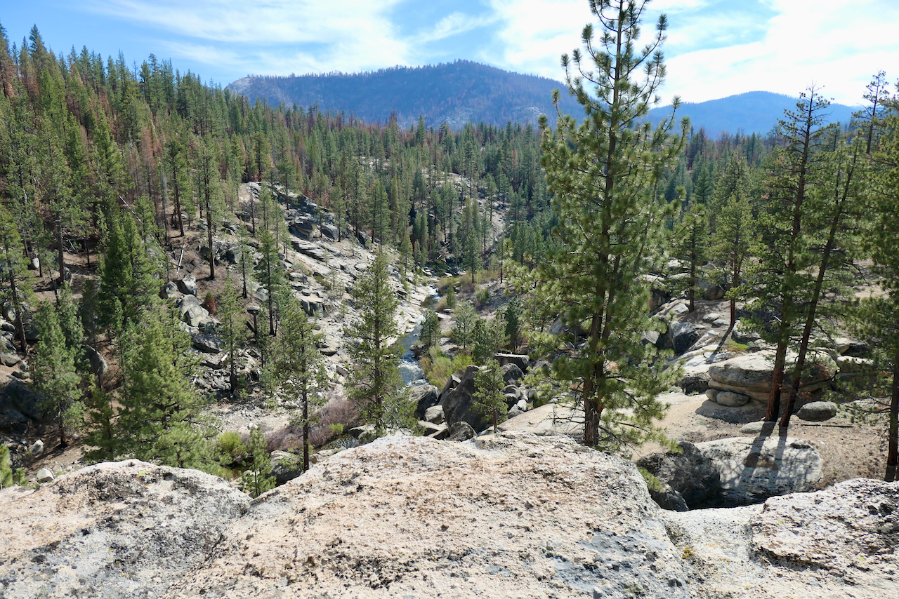
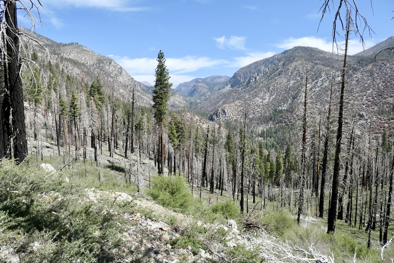
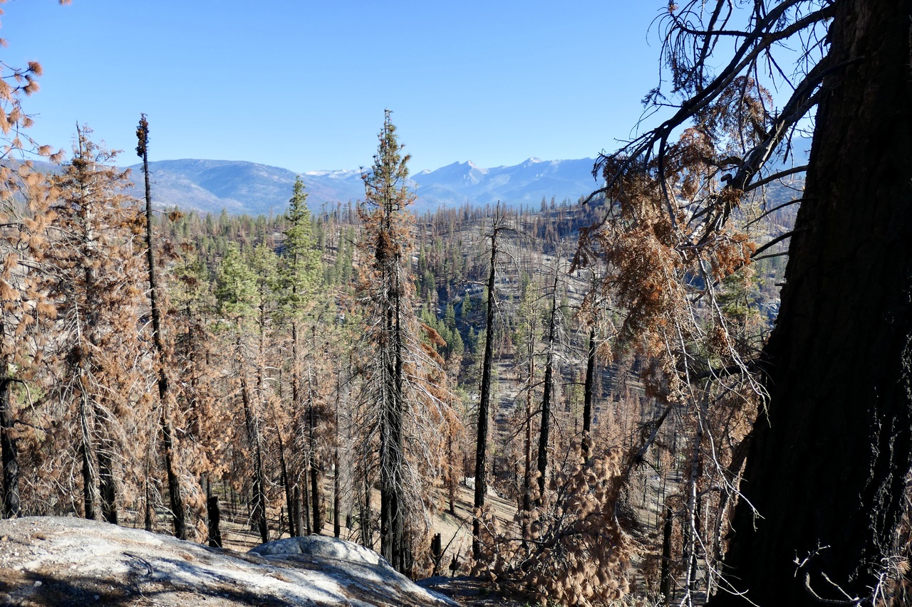
As I headed down towards the Little Kern, I got my first view of the peaks to the east,
and after another mile and change of fairly good trail, I could see down to the Little Kern canyon.
I have to admit I was impressed with the Little Kern Bridge.
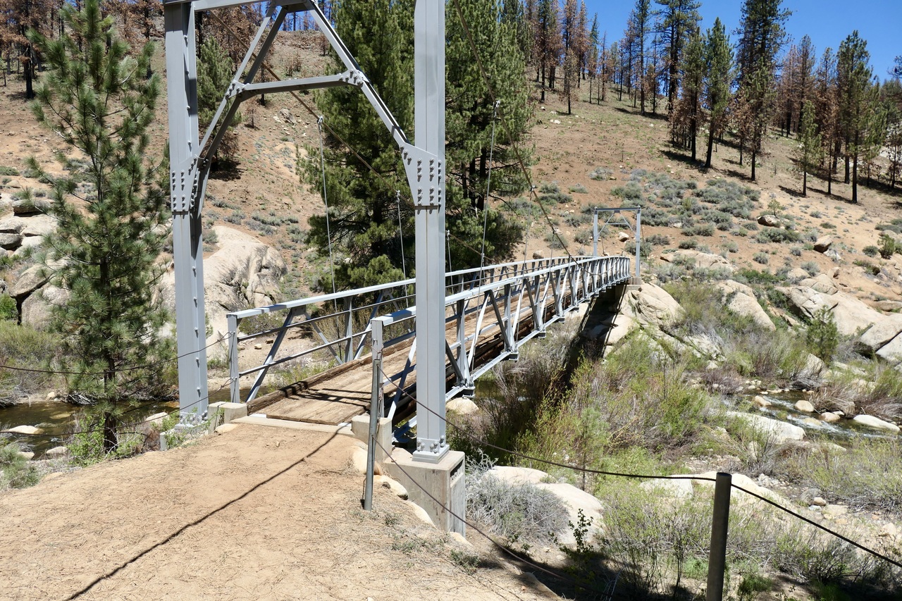
After crossing the bridge, I found a really nice firepit and seating area on the east side.
But there wasn't a lick of flat ground where you could comfortably pitch a tent. If I was going to try to camp around that area, I'd stick to the west side, which looks like it offers a better selection of flatness.
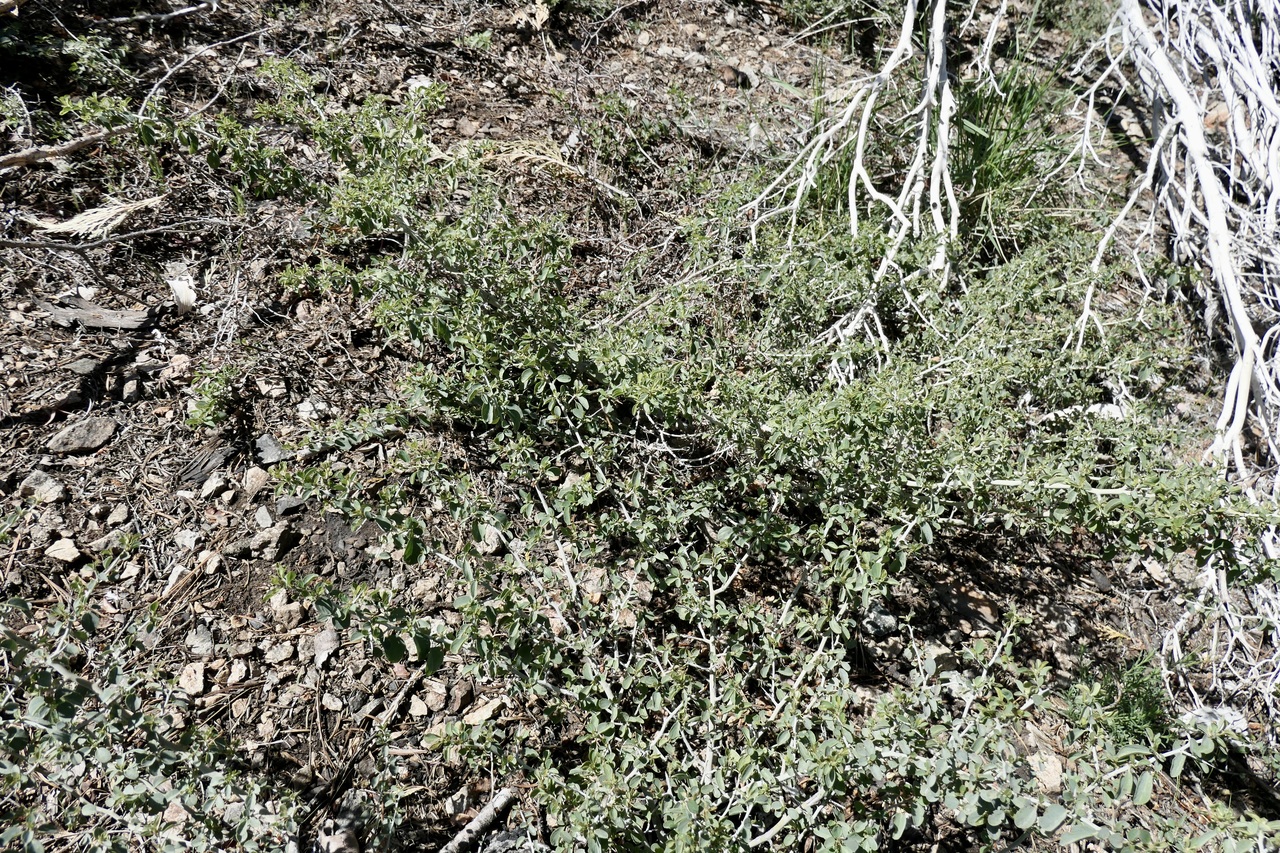
Seeing such a well established bridge bolstered my confidence that the trail would continue to be easy to traverse. But boy was I wrong. Over the next two miles, the trail that was marked on my paper map and GPS was pretty much nonexistent. At first the going wasn't too bad. But then the trail disappeared and the Mountain Whitethorn and Manzanita reared their ugly heads above the scorched ground.
At this point, I think you would be much better off just taking a bearing on your compass and trying to find lines of clear ground rather than trying to follow the supposed trail. Eventually I got near the four-way junction on the map and headed in the direction of the trail that leads to Willow Meadows.
This section wasn't that hard to follow, although I think I had to avoid about a dozen large fallen pine trees over the ~1.5 miles or so before I got down to the beginning of Willow Meadows.
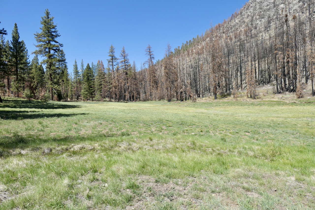
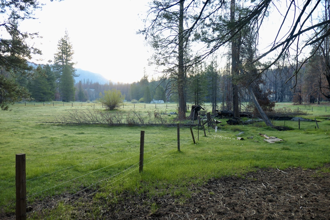
I couldn't believe how dry and seemingly devoid of life Willow Meadows was. Adding to the effect was a decaying horse skeleton
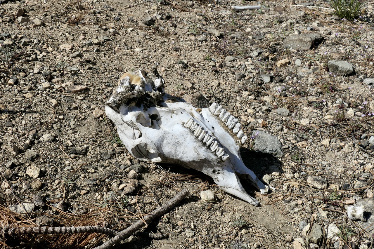
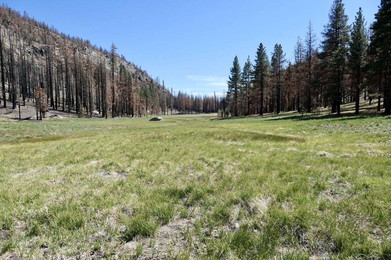
in the middle of the trail. But at least there was a semblance of a trail through Willow and Hockett Meadows. For almost two miles, I was once again happy that I could make swift progress along a well-trodden path.
But that feeling quickly came to a halt. As soon as I got to end of the meadows where the trail starts to descend, I found a hostile environment of whitethorn coating every foot of the trail.
After about 30 minutes of trying to step over branches of the insidious plant, and precariously trying to get around fallen logs on steep slopes, I decided it would be better to just head down to the bottom of the valley on an unobstructed course and try to get to the Kern River as soon as possible.
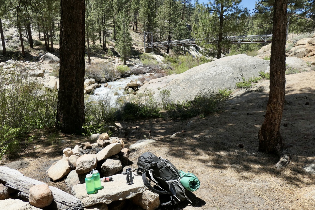
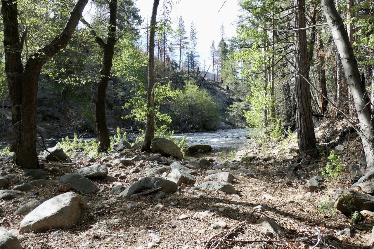
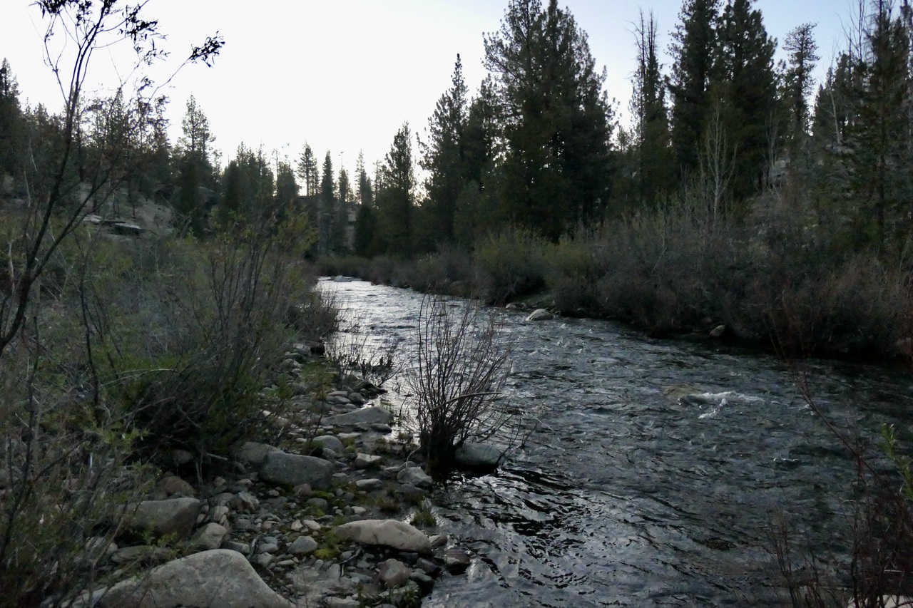
With a fair amount of reconnaissance in trying to find a good way to the Kern River, I eventually reached its shores. I found a very nice region with a flat patch of ground to set up my tent.
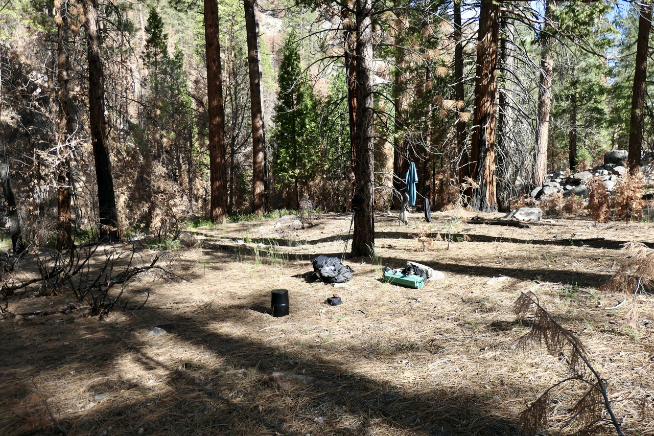
and took a well-needed bath in a calm pool of the Kern to wash off the blood caked onto my legs from all the thorns I had endured.
I was in pretty miserable spirits before that bath. But after washing off and eating a good meal of beef jerky and tortillas, I felt pretty wonderful. I slept like a baby despite the light of the full moon flooding my tent that night.
When I woke up, I was faced with a tough decision. Carry on to Kern Lake and then backtrack all the way to Jerkey Meadows? Or try to explore the wealth of trails between me and the trailhead I came in on? I only had one more full day on the trip, so I decided to go with the latter. The plan would be to explore the trails around Round Meadow and see if I could cross the Little Kern at one of the two marked crossings on the trail map west of the Little Kern Bridge.
Right after I made that decision in my head, I saw two bald eagles soaring past my campsite. I couldn't get to my camera in time. But it was a good omen for the day.
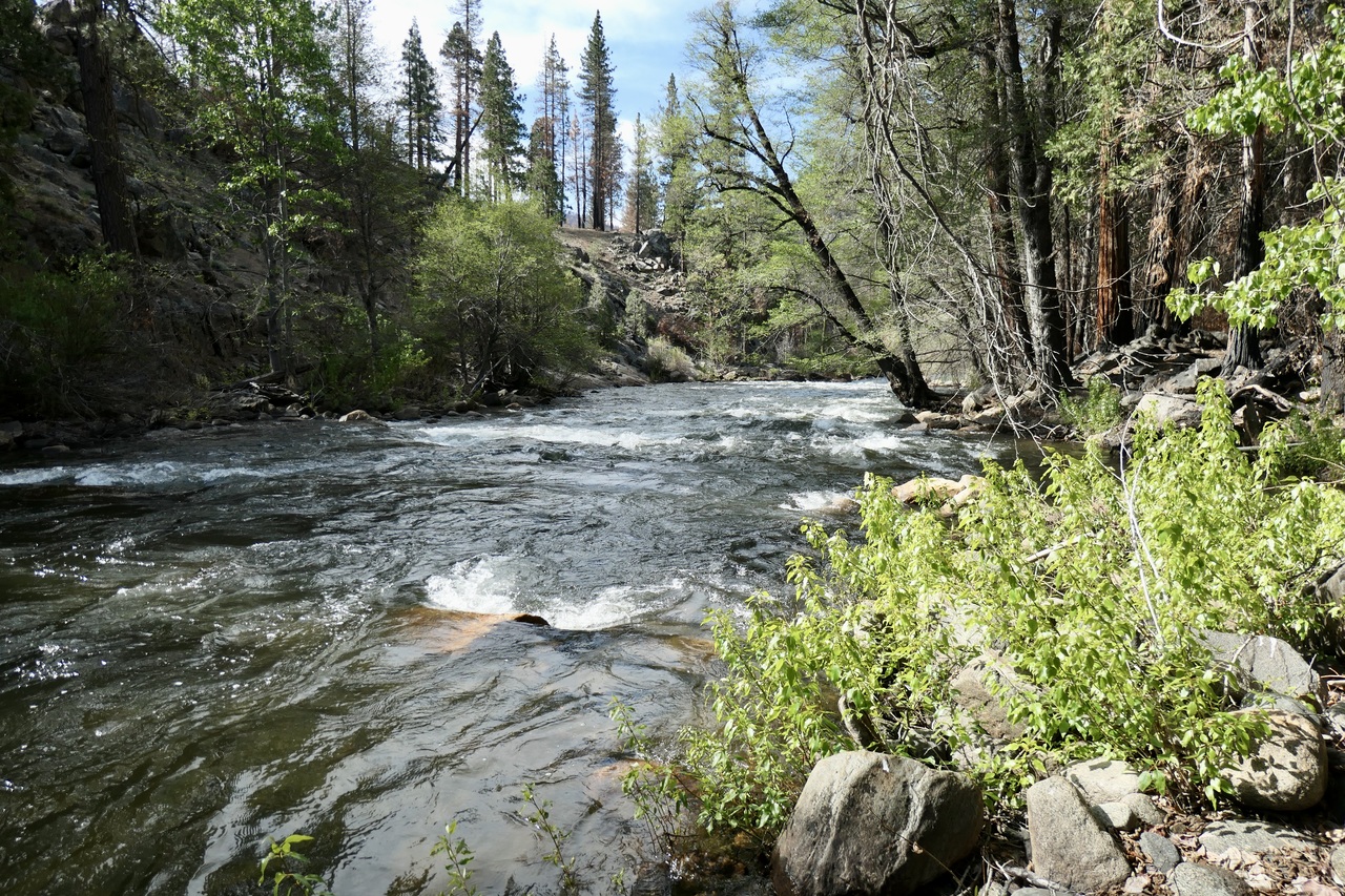
I took my sweet time enjoying breakfast and tea, and then basking in the tranquil sounds of the Kern River
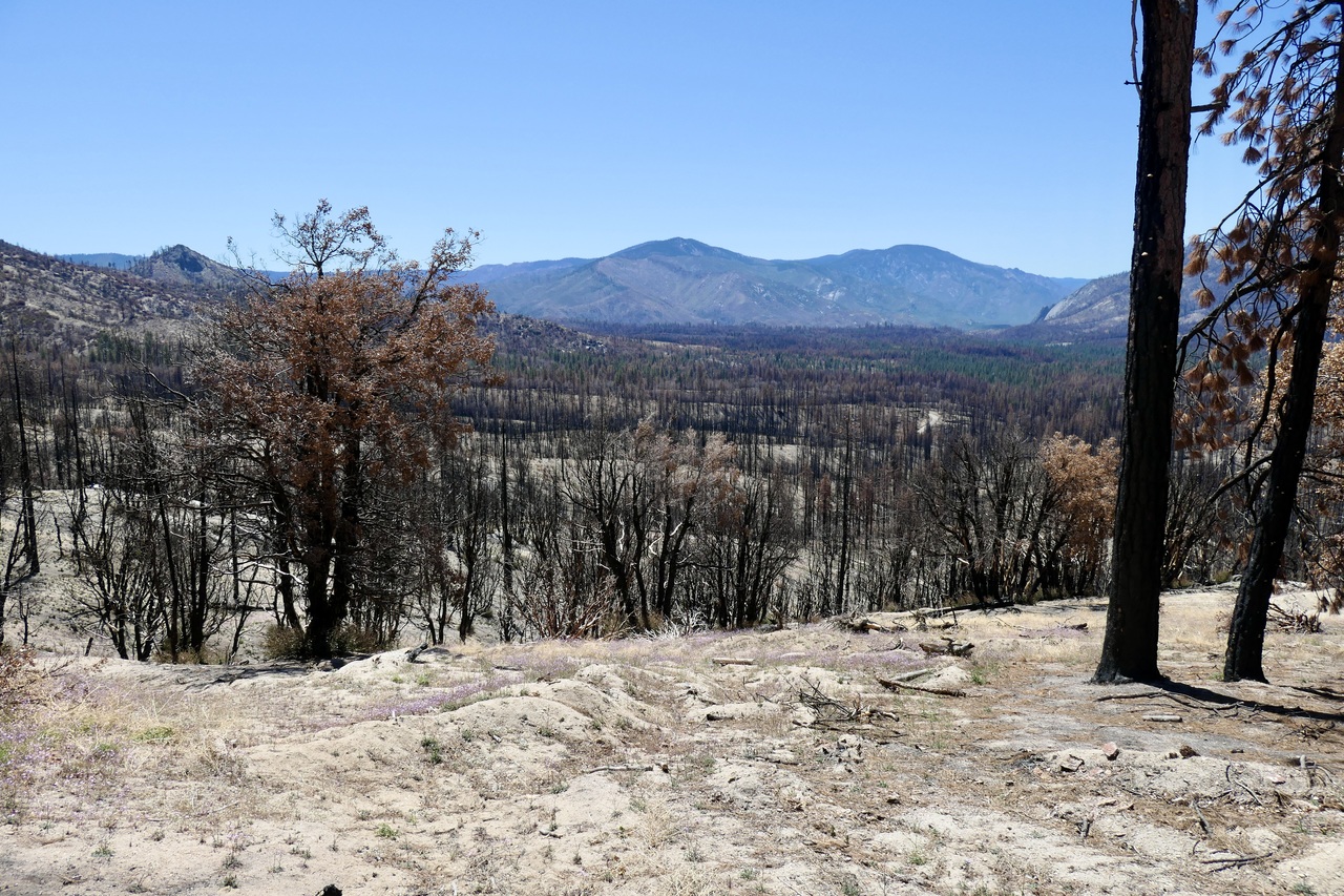
When I did get going, I decided to ignore any signs of the trail on my way back up to Willow Meadows. I basically just set a course towards the small gap in between the ridges surrounding Willow Meadows and sought out stretches of bare ground, and I'm happy I did. It was so much more pleasant than trying to follow that miserable excuse for a trail. Eventually I got a very good view of the valley I had planned to visit.
And within no time I was back at the northern reaches of Hockett Meadow. I found a pretty good spot just to the east of the meadow where I could peer down into the Kern River canyon below.
I briefly toyed with the idea of climbing up to the top of Hockett Peak, which looked like it would be no problem at all. But I decided it would be more enjoyable to get down to the Little Kern and explore around that since I was guaranteed to have ample water.
Shortly after noon, I was back at the four-way junction just to the west of Willow Meadow. Instead of going southwest back to the Little Kern, I proceeded on a northwest course directed towards Round Meadow. Again, the trail was entirely elusive due to the fire damage.
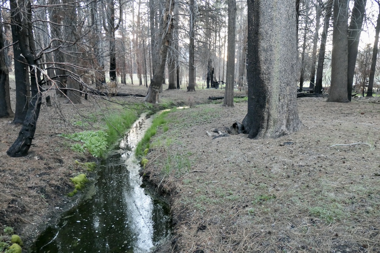
What's funny is that the fires create these stretches of discoloration in the soil that almost look like a trail, but don't lead anywhere. I was quite delighted to find a bit of flowing water in the unnamed creek just to the west of that four-way junction. I filled up there and then continued west.
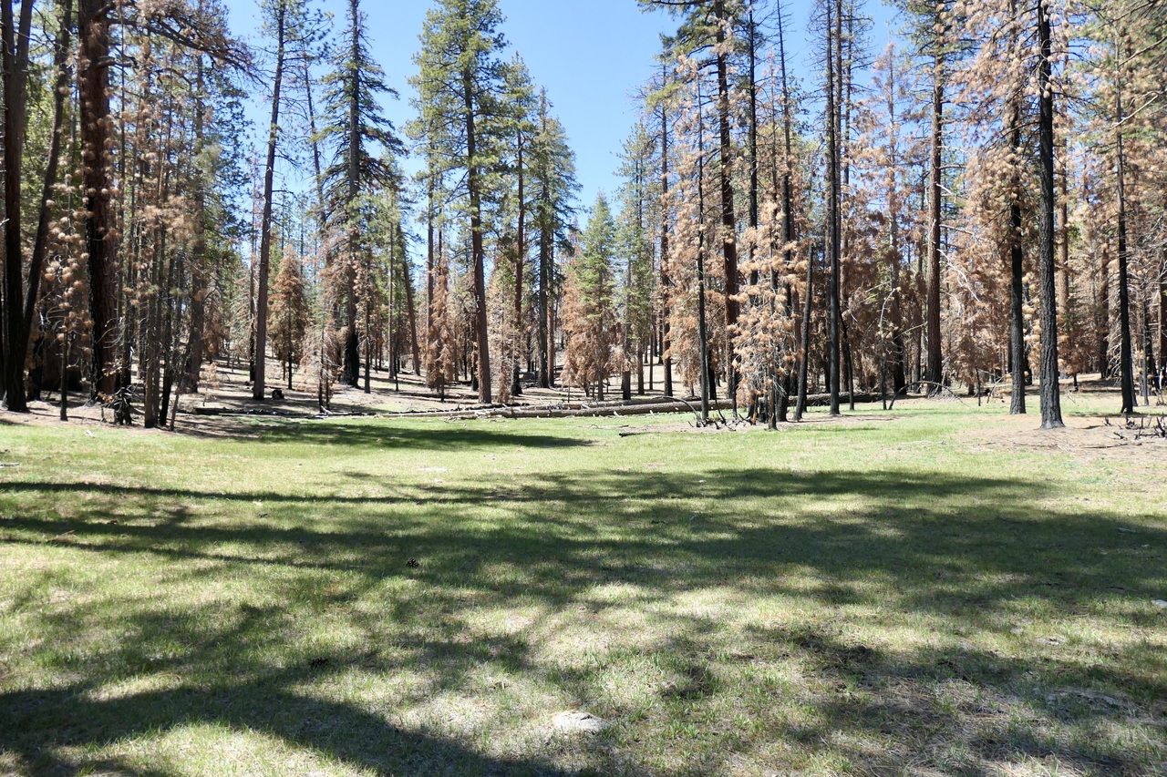
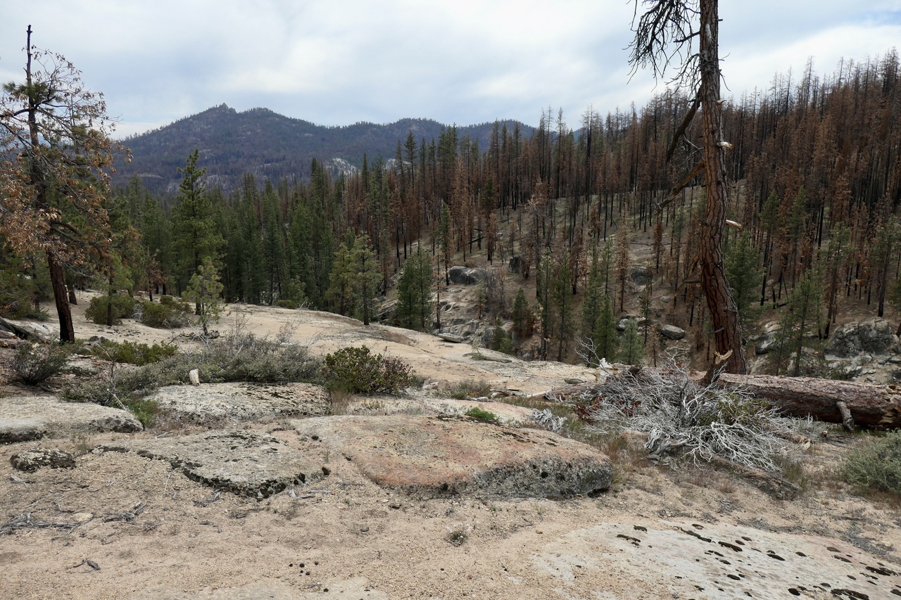
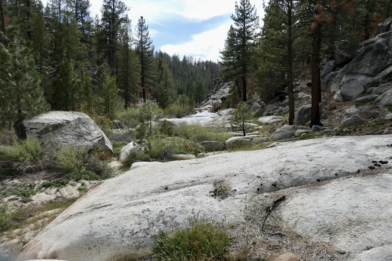
I must say that the remainder of that day was incredibly neat. I eventually picked up a faint trail once I got back into unburned forest, and was delighted when I came upon the small river canyon around Deep Creek. It completely surprised me with its huge granite slabs and ample flow of water.
The trail was easy to follow from this point to Round Meadow, but given the state of the signage, I can't imagine it had been maintained in the last 20-30 years. I couldn't make out a single letter of inscription on that wooden cross!
Round Meadow was also very cool. It has these incredibly interesting plants/trees growing in the middle that almost looked like teepees. Not sure what they are, but if you know the answer, please let me know.
Finally, the "unmaintained trail" that led down to the Little Kern just past Round Meadow was quite excellent, maybe my favorite of the entire trip. It was easy to follow, and it gave increasingly good views of the water.
Unfortunately, it did not look like it was feasible to cross the river at this point. Tom Harrison's map and my Garmin GPS map show the unmaintained trail crossing the Little Kern, but I don't think I could have safely done it with a heavy pack. There was a shallow stretch, but the rock underneath the water there looked slick and the current was flowing swiftly. I didn't think I could make it across without taking a swim (my guess is that in another month or two it would have been easy).
I wasn't too disappointed since I thought it was unlikely that this trail, which was marked as "unmaintained" would have a bridge or spot where it was easy to get across the Little Kern. But I did get a little nervous that the crossing about a mile to the west would be equally formidable.
It wasn't clear to me whether I could cover the mile or so to the next crossing by sticking to the north bank of the Little Kern. From where I was sitting, it didn't look that bad to the west.
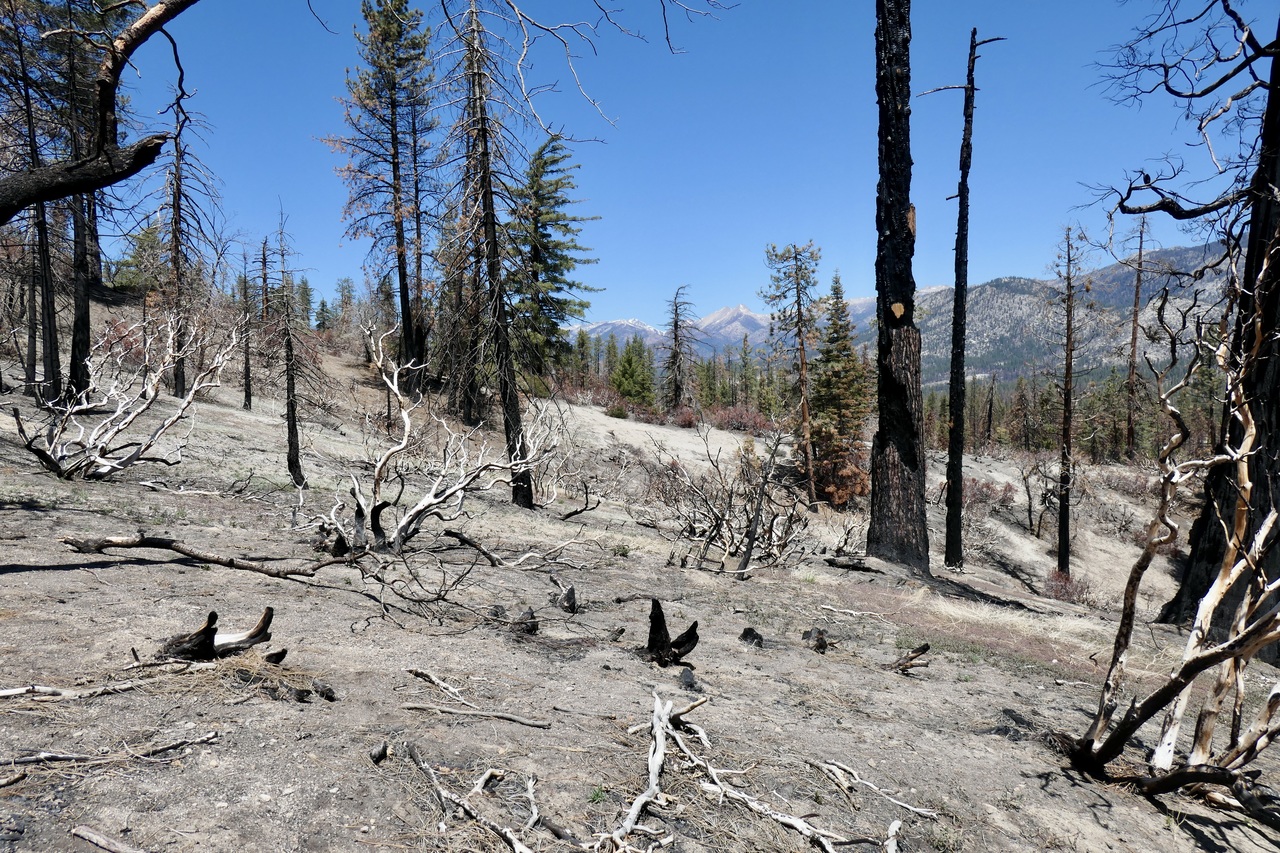
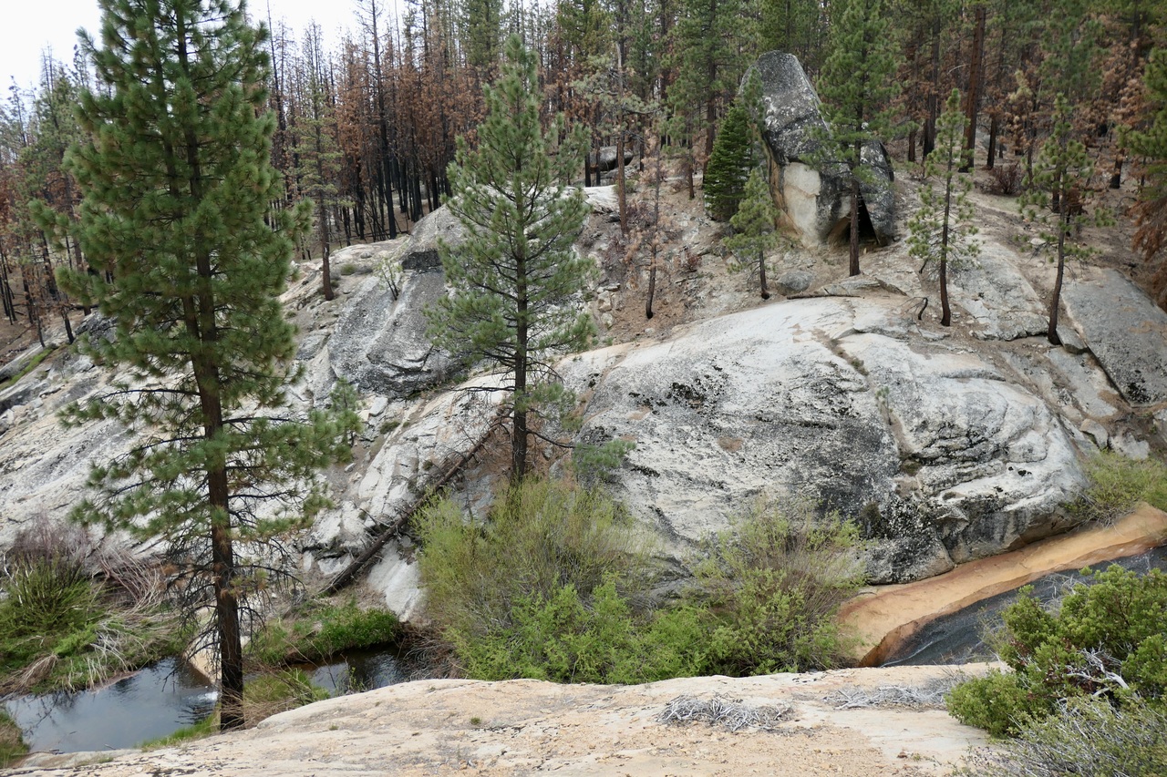
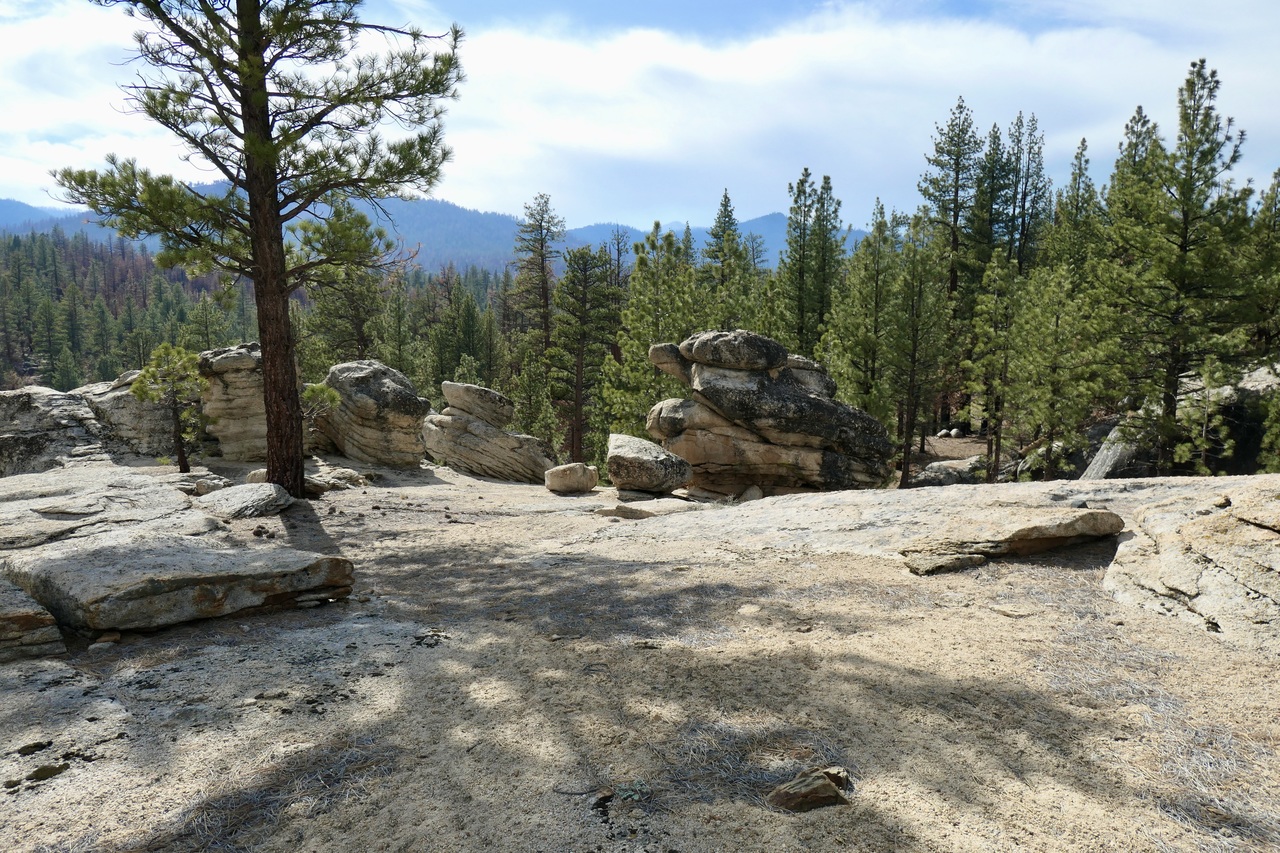
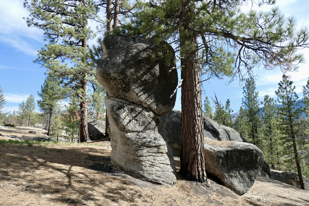
But the map showed that the terrain around the river was pretty steep, and I was worried about having to backtrack if I got cliffed out. So I decided to climb up a few hundred feet to a spot where things looked level. It was a bit of extra effort, but I'm glad I did it since the views of the Little Kern were quite brilliant,
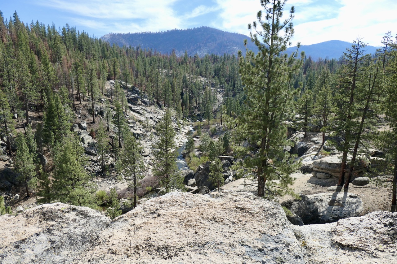
and I was finally treated to the sight of some cool granite formations!
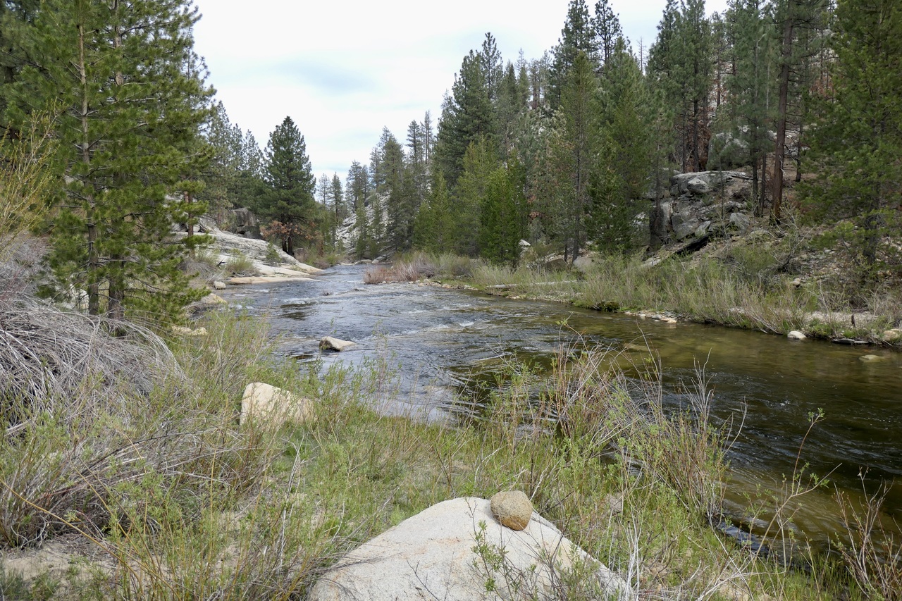
Eventually I found an easy way down to the Little Kern just east of where the trail crosses the water on my Garmin GPS map. There were a fair number of footprints in the sand around the water, but at first I couldn't figure out where I was supposed to cross. Finally I found clear signs of a trail on the opposite side (this picture was taken from that side after I crossed). The name of the crossing is the Burnt Corral Crossing.
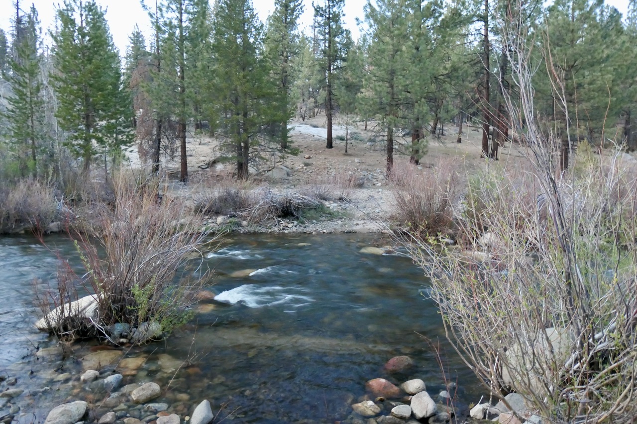
The river was moving pretty well here, but it didn't look all that deep. Maybe a bit higher than my knees. I decided I'd give it a go. I took it really slow, making sure my leading foot and hiking poles were firmly placed on the river bottom before trying to move my other foot. Of course, there's a chance I could have fallen. But honestly the consequences would have been minimal since I could have made it to the shore without a problem, and the air temperature was perfect.
Although my shoes were soaked, I was delighted to find an exquisite campsite on the other side of the river. It was about 5 pm and I was tired. So I made up my mind to call this my home for the night.
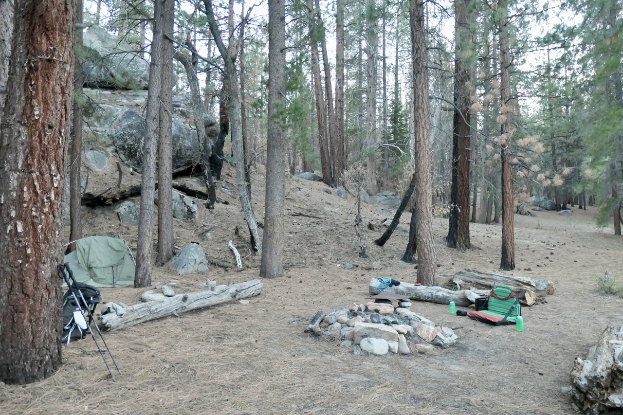
I took a nice bath in the Little Kern, tried to dry my shoes and socks off in the sun the best I could, and enjoyed the spectacularly tranquil sounds of the river passing me by.
Once the sun started to set I enjoyed another nice dinner and watched a few deer come down to investigate the area around the water. I went to sleep before the sun set, but was lucky enough to wake up exactly when the fully eclipsed moon was glowing a crimson red. I watched it for a few minutes as it appeared to waiver between the pine trees in front of my tent. When I got back in my sleeping bag, I slept very well.
The final day of the trip was short and sweet. I woke up around 4:45 am to the pale dawn light, packed up my stuff, ate a very small breakfast, and hit the trail by about 5:45.
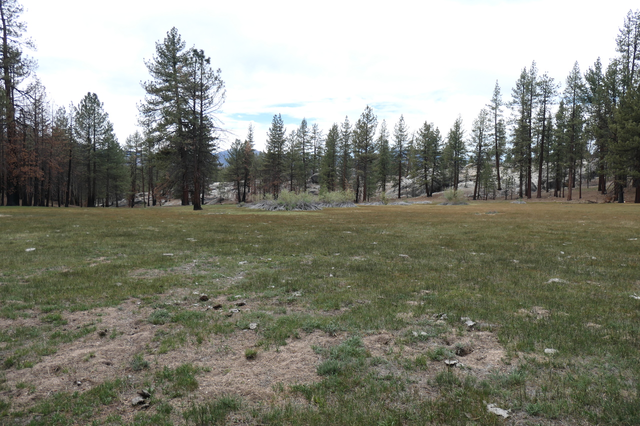
In no time at all I was entering the reaches of Grey Meadow. Although I didn't need to fill my bottles, I was happy to see that there was a fair amount of water in the creek on its northern border.
The meadow looked beautiful in the early morning light.
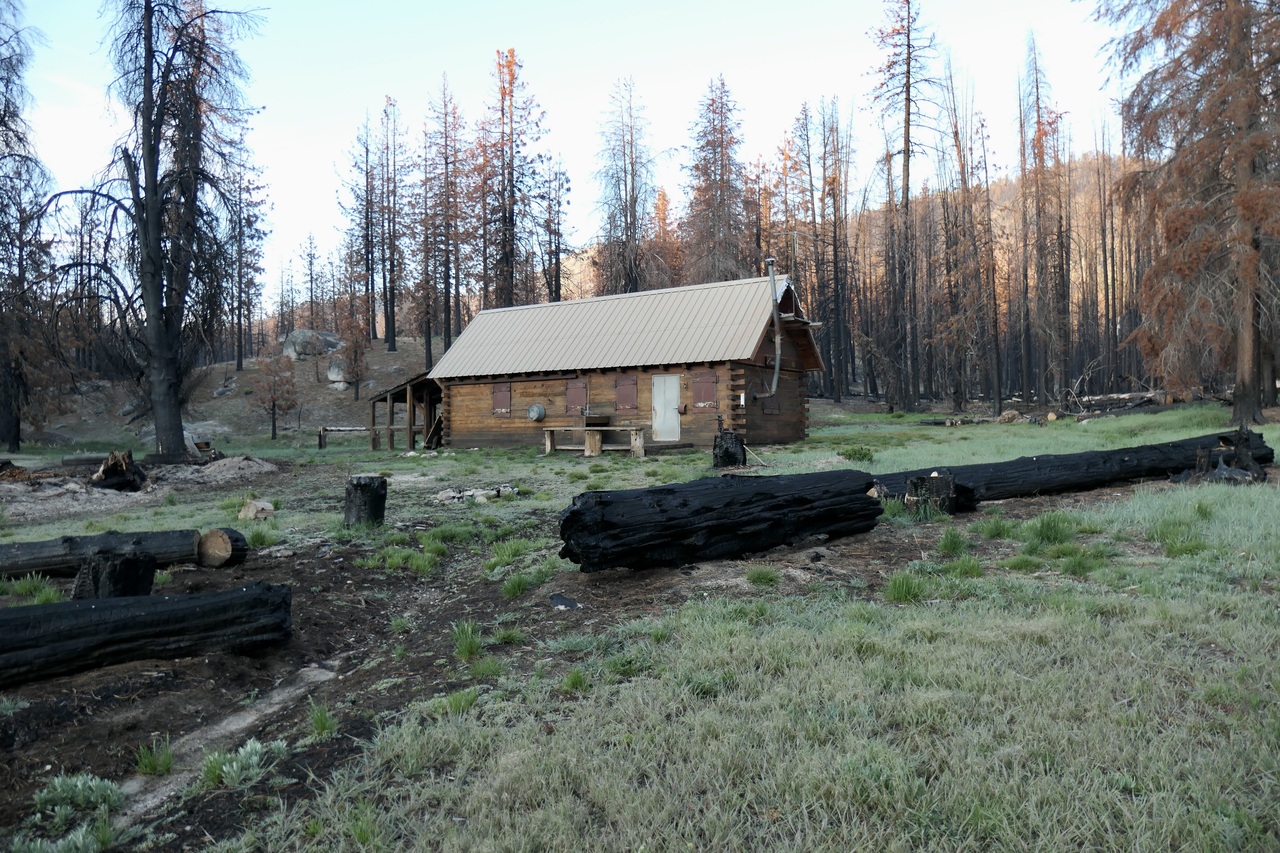
From the looks of things, the ranger station had not yet opened up for the season.
Even in this area the trails were very hard to identify. I basically just headed south and tried to avoid the meandering streams in front of me. Eventually I did pick up a fairly well established trail that proceeded to climb gradually up to a small flat at around 6,500 ft,
and then brought me down in the direction of Fish Creek. The early morning sunlight filtering through the trees provided a superb finale to the trip.
It wasn't obvious where I was supposed to cross Fish Creek, but I found a small pool of shallow water with now obstructions and just mobbed my way across it. My shoes and socks were still wet enough that I didn't really care with only a few miles left to go.
The next portion of the trail up to the junction near Jerkey Meadows was pretty cool. There were some great wildflowers and several spots that offered views of the ranges to the north.
When I got to the top of the "pass", I decided to abandon the idea of following the trail and just head towards Jerkey Meadow. On the way down towards Jerkey Trailhead it was even more evident how badly the trail is in need of some repair.
At the parking lot I found only one other vehicle. I couldn't believe I had not seen a single person in 50-some hours when I was so close to a forest road. Now that I know what to expect in the Golden Trout Wilderness&mash;adventure, trailblazing, and solitude— I'm excited to go back. Apparently the trail from Lewis Camp to Kern Lake via Coyote Pass is in better shape, so I reckon I'll take that one when I do return.