


TRIP DETAILS
TRAIL MAP
OVERVIEW
Notes:
- With easy terrain and a short amount of hiking required, Jackass Lakes is a great place to bring a first-time backpacker. It's also a great place if you want to have a Yosemite-like experience but all the Yosemite backcountry permits are taken up.
- The hike up to Madera Peak is an excellent first off-trail peak bagging experience. It makes a perfect day-hike from a basecamp at Upper Jackass Lake.
- Five or six years ago, I would have advised folks to take a 4WD vehicle to the trailhead. But they've done some wonderful work on forest road 5S86, so now I think a front-wheel drive car would probably be just fine.
- If you're taking multiple cars and/or meeting friends from other locations, you can park cars at the Oakhurst Visitor Center (40343 Highway 41, Oakhurst, CA 93644) and consolidate vehicles on your way up to the trailhead.
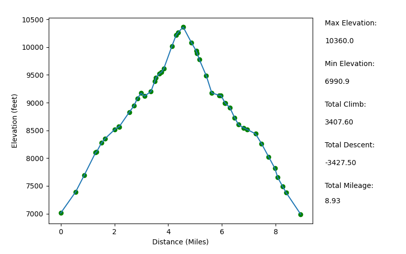
Elevation Profile (Mileage Slightly Underestimated)
TRIP LOG
The decision to do a backpacking trip to Jackass Lakes was sort of a last minute thing. Initially my wife and I, and our friend, Amber, were going to try to do a trip out to the Channel Islands. Amber lives in LA and we live in the Bay Area, so it was sort of a decent spot in between us. Unfortunately, there were no sites available on the islands. So I started thinking about spots that we could get a permit last minute that were sort of between us. I remembered how easy it was to get a permit for the Chiquito Pass Trailhead, so we began looking around there. We also wanted to do a trip where we didn't have to do a strenuous hike with our packs on. A good fit: Jackass Lakes.
Since Amber was coming from LA and we had space for three people in my car, we decided we'd meet up at the Oakhurst Visitor Center (see notes above) so we could just takeß one car up. They said it would be no problem to leave her car in the parking lot, which was really cool.
I was warning Tina and Amber that we were in for a very bumpy ride (I actually rented a 4WD car the second time I drove up 5S86 because my Nissan Altima got so banged up the first time) for about an hour on the way up. But to my delighted surprise, the road had been paved for much of the way! So it was a rather smooth ride with just a few rought patches.
We ended up getting to the parking area around 1430. It's a rather small patch of dirt with no bear boxes or restrooms. When I went behind a tree to change clothes, I got two mosquitto bites in just a matter of seconds. A bad omen, right? I knew we were in for a real treat with those delightful little creatures in the days and nights ahead.
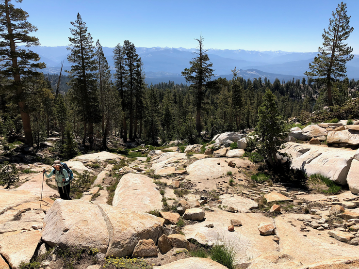
I quickly doused myself in mosquitto repellent, and after we were all properly dressed and packed, we set off on the trail. It's quite a great path from the get-go. There is one minor creek crossing to start,
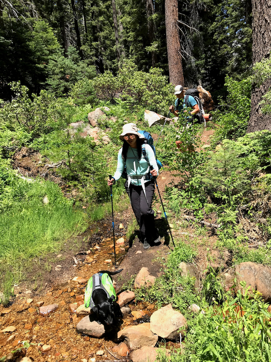
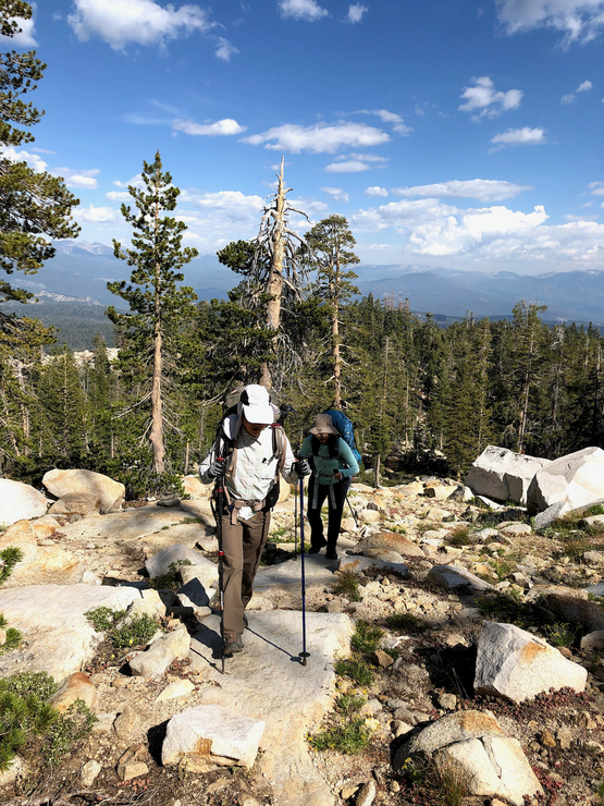
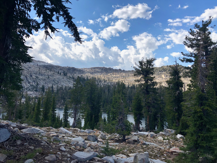
but then it's just an upward journey through beautiful pine forest. In a very short time, we were also greeted with sweeping views to the south.
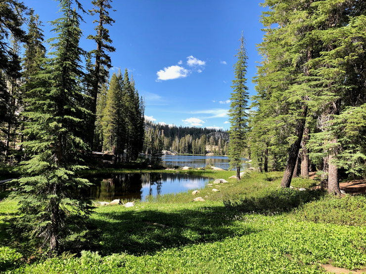
The views kept getting better and better as we ascended. In about two hours and a little over 1500 feet of elevation gain, we came upon the junction with the turnoff for Norris Lake. It's only a tiny detour, so we decided to check it out. It's actually a pretty picturesque lake that looks like a pretty good spot for fishing.
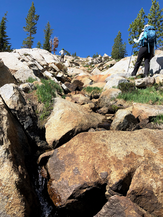
Up until this point, it was extremely easy to follow the trail. But after we got back on the trail to lower Jackass Lakes, we found it to be a bit more difficult. I think we were more or less following the trail most of the way, but every once in awhile we'd lose it and have to push back some spruce branches. The good news is that it's pretty open terrain on the whole, so not much bushwhacking is involved.
We eventually reached Lower Jackass Lake and took a pause to check it out and figure out where the trail had gone. It's a pretty small lake.
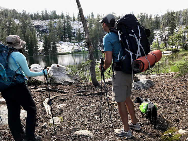
In my opinion, it's worth the extra ~hour to get up to Upper Jackass Lake if you plan on doing overnight camping.
Between Lower and Upper Jackass Lake we didn't really follow the established trail. The terrain is forgiving enough that you can pretty much just decide how you want to best attack it. When we got our first views of Upper Jackass, we were all pretty delighted to see how well postured it was among the surrounding mountains.
The campsite we chose on the eastern edge of Upper Jackass Lake was pretty much the first obvious one you'll see if you follow our route. I thought it was pretty cool, but it's not big enough for a large group. There was a group that came after us that was probably 10-12 people. They continued to the northern shore of the lake and found a spot with plenty of room. Based upon our limited exploration, it seems like a place that can accommodate quite a few groups.
After we set up our tents, Amber and I took a dip in the lake. It was a really refreshing swim. The reflections off the water with the clouds were just perfect.
Up until this point, the mosquittos hadn't been that bad. But when we set up for dinner,
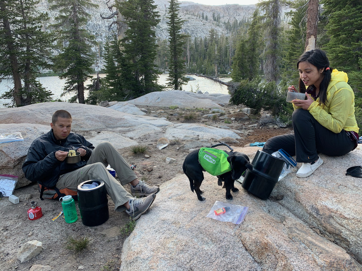
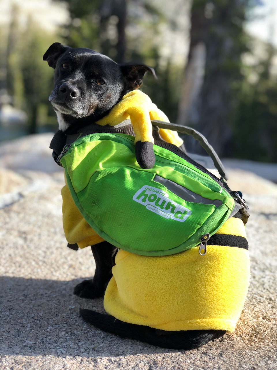
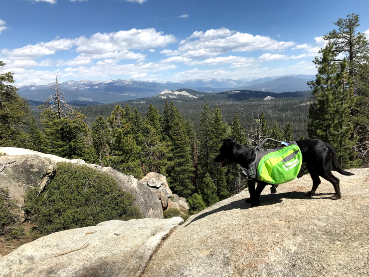
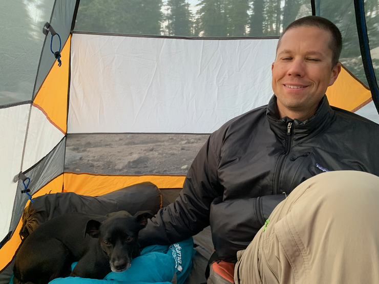
they came out in full force. There were pockets of air where the sunlight would hit just right and we could see hundreds of them buzzing about. None of us had any desire to prolong our exposure (especially Juniper, who was getting mauled), so we quickly got in our tents and enjoyed the end of the day in their protection.
The plan for Day 2 was to hike up to Madera Peak. Based on the topo map, it looked like there was a pretty straightforward ~1.5-mile route to the top from our campsite, although as we sat and ate breakfast, it wasn't completely obvious what the best approach was.
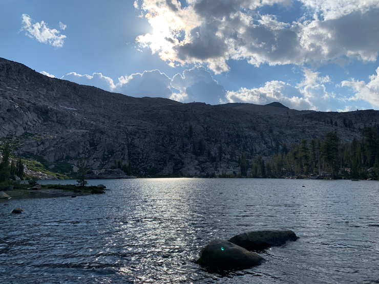
The lake looked gorgeous in the morning light,
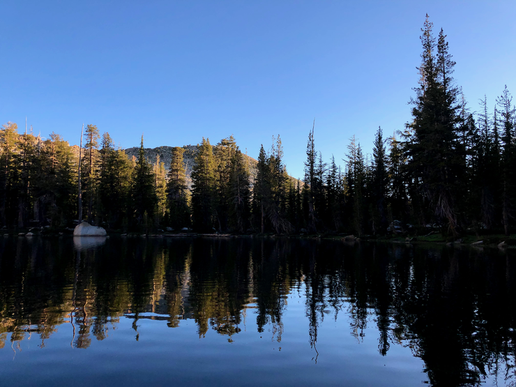
and the temperature couldn't have been much more ideal. If it wasn't for the mosquittos buzzing around us, it would have been an ideal morning.
We started off by taking the use trail around to the north shore of Upper Jackass Lake, passing by the large campsite there. Once we reached the rocky slopes at the western edge of the lake, we headed on a course to the north through some open forest (basically following the north-south seasonal creek that empties into the lake).
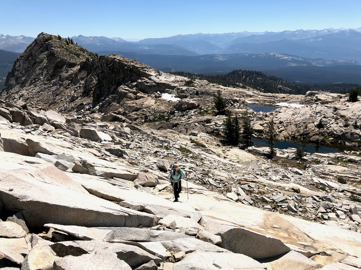
We then followed the creek as it curved to the west. The terrain along this stretch consists of lovely granite slopes
at nice gentle angles.
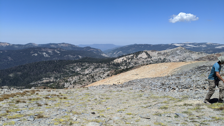
The view to the east got progressively better as we ascended,
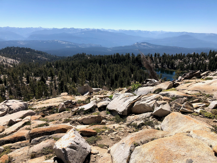
and within a short while, the slopes eventually led us to Burro Lake.
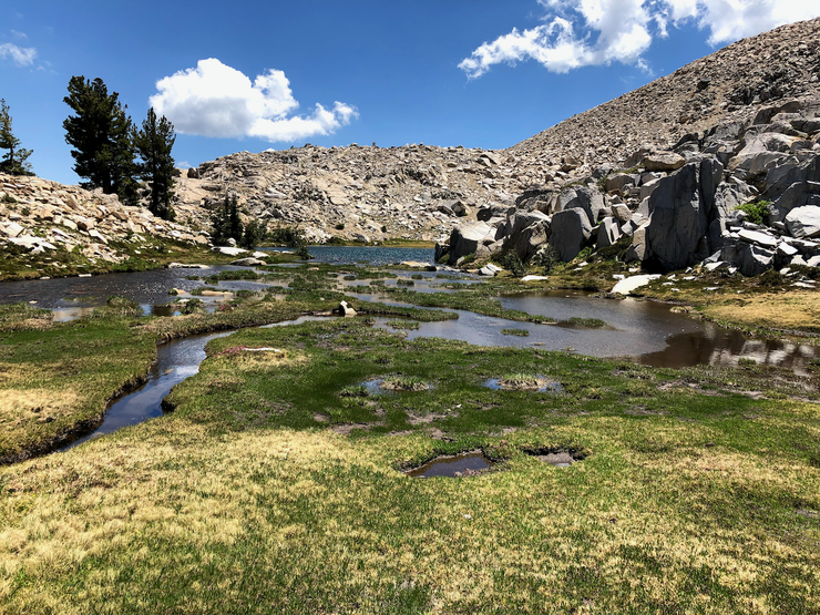
Burro Lake looked like an excellent place to go for a swim later and perhaps avoid the mosquittos with the steady breeze rolling off the mountainside. It would serve as a perfect place to have lunch and take a long break on the way back down later in the afternoon.
It wasn't completely clear what the ideal way to get up the mountainside was, but it looked like going north from Burro Lake and then cutting west on the ridgeline before the south-facing cliffs above was as good as any route (this is the sloped, east-west ridgeline between 9,600 and the north-south ridge at 10,300 that leads up to the peak).
I think that aforementioned ridgeline is indeed probably the most ideal way to get up. The slope isn't very bad, as you can see from this picture.
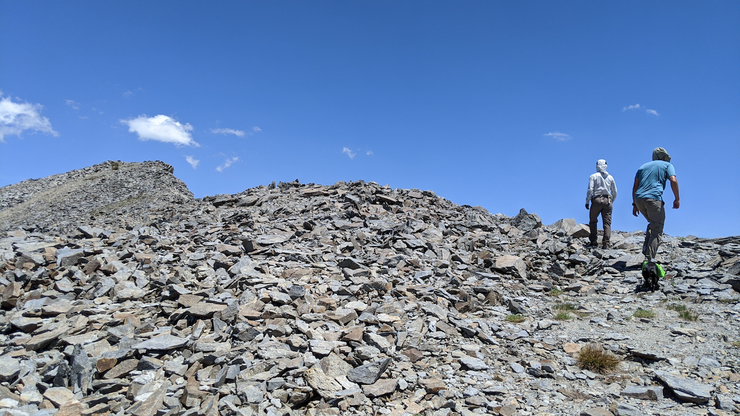
Around 9800, the terrain transitions from nice slabs of granite to chunky boulders and talus.
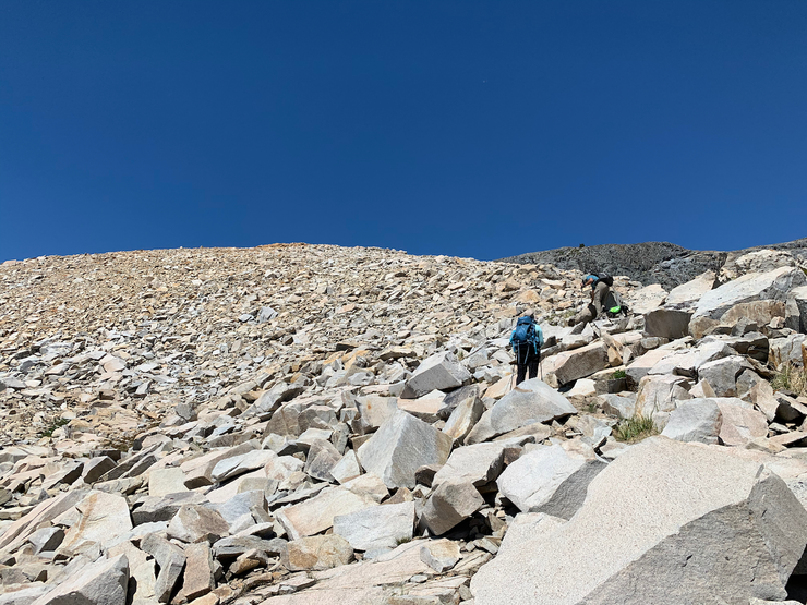
Our hiking polls quickly became useless at this point as we were crawling and scrapping over loose rocks, and our bags were starting to feel pretty heavy. So we decided to stash all our gear just before the rocks transition from a white-beige color to an orange-brown one.
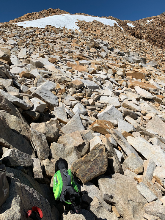
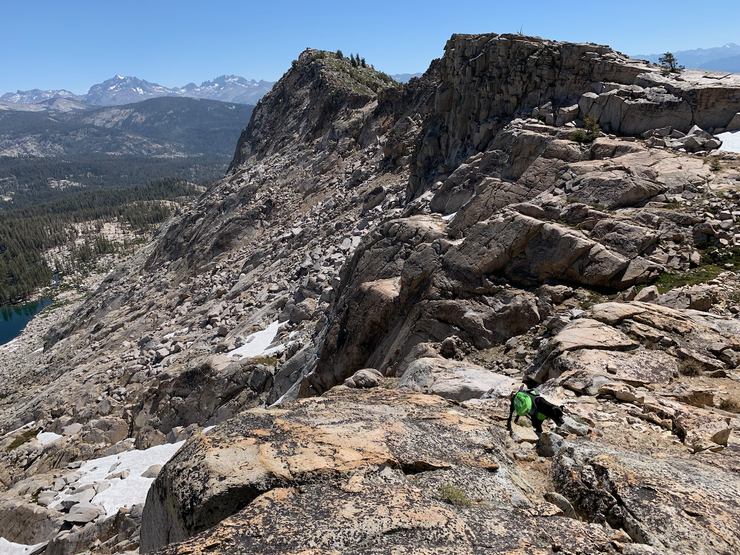
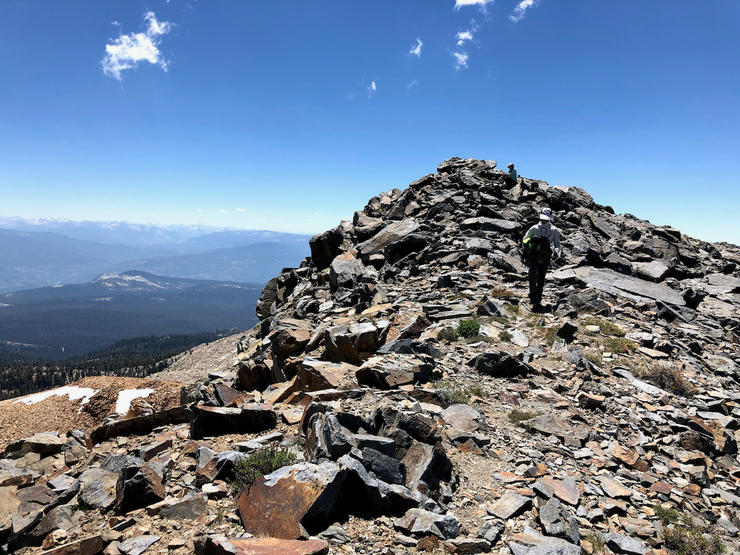
Initially Amber thought she'd just stay back while Tina and I tried to reach the peak, but she got a nice second wind and decided to join us (she and Tina were tough as nails on both the ascent and descent). These pictures give a good idea of what you have to get across to get to the top.
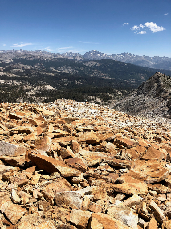
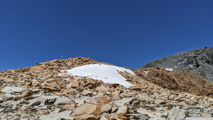
As you can see in the last one, the red-orange colored rock eventually transitions to dull grey as you move forward, a sign that you're getting close to the peak! It's actually pretty cool to look back at the mountain once you get back to camp at Upper Jackass Lakes and observe the transitions in color. You can tell exactly where you were hiking.
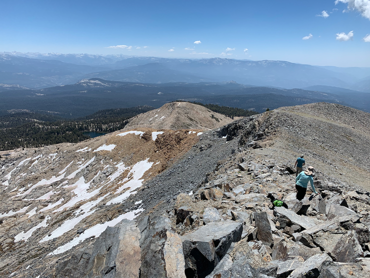
When we hit the grey, north-south ridge, we finally got a great view to the west.
While there's no official trail on the final stretch up to Madera Peak, the walking is very easy for the most part,
although we did have to carry Juniper for a decent while.
The views from the peak are simply excellent, especially the one back towards Upper Jackass Lake.
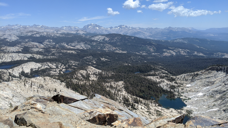
Far off in the distance you can see the Pacific Crest, Mammoth Mountain, and maybe even the Palisade Range. We could pretty much see the entire route back from the vantage point of the peak.
It was about 13:15, and we were all pretty hungry and tired. But we decided it'd be ideal to make it back to Burro Lake for lunch and a swim. So we proceeded at a steady pace back down the same route we took up. There were a couple of steep spots that were a bit more difficult on the way down than on the way up, but nothing dangerous. It felt fantastic to dive in
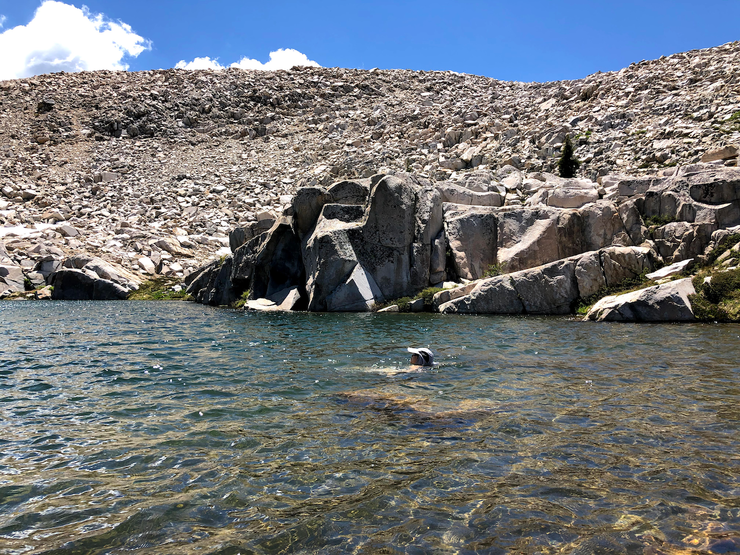
and eventually soak our feet in the waters of Burro Lake while we took in a nice meal.
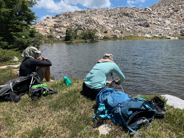
We took our sweet time getting back to camp. It was only about 1700 when we reached our tents, so we still had plenty of time to catch some fish before dinner time. Tina and Amber found a sweet little spot on the south side of the lake where we dropped our lines in.
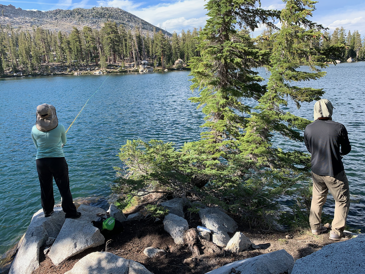
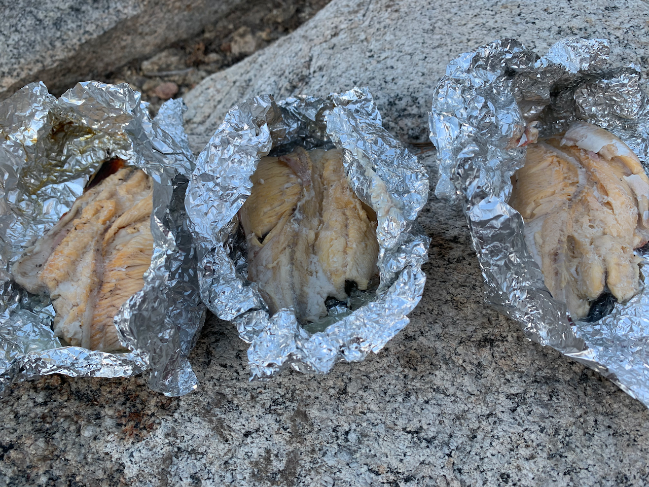
We had luck on our side that night, as all three of us caught a fish within an hour or so (with only a couple of lures lost and/or recovered from the rocks).
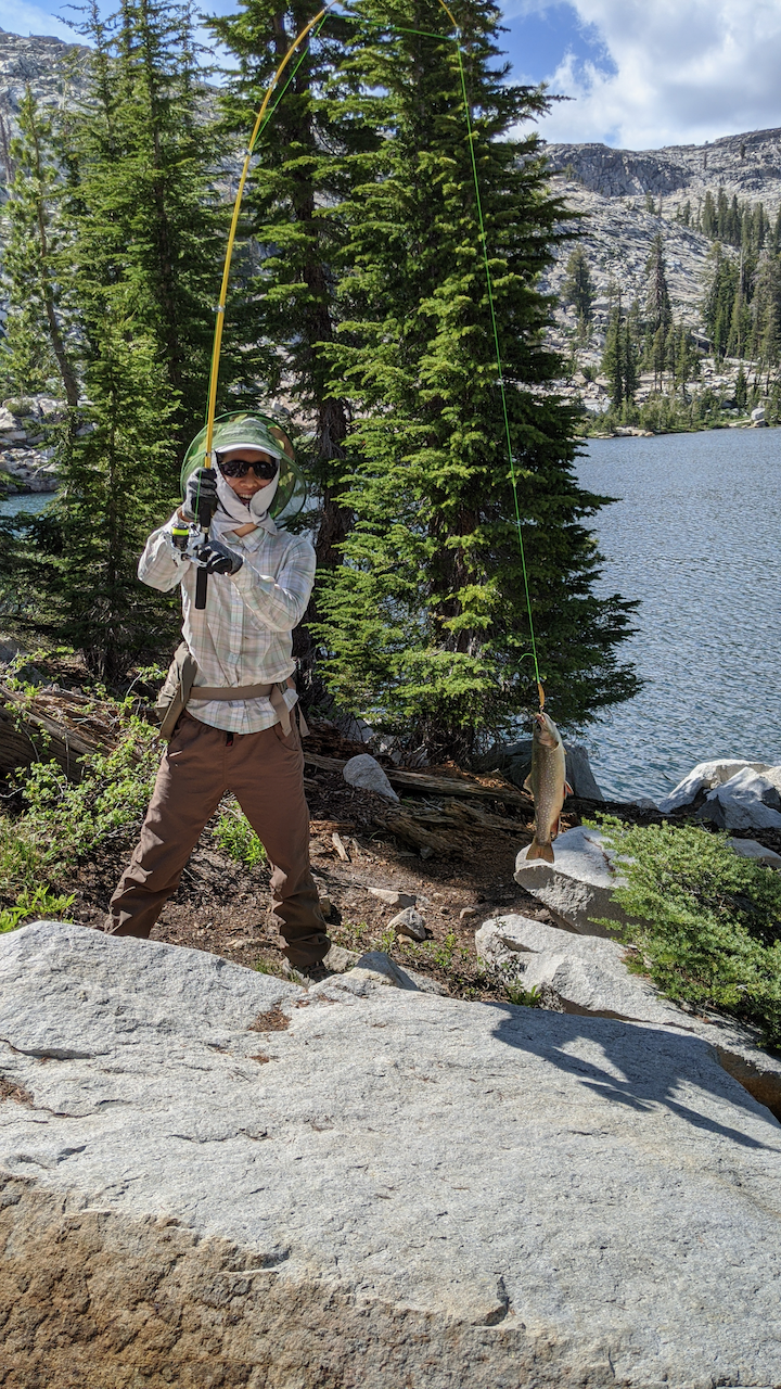
They weren't humongous, but they cooked up pretty well and gave us a nice treat to finish off a fantastic day.
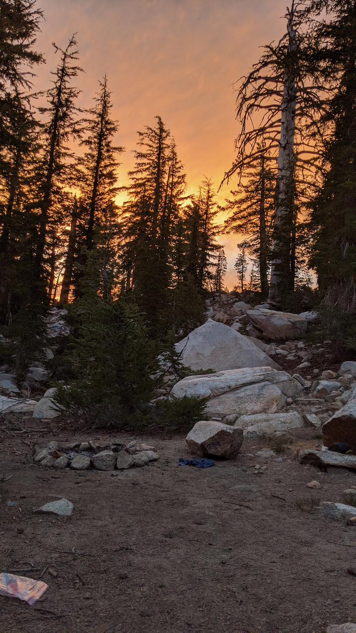
It was a superb evening in almost every way possible. I say almost because the mosquittos seemed to be even more agressive than they were the night before. We didn't spend much time outside the tents after we had finished our meal, but we could still see the brilliant colors of the sky from inside.
I think we all slept better than the first night given how action-packed the day was.
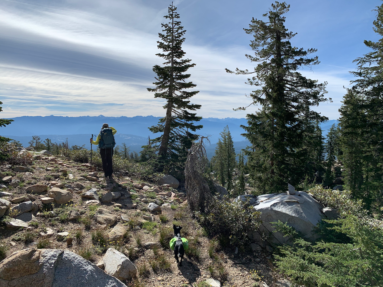
On the third day, we simply headed back out the way we came after a quick breakfast. The trail actually seemed a bit harder to follow on the way down, but still it wasn't bad at all. The combination of sun and clouds made for a gorgeous setting on our return stroll.
We got back to the car right around 11 and made it back to Oakhurst around noon. It was a pretty great trip all in all. One I'd gladly repeat.I'm pretty sure Juni was happy to finally be free of the need to wear warm clothing.