


TRIP DETAILS
TRAIL MAP
OVERVIEW
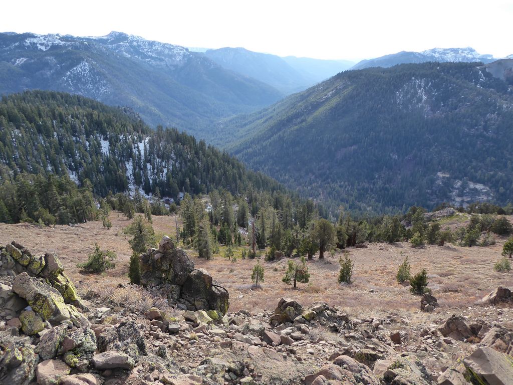
Carson-Iceberg Wilderness—although not quite as dramatic or rugged as the backcountry in Yosemite, Sequoia, or Kings Canyon National Parks—is a nice little gem in the Sierra Nevadas. With very easy access from Highway 108 and Highway 4, it makes a great destination for a short weekend trip from the Bay Area. For those seeking some solitude just a few miles away from a trailhead, this is a great destination.
One thing I should note is that many of the trails labeled on my Garmin Topo 2008 map in this area were almost non-existent. I am not sure if the forest service stopped maintaining them or if the accuracy of the map is just insufficient. But if you choose to follow a similar route to the one described below, be prepared for a bit of bushwhacking and some good old "find and seek" on your adventure through Stanislaus National Forest.
Notes:
- Permits are required for overnight trips into Carson-Iceberg from May to October. Since we did this trip in November, we didn't have to obtain a permit.
- There were also no fees to camp at Sand Flat Campground (a great place to sleep the night before a trip) at this time of year.
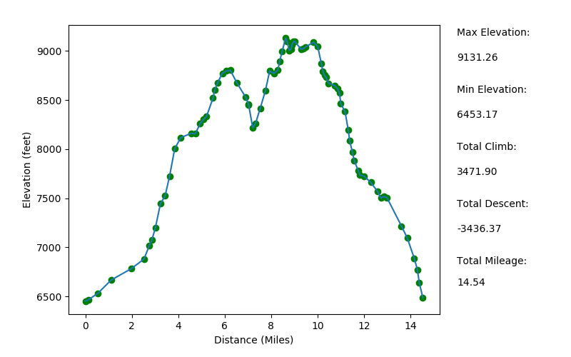
Elevation Profile (mileage slightly underestimated)
TRIP LOG
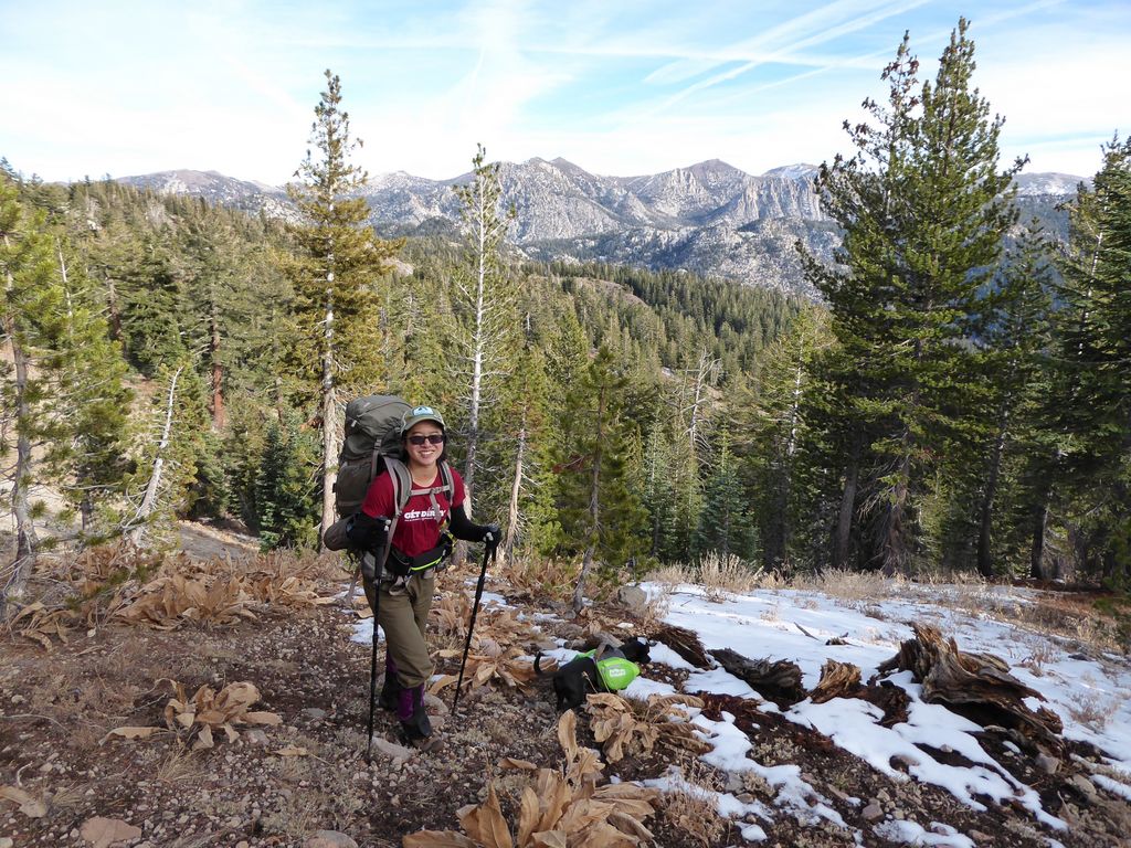
Tina, Juni (Tina's dog), and I embarked from Livermore at 0515, well before the sun had peaked its head over the horizon. We were fortunate enough to have a perfectly smooth, traffic-free ride all the way to the turn off from Highway 108 onto Clarks Fork Road. Our goal was to meet the rest of our crew, a group of friends from the Volunteers for Outdoor California, at 0800 at Sand Flat Campground. We met that goal with time to spare.
Now, I'm a morning person. So the idea of waking up at 3 or 4 am to start driving toward a trailhead is just peachy for me. But if the idea of waking up that early makes your head hurt just thinking about it, Sand Flat Campground is a perfect spot to crash the night before starting a trek into Carson-Iceberg. At the time we did the trip, there was no potable water at the campground, and only one of the many toilets was open for use. Still, since it was free, you can't really complain can you?
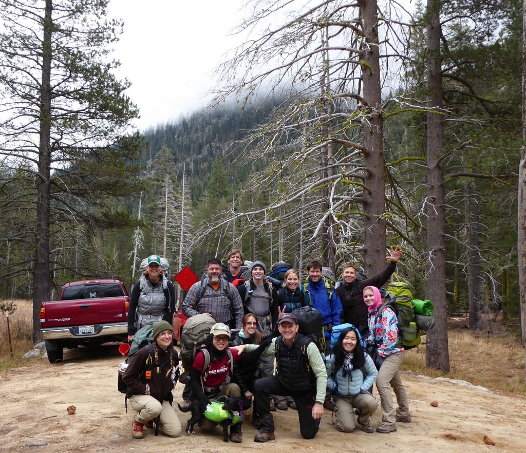
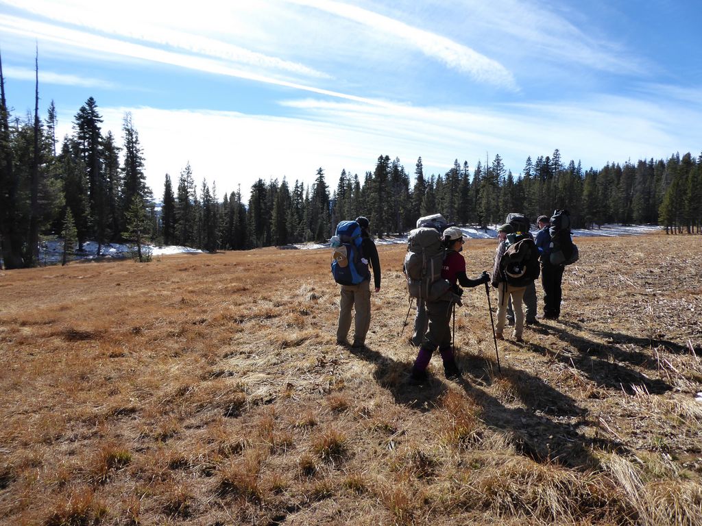
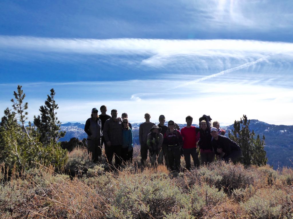
When we arrived, we exchanged greetings with the 11 other trip members that were already there and started suiting up for the trip. The drive to the trailhead at the end of Clarks Fork Road only took about 10 minutes or so, and once we got there, it was time to do some
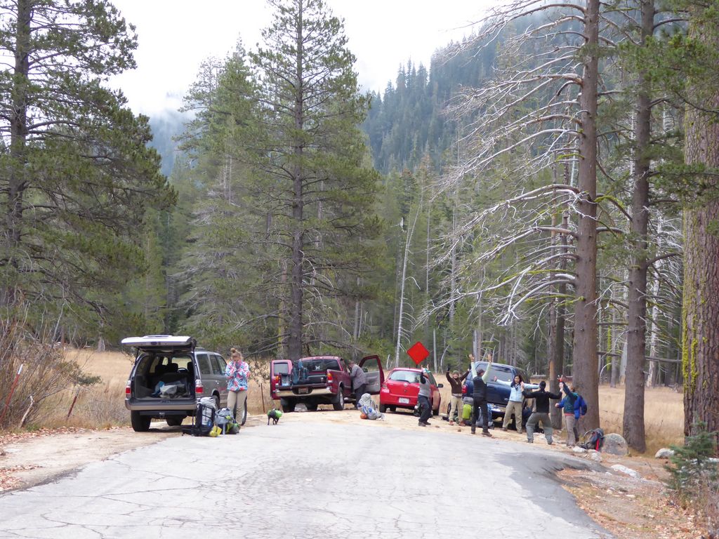
stretching before we hit the trail and take a nice group photo with everybody looking clean and warm before the cold, dirty days that would ensue.
There is a good looking sign at the trailhead letting you know that you're in the right spot, which is always a nice thing.
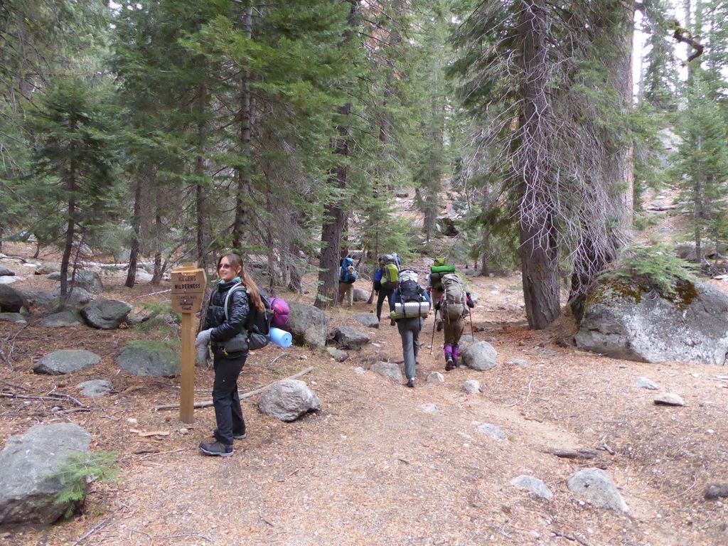
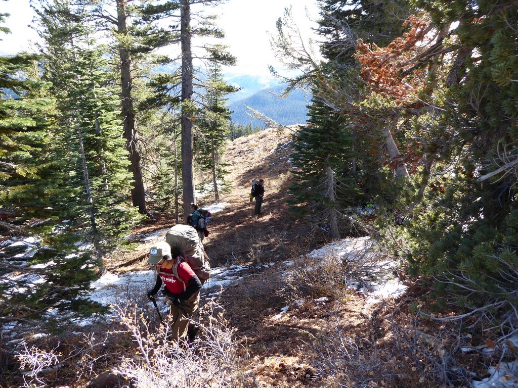
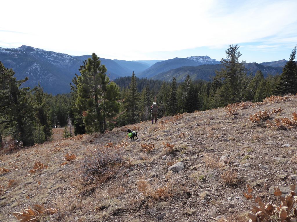
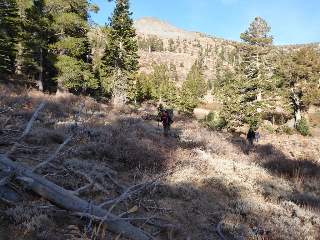
The trail starts climbing right away, but only briefly. People were in good spirits as we rounded the first couple of switchbacks, especially since they only lasted for a few minutes.
After climbing a few hundred feet, the trail flattens out quite nicely as it parallels the Clark Fork. Over the next couple of miles or so, there is not much elevation gain. Just a lovely path through beautiful stands of Jeffrey and Lodgepole pines. There were also some nice aspen groves, but unfortunately, they had all lost their leaves already.
The nice flat terrain is soon left behind when the trail reaches the point where the Clark Fork joins up with Boulder Creek. At this point, there is a lovely, mile-long climb up about 1000 feet of swithcbacks. The views towards the valley we had just come from got increasingly better with every 100 feet.
When the climbing was all done, we were greeted with the tranquil sights and sounds of Boulder Lake. This is a tiny little lake with clean water, but not a great place to fish. There is a perfectly-placed, fallen log that couldn't really be situated any better for water collection purposes. I took advantage of it to fill up on some water.
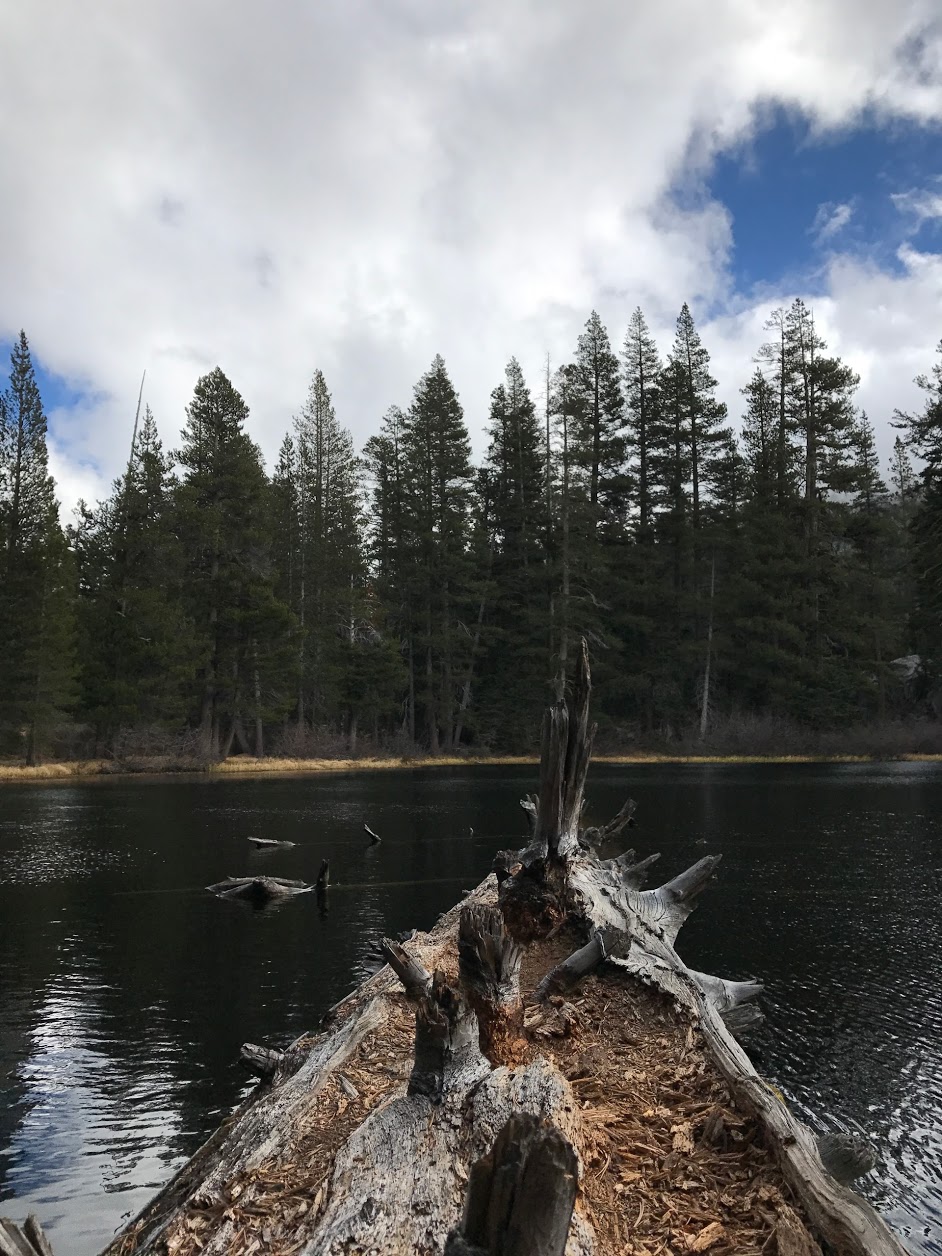
There is also plenty of flat ground to camp on, plus a large fire pit right next to the lake on the west side. I think it would be a very nice place to camp out for a night.
We decided to stop here for lunch. Everyone was feeling warm after the labor of the previous mile, and the sun was beating down upon us, which did a good job of disguising the 40 or 50 degree temperature. But as soon as people started finishing up their meals, some clouds rolled in and reality took hold. In no time, people were bundling up with their spare layers and running in little circles while they waited for the slow eaters (I am one of them) to finish up. Juni was eagerly roaming the confines to look for any morsels of food that were dropped; she didn't seem to realize it was getting cold since she was so consumed in her pursuit of crumbs, which I found very entertaining.
When we started going again, we quickly came upon some signs of snow,
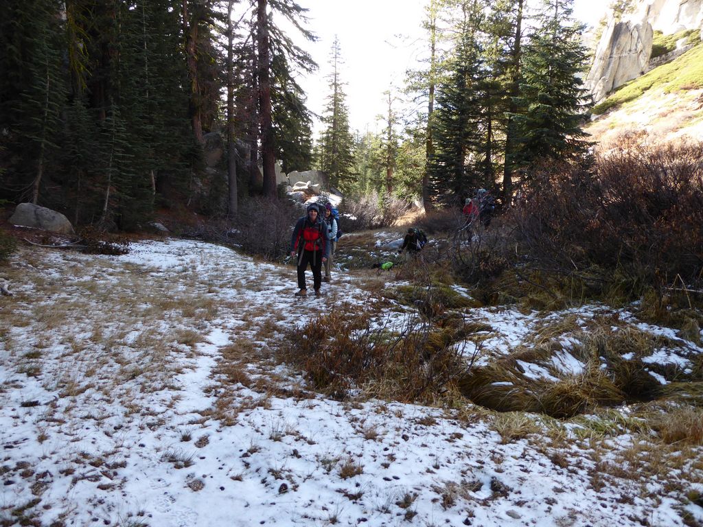
but it was just enough to make a fun crunching sound with each step, not enough to get our boots wet.
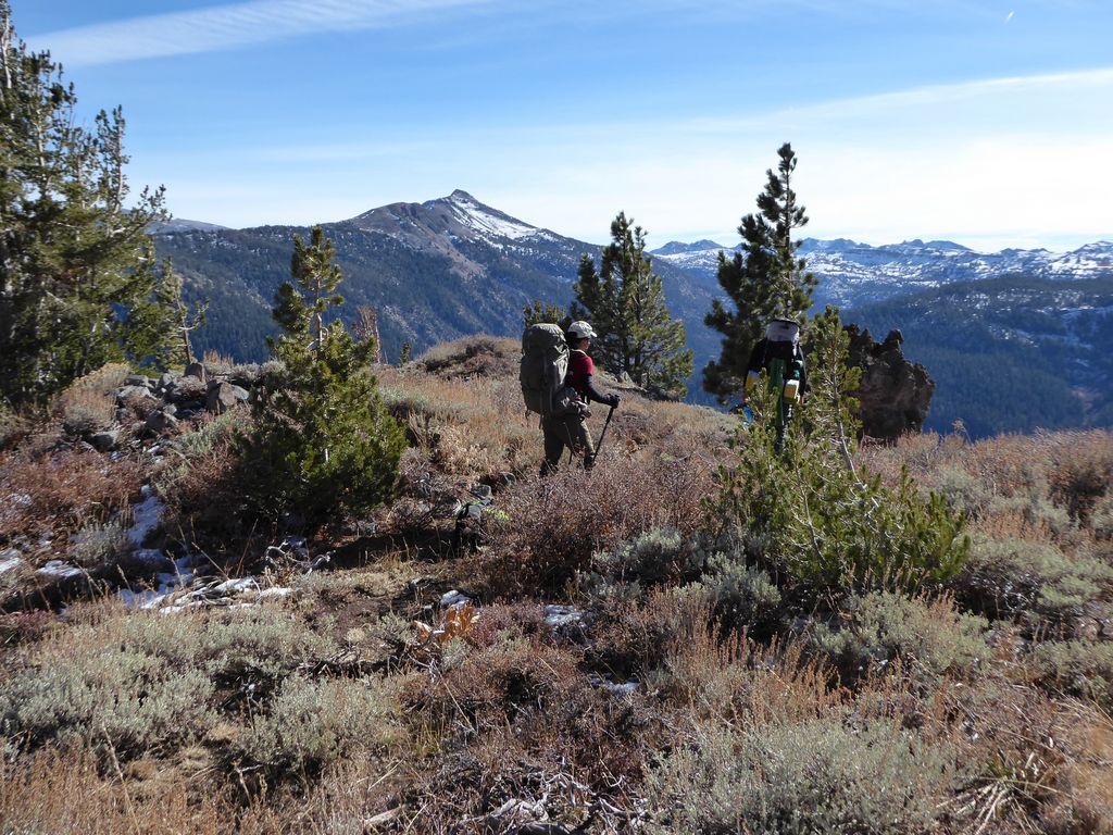
At this point there was a bit of disagreement between the various maps that were brought on the trip. My map showed that there was a maintained trail that would lead all the way to the Pacific Crest Trail about a mile to the northeast. Other maps showed no trail. It turned out there was a pretty well-worn trail that would bring us to a junction with the PCT. This portion of the trail had a small amount of elevation gain (~400 feet or so) before the junction, again with some short switchbacks.
When we eventually got to the PCT, we stopped for some collective high fives and took some time to enjoy the views to the south
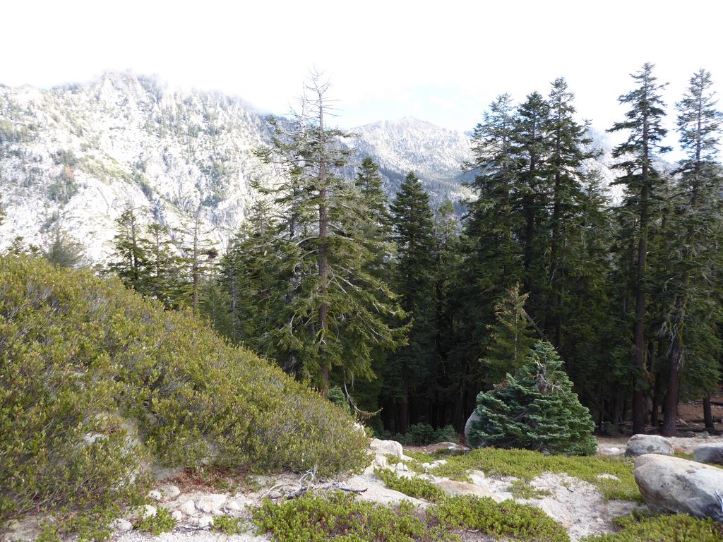
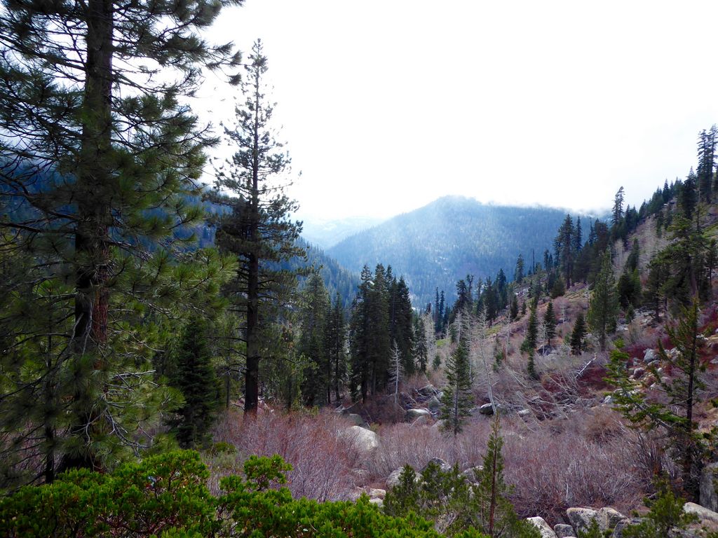
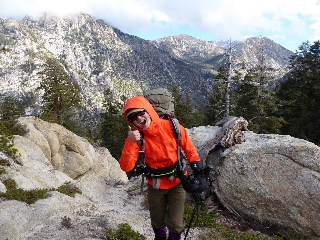
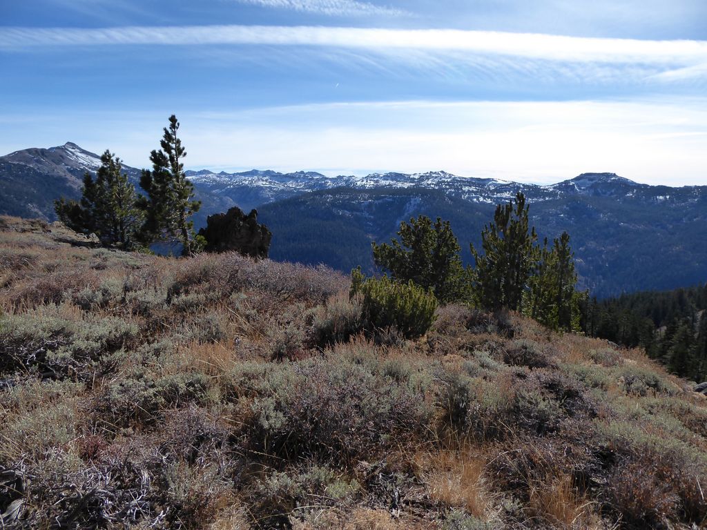
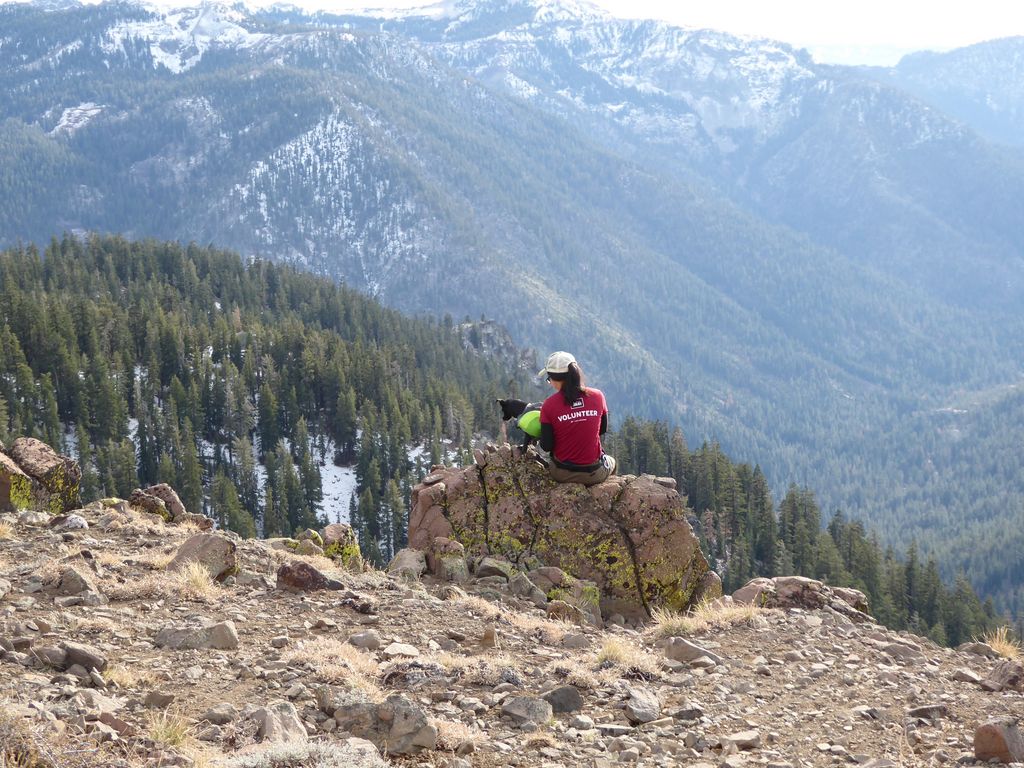
About a half a mile after the junction, we came upon our first spectacular views of the trip. At around 8880 feet elevation, we had clear views to the east, north, and west. Whitecliff Mountain and the Dardanelles were visible through low-lying clouds that made for a very dramatic and foreboding sight. We stopped here to take a requisite set of pictures. Tina was very happy, as should be apparent from this picture:
We also got a nice shot of the two of us and Juni.
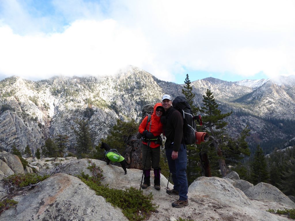
I must say I was quite impressed by the stamina and dexterity of that little dog. She had no problem keeping up with us. I would hazard a guess that she probably put in about 30 percent more mileage than us humans with all her little side explorations she went on. And I was equally impressed with Tina's ability to charge up the switchbacks with ease. She and her little dog are real troopers.
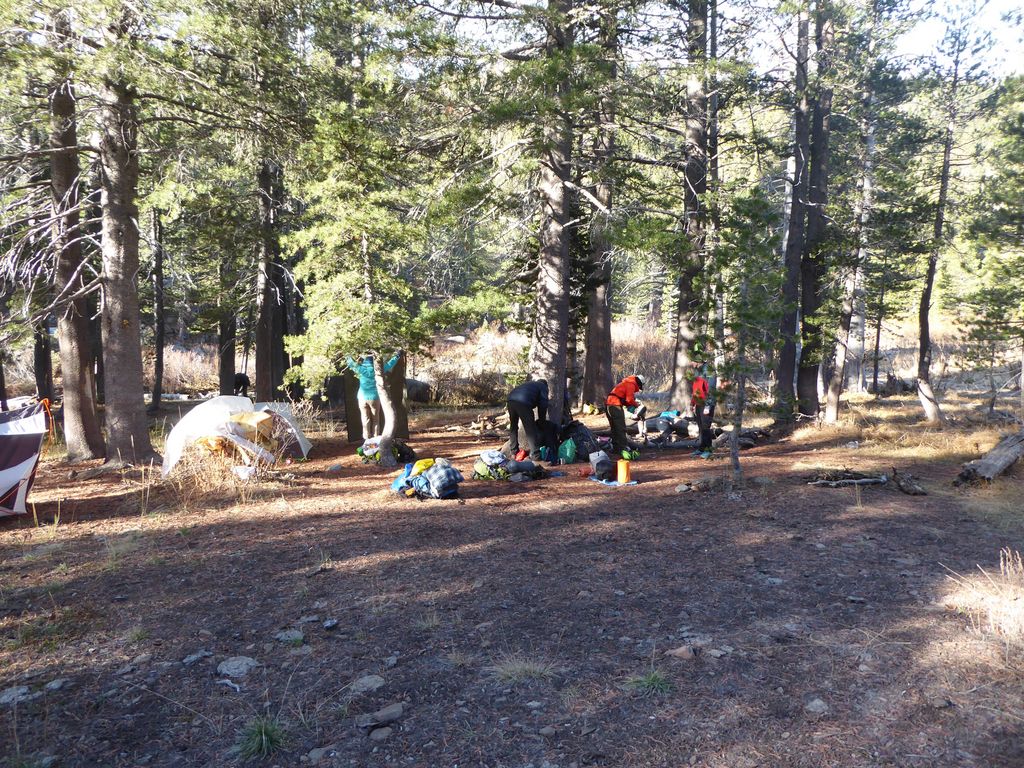
With our short photo session complete, we forged ahead. It was still fairly early, but the plan was to break camp in a short while. We hiked for another half a mile or so until we split off from the PCT in a southwesterly fashion and started going cross-country to look for a campsite. Luckily, there was water flowing just a few hundred yards to the west of where we broke off, so we decided to set up camp there. On the map above, the spot where we camped is at the location of the last blue waypoint.
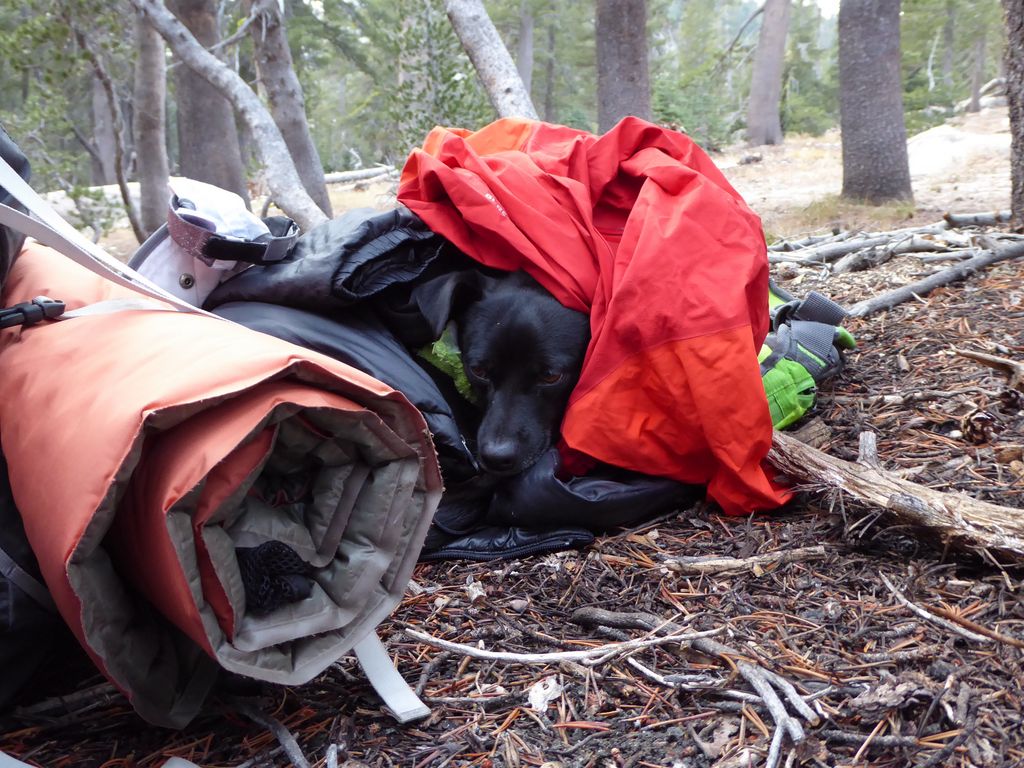
Tina and I found a pretty good flat spot of ground for our tent within just a few minutes. I had a really good laugh while we were setting it up as I noticed Juni had finally gotten cold and decided to burrow in the first insulative materials she could find.
The temperature was quickly dropping as the sun started to disappear behind the ridge to the west. We all collected some firewood and congregated around the fire once it was lit. The night would prove to be well beyond freezing, as evidenced by the many frozen items we found the following morning. But the roaring fire, good company, and a bit of booze that was being passed around made for a truly delightful evening.
When we finally extinguished the fire, it was pretty difficult to feel comfortable despite the five layers I had on over my chest and the two I had over my legs. Luckily, my sleeping bag kept me very warm as soon as I jumped in it, and Tina's did the same for her. She also had the benefit of a furry, four-legged companion to provide some extra joules in her sleeping bag.
That night, the wine I consumed before bed came back to haunt me. I got up to pee three times. But as cold as it was, I savored every second of it staring up at the brilliant stars above. At around 0200, the Milky Way was so bright I was tempted to bring my sleeping bag outside and just gaze up at it for awhile. Yeah, the 20 degree temperature froze and shattered that temptation almost instantaneously.
The very first thing we did the next morning was get another fire going. As I mentioned before, it was quite funny to see how many things froze overnight. But it was even funnier to watch things freeze that morning. After my first attempt at collecting water from the stream, I realized the ceramic filter was frozen, so I went up to thaw it over the fire. By the time I returned to the stream, all the water in the pump and hose had frozen, as well as the little hole I had punched in the ice to fill up!
People were in good spirits as we exchanged stories about enduring the cold in our sleeping bags the night before. We were pretty slow to get going, but eventually we got our act together and started trekking west. It really helped that we had some morning sunlight to dry things out and heat up our bodies. It's truly amazing what a difference that can make.
The first thing we did was climb about 300 feet just above and south of an intermittent stream that looked like it held no water. Within about a half an hour we were at Coyote Meadow,
which was a treat. As with most meadows, it wouldn't have made the best place to camp due to the amount of soggy ground and tall grass in its reaches. None of the streams were holding enough water to easily pull either.
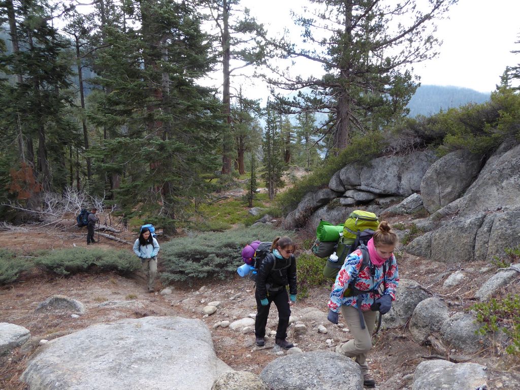
After the meadow we continued to climb steadily. We did another half a mile or so through some pretty thick forest before we stopped for lunch. The spot we chose was a rather unimpressive one: no views or clearings due to the surrounding trees.
I was actually rather excited to join back up with the trail at this point since it looked like that path would make the most sense from a contour standpoint. We looked to be going in that direction as we climbed a decently steep hill
and we did come upon a neat little clearing with unobstructed views to the south and west
and stopped for another group photo.
But the trail proved to be quite elusive at this point. And worse still, we were following an isocline with a very steep transverse gradient along loose talus that was just inviting someone to turn an ankle or take a tumble. I really despise this type of hiking where you're always off-balance and uneven. It makes me want to curse at the top of my lungs.
Eventually a few of us decided to climb an extra 100 feet or so to a much flatter area with better traction.
I would recommend doing this a bit earlier (around Waypoint 7081 if you have downloaded the waypoints). Just a bit of extra effort will make life much smoother: literally.
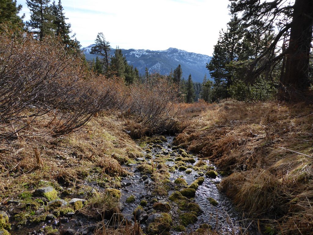
Once we had this bit of nastiness behind us, we came upon a picturesque spring where some of us filled up on water.
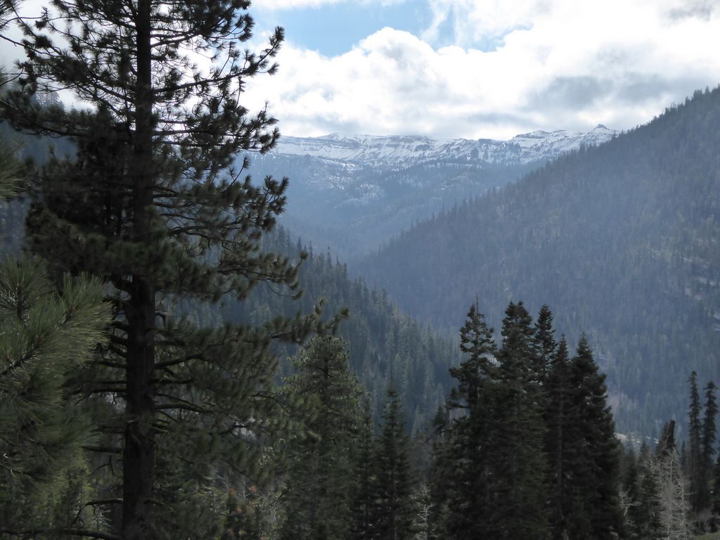
It was a perfect moment to relax and take in the peaceful sounds of the mountains. Soon enough we would be treated to an even more picturesque area at the top of an exquisite bluff that lies just south of the trail.
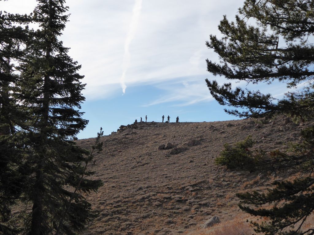
It was really cool to see everyone enjoying the view as we approached with the impressive backdrop behind them.

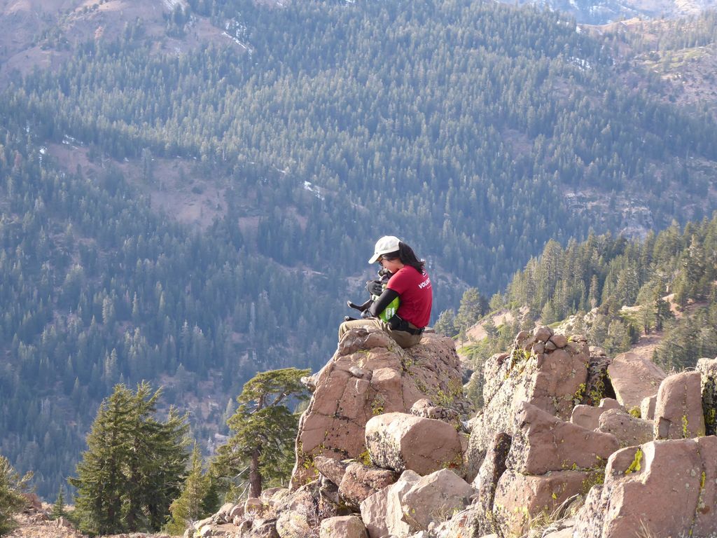
We hung out for a good while on top of the bluff and took a whole bunch of pictures of the scenic valley below
and I got several of Tina holding Juni on a well situated rock.
Everyone was in a great mood as we enjoyed the views from the bluff. But while this little intermission was as sweet as could be, the path ahead would not be nearly as enjoyable. For some of us less than others.
The next half a mile or so wasn't that bad. We were losing elevation at a decent rate, walking through some fairly sparse brush intermixed with small rocks
that made the going slow. But right around Waypoint 7181 (where the "trail" crosses a stream that flows southwest), we reached a juncture that would split the group up into two parts.
Tina and I, along with two others, were lagging behind the other nine at this point. As we approached the aforementioned waypoint, we saw that the nine people ahead of us had already started descending a very steep chute that appeared to parallel the stream on the map. As I watched the last of them go down while processing just how steep the path ahead would be, I saw one of them take a spill and quickly decided there was no way in hell I was going down that chute.
Now, don't get me wrong. I love a strenuous off-trail adventure as much as about anything else in life. I love getting off the beaten path, the anticipation of the unknown, and the challenge that comes with finding my own way through the wilderness. But one thing I have learned in life is that hiking down a very steep slope with loose rock while wearing a heavy pack should be avoided at all costs if possible. And I mean at all costs. There are several reasons why:
- The great majority of injuries and accidents in hiking and mountaineering happen on the way down. Gravity is a very formiddable enemy on a steep incline, especially with loose footing at the end of . A heavy pack makes the situation much worse. It can turn a simple fall into a disastrous spill.
- Even though it's tempting to think a steep, short route like this will save time and energy, it's almost guaranteed to take longer and burn more energy due to the caution and balancing that need to be exercised with each step. I don't necessarily agree with the statement, "There are no shortcuts in life." But when it comes to backpacking downhill with a heavy pack, such a postulate may hold up.
- If the going is slow enough, you may be forced to set up camp in a very unpleasant area after the sun sets. Sure, people probably have enough water and food to make it through the night. But it turns a trip that's meant to be fun into one that just needs to be endured.
- With 100-150 ft contour interval maps, it's very well possible that on your way down you'll reach an impassable cliff, waterfall etc. that forces you to turn around and backtrack a significant distance, further lengthening the the time of traversal. I have experienced this many times and it is terribly vexing.
- I've eaten shit enough times on terrain like this to know better.
The four of us had a very quick conference and we all agreed that we'd find another way. None of us wanted to risk turning an ankle or breaking a leg or worse. The more I looked at the map, the better I felt about not going down that chute. The average grade of their route was 32%! And that's the average. That is very steep.
At first, the hope was that we wouldn't have to make a truly drastic split from the rest of the group, but after studying the map it became obvious that we'd have to do exactly that to make it down with a more gradual traverse. We should have communicated our decision to the rest of the team once we knew this, but by then it was too late. They were out of sight. The topo map showed a trail that extended northwest and eventually met up with the north-south trail that leads to Adams Camp. That's where we all agreed to camp that night, so it seemed like a great option to go with.
Initially, our supposedly easy descent was a bit hairy. The trail was very vague and there was plenty of talus to make the going slow. However, after about a quarter of a mile, once we got under the trees again, the trail become much more prominent and the footing improved significantly. In fact, the ground turned into a perfectly soft, organic soil that served as a nice shock absorber during the sections where the trail became steep. There were plenty of these. I mean, we had to descend more than 1200 feet in about a mile and a half. I just kept thanking the lord I didn't have to descend that same amount over half the distance!
We were able to easily follow the trail for about a mile or so before it again started to disappear. But the good news was that at this point, the gradient was far smaller and the forest was not very dense. So we were able to easily travel in the right direction towards Adams Camp.
Our spirits were quite high in light of the fact that we had managed to find a much easier way to our destination, but there was some concern about the rest of the group. Would they be able to make it to Adams Camp or would they find an impasse that forced them to turn back? Would somebody take a nasty tumble and need to be carried out by a helicopter? I actually thought there was a decent chance of the latter, but as it would turn out, there were just a few precarious falls and some bruises. One of the group members did go into a bit of a free tumble, but was luckily stopped by someone else before her momentum picked up.
When we finally came upon the very well-maintained north-south trail at around 1615 or so, everyone breathed a sigh of relief knowing that Adams Camp was just a few skips away. As we'd soon find out, though, Adams Camp is a very elusive destination.
The two maps we had in our group showed this destination to be in two different locations. Furthermore, the turn-off trail that is clearly on the Topo 2008 map does not exist! We probably spent a full hour circling and searching for this mysterious place. We were shouting at the top of our lungs under the assumption that the other group had already made it to the camp. But we heard nothing.
Daylight was evaporating quickly, and after considering several different options, we decided that the best course of action would be to hike south on the well established trail back toward the car. If we found the other group, great. We'd join up with them to camp and have some good stories to exchange. If not, we'd hike the extra two miles to the car and wait for them there. I was a bit concerned by the fact that they had not been able to reach our destination, but maybe they just decided to call an audible. I couldn't imagine why they wouldn't stick to the plan unless there was a definite emergency, but maybe they were just too exhausted?
By the time we gained some steam on the trail, the sunlight was completely gone. After hiking a good mile or so, shouting all the while, we finally heard some voices responding! We could see the faint glimmer of a camp fire in the distance as well. All of this brought forth a very relaxing sensation, especially when we finally made contact and heard that nobody was badly injured.
The impromptu camp (the last green waypoint in the counter-clockwise direction) they had chosen for that night was alright. Plenty of water flowing through disaster creek and some flat ground on which to set up our tents. We would have another great night together around the fire, and this time the temperature was probably a good 10 degrees warmer than it had been the night before.
The next morning was extremely pleasant due to the fact that we had only two miles of hiking to do along a trail that looked to be quite gradual and well maintained. We got the fire roaring, enjoyed a good breakfast, and packed up all our gear by about 0900.
And indeed! Our suspicions were confirmed as we merrily trotted down the easy trail. This last remaining stretch was absolutely gorgeous. The trail was simply delightful
and there were even more extensive groves of aspens that made me wish I could turn back time a few weeks so I could see the gorgeous leaves changing colors.
We arrived at the cars at 1030 or so, did a cursory breakdown of our gear, and got in our cars. The plan was to meet up for lunch in Sonora at the Diamondback Grill. Part of me wanted to head home directly so I could have some time to dry out my wet gear in the afternoon sun, but I'm very glad I took the extra couple of hours to eat lunch with the group. The food was delicious and the company was excellent.