


TRIP DETAILS
TRAIL MAP
OVERVIEW
Notes:
- If I could use only two words to describe Humphreys Basin, they would be "vast" and "open". It feels like every part of the basin is accessible with a little bit of legwork.
- The road leading up to the North Lake trailhead is a bit bumpy. I am glad I rented a car with high clearance instead of taking my van.
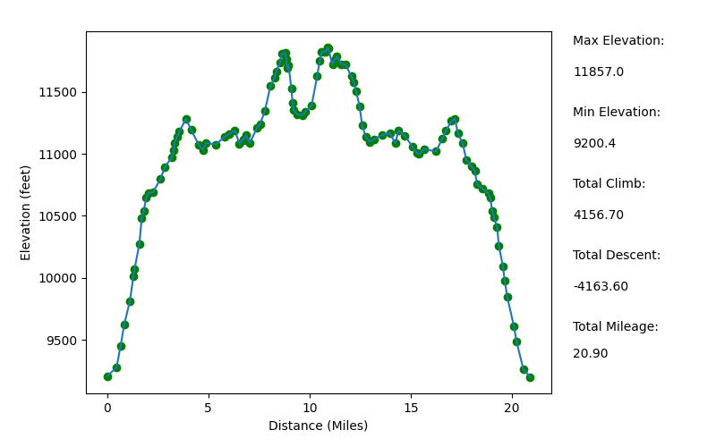
Elevation Profile
TRIP LOG
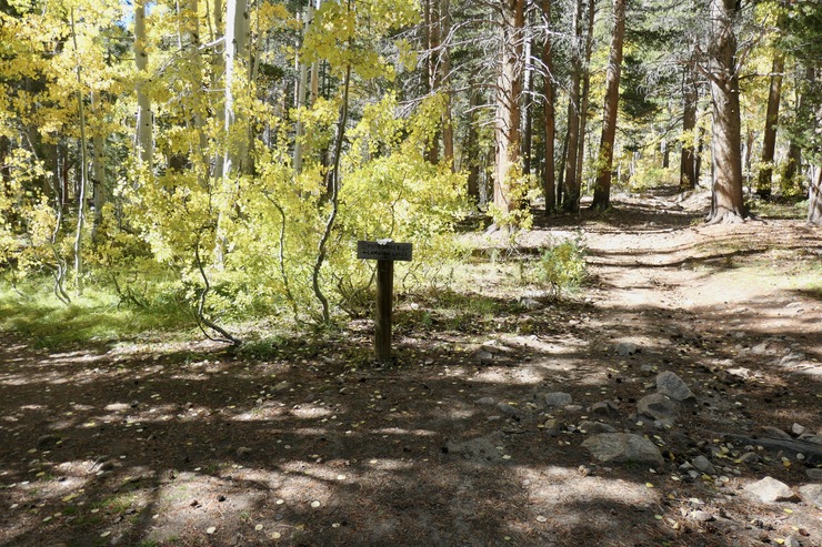
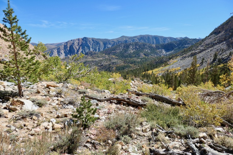
After a long drive from the Bay Area, a quick bit of gear preparation, and a short walk along the dirt road from the North Lake parking area to the campground (where the trailhead is located), I was greeted by the beautiful fall colors at the Piute Pass trailhead sign.
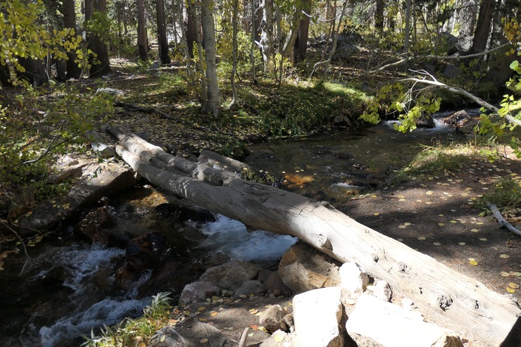
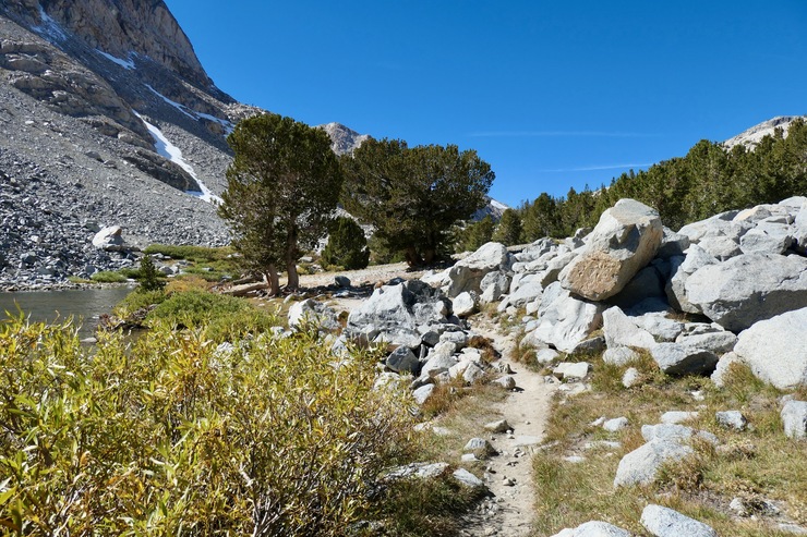
The water was flowing well in the creek, but the two crossings that stood out in my mind from my previous trip were still pretty easy thanks to the large logs that had been placed across the water.
I could feel the 9,000 ft+ air for sure, but a steady climb with gorgeous views behind me
kept me feeling groovy. At around 1300 (about two hours after I started the hike), I rolled up to Loch Leven, and stopped for a spot of lunch under some nice pine trees.
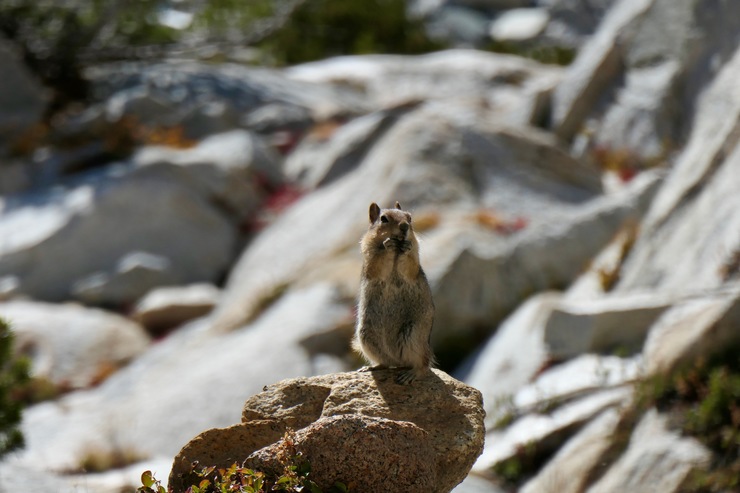
Once I was finished, I was greeted by a group of friendly marmots that seemed pretty interested in what I was doing.
I was still feeling fresh as I passed by Piute Lake,
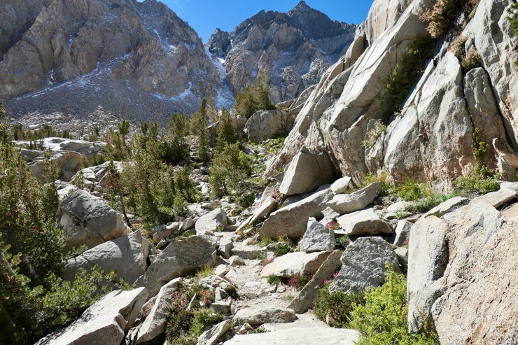
and making solid progress all the way towards Piute Pass. There was a minor obstacle just before the pass: a solid wall of snow and ice that had to be traversed (you can see it fairly well in this photo).
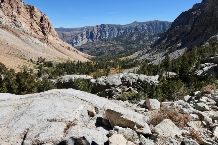
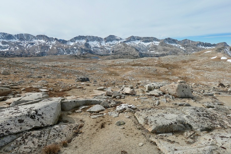
Luckily, enough feet had trampled a depression in the firm snow that there wasn't much risk of slipping. The views from Piute Pass were worth the long walk; not quite as dramatic as some of the high Sierra passes, but you really do get an overwhelming sense of just how vast Humphrey's Basin is...and how tiny you are in comparison.
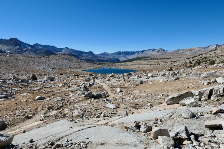
I was fairly intrigued at the possibility of checking out some of the small basins and lakes to the south (in particular Goethe Lake and Muriel Lake), but I wasn't sure I'd have time. Still, the route up to that area looked rather inviting.
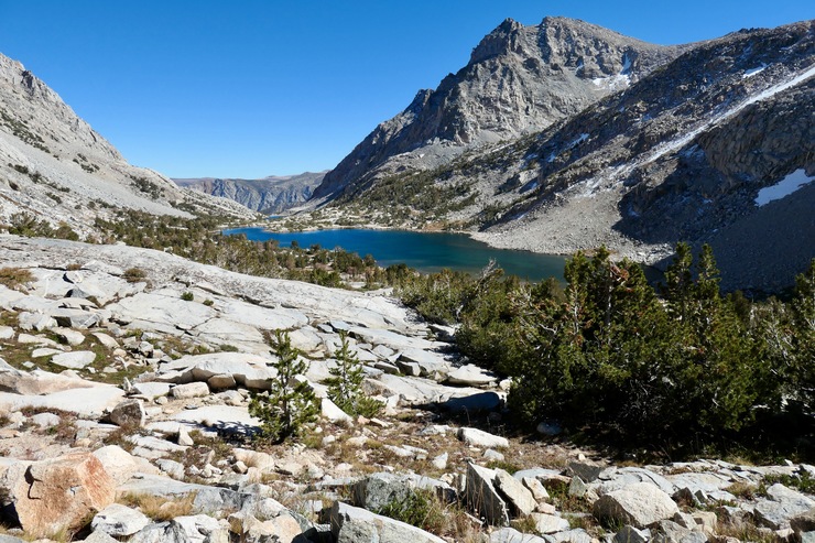
After heading down from the pass, I quickly found myself looking at beautiful Summit Lake. On my way out, I would see several people camping there, but it didn't look like the most ideal place to set up a tent to me. I imagined the wind could be ferocious.
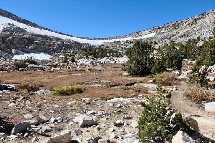
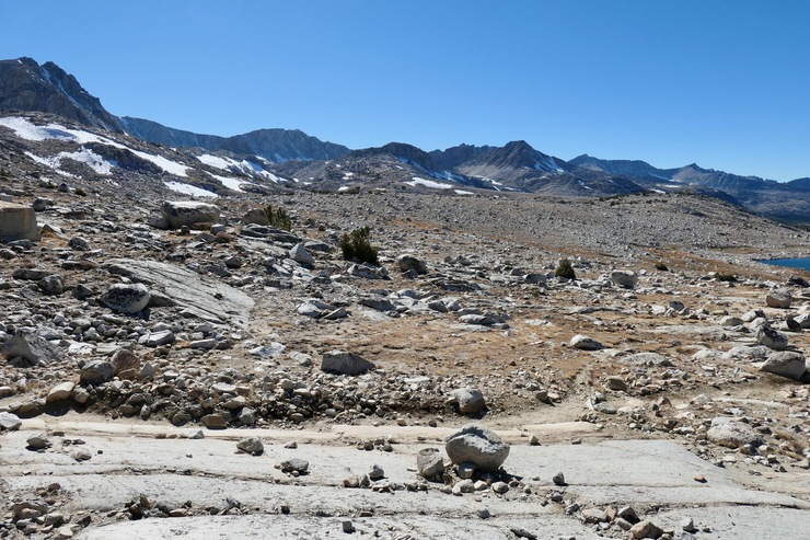
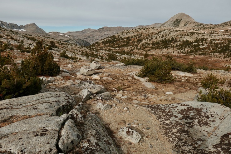
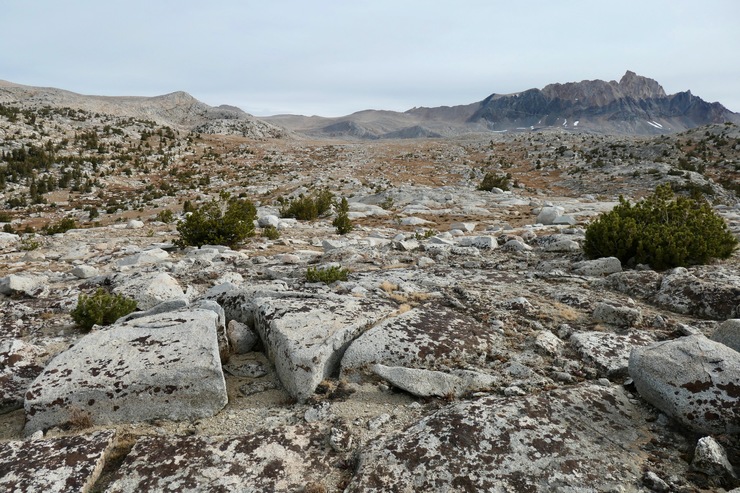
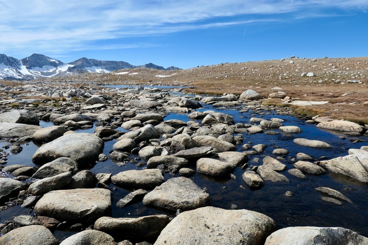
I stayed on the trail for about a mile after the pass, breaking off right around the junction with Piute Creek. With almost no major obstacles in your way, you can basically choose any direction you want to traverse in Humphrey's Basin. So I did just that. I set a bearing for Tomahawk Lake (where I had planned on camping the first night), and was hardly deviated from my course. Most of the walking was over firm, open ground like this:
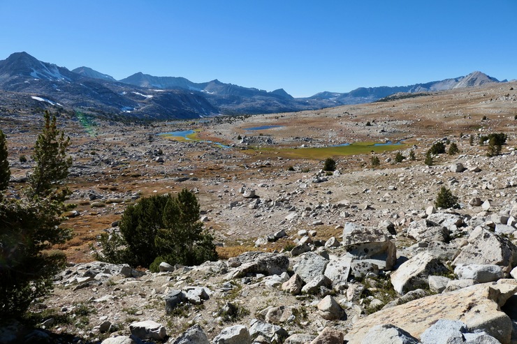
Only occasionally did I run into small collections of whitebark pines
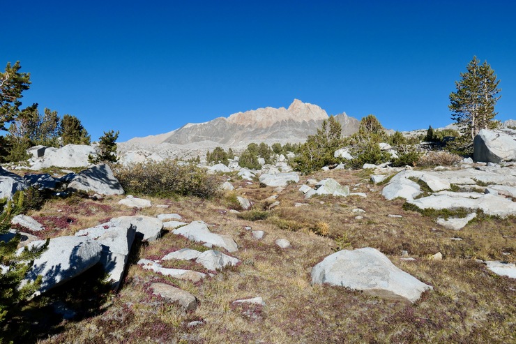
or shallow tairns
that required circumvention. All the while I relished in the phenomenal views of the towering range of peaks to the south.
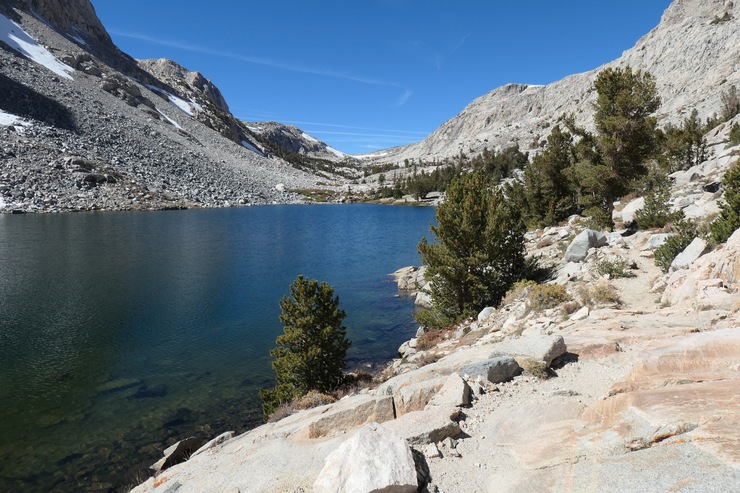
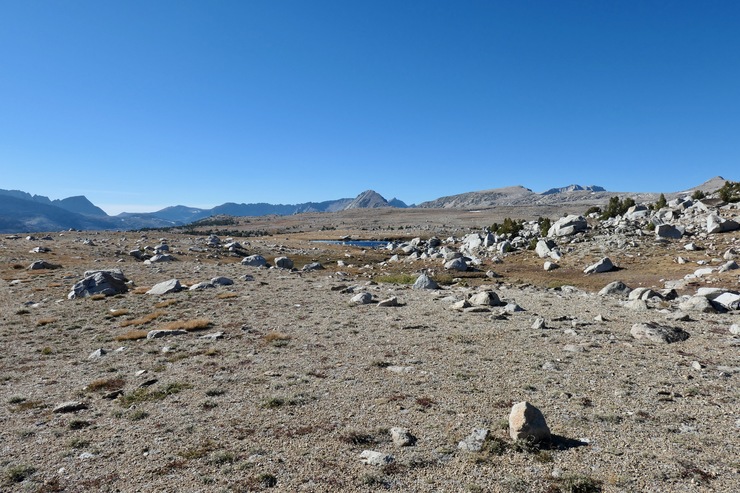
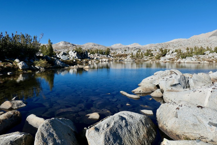
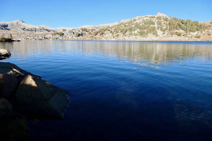
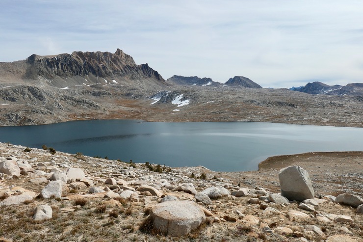
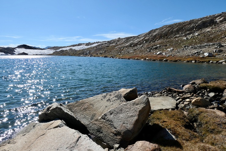
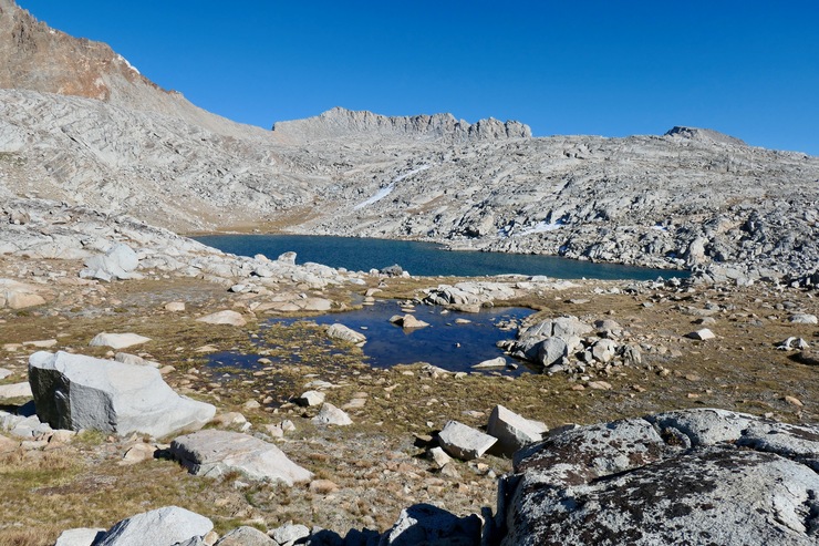
I was only mildy tired when I finally got my first look at Tomahawk Lake.
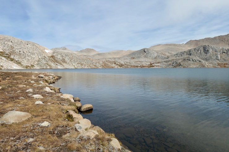
I'm really glad I read some Sierra Forums before doing the trip, because it came highly recommended. And after two nights camping there, I totally concur with those recs. I ended up setting my tent up on the west side of the lake.
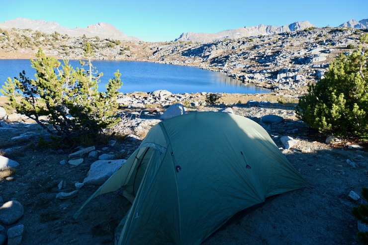
The east shore also looked appealing, but I felt good knowing that I'd get hit with morning sunlight a bit earlier where I was. The water in the lake was very clean, with minimal silt to clog a filter. Plenty of great spots to fill up along the shore as well.
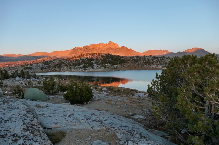
I didn't see many fish during my few days there, which was a bit of a surpise. After I had filled up my water bottles and pitched my tent, I jumped in the water to rinse off. The air temperature was in the upper 50s and the setting sun wasn't much of a help, so I quickly put on my clothes right after I got out to help warm up. I was treated to a pretty great display of alpenglow on Mt. Humphrey's before I crawled in my tent.
As I drifted off to sleep, I could hear the wind howling away somewhere in the distance. But luckily my site was well sheltered, so I didn't have much trouble staying asleep.
The next morning I awoke with a fairly good idea of what my plan would be for the day. I decided I'd do a clockwise loop around the northern stretch of the basin and try to visit the major lakes within it. So after a quick breakfast and some tea, I got rolling in a northern direction under the grey sky.
The terrain, although a bit more broken and rocky, was still fairly easy to navigate.
I was impressed by how tranquil and gorgeous Mesa Lake was with its mirror-like surface set behind a carpeting of red heather.
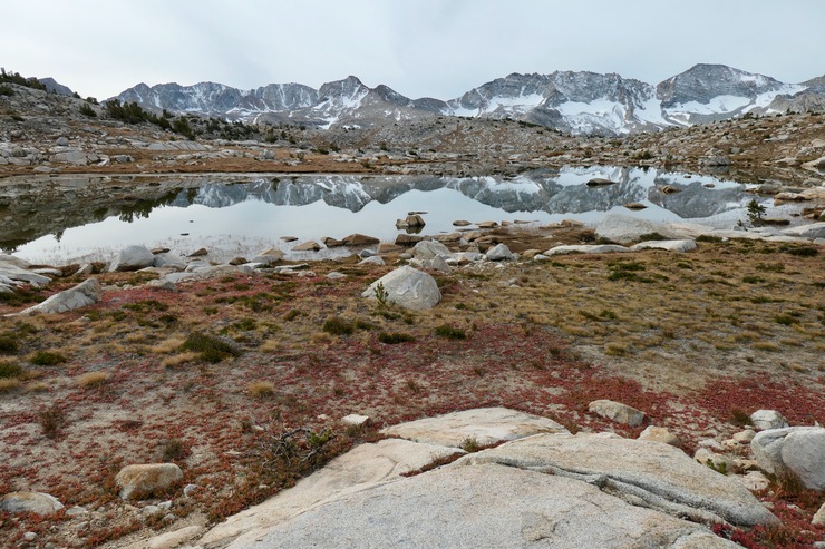
If I ignored the water and vegetation, it almost reminded me of the pictures returned by some of the Mars rovers.
Before I headed east to Desolation Lake, I felt like checking out at least one of the cols in the surrounding area so I could get a good view. So I started on a gradual ascent to the north over some large granite slabs,
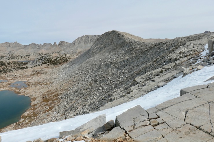
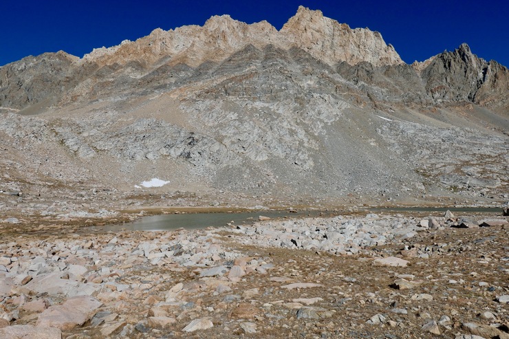
eventually making my way to the little col just north of Star Lake (I am not sure if this is Puppet Col; it's not marked on my map). The views from the col were pretty cool,
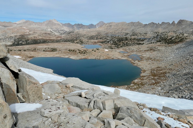
but fairly intimidating from a descent standpoint. The slope to the east of Star Lake looked like it would give the best shot, but it would likely be class 2 almost the whole way, with some class 3 portions.
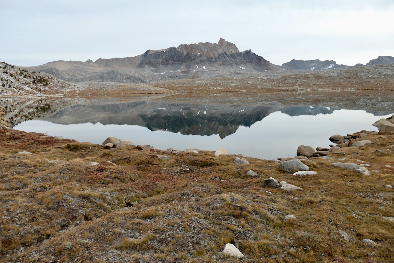
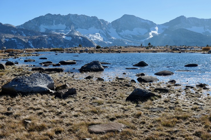
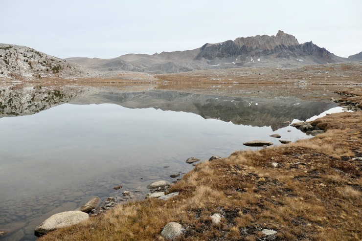
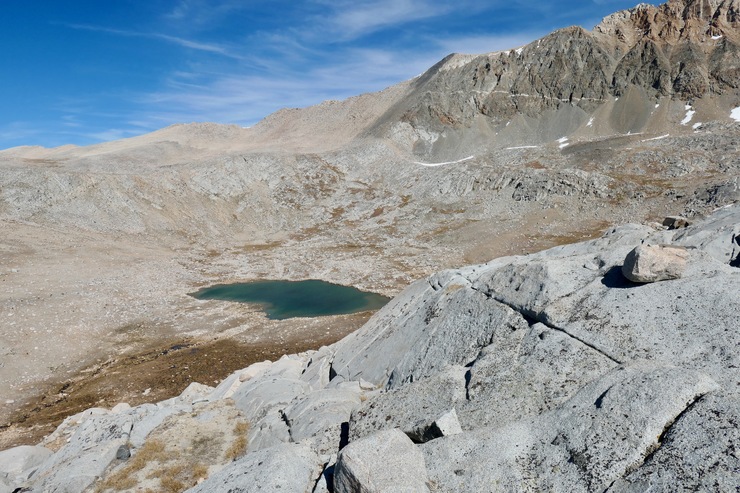
After a short break and a snack at this high perch, I headed down and attempted to traverse the escarpment to the east. I got a bit turned around when I reached a point where it was just too steep to safely descend, but eventually I was greeted with some beautiful views of Desolation Lake.
I started descending further on a somewhat tricky southeast course and got to the very spongy shore of the lake.
It wasn't too tough to cross the shallow water at the southern outlet of the lake with the help of the large boulders therein.
The outlet was such a nice area with the slow trickling of water that I decided to sit on one of the bigger rocks to have some lunch, enjoying the soothing sun that had finally broken through the clouds. From here I made a straight shot to the east, ascending along some not-too-steep
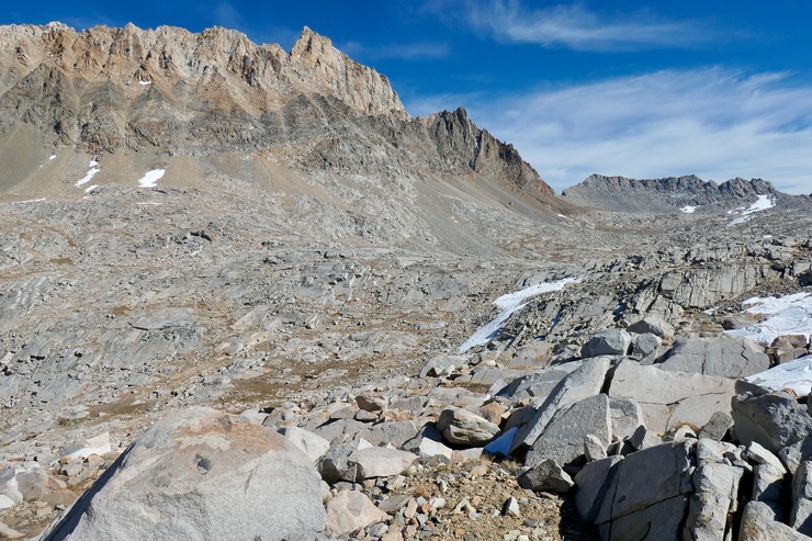
granite slopes and getting closer and closer to the domineering wall below Mt. Humphreys.
There were only a few tricky sections where I had to really use both my legs and my hands to get up or down some rock walls. Nevertheless, I was feeling a bit lethargic after my lunch. So I decided I'd take a break and enjoy a nice swim in the westernmost of Humphrey's Lakes.
The water wasn't outrageously cold, and it really helped that the sun was beating down hard in the sky. So I lied down on a big chunk of granite and just soaked up the heat. When I got going again, I kept looking over at Mt. Humphrey's as I was hiking and just marveling at it.
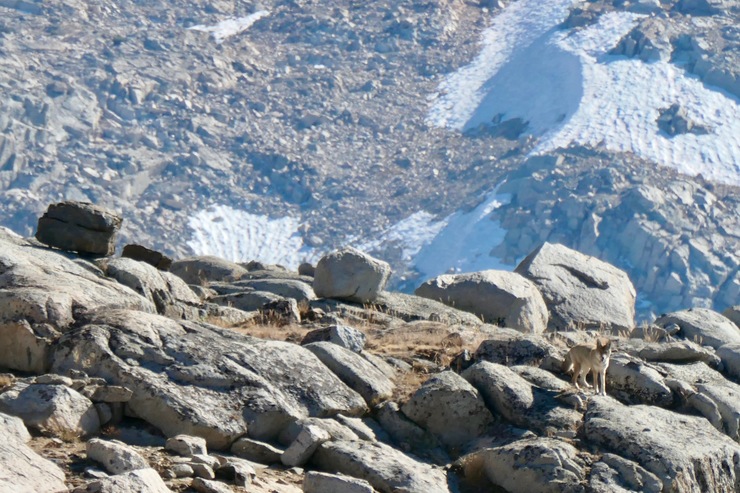
The rest of the day was fairly uneventful. I did see a coyote in the distance who seemed very frightened by my presence.
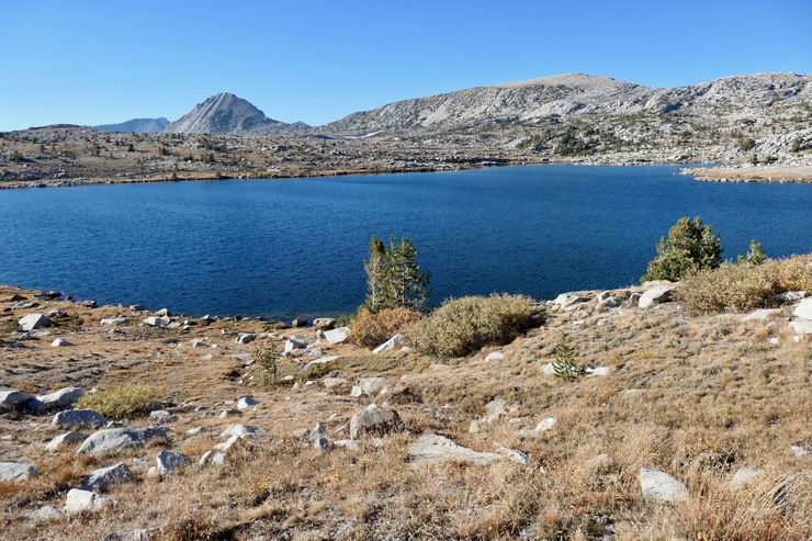
Marmot Lake looked like it was worth a visit, but probably not a great place to camp.
The way back to Tomahawk Lake was equally easy and gentle compared to what I had been through over the last 24 hours. A lot of pretty stretches of alpine grass surrounding friendly streams of water.
There were just a few fields of boulders resting on top of really wet ground that made it slow going at times.
During the day I had decided I wanted to get back to my wife and daughter a day earlier than I had planned since my daughter was starting to get sick before I left. So I had a lot of extra food to consume that night. I thought I'd sleep better because of it, but then I got hit by a minor cough of my own that kept me up at times. Even so, I cherished every time I woke up with a quick exit of the tent and a glance up at the brilliant night sky. That never, ever gets old.
There's not much to report on the last day of the trip. I basically just backtracked along a slightly different course up to Piute Pass.
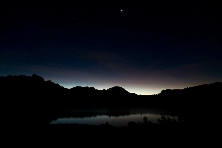
I did spend some time in the morning trying to capture pictures of Venus rising over Tomahawk Lake, which was pretty fun
And another interesting thing...when I passed by Summit Lake on my way out, I was greeted by a friendly woman who had camped there the night before. Her and a friend had planned to do a loop, but she wasn't quite sure if they'd be able to make it or not since her friend was feeling some elevation sickness. They also didn't have a detailed map, so I gave them mine. She was very thankful, but that kind of generosity just seems to be the norm out in the backcountry, which is one thing I love so much about it all.
Oh, and another crazy thing that happened...when I finally got up to Piute Pass and stopped for a snack, I started to notice things were getting darker even though there wasn't a cloud to be seen. I was wondering if I was hallucinating ever so slightly from altitude or something like that, but I didn't make much of it since it only lasted a short time. When I got back down and talked to some folks in the following weeks, I felt like a fool for not remembering that there was an annular eclipse taking place at that exact time haha.
I wish I could have spent more time up in the basin. And I really hope I get to return sometime in my life.