


TRIP DETAILS
TRAIL MAP
NOTE: Waypoints are sparse and mileages are approximate. For a more accurate route, see this track.
OVERVIEW
I have read various trip reports for the Enchanted Gorge and most of them seem to indicate that the spectacular views and terrain one encounters near its entrance in the Ionian Basin are not worth the misery of walking through the thick brush near the confluence with Goddard Creek. While it is true that stinging nettles coat the landscape at certain points, making it difficult to move forward without feeling a few burns on your skin, I found the hike to be incredibly enjoyable overall and would highly recommend it if you're the adventurous type.
This is mainly because I did this hike in early September of 2007. Thanks to a somewhat dry winter, Disappearing Creek was low enough to wade through whenever I found these overgrown areas. And because I followed the advice of Matthew Holliman and brought a pair of Chaco sandals, walking through the water's mild rapids was quite refreshing for my feet. I also had the luck of not having to cross any snow bridges and risk falling into some deep crevice in the gorge. For these reasons, I would recommend doing this hike late in the season.
I would say that this route is not for the novice or the feint of heart. In fact, Arnot describes it as one of the most challenging and remote in the park. There are many times when you will have to use your arms just as much as your legs to get yourself over or around things. Getting lost is not much of an issue since you are fenced in by steep slopes during all the trail-less portions of the trip. But the loose talus and rough terrain make it pretty hard on your body. And even though I tried to take in an adequate amount of calories each day, I still dropped 11 pounds on the trip.
I actually contemplated trying to make it down into the gorge the year before and thought I could do the trip in 6 days or less since the mileage is so small. I was very lucky to run into a few experienced people on my way to Muir Pass that told me making the trip in 6 days would be a Herculean feat. I made it to the top of Black Giant Pass on the afternoon of the second day, and despite my ego's will to finish what I started, decided to turn back and try it again the following year when I had planned more adequately. In retrospect, I am very glad I did this. You would have to be quite a savage to make it down the gorge and up Goddard Canyon in less than 3 days.
Good References on the Enchanted Gorge:
- Enchanted Gorge via Florence Lake (California Rambling)
- Enchanted Gorge via Hells Pass (Bill Finch)
- High Sierra: John Muir's Range of Light
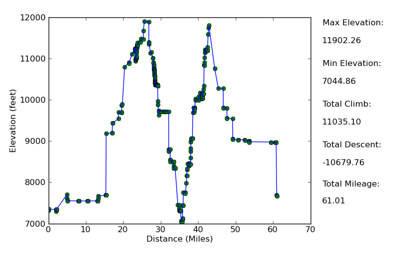
Elevation Profile
Day One:
I started out at the Florence Lake trailhead around 2:00 p.m. I was moving slowly, weighed down by the an extremely heavy pack filled with 9 days of solid food and a sizeable amount of food digesting in my stomach. I had eaten a few hours earlier at a small cafe just outside of Fresno with my parents. We had just finished a stay at the Wuksachi lodge in Sequoia NP, and even though it was a beautiful 3 days of roaming around the park, I was quite eager to get out into the backcountry.
Fortunately, the trailhead out of Florence Lake provides some interesting scenery in the early stretch. I chose to hike the 4.2 miles around the lake, which isn't all that great and made me wish I had taken the ferry. But once I got past the lake I was greeted by some beautiful pine forests filled with friendly horses roaming around the Muir trail ranch. I was a little worried that they might freak out at first, but they were actually quite calm and let me pet them as I passed.
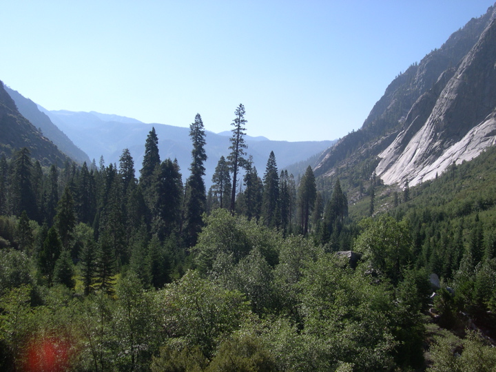
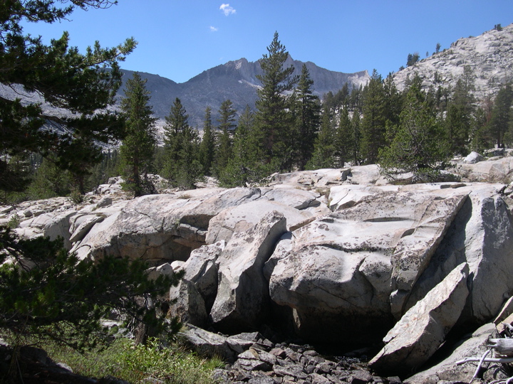
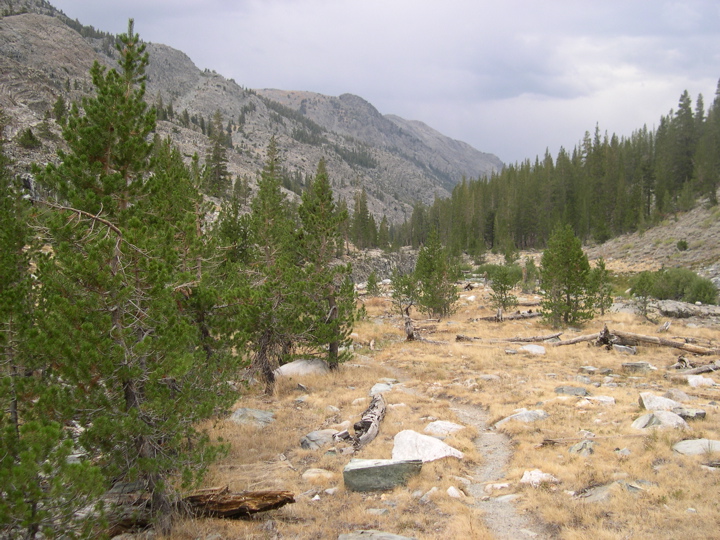
A few miles past the Muir Trail Ranch, the trail crosses the boundary of Kings Canyon NP and this is where it starts to look really cool. The trail, surrounded by Manzanita bushes and climbing slowly in elevation, butts up against the Kings River on dramatic shelfs of granite that overlook whitewater rapids. There are also several very nice groves of Aspen trees that shimmer perfectly in the fading sunlight. No matter how off schedule I am, I can't help but stop and stare at that the sunlight filtering through the Aspen leaves.
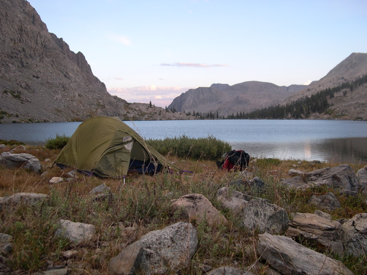
I ended up stopping earlier than I had planned around 7:30 at an area a few miles before the junction with the Goddard Creek and Evolution Valley trails. It was a very mild evening at 9,000 feet.
Day Two:
The next day started just like a perfect day should: cool, sunny, and full of switchbacks. Immediately after the junction with the Goddard Creek and Evolution Valley trails, the route up to Evolution Valley climbs 1000 feet in a flash. The switchbacks graze a very nice waterfall and bring you up to a gorgeous stretch of river where the water takes on some beautiful blue and green hues.
Next there were more switchbacks that brought me up to Evolution Lake. I must say that I love this place enough that I would have been content spending a few days there and just fishing and swimming in the lakes. There were plenty of people camped there, so I'm obviously not the only one who feels this way. The landscape is dotted with lone pine trees amidst big slabs of granite, offering tons of places to set up a tent.
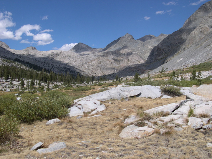
Evolution Lake joins up with Sapphire Lake via a tiny stream that was still running with a decent amount of water when I passed it. The trail then begins to climb rather steeply on the west side of Sapphire Lake. At this point I was running pretty low on gas and I began to despair a tad since I realized I might not make it over Black Giant Pass today as I had planned. By the time I got up to Wanda Lake I was feeling exhausted. In retrospect, I should have been doing more hiking during the three days I spent with my parent at Wuksachi Village and less time eating.
I ended up camping right alongside Wanda Lake with a dissapointing feeling hanging over me as I set up my tent and preparing dinner. But the
alpenglow I saw that night and the 360 degree view I had of one of the most brilliant night skies I've ever seen quickly remedied that. In retrospect, it was a pretty great place to spend the second night before climbing into the Ionian Basin.
Day Three:
I woke up very early this morning so that I could start the hike up to Muir Pass before the sun got too high. The stretch up to the pass is quite easy, with a nice gradual climb to the top. Once at the pass, I stopped briefly at
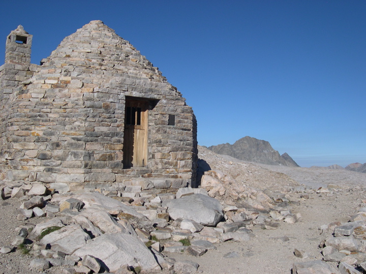
the hut to consider the best route to Black Giant Pass. The year before when I attempted to do the Gorge, the
rocks between the two passes were layered with a fair amount of red-algea coated snow (a man I ran into also warned me that this stuff will give you some pretty awful diarrhea, so I did my best to avoid licking it). The snow actually made it quite easy to traverse the rocks, but this time there was hardly any at all. I ended up following the John Muir Trail for a few hundred yards southeast after the pass and then branched off and made my way in a more or less straight line to the southeast.
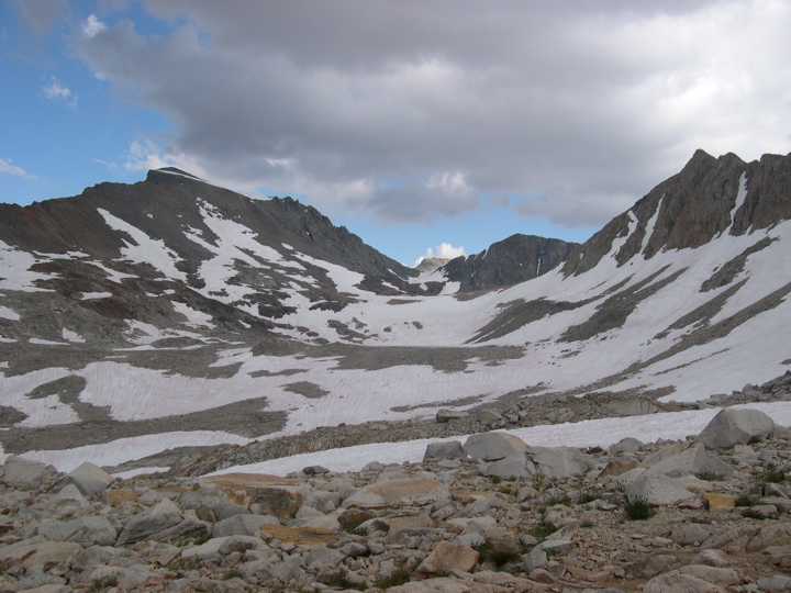
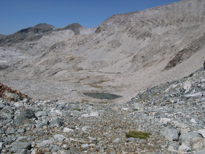
The
unnamed lake that greets you before Black Giant Pass isn't visible from Muir Pass, but comes into view once you've gained a few hundred feet in elevation. From the north side of the lake, the
climb up to Black Giant Pass looks incredibly difficult, but as Bear Grylls says (and I write this with an English accent), "You never know how steep something is until you rub your nose against it!". I was lucky to have read a few trip reports that promise the climb is actually rather easy, and indeed it was. I made my way around the east side of the lake, which seems preferable, and then up to the top of the pass once I was far enough south to find the proper slope.
At the top of the pass, I took in the enjoyable view of
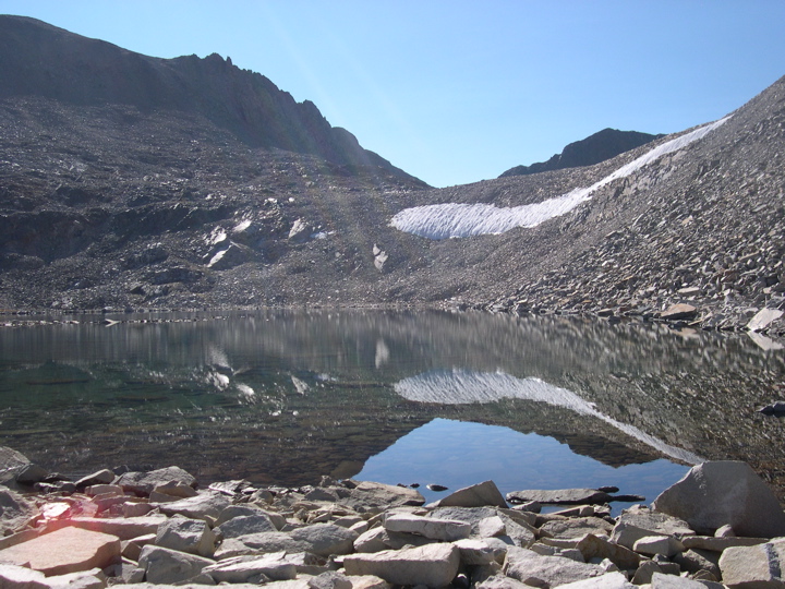
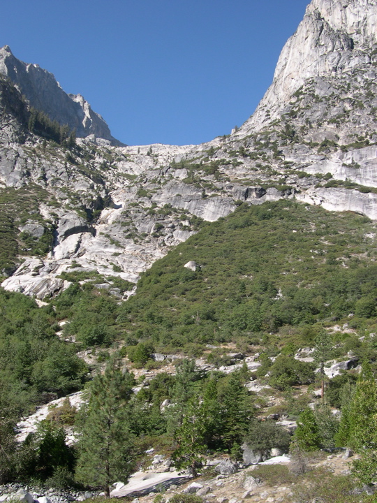
another crystal clear unnamed lake (Lake 12100, maybe?) before I let my mind accept the fact that I was about to drop down a nasty talus field. I recently read a great trip report on the Enchanted Gorge in which the authors say that it's possible to do both the descent of the Gorge and the ascent up Goddard Canyon in a day. With talus like this, though, I think you could only do it in a day if you had the ability to morph your feet and hiking boots into mountain goat feet. I'm pretty certain they were only talking about the case in which the snow coats the rocks and lets you walk at a decent pace instead of clinging to loose rocks and testing your footing at every step. They do say that it's easier in the earlier season with the snow, but that comes with the elevated risk of falling through a snow bridge into the creek below.
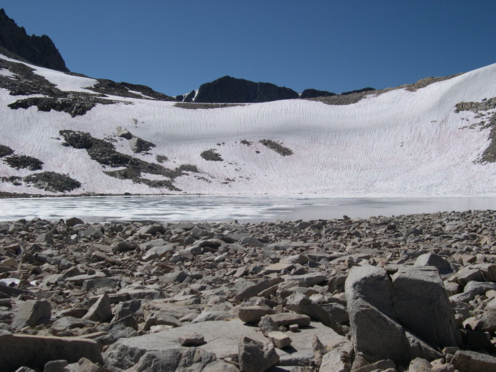
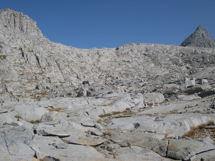
I made the descent down the talus field around the northwest side of the lake and found that it wasn't actually that bad since most of the rocks were large enough to take some weight. After making it to the western edge, I could see the
nice bouldery route on the west down to the next unnamed lake. This portion was actually really enjoyable since the rocks were holding up to my footsteps and there is a well defined gradient to follow. At the bottom of the slope, I think I officially entered the Ionian Basin according to the maps. I stopped for lunch here and savored the flat land as I knew it would be my last taste of it for some time to come. I remember this being one of the most enjoyable Clif Bars I've ever tasted in my life as I stared at the
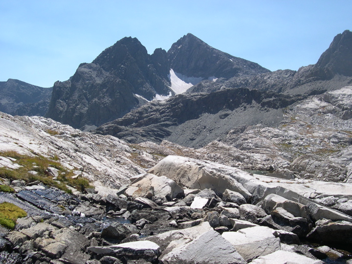
Three Sirens on one side of me and
Charybdis on the other.
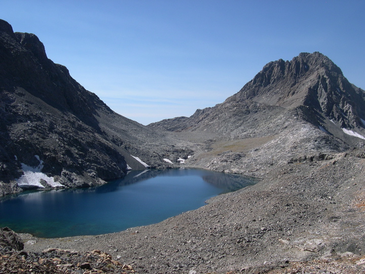
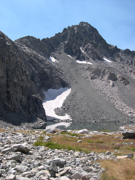
When I finished lunch, I started heading down toward
Chasm Lake. I was taken back by how crystal blue the water was; guess I was expecting a dark black color because of its name. Getting down to the shore of the lake turned out to be a lot more challenging than I had guessed it would be from the topo map. I found myself hanging onto cliffs and lowering myself down on the southeast wall of the lake since this appeared to be the easiest way down. After exploring the base of the lake, I'm pretty sure that this is was the best way I could have taken.
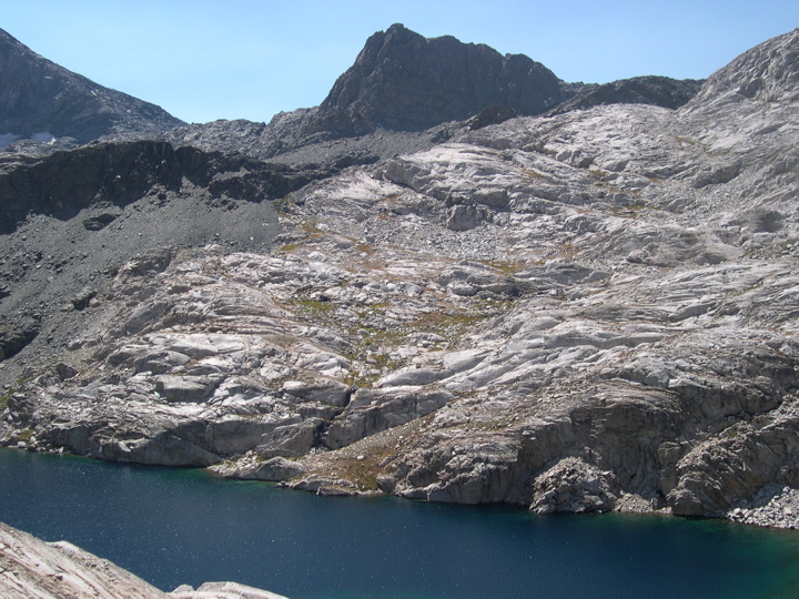
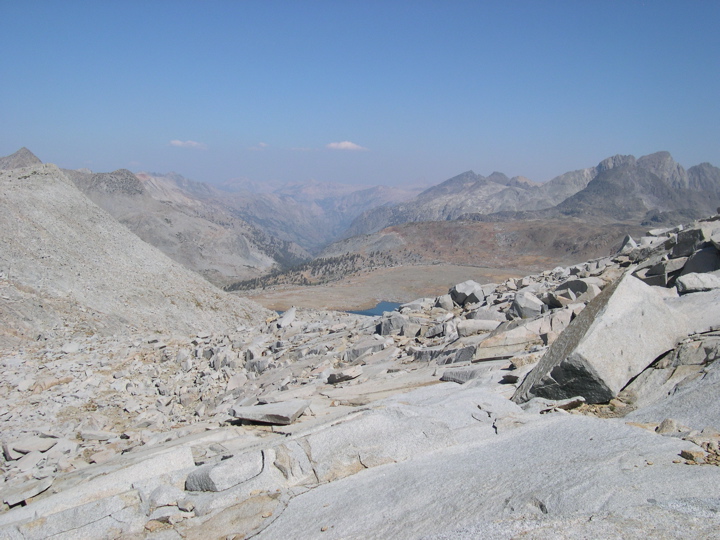
Once I got down, a view of the
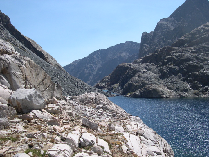
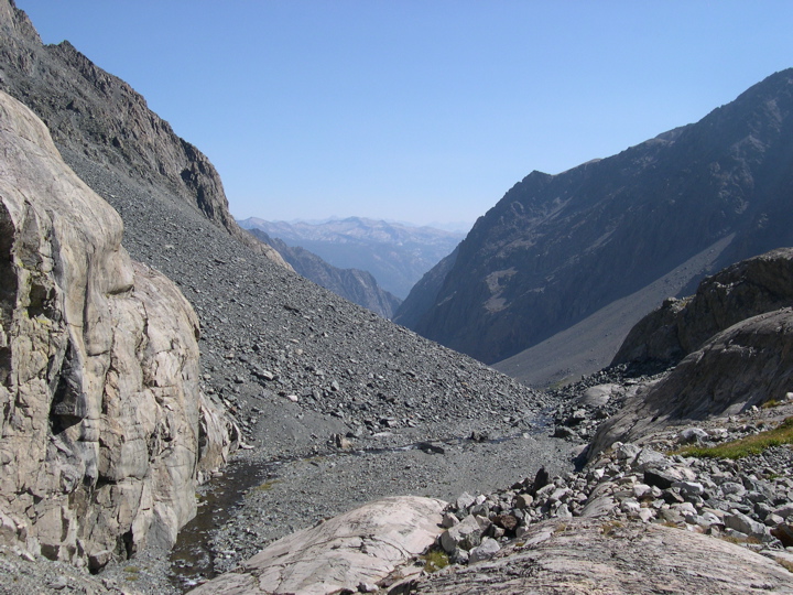
entrance to the Gorge greeted me. This is one of the coolest places on the whole route, so it's worth taking it in. After passing the large stretch of shore, I came upon a
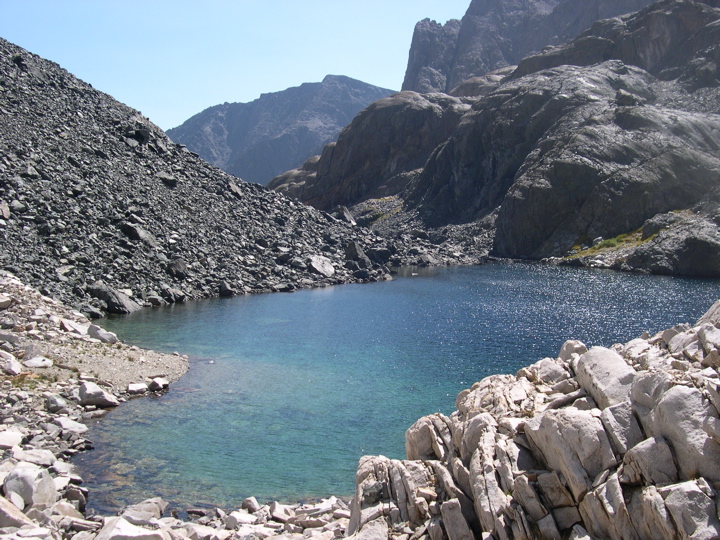
smaller body of water that is probably indistinguishable from the larger lake earlier in the season. When I got to the mouth of this microlake, I finally saw
the view that I had been so excited about from the spectacular pictures of the Gorge. The talus looked forbidding, but I was still overcome by just how awesome the landscape was.
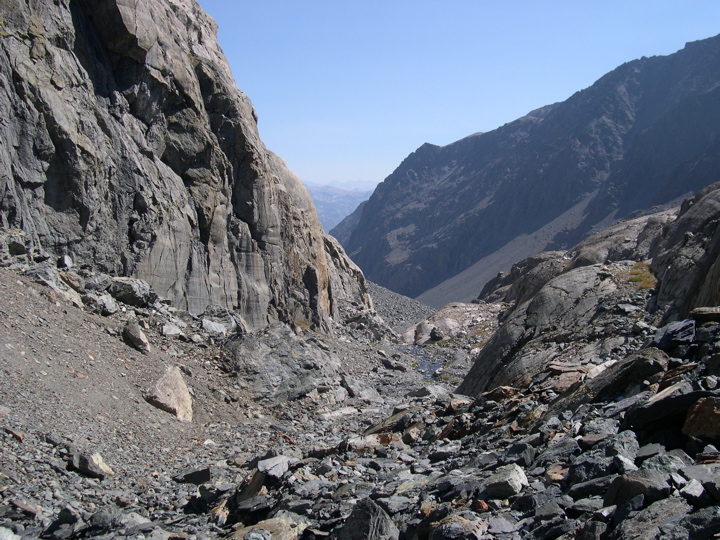
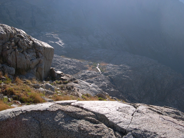
The next two miles or so took me about five hours to descend. The rocks just refused to stay put under my feet and I kept thinking about how unbelievably awful it would be to break a leg or sprain an ankle at this point. Still, I didn't mind moving slowly and looking

down and
back up the gorge and at the steep walls surrounding me. And I was really amused by how Disappearing Creek lives up to its name. At some points it's only a few feet under the rock and you can hear it running, but at others it seems like it's really gone.
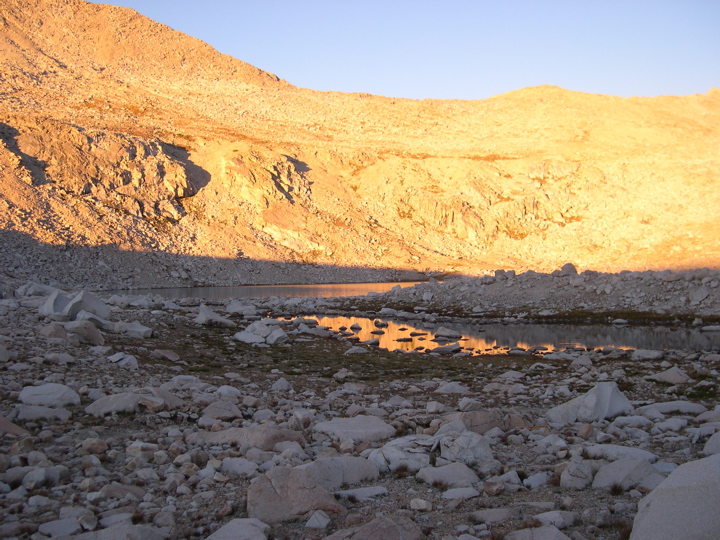
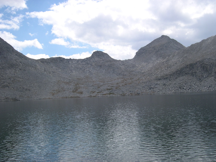
Eventually, I could see
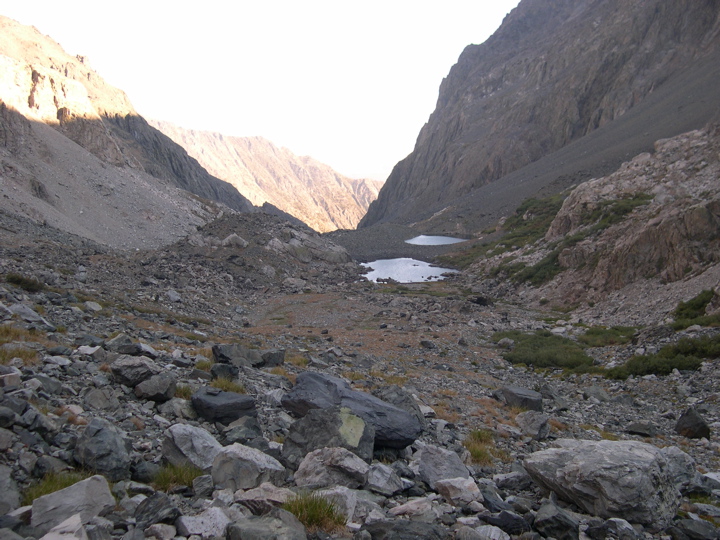
two little dots of water ahead and several hundred feet below me. The sun had fallen below the western wall of the gorge, and I reckoned that making it to those ponds would be a good end to the day. I made it to the northern pond and found some nice patches of dry dirt to set my tent on. So far I was finding the Gorge to be every bit as enchanting as I could have imagined, and the
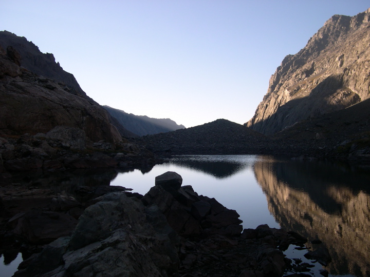
light reflecting off of the pond during sunset and sunrise of the following day was so beautiful that it will probably stick with me until I die.
Day Four:
This was the day I had been dreading. All the accounts of the gorge I had read forewarned of the dreadfulness of the brush I was about to encounter on my way down the next stretch of the hike. I was fully prepared to spend most of the day in the water slowly creeping along in my sandals over wet rocks if it meant avoiding massive nettles and thorns. In the end, it turned out to be a nearly 50/50 compromise between land and water walking, where I switched whenever I found one to look easier than the other. I am extremely glad I brought some hearty sandals, though, and would highly recommend it to anyone doing this trip late in the season.
In the first two miles or so after then pond, I was able to stay on land without any bushwhacking necessary. The main obstacles were some
very impressive waterfalls that needed to be circumevented. For the most part, I was able to stick to the eastern side of the creek and make my way down huge patches of granite, but occassionally I passed to the western side when the steepness of the eastern wall demanded it. This stretch was really lovely and I never once looked ahead and thought to myself, "oh my god, how am I going to get down there" as I have on other canyon descents.
Eventually, the foliage started to crop up. There were some very pretty and colorful plants and wildflowers along the river and nothing was thorny or stingy. I had never actually seen a
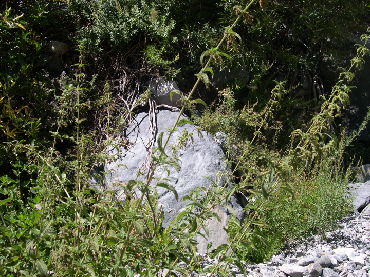
stinging nettle before; I had only read about them. I was thinking maybe they had died for the season or something, but then I happened to push one out of my way while trying to advance on the west bank of the creek. I remember thinking at first that the pain wasn't that bad, but then thirty seconds later I realized that I was wrong. It's strange. The burn seems to increase with time for a while after you contact it and then it levels off and just itches and nags you for the entire day. I felt like I should have been able to just pull something out of my skin to make it go away, but there was nothing there.
At this point I tied my boots to my bag and put on my sandals to take to the creek. It was really fun at first boulder hopping and swinging from tree branches to get over little gaps. And to my amusement, I encountered a stretch of the creek where hundreds and hundreds of caterpillars were coating every rock and plant that I could see. It was difficult to avoid stepping on them, but at least they weren't ants or spiders or something nasty. There were also plenty of fresh raspberries to eat, which was delightful.
I think it was at around 8700 feet elevation or so — right about where Disappearing Creek joins up with another minor tributary coming from the northeast — where the hiking got pretty unpleasant. I can always look back at a trip and tell the points where I really was not enjoying myself because I don't feel like taking any pictures, and this was one of those times. I tried to continue my strategy of staying in or very near the creek, but the walls of rock on either side were very steep and the brush was damned thick on top of them. In retrospect, I might have been better off climbing up about 150 feet on the eastern side and trying to go horizontally for that portion since it's not that steep. Instead, I was crawling under trees and scrambling along the steep western edge.
It was starting to get pretty dark, my feet were getting cold, and I started to panic a little bit since I hadn't seen a flat patch of land where I could set up a tent for some time. From looking at the map I realized my only bet was to climb a hundred feet or so on the eastern side of the creek and look for a spot to sleep. I went on for a few hundred yards of awful bushwhacking until I found a flat bank of dirt surrounded by huge boulders and a large pine tree. It was also chalk full of bear tracks, but it looked like the best place I was gonna find so I set up my tent there.
That night I lit a fire in one of the crappiest fire pits I've ever made and spent all my effort trying to ignore the pain of burning from the nettles on my hands and feet. The burning on my feet was also complimented by some wicked sunburn and the chafed skin where my sandal straps had dug in...all bad. Surprisingly, I fell asleep pretty quickly and luckily no bears decided to make their way down their trail that night.
Day Five:
When I woke up and checked my map and GPS, I was rather ecstatic to see that I was almost at the confluence with Goddard Creek. From what I had read, that's where the hike turns back into the ridiculously sweet thing it was before the plethora of nettles and manzanita bushes. The remainder of the descent down the gorge was straightforward and crossing to the western side of the creek in my boots was pretty easy since there were plenty of rocks and logs to get me across. So finally, I was at the confluence of Goddard Creek and Disappearing Creek on some nice flat ground amidst a lovely collection of
pine trees.
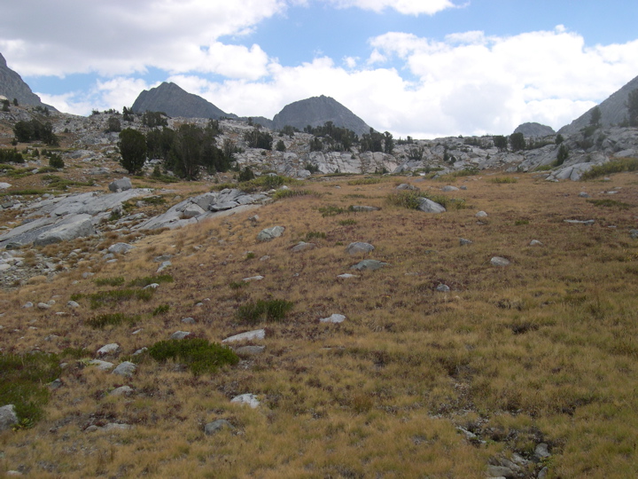
I didn't waste much time in this miniforest despite the fact that it was a really pleasant temperature and there were hardly any bugs bothering me. It seems like early September is the perfect time to avoid mosquitos and horseflies in the Sierras. I'm quite sure that I would have been eaten alive at this spot if it was July or August. Getting through the dense brush and walls of pine trees and to the foot of Goddard Canyon was actually a little bit of a bushwhack, but not too bad.
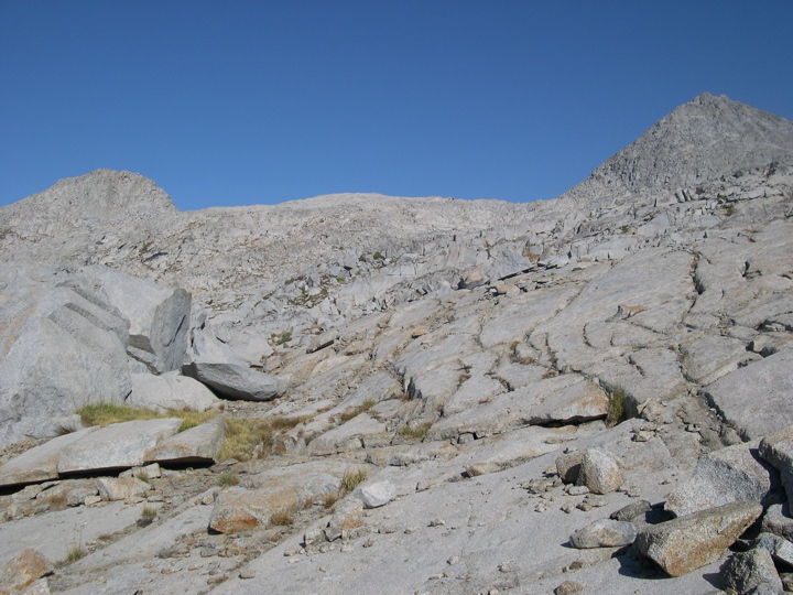
The next segment was just great. There's basically a
granite highway that takes you up the first 1000 ft of elevation. The walking is strenuous, but the footing is easy and there are no spiny shrubs to deal with. In fact, Goddard Canyon seemed to have no stinging nettles, and the vegetation and rocks were altogether different than they were in the Gorge. I've read that the formation processes and resulting rocks are different in the two, and you can see the difference easily. It never ceases to amaze me how two areas separated by no more than a couple of miles can be so incredibly different just because of a giant wall of rock between them.
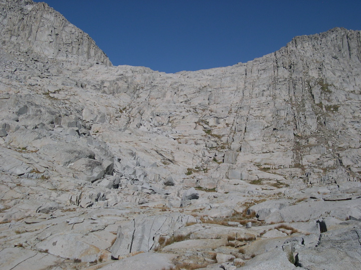
After the granite highway, I tried to follow the advice of Holliman and Arnot and stick to the east side of Goddard Creek. For the most part I stayed high above the creek and traversed the talus horizontally, but occasionally found it easier to walk right alongside the creek. I don't think hiking along the west side would be a wise decision. It's just too steep.
At one point while I was trying to make my way north along the eastern slope I took a rather nasty spill down the side of the mountain. After sliding for about forty feet and plopping down flat onto a patch of flat ground below a little overhanging rock, I got up and realized that I had lost my watch and there was blood all over my pants and shirt. I couldn't tell where I was bleeding for a hot minute, but then looked at the back of my left arm and saw a huge gash — I got a nasty little scar from it. I spent a good hour cleaning it and patching it up and then trying to find my watch. The little thing was on a rock about 30 feet above where I finally landed; it must have gotten caught on a rock and the pin ripped out and let it loose.
The fall inspired me to pay much closer attention to my footing, so I was staring down at the ground and testing each rock with caution. I must have been in quite a zone of concentration and balancing, because after a few hundred yards of this I looked up and saw a decent sized
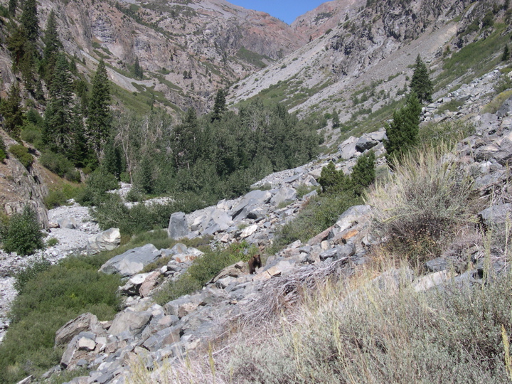
black bear heading my way. It's funny: the first reaction I had was to grab my camera, turn it on, set it to automatic, and take a picture. I did this before it really registered that he was a big bear and he was heading straight for me and paying just as much attention to the ground as I had been.
I was about to take another one when it dawned on me that he might just keep walking my way since he hadn't taken any notice of me at all. He was also getting pretty close. I looked around and thought how I was pretty much trapped by the unstable ground surrounding me and decided it would be best to alert him to my presence in a nice calm fashion. So I said with a loud voice, "Hey Bear! Go away!". He stopped walking and brought his head up to look at me. He didn't move, he just sat there and stared at me for what felt like an eternity (probably only like 10 seconds). I didn't want to try and beat him at a staring contest; I actually remember thinking that I should show I wasn't trying to threaten him at all. So I looked up the slope and down the slope as if I wanted to find an alternate route. When I looked back at him, he did the same thing, and then he turned around and
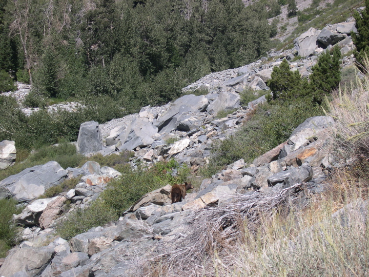
started walking back the way he had come. After a dozen feet or so of a slow paced trot he turned left and bolted quicker than I could have imagined across to the other side of the creek. I was so amazed at how nimble that thing was. And I was pretty happy to see that he was
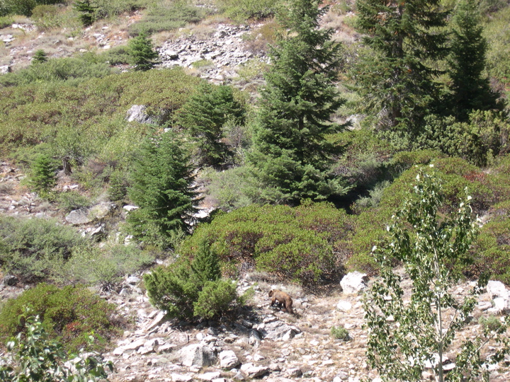
going down the creek instead of up it, since that meant that I probably wouldn't see him again.
So I was a little freaked out to start the day, but I felt confident that things would get better. Unfortunately, I made a bad decision in following an easy granite slab to the northeast at about 8200 feet. From the map it looked like I would be able to get back down to the creek pretty easily, but there was a 50 foot ledge between me and the ground, so I couldn't. I continued to gradually climb along the eastern slope even though the ground was looking less and less inviting. There were flat patches here and there, but they were mostly swallowed by huge manzanita bushes and shrubs. What made it worse was that I was almost out of water, thirsty as hell, and I had been using my hands to crawl over scolding hot rocks so they basically felt like they were burned. Yup, I really wanted to get down to the creek. Finally I climbed over a series of rocks and saw a place in the ledge where there were some good outcroppings where I could lower myself down. It was quite difficult, though, and if I did it again I would have tried to avoid getting too high off the creek at that part of the canyon.
Shortly after filling up my water bottles, clouds started to roll in above the western ridge of the canyon. I heard thunder off in the distance, and since I was so damned beat, I decided to set up my tent alongside the creek even though it was only 4:30 and there was still plenty of daylight left. It turned out that the storm never made its way into the canyon, and the night was actually pretty enjoyable as I had a

superb view down the canyon. Again, the stars and alpenglow were phenomenal and I didn't really notice the pain in my body as the night fell upon me.
Day Six:
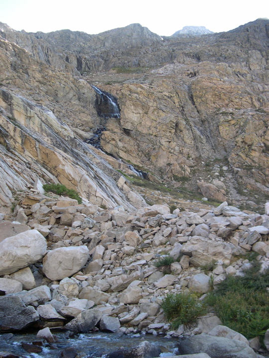
The last two days had their ups and downs, but this one was just downright great. I was slow getting up and eating breakfast, and after gaining 700 feet in elevation I came to a
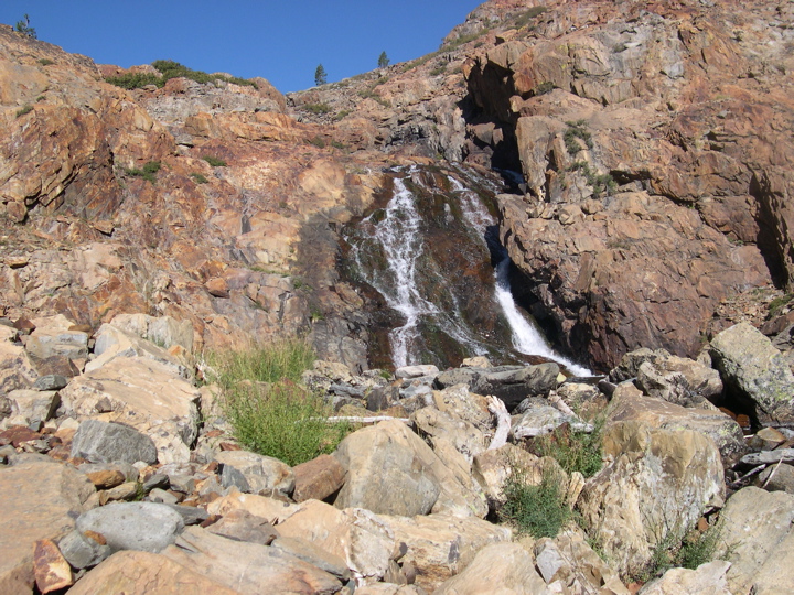
waterfall with a
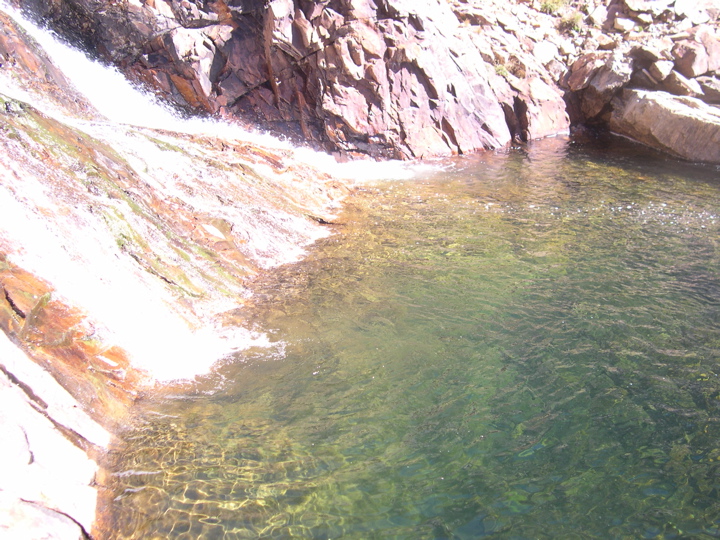
gorgeous little pool of water below it. At first I was a little concerned that I'd have to backtrack to climb over it. But after taking off my pack and testing the western wall, I was fairly confident that I could climb it even with my pack on. So I decided to take a nice break and go for a swim. The water felt really, really good, and drying in the sun felt even better.
The terrain following the waterfall was steep at first, with a good deal of boulder climbing. But pretty soon it leveled out and I was excited to see the
lake at 9800 feet. When I got close to the lake, I looked down and saw what looked like hundreds of trout swimming back and forth in circles. I had some hooks and line in my survival kit, and I was contemplating picking a few up for dinner. But I had plenty of food left in my pack and I just don't like the idea of going to sleep with the smell of fish guts on me when I knew there were plenty of bears around. But I'm fairly certain that if I had dropped a line in I would have had one of those guys within seconds.
My first attempt at getting around the lake was a failure. I tried climbing the granite high on the east side of the lake and going due north, but met a steep ledge pretty quickly that I couldn't pass. So I ended up going back down to the shore and skirting the east side of the lake. There were parts where it looked like I'd have to get wet, but somehow there was always enough ground to keep going forward on dry land. There is another stream that heads southwest at this point, which you can see from the lake, but I failed to investigate it.
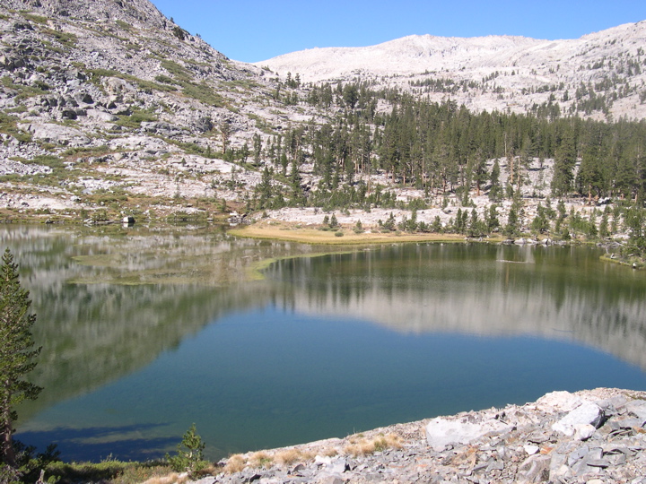
Beyond the lake Goddard Creek climbs between some nice
granite outcroppings that make the hiking very enjoyable. At about 10200 feet, the ground begins to level out and large patches of grass present themselves. The combination of this and the
beautiful mountains that nestle you in make the area seem really exquisite. And finally the creek forms
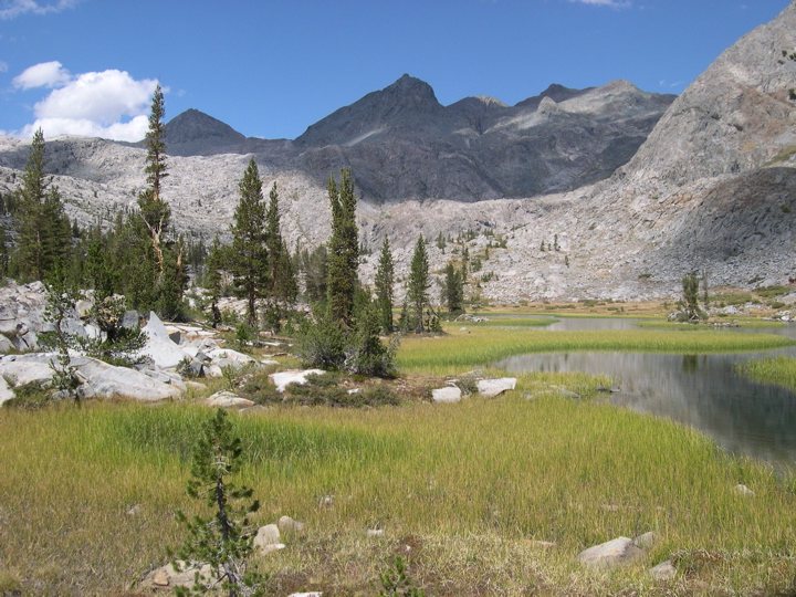
little pools amdist a meadow before emptying into
Lake 10232. Looking back at the trip, I think this was my favorite lake of them all. You truly feel a sense of peace and isolation here.
I was enjoying the lake so much as I crept along the western edge that I almost failed to notice the clouds rolling in from both the western and eastern sides of the little valley. I was very intent on making it up to the little pond that lies to the west at about 11100 feet, so much so that I almost started climbing up the western rim. But I started to hear thunder so I decided to hike to the northern side of the lake where it looked like I could set up a tent in case lightning started to come down.
When I got to the northern side, I sat and deliberated about what to do. It was only 4:00 pm and I knew I had the energy to make it to the higher ground. The clouds seemed like they were just building and building around the little valley, but refusing to enter it. Finally, I felt a few drops of rain, which prompted me to set up my tent. Shortly after getting inside and getting on top of my thermarest to insulate myself it began to hail just as wickedly as I've ever seen. And then lightning and thunder started to storm down all around the valley. It never got to close to my tent, but I sat there curled in a ball for an hour or so just watching it through the little window in my fly. The tent was holding up well, and I rather enjoyed watching the storm.
At around 6:00 the sky began to clear. I got out of the tent and started cooking some rice, fairly certain that the storm was one of the regular mountain storms that come around 3:00 and leave by 6:00 like clockwork. I had to admire
my campsite: the view I had across the lake was just spectacular. In retrospect, I'm glad that the impending storm made me decide to set up camp there.
Day Seven:
During the previous day while I laid in my tent and waited for the lightning to subside, I spent part of the time consulting my map and GPS to figure out the best way to get up to Reinstein pass. It looked like there was a nice gradual ascent possible from the very west tip of Lake 10232. But it also looked like if I could make it up 500 feet or so of a pretty steep climb to the northwest then I'd be in good shape, too. I decided to go with the latter option since my pack was feeling nice and light after I had emptied seven days worth of food.
Overall, the steep climb was straightforward. There are plenty of good footholds and places to rest along the ascent. And with every step the

view behind me got better and better. Near the top you can see a
nice waterfall on the eastern side of the rim. A few hundred more feet up and the terrain turns to a
nice bed of granite that makes for easy going.
Getting to the base of Reinstein pass took a little time just because there are plenty of rock structures that you have to climb up and down in order to make your way forward. It looks like there a number
of ways to get to the top of the pass. I ended up hugging the western wall and switching back and forth until I saw a
route that went northwest over the pass.
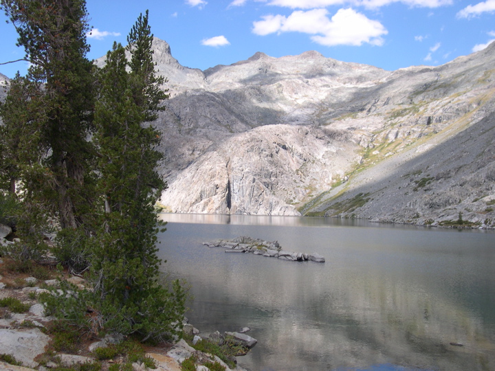
I gotta say that when I got to the top and saw the view of
Martha Lake, I was elated. Not only was I happy to enjoy the beautiful view, but I finally felt like I was out of danger. That's not to say that I ever really felt like my life was threatened while I was down in the canyons — even with the bear I met I didn't truly feel truly scared for my life — but I did feel like the level of risk I was taking was a significant step up from my everyday life. I savored the view...and the fact that I was about to taste real food.
Looking back, I could see a new set of clouds sweeping towards me from the south. I decided it was time to get going down to Martha Lake. Fortunately, it was the easiest descent I had made during the trip. It was basically just a few switches back and forth as I made it down to the lake. I sat down on a huge boulder for lunch and recalled what Holliman had said about getting around Martha Lake. He had taken the
western path, but said that he thought the

eastern one might be easier. From what I could see where I was sitting, it indeed looked like a good option, so I took it. It was a really nice route over some large boulders, and even though it was probably longer than taking the western edge, I think it was a good choice.
Once I had gotten around the lake, the terrain turned into some sweet stretches of grass with
beautiful colors. I continued walking north and finally picked up a
trail once again. Five full days without seeing a person or a trail made this such a welcome sight.