


TRIP DETAILS
TRAIL MAP
OVERVIEW
Notes:
- This is an incredibly beautiful area just a stone's throw away from the town of Mammoth Lakes. It seems as if the day hike to Duck Lake is incredibly popular even in October, but we were lucky enough to not see another person on the trail beyond during our trip. This includes about five miles hiking on the JMT!
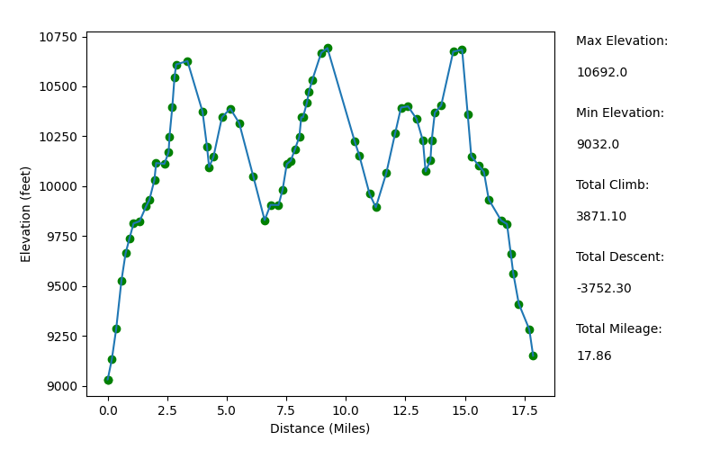
Elevation Profile
TRIP LOG
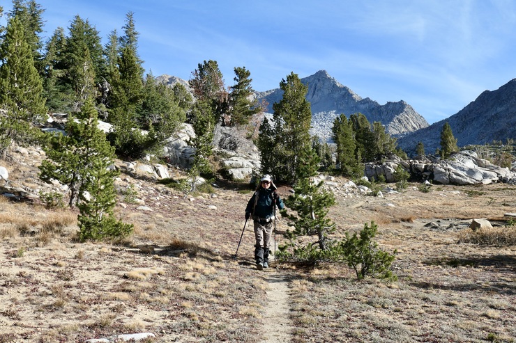
We pulled into the very large parking lot at the Duck Lake Pass trailhead right around 1300. It was only a 20 minute drive from the Westin Monache hotel where we had been staying, so Tina and I were feeling fresh.
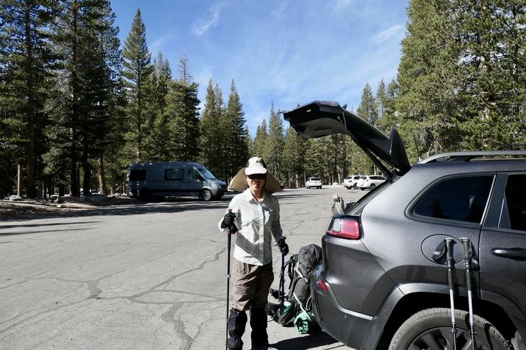
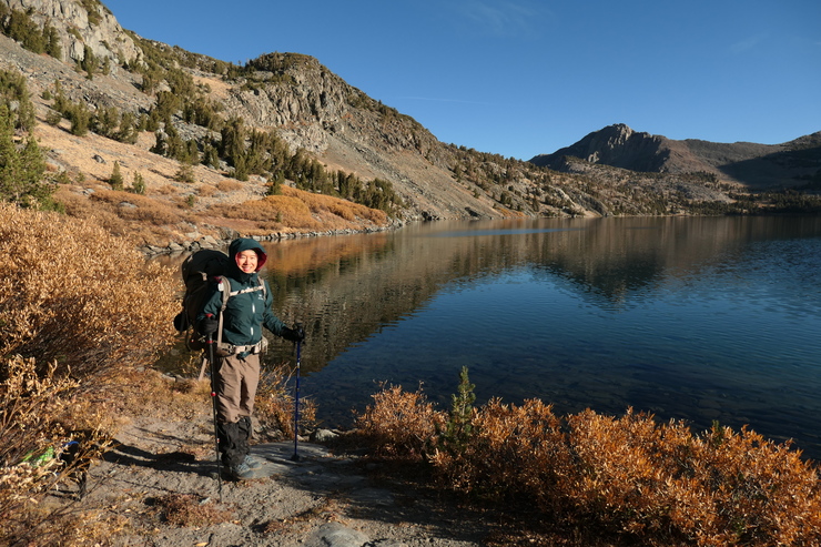
The weather was absolutely perfect for a backpacking trip, and we were both very excited to get a few nights to ourselves after 10 months of raising a newborn. Within an hour of parking our car, we were already at Arrowhead Lake. We stopped there and put our packs down to enjoy the gorgeous environment.
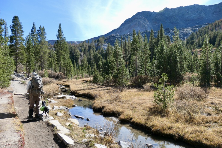
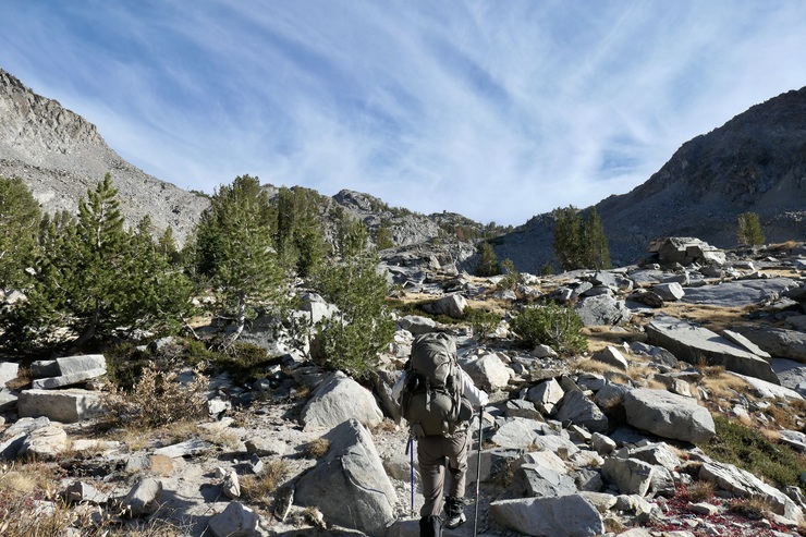
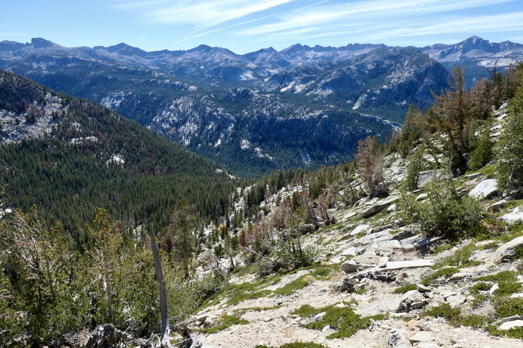
The next couple of miles were very pleasant, with just a modest incline and a nicely carved trail paralleled by creeks from time to time.
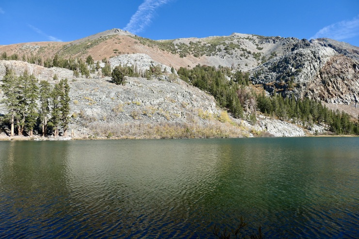
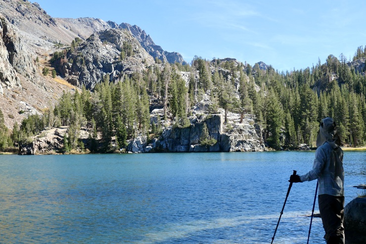
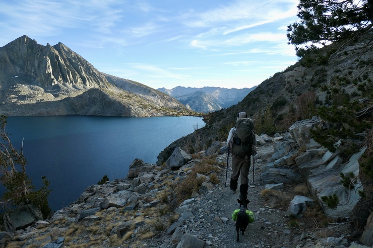
We enjoyed the view of Skelton Lake while we walked, deciding not to take a break along its shore. Both of us were quite surprised at how beautiful Barney Lake was, though.
We stopped where the trail crosses Barney Lake's drainage creek to fill up water, and took our sweet time soaking in the stunning color of the water.
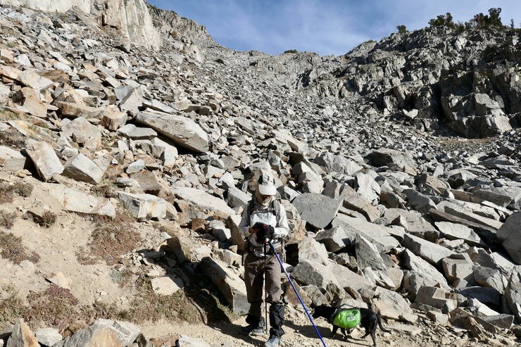
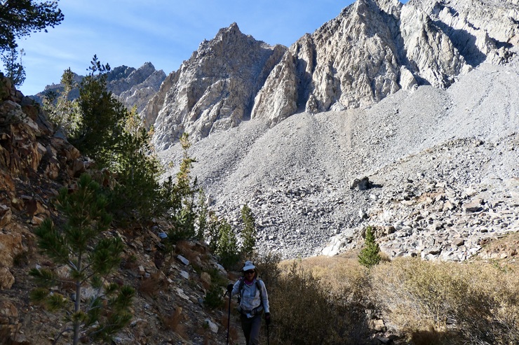
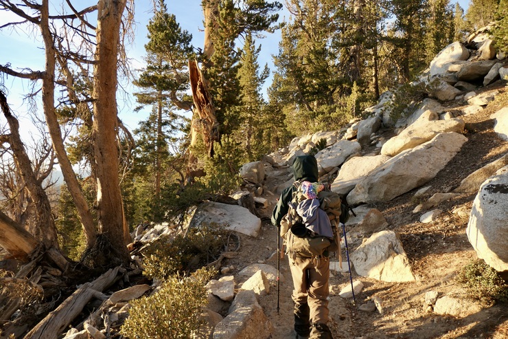
The climb up to Duck Lake Pass was not bad at all. There are a few steep sections with switchbacks, but for the most part it's a very easy walk up.
As you ascend, you're treated fantastic views of Mammoth Mountain to the north.
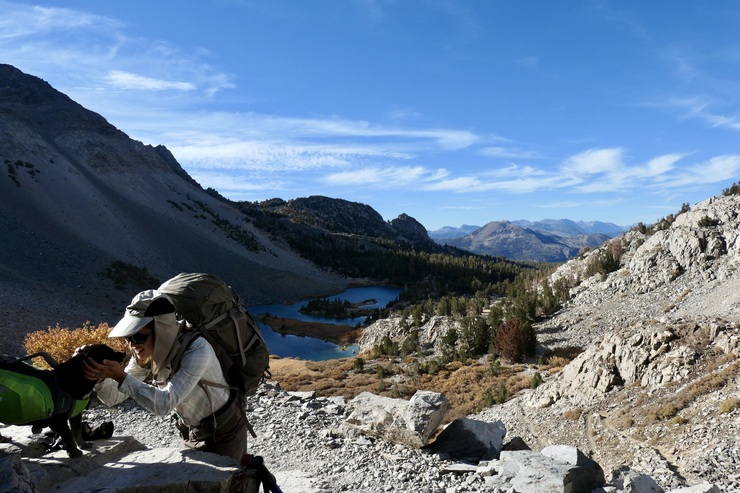
When we arrived at the pass, we were faced with our first and only tough decision of the trip: where should we camp? I hadn't done a ton of research on the subject before we set out. I imagined there would be plenty of established campsites due to how popular the area was. But as we studied the topo map and the view in front of us, it became clear that there were basically two main options. The first was to take the east fork of the trail towards Pika Lake, where it looked like there was plenty of flat ground. The second was to head south and try to seek out a site near the outlet of Duck Lake. It was clear that there would be no good camping spots on the western shore of Duck Lake due to the steep terrain.
The deciding factor for us was that we wanted to make it to Ram Lake the following day. If we chose to camp by Pika Lake, we would have to do a good bit of backtracking to make it there the following day. So we headed south towards the gorgeous sunlight filtering over the Sierras.
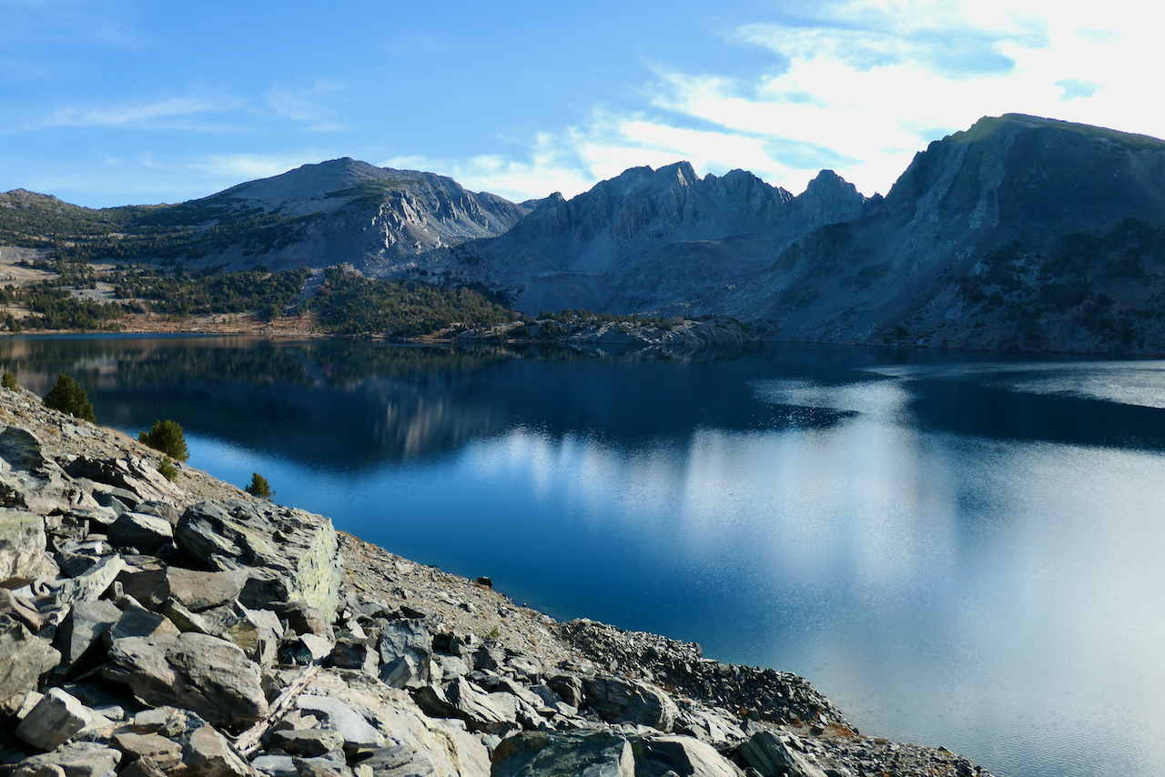
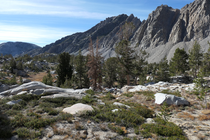
The kilometer or so of trail that parallels the western edge of Duck Lake is quite spectacular. We took our sweet time enjoying the views of the stunning mountainscape surrounding us.

When we finally reached the south shore of the lake, we found a sign informing us that camping in the immediate area of the lake was not allowed. Luckily, there was a good amount of territory southeast of the lake that looked somewhat hospitable. We found a nice flat spot equipped with an old fire ring just about a hundred meters away from the lake.
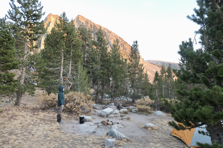
The evening was downright beautiful. But sadly, it was tainted by the fact that I had forgotten our camping stove. So we weren't able to heat the orzo that we had brought. Tina was a great sport about it, though. We made due with beef jerky and tortillas, and settled in for a cozy night in our sleeping bags. The sound of the wind was a very nice change of pace from a crying baby.
The next morning was hard work. It really made me appreciate the beauty of camping stoves.
We spent the first couple of hours of the day heating up water using a variety of rock formations, while simultaneously eating our breakfast and trying to enjoy the beautiful morning.

We were able to make a decent cup of tea and a huge pot of orzo that we would leave simmering for the rest of the day.
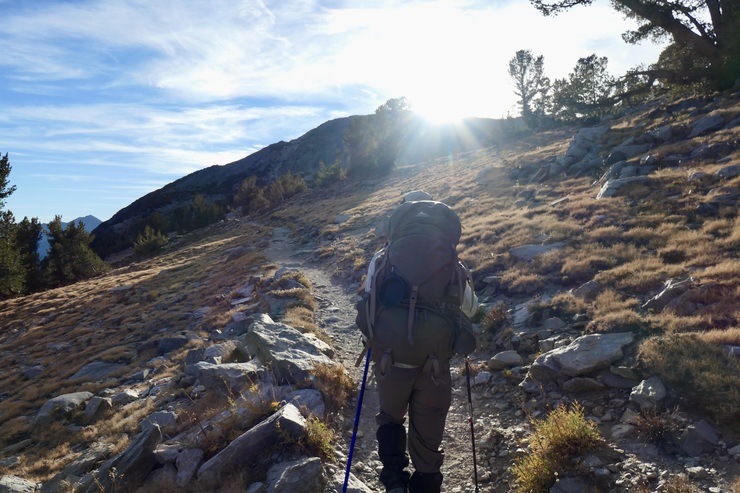
We got going fairly late in the morning under a gorgeous blue sky filled with some high clouds.
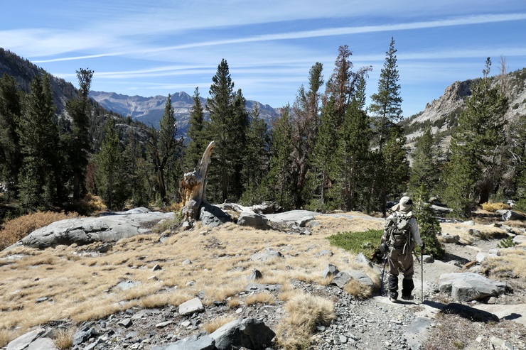
The initial descent down to the junction with the JMT was very pleasant. The views south were excellent at times.
We didn't stop at Purple Lake, although it looked like a pretty good place to spend a few hours. Instead, we forged ahead and made our way on the unmaintained trail toward Ram Lake. The trail was fairly easy to follow at times, but at others we had to use some guesswork as to what the best course was. The ridge to the west of us was pretty impressive, and I kept scanning to see if there were any good places where we could cut over directly to Duck Lake. I think there might be one or two spots where this would be possible.
The nice thing was that even when we lost the trail, the terrain and alpine vegetation presented no real obstacles.
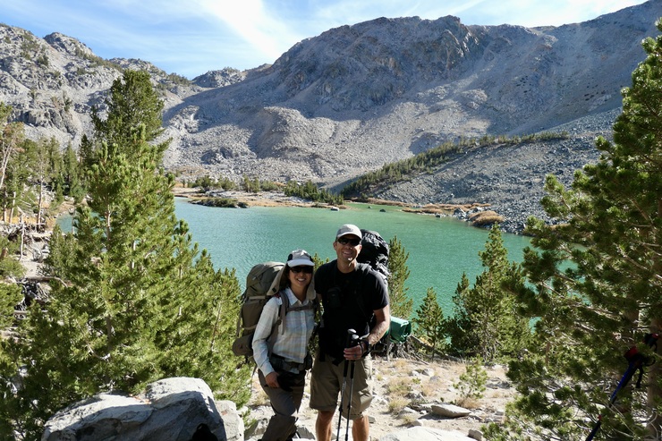
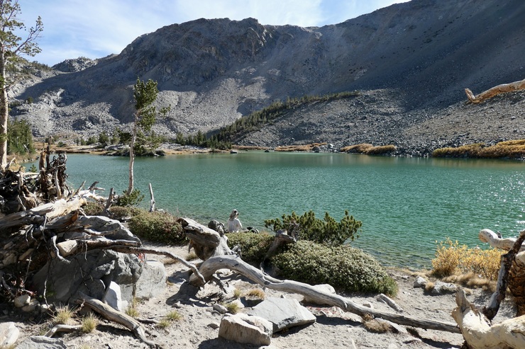
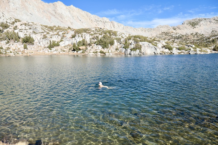
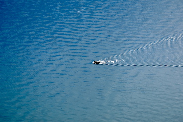
When we reached the shore of the west portion of Ram Lake (it could be a totally separate lake, but I don't see a name for it on the map), I immediately took off my pack and clothes and jumped in the water, trying to take advantage of the limited sweat I had built up on the last stint of the hike. The water was still absolutely frigid on my skin, though. Tina took a bit more time debating on whether or not she wanted to jump in, but eventually showed me that I was a bit of a sissy when she leisurely swam back and forth in the pristine water.
We got going shortly after Tina got out of the water, eager to get some more heat added to our body temperatures.
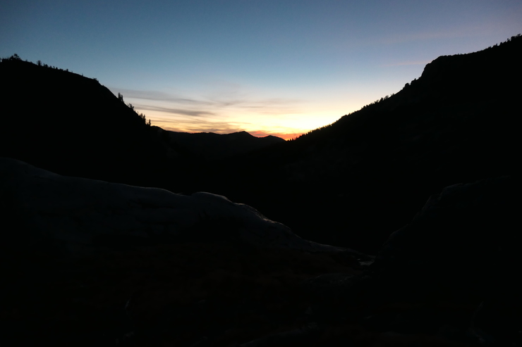
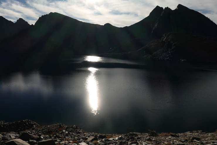
The setting sun provided some brilliant colors and views as we neared our campsite.
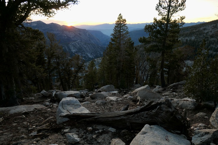
We may have spent a bit too long admiring things, though, as the daylight quickly slipped away from us. It was quite dark as we headed up the last set of switchbacks before our campsite.
Dinner that night was not exactly gourmet. The orzo had cooked, but it was probably somewhere around 50-60 degrees in temperature when we ate it. Still, we were extremely content with a wonderful day out in the Sierras. What shocked us most was that we did not see a single other person on the JMT the entire day even though there was no snow or storms to speak of! I am used to seeing at least a half-dozen people every hour when I'm on the JMT when there is weather that nice. We felt blessed to have this paradise all to ourselves, if only for a day.
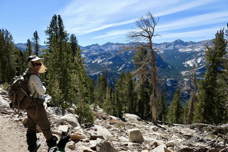
The last day consisted mainly of backtracking to our car. We took our very, very sweet time enjoying every last moment in Duck Lake's reaches.
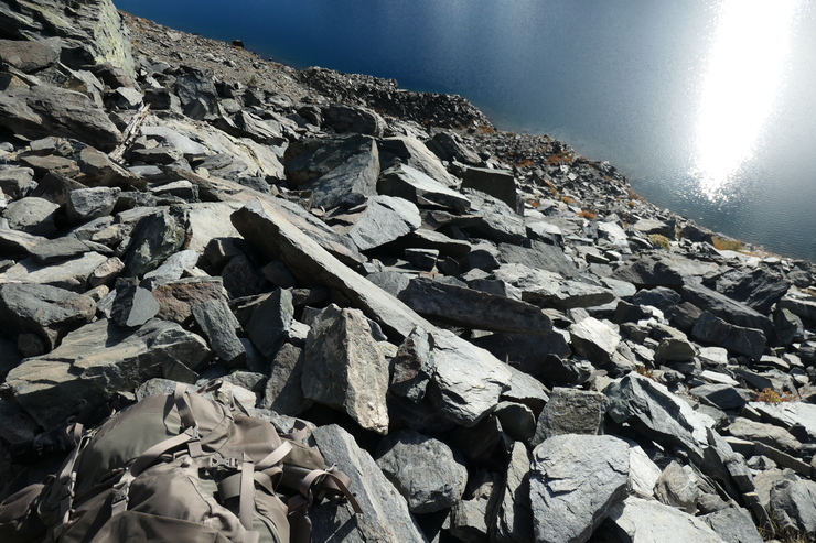
We probably spent the better part of an hour sitting on the trail high above its shore and admiring the sun spangles and variety of water fowl that had flown in for the morning. The light and shadows were providing a dazzling show.
We decided we'd take a slightly different course for the last few miles of the hike, diverting to the west and heading towards Emerald Lake
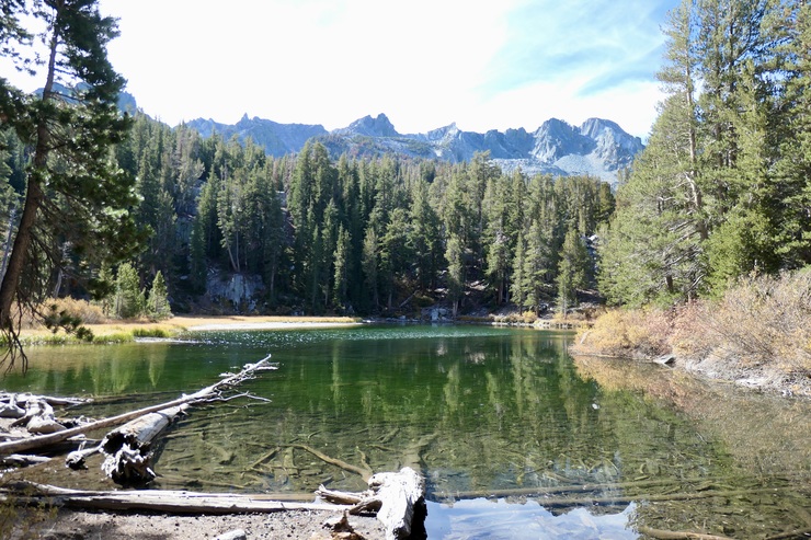
It didn't look like the best place to swim, but a decent place to camp, nevertheless.
When we got back to the car, we both felt revitalized and refreshed, and ready to take on the joy of caring for a 10-month old child once again.