


TRIP DETAILS
TRAIL MAP
OVERVIEW
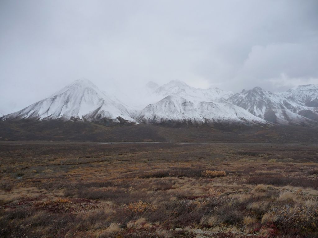
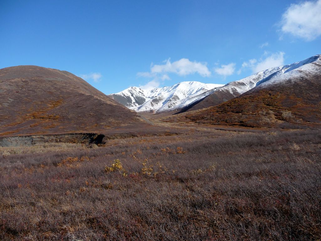
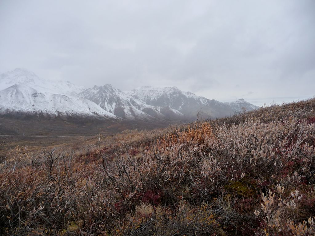
All I can say about this trip is wow. Wow, wow, wow. There is something so unique and different about the Alaskan Range. The clouds and weather have a behavior the likes of which I have never seen anywhere else. The mountains and valleys have a vastness to them that makes you feel like an ant. It almost feels like a different planet.
Everything, little and big, makes me want to return Denali National Park and explore more.
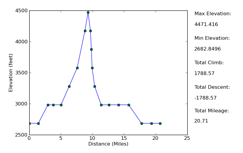
Elevation Profile
TRIP LOG
In the late hours of the night before setting out for our trip, I tossed and turned in my sleeping bag. We were staying at the Grande Denali Lodge (which is quite a lovely hotel, by the way), and I had decided to make the floor my bed since there were four guys and only two queen beds in the room. Right behind my head was the balcony door, and the sound of rain and wind was pumping quite a bit of fear and trepidation into my mind. Were we going to have to endure this kind of weather for four days and three nights? If so, it would be a rather miserable way to see the last frontier.
I managed to get some decent sleep despite the fury of the weather. And somehow, magically, when I woke up at 7:00 am, there was an enormous patch of blue sky to the south and the rain had ceased. This lifted my spirits enormously. Eager to take advantage of the inviting conditions, we did the last of our packing up and hopped into the car. There were four of us all told in the vehicle, but only three of us would be making the journey. My dad was going to stay back at the Princess Hotel and pick us up upon our return; serving as our own Michael Collins of the Apollo 11 crew.
Due to the fact that it was late in the season (I still can't say I know the dates exactly. The rangers all had conflicting start/end dates for the season and road lottery, but September 17 seemed to be the majority winner.), we would be able to make it all the way to mile marker 40. In fact, the bus doesn't even run this late in the year, so our trip options had been limited to start points within 40 miles of the park entrance. But this worked out perfectly since units 4 and 5 were very high on my list anyway.
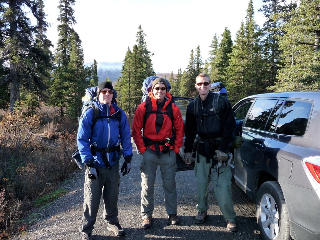
We arrived at the

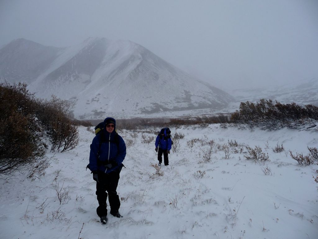
Savage River Campground It was about 0900 when my dad pulled away in the car, leaving us with our packs and a 30 mile journey ahead of us. The plan was to stick by the Savage River and cross to the east side (the road from the campground lies to the west of it) when we found a very easy crossing. Also part of that plan was not getting killed by a bear, and we were following every piece of advice that the rangers had given us on the previous day: shouting random phrases, keeping close together, and always scanning the horizon for any evidence of danger.
Despite the somewhat foreboding description of Unit 4 on the NPS website, the
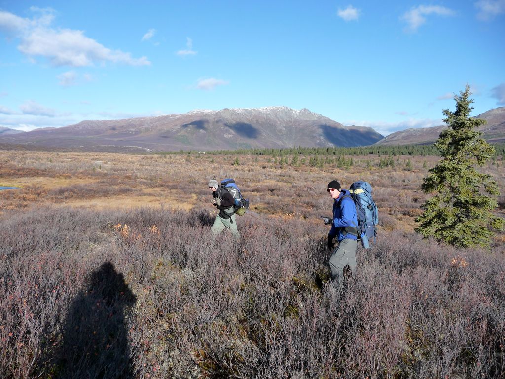
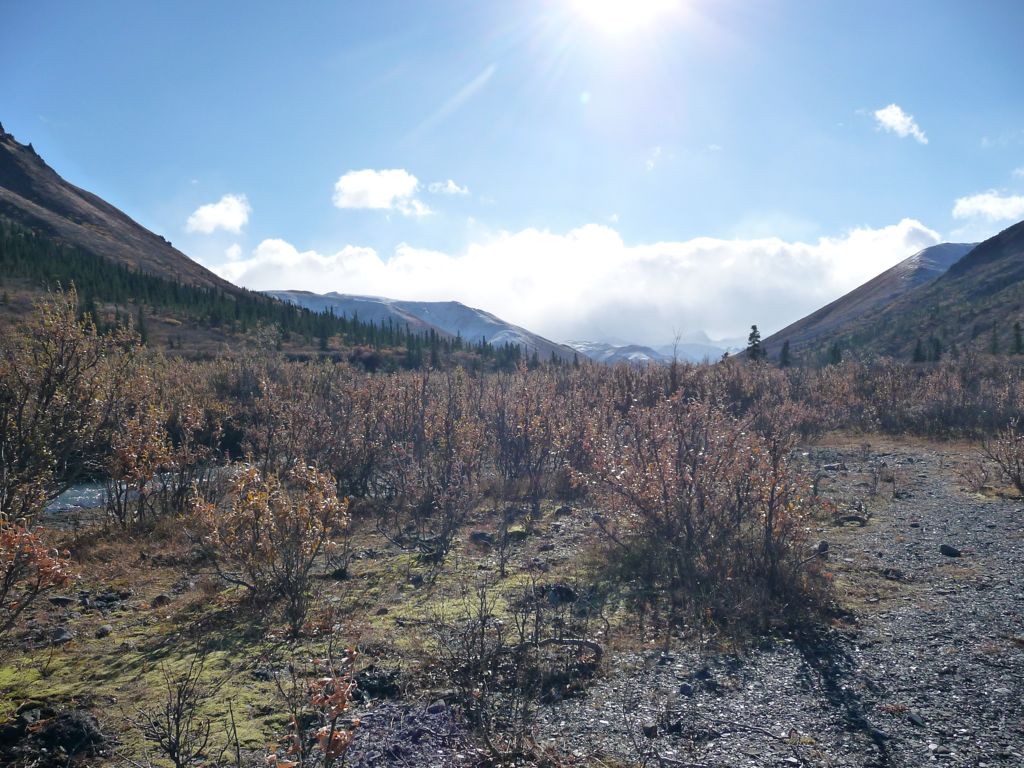
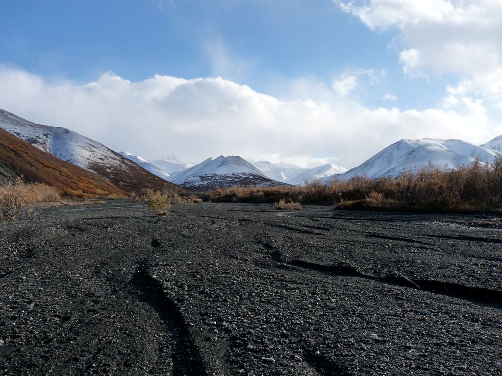
brush during the first few miles of the trip was incredibly easy to traverse. For about two miles, we trudged through mixtures of tundra and small bushes while the view of the
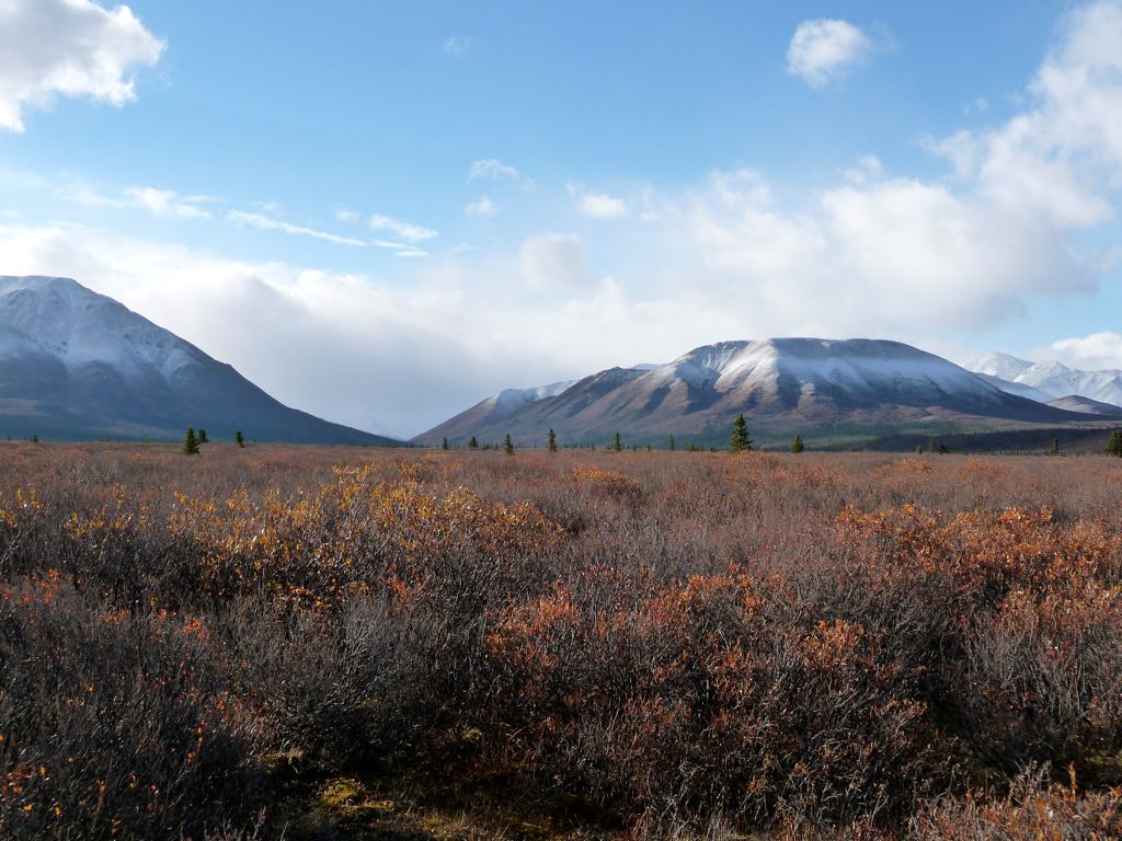
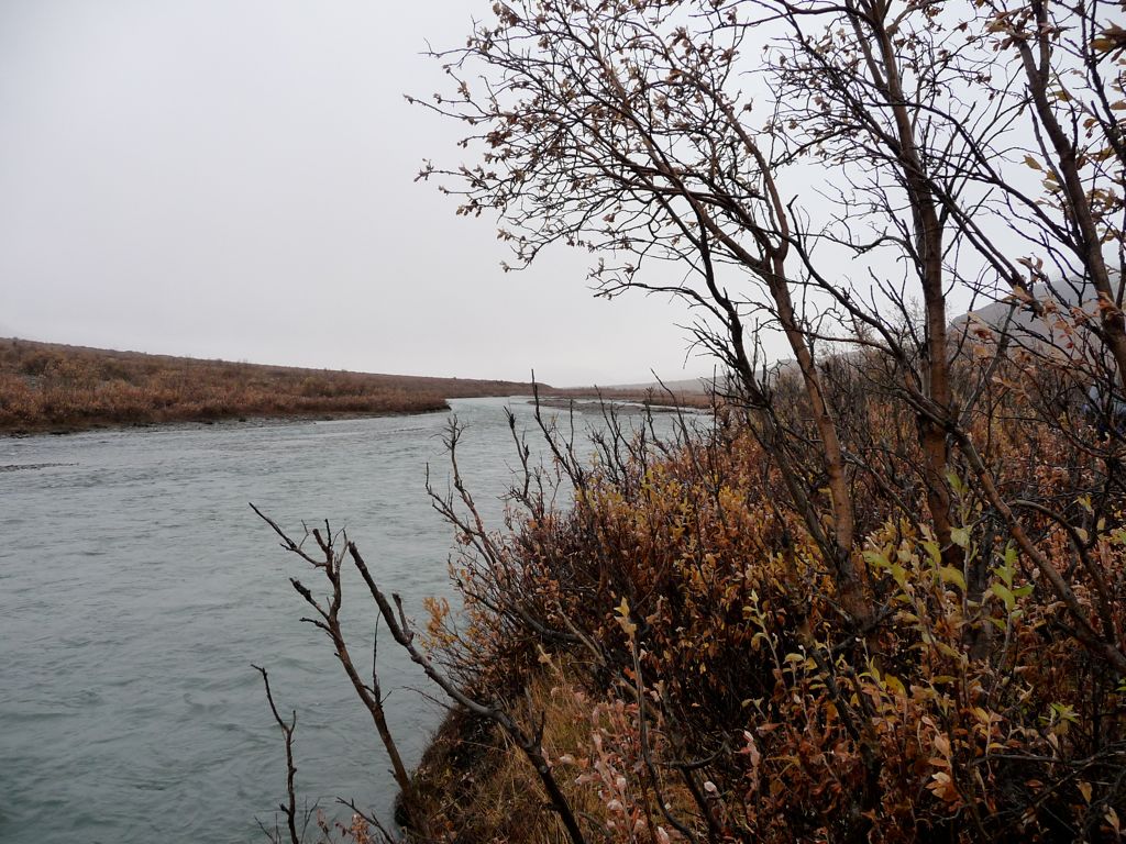
Savage River Valley slowly got larger and larger. At about the two mile mark, we started paralleling the
Savage River. It was quite low and the currents were weak, which we had expectd since it was late September and the rivers in Denali are primarily fed through glacial melting (meaning late spring/early summer is the time when they really swell up).
Eventually, we found ourselves in a sparse
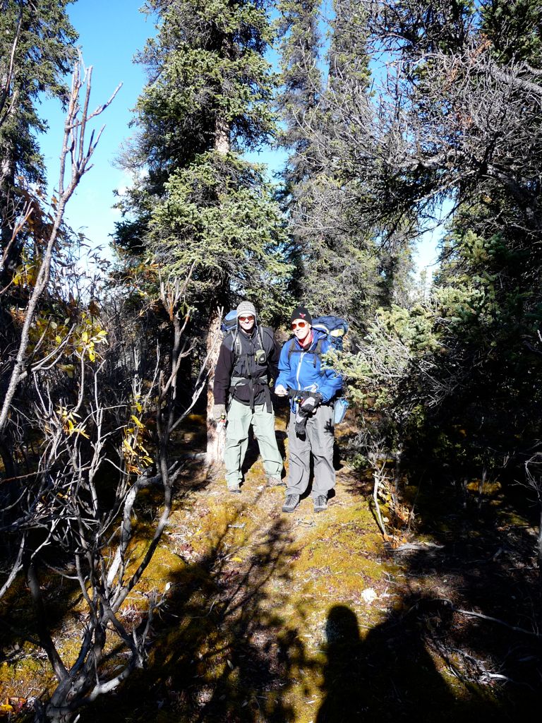
pine forest that bordered the river. It was still easy going, and occasionally we'd come across an inviting
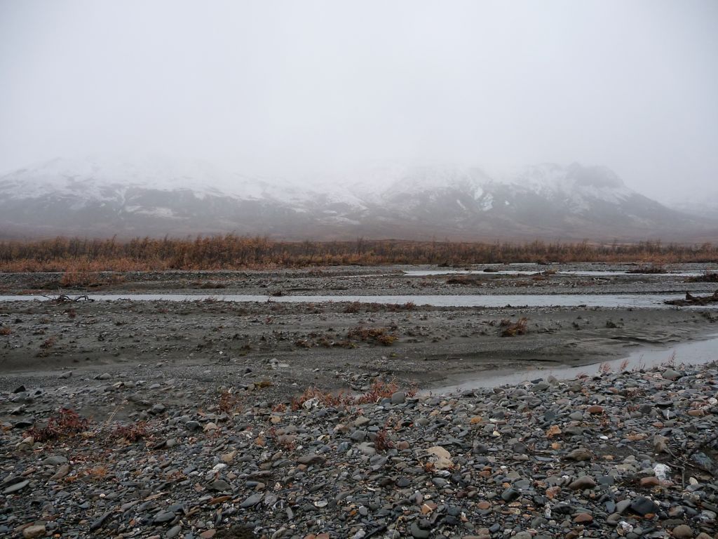
corridor of pebbles and stones that probably served as stream-beds that had just dried up. So far we had found no places along the Savage where we could have crossed without getting a bit wet. Without our packs, we could have probably jumped across with a running start at points. But with the packs, no. At around noon we decided we'd just get it over with the hard way. So at a
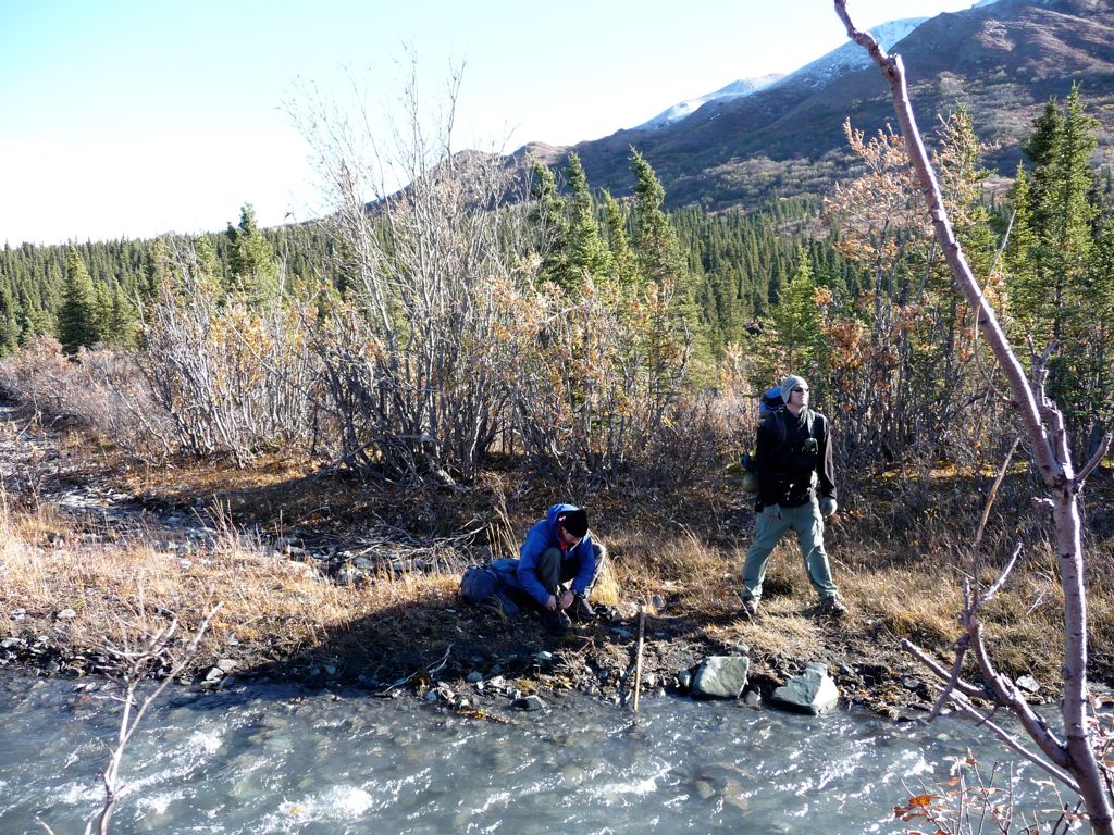
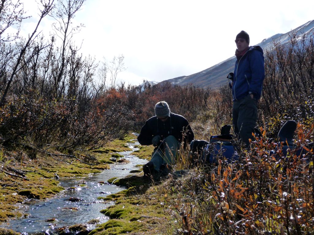
shallow notch in the river, we stopped and exchanged our boots for sandals (actually, we all used Jason's sandals since he had brought the only pair), and crossed one by one.
On the
other side, we stopped for a quick lunch. The weather was still holding up perfectly, and aside from a
thick blanket of grey covering the mountains to the north that appeared to be stationary, the sky was abundantly blue. When we got going again, we found that our increase of just a few hundred feet of elevation had left the pine trees behind. Most of the walking was through very squishy tundra and thick bushes. At one point, when we took a break, I decided to lie down on the tundra despite the feeling that its soggy contents might soak my pants through. To my delightful surpise, not only was it completely dry, but it turned out to be the single most comfortable natural surface I have ever felt. Well, perhaps my mother's womb was more comfortable...I really can't remember. But it beat out any dirt or stone or wood surface I've ever rested my back on. We all took turns
enjoying its delight.
At this point, we had actually climbed up a few hundred feet to the east of the Savage and were making our way through dense brush and intermittent
streams. This was mostly due to the fact that we saw
sharp escarpments surrounding the river below. But when we finally got fed up with the constant pushing and pulling of
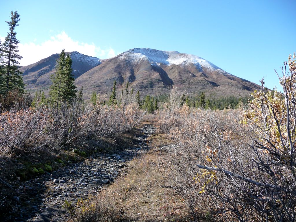
branches, we agreed that skirting the river would be a better option even if we did have to climb high above the banks at times. This actually turned out to be the never-ending theme of the trip. We'd follow the river to a point where it was impossible to go further, so we'd be forced to climb high onto the bank to pass. There we'd find a nice workable path that tended to lead us further from the river, and we'd follow this. Eventually the path would turn into a nightmare of brush, which would force us back down toward the river. But hey, that's bushwhacking I guess. Luckily, though, this time our journey back to the river brought us to a sweet
gravel-bed highway that we would follow for the rest of the day.
The gravel bar was filled with tons of treats. We saw a couple of
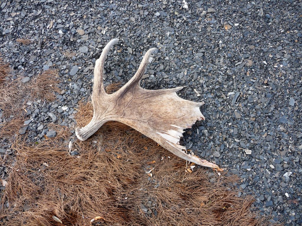
moose antlers, a huge
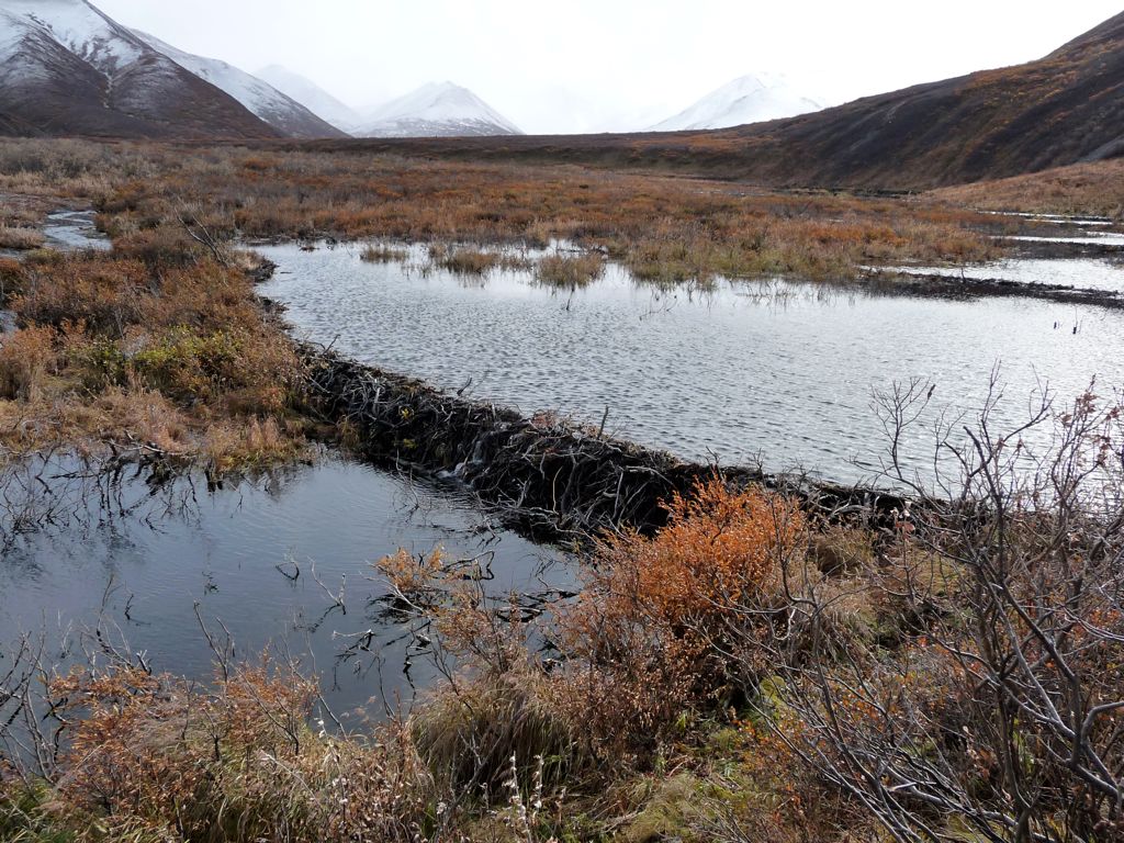
beaver dam (which we actually used as a bridge), and a
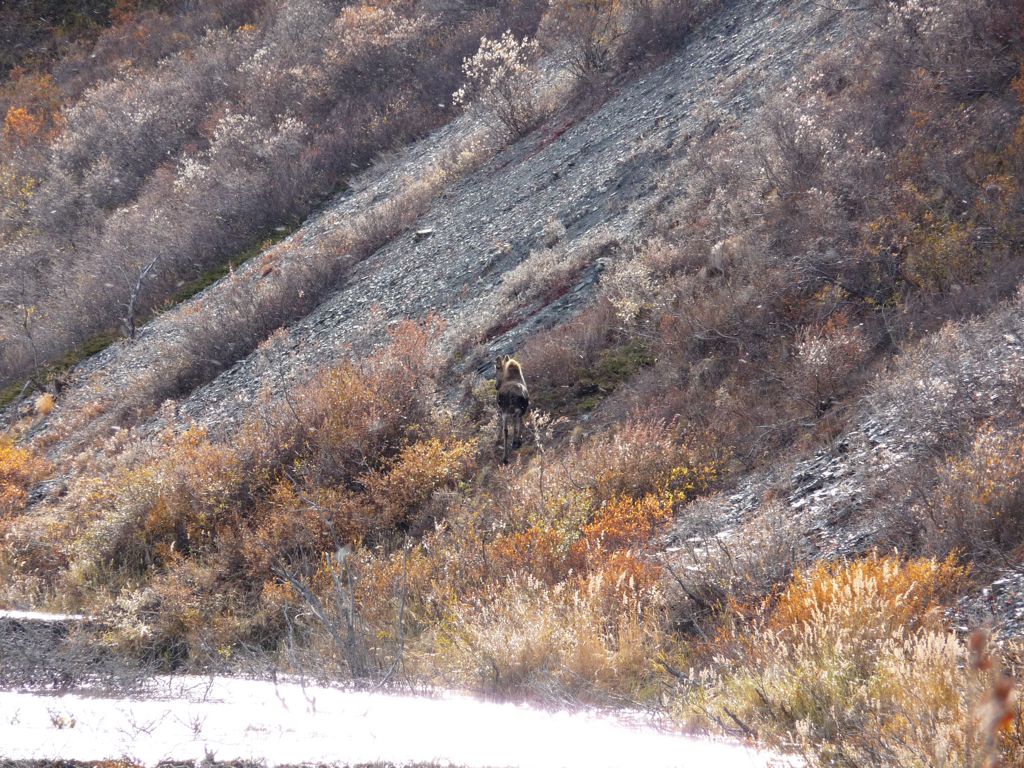
female moose. After a day full of bushwhacking, this was the perfect treat. Open and free travel with the best scenery money could buy.
We made it a few miles along the gravel bar before we found what looked like a
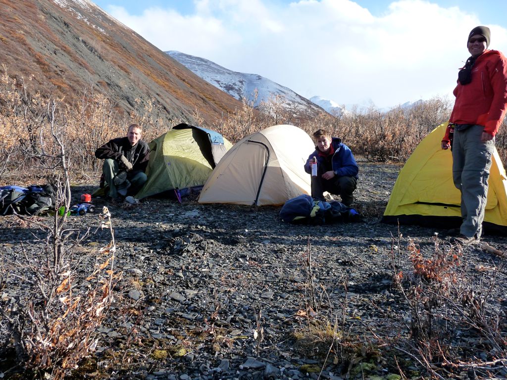
nice spot to camp. I say "looked like" because it had good visibility in all directions, which was recommended in the backcountry video we had just watched. That same visiblity meant a wide-open tunnel for wind to travel. And I don't think it's an underestimate to say that at times that wind picked up to about 50 miles an hour during the night. It didn't take us long to learn that gravel like this was the worst possible surface for staking a tent.
Having set up camp and not knowing of the crazy night of flapping nylon surfaces to come, we enjoyed exploring the
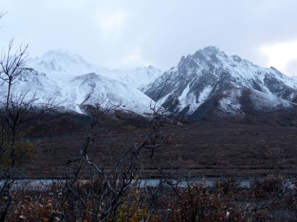
surrounding areas and photographing the
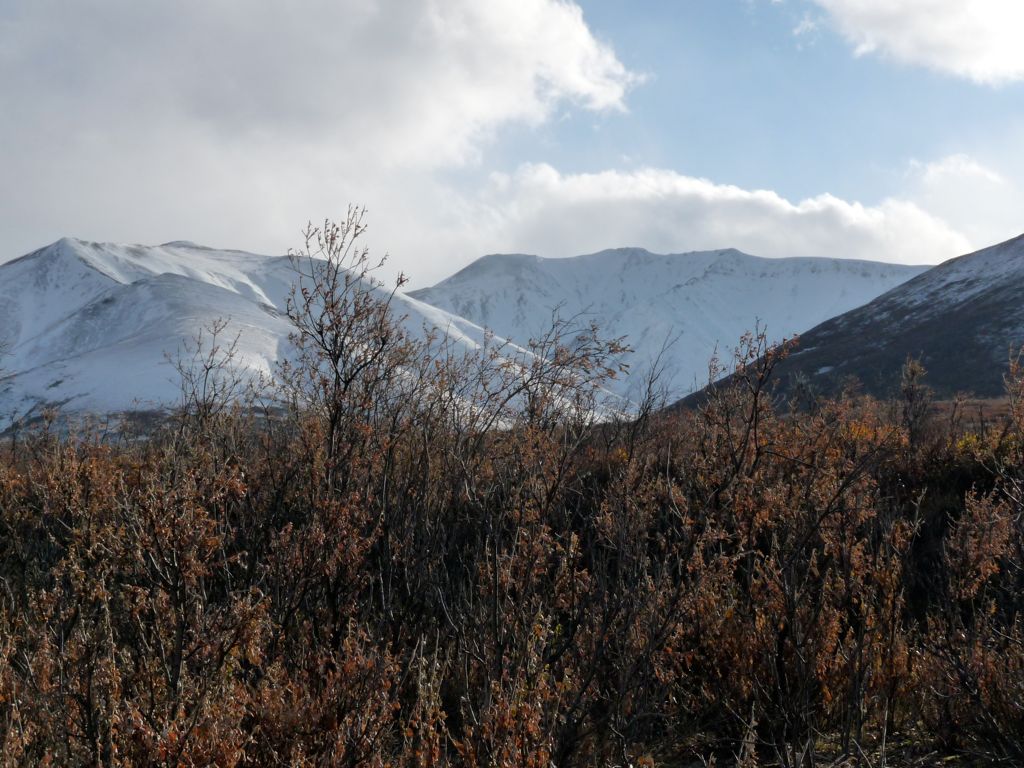
intimidating snow-capped mountains we were headed towards. Now, where we were sitting, there appeared to be no shortage of wood to burn or any risk of fire danger, and we all agreed that lighting a fire would not be a bad thing aside from it being illegal in the park. So we gathered up some wood and started a nice burn going before we had our dinner. Boy, did that fire hit the spot. I could write a very long essay on all the reasons I feel no guilt for disobeying park laws, especially when they are as ridiculous as banning campfires in a park where nightime temperatures could easily induce hypothermia. But I won't do that. All I'll say is that fire made the evening as perfect as any I can remember.
When we all decided we'd have enough of the cold and wind, we headed into our tents. Jason came up pretty big that night. He was determined to see the Northern Lights, so he kept opening his tent and looking out. Sure enough, just when I was about to doze off he woke us up and told us to look out of our tents. There was a soft green glow hovering above the mountains to the north. It wasn't as dramatic as the other times I've seen it, but it was still incredible. The sky in that direction quickly became covered with clouds, which I took as my queue to start dreaming for the night. I don't think I ever got into a deep enough sleep to dream that night, though. The winds were so loud and fierce that I felt like I was sticking my head out of a moving train the whole night. Jason's tent was on the verge of collapse and I kept worrying that we'd have to do an emergency fix at some point in the night. Fortunately, we made it through in one piece. None of us took any substantial amount of water into our tents and the poles held up.
As a logical followup to the previous night, the second day began with conditions as miserable as any I can remember. A frosty rain blanketed the land and that rain was made to travel horizontally at times by the ferocious winds raging through the valley. The normally simple task of breaking down our tents turned into an enormously difficult exercise that required coordination between all three of us. When
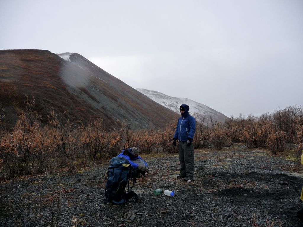
we had finally sealed everything up in our packs, it became clear that this day would not be an easy one. Still, the three of us were motivated to carry forward, hoping for some kind of break in the weather.
The highlight of the morning came when we were filling up our water bottles along the river. While Jason and I were pumping water, Eric noticed a grey wolf creeping along the opposite side of the river. The creature stopped and stared at us for a few seconds, perhaps intrigued by what we were doing. By the time I got my camera out of its case, though, he had meandered up the bank of the river and buried himself in brush. What a gorgeous looking animal.
Wind speeds seemed to be picking up as we moved northward. And unfortunately, we were headed directly into the wind. Periodically, the gusts would become so severe that we would have to stop and face southward to avoid falling over or having our faces scorched. At one point, Eric's backpack cover was blown clear off his backpack. It flew backwards, tumbling along the ground, and was then snatched up into the air and finally caught by a willow tree. It took us awhile to recover it.
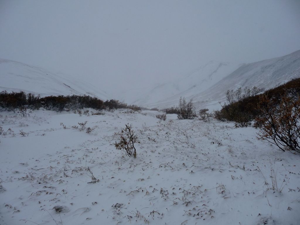
After about an hour of walking, we reached a point where we needed to break off from eastern fork we had been following and get over to the main branch of the Savage River. This took us on a northeastern course through a field of

tundra and sparse brush. The going was easy and the wind has ceased a bit. What had been rain a few hundred feet below was now snow, and it was accumulating on the ground at a very fast pace.
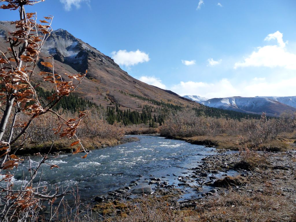
Making it to the main fork proved to be quite easy. In fact, I would say the going through this area was just as easy as it was along the gravel bed. The ground was firm and there was not much brush. In less than an hour, we had reacquired the Savage. But to our surprise, there wasn't a drop of water flowing. The
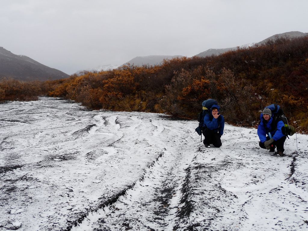
dry river bed made for the easiest traveling we had done all trip. It was significantly colder, but the wind had died down slightly, making it much more tolerable than it was earlier in the morning.
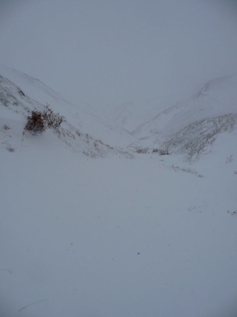
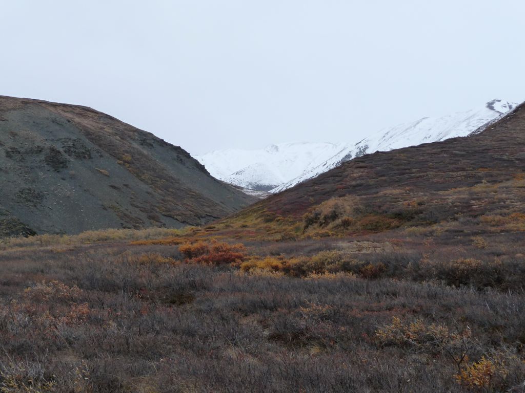
As we followed the river bed, I kept scanning the western ridge and looking for our pass. Even with the GPS, it was actually a bit confusing. In fact, I made the mistake of telling Eric and Jason that we had reached the point where we should start climbing westward too early. So we began climbing through some
fairly deep snow prematurely, which they were not at all happy about. When I realized we needed to be in the next canyon to the south, we all had our first taste of really deep snow as we diverted our course in that direction. It didn't take long to reach a vantage point where we could see up the
little valley we'd be headed up.
At this point there was discussion amongst the group as to whether we should continue over the pass or retreat due to the weather. There was good reason to be leery. The snow was knee deep, the temperature was well below freezing, and at times the wind blew wildly enough to cause near white-out conditions. Eric was convinced that even in a Chicago winter, these conditions would be deemed a storm. Now, at the time, my hard-headed desire to make it over the pass led me to discredit his claim. I was of the opinion that it was just a bit of wind and some snow; you know, "the kind of stuff we used to play in as kids." But looking back at the video that we shot along this stretch, seeing and hearing the sheer force of the wind, I'd have to agree with his evaluation. It was some pretty nasty weather.
I am proud to say that determination and perseverance won out, and we all agreed we'd continue toward the
disappearing pass. The next 400 feet of elevation gain was anything from easy, though. At times, there was exposed rock near the edges of the little U-shaped valley we were climbing. But at other times, all we could see was

white ground. The support strength of the snow alternated between being completely sturdy to frail enough that whoever was in the lead would sink down to his chest with one step. Snowshoes would have certainly helped, but there was no real danger since the surface buried underneath was free of sharp rocks or branches. Only once did we hear water running beneath us, and it was only a trickle.
The ascent felt like it took forever. And with each small gain in elevation, the winds (which were opposing our movement) became more and more severe. But finally, around 13:00, we reached the pass. It felt quite amazing to be standing there, and almost instantaneously that feeling gave way to the bitter cold and biting wind. I managed to shoot some video footage as Eric and Jason came up the pass, and when I watch it now I can almost feel the wind knawing away at my face. And we were only at 4000 feet. I can only imagine what the people climbing Denali must endure.
The way down from the pass was even more straightforward than the way up had been. Looking back, I think that the only real difficulty had been the snow and the wind. If the conditions had been favorable, the pass would have been a piece of cake; the descent being even more
gradual than the ascent. A few hundred feet down, it leveled out even
more
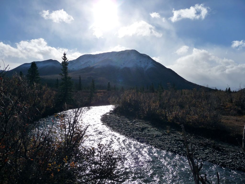
Some ways down the broad sub-valley we where following, the snow was more shallow and the winds started to relent. Traces of a stream frozen over with ice began to appear, and eventually this became the most favorable route to follow. It was very slippery and wet, but the good news was that the depth of the stream was minimal throughout. We were nearing the spot (waypoint at lat=63.570, lon=-149.285) where a decision had to be made as to which route we'd take. Both the ranger who issued our permit and the park website description of Unit 5 warned that following the path of least resistance in terms of elevation would result in the most resistance in terms of obstructions. They advised staying high above the East-West tributary river we were about to meet as we headed toward the Sanctuary River. The problem was that energy was low, and so we kept following the gully that would lead us down to the tributary.
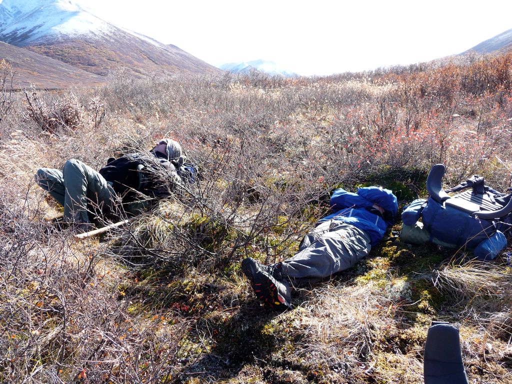
When we finally arrived at the tributary, we took a well-needed
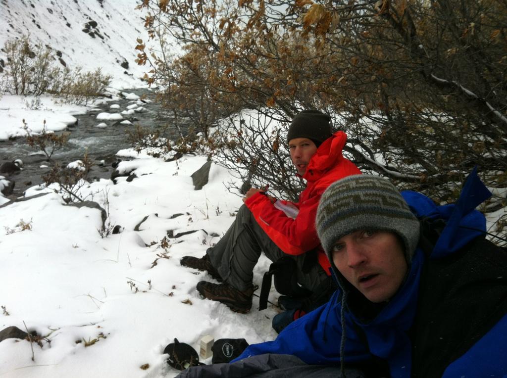
lunch break. Eric suggested a cup of coffee to warm us up, which I was incredibly psyched for. Problem was that the instant coffee was nowhere to be found. And we didn't find out it was missing until after I had boiled water. So we ended up just drinking a hot cup of water instead. Classy. Worst part is Eric found the coffee later that night. It had been buried at the bottom of one of the bear canisters.
While the other guys were still eating, I decided to climb up the north wall we were sitting against and check out what it looked like up there. When I got to the top, I could see that the path to the west was clear, and the slope was fairly gradual. But from the map, it looked like we'd still have to do some nasty downclimbing when we wanted to join up with the Sanctuary. Considering that and the morale of the team, I decided it'd be best to just follow the tributary. Couldn't be that bad, right?
Wrong. That mile and a half was nothing but a pure slog. Not only were there dense coats of trees and bushes at every step, but the ground was like a giant wet mop. On numerous occasions, my legs sank deep enough to bury my boots in muddied water. And there were three or four spots where we had to skirt along very steep embankments with precarious footing. Normally, I'm a pretty trigger-happy guy when it comes to the camera. But I was just too miserable at that point to take pictures. I just wanted to get the hell out into the open. If you're going to do this route, do not follow our path. Stick to the high road.
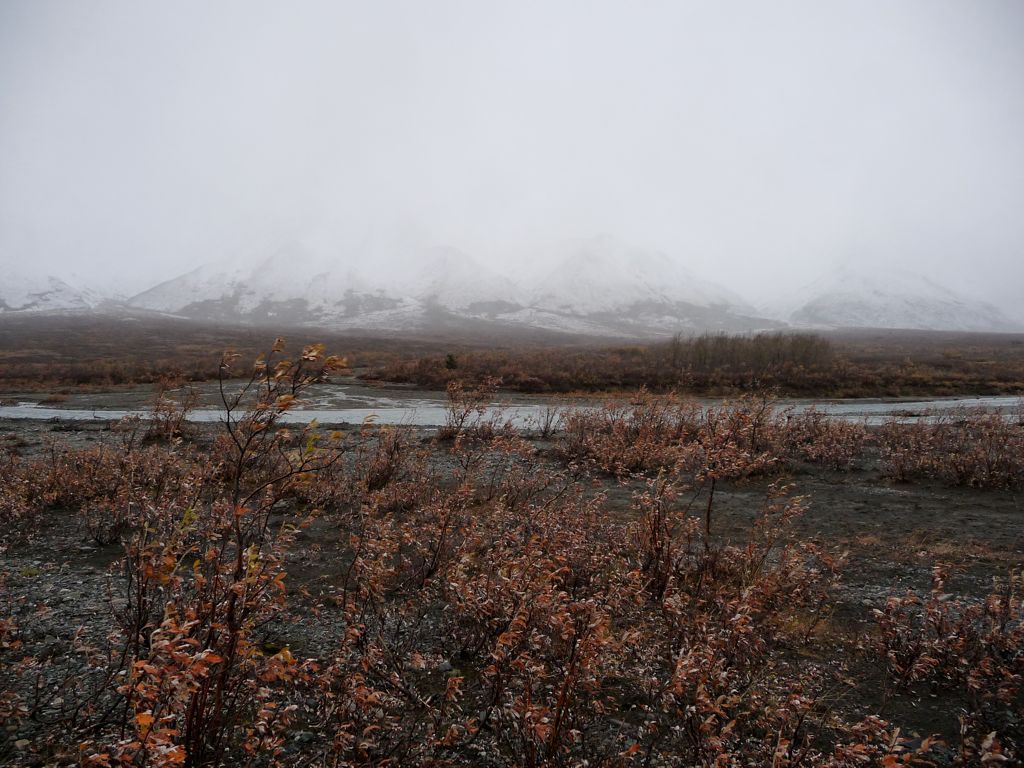
About an hour and a half later, we finally emerged into
the open air. Even though the weather was still crappy—a steady rain and not a patch of clear sky anwhere to be seen—we were in great spirits. The view to the
south was beautiful and the one to the
north showed no obstacles.
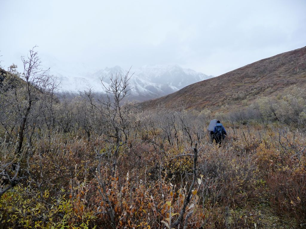
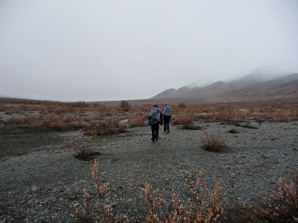
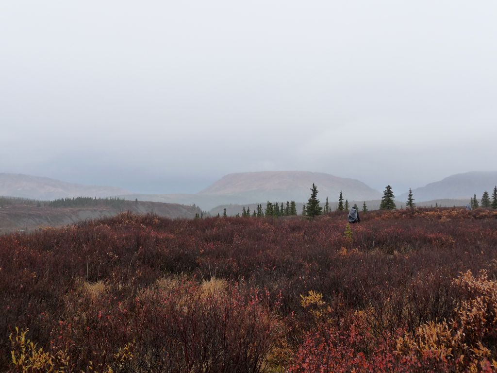
The going was very easy, and at this point the game plan was to follow the lovely, open
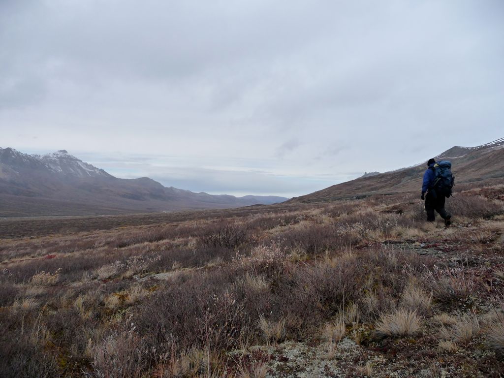
terrain to the north until we find a place that offered some protection from the wind. There aren't a lot of places where you can get it, though. Let me tell you that. Or, I should say, there aren't a lot of places that are protected from the wind that aren't also littered with an abundance of bear feces.
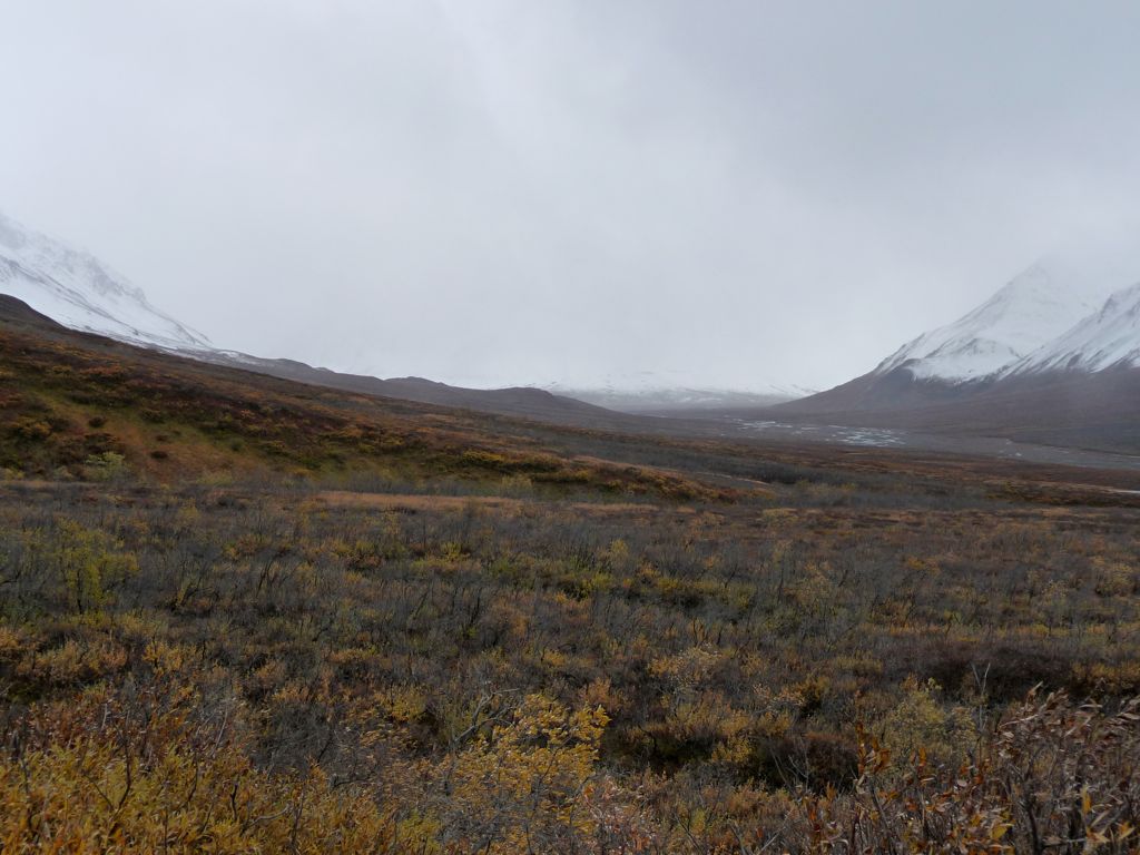
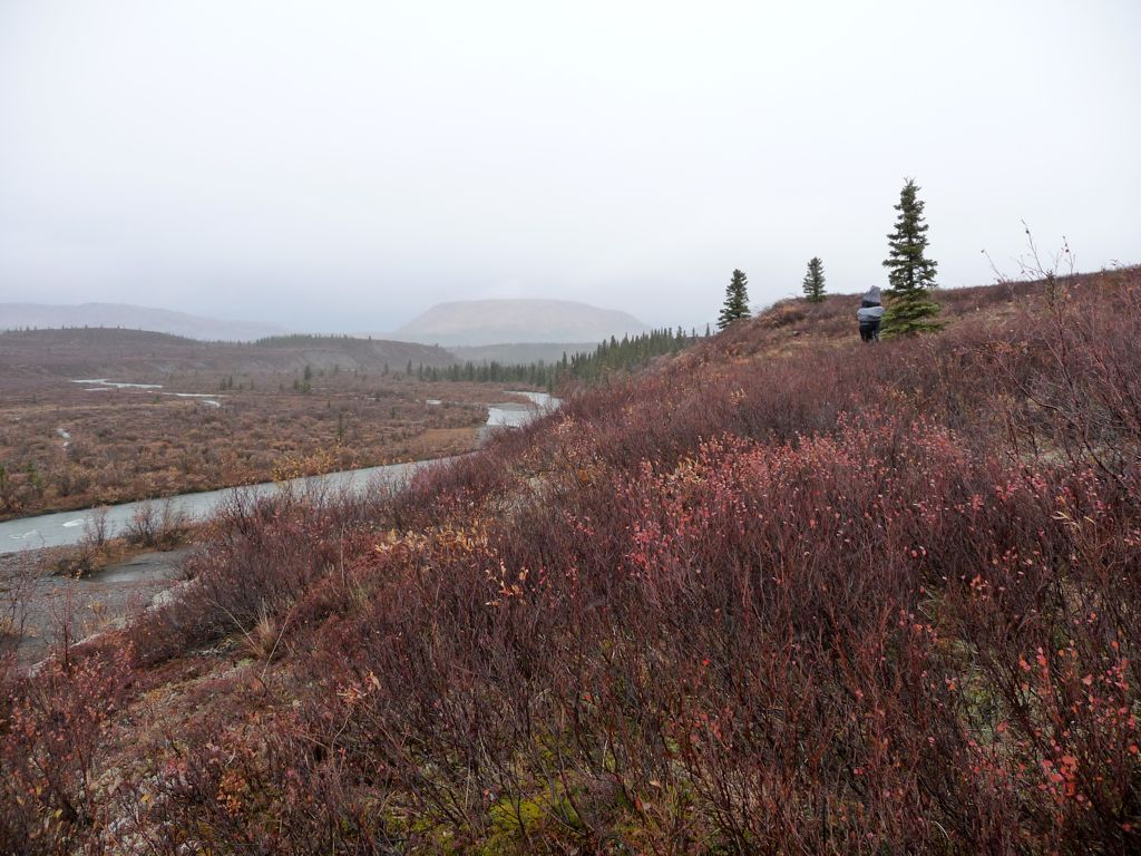
On our way to find a campsite, we indulged in plentiful blueberries and marveled at the
wonderful colors all around us. We passed two little sub-valleys running from the mountains to the east down to the Sanctuary, and followed the second one down towards the river. There was so much fresh bear poop that I couldn't believe we weren't seeing bears wandering around.
We eventually came quite close to the Sanctuary, and as we did, we noticed a natural shelf running perpendicular to the direction of the river. It was here where we decided to set up
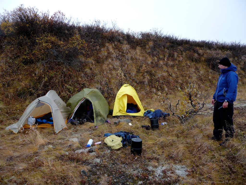
camp for the night. The ground here was much firmer than the loose gravel we had seen the night before, so we could very effectively stake our tents down. We also packed them closely together in a line parallel with the wind so that one tent would serve as blockage for the others. This turned out to be a pretty effectve strategy, as the night ahead would reveal.
With the tents set up, we proceeded to get water and then gather firewood for our second fire during the trip. It may have been against the rules, but I would have gladly paid a $200 fine for the warmth. We all had dry clothes and shoes to change into, but without the heat from that fire, I don't think any of us would have wanted to do anything but stuff our faces with some food and get in our sleeping bags. Instead, we enjoyed a nice meal of Ramen and tuna, accompanied by tough beef jerky and trail mix. Real gourmet shit let me tell ya.
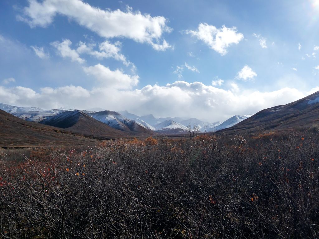
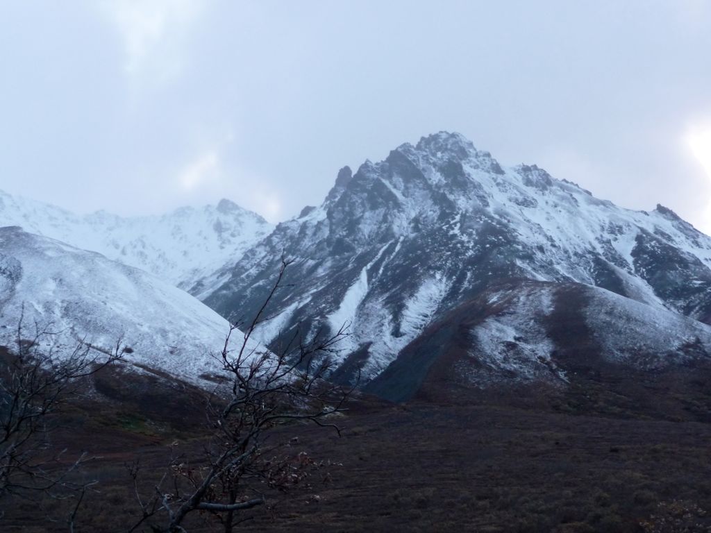
None of us could get over how dramatic and impressive the mountains to the
west were as we sat there. We joked around about climbing the most
intimidating of the peaks on the next day, and part of me got tempted by the idea of doing so. But the overwhelming feeling was that tomorrow we would make a straight shot for the exit and end the trip a day early. The weather was simply relentless and it had sapped a good deal of our motivation to explore the landscape outside of a car. So we all went to bed that night excited by the fact that we would only have to endure one more day of all of this dark and all of this cold.
The first thing I did when I woke up on the third day was put my hand outside of my tent to get a feel for how bad the rain was. It was difficult to discern between the flapping of the tent walls and the pitter-patter of rain on them; just a lot of noise coming from every direction. What I discovered was that it was pretty damned bad. I could hear Eric and Jason stirring in their tents. I asked, "So do you guys want to get the hell out of here?" And they unanimously replied, "Yes."
Our breakfast consisted of eating Pop-Tarts with mittens on while simultaneously packing up our gear. There was no attempt to dry the stuff off. The rain wouldn't allow it. From time to time, I'd get a mouthful of wool and dirt along with my Pop-Tart, but it was hard to actually notice since all my senses were in disarray. I could tell I was cold and I could tell I was wet, but it was hard to sense other things like the taste or texture of the Pop-Tart.
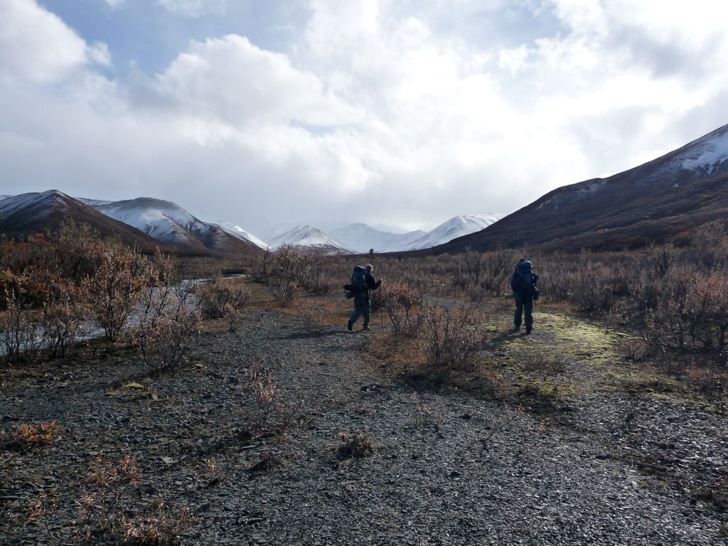
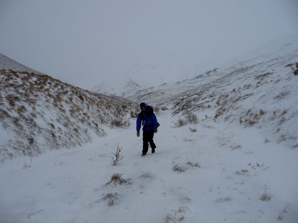
Once we got moving, things immediately felt better. The warmth generated by my body's motion was delightful, and there was a good stretch along this part of the
Sanctuary where we were walking on a nice gravel bar. I lagged behind
Eric and Jason for awhile. They were keeping a really good pace, motivated by the thought of a hot meal and dry clothes. Our goal was to do the 11 miles we needed to get back to the park road before 1400, which meant doing about 2 miles an hour with breaks.
The going was not too difficult for the first few miles. We tried to stick to the gravel bar along the river, which meant doing a couple of crossings. For a few of them, we got about knee deep in the water. There was no regard for keeping our feet dry because our they were already pretty soaked and we knew that we'd be putting our feet under some dry blankets that night. The crossings led to more stretches of easy gravel walking, which is why we chose to do them. And it paid off with
vast stretches of easy, uninterrupted walking.
Eventually, I'd say maybe after about three miles or so, the gravel bars started to fade away and the
river bank became overgrown with brush. When we reached a blockade along the bank, we would try to find little game trails that stuck close to the river, but frequently these would lead us far away from it. Sometimes they would be lovely corridors of hard dirt and rock that were just too tempting not too follow. The problem was that after a few hundred yards, they would take us into these enormous marshes where there was no dry ground in the direction we needed to go. Finding a consistent course was hard; if not, impossible.
There was a point, I'd say about 5 or 6 miles away from the road, where travel along the river became extremely difficult due to the steepness of the bank on the eastern side we were following. We were forced to climb about 50-75 feet
above the river and traverse some dense
sections of bushes and tundra. We stopped for a quick snack break around noon. It was still pouring, but the temperature was not that bad. Still, it was hard to get comfortable with all the wetness. We had just about 4.5 miles left to finish, and we were all prepared to march out of here.
After about a mile of more strenuous hiking through tundra, we descended from the small ridge we had been following. This put us square in the middle of some Taiga forest (visible in satellite view). The forest was dense for a few hundred yards, but it brought us to a set of small gravel bars that seemed to be offshots of the Sanctuary. The remaining distance was remarkably easy compared to what we had done before because we were able to follow a bed of rocks for most of it.
Then things got really easy. Approximately two miles away from the road we found a series of well-worn trails leading directly towards our exit. This put us in really good spirits. There is nothing like finding the beaten path after you have been off of it for a few days.
By 1400, we could hear the sound of cars driving along the road. And it wasn't long after that when we appeared at the Sanctuary Campground. We took a bit of time to dry off under the roof of the restrooms near the entrance of the camp and filled up our water bottles from the Sanctuary one last time. It would have been so nice to have a car parked at the campground, but our vehicle was in my dad's possession, and he wasn't supposed to pick us up until the following day. Eric and Jason both had their cell phones, but neither of them had signal.
The plan all along involved the possibility of hitch-hiking once we got to the road, and we were more than ready to do this after all the miles we had just walked. Fortunately, the process of getting picked up was extremely painless. Eric got picked up by the second car that passed (remember that the road was still open to all vehicles at this point in time). He was going to ride until he got a cell phone signal and then call our dad to come pick him up. They would then come back to the Sanctuary and pick us up. But if Jason and I could find a ride to get us further down the road, we would. And indeed, Jay and I got picked up less than half and hour after Eric by a nice older woman and man who had retired and took up working at the Princess Hotel their summer hobby.
They told us all about the fascinating things they had seen during their years at Denali while we drove eastward. Fatigued and chilled, I was still mainly focused on enjoying the comforts of the car interior. But part of me wanted to get right back out and explore more of the countryside. Both Jason and I were keeping an eye out for my dad and brother in a passing Totota Highlander, and when we saw one coming our way, we tried flagging them down by waving. They completely missed it, though. So the older man did a U-turn and put his foot on the gas to catch up to them. When we finally flagged them down, I felt so relieved. Finally, we were on a sure course for a hot shower and a dry bed.
Afterword: The following two nights we stayed at the Princess Hotel. Our days consisted of a day hike up to Mt. Healy and driving up and down the road looking for wildlife. I have got to say, there couldn't be a more perfect way to follow up a few days of roughing it in the Denali backcountry. We saw tons of moose, one grizzly bear, and an abundance of stunning landscapes, all from the park road. It was the thick of moose rutting season and a large section of the park right off the road (miles 6.5-11.5) was closed off because aggressive bulls were out and about. We also took a trip to Healy to have dinner at the 49th State Brew, which was really cool. They have a full replica of the bus that Christopher McCandless inhabited before he died along the Stampede Trail. If you have a free eveving, I would highly recommend making the trip.