


TRIP DETAILS
TRAIL MAP
OVERVIEW
Notes:
- This was one of the very few places that was not turning away hikers during the Great California Shelter-In-Place restriction of 2020. We were very concerned that things would be closed down or inaccessible, but luckily the rangers of the Los Padres National Forest were extremely helpful in providing us information on what was open. A great thanks go out to Jennifer and Linn for all their assistance!
- Considering that this was one of the few places that was allowing outside hikers, we were absolutely shocked at how few people we saw. We only ran into three other groups on the trail during the three days we were out there. To me, this is one of the most appealing things about Ventana.
- The trails here are not at all well maintained. This could be a great thing if you are looking for bushwhacking adventure, or a terrible thing if you are looking for a more relaxing getaway to the backcountry. In particular, the trail up to Cone Peak was reportedly very overgrown, although apparently not too difficult to follow. The Ventana Wilderness Alliance Forums have recent information for trail conditions, so I recommend checking that before you go.
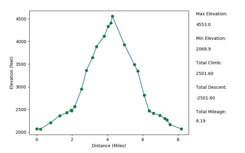
Elevation Profile (Mileage Underestimated)
TRIP LOG
In the days leading up to this trip, we were actually set on exploring the area around Pine Valley and Pine Falls. However, after inquiring about this with Ranger Linn of Los Padres National Forest over the phone, she seemed to recall that Tassajara Road had recently been closed. She recommend I check the Monterey County Road Closures, and sure enough, Tassajara Road was closed due to hazardous conditions.
When I called Linn back, I asked if she had any other recommendations. She said the Arroyo Seco trail was one of her favorites, and she gave a pretty enticing description, so that's what we ended up doing. I'm quite glad I got the recommendation and additional information about conditions on the trails. I checked the Ventana Wilderness Alliance Forums to try to find out which trails weren't too overgrown, but it was hard to get ample information that way. We just decided we'd attempt to go up to Cone Peak, but if it was too overgrown, we'd alter our plan and explore the area around where we camped.
The ride out to the Arroyo Seco Trail itself was quite a treat. We did not expect to pass a military fort with tanks on display, but we found exactly that when we came upon Fort Hunter Ligget. We were surprised that Del Venturi road was closed going west from the fort, but we were able to use Mission Creek Road to get up to Milpitas Road, fortunately. The drive on Milpitas was absolutely gorgeous: a rich oak savanna ecosystem peppered with wildflowers and beautifully inviting grass.
We met one other group of six hikers in the parking area just before the Arroyo Seco Trailhead, and talked a bit with them while we got our gear ready. It sounded like we'd run into them on the trail a few times since we were doing similar routes, but after a brief encounter 20 minutes into our hike, we never saw them again.
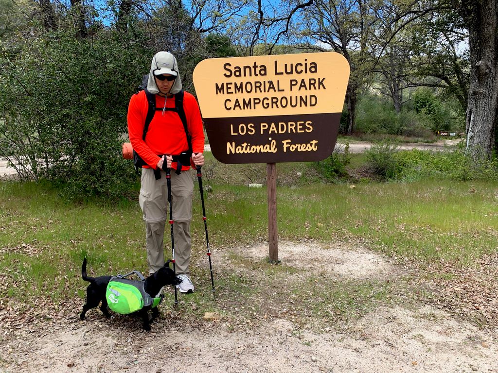
The Santa Lucia Memorial Park Campground had plenty of open area to park, and the toilets were still open, which was a pleasant surprise.
The trail was quite easy to find, and initially it looked as if the Arroyo Seco wasn't going to be quite as swollen as we thought it was (but we'd find out later that the water level was quite high).
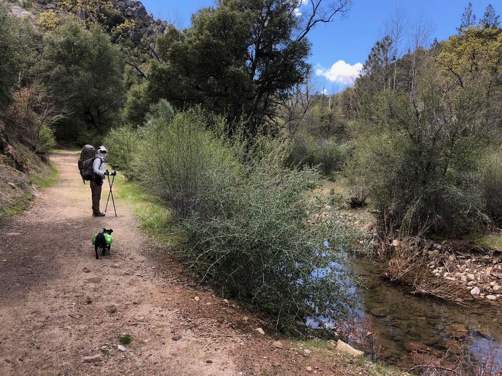
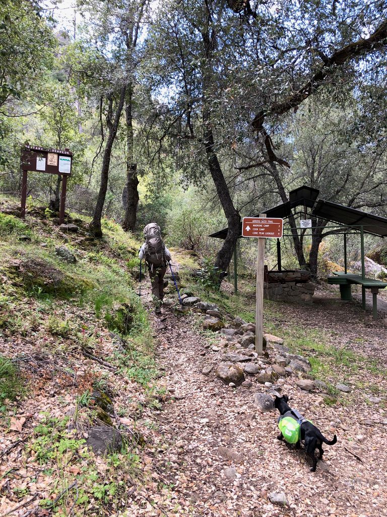
A few hundred yards into the walk, we passed a really cool recreation area with picnic tables and what looked like access to some good swimming in the waters of the Arroyo Seco. The signage, which is apparently not the best in Ventana, was great at this point.
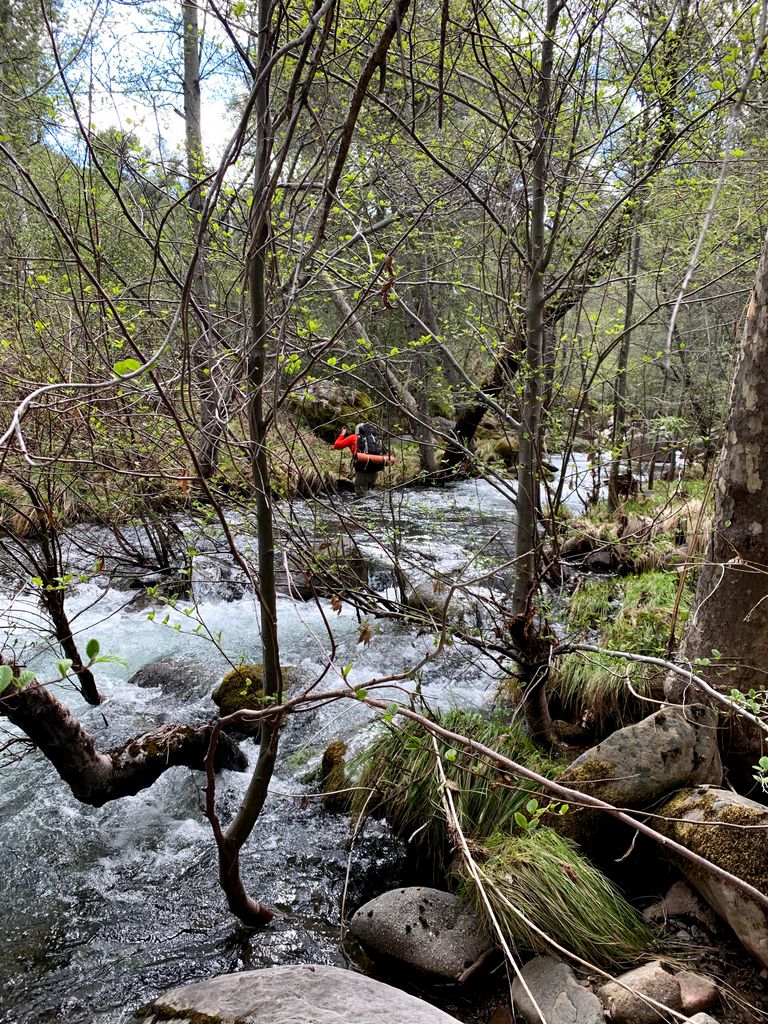
Not long after this, we came to the first river crossing. The group we had just said goodbye to at the parking lot had already made their way across, which was pretty encouraging. But the crossing was not trivial, especially with a 20 pound dog. Tina actually lost one of her hiking poles going across, which was a real bummer. We took a bit of time to search downriver, but the water was so deep and the current so strong that it didn't seem very hopeful.
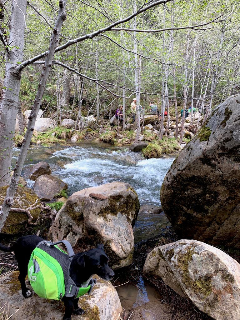
The water was about up to my waist at certain points, but luckily there are some partially submerged rocks to use for support as you go across.
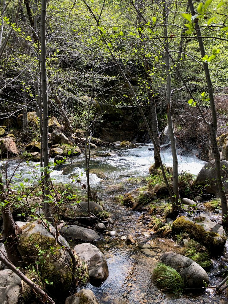
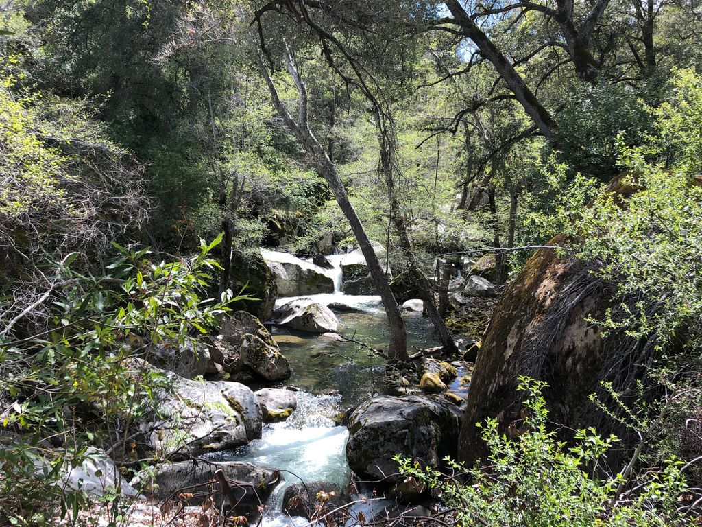
Just a little ways down the trail from there, we came upon a picturesque waterfall. I was definitely impressed by how many sizeable cascades there were as we went up the river. I quickly realized that the headwaters of the Arroyo Seco were a lot mightier than I had expected.
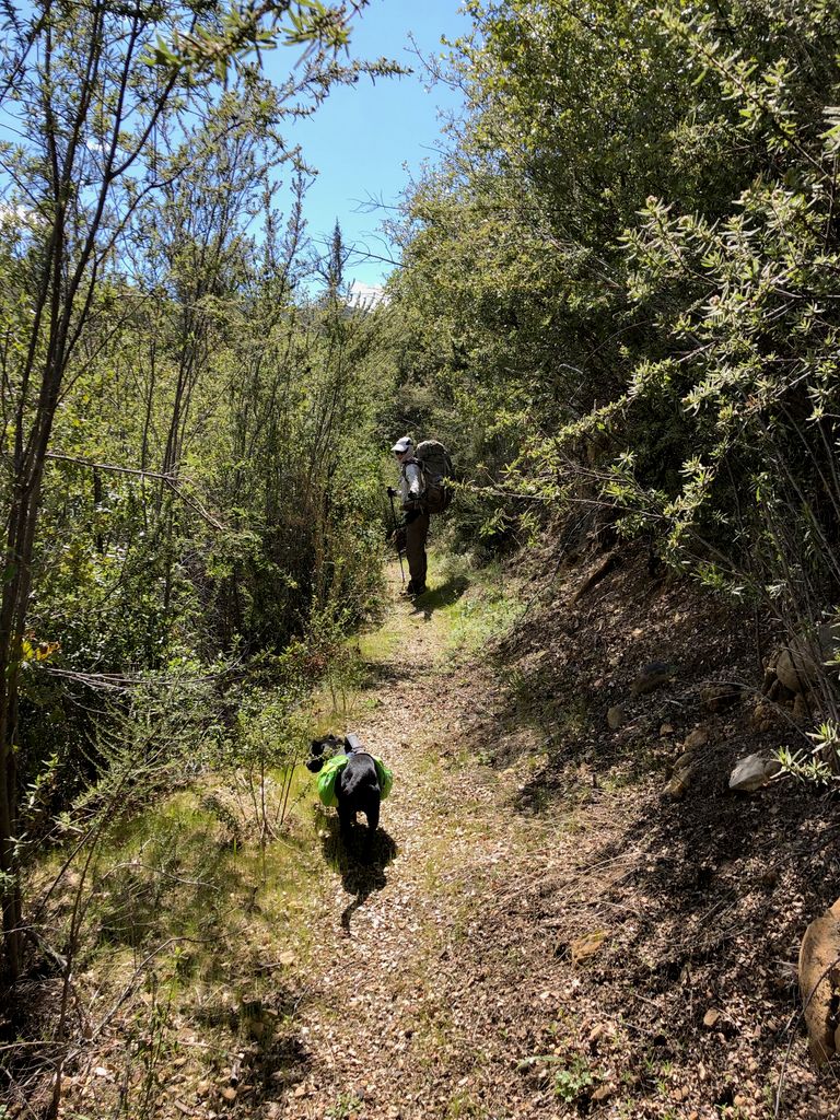
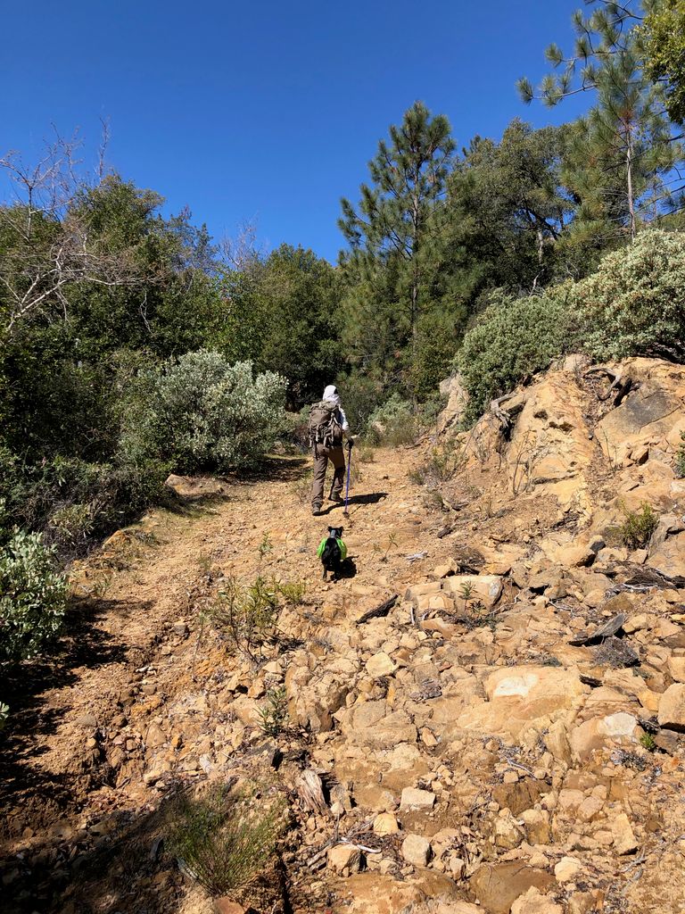
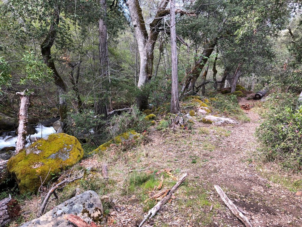
The trail was slightly overgrown for the first 1/2 mile or so, but then we came to a nice clear area.
I was just starting to think to myself how lovely it was to be on this clear part of the trail when Tina let out what was probably the most alarming shout I've ever heard expelled from her lungs. A very large rattlesnake, just a few feet in front of where she was walking, had startled her. When I realized what was going on, it began shaking its tail and hissing, while it slowly started to slither away from the trail. You can see it in this picture if you zoom in and know exactly where to look, but it's pretty blurry.
It eventually retreated underneath the log on the left side of the picture, allowing us to pass. But as you can imagine, it was a highly unsettling event; not exactly the best omen for the first part of the trip. The guys in the group at the parking lot had told us about how much wildlife they had encountered here before, and we had witnessed perhaps the most threatening aspect of that wildlife firsthand within the first hour of our hike.
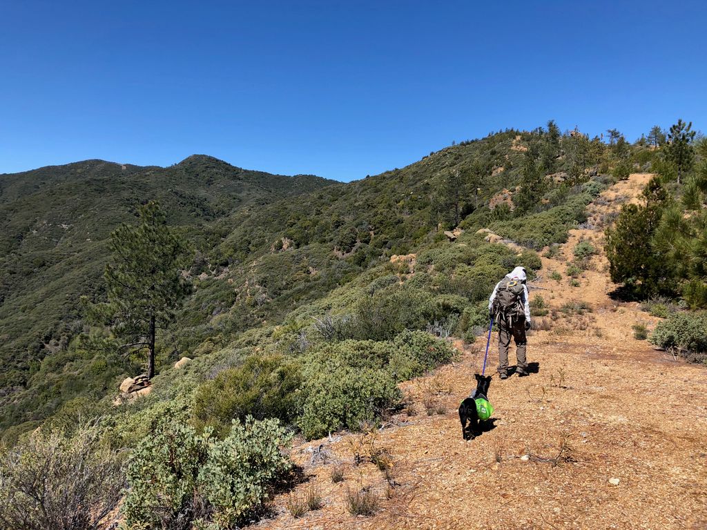
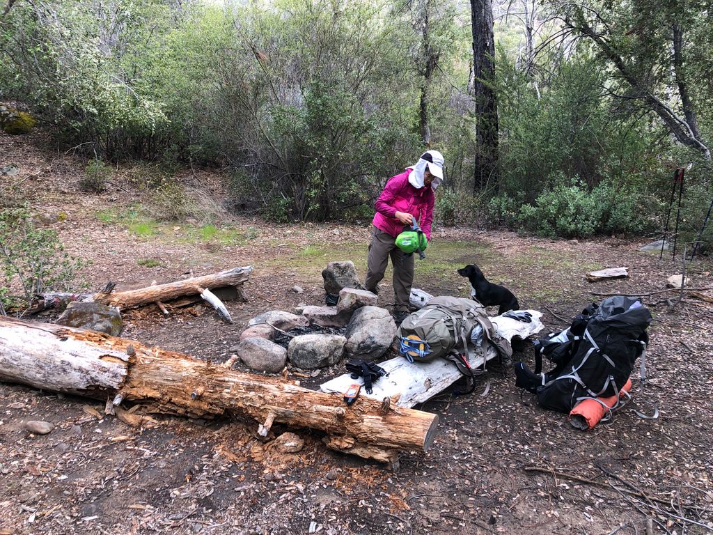
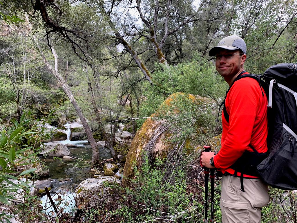
About another mile into the hike, the trail opened up and gave us some glimpses of the surrounding peaks. Not much longer after that, we came across a very easy creek crossing just before the Forks campsites . As we passed, I noticed how ideal the sites were: very flat ground, pre-establisehd campfire pits, close access to running water...they pretty much check all the boxes.
Our initial plan was to cross the river here and at least make it to the Madrone campsites before we called it a day. I found a decent spot to cross the river, and again, it was about waist deep water with a fair bit of current. When I got out of the water and walked back toward where Tina was waiting on the other side, I noticed she was talking to a young fellow who was also backpacking.
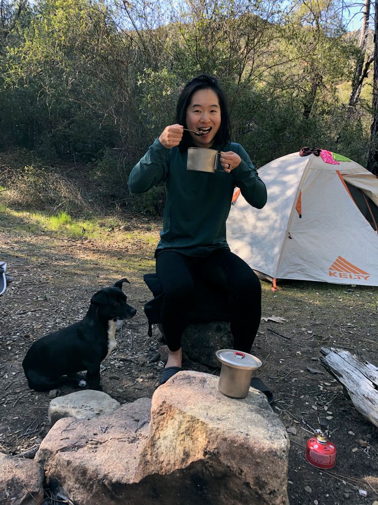
He had just come down from Cone Peak, where he spent the night before. His description of the trail going forward was enough to instill a fair bit of apprehension in Tina and me. He said the trail was thoroughly overgrown, but still straightforward to follow. He had a garbage bag on the sleeping pad attached to his pack, which was pretty torn up. But he wasn't covered in blood, so I thought maybe we could still give it a shot. After weighing our options, though, we decided we'd just call it a day here and set up camp at Forks. It turned out to be a great decision.
Just as we finished setting up our tent, the young fellow appeared again after finally making his way to our side of the river. And shortly after that, another couple showed up. They had come from the Arroyo Seco trailhead like us, and were similarly curious about the conditions of the trail going towards Cone Peak.
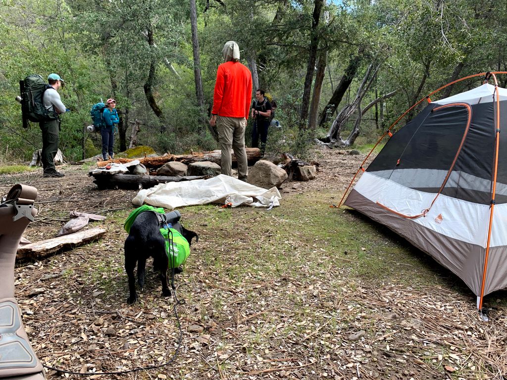
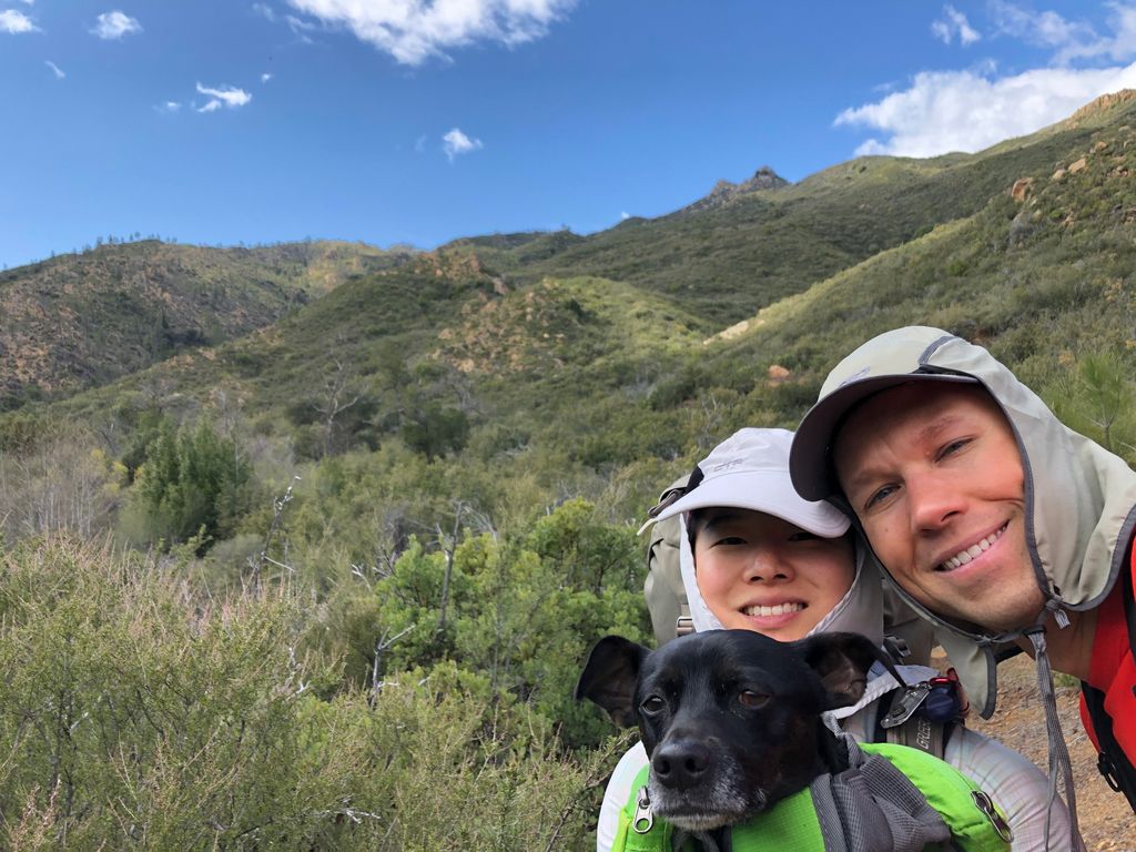
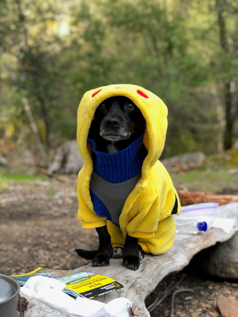
We talked for awhile, maintaining 10 feet of social distance of course, and then the couple decided they'd turn around and head up the trail towards Rodeo Flat instead of crossing the creek. After we all said our goodbyes, Tina and I started to prepare for dinner. We wiped Juni down with rubbing alcohol since she was parading around in poison oak, and then bundled her up in her camping clothes.
There was enough dead wood around to make a nice fire that evening.
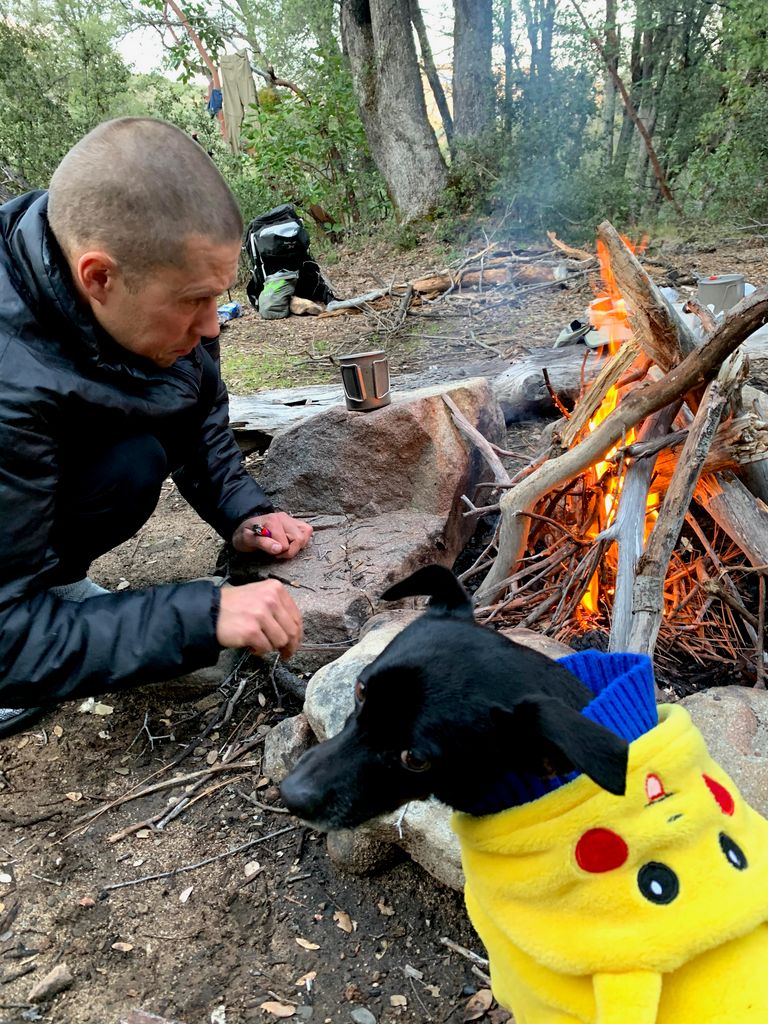
We then had a nice dinner, and enjoyed the perfect temperatures and absolutely glorious night sky. I was amazed at how brilliantly the stars shone. We could easily make out all the stars in Ursa Minor and see the faint light of the Milky Way splashed acros s the heavens.
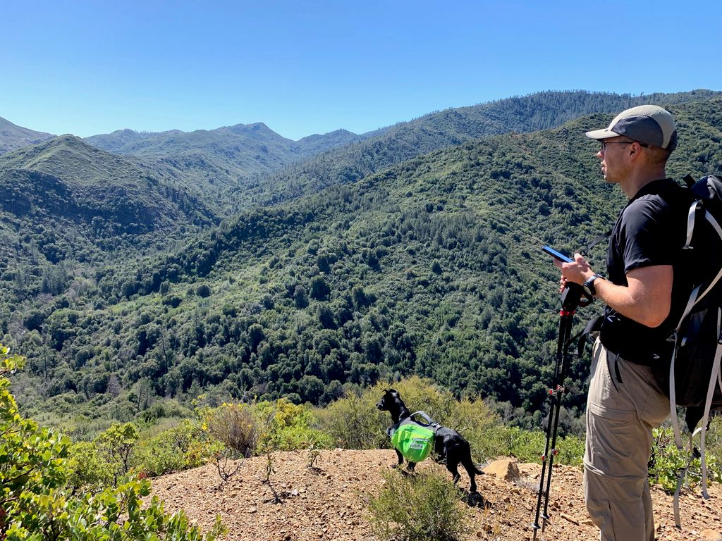
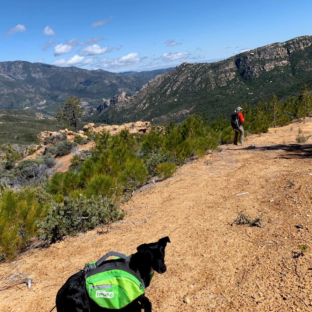
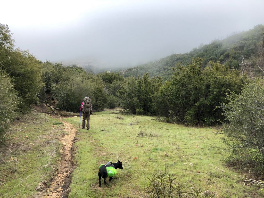
The next morning we decided over breakfast that we'd do the 2000 foot hike up to Rodeo Flat and check out the views from up there. They looked like they'd be quite good from the map. As advertised on the map, the trail is VERY steep. There is quite a bit of loose rock that makes it a bit more challenging than we were hoping for, but it could have been a lot worse.
The views on the way up the trail are quite excellent. We could see Cone Peak and a host of other features come into view as we gained in elevation.
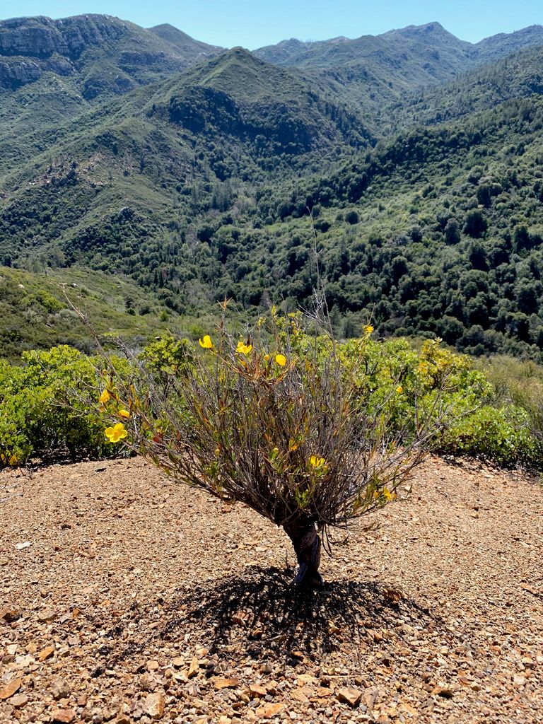
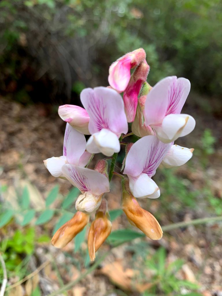
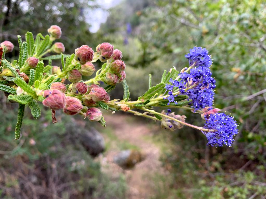
There were some very pretty wildflowers on the way up that added to the dramatic topography in the distance. It actually looks like it may have been a fire road at one point. We were both curious about the history of this particular trail.
After the first several hundred feet, there are some sections that are a bit flatter.
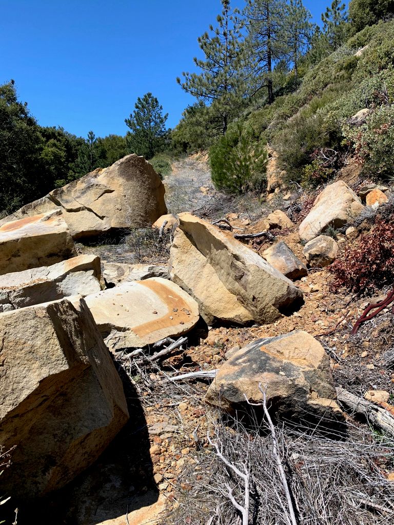
It became apparent that the trail hadn't been maintained for quite awhile. There was even a a big ol' rock fall along the trail.
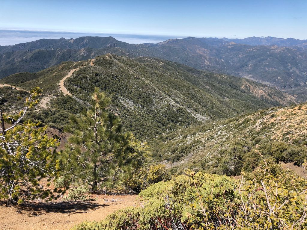
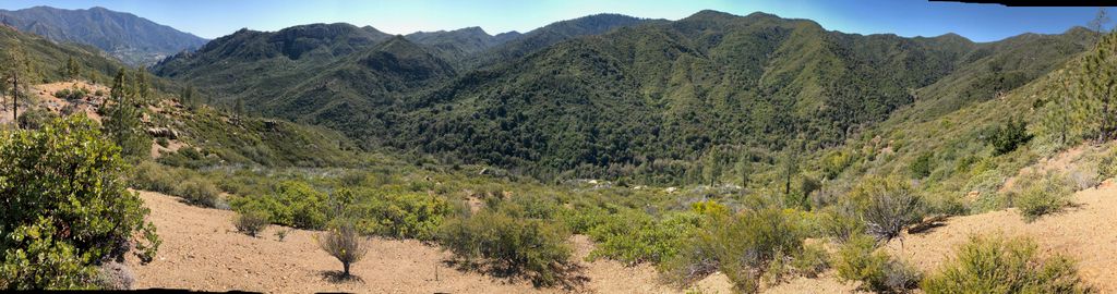
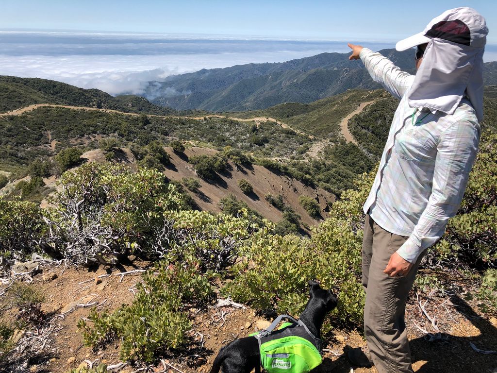
The last 600 feet (out of 2000 feet) of climbing was tough. The trail got quite steep, and there is enough overgrowth to make you watch your every step. But once we finally got to the pass, we were greeeted with phenomenal views of the terrain to the west, along with a fog-covered ocean.

I would have absolutely loved to continue down the inviting stretch of trail below. Hopefully we get a chance to go back there someday and do a loop over into one of the adjacent canyons.
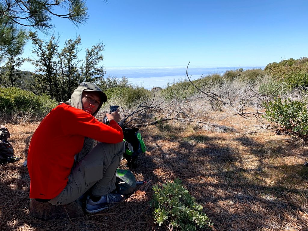
There is a a great spot to have lunch at the top of the trail under the shade of some pine trees. As we sat there looking out into the distance, I noted to Tina that I was disappointed we didn't see any Santa Lucia firs up close. We could see the silhouette of some off in the distance, but they would require a good bit of walking to get to.
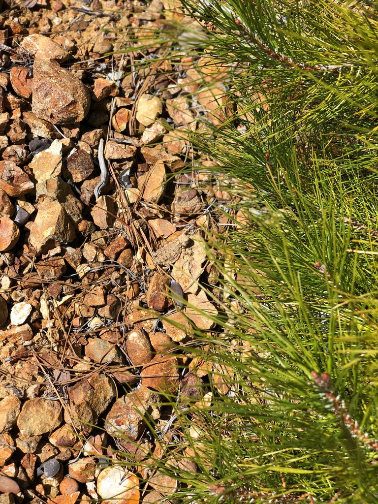
On the way down, we saw one of the many horned lizards that scurry about on this part of the trail. See if you can find it hidden in this picture.
Juni was constantly chasing them at every opportunity.
When we finally got back to camp, we both bathed in the pleasantly frigid waters of the Arroyo Seco. Tina and I both had worked up her appetite, and we had plenty of food for our two nights, so we ate quite well.
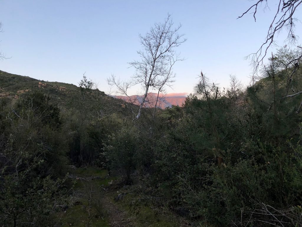
The alpenglow that evening was far away from us, but still incredible. The night sky was spectacular as well. We could see all the stars in Ursa Minor (the little dipper), which is a sign that the skies were top notch.
The sound of the flowing water at Forks Campsite is quite wonderful to wake up to. It And it was such a splendid morning that I didn't want to leave quite yet. But alas, we both had to get back to work.
We packed up our gear,
and made our way under the fog.
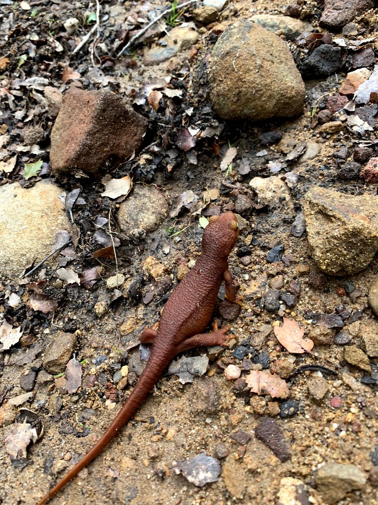
There were some cute newts dotting the trail. These guys are always a challenge to not step on.
Tina took some pictures of gorgeous flowers,
and then some pictures of hideous, abundant poison oak.

We stopped quite frequently during the short hike back to the car to admire the truly stunning cascades along the mighty Arroyo Seco.
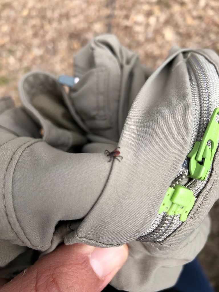
I think we had a total of 23 ticks on our pants at the end of the hike. This looks like a western black-legged tick. Poison oak and ticks considered, I'd do the trip again in a heartbeat.